
Home
Preamble
Index
Areas
Dales
Hills
Lakes
Places
Reserves
Rivers
Structures
Villages
References
Me
Saunterings: Walking in North-West England
Areas
The walks described in
Saunterings (a set of reflections based upon walks around the counties of
Cumbria, Lancashire and
North Yorkshire in North-West England) were in the Areas listed below, indicated by the
relevant Ordnance Survey map, from north to south:
OL4 (NW Lakes) |
OL5 (NE Lakes) |
OL31 (N Pennines) |
OL19 (Howgills) |
OL6 (SW Lakes) |
OL7 (SE Lakes) |
OL30 (N Dales) |
OL2 (S & W Dales) |
296 (Lancaster, Morecambe) |
OL41 (Bowland) |
OL21 (S Pennines) |
286 (Blackpool, Preston) |
287 (W Pennine Moors)
OL4: The English Lakes, north-western area (Keswick, Cockermouth & Wigton)
north sheet (north of Cockermouth, from Maryport to Bassenthwaite)
19. Viewpoints around Keswick (part 2)
south sheet (including Ennerdale and Derwent Water)
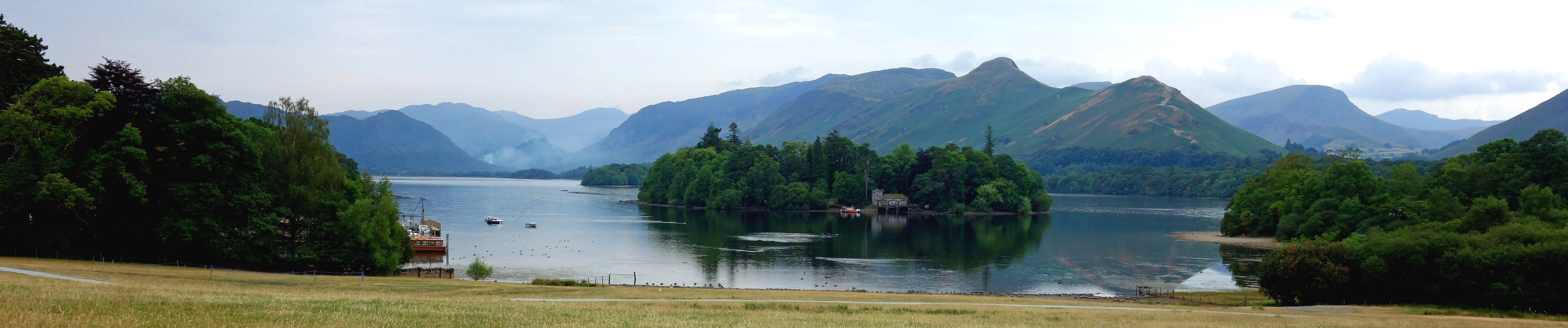 155. Two Sides of Bassenthwaite Lake and One of Derwent Water
141. In and Out of the Lake District, in the Ennerdale Region
18. Viewpoints around Keswick (part 1)
OL5: The English Lakes, north-eastern area (Penrith, Patterdale & Caldbeck)
north sheet (north of Penrith, from Caldbeck to Kirkoswald)
61. Knott Alone in the Caldbeck Fells
54. Follies around Flusco
42. Appreciating Long Meg and Lacy's Caves
south sheet (including Thirlmere, Ullswater and Haweswater)
north half of this map
188. From Pooley Bridge to Glenridding on the Ullswater Way (Eastern Half)
178. Back in the Saddle of Blencathra
143. Two Days as a Lake District Tourist
 17. Sheep-Wrecked Matterdale?
7. Castling in Cumbria: From Brougham to Lowther
southwest quarter of this map
221. Small Water with Little ‘Uns
187. From Glenridding to Pooley Bridge on the Ullswater Way (Western Half)
65. From Grasmere to Grisedale Tarn
12. Blea Water, High Street and Kidsty Pike
3. Zipping over or around Thirlmere
southeast quarter of this map
185. The Peace of Shap
104. From Bampton Grange to the Lake District's Highest Hills
OL31: North Pennines (Teesdale & Weardale)
 56. Cross Fell: The Apex of England
OL19: Howgill Fells and Upper Eden Valley
north sheet (north of Kirkby Stephen, from Maulds Meaburn to Brough)
247. In the Footsteps of Romans on Crosby Ravensworth Fell
172. Out to Pasture in the District of Eden
97. Remeandering the Lyvennet
35. Dufton Rocks
31. Pink Stones on the Orton Fells
south sheet (from Orton to Hardraw)
north half of this map
232. The Scotch Argus of Smardale
203. Orchids and Bogbeans at Sunbiggin
154. Damming the Howgills
144. Fencing The Clouds
 51. On Wild Boar Fell
38. Reflections from Jeffrey's Mount
southwest quarter of this map
225. Garsdale
219. Sedbergh, Brigflatts, the Waterside Viaduct and an Elephant
163. Baugh Fell and Alpacas
68. Landscape and the Howgills
67. The Consolation of Arant Haw
15. On the Hobdale Fence
2. The Dentdale Diamonds
southeast quarter of this map
13. The Cairns of Grisedale Pike
OL6: The English Lakes, south-western area (Coniston, Ulverston & Barrow-in-Furness)
north sheet (from Seascale to Coniston, including Wast Water)
north half of this map
231. On the Wasdale Explorer
229. One Good Tarn Deserves Another Three
228. To the Largest Natural Tarn in the Lake District
southwest quarter of this map
227. La'al Ratty and Muncaster Fell
226. Impressions of Ravenglass
142. Eskmeals: Dunes, Estuary and Firing Range
southeast quarter of this map
246. Up and Up on the Coniston Fells
245. To Beacon Tarn – One of the Best Short Walks in Lakeland
230. Harter Fell and the Architectonic Head of Eskdale
 28. Broughton Moor, or What's Left of It
south sheet (from Bootle to Barrow)
205. Where is Subberthwaite Common?
107. Along the Sands from Millom to Silecroft
57. Around a Windswept Sandscale Haws
OL7: The English Lakes, south-eastern area (Windermere, Kendal & Silverdale)
north sheet (from Grasmere to Kendal, including Windermere)
northwest quarter of this map
209. From Orrest Head to Ambleside
159. Up Dove Crag in Homage to Wainwright
146. A November Day around Grasmere and Rydal Water
49. Lingmoor Fell - For the Best Medium-High View in Lakeland?
43. The Red Screes - Wansfell Question
 9. "The Prettiest Mere of All" Lakeland
northeast quarter of this map
166. Bretherdale Then and Now
100. Crookdale and Horseshoes
60. The Longsleddale Green Lane
23. The Kentmere Diatomitee
southwest quarter of this map
220. Pottering about Near Sawrey
164. A Walk in the Kentmere Park
137. Bowness and its Hinterland
southeast quarter of this map
217. The Lambrigg and Killington Turbines: Why Bother?
179. A Kendalian Intermezzo
131. A Taste of the Kendal Mint
128. Spring around Scout Scar
south sheet (north of Carnforth, from Penny Bridge to Burton-in-Kendal)
northwest quarter of this map
 69. Lakeside, Finsthwaite Heights, Rusland Heights and Tourists
32. Russet Rusland Valley
northeast quarter of this map
181. Trail-Blazing on Farleton Knott
175. White Scar, Whitbarrow and Witherslack
160. Levens Park and the River Kent
105. An Autumn Stroll through Beetham Woods
55. Butterflying on Whitbarrow
southwest quarter of this map
 211. Bigland: Hall, Tarn, Heights, Barrow, Allotment and Woods
52. Morecambe Bay - from Cark to Grange-over-Sands
southeast quarter of this map
210. The Arnside Tide
198. The Bitterns and Marsh Harriers are Booming
186. Thoughts from the Towpath (Holme to Carnforth)
167. Yealand Woods, Leighton Hall and the Pheasants
134. North and South in the Arnside and Silverdale AONB
98. Karren and Flora on Hutton Roof Crags
OL30: Yorkshire Dales, northern and central areas (Wensleydale & Swaledale)
north sheet (from Keld to Marske, including Swaledale)
158. Around the Kisdon Triangle: Muker, Keld and Thwaite
 26. A Booze by Any Other Name
25. Mysterious Harkerside Moor
south sheet (from Askrigg in Wensleydale to Kettlewell in Wharfedale)
177. Two of the 'Dales 30': Fountains Fell and Darnbrook Fell
162. A Cracking Bit of Wensleydale
58. From Hawes, in the Poet Laureate's Footsteps
33. Is Nappa Hall Napping - or Dying?
10. The 'Hillfort' of Addlebrough
OL2: Yorkshire Dales, southern and western areas (Whernside, Ingleborough & Pen-y-ghent)
west sheet (from Kirkby Lonsdale to Pen-y-ghent)
northwest quarter of this map
235. Barbon Low Fell and Trig Points
191. Back in Barbondale
139. Ruskin’s View and a View of Ruskin’s View
135. By the Old Farmhouses of Dentdale
127. To Calf Top Top
 106. Twelve Ponds and a Power Station
95. Barbondale and the Dent Fault
71. Low in Low Barbondale
northeast quarter of this map
248. Whernside in the Wind
222. What’s Great about Great Knoutberry Hill
132. Three Viaducts and a Tunnel of the Settle-Carlisle Railway
14. Logging Along the Cam High Road
southwest quarter of this map
243. The Ingleton Waterfalls Rip-Off
240. Turning Again to Whittington
206. Up, Up and Away
196. From Motte to Motte: Arkholme to Hornby
195. A (Mis?)Guided Tour of Kirkby Lonsdale
173. Early Spring in Chapel-le-Dale
 168. To Lancashire’s Highest Point, Wherever It Is
161. Caves, a Waterfall, Windmills and a Crocodile
152. Is the Purple Saxifrage on Ingleborough in Flower Yet?
151. From Cowan Bridge with the Brontës and Beyond
62. On and Off the Ingleton Waterfalls Trail
50. With the Lune from Kirkby Lonsdale
47. The 'Wild Desert' of Kingsdale
40. In the Borderlands of Burton-in-Lonsdale and Bentham
24. Up Ingleborough with the Holiday Crowds
southeast quarter of this map
216. The View from Smearsett Scar
201. An Erratic Saunter from Austwick
189. The Standard Pen-y-ghent Walk
148. The Man on the Clapham Omnibus …
102. Upper Ribblesdale: Drumlins, Three Peaks and a Cave
 63. Crummackdale: These Are a Few of My Favourite 'Superficial Things'
22. In the Lancashire Yorkshire Dales
16. The Wildflowers of Sulber
south sheet (from Settle to Bolton Abbey)
237. Stainforth and Salmon
140. Short-Circuiting Wharfedale
133. The Limestone Hills East of Settle
46. To the Point of Winterburn Reservoir
8. What Price Catrigg Force?
6. The Count of Flasby Fell
296: Lancaster, Morecambe and Fleetwood
north half of this map
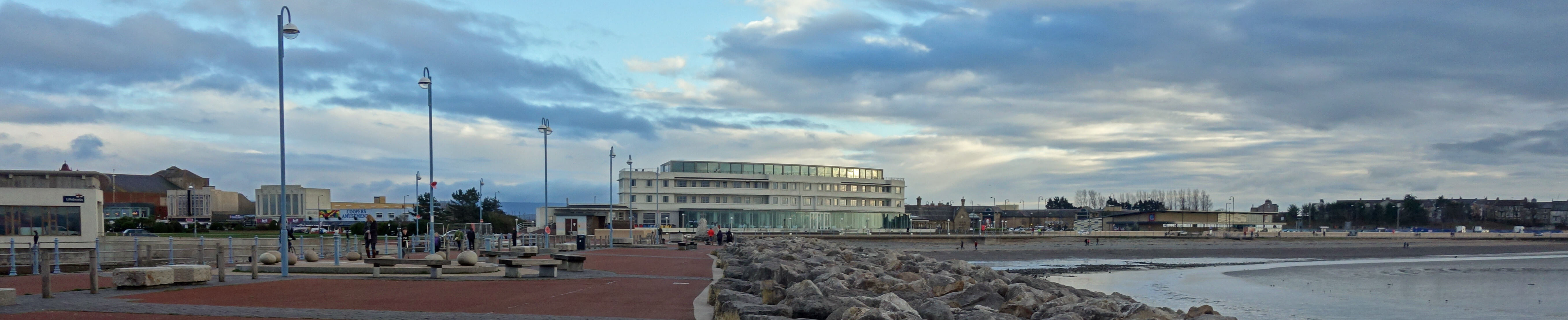
244. The Art Deco of Morecambe
 214. The Shining Levels of Morecambe Bay
204. In the Dock at Glasson
199. Ten Features of Lancaster, Five Old, Five New
174. Morecambe Away and Home
136. Green Fields or ‘Garden Village’?
130. By the Lancaster Canal and the River Lune
123. Over to Overton and Around Little Fylde
101. Passing the Time at Heysham
76. The Belted Beauties of Sunderland
70. Up the Conder
37. Whoopers on Thurnham Moss
 36. The Flow and Ebb and Flow of Morecambe
4. In a Flap at Bolton-le-Sands
south half of this map
193. Reflections on Three Walks, Remembering Nicola Bulley
182. Along the North Fylde Esplanade
157. The Preesall Salt of the Earth
153. Thoughts from the Towpath (Galgate to Garstang)
112. Walking around Pilling with Pink Feet
103. Bogged Down around Rawcliffe Moss
21. The Fortunes of Fleetwood
OL41: Forest of Bowland and Ribblesdale (Pendle Hill, Clitheroe & Settle)
west sheet (from Hornby to Chipping)
northwest quarter of this map
 241. The Wildlife of Aughton Woods
239. Breaking the New Year Ice on Caton Moor
238. An Advent Adventure on Baines Cragg
236. The Not-the-Lune-Valley-Ramble Ramble
213. The Gressingham Puzzle
212. The Moor the Merrier
208. Trials on Clougha
207. Eel Entrainment by United Utilities
197. Around the Windmills of My Mind, Metaphorically Writing
194. Walking and Wincing, Locally
192. Who should we Trust with our Waterways?
176. The Cragg – Clougha Cuckoo Circuit
169. A Quinquennial Ambulation over the Moor
149. Wayfinding and the Highfields
147. Snow-Walking in Littledale
113-125 are about walking and walks from home during another lockdown.
125. “Walking is not a sport”
 124. The Most Prominent Hills of North-West England
122. Walking Uphill and Walking Up a Hill
121. The Phantom Hills of Mallowdale Pike, High Stephen’s Head and Gallows Hill
120. A Walk in Littledale in 1847
119. Silence, Serenity and Solitude
118. Coast-to-Coast in Six Days
117. Empirical Studies into Gender Differences in Hilly and Horizontal Pedestrianism
116. Are the Caton Windmills on their Last Legs?
 115. Risk, Fear and Pain – or Beauty, Joy and Wonder?
114. Never Mind the Danger
113. White Stoats on Caton Moor
111. From Millstone Grit to Limestone
110. Cloughs and Grit: Clougha Pike and Grit Fell
79-94 are about walks from home during the (first) coronavirus lockdown.
94. Away from It All on Caton Moor
93. The Brookhouse - Claughton Circular
92. The Small-Leaved Limes of Aughton Woods
91. The Littledale Cuckoos are Back!
90. “One Form of Exercise – such as Walking” to the River
 89. Tracking the Thirlmere Aqueduct
88. The Lune Millennium Park Artworks
87. Around the Claughton Clay Pit
86. Bluebells and Going Round the Lune Bend
85. The Tarn Brook Heronry
84. A Loop along Littledale Lanes
83. Gray's Seat and the View from the Crook o'Lune
82. A Peek into Artle Dale
81. The Lost Meander of the Lune
80. The Caton Moor Hares
79. Sand Martins by the Lune
75. To Ward's Stone: A Classic Walk?
72. Turner and the Lune Aqueduct
 41. Safe in Littledale
1. The Taming of Caton Moor
northeast quarter of this map
249. Up Summersgill Fell With and Without Permission
233. A Rivetting Tale of High Gimmerdale
183. On the Moors and Pastures above Bentham
156. The Long and Winding Hornby Road
126. Return to Roeburndale
108. Westward Home! (from Lowgill with Thoreau)
96. Castles and Towers from the Cross of Greet
78. Around Roeburndale
southwest quarter of this map
242. Brock Valley Woods and Beacon Fell
218. A Lowland Bowland Walk from Dolphinholme
202. Pausing at Garstang
200. Walking Up Hazelhurst Fell in the New National Landscape
170. Nicky Nook and Landscape Art
109. Fair Snape: the Fairest Fell of Bowland
99. Heather on Hawthornthwaite Fell
southeast quarter of this map
180. At the Heart of Bowland: Langdendale, Bleadale and Haredendale
64. Beyond the Leagram Pale
59. The 1 in 5,000 Hen Harriers of Bowland
53. Why? On the Wyre Way
 30. Dunsop Bridge, Whitewell and Duchy-land
east sheet (from Settle to Barrowford)
north half of this map
215. On the Old York-Lancaster Road from Hellifield to Settle
165. In Gisburn Forest in the Forest of Bowland
145. Naturalising the Long Preston Deeps
66. In Search of the Paythorne Salmon
5. Circumperambulating Stocks Reservoir
south half of this map
223. A Grand Bowland Circuit, plus Easington Fell
77. Bridging the Lower Little Ribble
OL21: South Pennines (Burnley, Hebden Bridge, Keighley & Todmorden)
north sheet (from Skipton to Burnley)
184. Three Ways to Gawthorpe Hall
150. Psychogeographic Walking around Burnley
129. From the Delights of Downham to the Heights of Pendle
73. The Raygill Foraminifers
20. On the Sunny Side of Pendle
11. The Struggle over Boulsworth Hill
south sheet (from Hebden Bridge to Littleborough)
 34. Thieveley Pike and the Singing Ringing Tree
286: Blackpool and Preston (Lytham St Anne's & Leyland)
171. Along the Ribble Way to Brockholes
138. From Barton to Preston: Ghosts, Lunatics and Invincibles
74. Blackpool Promenading
45. Thoughts from the Towpath (Bilsborrow to Preston)
29. The Quiet End of the Ribble Way
287: West Pennine Moors (Blackburn, Darwen, Accrington & Bolton North)
224. Around Anglezarke Reservoir
48. With The Grane
39. Halls Galore by the Middle Ribble
27. The Footpaths of Anglezarke Moor
Home
Preamble
Index
Areas
Dales
Hills
Lakes
Places
Reserves
Rivers
Structures
Villages
References
Me
© John Self, 2018-

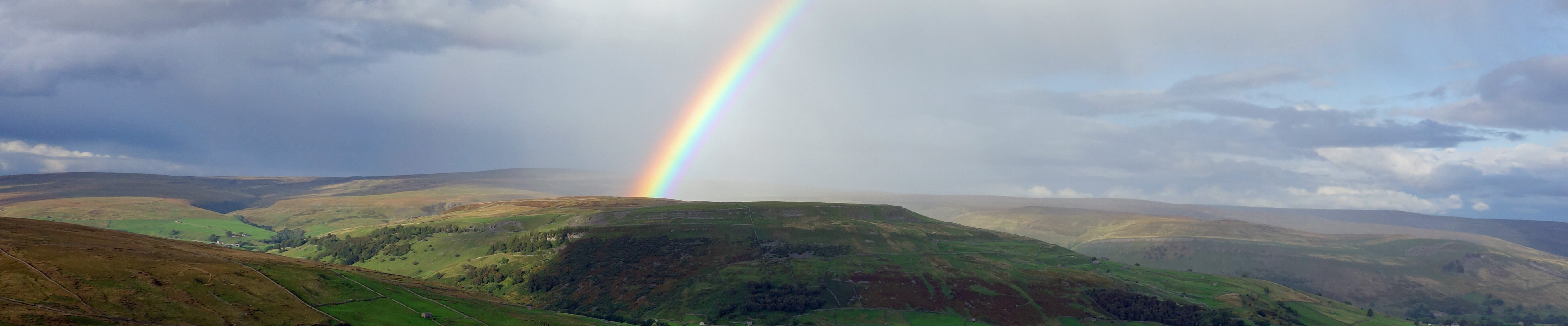
Top photo: Rainbow over Kisdon in Swaledale;
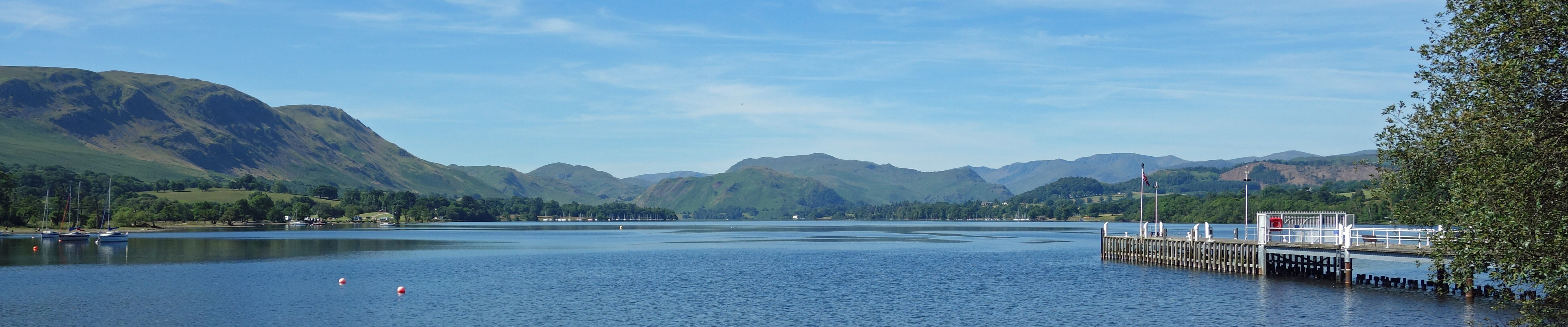
Bottom photo: Ullswater