
Home
Preamble
Index
Areas
References
Me
Saunterings: Walking in North-West England
Saunterings is a set of reflections based upon walks around the counties of Cumbria, Lancashire and
North Yorkshire in North-West England
(as defined in the Preamble).
Here is a list of all Saunterings so far.
If you'd like to give a comment, correction or update (all are very welcome) or to
be notified by email when a new item is posted - please send an email to johnselfdrakkar@gmail.com.
133. The Limestone Hills East of Settle
Settle has long been settled, having been granted its market charter in 1249. The market was still going strong when I stepped off the bus at Market Square, although no doubt it is not as strong as it used to be. A number of ancient paths converged on Settle and I set off on one of them, the Settle – Malham packhorse route.
I walked up the steep, narrow lanes of Upper Settle onto the Malham Road, on the line of the packhorse route but now surfaced, of course. Thomas Pennant said that this route was “exceedingly tedious and steep” (Pennant, 1773). What the packhorses said about it is unrepeatable. I too found it steep but I enjoyed the views that opened out of the limestone scars of High Hill, Sugar Loaf Hill and, to the right, Rye Loaf Hill. The local hill-namer must have been a baker.
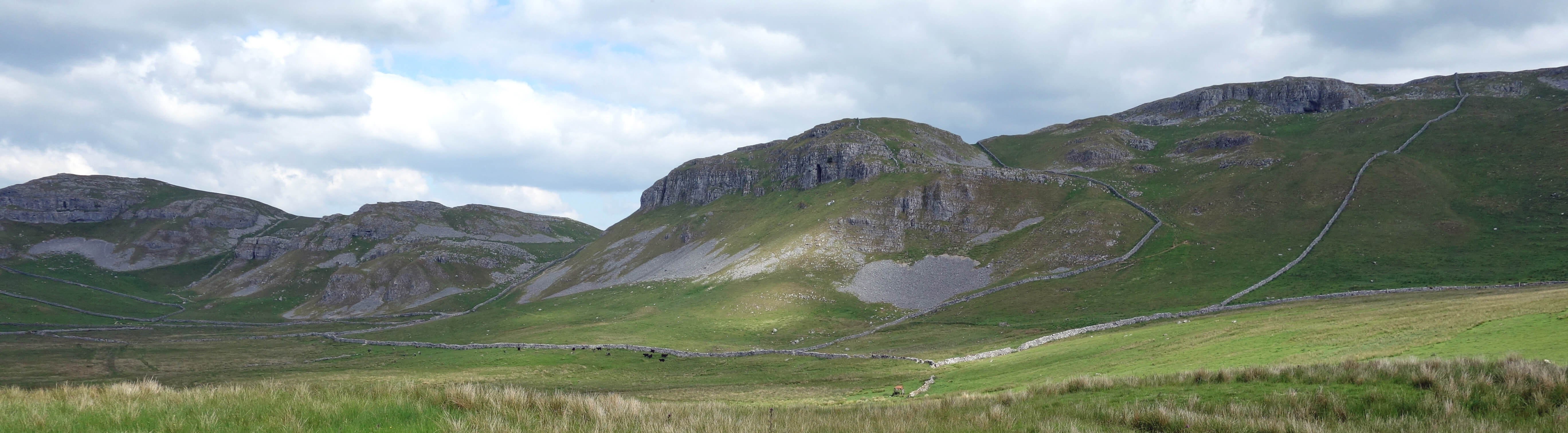
The limestone hills from Stockdale Lane
After a mile or so the modern road leaves the line of the packhorse route, which continues to the north-east as Stockdale Lane, part of the Pennine Bridleway. I was disappointed to find that the packhorse route was surfaced all the way to Stockdale Farm – although no doubt the isolated farm appreciates it – because I was hoping to get into the spirit of walkers along this track in past centuries.
Beyond the farm, the route at last became a stony track more like it was, sometimes between
two walls or with a wall on one side. Even so, I could not really relate to the experiences of those earlier
walkers if the comments of Housman (1808) are anything to go by. He wrote that “The road (when it can be
called such) leads us over a wild, hilly country and extensive tracks of moors … the road is nowhere good, and some of it almost impassable … this road between Settle and Malham is by no means to be recommended to strangers except in clear weather”.
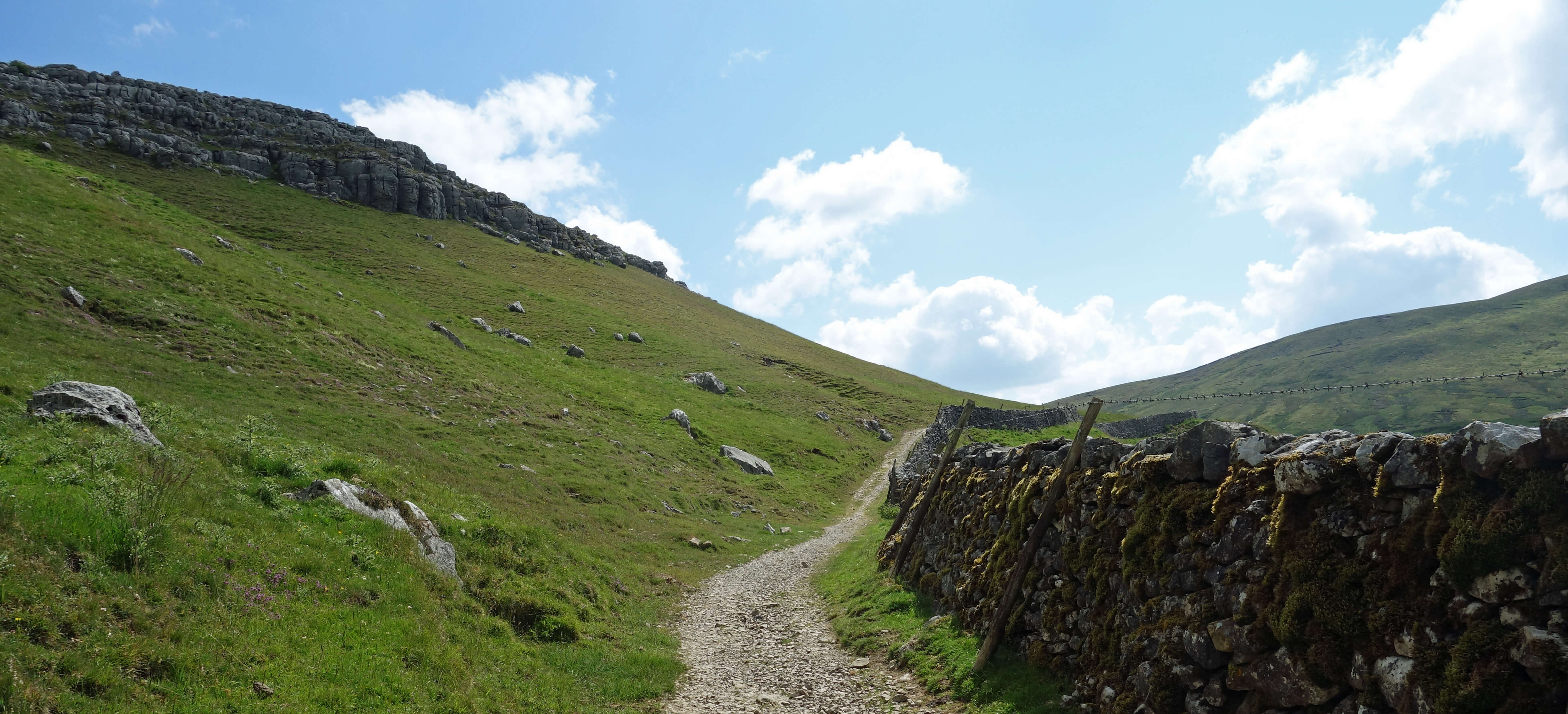
Settle packhorse route
Well, I had clear weather and found the track quite benign, too gentle to be a challenge. So, after a
while, I went ‘off-piste’ as some skiers do – and for the same reason. A piste or path marked on the map
is safe, direct and easy to follow. It is also beaten into moguls or bare stony ground by the volume of
people upon it. To be safe for everyone it is likely to be bereft of excitement or adventure. Off-piste or off-path there’s the challenge of navigating a route through new terrain, avoiding cliffs and bogs, and the possibility of seeing wildlife that would only be seen dead near a popular footpath.
I am not sure of the ethics of off-path walking. The 2004 Act that established hectares of open
access land only makes sense if walkers are actually expected to access that land. On the other hand,
wildlife has less space for itself nowadays and prefers not to be disturbed by people. Also, even without
trespassing, it may occasionally be necessary to climb a wall, which you should not do. And if when
walking alone off-path you should have an accident then you may be alone for some time. So, while I
find regular trail-tramping a little too straightforward, I trek off-path in moderation.
On this occasion I walked north for two kilometres over pathless land past limestone crags and
shakeholes. Nothing is marked on the map and I saw nothing of great interest, but it was quiet apart
from one or two wheatears and several skylarks. At the highest point (525 metres) there was a revelation
of Pen-y-ghent ahead and, to the west, a more distant Ingleborough, both in shade but otherwise looking impressive.
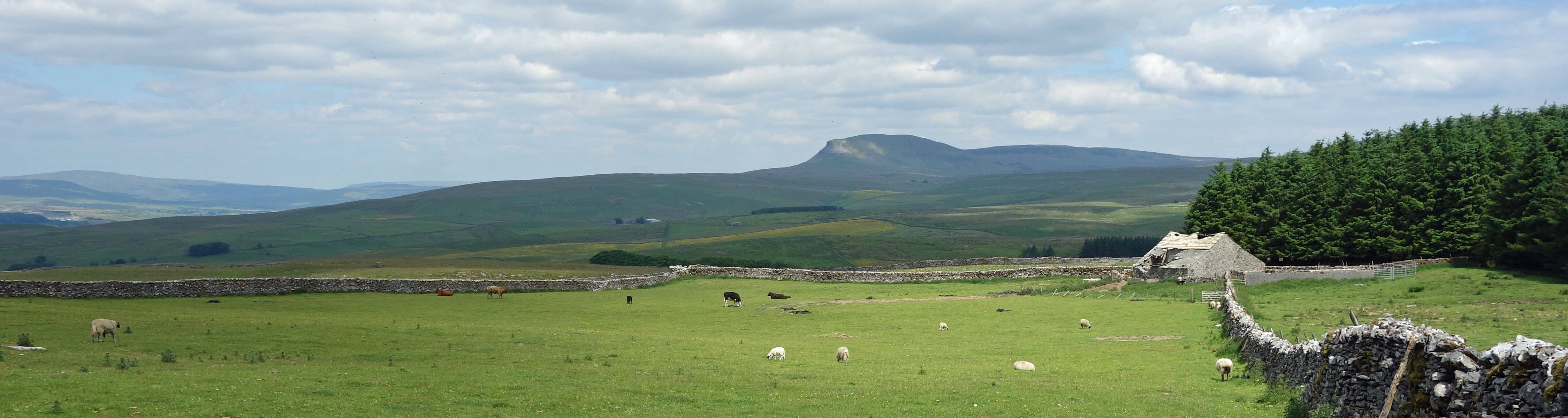
Pen-y-ghent from the Pennine Bridleway
I dropped down to the clear path of the Pennine Bridleway. Yes, the same bridleway. It seems odd to have
the two Pennine Bridleway paths running in parallel two kilometres apart. The reason is that these two
paths are not really part of the Pennine Bridleway proper. The Pennine Bridleway is a 205-mile trail from
Derbyshire to Cumbria, running in this region from Long Preston through Settle to Stainforth. The two
bridleway paths that I walked on are part of the ‘Settle Loop’, a ten-mile side-circuit off the main trail.
I then came to Langcliffe Scar, where there are a number of well-known caves. Some of them are
marked on the OS map in its special font for antiquities. Of course, all caves are antique but these ones
are marked as special because of the historically significant finds therein, in particular the remains of
pre-Ice Age hippos and rhinos. Victoria Cave was discovered in 1838, the year of Queen Victoria’s coronation.
Since it forms a prominent large dark hole in the cliff-face, visible from afar, either people were unobservant before 1838 or the cave opening has been much enlarged since then.
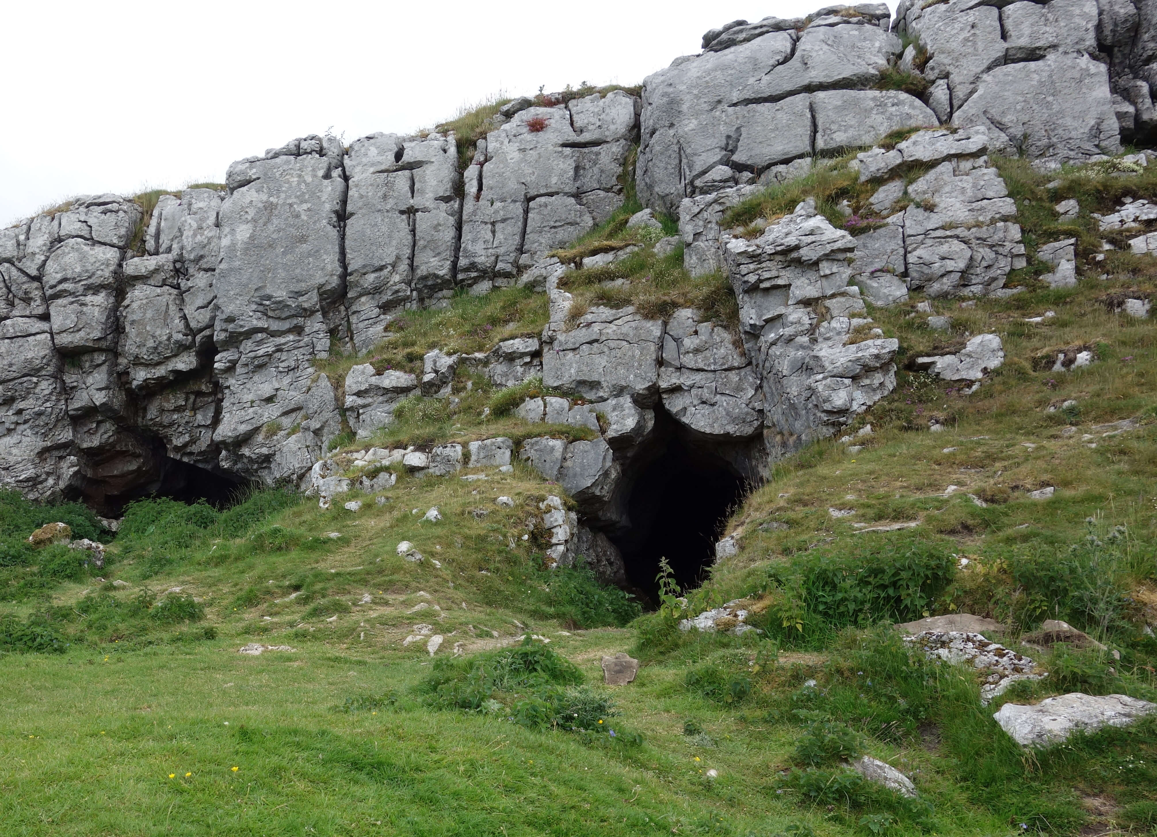
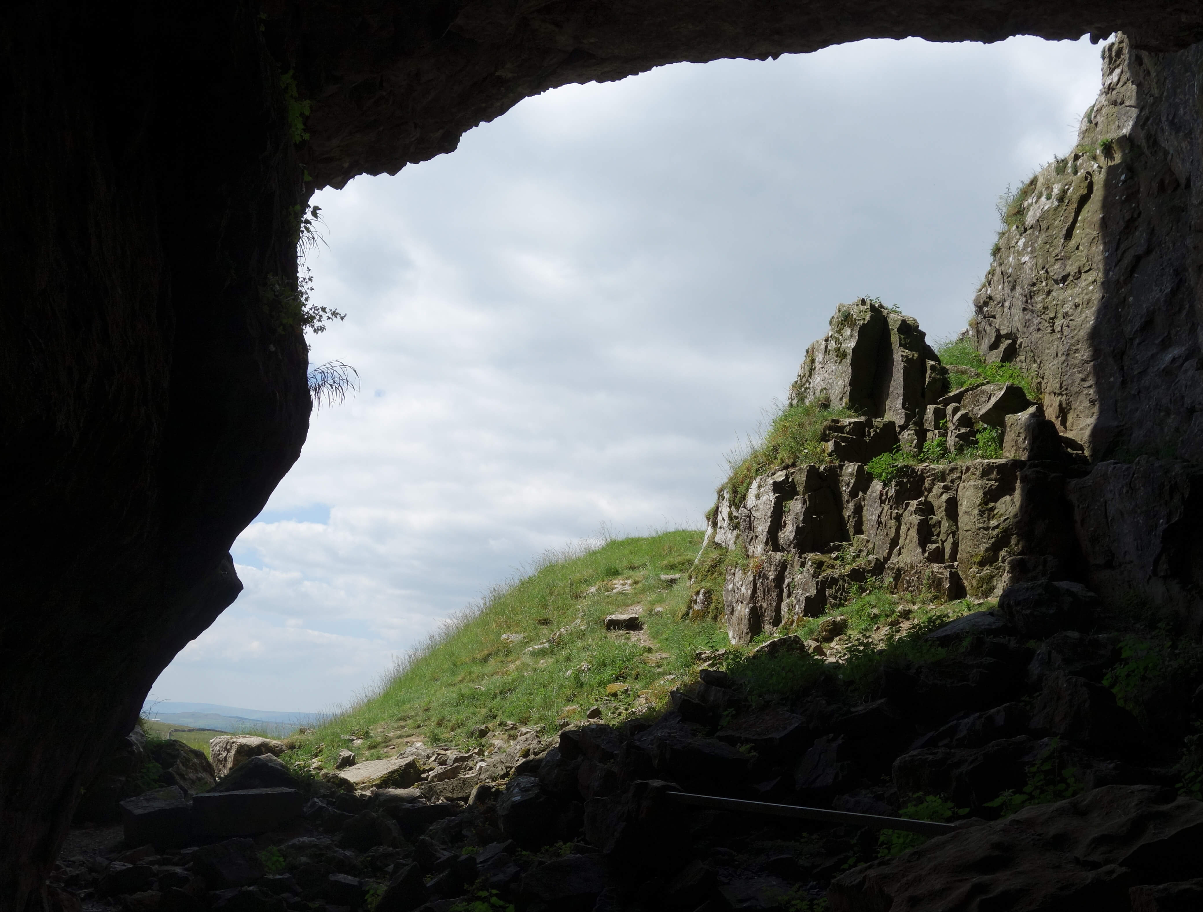
Left: Jubilee Cave;
Right: Victoria Cave.
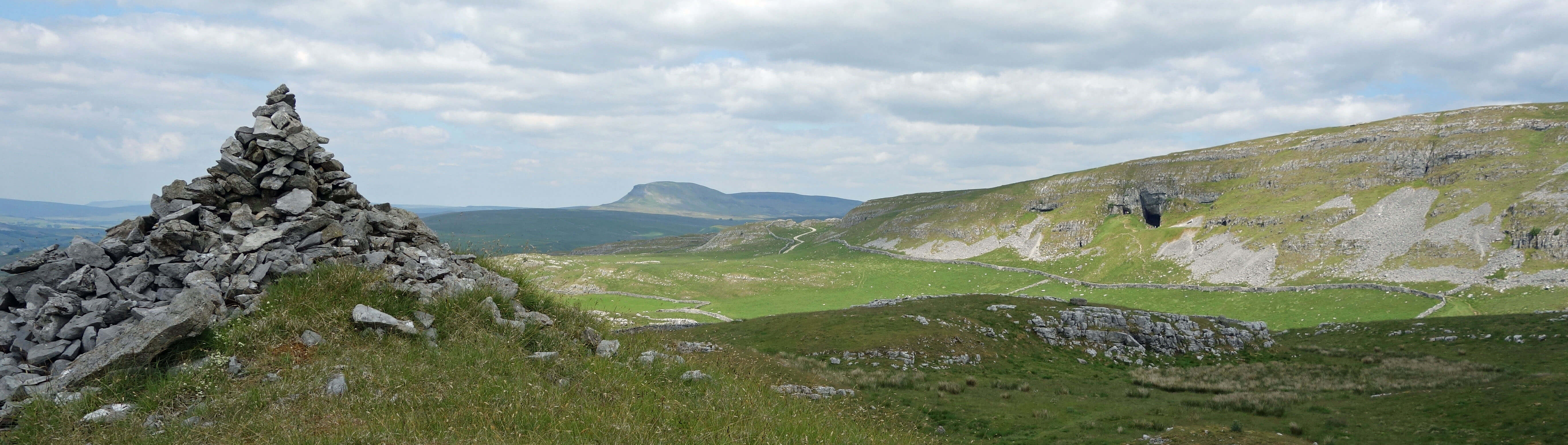
Pen-y-ghent and Victoria Cave from Warrendale Knotts
The latter is the case.
Date: June 22nd 2021
Start: SD819636, Settle market square (Map: OL41 or OL2)
Route: SE through Upper Settle, NE, SE on Malham Road, NE on Stockdale Lane, E on
Pennine Bridleway – beyond Stockdale Farm – N over Back Scar – Pennine Bridleway – W, S past Jubilee Cave
and Victoria Cave – W over Warrendale Knotts – trig point – W over Blue Crag (necessitating a climb
over a wall: it would have been better to drop south from the trig point to the Dales High Way) – Pennine Bridleway – S – Settle
Distance: 8 miles; Ascent: 380 metres
Home
Preamble
Index
Areas
References
Me
© John Self, 2018-

Top photo: The western Howgills from Dillicar;
Bottom photo: Blencathra from Great Mell Fell