
Home
Preamble
Index
Areas
Dales
Hills
Lakes
Places
Reserves
Rivers
Structures
Villages
References
Me
Saunterings: Walking in North-West England
Saunterings is a set of reflections based upon walks around the counties of Cumbria, Lancashire and
North Yorkshire in North-West England
(as defined in the Preamble).
Here is a list of all Saunterings so far.
If you'd like to give a comment, correction or update (all are very welcome) or to
be notified by email when a new item is posted - please send an email to johnselfdrakkar@gmail.com.
135. By the Old Farmhouses of Dentdale
We walked through the narrow, cobbled main thoroughfare of Dent where a ginormous rock has been
placed to make it even narrower. On the rock is carved ôAdam Sedgwick 1785-1873ö. There is no explanation
of who Adam Sedgwick was or why this memorial to him is placed here. Those who do not know may consult his
Wikipedia page,
where it states that he was born in Dent and became Professor of Geology at the University of Cambridge.
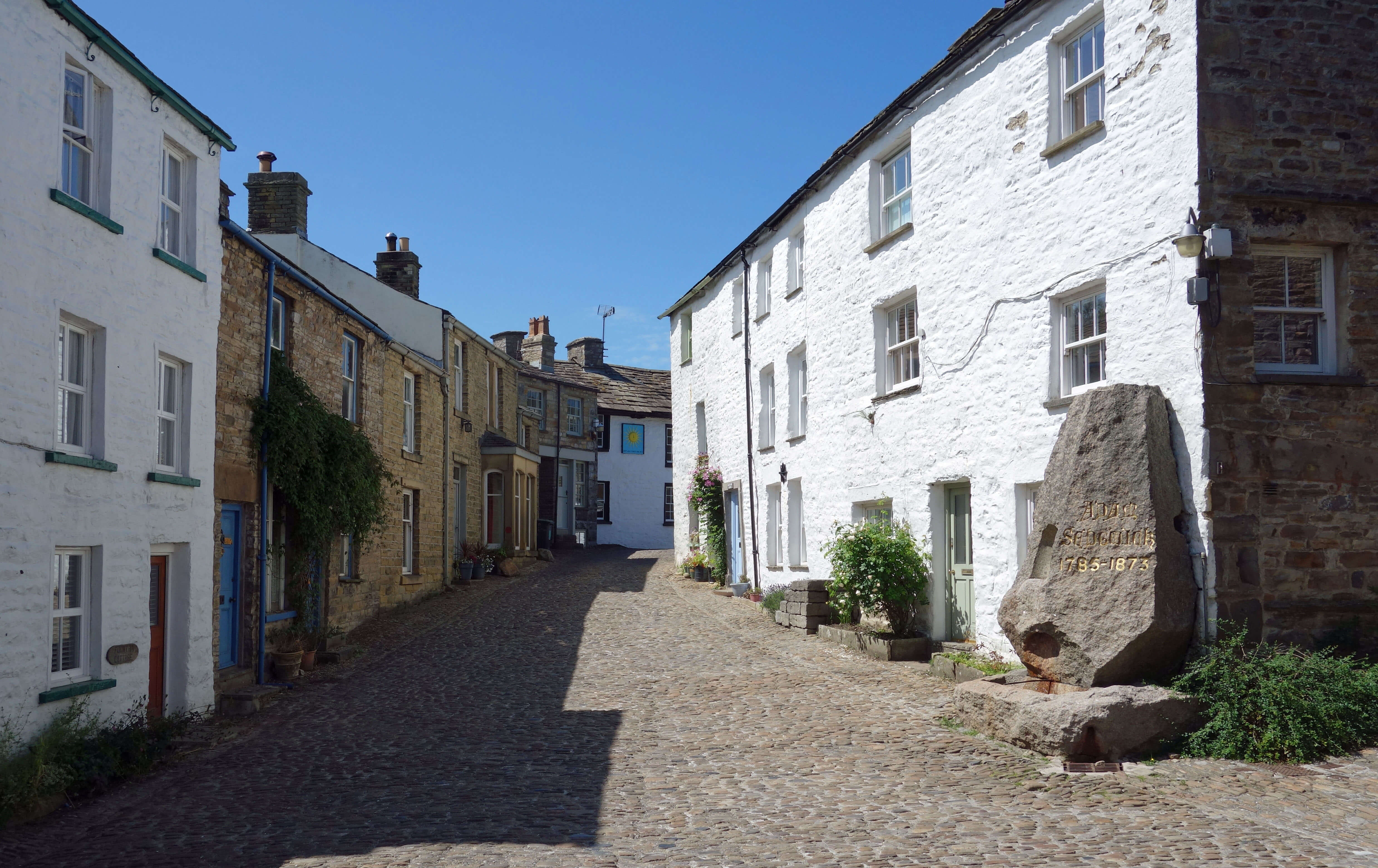
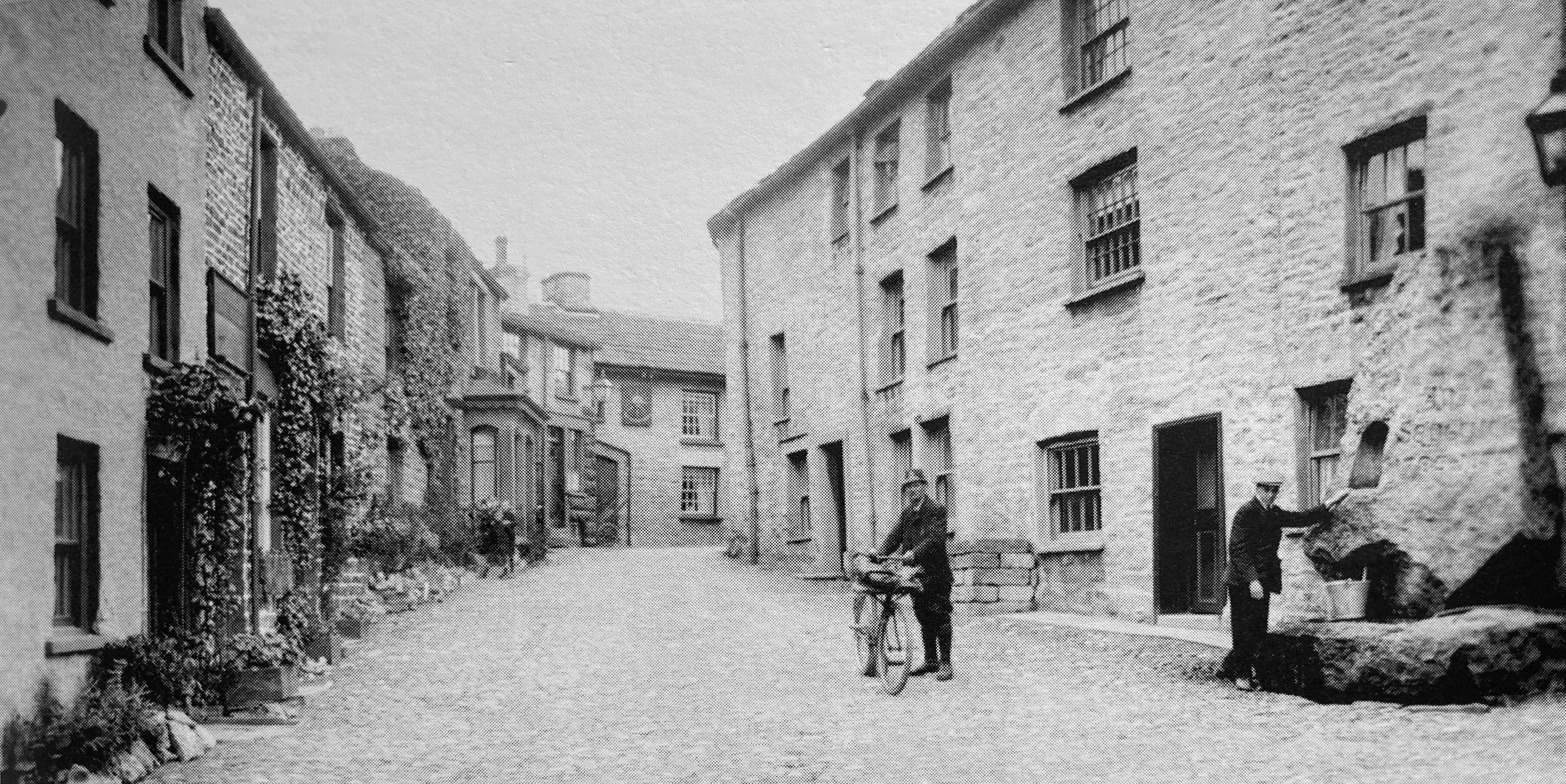
The Sedgwick Memorial in Dent now (left) and in 1924 (right)
The Wikipedia page gives details of his illustrious career but says nothing about a document that
he wrote in 1868,
A Memorial by the Trustees of Cowgill Chapel,
that is of more relevance to these notes. He was spurred to write this 122-page pamphlet in the last
years of his life ľ in fact, he was so infirm that he had to dictate it ľ by a controversy concerning the
re-naming of Cowgill Chapel, which is four miles up the valley from Dent.
In 1837 Sedgwick had laid the
foundation stone of this chapel, which his
sister-in-law had been instrumental in getting built, and he had been a Trustee thereafter. It cannot have
been easy fulfilling this role, living in Cambridge, and no doubt his writing of the pamphlet was
partly to assuage a feeling of guilt over being unaware that the vicar had sought to have the name
changed to Kirkthwaite Chapel, which Sedgwick strongly disagreed with.
I am not interested in the reasons for this dispute or the formal mechanisms by which churches
are named or re-named. The pamphlet is more interesting to me because of the Ĺasidesĺ within it, where
Sedgwick described the changes in the valley since his childhood, to give background to why Cowgill Chapel
came to be built and what its role was seen to be. Like most people he had a somewhat rose-tinted memory
of his early years although he also mentioned drunken riots, blasphemy, cock-fighting and gambling. He
clearly retained a fondness for what he called the ôhonest, warm-hearted inhabitantsö. Most of all, though,
he lamented the loss of a ôland of rural opulence and gleeö.
Dentdale was an isolated, self-sufficient Ĺparadiseĺ.
Almost everything the inhabitants needed was provided within, supporting a variety of trades: farmers,
blacksmiths, bootmakers, coopers, tailors, and so on, even wig-makers. However, over the years of
Sedgwickĺs life this all changed, for two main reasons. The Industrial Revolution meant that goods
could be produced more cheaply outside the valley and therefore many trades became obsolete and the
traders moved away. Secondly, the enclosure acts meant that many landowners became poor rent-paying
farmers. In these changes, Dentdale was, of course, little different to all the other dales ľ but none of
the other dales has a pamphlet like this documenting the process.
Hartley and Ingilby (1956) says that between 1778 and 1951 the number of houses in Dentdale dropped
from 416 to 257 and that many of those that remained were becoming derelict or were being turned into barns.
On this walk we set out to see how the farmhouses are getting on today. They are lined out, on both sides of the valley, above the level of the floodplain. Footpaths pass by most of them. So we walked on the north bank by Shoolbred, Scotchergill, Peggleswright (mentioning just some of the names) to Bankland, where we dropped down to cross the River Dee at Tommyĺs Bridge. All the houses on this sunny side of the valley seemed in fine fettle. (Of course, some old farmhouses may have disappeared altogether.) Few, if any, of them were actively farming. They were homes (or second homes or holiday homes) with excellent views across the green valley to Whernside and Great Coum.
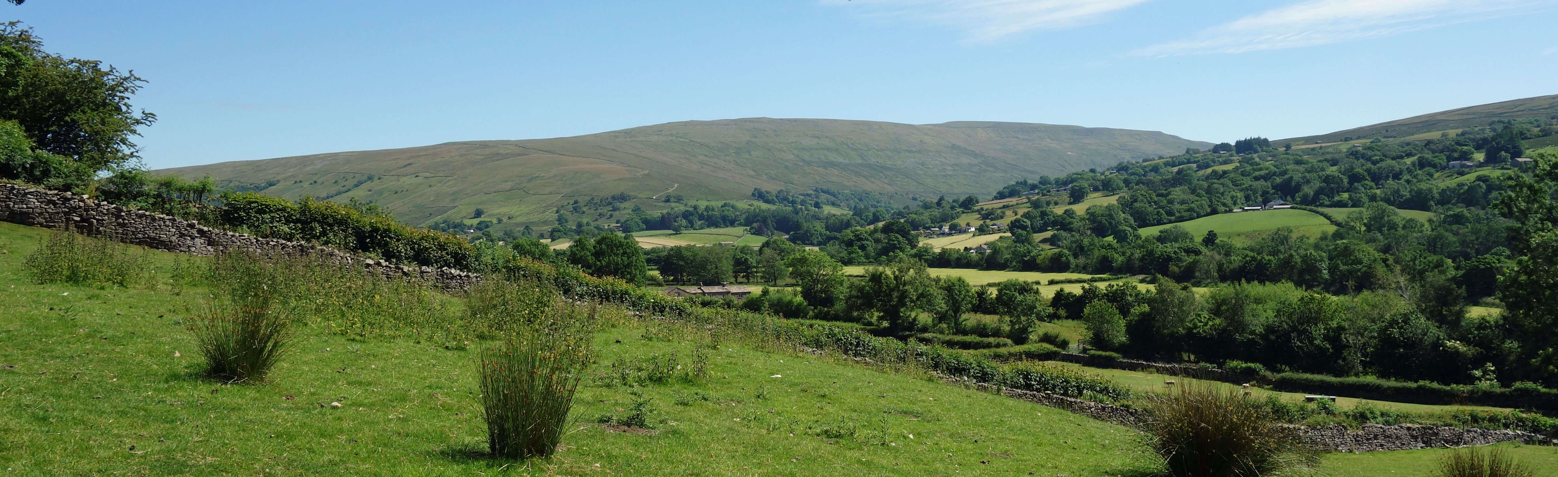
The view towards Whernside
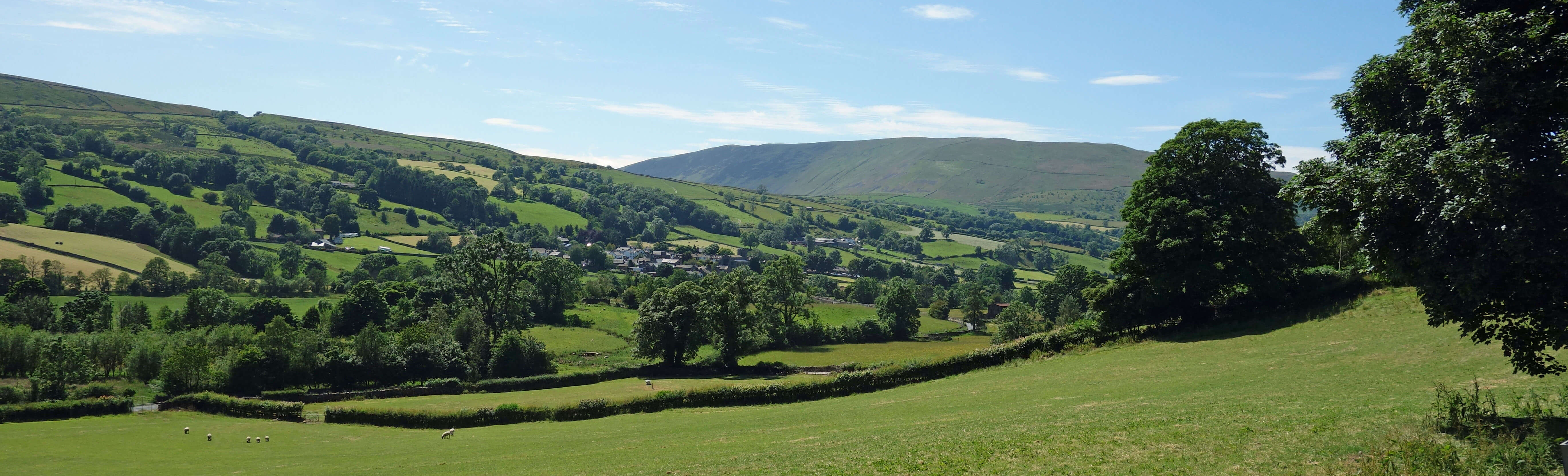
The view back towards Dent, with Middleton Fell behind
We then returned on the south bank by Coventree and West Banks. The houses on this less sunny side were
more of a mixed bag: most were in good condition, a couple maybe needed some care and attention, and one
was derelict. We passed only two obvious farms, both by the road, as a farm needs to be nowadays. All
the houses had private tracks up from the road.
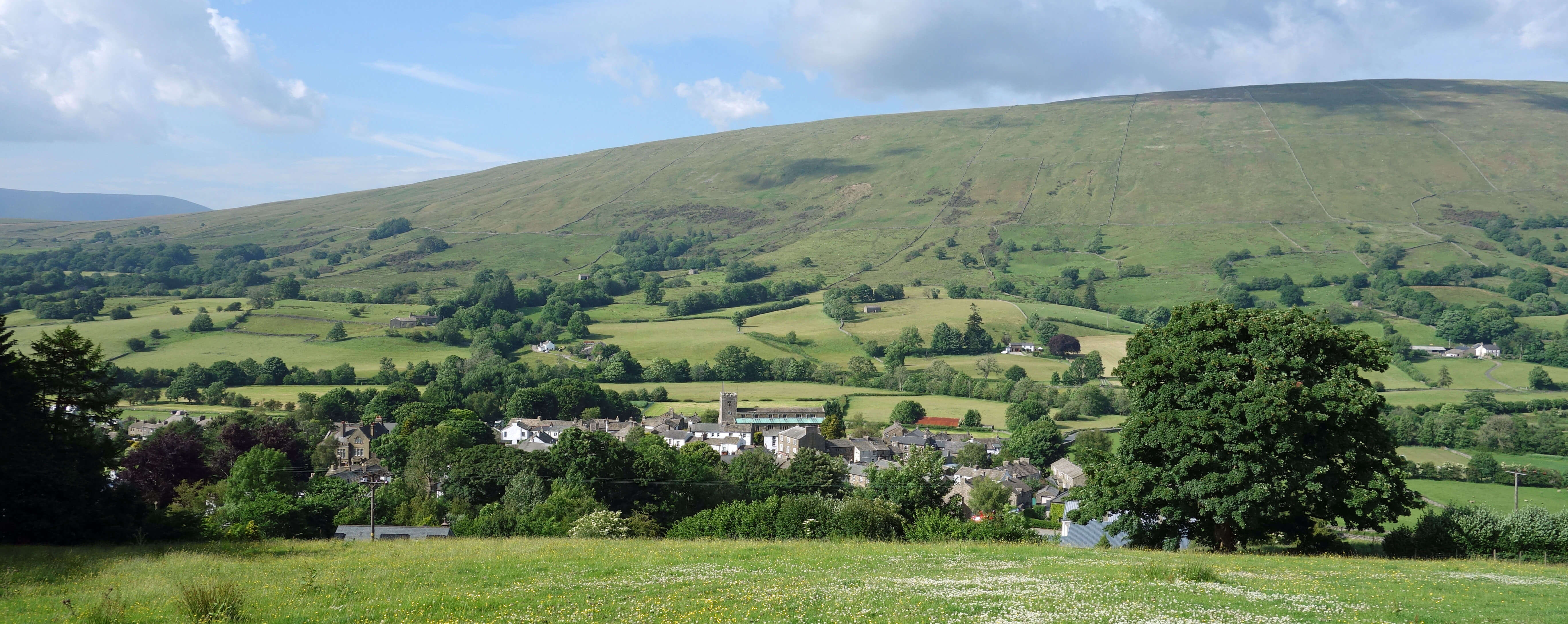
Dent with Rise Hill behind
The following morning we continued our tour of the Dent farmhouses
from near Ibbeth Peril, three miles up the valley from Dent. There was barely
a dribble of water at Ibbeth Peril, where on a previous visit there had been an impressive waterfall
into a much larger plunge pool.
(A virtual visit into the cave seen to the left of the waterfall can be taken
here).
The Dee is
here flowing over limestone but not if there is so little water that it all disappears through it.
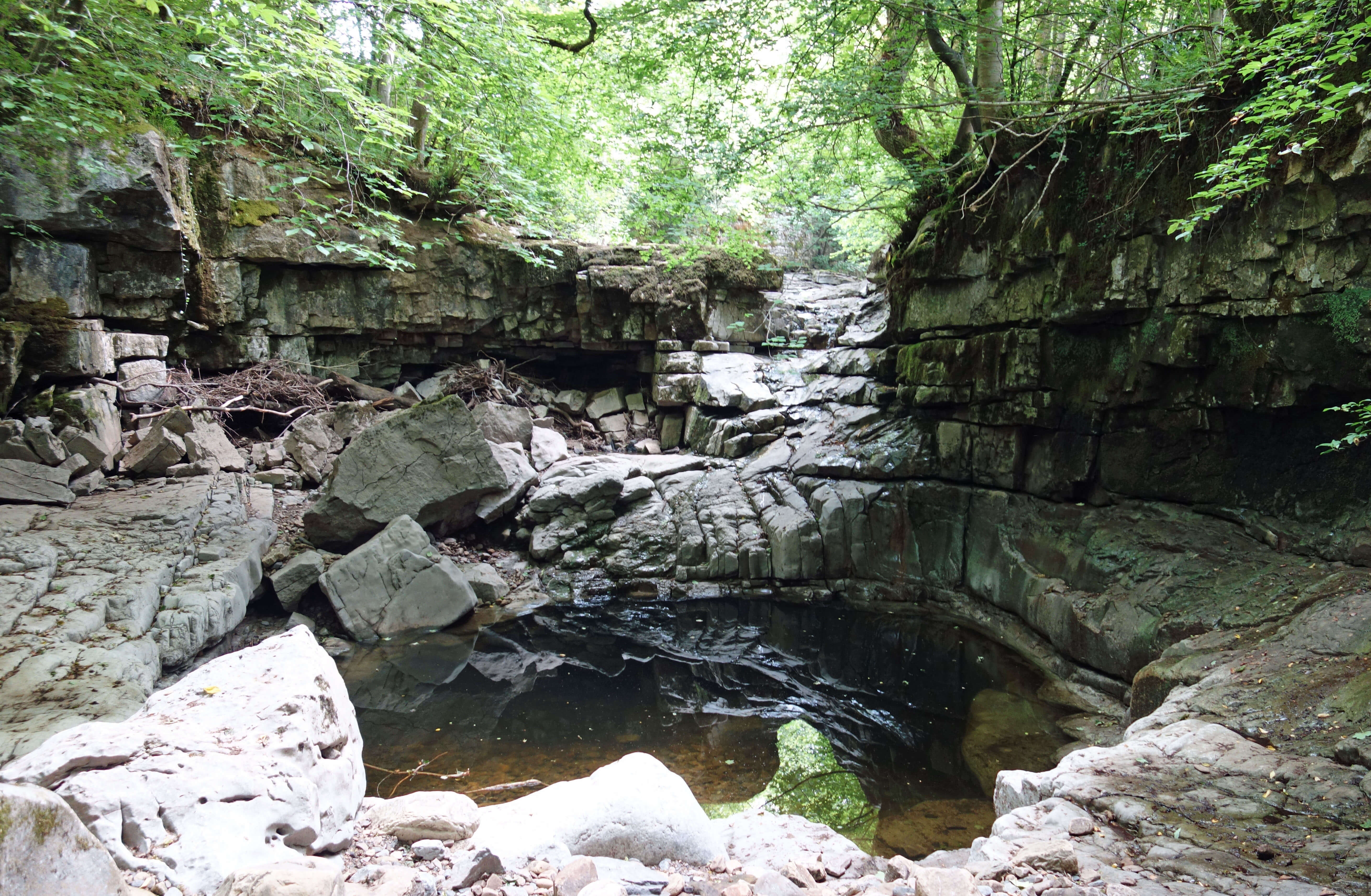
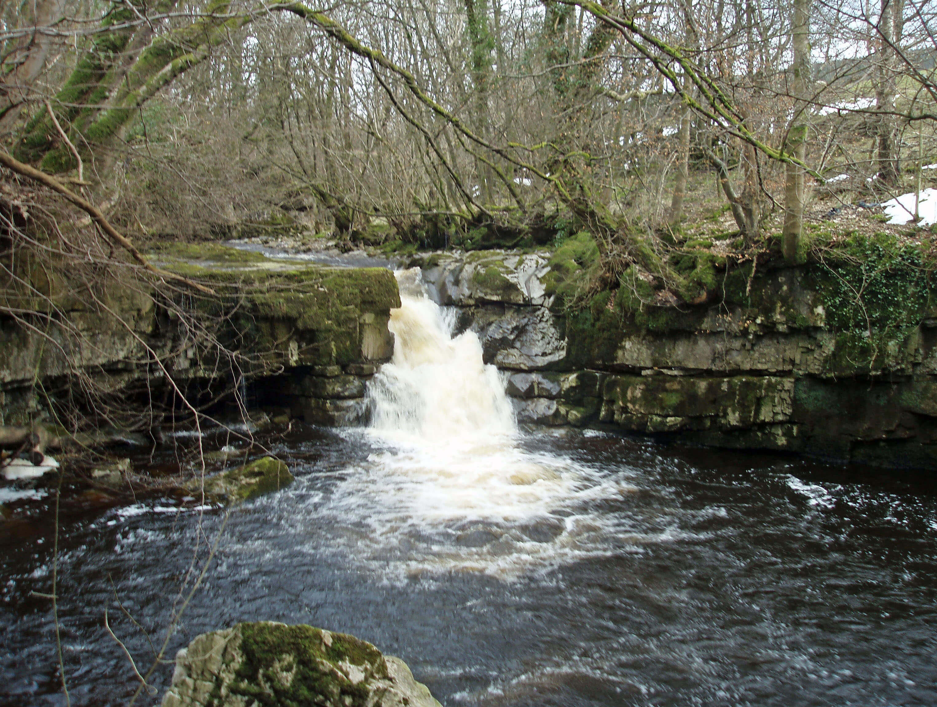
Left: Ibbeth Peril; Right: Ibbeth Peril on an earlier occasion.
We walked
past the remains of Gibbs Hall, now behind a number of cottages, and crossed the Dee at Lennyĺs Leap. A cuckoo
cuckooed, flouting the old rhyme ôIn June I change my tune, in July away I flyö. On
the south bank we followed the Dales Way past various homesteads, most in good condition, one or two
needing work, and one or two getting it. The conifer plantation that darkened this part of Dentdale is, I'm pleased
to say, no more.
At Ewegales Bridge and Lea Yeat Bridge we found that both were being repaired after damage to
their squinches. I never knew bridges had squinches. On the road between the two we noticed a building
with the sign ôKirkthwaite Church of England School 1866ö. It must have been part of the great Cowgill-Kirkthwaite
controversy. And then we reached the church that was the cause of all the trouble. It is now called the
Church of St John the Evangelist and seemed at peace. Inside the church, which was open to our
surprise, there was a memorial to the 72 people who died in Dentdale during the construction of the
Settle-Carlisle railway. They are all named, unlike on memorials to those who died at Ribblehead.
Nearly half the dead were children, not workers.
After walking up to Dockra Bridge, over Cowgill Beck (which was dry), we continued walking by the
farmhouses on the north bank ľ but at Spice Gill Farm we had to drop down to the road to get back to the car.
We could not find the footpath by Spice Gill Farm because it was surrounded by rubbish. By this I
donĺt mean the usual rusty old machinery that accumulates around farms. I mean household rubbish, of the kind which
we take to the tip. Spice Gill Farm, dated 1678, is one of Dentdaleĺs many listed buildings. We
couldnĺt tell if it was occupied or not. Anyone prepared to live surrounded by this rubbish is not going
to be bothered to keep the house in good shape.
It was a shame to end our tour on such a note. It left some questions. Everybody generates
rubbish ľ what are Dentdale residents supposed to do with theirs? Do the authorities know that some
of it is tipped at Spice Gill Farm? If so, do they care? Itĺs hardly Ĺout of sight, out of mindĺ since
itĺs on a public footpath (or is supposed to be). What can the authorities do about it? Perhaps it
serves as a reminder that
a paradise like Dentdale does not arise by chance. It requires constant vigilance and work.
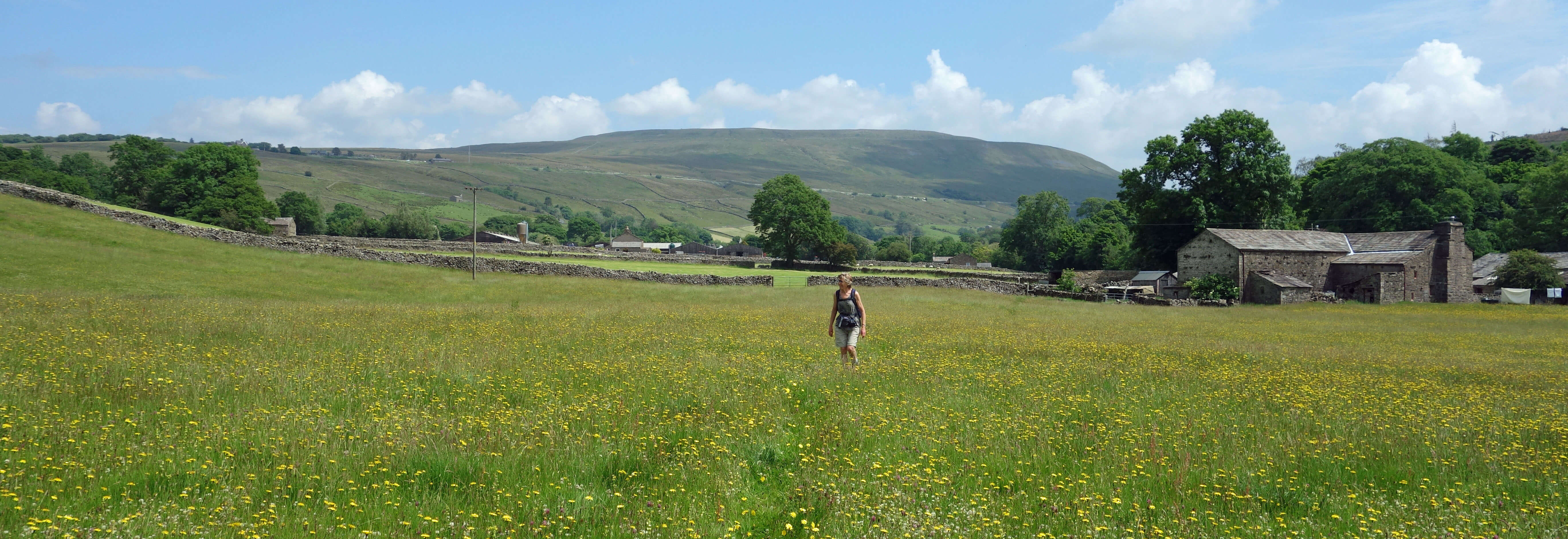
The image we prefer to retain, of walking through countless meadows, in this case with Great
Knoutberry Hill in the distance
Date: July 1st/2nd 2021
(a) Start: SD703872, High Laning campsite (Map: OL2)
Route: SE, NE through Dent ľ Shoolbred ľ SE ľ Bankland ľ W, S over Tommy Bridge, SW ľ Mill
Bridge ľ SW ľ Slack ľ NW ľ beyond West Banks ľ N ľ Dent
Distance: 4 miles; Ascent: 70 metres
(b) Start: SD742865, lay-by near Ibbeth Peril (Map: OL2)
Route: W ľ Basil Busk ľ S over Lennyĺs Leap ľ Tub Hole Barn ľ E, NE on Dales Way ľ Ewegales
Bridge ľ E ľ Lea Yeat Bridge ľ W ľ Cowgill church ľ N ľ Dockra Bridge ľ SW, W ľ Spice Gill Farm ľ S, W on road ľ lay-by
Distance: 5 miles; Ascent: 80 metres
Home
Preamble
Index
Areas
Dales
Hills
Lakes
Places
Reserves
Rivers
Structures
Villages
References
Me
ę John Self, 2018-

Top photo: The western Howgills from Dillicar;
Bottom photo: Blencathra from Great Mell Fell