
Home
Preamble
Index
Areas
References
Me
Saunterings: Walking in North-West England
Saunterings is a set of reflections based upon walks around the counties of Cumbria, Lancashire and
North Yorkshire in North-West England
(as defined in the Preamble).
Here is a list of all Saunterings so far.
If you'd like to give a comment, correction or update (all are very welcome) or to
be notified by email when a new item is posted - please send an email to johnselfdrakkar@gmail.com.
2. The Dentdale Diamonds
What’s with all the green diamonds on Ordnance Survey (OS) maps? In preparation for these saunterings I
replaced my beloved but battered OS maps with a sparkling new set. I found that the new maps have been
decorated with green diamonds, which according to the legend denote Recreational Routes (RRs). Some maps
look like green ants have been set loose upon them. The winner is OL21 (South Pennines), which marks 22
such routes, from the Brontë Way to the Worth Way. The only one of these 22 routes that I had heard of
was the Pennine Way. Clearly, I have a lot of Recreational Routing to look forward to.
When I studied the new maps for an outing in lower Dentdale and on Frostrow Fells I was surprised
to find that every step of my planned route was on a green diamond. I would be following three RRs.
With all respect to lower Dentdale and Frostrow Fells, I don’t think anyone would claim this to be prime
walking country. Lower Dentdale, by the River Dee, is pleasant enough but rather enclosed. The Frostrow
Fells provide fine views north to the Howgills and south to Middleton Fell but they themselves form a
rather small, run-of-the-mill moor, reaching no higher than 300 metres and with no distinctive peak.
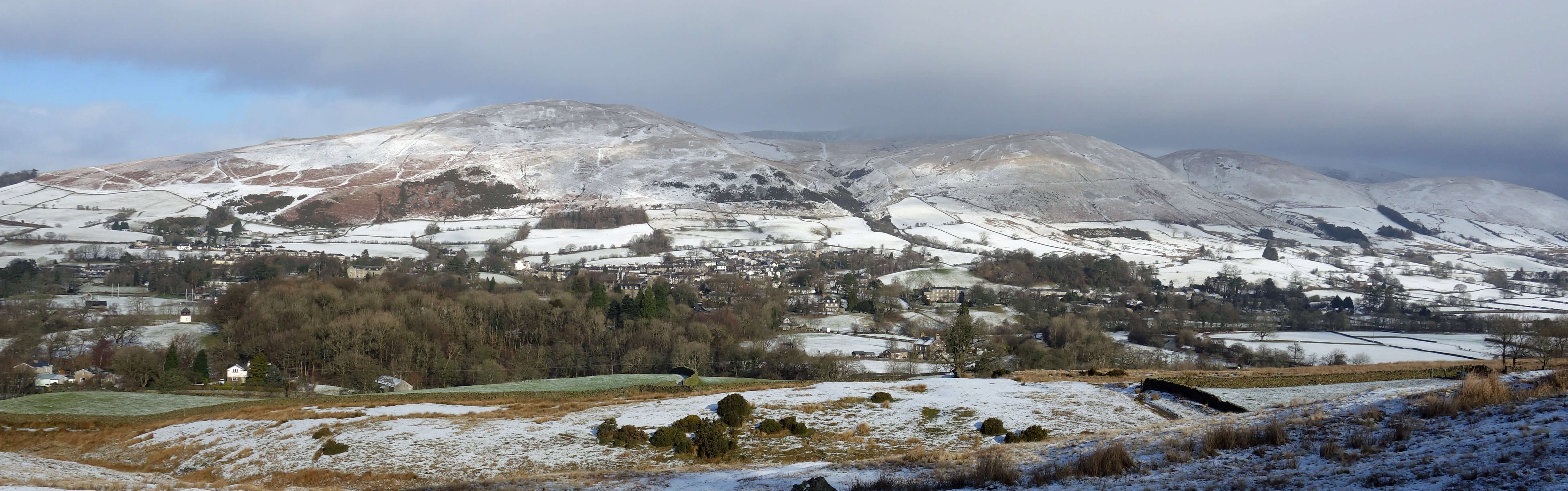
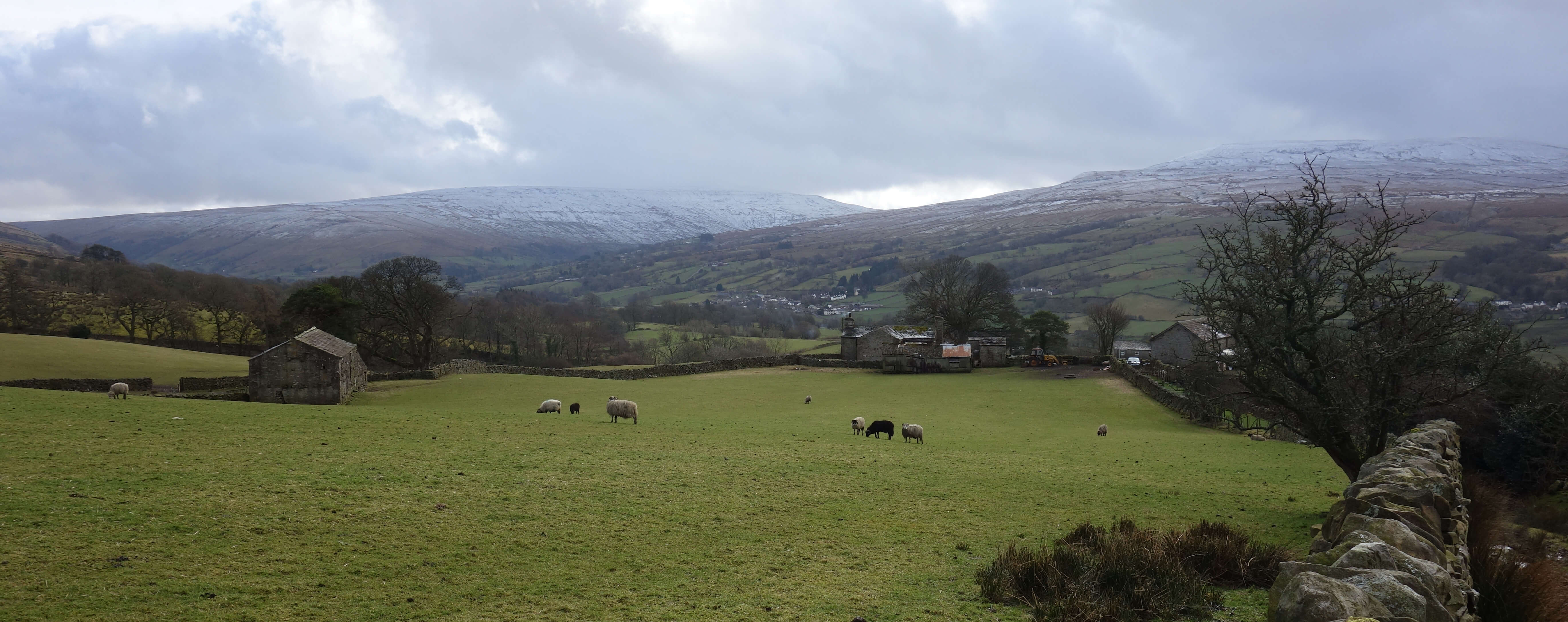
Sedbergh and Winder from above Millthrop
So I set out to investigate these RRs. As I left the bridge by the River Rawthey to walk through
Millthrop I was already on the
Dales Way.
At least I had heard of this one. The Dales Way is a well-established
Long Distance Path (LDP), started in 1968, of about 80 miles between Ilkley and Bowness. I have walked much
of it already, incidentally. I particularly like the fact that the Dales Way neither starts nor ends in the Yorkshire Dales.
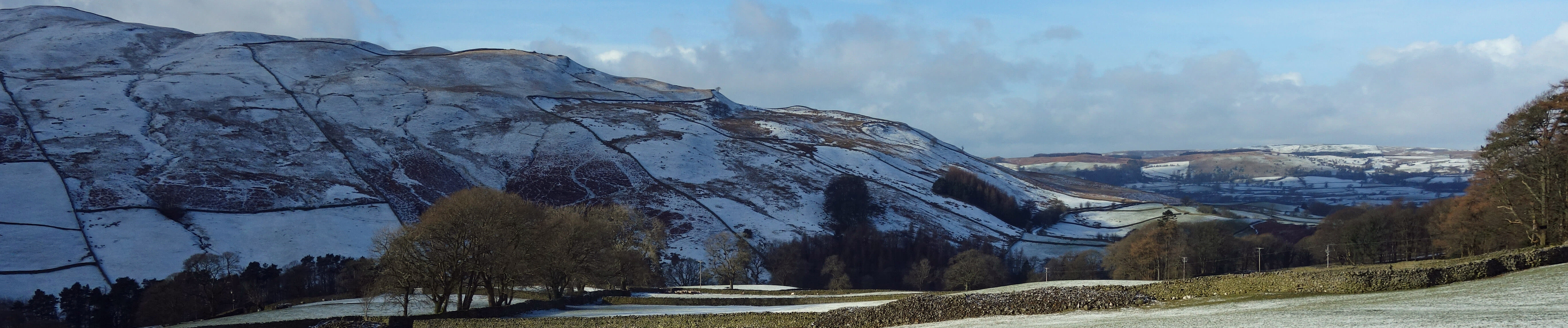
Middleton Fell from the Dales Way, to the south (top) and to the north (below)
Studying the OS map, I saw that the green diamonds also have “A Pennine Journey” written alongside.
I may have heard of this but I had never paid any attention to it. Looking it up, I found that it is another
LDP, this time of about 250 miles, described in Pitt (2010). It is based upon Alfred Wainwright’s 1938 walk from
Settle to Hadrian’s Wall and back. As if we don’t have enough Wainwright walks! This 1938 walk was before he
became celebrated for his seven-volume guide to the Lakeland Fells. Walking conditions were different in 1938
to what they are now. There was little traffic and therefore much of Wainwright’s route was on then-quiet
country lanes. Also, we now have open access areas that make it clearer where we are supposed to walk and
not walk. The outcome is that the new
Pennine Journey
shares only a few sections with the 1938 route.
Nonetheless, walkers are encouraged to follow it, that is, the new route.
After strolling the shared green diamonds alongside the Dee, in silence apart from the burbling of the
river and the gentle mewing of a buzzard, I turned north at Barth Bridge onto another set of green diamonds,
this time for the
Dales High Way.
The Dales High Way is, I found, also a LDP, of 90 miles between Saltaire
and Appleby. It was devised in 2007 as a high-level alternative to the Dales Way by Tony and Chris Crogan,
who, naturally, have published books on the route. I don’t, of course, know the Crogans but why should I
trustfully adopt a LDP designed by others?
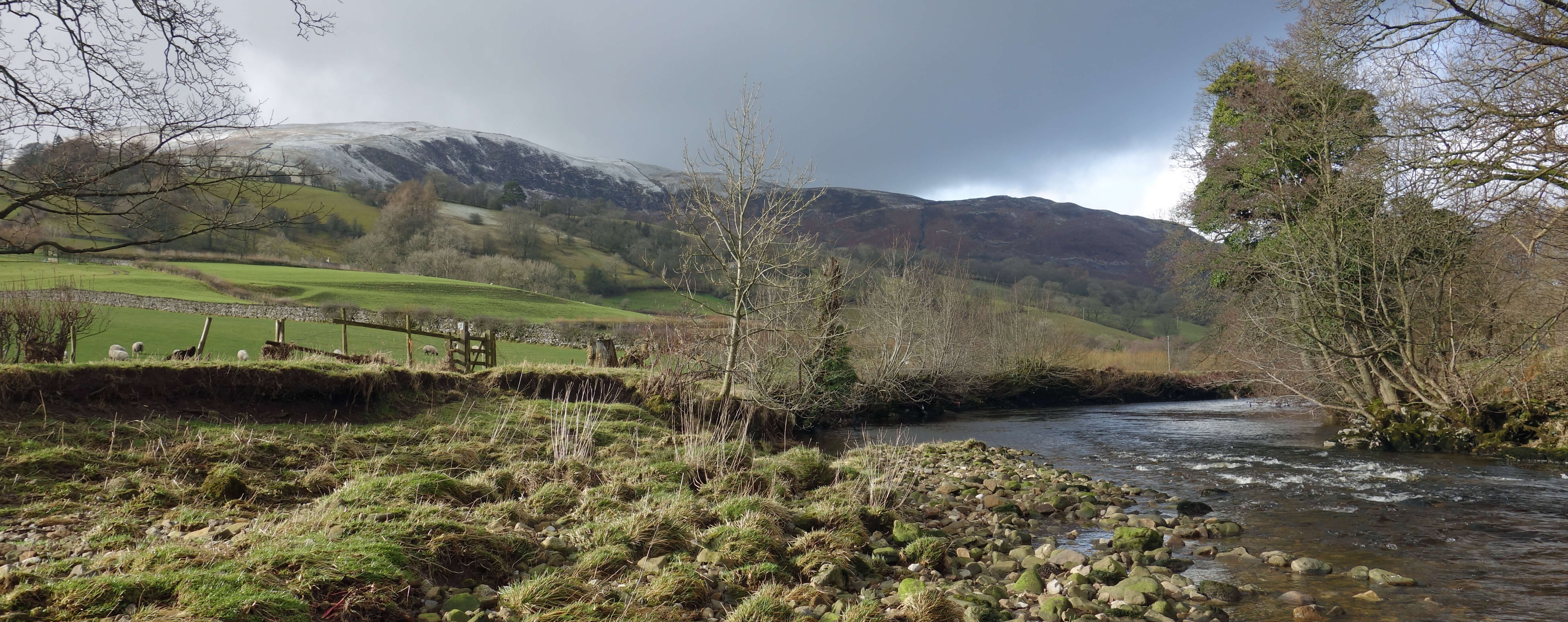
Left: the Dee at Barth Bridge; Right: looking towards Whernside.
Anyone can design a long-distance path, and a short-distance path for that matter. Who decides if
it is a LDP? What exactly is a LDP anyway?
The Long Distance Walkers Association
(LDWA) is duty bound to
try to define it but it has no formal right to do so, as far as I can see. The
Walking Englishman
website
lists over 650 LDPs, including, for example, a 68 mile
Forest of Bowland Walk,
which apparently passes close
to my home but which I have never heard of, have never seen any sign of, and is not marked on OS maps.
The LDWA lists it too.
Who decides if a path is a RR? Are all LDPs RRs? Are all RRs LDPs, or can a RR be of short or
medium distance? If not all LDPs and RRs are marked on the map, how does the OS decide
which ones to mark? Who decides on the name for a
LDP or RR? When a path is designated as a LDP or RR who is responsible for
maintaining it (signposting and so on)? If we are to be marched along designated routes then let’s demand
some real precision, organisation and regimentation!
I can’t say that my expedition along Dentdale and over Frostrow Fells was enhanced by the knowledge
that I was walking on green diamonds. If anything, the opposite. Perhaps most walkers appreciate the green
diamonds. They provide a reassurance that someone has reconnoitred a recommendable route and perhaps a hope
that the route, being an ‘official’ one marked on OS maps, will be easy to follow. They therefore reduce
some of the stress of rambling, for those who find it stressful. Perhaps our maps should be choc-a-bloc with green diamonds.
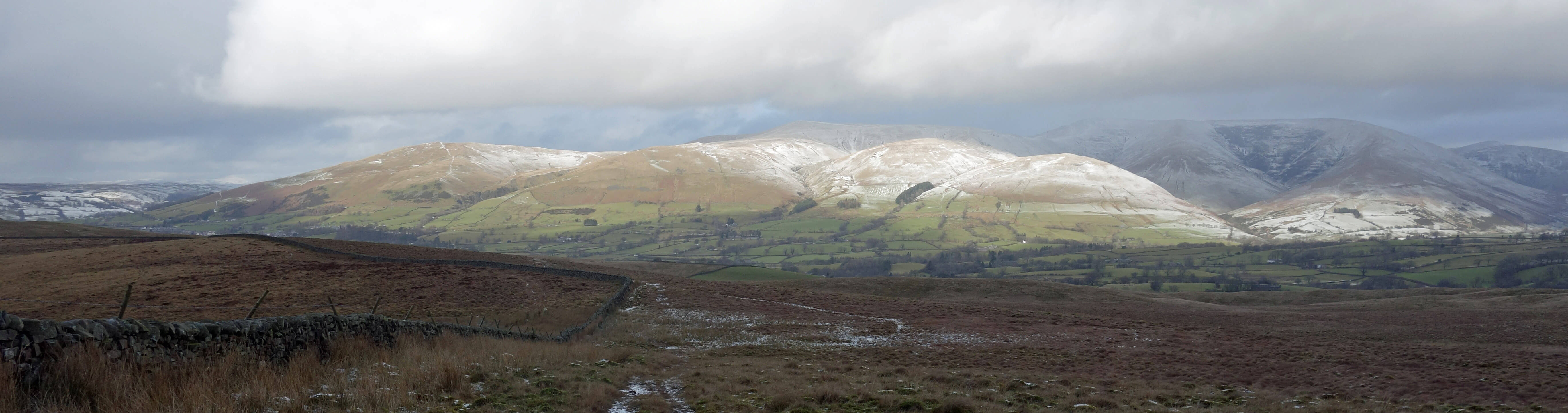
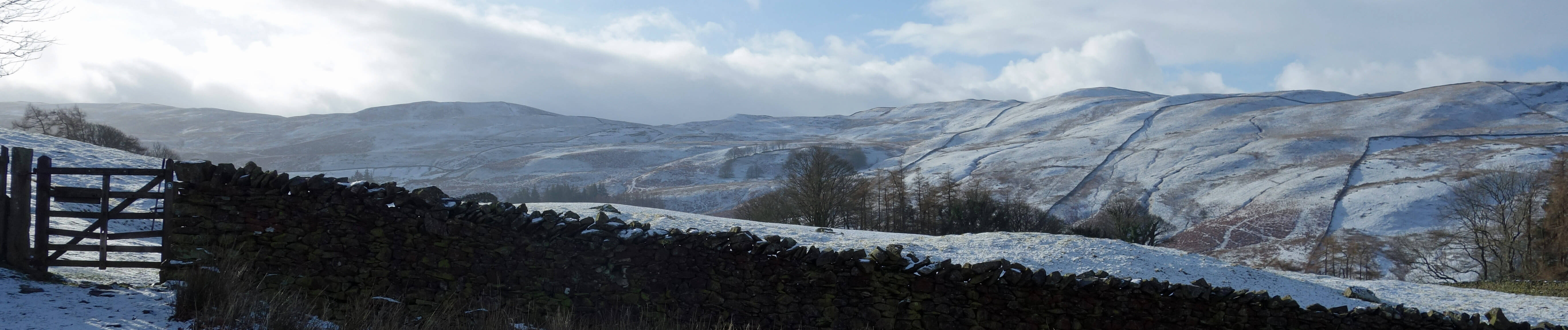
The Howgills from Frostrow Fells
For me, the green diamonds take away some of the satisfaction of sauntering. Much of the point
is to wander wherever interests me, not to tramp where someone has told me to. I saw many Dales Way signs –
so many, in fact, that it must be hard to lose the Way. However, I saw only one Pennine Journey sign. It
told me to follow the Dales Way for six miles, which, fair enough, is all it needs to say. And I saw one
Dales High Way sign, near Barth Bridge. If there were any signs on Frostrow Fells then
I recklessly ignored them. I don’t know what came over me. I think the names of Hunder Moor Hurrock and
Clatter Beck on the map just appealed to me. I also wanted to stay high on the moor as long as possible
so that I could continue to admire the Howgills as snow clouds and sunny patches swept over them.
Date: February 12th 2018
Start: SD662914, by bridge over the River Rawthey, Millthrop (Maps: OL19, OL2)
Route: S, SE, S (on Dales Way) – Brackensgill – SE (on Dales Way) – Barth Bridge – N – Lunds – N, W – Hunder Moor
Hurrock, Long Rigg, Dales Way – N – Millthrop
Distance: 8 miles; Ascent: 170 metres
Home
Preamble
Index
Areas
References
Me
© John Self, 2018-

Top photo: The western Howgills from Dillicar;
Bottom photo: Blencathra from Great Mell Fell