
Home
Preamble
Index
Areas
Dales
Hills
Lakes
Places
Reserves
Rivers
Structures
Villages
References
Me
Saunterings: Walking in North-West England
Saunterings is a set of reflections based upon walks around the counties of Cumbria, Lancashire and
North Yorkshire in North-West England
(as defined in the Preamble).
Here is a list of all Saunterings so far.
If you'd like to give a comment, correction or update (all are very welcome) or to
be notified by email when a new item is posted - please send an email to johnselfdrakkar@gmail.com.
3. Zipping over or around Thirlmere
Thirlmere is perhaps the least highly regarded of the Lake District’s lakes (which are
generally taken to number sixteen: Bassenthwaite Lake, Buttermere, Coniston Water, Crummock Water, Derwent Water, Elter Water,
Ennerdale Water, Esthwaite Water, Grasmere, Haweswater, Loweswater, Rydal Water, Thirlmere, Ullswater, Wastwater and
Windermere). For a start, Thirlmere is not a natural lake. It is a reservoir, although, to be fair,
there were two lakes (Leathes Water and Wythburn
Water) before they completed the dam to create Thirlmere in 1894. At least, that is what is almost always written
but I have found online a map of 1867
that shows one lake (already called Thirlmere) with a narrow ford in the
middle at a now-submerged Wath Bridge, east of Armboth. To the south, the 1867 Thirlmere extended just past the
present Hause Point.
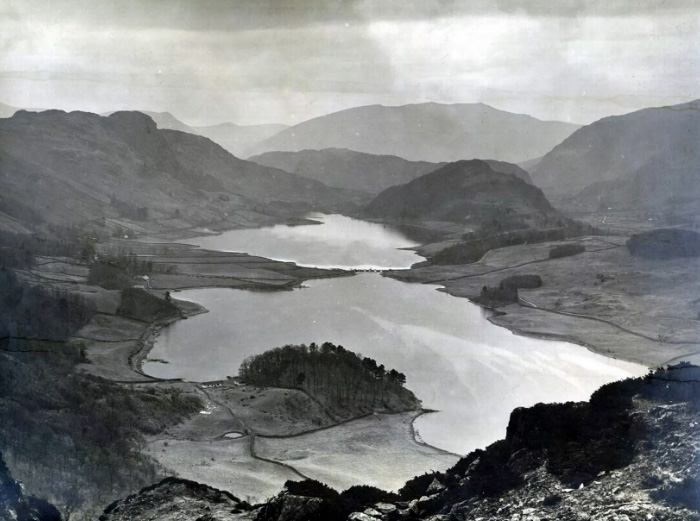
Thirlmere before it was dammed
Thirlmere, looking north
Nowadays most people who see Thirlmere see it from a car as they pass on the A591, the road between
Grasmere and Keswick. There is little reason to stop at Thirlmere, as there are no cruisers on the lake, no
shops, no museums, no Dove Cottages or Hill Tops (although there is one inn, at Thirlspot). Those who do stop are
probably intending to walk away from Thirlmere, to the east up Helvellyn or to the west up to the High Seat ridge.
Perhaps this apparent lack of public affection for Thirlmere encouraged an
enlightened proposal to add some
sadly missing touristic pizzazz to Thirlmere. The idea was to install zip-wires across the lake near Armboth.
You would zip over the lake and A591 on the highest and longest zip-wires in England. This would be “an all-year-round
attraction, attracting a large number of visitors … [to] this stunning part of the Lake District … [and the] … environmental
impact is minimal”. According to an online poll, people under 45 were over four times more likely to support the
proposal than be against it and people over 59 were twice as likely to be against it. It’s only a matter of time, then.
Mind you, the company proposing the zip-wires ran the poll. The planning application was duly submitted in November
2017, with the support of
Cumbria Tourism, the official Tourist Board for the Lake District, who consider that
“the proposal aligns with Cumbria Tourism’s longstanding commitment to promoting the county as the UK’s ‘adventure capital’.”
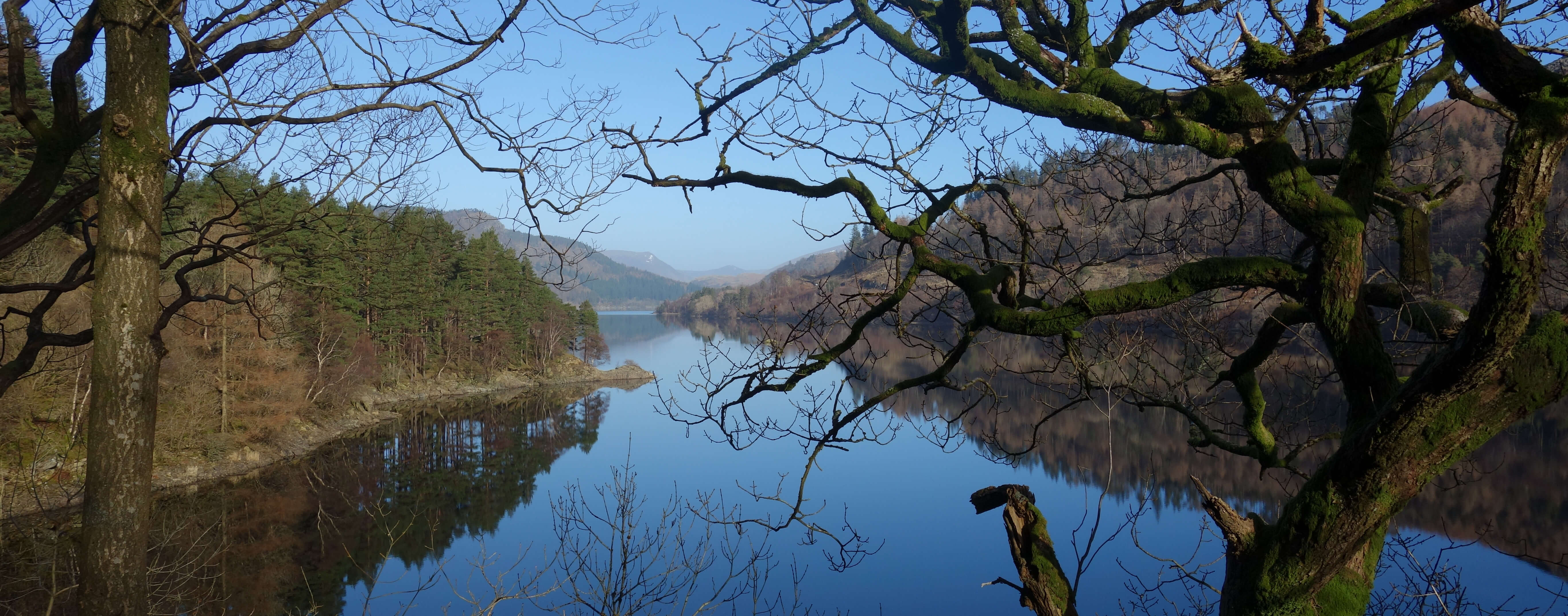
Where the zip-wires would be: looking east across Thirlmere
Some people seemed to find the proposal objectionable. For example, the British Mountaineering Council gave
eight reasons to
oppose the proposal.
It would:
- be inconsistent with National Park statutory purposes;
- result
in unacceptable levels of traffic on local highways;
- negatively impact upon the landscape character and
tranquillity of Thirlmere;
- set a precedent for similar developments elsewhere in the Lake District and
other National Parks;
- undermine and threaten the Park’s World Heritage Site status;
- introduce
commercial development to an area of tranquillity;
- not accord with the Sandford Principle, that conservation
interests should take priority over public enjoyment;
- require permission from the Civil Aviation Authority,
so as not to impede flight paths.
Well, yes, but apart from that?
My own thinking on the matter was simplistic, as it usually is. Since the fastest zip-wires reach 100 mph
(and surely our Thirlmere zip-wires would need to be the zippiest) and since it was decided in 2005, after a prolonged,
controversial inquiry, that (in order to ban jet-skiing, power-boating, water-skiing, and the like) nothing would be
allowed to travel at more than 10mph over Lake District lakes,
why don’t we just interpret ‘over’ a little liberally? Then we can forget the whole thing.
I planned to walk around Thirlmere in order to imagine the zip-wires and to enjoy Thirlmere before they became
a reality. However, the evening before my walk the local BBC news reported that the zip-wire proposal “had been scrapped.”
I didn’t know the legal definition of ‘scrapped’ but it turned out that the
proposal had been withdrawn, before the
committee could reject it, because the Ministry of Defence objected that “the wires would pose a threat to low-flying
aircraft.” So I went to complete a lap of celebration instead.
I followed the permissive path that meanders by the western lake-edge, around boulders, over the
becks, with occasional inlets providing views of the lake. However, it was slow progress compared to striding
out on the quiet road, which I did from time to time. I paused for a while by the lake at Armboth, imagining the
zip-wirers above me and a huge ‘zip-wire-station’ across the lake. I didn’t tax my imagination for long, since the
proposal is defunct. Instead, I admired the view. The lake was perfectly still, with the snow-streaked mountains
reflected within it. It would be an exaggeration to say it was perfectly quiet, as there was a low hum from the A591,
but it was certainly peaceful.
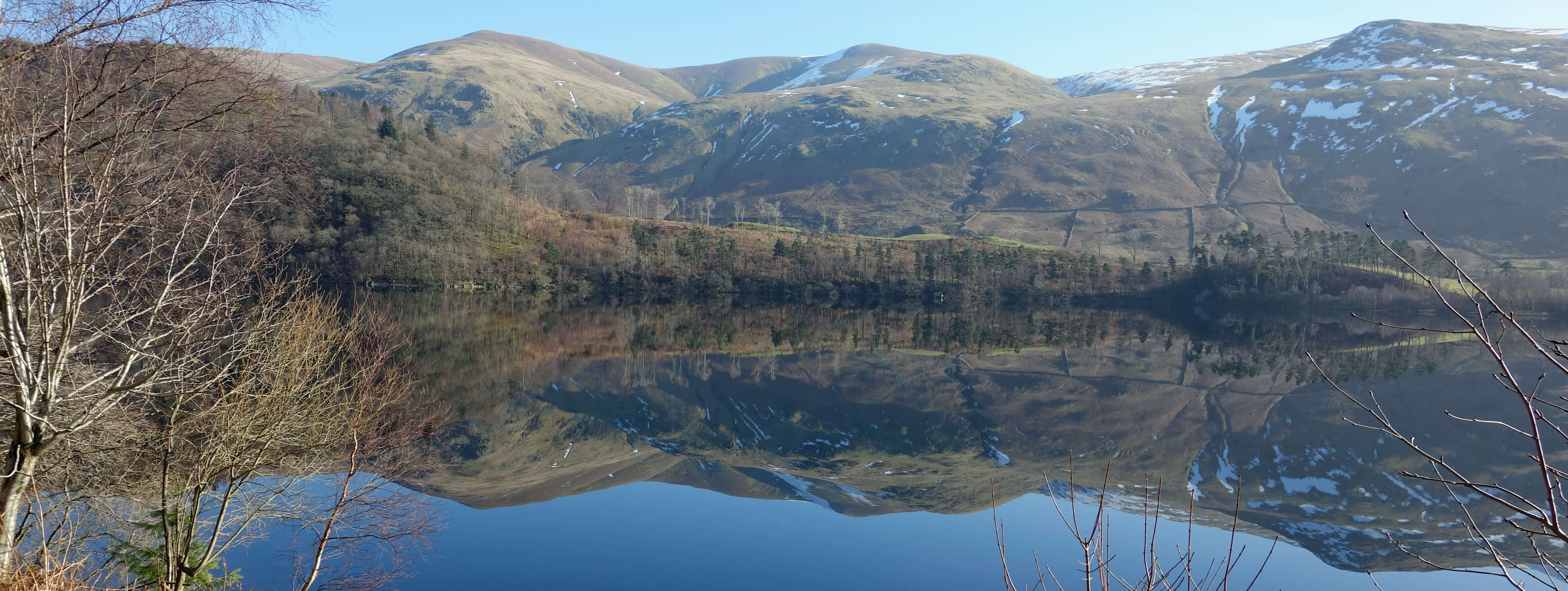
Where the zip-wires would be: looking north to Blencathra
United Utilities are making a commendable effort to improve their eco-credentials around Thirlmere, after many
years of complaints over their treatment of surrounding forestry: permissive footpaths, information boards, and
well-maintained footbridges (many repaired after Storm Desmond in 2015). At Armboth there are loos “powered by nature”.
The notice says that “if it’s dark or icy they might be shut”. It doesn’t logically follow that if it’s not dark and
not icy then they will be open, so I must not complain that they weren’t.
A group of four deer hopped nonchalantly over the footpath ahead of me. There were many United Utilities signs
warning walkers not to stray from the footpaths because of on-going “deer management”, which I assume is a euphemism for
deer culling. I wished the deer luck, and walked on. I crossed the dam, 20 metres high at its highest
point and walked back on the eastern side of the lake through peaceful Greathow Wood and Highpark Wood.
The peace was abruptly shattered by a jet, followed soon by four
more, blasting over the lake. Isn’t it ironic that the zip-wire proposal was scuppered not by concerns about scenery,
landscape, tranquillity and all that but by these blasted jets?
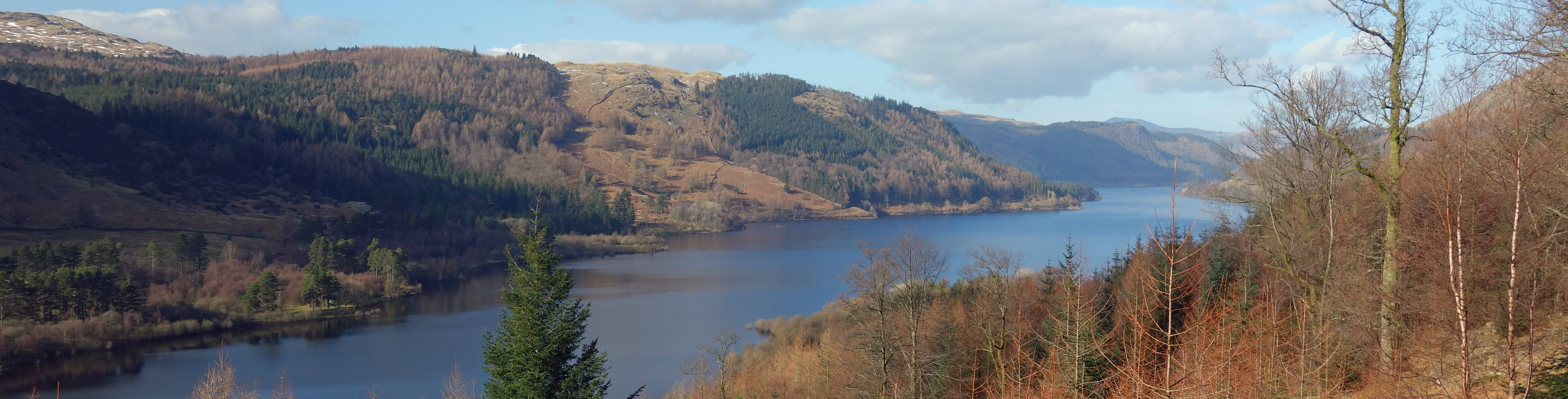
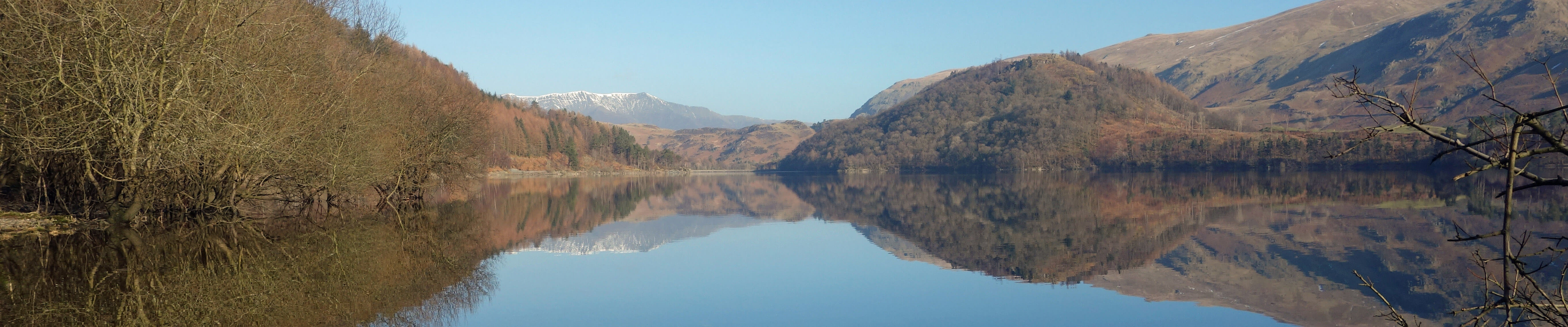
Thirlmere from Highpark Wood
Date: February 21st 2018
Start: NY316140, Dobgill Bridge car park on west side of Thirlmere (Map: OL5)
Route: N (partly on permissive path by the reservoir, partly on road) – Armboth, dam – E, S through
Greathow Wood – Highpark Wood car park – E, S through wood – Homesdale Green – N, W – Wythburn – N – Dobgill Bridge
Distance: 10 miles; Ascent: 100 metres
Home
Preamble
Index
Areas
Dales
Hills
Lakes
Places
Reserves
Rivers
Structures
Villages
References
Me
© John Self, 2018-

Top photo: The western Howgills from Dillicar;
Bottom photo: Blencathra from Great Mell Fell