
Home
Preamble
Index
Areas
Dales
Hills
Lakes
Places
Reserves
Rivers
Structures
Villages
References
Me
Saunterings: Walking in North-West England
Saunterings is a set of reflections based upon walks around the counties of Cumbria, Lancashire and
North Yorkshire in North-West England
(as defined in the Preamble).
Here is a list of all Saunterings so far.
If you'd like to give a comment, correction or update (all are very welcome) or to
be notified by email when a new item is posted - please send an email to johnselfdrakkar@gmail.com.
1. The Taming of Caton Moor
According to Robert Burns, the best-laid plans often go agley.
What about the worst-laid plans, whether of a life, a blog or a walk? They are agley already.
My life-plans are ů well, it is far too early to discuss my life-plans with you: I hardly know you.
My blog-plans are to entertain and enlighten (myself mainly). But as far as
this first saunter is concerned, the plan was simple: to walk
from my village, Brookhouse, up to the top of our local hill, Caton Moor. Nothing
could go agley with that.
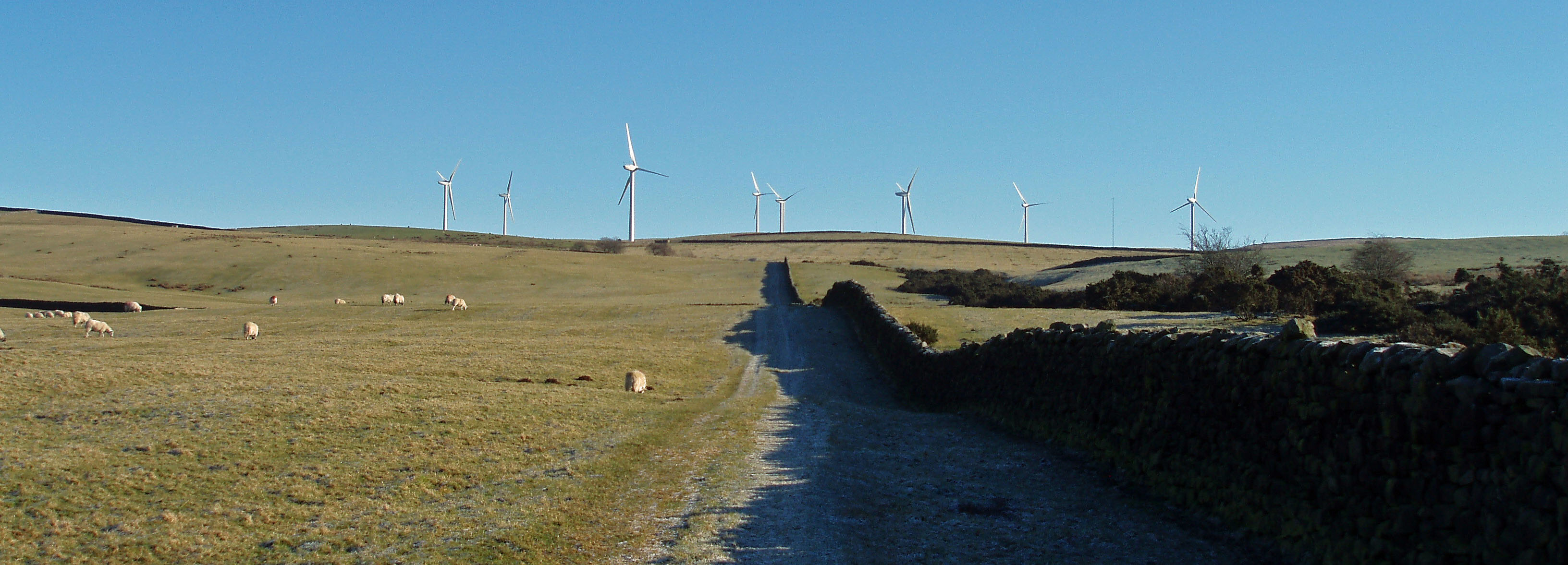
The path up to the Caton Moor turbines
From the bottom of the track past the old workhouse of Moorgarth
I could see ahead the turbine blades caressing the horizon. They didnĺt seem far away.
I walked up the track, badly eroded after the November deluge when Lancaster University weather
station recorded more rain in a day than ever before, passing a few Water Works constructions and
then crossing four fields of sheep [1].
As the slope levelled off the blades could
be seen to have grown and arisen on sturdy bases. I trudged across the open, boggy moor and at last approached the
turbines, to appreciate the immense size of these alien constructions. They have an overall
height of about 90 metres (nearly the height of Big Ben). The blade tips move, at their maximum, at
about 180 mph, which is best appreciated by standing in their shadow on a windy day. These turbines
were put up in 2007 to replace a less efficient set of 1994, possibly the earliest such turbines
in North-West England.
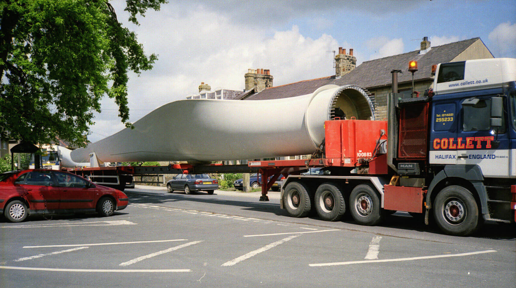
Right: A wind turbine blade being manoeuvred through Caton in 2006.
I donĺt know if the water and wind-power gathered from my local
hill directly benefits my village or whether it disappears into the National Grids to be shared with all.
Still, it is good to feel that my rather insignificant moor is making a contribution. So I donĺt
object to these turbines on the moor, as many do. I am, however, sad that the way we live has made
them necessary. I used to run about on these empty moors before the turbines were there. People are now urged to
visit what is advertised as a tourist attraction.
The moor has changed in other ways too. I was trespassing in the 1980s.
Now the moor is all open access land, thanks to the Countryside and Rights of Way Act of 2000, so I can
saunter where I will. We now have the permissive path (the track from Moorgarth) to help us up to the moor.
It is described as a 'tramper trail',
a tramper being an all-terrain mobility scooter. However, I have never seen a tramper there ľ and perhaps
just as well because one of the little bridges over a boggy beck has long collapsed. I doubt that anybody
checks that this path is still usable by trampers. It is still usable by me, anyway. There is a
second tramper trail around the turbines,
which looks a safer bet for trampers.
On the path from the turbines to the picnic site there is a Ĺtercet waymarkerĺ,
indicating that this path is on the Lancashire Witches Walk,
a 51 mile route from Barrowford to Lancaster that opened in 2012. On the waymarker is inscribed a verse
(a tercet) of a poem by the Poet Laureate, Carol Ann Duffy, written to mark the 400th anniversary of the
Pendle witch trials. Each of the ten waymarkers along the
route commemorates one of the alleged witches, Anne Redferne in this case. However, I am not aware that many
witches, or even ordinary people, set out to traverse the Witches Walk.
The newish track from the picnic site to near the trig point
is a permissive bridleway. Again, I have never seen a horse on the bridleway. Anyway, the bridleway is more convenient for me
than the previous pathless morass. This track is part of the
North Lancashire Bridleway
that was opened in 2004 and
runs for 31 miles through the Forest of Bowland Area of Outstanding Natural Beauty.
I suspect that the land-owner, the Oystons of
Claughton Hall, obtained some grant to construct this track. Perhaps the track also provides access to
the shooting butts that have recently appeared above Moorcock Hall. I have never seen any
shooters either! There is very little heather and therefore few, if any, grouse for them to shoot.
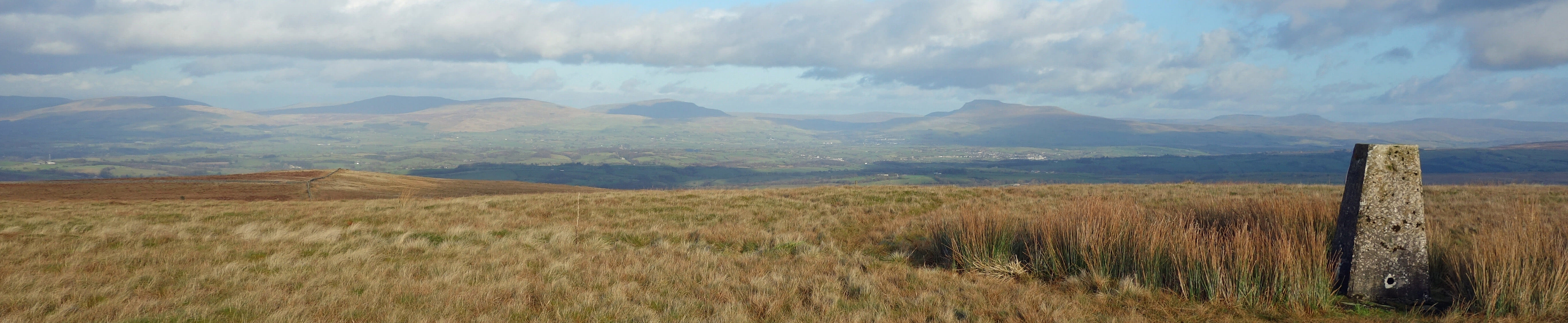
The Caton Moor trig point, with Middleton Fell, Gragareth, Whernside,
Ingleborough and Pen-y-ghent
Turbines, picnic site, permissive path, tramper trails, bridleway, shooting butts ů while not exactly
wild before, Caton Moor now seems tamed. Where to walk ľ even where to picnic ľ is prescribed.
And yet little has changed. There is sometimes a car parked at the picnic site but on this occasion,
a January Monday, there wasnĺt ľ and I saw nobody anywhere. If there are people they tend not to wander
where they are not encouraged to, leaving most of Caton Moor empty. Some people must walk to the Caton Moor
trig point, as there is a rough path to it, but I have
never met anyone there. To keep it that way, perhaps I shouldnĺt say that its modest 361-metre top provides
a fine 360 degree view, to the Forest of Bowland tops of Clougha, Wardĺs Stone and White Hill, to the
Three Peaks of Pen-y-ghent, Ingleborough and Whernside, to the Howgills, along the Lune valley, to the
Lake District fells, and across Morecambe Bay (to the Isle of Man, if itĺs very clear). And to Blackpool Tower.
Date: January 29th 2018
Start: SD543644, Brookhouse (Map: OL41)
Route: SE ľ Moorside Farm ľ SE up the track past Reservoirs ľ E by Traitorĺs Gill
ľ Caton Moor wind turbines ľ N ľ
picnic spot ľ SE, NE ľ Caton Moor trig point ľ SW, NE ľ picnic spot ľ W on Quarry Road ľ Moorside Farm, Brookhouse
Distance: 6 miles; Ascent: 300 metres
[1]. Footnote added in April 2019. This permissive path no longer exists: it is now marked Ĺprivateĺ.
Therefore the first tramper trail mentioned is no longer usable.
Home
Preamble
Index
Areas
Dales
Hills
Lakes
Places
Reserves
Rivers
Structures
Villages
References
Me
ę John Self, 2018-

Top photo: The western Howgills from Dillicar;
Bottom photo: Blencathra from Great Mell Fell