
Home
Preamble
Index
Areas
Dales
Hills
Lakes
Places
Reserves
Rivers
Structures
Villages
References
Me
Saunterings: Walking in North-West England
Saunterings is a set of reflections based upon walks around the counties of Cumbria, Lancashire and
North Yorkshire in North-West England
(as defined in the Preamble).
Here is a list of all Saunterings so far.
If you'd like to give a comment, correction or update (all are very welcome) or to
be notified by email when a new item is posted - please send an email to johnselfdrakkar@gmail.com.
4. In a Flap at Bolton-le-Sands
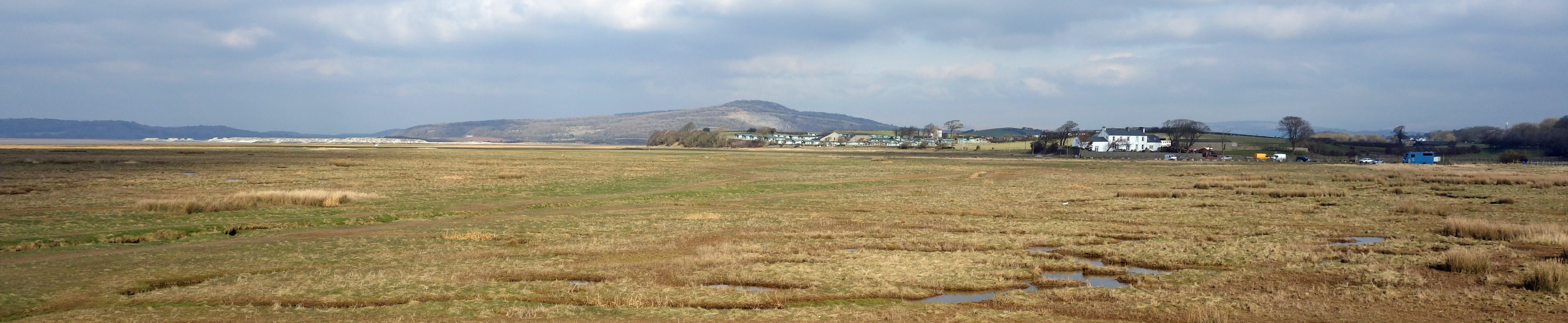
Warton Crag and Wild Duck Hall from Red Bank
The coast of Morecambe Bay is low-lying and somewhat fluid. Over the centuries we have tried to claim
salt-marshes for farmland and occasionally the sea has tried to claim it back. To prevent seawater inundation,
we build barriers, like the Pilling Embankment to protect Fylde. Unfortunately, barriers also prevent water
from rivers, streams and becks from reaching the sea, and so, in trying to prevent seawater flooding we may
cause freshwater flooding.
The answer, of course, is a tidal flap in the barrier. The force of the river opens the flap but the
force of the sea closes it. Most of the Morecambe Bay outlets have tidal flaps. However, if the flap is
closed to seawater then it is also closed to migratory fish such as salmon, trout and eel. Those who installed
the flaps presumably considered that the prevention of flooding justified the loss of fish in our rivers.
In our more enlightened times considerable thought is being given to the design of flaps that achieve the
apparently impossible of allowing fish, but not seawater, to pass. One possible solution is being trialled at
Red Bank in Bolton-le-Sands.
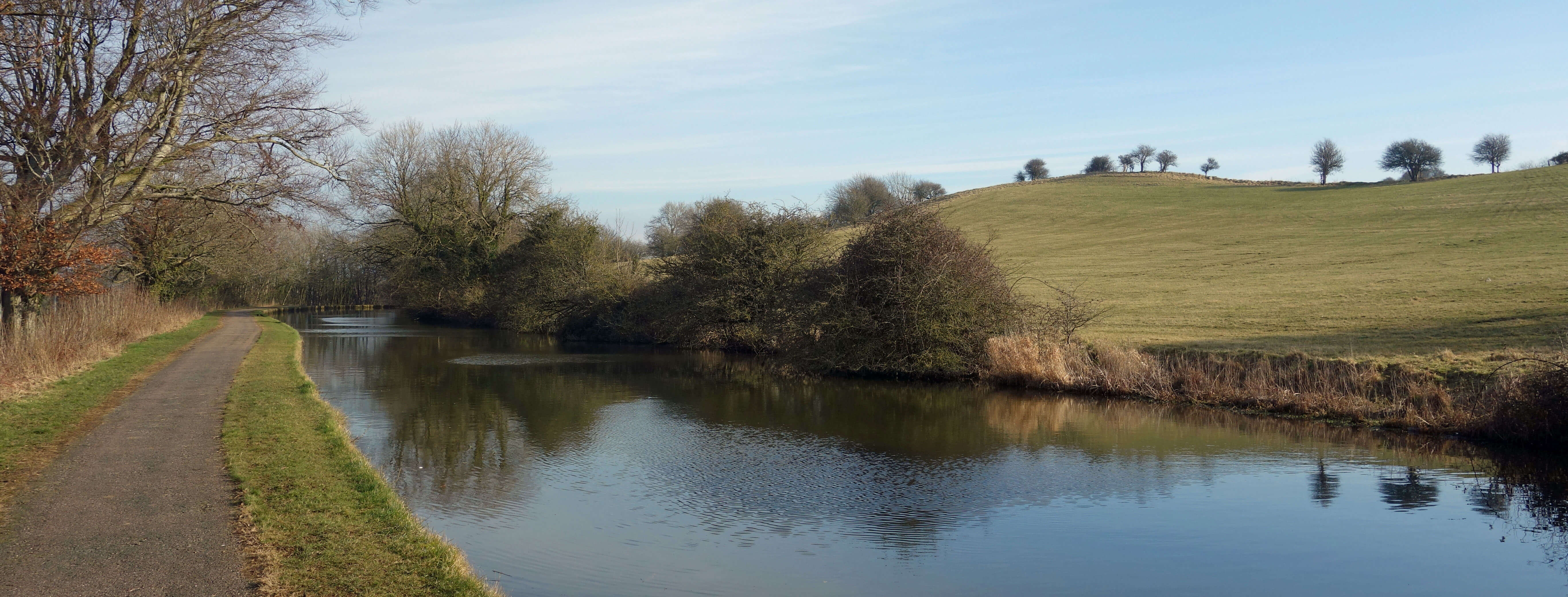 Right: Lancaster Canal to Carnforth.
Before going to look at it (it would only take five minutes to walk straight to it), I walked on a
detour through the village of Bolton-le-Sands, along the canal to Carnforth,
and back along the
Lancashire Coastal Way.
This 59 mile Recreational Route runs between Freckleton and Silverdale,
although
Lancashire County Council
believes that it is 137 miles long, between Merseyside and Cumbria.
The sky was disappointingly milky over Morecambe Bay. I could only just see Grange-over-Sands. The Lake
District hills had disappeared. I was also frustrated, as I walked inland, to be held up for several minutes at
the level crossing, but once at the canal I strode along, pausing only twice, once to watch a luxuriantly turquoise
kingfisher and the other to read a sign by the
Friends of Carnforth Coke Ovens.
I am glad that the coke ovens have
friends but I haven’t been able to find out why they deserve them.
I was soon at Carnforth, where I paused to browse in the excellent
Carnforth Bookshop,
which always has a
good range of books about North-West England. With my backpack now heavier, I proceeded past Hagg Farm, with a
date of 1638, to the Coastal Way. The signpost to it was accompanied by a “Danger Quicksand” warning, which must
be a novelty for a Recreational Route. I treaded warily around the bleak estuary of the River Keer, accompanied
by a little egret. Sightings of the once-rare little egret are now so common that I perhaps shouldn’t bother to
mention it. I did not see many other birds as my eyes were fixed upon all the winding creeks trying to trap the
unwary. I did, however, hear skylarks, for the first time this year.
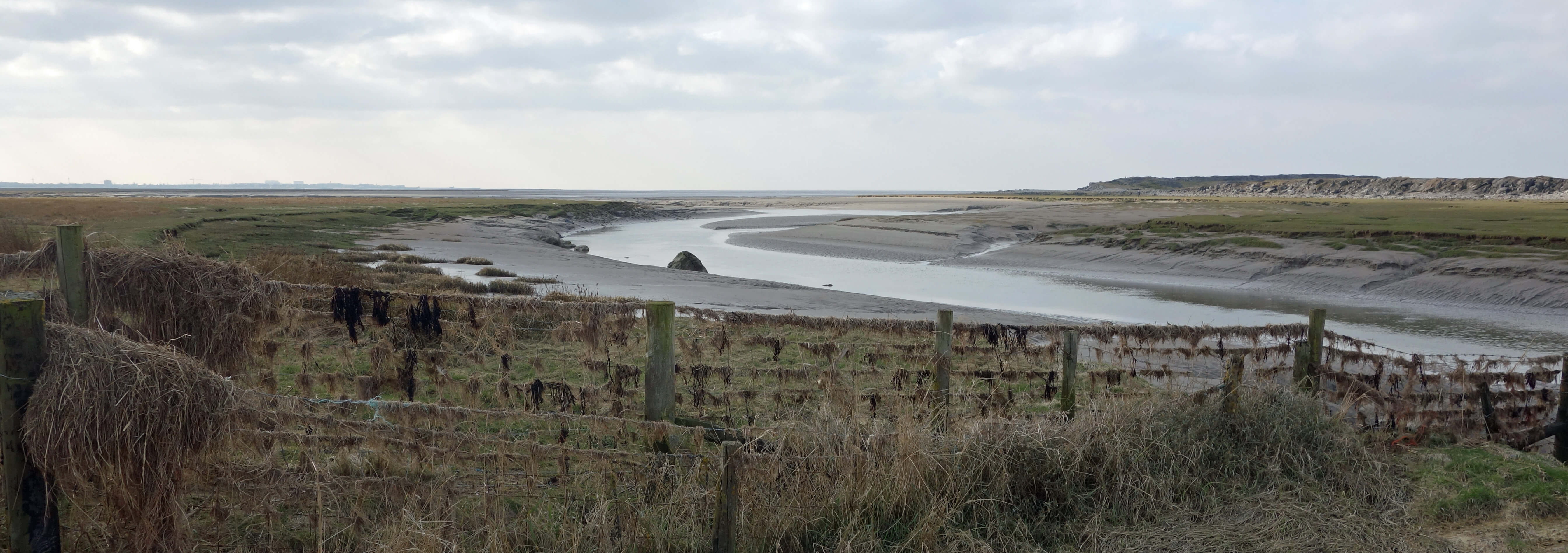
The River Keer estuary
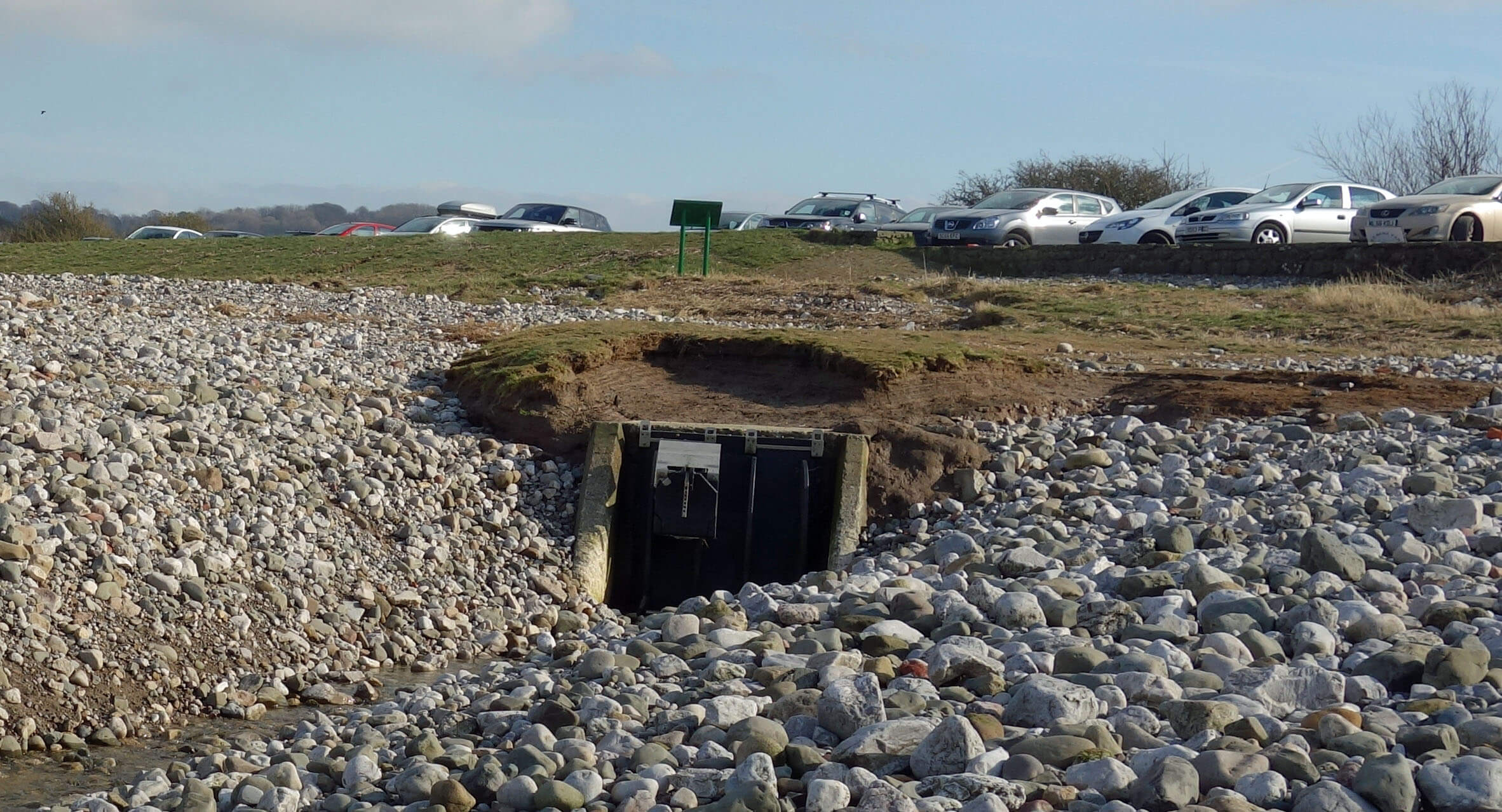 Right: The eel pass at Red Bank.
At Black Dyke I noticed an eel pass that said that it had been funded by
The Rivers Trust, the Sustainable Eel Group, the
Marine Management Organisation and the EU’s European Fishery Fund, which is pretty impressive for a structure that
was about one-foot square. Which reminds me … the ‘solution’ to our migratory fish problem.
The key point is
that the crucial time for the fish is the transition phase when the river and sea forces are about equal. The
river is concentrated towards the flap and is therefore normally running fast – and perhaps too fast for fish,
especially eels, to swim against, even assuming that they could reach the flap. When the tidal sea water balances
the river flow there is a lull – for a few minutes twice a day – when the fish can, in principle, pass through.
The solution being trialled around the Morecambe Bay coast is to install a second, much smaller, flap
within the tidal flap. It looks rather like a cat-flap. This small flap has some device, such as a float,
that adds inertia to the flap, to hold it open during the transition phase. The fish are, apparently, quite
adept at utilising the small flap at this time. The first such flap was installed on the River Gilpin, which
flows into the River Kent, in 2009, and a number have since been installed around the bay. Most are larger
than the one at Red Bank, which was installed in 2014. The Red Bank flap-within-a-flap seemed to be still in
working order, and not clogged up with debris as flaps are liable to become. I hope that the eels appreciate it.
Date: February 23rd 2018
Start: SD473682, by Red Bank Farm, Bolton-le-Sands (Maps: 296, OL7)
Route: E – canal – N on canal tow-path – Carnforth –
NW – Hagg Farm – W – Keer estuary – S (on Lancashire Coastal Way) – Red Bank Farm
Distance: 7 miles; Ascent: 25 metres
Home
Preamble
Index
Areas
Dales
Hills
Lakes
Places
Reserves
Rivers
Structures
Villages
References
Me
© John Self, 2018-

Top photo: The western Howgills from Dillicar;
Bottom photo: Blencathra from Great Mell Fell