
Home
Preamble
Index
Areas
Dales
Hills
Lakes
Places
Reserves
Rivers
Structures
Villages
References
Me
Saunterings: Walking in North-West England
Saunterings is a set of reflections based upon walks around the counties of Cumbria, Lancashire and
North Yorkshire in North-West England
(as defined in the Preamble).
Here is a list of all Saunterings so far.
If you'd like to give a comment, correction or update (all are very welcome) or to
be notified by email when a new item is posted - please send an email to johnselfdrakkar@gmail.com.
6. The Count of Flasby Fell
When the Yorkshire Dales National Park was created in 1954 its boundaries were carefully defined so that the
Park was unsullied by undesirable urbanness. Skipton, Settle, Ingleton, Richmond, Leyburn and Pateley Bridge
were all kept just outside the Park. As a result a number of places claim to be ‘the gateway to the Dales’.
The most insistent of these is Skipton, being as it is on the route from the cities of Leeds and Bradford.
Nowadays it is not necessary to go through the Skipton gateway at all because of the bypass opened
in 1982. For this walk, in fact, I started from a lay-by on the bypass. It is a variant of a walk for
those in Skipton wishing to get a foothold in the Yorkshire Dales, to hear the skylarks and the lapwings
and to gain, for relatively little effort, a fine
view of some Dales scenery.
Sharp Haw and Rough Haw in the distance
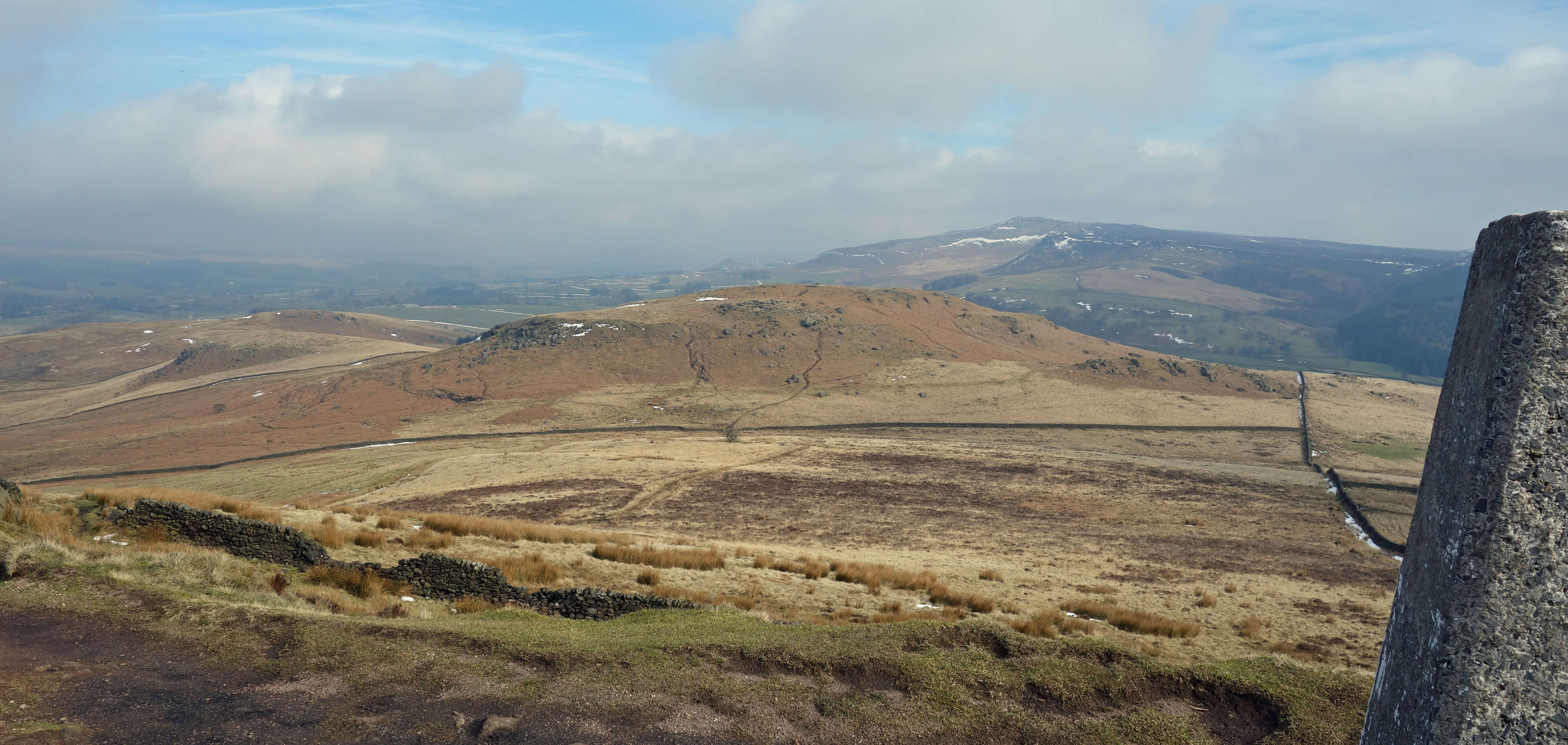 Right: From Sharp Haw towards Rough Haw.
It is also possible to ‘bag’ the various tops of Flasby Fell although this is no
great achievement since the highest, Sharp Haw, is only 357 metres high, which is just 200 metres up from the lay-by.
Still, it has a distinctive conical top, which it is satisfying to conquer. My glow of success was somewhat
dimmed by finding a shiny garden bench awaiting me at the top, with the message “sit thee down and rest awhile,
the view will surely make thee smile.” How sweet!
However, I must not be sniffy about Flasby Fell. Sharp Haw is a Marilyn and as such is an object
of desire for certain walkers. They have a mission to get on top of all the
Marilyns in England, all 175 of them.
A Marilyn is a hill that, regardless of absolute height, has a relative height of 150 metres. This means that if
you walk in any direction at all from the top of a Marilyn you must drop at least 150 metres before you can walk up
a higher hill. For example, the isolated Pendle (557 metres) is clearly a Marilyn because you have to drop nearly
400 metres before you can begin to walk up Whernside or any other higher hill.
Not all Marilyns are big mountains
– for example, Arnside Knott (159 metres) is a Marilyn because you have to drop to near sea-level in every direction.
Not all big mountains are Marilyns – for example, Bowfell (902 metres) is not a Marilyn because you only have to
drop 120 metres or so before walking up Scafell Pike. If you are into peak-bagging then the Marilyns can help by
coalescing the peaks into smaller sets. For example, the Howgills has about forty named tops over 400 metres but
only two of them are Marilyns. If you want to work out for yourself which two they are then look away now …
while I add a bit of irrelevant padding here in case your eyes have wandered ahead … before I say that
obviously one of them must be the highest point of the Howgills, The Calf, and the other happens to be Yarlside.
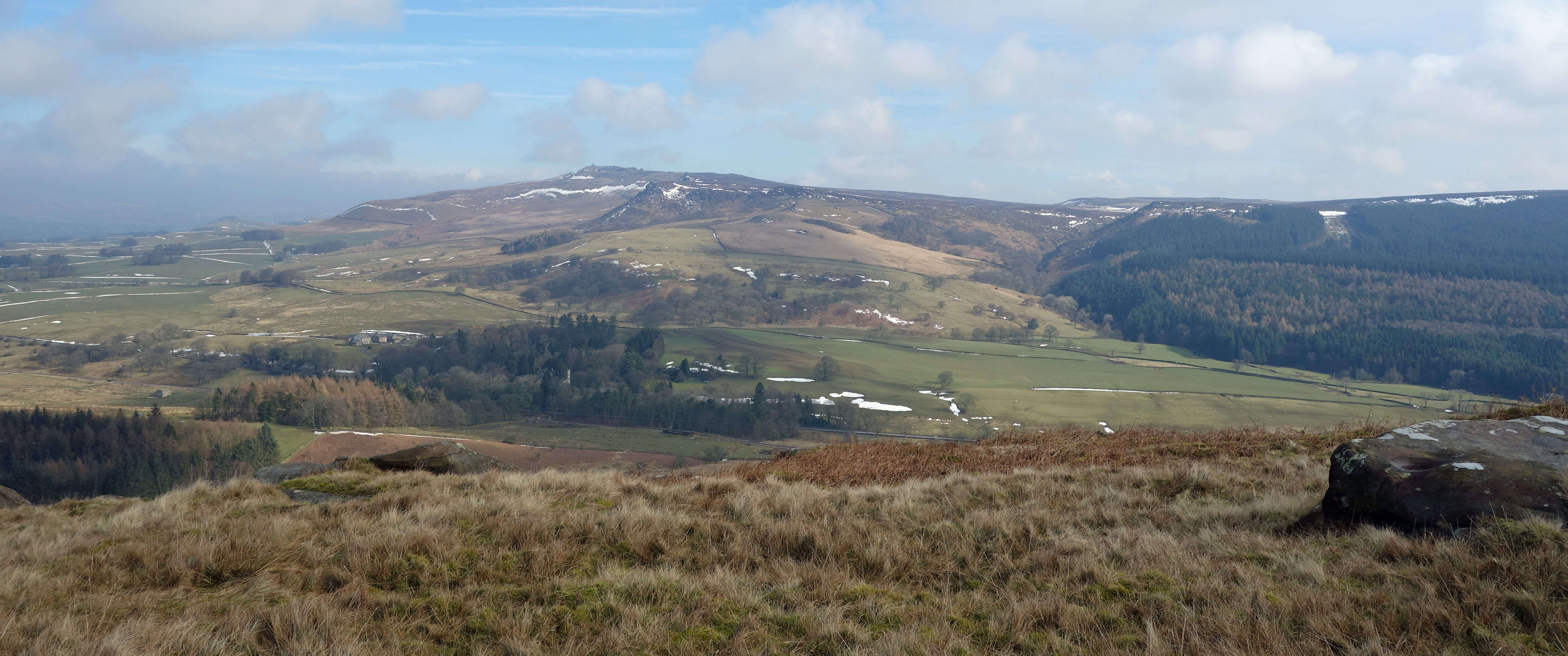 Left: From Rough Haw towards Cracoe Fell.
The only other named summit on Flasby Fell is Rough Haw (339 metres). Some lists of hill-tops to be bagged
do not use a precise prominence rule like the Marilyns. For example, the original peak-bagging list, the
Munros of Scotland (Marilyn Munro – ah) listed all separate mountains over 3,000 feet, but ‘separate’ was
rather vaguely defined and as a result the list seems subject to perpetual revision.
There are
other lists of
peaks to bag. Or you could make up your own. You could decide to include all OS named tops – so Rough
Haw would be in. You could decide to include all tops with an immediate drop of, say, 10 metres in all directions –
that would include three further unnamed rises (326 metres, 289 metres and 283 metres) on Flasby Fell. You could include all
peaks with a shiny bench on top.
One? Two? Five? Who cares? I am more interested
nowadays in appreciating the fells than in counting
them. I investigated the stones on the slopes of Rough Haw that are believed to be the remains of Neolithic
or Bronze Age ramparts. I couldn’t see it myself as I scrambled up past impressively large boulders but I was
prepared to bow to the antiquarians. Then, as I dropped down the northern side, I came across a disorderly
row of boulders that could have once been a wall or even ramparts, if they insist.
I changed my mind about visiting the two northerly unnamed summits. They did not promise a better view
than the ones I’d already had. Reaching Flasby Beck, it seemed impolite, having come this far, to not have a
look at the village of Flasby. It only took a few minutes to walk around the triangle of houses but there was
nothing particularly noteworthy, not even a view of Flasby Hall.
I walked back to Crag Wood but found it semi-demolished, and what wasn’t demolished was mainly rhododendron.
And then, lo and behold, another shiny bench. How convenient! Just the place to sit for a sandwich.
The morning mist that had rendered Ingleborough a small island in a grey sea had now evaporated, and Pendle, snowier
than the Dales tops, was prominent.
Eshton Hall looked rather grand, if a little distant.
Sandwich over, I aborted the rest of Crag Wood and
returned to the fell. I walked up the unnamed summit (326 metres) and, flushed with my success with the ramparts,
searched for the ancient enclosure marked on the map. I could find nothing among the bracken and boulders that
looked like an enclosure to me. On balance, I think I am more convinced of antiquity by something tangible,
something that I can lay my hands on, such as the
Flasby Sword, an Iron Age sword and scabbard discovered
here in 1848. It is now in the Craven Museum in Skipton.
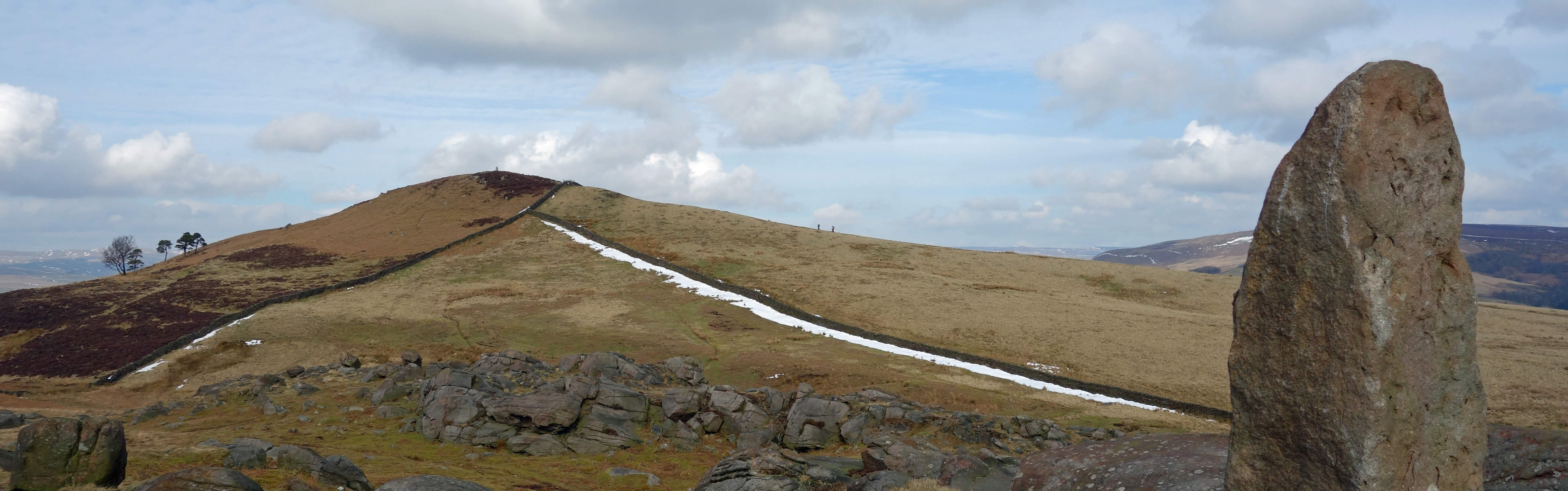
Sharp Haw from the unnamed summit to its south
Back at the car, I thought about nipping in to the museum and laying my hands on the sword, but I
knew that they wouldn’t let me. They wouldn’t even let me see it, because it is apparently in such poor
condition that the sword cannot be removed from its scabbard. I suppose that I would be prepared to accept
that it is in there, but even so it’d be a tad unconvincing. Anyway, it is clear that Flasby Fell is a
landscape of vintage Yorkshireness, and I am not referring to the cantankerous fast-bowler Fred Trueman,
who lived in Flasby.
Date: March 9th 2018
Start: SD988527, layby on the Skipton by-pass (Map: OL2)
Route: N across golf course – Brackenley Lane – W, NW – Sharp Haw –
NE – Rough Haw – W – Flasby – around triangle, E, S, SE – New Laithe – S – near White Rock in
Crag Wood – SE – unnamed summit south of Sharp Haw – SE, retracing outward route – Skipton by-pass
Distance: 8 miles; Ascent: 200 metres
Home
Preamble
Index
Areas
Dales
Hills
Lakes
Places
Reserves
Rivers
Structures
Villages
References
Me
© John Self, 2018-

Top photo: The western Howgills from Dillicar;
Bottom photo: Blencathra from Great Mell Fell