
Home
Preamble
Index
Areas
Dales
Hills
Lakes
Places
Reserves
Rivers
Structures
Villages
References
Me
Saunterings: Walking in North-West England
Saunterings is a set of reflections based upon walks around the counties of Cumbria, Lancashire and
North Yorkshire in North-West England
(as defined in the Preamble).
Here is a list of all Saunterings so far.
If you'd like to give a comment, correction or update (all are very welcome) or to
be notified by email when a new item is posted - please send an email to johnselfdrakkar@gmail.com.
46. To the Point of Winterburn Reservoir
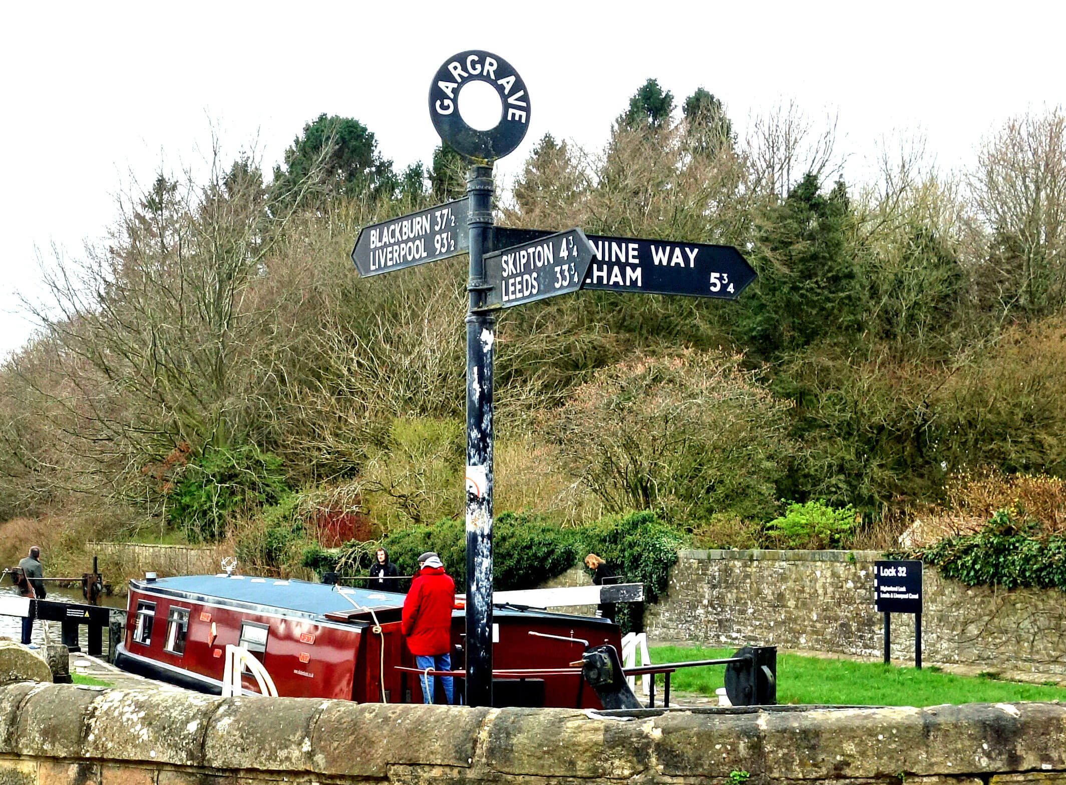 Right: The canal at Gargrave.
If a reservoir wants to be fully appreciated then it should not use ‘Reservoir’ in its name.
It should be something friendly, like Gurnal Dubs or Kitmere. A ‘Reservoir’ only reminds us that, however charmingly sited and skilfully engineered it may be, it is not a bona-fide, natural lake. We don’t get emotional about anything unnatural. Unless it’s the Ribblehead Viaduct. Or the Hoad Monument of Ulverston. Or Blackpool Tower. Oh well, perhaps Winterburn Reservoir has a chance after all.
A ‘Reservoir’ in the name might at least lead us to wonder what the reservoir is for. It is an expensive business building a reservoir. Nobody builds a reservoir for fun. On this walk I hoped to see evidence of the purpose of Winterburn Reservoir.
Gargrave was under a grey sky. I suppose it was cloud – but every cloud has a silver lining and
there were no linings. Gargrave developed through being on an important east-west route across the Pennines.
The Romans walked nearby and more recently Gargrave has been a staging post on the Leeds-Kendal A65,
the Leeds-Liverpool Canal (completed in 1816) and the Leeds-Lancaster railway line (completed in 1850).
It also has the River Aire running rather prettily through it.
Nowadays it is also on the north-south route of the Pennine Way, and I headed that way myself, first
crossing the canal, which I was pleased to see was active (unlike the Lancaster Canal on my previous outing) with some canal-boaters struggling to un-lock themselves.
I continued north across the parkland of Eshton Hall, through Gamsbers Wood, and along a fine path above
Eshton Beck, emerging on Winterburn Lane to be confronted with the surprising sight of Friars Head. The front wall of this 17th century building – and it is not a huge building – has (I make it) 584 panes of glass. There are seven sets of twelve narrow windows, each with six lights, plus on the second floor a further four sets of windows with twenty lights. Friars Head is thus an impressive example of the local building style that favoured narrow windows. Where in a modern house we would have one rectangular window, here they preferred a set of tall, narrow windows separated by stonework. It was good to see that Friars Head is still in normal use, judging from the farmyards to the rear and the gardens to the front, and hasn’t been converted or deserted as so many grand old buildings have.
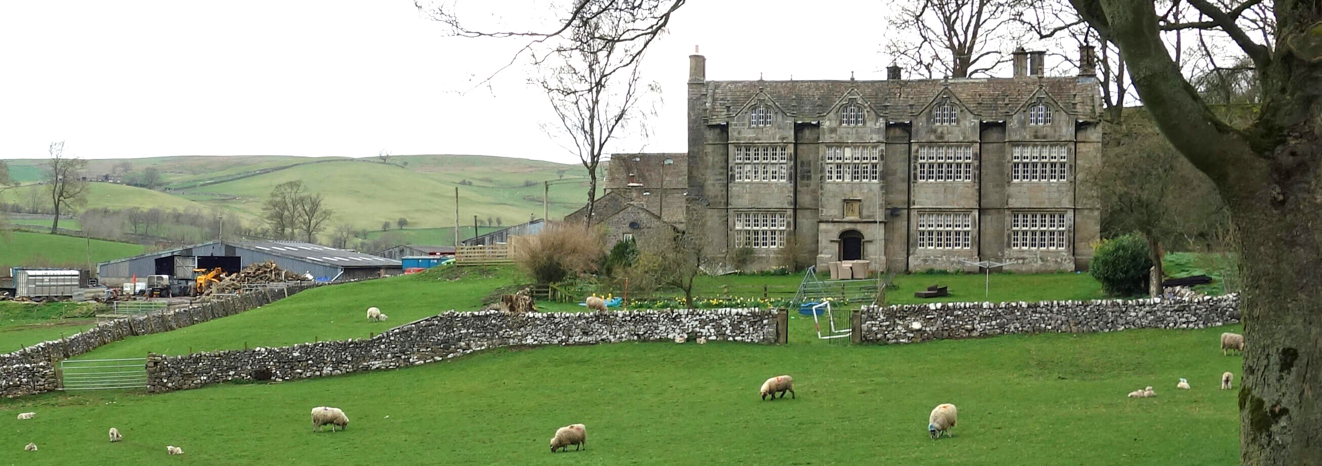
Friars Head
I walked on, to meet a sign saying “Warning: shooting in progress”. I wondered if, more to the point, the shooters met a sign saying “Warning: walking in progress”. I heard no sound of shooting, so I carried on. I reached the reservoir outlet but couldn’t see the reservoir itself without a walk up to the farm of Way Gill, but that did at least get me high enough for views across to Cracoe Fell and, in the distance, a grey Pendle. I was sorry to disturb the many geese and a large flock of oystercatchers, all of whom probably expected to be left in peace on such a dull day.
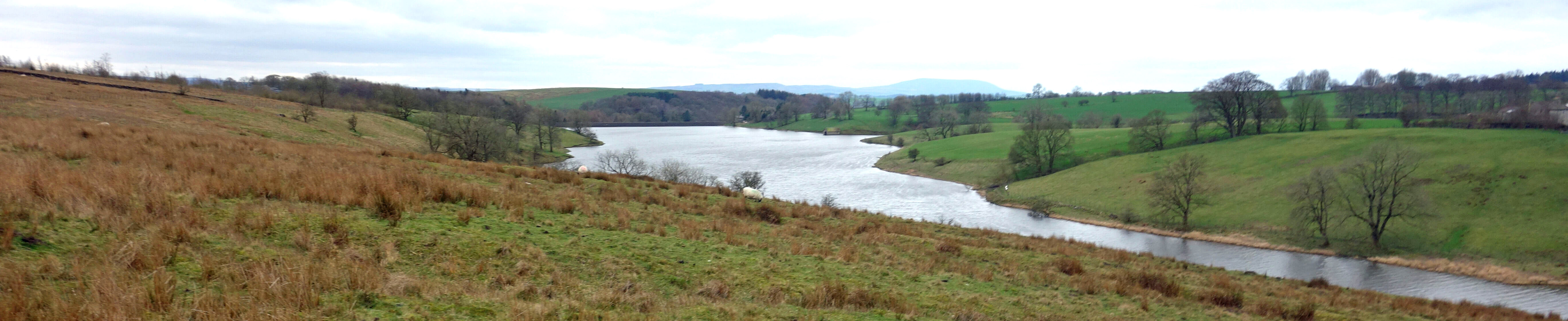
Winterburn Reservoir, with Pendle in the distance
I crossed the bridge at the northern point of the reservoir and strode out south on the good path of the
Dales High Way. I was saddened to see a hideous repair of a grey stone wall using huge yellow-orange
sandstone blocks quite alien to this region. I now realise that, philistine that I am, I had failed to
appreciate what is surely a masterpiece of ‘land art’, a deeply moving conceptual allegory on the problems of integration in modern society.
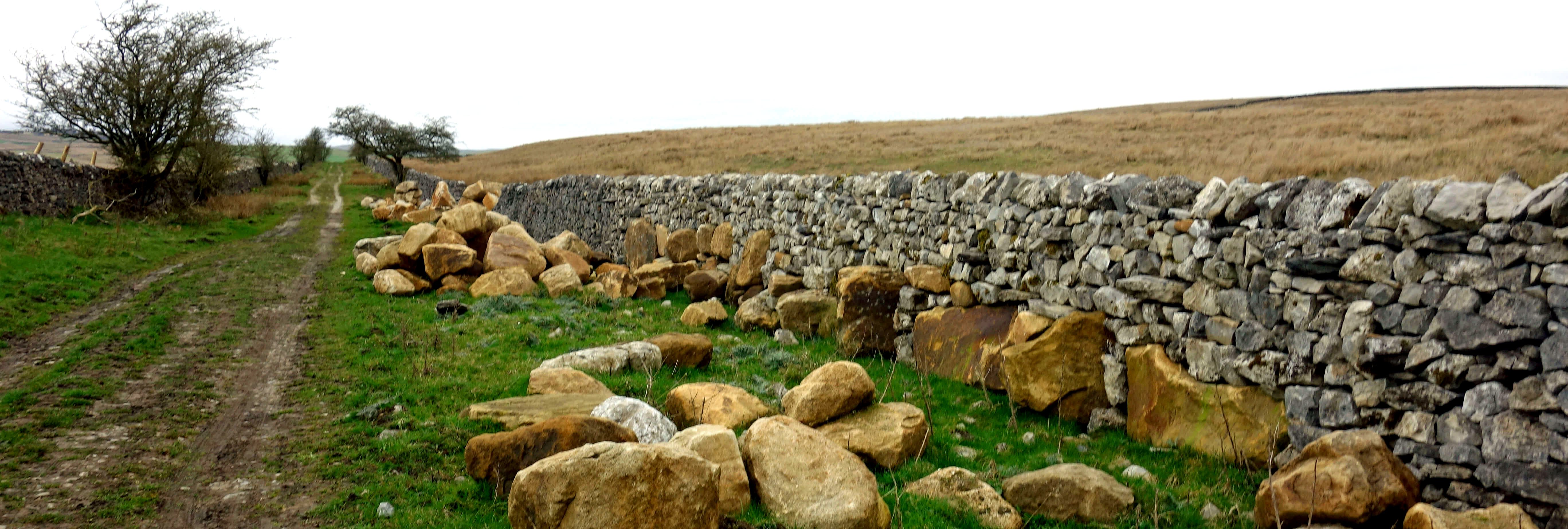
Land art on the Dales High Way
The skylarks and the curlews were in good voice despite the increasing gloominess. I hurried on, reaching the road at Flasby, and shortly after, at Eshton Bridge, had a view of Eshton Hall. It seemed to be mainly with curtains drawn. The hall was built in 1827 on a rather grandiose scale, it seems to me. In 2005 it was converted into apartments.
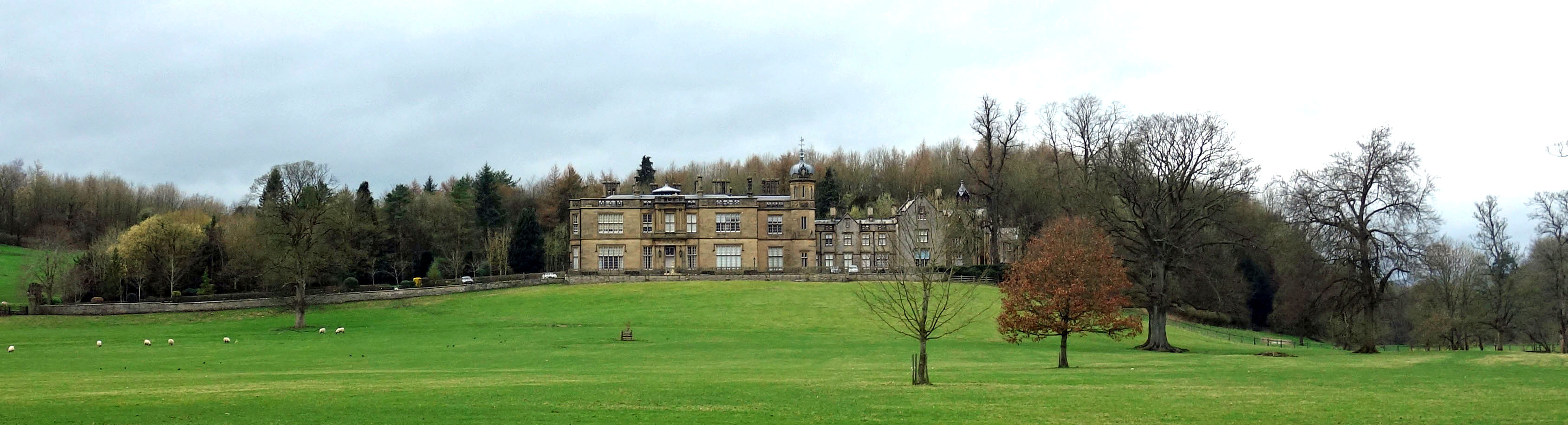
Eshton Hall
I detoured a little in order to have another look at the Leeds-Liverpool Canal. I had seen no signs on
my walk of the purpose of Winterburn Reservoir but I hoped to see some by the canal (but I didn’t)
because the reservoir was built to provide water for it. At least, that is what I have read.
However, the canal was finished in 1816 and the reservoir in 1893. I picture engineers standing by a
dry canal for 77 years, scratching their heads, wondering what they had overlooked.
No, of course, the
problem was that the increasing traffic on the canal, with the corresponding greater use of locks, was
transferring water along the canal. Somehow, in a way that I had not been able to detect, Winterburn
Reservoir tops up the canal. But how did those engineers have the foresight to aim the Leeds end of the canal north-west towards a non-existent Winterburn Reservoir, rather than aim more
directly south-west to Liverpool?
Date: March 22nd 2019
Start: SD932542, Gargrave (Map: OL2)
Route: N on Pennine Way, NE on Chew Lane, N on Eshton Road, N through Gamsbers Wood – Eshton,
Brockabank, Winterburn – N, NE – Winterburn Reservoir dam – W, N, NW – top of reservoir – SE on Dales High Way, SW on Cross
Lane, SW, SE – Flasby – SW, S – Eshton Bridge – SW, SE – Ray Bridge, A65 – W – Gargrave
Distance: 10 miles; Ascent: 120 metres
Home
Preamble
Index
Areas
Dales
Hills
Lakes
Places
Reserves
Rivers
Structures
Villages
References
Me
© John Self, 2018-

Top photo: The western Howgills from Dillicar;
Bottom photo: Blencathra from Great Mell Fell