
Home
Preamble
Index
Areas
Dales
Hills
Lakes
Places
Reserves
Rivers
Structures
Villages
References
Me
Saunterings: Walking in North-West England
Saunterings is a set of reflections based upon walks around the counties of Cumbria, Lancashire and
North Yorkshire in North-West England
(as defined in the Preamble).
Here is a list of all Saunterings so far.
If you'd like to give a comment, correction or update (all are very welcome) or to
be notified by email when a new item is posted - please send an email to johnselfdrakkar@gmail.com.
140. Short-Circuiting Wharfedale
We set out to explore middle Wharfedale by means of four short circuits over two days: two walks together, one walk alone (me), and
one ride on horseback (Ruth).
Wharfedale is the most visited of the Yorkshire Dales and not just because it is the closest to Leeds and Bradford. The
River Wharfe runs through the most varied landscapes of all the rivers of the Dales. It arises on the eastern slopes of Cam Fell,
to the north of Pen-y-ghent, with various becks coalescing to form the Wharfe at Beckermonds. It then flows east through
Langstrothdale, past evocatively-named hamlets such as Yockenthwaite and Hubberholme, and then south past Buckden to Kettlewell.
It gathers its main tributary, the River Skirfare, from Littondale and proceeds through a glaciated limestone valley past Grassington
towards the narrow, wooded area of The Strid and Bolton Abbey. This is all classic Dales country. Wharfedale is usually
considered to end at the Dales boundary but the River Wharfe itself continues through Ilkley, Otley and Wetherby to join the Ouse south of York.
Our plan got off to a flying start when Ruth took a step from the van and tumbled over the walking boots that I had
foolishly placed there, spraining an ankle in the process. After some time wondering ôWhat do we do now?ö we set off, one of
us rather gingerly, down the path from Grassington to Linton Falls. There was too little water for the falls
to be impressive. We then followed
the Dales Way east. This must be one of the most walked sections of the Dales Way ľ but few walkers will have walked it slower
than us.
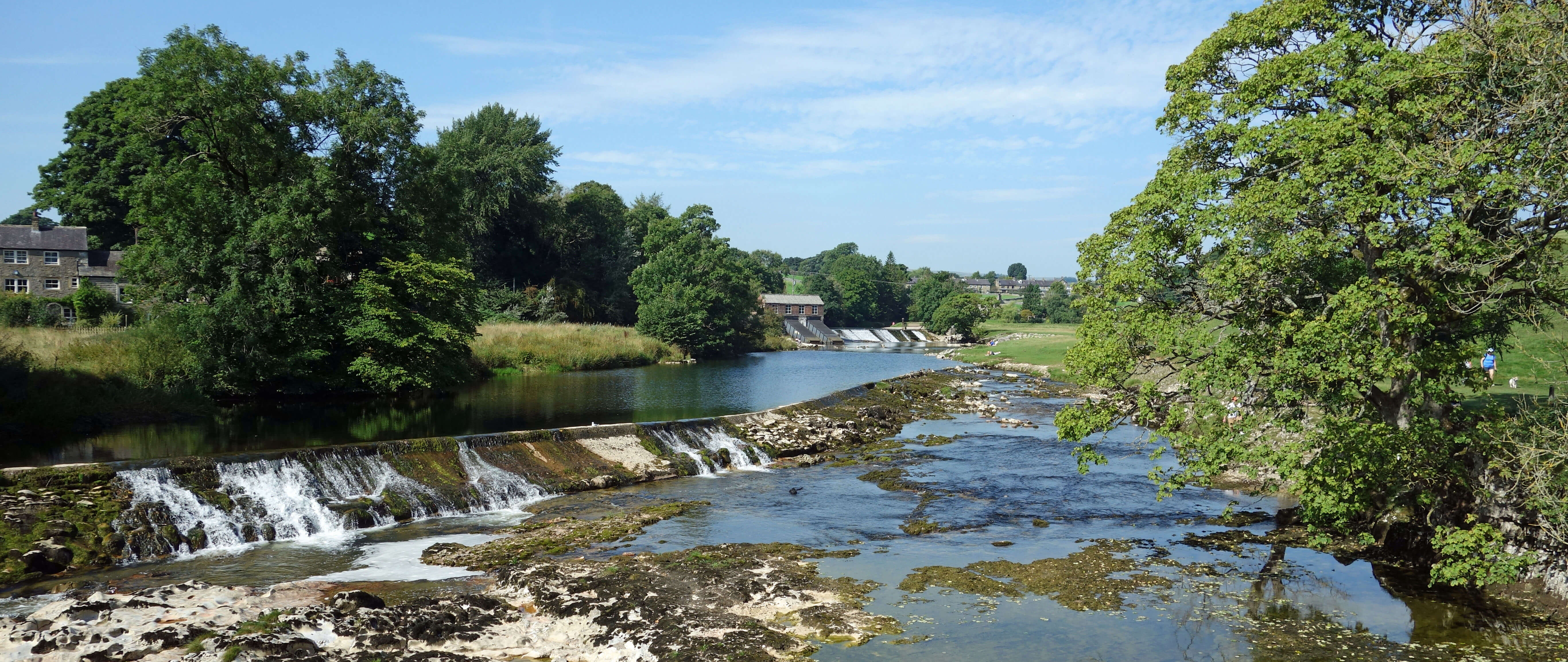
The River Wharfe at Linton Falls
After a picnic by the river, we continued to the Hebden suspension bridge, which a plaque says was completed in 1885,
although much of the present structure is surely more recent. After walking through the village of Hebden, we picked up the track
west that eventually becomes the High Lane into Grassington. By now Ruth was hobbling so much that a walker offered her his
walking stick. Back at the van we were surprised (well, I was) to find that Ruthĺs left ankle was twice the size of her right
ankle and some of it was a rather unappealing purple.
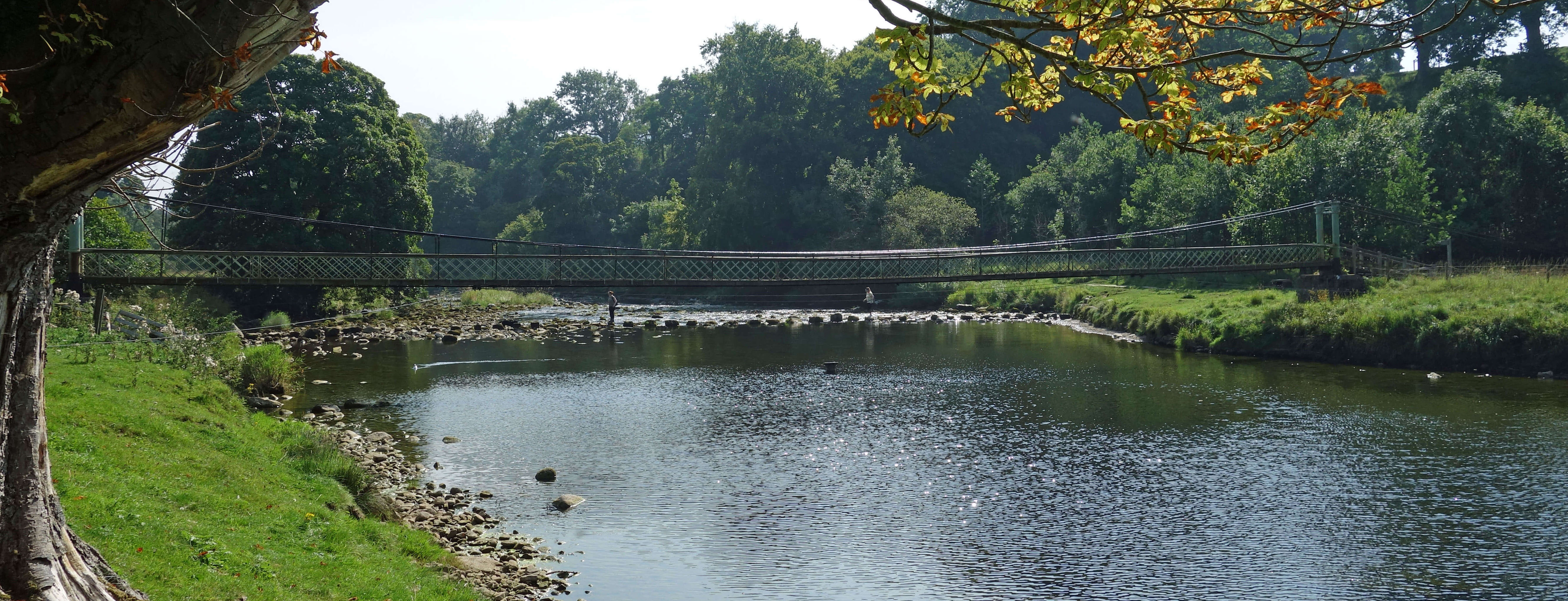
The Hebden suspension bridge and stepping stones
On the following morning Ruthĺs planned ride depended on whether she could get her left foot in her riding boot. She could,
eventually. So I left her to her ride and walked up the limestone hills to the east of Conistone. It had rained overnight,
after the unseasonably hot day yesterday, and there was still misty moisture in the air, making the views not as good as they can be.
I walked up Scot Gate Lane, which looked like it was a historic track over the moor, to Mossdale and Nidderdale, I assume. At the
Dales Way crossing I took the Way path south for a couple of miles of easy walking.
At Lea Green, where there are signs of ancient
settlements and field systems (but not to my untutored eye), I cut west to follow the path that returns northwest to Conistone. This
I found a more enjoyable path than the Dales Way. For one thing, there was nobody else to be seen,
whereas the Dales Way was littered
with walkers. The path had more character and passed some fine scenery, including a secluded limestone
cliff above Dib Beck that I never knew was there.
Back at the riding stables the next question was whether Ruth would be able to get
her riding boot off. Eventually, she could. (It is outside my brief to describe outings on horseback but I have it from the horse-riderĺs
mouth that it was ôa lovely rideö on Kilnsey Moor, on the other side of the Wharfe.)
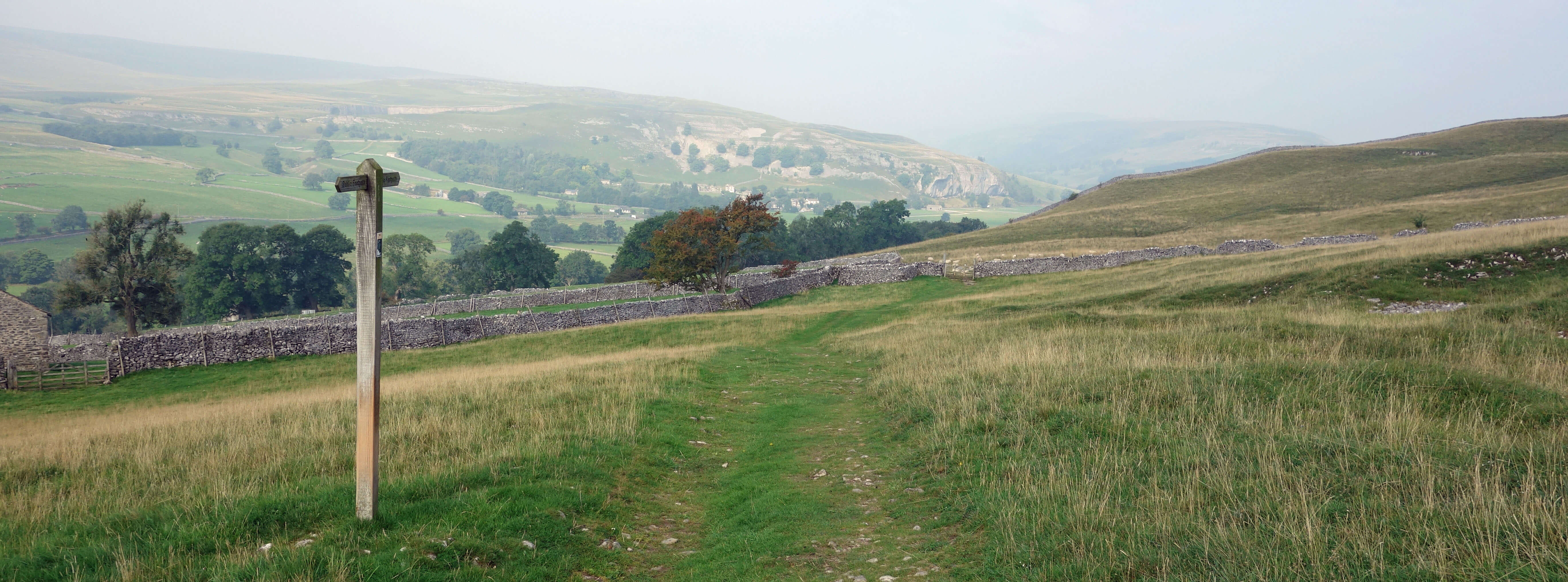
The path to Conistone, with a hazy Kilnsey Crag in the distance
There was no question about the planned fourth short circuit on the limestone terraces north of Conistone.
Ruth couldn't walk on uneven surfaces. Instead, we drove into Kettlewell and ambled about its lanes, which
there are more of than we thought (and more pubs too!), trying to recall
details of previous visits of some time ago.
As with most Dales villages, its air of reassuring timelessness is challenged by
its increased business.
We walked a little way up the narrow, steep road that crosses over the moor into
Coverdale and that provides a good view of the stone walls aligned in the fields of Kettlewell.
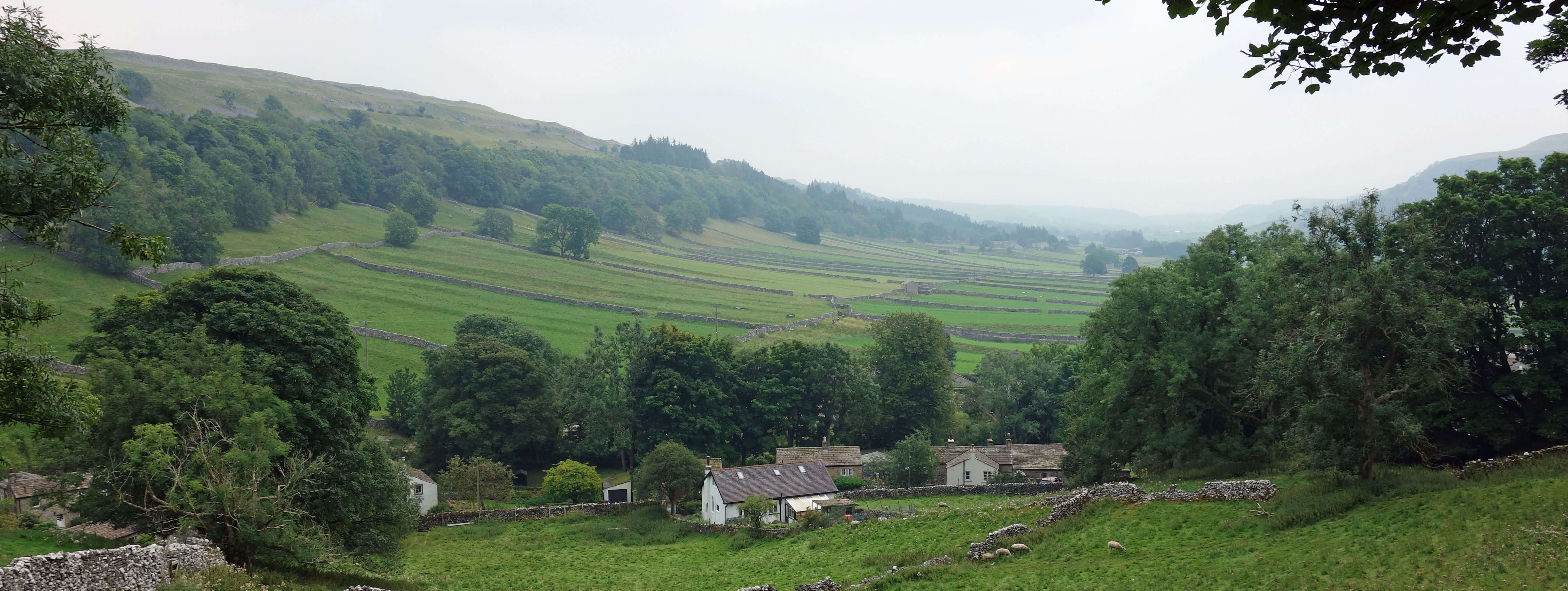
The graceful fields of Kettlewell (with drizzle approaching)
In the village we saw the familiar signs of the Dales Way. Way walkers are led down from the hills to Kettlewell,
which must be good for its trade, and on to Buckden. The Dales Way is an 80-mile trail from Ilkley to Bowness-on-Windermere. The Way
is always described as being walked in that direction, which means that it is downhill all the way, metaphorically speaking.
The best bit is the first half or so up Wharfedale to (near) its source. Thereafter the Way proceeds, somewhat aimlessly, through
Dentdale to Sedbergh, with the final section across relatively uninspiring land, neither Dales nor Lakes, to Bowness. If I were walking 80
miles to the Lake District I wouldnĺt want to end up in Bowness. Anyway, the Dales Way seems psychologically misguided to me.
A Dales Way should revel in the scenery of the Dales ľ after all, there is plenty of it. It shouldnĺt give the impression
that a Dales walker really wants to escape and get to that other National Park to the west.
Since the Dales Way was devised the borders of the Dales National Park have changed. The north-west boundary no longer
runs across the middle of the Howgills. It has moved fifteen miles north, to north of the Orton Fells. A New Dales Way could
continue from Sedbergh to Tebay or Ravenstonedale, say, and then across the Orton Fells through Crosby Ravensworth and Maulds
Meaburn to Shap, say. That would give another two or three days of good Dales walking
instead of the pointless Bowness section
and help to incorporate the newer parts of the Dales.
Shap is not within the National Park but then neither is Ilkley. A walk
across the Yorkshire Dales should start and finish just outside the National Park otherwise it isn't fully across it.
A walk between the south-east corner and the north-west corner of the Yorkshire Dales would make, to me, a more satisfying, complete,
genuine Dales Way.
Date: September 8th/9th 2021
(a) Start: SE003637, Grassington car park (Map: OL2)
Route: S ľ Linton Falls ľ SE on Dales Way ľ Hebden suspension bridge ľ N ľ Hebden ľ NW ľ
High Lane, Grassington ľ S ľ car park
Distance: 5 miles; Ascent: 85 metres
(b) Start: SD980675, Conistone (Map: OL2)
Route: N, NE, E on Scot Gate Lane ľ Dales Way ľ S ľ Lea Green ľ W, NW ľ Conistone
Distance: 5 miles; Ascent: 160 metres
(c) Start: SD968723, Kettlewell car park (Map: OL2)
Route: around the lanes of Kettlewell, plus a short walk up the road to Coverdale
Distance: 1 mile; Ascent: 50 metres
Home
Preamble
Index
Areas
Dales
Hills
Lakes
Places
Reserves
Rivers
Structures
Villages
References
Me
ę John Self, 2018-

Top photo: The western Howgills from Dillicar;
Bottom photo: Blencathra from Great Mell Fell