
Home Preamble Index Areas References Me
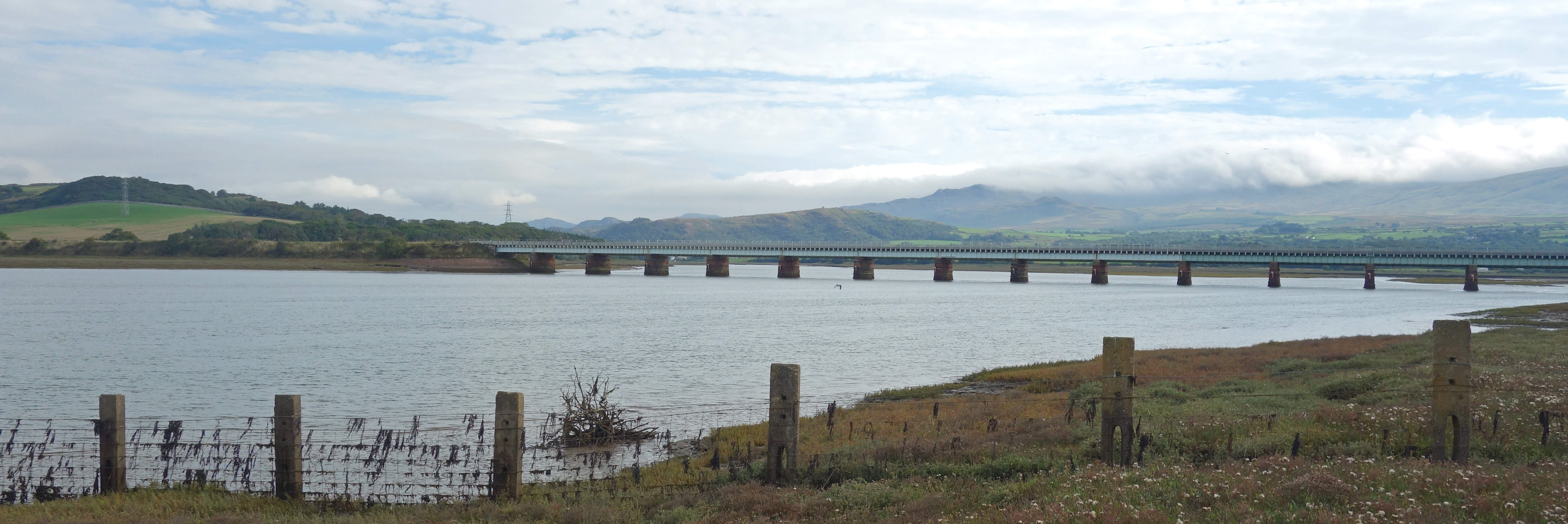
Eskmeals Viaduct and bridleway
We spent some time wandering about, along the shore, up the highest sand dune and over to the seaward side. Here, three volunteers were commendably gathering up bagfuls of rubbish washed up on these shores. Apart from them we had the promontory to ourselves. It is a spot that may not seem part of the Lake District but that is considerably more peaceful (usually) than many places that do.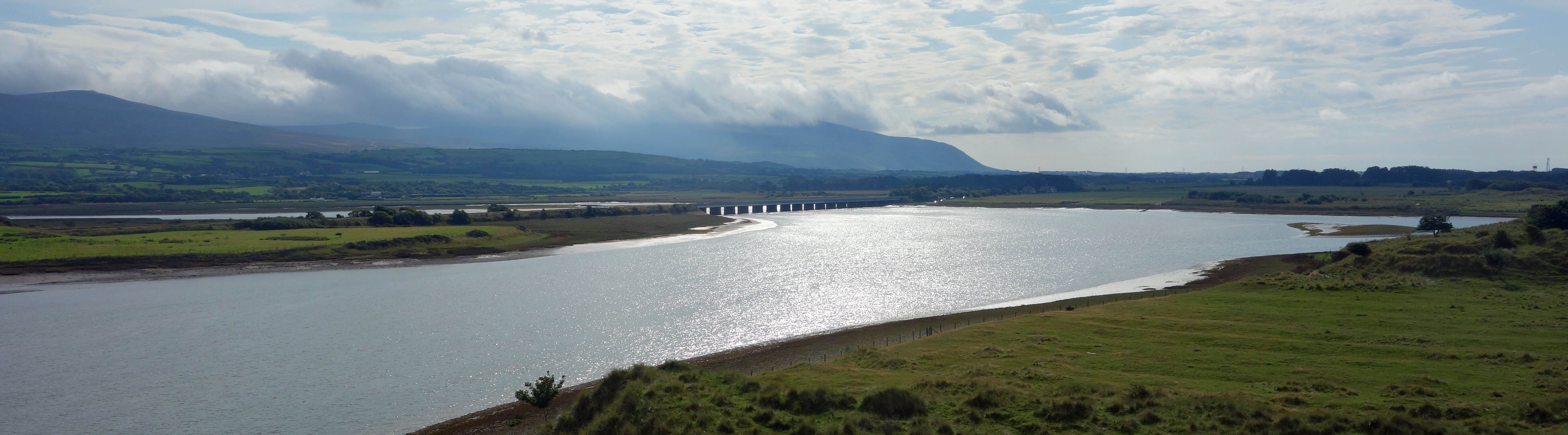
From the highest sand-dune, looking south to Eskmeals Viaduct and Black Combe, in cloud
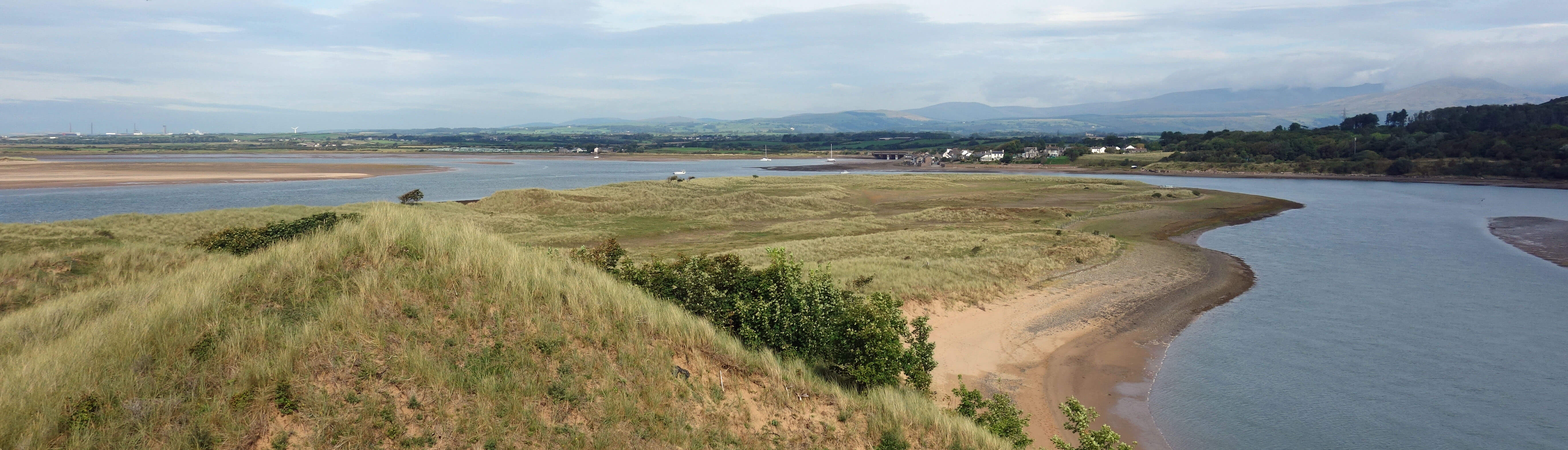
From the highest sand-dune, looking north to the village of Ravenglass on the other side of the River Esk
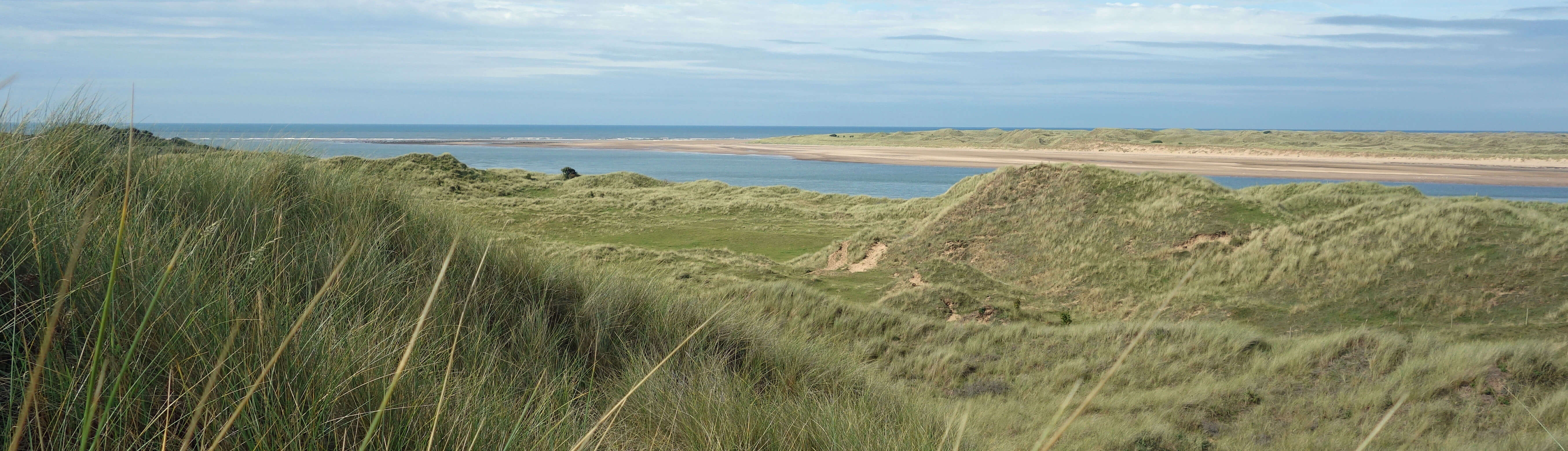
From the highest sand-dune, looking west across the dunes and River Esk to Drigg Dunes
This was the first half of a ‘figure of eight’ walk, with a leisurely lunch break in the middle. The second half was a circuit inland, still (we had to remind ourselves) within the Lake District National Park. We walked south, with the Ministry of Defence’s Firing Range, a two-mile long area closed to the public, to the west. On this occasion it was not blasting shells into the sea. It is the shells that made me add the '(usually)' to a sentence above. We turned east past Eskmeals House and then battled along an unused, overgrown footpath with stiles well hidden in bushes. We were relieved to reach the lane near Waberthwaite and to be able to stroll back through Newbiggin and by the estuary to the viaduct.According to some written recollections of my grandmother (father’s mother) an offer was made in 1911 to the family to rent part of the sandhills for use in “Safety in Mines Research”, which was installed under a committee headed by Sir Henry Cunningham. Her recollections continue as follows:-So it seems that this area has been used for industrial-military purposes for over a century. There was an out-of-bounds region here when the National Park was established. Old OS maps tended not to show military establishments in detail but maps from 1899 to 1957 on-line indicate a 'Vickers gun range' with 'flagstaffs' (for warning flags?) but no buildings within the present restricted area. The history of Vickers is complex, with its aircraft, shipbuilding and steel-working interests being separately nationalised at various times. Whoever owned the firing range when the Park borders were defined, why was it included in the National Park? Did the Park authorities optimistically believe or hope that the land would be released soon (as other military land had been) and would revert to natural sand-dunes?
“A committee house was built right inside the sandhills with a light railway running to it, while on the edge of them (nearest to Eskmeals House) was a bungalow for the chief chemist with laboratories where experiments were tried out in glass tubes, before further experiments were made in great tubes the size of mine workings. All the miners’ lamps for the North were tried out here. To accommodate the junior chemists we built, at our own request, four cottages on the main road near Eskmeals station. We called them Falcon Place in memory of an old oak-panelled house on the Workington docks whence my great-grandfather had come to Eskmeals. Then the first world war came and brought great animation to the branch of Vickers which tested man-of-war guns. The noise of their testing was frequent and the first caterpillar wheels in the world were tested on our main road, little balloons were sent up for marksmanship trials, and 200 women and girls came daily to fill shells in a new big building at the south end of the site (Marshside)”.
This will give you the bones of the origins of the range. When we came back from Ceylon in 1947 we could walk all along the shore and directly across the sandhills to the shore when the warning flags were not flying and there were huge sheets of armour plating held upright by mountains of sandbags for testing the guns, by that time, I believe, of tanks.
The range extended some way north but did not occupy the final half mile or so up to Ravenglass Point and we could walk on that part of the sandhills at any time. The building for the chemists and the one for the committee were in my family’s possession from, I think, before the last war, and were I assume bought off Vickers as they were not used by the Ministry of Defence. When the takeover occurred I do not know but presumably before the National Park was constituted. In 1947, and for several summer holidays thereafter, the family used to stay in what was the chemists’ house. The two buildings were called Sandy Gap (the one with the railway to it) and the chemists’ house was in effect two properties, one housing the laboratories and one the living accommodation. They were known as Broombank and Broomclose. Sandy Gap was overwhelmed by shifting sand and I remember in the late ‘40s going into the abandoned house and marvelling at the way the sand reached up to the ceiling in many of the ground floor rooms. Broombank and Broomclose are still there I think, but now in the Danger Area. Sandy Gap was, I believe, demolished long ago, but I haven’t been able to access that part of the sandhills for many years.
In 1950 my parents took over one of the Falcon Place cottages as my father was still working in Ceylon so we were up at Eskmeals for only short periods of time, mainly holidays when my parents were back in the UK. In 1955 the tenant of Eskmeals House (it had been let by the family from 1920) died and we moved in as our permanent home. They left Eskmeals House in 1979 when the Ministry said they wished to extend the Danger Area and purchased the house and surrounding land from my father. It lay abandoned for many years and whether the Danger Area was ever officially extended I don’t know. As far as I am aware the use of the road alongside was never restricted.
Note added in June 2025: I received a message from Nigel Platts who gave more information about the early history of the Eskmeals firing range - and is happy for me to include his message here:
I came across Sauntering number 142 when I was looking up Eskmeals Gun Range. I have a close family link to the Gun Range as my grandfather, Harry Williams, was in charge there during part of its early existence. He was born into a naval family in Portsmouth in 1873 and followed his father into the RN after receiving his education at the naval school in Greenwich (since migrated to Suffolk). In or around 1900 he was invalided out of the navy having survived blackwater fever and suffered hearing damage through his specialism of gunnery. He was recommended to Vickers Son and Maxim and was sent to the new facility at Eskmeals where, in due course, he took over as head. It was there he met my grandmother. They were married in Bootle church and around 1910, when my mother was a year old, built Beach House, the large house at the edge of the Eskmeals site. There they lived until the early part of WWII when the house was requistioned by the War Office to be used as the officers’ mess for the wartime gun range. My grandfather (grandmother died in 1938) received negligible compensation (his contribtion to the war effort?) and never returned. Instead they rented Swallowhurst Hall near Waberthwaite until 1946 when my mother and her sister, now both married, left the area. My grandfather died in 1950 whilst living with us in Surrey - my father’s job in the steel industry having taken him to London.
My grandparents, great grandparents, parents, uncle and aunt are all buried at St Michael’s, Bootle where I was Christened. Although we live in Surrey we visit regularly as we have a house near Newby Bridge.
All this is a somewhat lengthy family story but it does give some perspective on the relative antiquity of the Gun Range which predates the creation of the National Park by many decades. What I can also say is that the state of the foreshore at Bootle beach has deteriorated significantly since my childhood. Where once there was a pleasant green with ample space for parking, picnics and games of cricket, leading down to stones and then a glorious sandy beach, there is now a scruffy mixture of tarmac, stones, weeds and rubble shored up on the seaward side by lumps of concrete. Much of the natural rocks and stones were removed to provide ballast for sea defences further down the coast. All this in a National Park.
Home Preamble Index Areas References Me
© John Self, 2018-

Top photo: The western Howgills from Dillicar; Bottom photo: Blencathra from Great Mell Fell