
Home
Preamble
Index
Areas
Dales
Hills
Lakes
Places
Reserves
Rivers
Structures
Villages
References
Me
Saunterings: Walking in North-West England
Saunterings is a set of reflections based upon walks around the counties of Cumbria, Lancashire and
North Yorkshire in North-West England
(as defined in the Preamble).
Here is a list of all Saunterings so far.
If you'd like to give a comment, correction or update (all are very welcome) or to
be notified by email when a new item is posted - please send an email to johnselfdrakkar@gmail.com.
144. Fencing The Clouds
These Saunterings transport a reader to the sunny idyll that is North-West England. In over 500 photos so far there
is scarcely a rain-cloud or a puddle to be seen. There is a reason for this: I don’t go walking if there’s
a prospect of a rain-cloud or a puddle. I am not like those walkers who commit to travel for a walk in, say, the
Lake District next
Sunday and then feel bound by that commitment, come monsoon or blizzard. I am content to wait for blue skies.
On this occasion the forecast of heavy rain, at least in the morning, left little hope for a
worthwhile walk on a visit to the Kirkby Stephen region. However, in the afternoon the sun shone intermittently,
so we paused for a short walk on The Clouds (or in their full nomenclatural glory, Stennerskleugh Clouds and
Fell End Clouds). This is a small area of limestone outcrop to the west of Wild Boar Fell. The Clouds are
a Site of Special Scientific Interest, and are therefore protected under the 1981 Wildlife and Countryside
Act, and they were also a Special Area of Conservation, which provided a higher level of protection under EU law.
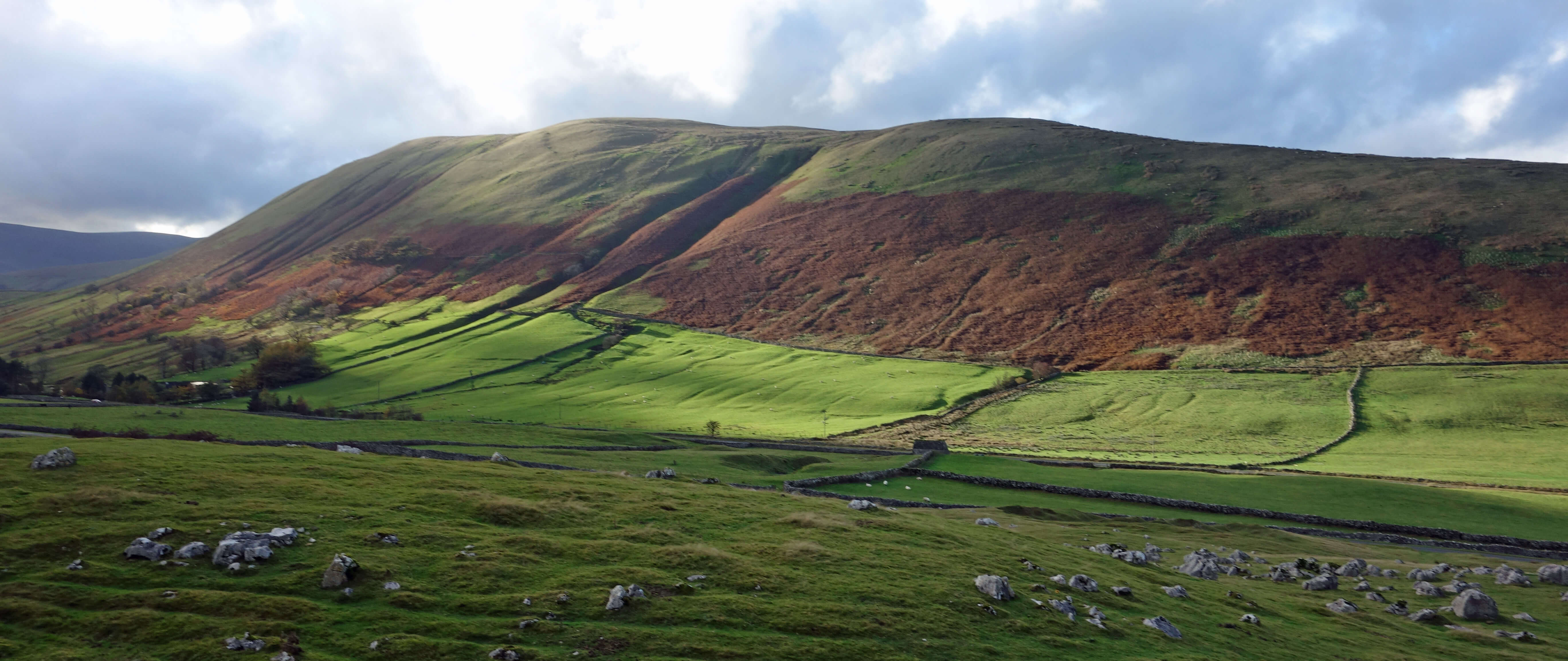
Harter Fell from The Clouds
In 2013 Natural England, the body responsible for the welfare of SSSIs, assessed the site to be in poor (or, in
its words, ‘unfavourable’) condition, mainly because sheep were eating the esteemed flora. It therefore
proposed that the sheep be replaced by cattle, which would require a fence around The Clouds. This apparently
simple, innocuous proposal stimulated a number of questions, such as:
• How will the fencing affect commoners’ ability to exercise their rights on common land?
• What is to happen to the hefted sheep, that is, the sheep reared to regard this land as their home?
• What about the sheep farmers – are they to sheep-farm elsewhere or take up cattle farming?
• Does the proposal breach farmers’ tenancy agreements?
• Would the sheep’s diet suffer from losing access to the sweeter grasses and plants growing near to limestone?
• Would the presence of cattle affect the water supply to local properties?
• What evidence is there that replacing sheep with cattle will yield the desired ecological benefits?
• How does the proposal affect the island of non-open access land in the middle of The Clouds?
• Is fencing appropriate for a landscape with traditional stone walls as boundaries?
• Who would be responsible for maintenance of the fences and access points?
• Would water have to be brought in for the cattle, as there are few natural sources of water in the area?
• Would the cattle affect archaeological remains and other features of historical interest, such as mine workings?
• What about the ponies that rely upon the minerals and calcium found in the area?
• Would the presence of cattle deter walkers in the area?
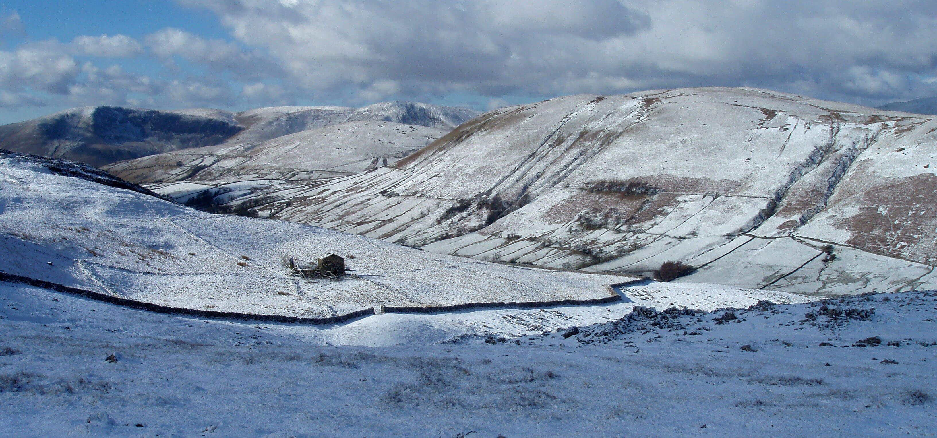
Harter Fell from near the same spot - on a different occasion, obviously (I like the photo and
thought you might too)
The planning inspector duly wilted in the face of so many questions, most of which Natural England
could not answer satisfactorily, and declined to give consent to the proposal (a rare example of one part of
the government machinery saying ‘no’ to another part). According to the report, the inspector had visited the
site for two days – one day to walk alone and the second day with interested parties. While the inspector
was no doubt competent to assess the proposal on its merits, I rather doubt that two days is enough to
appreciate fully the subtle, special character of this region. Natural England officials probably only visit
the site once every few years to assess its condition.
A more fundamental and broader question arises: What is the ‘natural’ state of The Clouds? Sheep
have been farmed here for centuries, helping to create the present landscape, much valued by local farmers
and visitors, like me. But, of course, it is now ‘unnaturally’ barren, with hardly a tree or a shrub or
even a wildflower to be seen. Who is to decide what is natural? As I understand it, anyone wishing to
carry out work affecting an SSSI must get approval from Natural England (for example, if a farmer wanted
to install fencing) but I don’t know if Natural England has the powers to impose changes on an SSSI (presumably
not, without the agreement of an inspector). In the case of The Clouds, Natural England did not seem to
have an adequate appreciation of all the factors that should be considered before making their proposal.
Anyway, the proposal was rejected and has, I think, been shelved. On our walk we saw sheep and
one pony but no cattle and no fences. The sun shone on surrounding hills and in the Eden valley to the
north but less so on The Clouds themselves. They stayed rather grey, lacking the bright nebulosity for
which they known.

The Clouds and some clouds
Date: October 30th 2021
Start: NY734006, by the road (Map: OL19)
Route: E – Stennerskeugh Clouds – S a bit - NW - road
Distance: 2 miles; Ascent: 100 metres
Home
Preamble
Index
Areas
Dales
Hills
Lakes
Places
Reserves
Rivers
Structures
Villages
References
Me
© John Self, 2018-

Top photo: The western Howgills from Dillicar;
Bottom photo: Blencathra from Great Mell Fell