
Home
Preamble
Index
Areas
Dales
Hills
Lakes
Places
Reserves
Rivers
Structures
Villages
References
Me
Saunterings: Walking in North-West England
Saunterings is a set of reflections based upon walks around the counties of Cumbria, Lancashire and
North Yorkshire in North-West England
(as defined in the Preamble).
Here is a list of all Saunterings so far.
If you'd like to give a comment, correction or update (all are very welcome) or to
be notified by email when a new item is posted - please send an email to johnselfdrakkar@gmail.com.
145. Naturalising the Long Preston Deeps
The River Ribble pauses halfway. It is quite sprightly as it runs from the hills of Ribblehead through
Horton and Stainforth to Settle. And at Long Preston it is still 130 metres above sea-level, so it runs
jauntily south-west by Barnoldswick and Clitheroe to the estuary and the Irish Sea. But in the few miles
between Settle and Long Preston it proceeds sluggishly in long, deep meanders. After heavy rain the
surrounding fields are flooded and in winter travellers along the A65 can see that they are passing a
sort of lake. This region is known as the Long Preston Deeps.
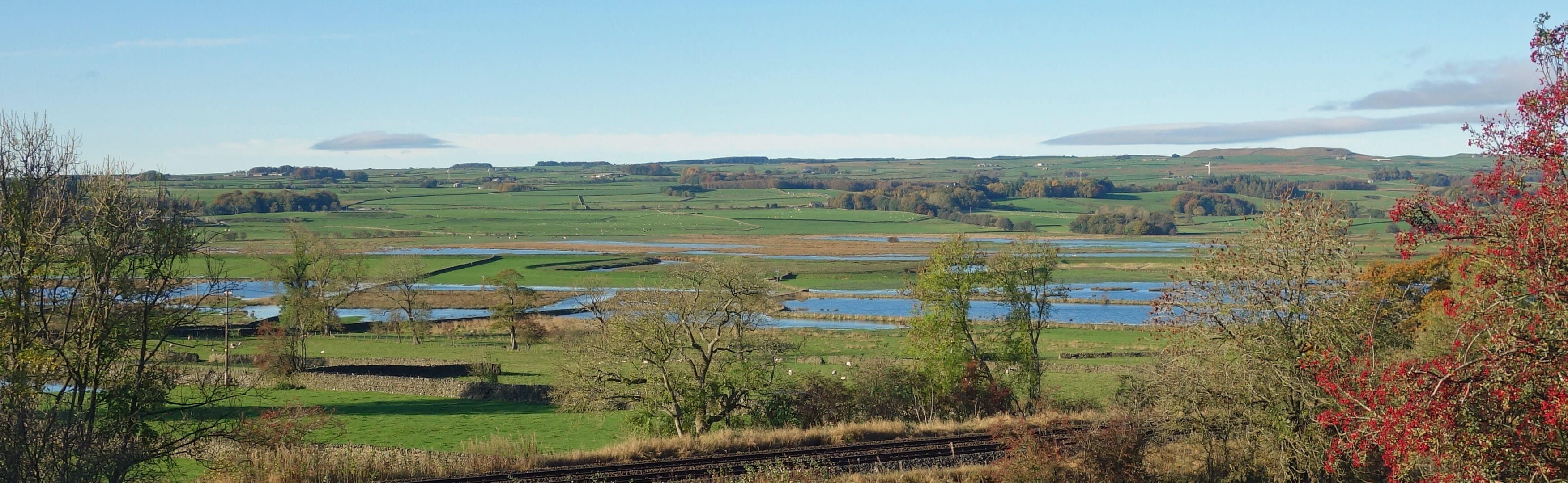
The Deeps from Long Preston
I began from the maypole by The Maypole in Long Preston, a village that suffers from the A65 traffic
streaming through it. As I walked down the road towards Wigglesworth I could see that the fields were flooded
but not to the extent that they often are. There was a range of low hills to the south towards Hellifield,
and indeed to the east and west as well. The Long Preston Deeps lie in a shallow basin, which the
Ribble enters at Settle and eventually leaves at the low-lying Cow Bridge on the road to Wigglesworth.
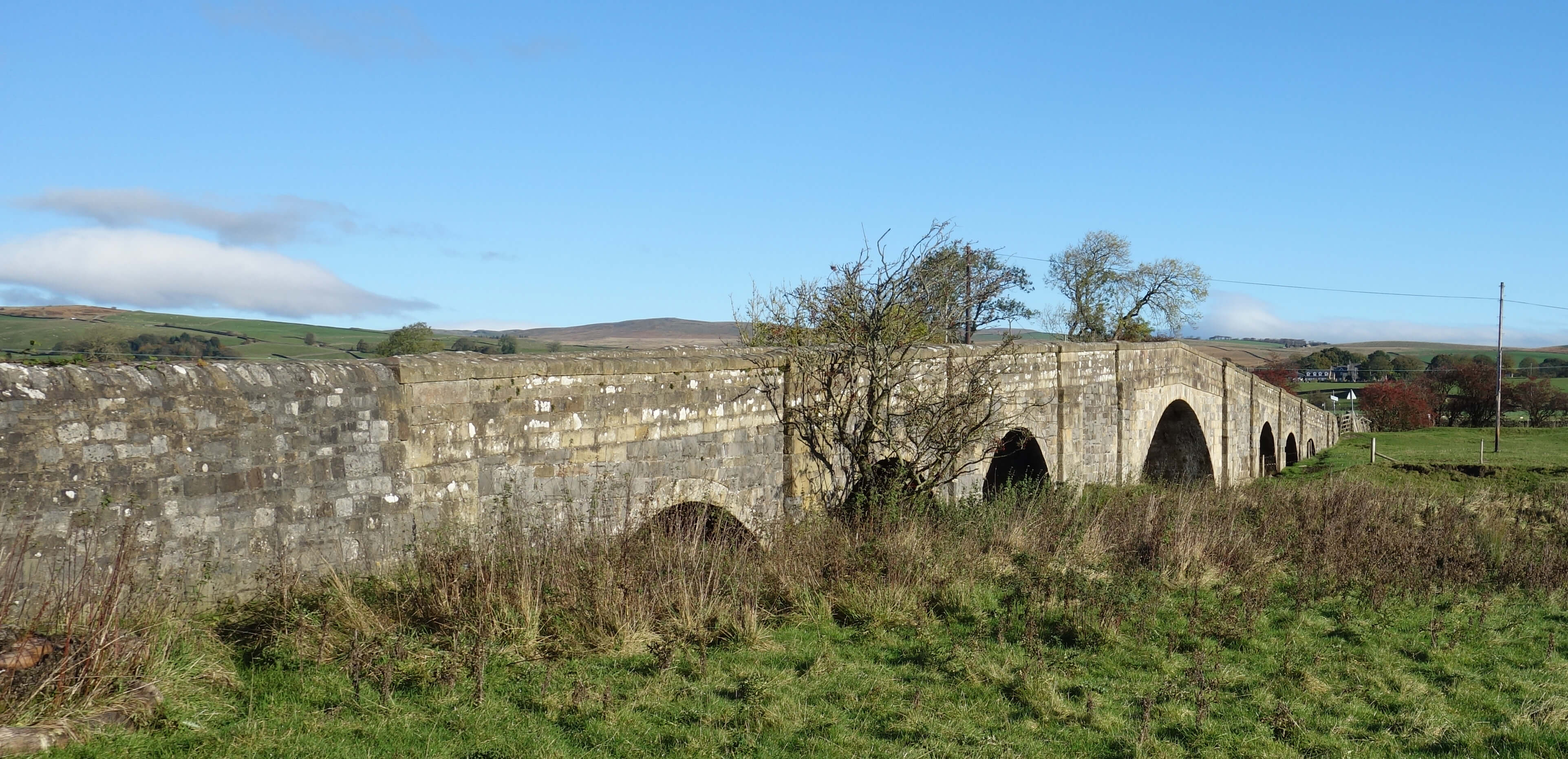 Right: Cow Bridge.
The Deeps are a Site of Special Scientific Interest primarily because of the flora of this wetland site and the birds
that nest and feed upon it. After
previous attempts to build flood defence embankments and to drain the fields for farming,
there is now a programme to ‘naturalise’ the Deeps (as described in the
first few minutes of this
video). As the video shows,
the Ribble normally flows low between high, fragile-looking banks that appear to have hardly a protective rock within them.
Unlike the case of The Clouds SSSI discussed in the previous Sauntering, all those involved in the naturalisation
programme seem certain that the version of nature that they are creating is
just as nature intended. What the local farmers gain I'm not sure – except perhaps some
compensation from others trying to manage this troublesome land.
As with all landscapes, it is possible to just accept the Deeps for being what they are – and to
admire (or not) the scenery, which in this case, with a slow river within flat green fields, is not so
exciting. I have passed these fields many times, on the A65 and on the Leeds train, but never once, until
now, paused to reflect on why these Deeps are here.
Greenhalgh (2009) describes this as a “unique area”.
I don’t know if it is literally unique but it is certainly unusual to find such a floodplain within the
middle reaches of a river. It is unusual enough to make one suspect that there might have been some
unusual cause or event that created these Deeps. If so, what could it have been?
The Ribble Way crosses the road near Cow Bridge and I was tempted to follow it north. But I had not walked
here before and couldn’t be sure that the path wouldn’t disappear under water somewhere along the way. So I continued
on the road to Wigglesworth, which is a small village with a large pub. The road turns north through Rathmell,
the birthplace of
Richard Frankland (1630-1698),
a nonconformist divine who founded the Rathmell Academy, which was apparently important in the history of northern
religious practices.
From the road there are occasional views to the east of the flooded fields of the Deeps
but there isn’t much to be seen from a distance and probably not much more when close by. I preferred
the long-distance views of Ingleborough and Pen-y-ghent ahead and came to regret not making better use of
this bright, clear November day – oh, to be walking up a proper hill rather than tramping along a road
beside flooded fields.
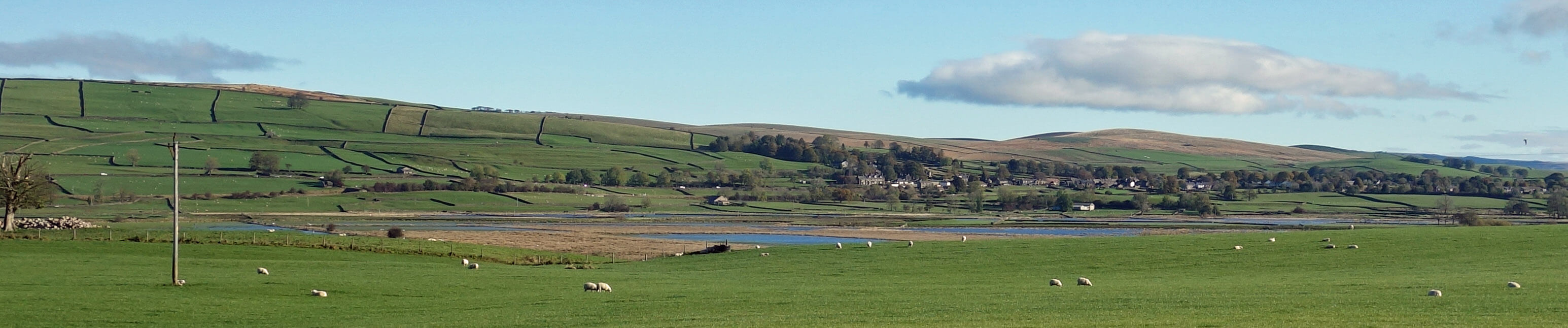
To Long Preston across The Deeps from near Rathmell
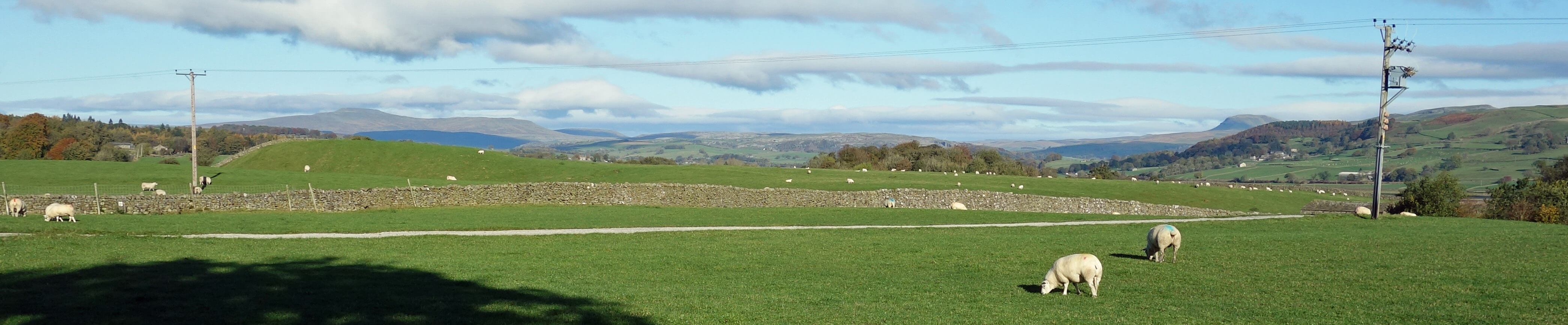
Ingleborough and Pen-y-ghent from near Rathmell
As for why the Deeps are here, the explanation goes something like this. The Ribble used to flow east towards
where Gargrave is today to join the River Aire and thus flow to the North Sea. Then glacial deposits built a barrier
in the Long Preston region behind which a lake formed. Eventually the barrier was breached where Cow Bridge now is
and the lake escaped by flowing west to the Irish Sea. The Deeps have been formed in the layers of
silt that accumulated in the lake. The present floodwater ‘lake’ is therefore a kind of remnant of this
post-glacial lake.
Date: November 4th 2021
Start: SD829585, Long Preston (Map: OL41)
Route: (linear) SE on A65, SW on B6478 – Cow Bridge – E – Wigglesworth – N – Rathmell – N,
E, NE – Settle market
Distance: 8 miles; Ascent: 50 metres
Home
Preamble
Index
Areas
Dales
Hills
Lakes
Places
Reserves
Rivers
Structures
Villages
References
Me
© John Self, 2018-

Top photo: The western Howgills from Dillicar;
Bottom photo: Blencathra from Great Mell Fell