
Home
Preamble
Index
Areas
Dales
Hills
Lakes
Places
Reserves
Rivers
Structures
Villages
References
Me
Saunterings: Walking in North-West England
Saunterings is a set of reflections based upon walks around the counties of Cumbria, Lancashire and
North Yorkshire in North-West England
(as defined in the Preamble).
Here is a list of all Saunterings so far.
If you'd like to give a comment, correction or update (all are very welcome) or to
be notified by email when a new item is posted - please send an email to johnselfdrakkar@gmail.com.
165. In Gisburn Forest in the Forest of Bowland
There aren't many forests within a forest.
Gisburn Forest is the only forest marked on the OS map within the Forest of Bowland. The latter
forest is one in the historic sense of an outlying area of land that was of little value except
for timber and game and was thus set apart as a hunting ground. The modern form of Gisburn Forest
is more like what we think of nowadays as a forest. It was created by the Forestry Commission
between 1949 and 1960 after the construction of Stocks Reservoir and its plantations of dark,
dense conifers made it the largest woodland in Lancashire. I set out to wander in and around
the northern half of Gisburn Forest.
In the first chilly wind of autumn I began from the watershed at Bowland Knotts,
one of the rare cases when a walk begins at more or less its highest point (422 metres). I headed
east, alongside the wall, intending first to walk two miles or so to the north-eastern corner of
Gisburn Forest. It may be two miles on the map but it’s probably double that on the ground, what
with all the little detours around boggy pools, heather, bracken and bilberry. At least the
vegetation on this exposed ridge was only knee high, at most. It wasn’t difficult going but
rather frustrating not being able to get into a purposeful stride. But that’s probably no bad
thing. It’s terrain to be taken carefully.
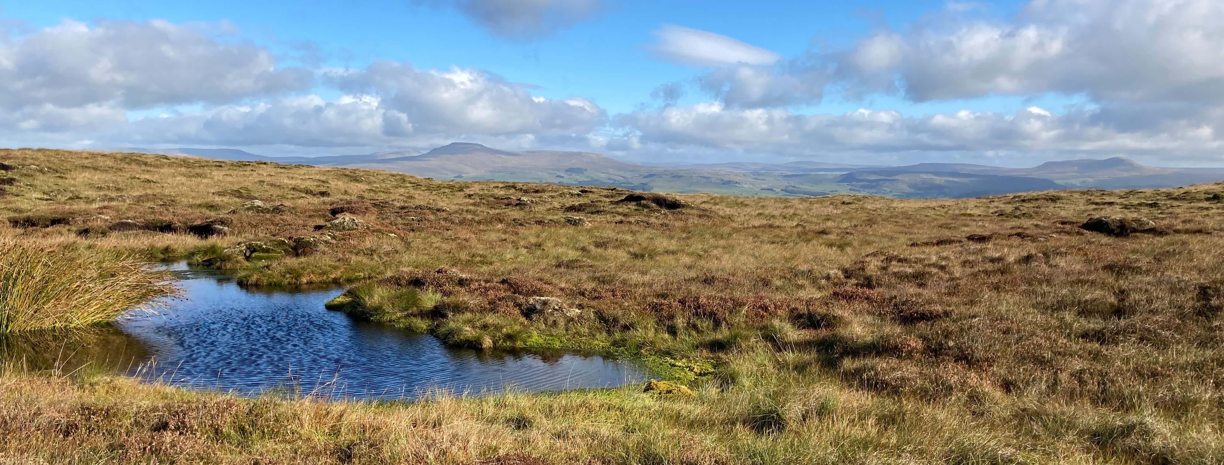
The view north from near Bowland Knotts towards Ingleborough and Pen-y-ghent
I paused often to look at the scenery, with Ingleborough and Pen-y-ghent well
displayed to the north. The third of the Three Peaks, Whernside, was also visible at first but gradually
disappeared behind Ingleborough. Nearby the dominant feature was the large, weathered, millstone grit
boulders scattered about.
The wall eventually forms the northern boundary of Gisburn Forest, although many of the
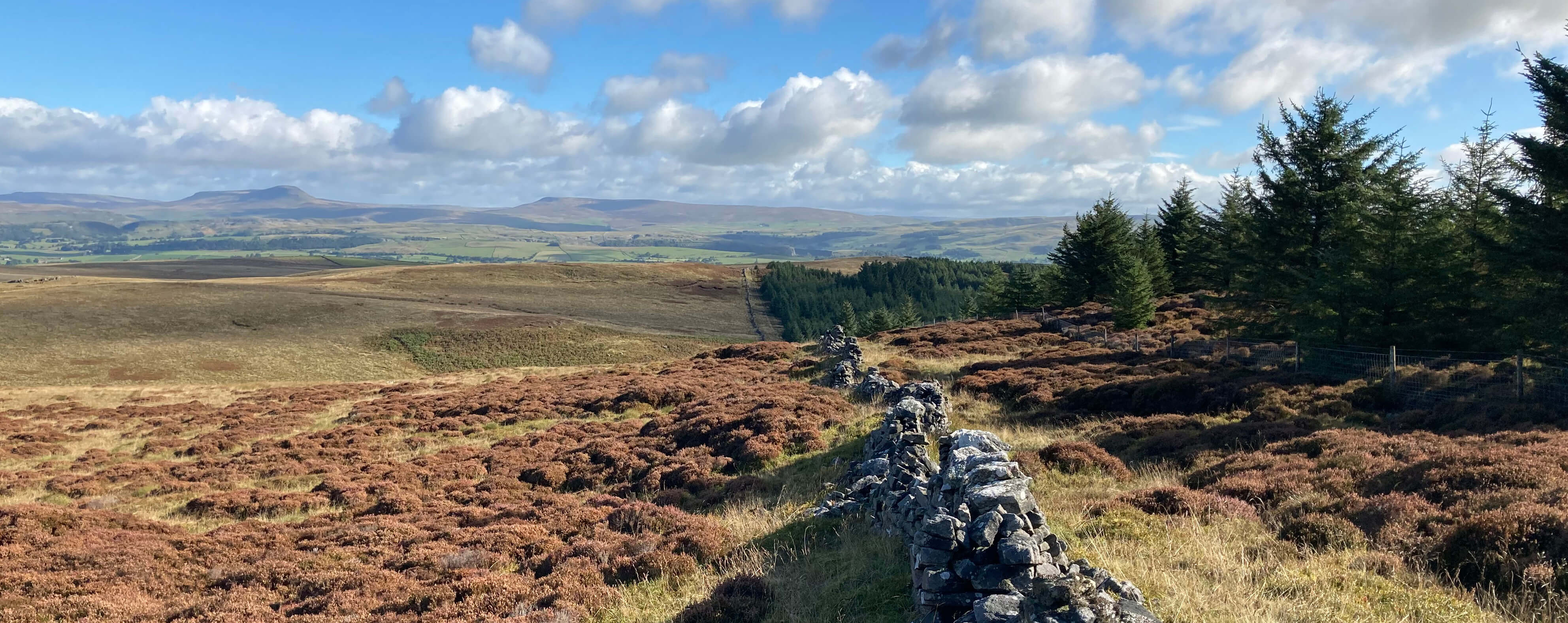
trees here have been harvested. In one clearing I saw two deer but they saw me first. I duly reached the north-east
corner where there’s an aptly-named Resting Stone. I sat upon it for a snack while admiring
the view north and east.
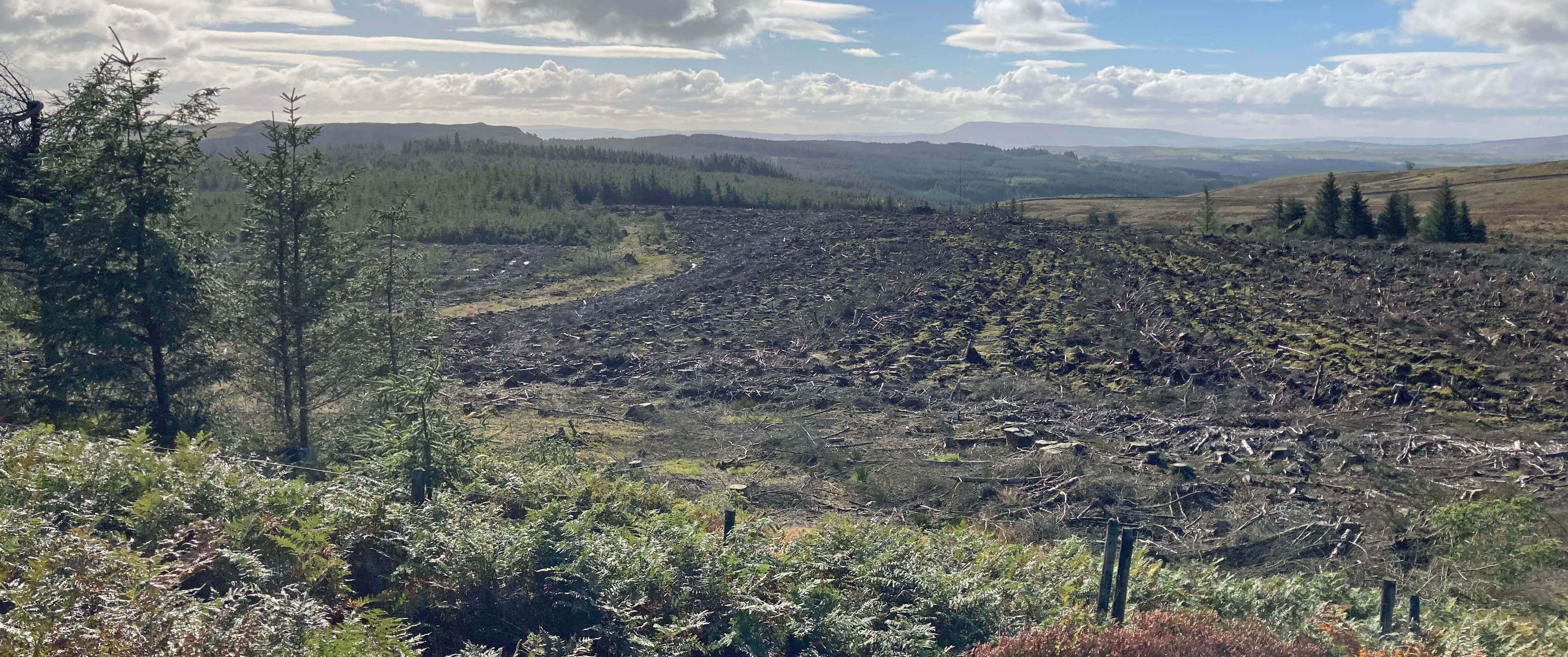
A rather desolate Gisburn Forest, with Pendle in the distance
The northern edge of Gisburn Forest, with Pen-y-ghent in the distance
Resting Stone and Pen-y-ghent
I then headed south over Gisburn Common aiming for the public footpath that runs south
inside the Gisburn Forest boundary. That’s what the green dots on the OS map say but
unfortunately there is little indication that public feet have ever come this way and therefore
there is no path. The ‘path’ is in fact a struggle, with old tree stumps and other brash
in the way, as well as the occasional fallen tree across it. To the west, through
recently-planted conifers, I could see an apparently charming, open valley (Dob Dale), which, according
to the map, also has a public footpath. The young conifers were planted far enough
apart for me to walk through, so I headed for Dob Dale.
Then I thought better of it. I had no guarantee that the forest would continue to be
easy to walk through, nor that the public footpath in Dob Dale was better than the one I had been on.
Indeed, I know that it wasn’t on the only previous occasion I had tried to tackle Dob Dale, some years ago.
Then the path was thoroughly buried under the debris of forestry work. It is, of course,
foolish to walk alone into a pathless, unfamiliar forest. So I retreated to the ‘path’ along
the eastern boundary but I soon had had enough of it.
My original plan was to walk west from this path, on the public footpaths
shown on the map,
through the centre of Gisburn
Forest and then back up the road to Bowland Knotts. I wasn’t looking forward to it, for
more than the usual reasons, which are that forest walking is dull, with only replicas of
the same tree (usually a conifer) to see and with no long-distance views, meaning that it is
easy to become disorientated, especially since the tracks and paths are ephemeral, coming and
going as forestry work proceeds. The extra reason to be wary of walking in Gisburn Forest is
that it has become a mecca for
mountain biking.
A decade or so ago a few mountain bike trails
were set up here and they proved so popular that, it seems, much of the forest has now been given over to
mountain biking. That’s fine by me – it’s clearly an enjoyable activity for younger folk – but
it does mean that the trails are hazardous for walkers.
I don’t know how hazardous because I abandoned that plan and walked east instead, out
towards Badger Hill and the open moor. I made my way back, north of the way I’d come. It was
slow going, of course, but really quite exhilarating being out on the moor where it is hard to
see why anybody else would walk and with wide views across to the Dales hills, and even a watery
Lake District in the distance.
I feel a duty to give a realistic impression of wild walking on these millstone grit moors. It
is a slow slog, a perpetual challenge to find a serviceable route
around bogs, rocks, bracken and heather (after wet weather it is probably best to not even try).
Bright green areas should be avoided: they are unreasonably healthy because they have
water of indeterminate depth below them. A particular problem is that you
may step on what looks like solid
ground but isn’t. Erosion may create a gully in the peat that the surrounding vegetation grows over to
hide a void below. If you step upon it then you will not find solidity for some distance below
where you expected.
I do not hurry on the
moors, in the belief that the more the leg has downward, rather than forward, momentum the less likely it is
to be damaged. On this walk I stepped into two such voids,
emerging muddied but unbowed, as the cliché goes.
The names on the map – Black Hill, White Swan, Lawkland Fell, Brown Bank, Top of the
Clough – are entertaining but don’t seem to name anything specific. And on I slowly plodded,
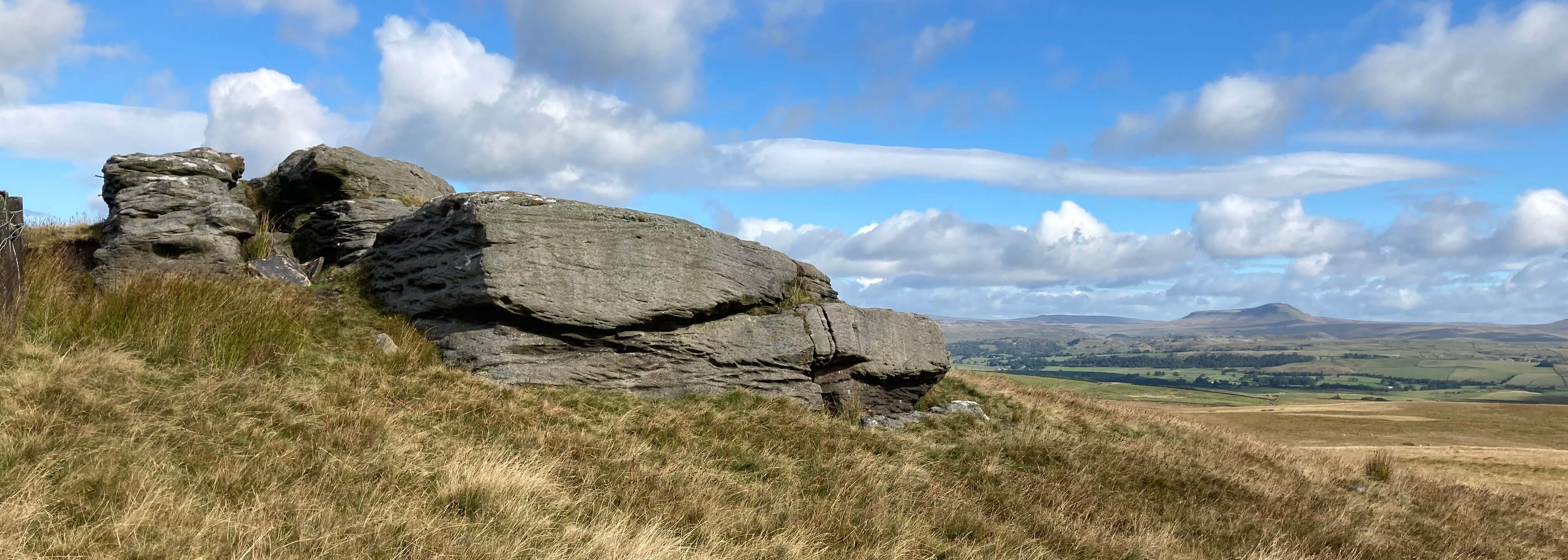
eventually climbing back to the relative haven of the wall at the strangely-named Rock Cat Knott. Back at
Bowland Knotts I detoured to have a look at the impressive jumble of large millstone grit
boulders, best seen from the southern side.
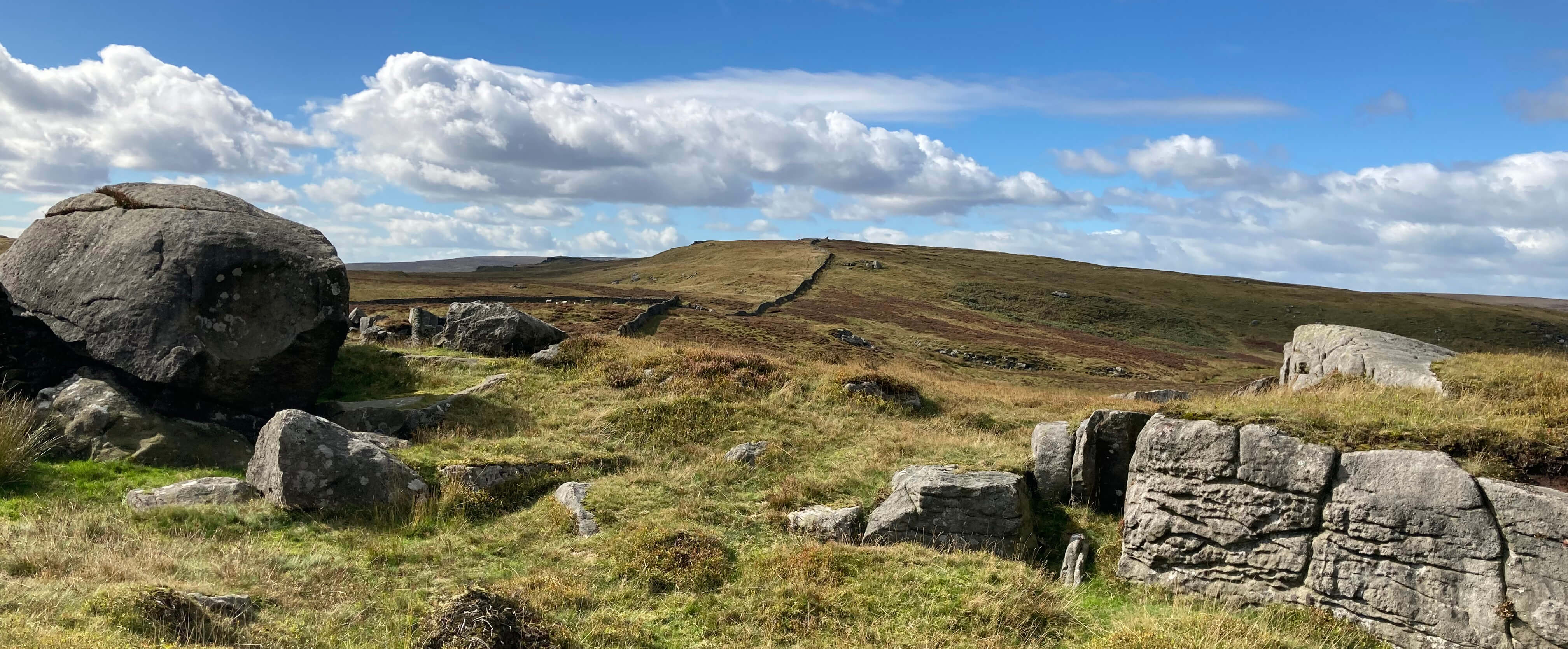
Rock Cat Knott, looking towards Bowland Knotts
So I didn’t really walk in Gisburn Forest at all. I will put it back on my ‘to do’
list, but not near the top.
Date: September 26th 2022
Start: SD726607, Bowland Knotts (Map: OL41)
Route: E, NE – Resting Stone – S across Gisburn Common and inside Gisburn
Forest – N, E – Badger Hill – NW, W over Black Hill, White Swan Moss – SW – Rock Cat Knott – W – Bowland Knotts
Distance: 7 miles; Ascent: 110 metres
Home
Preamble
Index
Areas
Dales
Hills
Lakes
Places
Reserves
Rivers
Structures
Villages
References
Me
© John Self, 2018-

Top photo: The western Howgills from Dillicar;
Bottom photo: Blencathra from Great Mell Fell