
Home
Preamble
Index
Areas
Dales
Hills
Lakes
Places
Reserves
Rivers
Structures
Villages
References
Me
Saunterings: Walking in North-West England
Saunterings is a set of reflections based upon walks around the counties of Cumbria, Lancashire and
North Yorkshire in North-West England
(as defined in the Preamble).
Here is a list of all Saunterings so far.
If you'd like to give a comment, correction or update (all are very welcome) or to
be notified by email when a new item is posted - please send an email to johnselfdrakkar@gmail.com.
166. Bretherdale Then and Now
The appeal of a place does not depend only on the properties of that place. It depends also on
the person to whom the place may appeal and on whatever associations and memories
the person may bring to bear.
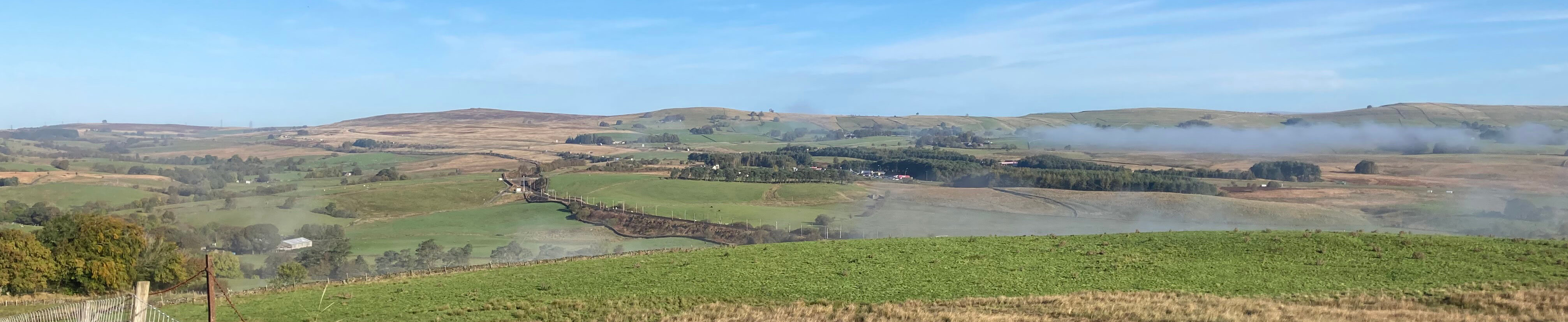
The last of the morning mist over Orton
The autumn mists had not yet cleared from the Howgill valleys as I set off from my oft-used
parking spot south of Roundthwaite. Roundthwaite is a hamlet of a dozen or so houses, one of which
in the past has borne a sign saying “Roundthwaite Fell Ponies”. I didn’t see such a sign this time
but I don’t know if that means that the house in question is no longer the base for the fell ponies
that roam the nearby fells (or used to).
I understand that Natural England is attempting to encourage, by means of 'subsidies', fell pony
owners to remove their ponies from the fells, with the aim of 're-wilding' them (the fells, that is).
This is a complex issue,
relating to the legal status of common land, questions about what exactly is the 'wild' state
of these moors, the fact that fell ponies are 'semi-wild' themselves,
and the desire to preserve this distinctive northern breed of horse.
But this wasn't my focus for today.
I was heading for Bretherdale, one of the lesser-known dales of the Lake District National Park.
In fact, it wasn’t even
in the National Park until the recent boundary changes. It lies tucked away
in the triangle of land between the
M6 and A6 west of Tebay. Very few visitors to the Lake District will have heard of Bretherdale and
even fewer will make a point of visiting it. I, however, am particularly fond of Bretherdale.
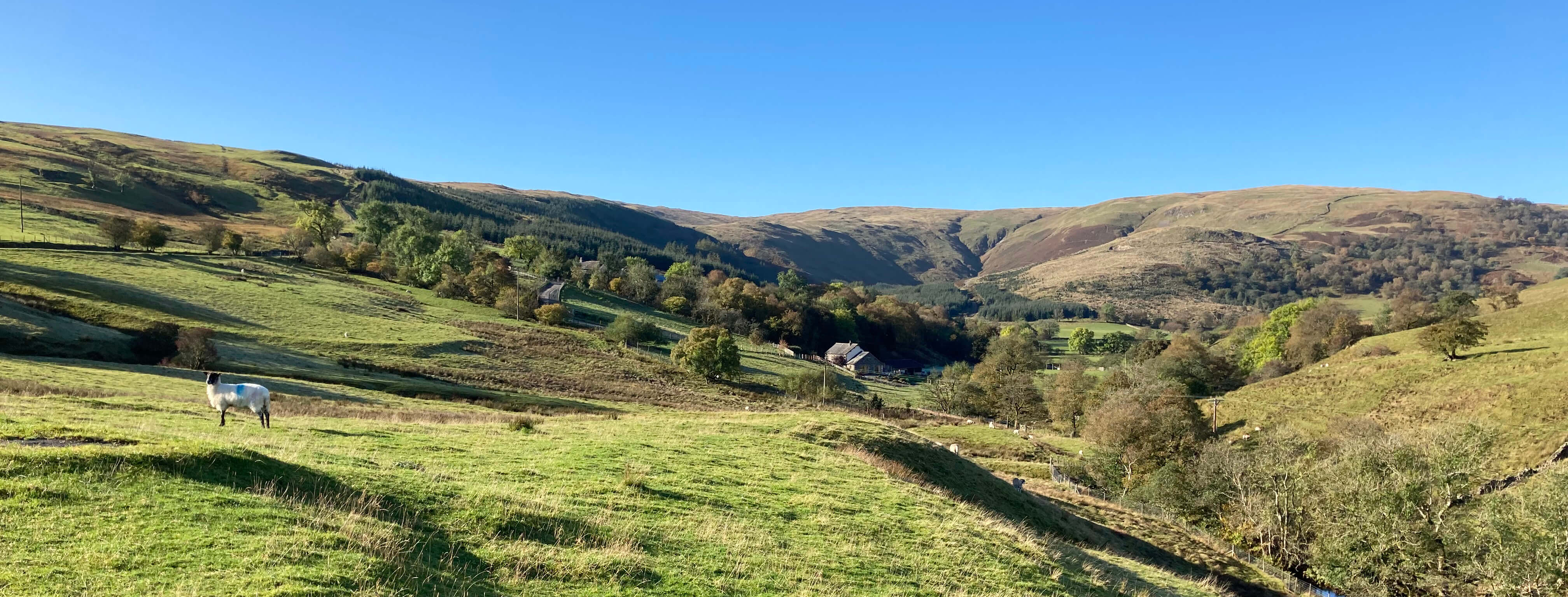
Bretherdale
Many years ago, when I was in a state of Olympian fitness through mercilessly pounding the
local roads, I began to find road-running monotonous and masochistic. Rather than let this fitness
go to waste, I decided to use it to run around the hills and dales of the region that I was fortunate
to live in. Bretherdale was the first such outing, in February 1988. A very cold wind brought
flurries of snow. I didn’t expect, in February, to see lambs frolicking in the fields or any other
activity. Even so, it was an invigorating outing and one which helped motivate me to stay fit
enough to be able to go out-running from time to time.
Without Bretherdale perhaps these Saunterings wouldn't exist.
In 1988 I did not really notice the emptiness of the dale, since I had expected it. So I was
somewhat surprised to read in Hayes (2004) that
“Bretherdale not only lives in the past, it is the past.
Derelict farmhouses litter the valley as if a plague has run through forcing human kind to drop
everything and go.”
That was not my memory. Yes, there were abandoned farmhouses and barns but
then so there are in most dales of the north-west. However, there was still evidence of human kind.
So in April 2006 I went, walking this time, to have another look at Bretherdale. At that
time, Bretherdale was breathing a sigh of relief because a controversial proposal to build 27 wind
turbines on its southern slopes had, at last, been rejected. A high profile campaign had enlisted
various environmental luminaries to argue for the landscape of Bretherdale, even if they had never
heard of Bretherdale before. In the end, the clinching factor seems to have been not the merits of
the Bretherdale region itself but the fact that windmills here would spoil the view from the
National Parks of the Lake
District and Yorkshire Dales.
Now that Bretherdale is within the former it is presumably better protected
against such proposals. Anyway, in 2006 I felt that, if Bretherdale had been
moribund, it was at that time reviving. For example, Bretherdale Hall, which in 1988 had been, I think, rather neglected, was
in 2006 being ambitiously rebuilt.
So today I was again visiting to see how Bretherdale was getting on. At the entrance
to the dale there was a sign saying that Breasthigh Road was “closed to all traffic”. I supposed
that when people see “Road” on the map they picture something like a dual carriageway. Breasthigh
Road is a steep, rough track that rises from Bretherdale over the ridge to its southern neighbour,
Borrowdale.
I crossed a cattle grid to enter the domain of sheep, who looked quizzically at this
intruder. Then I reached Bretherdale Hall, now fully renovated and serving as a “luxury holiday
home for up to 18 guests” according to its website. Here there was a view up to the head of
Bretherdale and, to the right, traditional meadows that form a Site of Special Scientific Interest.
The sound of the M6 had now disappeared and the silence of the valley was broken only by the mewing
of a buzzard. I couldn’t see it but it was getting alarmingly closer as I walked along. And then
suddenly it rose from its perch, just feet away, by Corkham Beck.
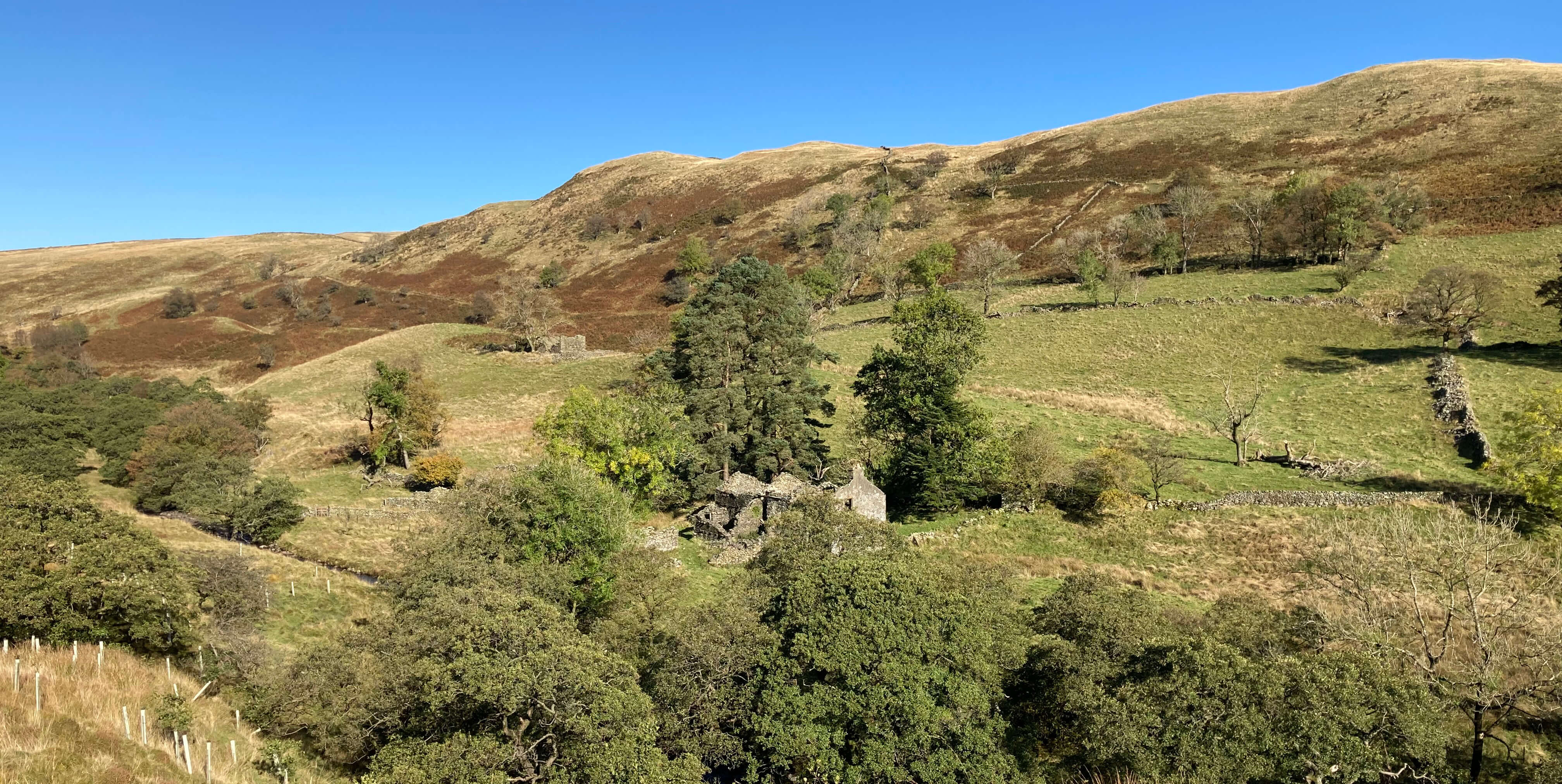
Midwath Stead was much as I remembered. It still had the “free-range children” sign – but
presumably for a new generation of children. The few houses seemed active enough to me,
with no sign of dereliction here, although I know that Ings House, just up the hillside, has been
abandoned. I noticed that a “Midwath Stead” sign was attached to one of the houses, which makes me
wonder if the name is that of the house or the hamlet.
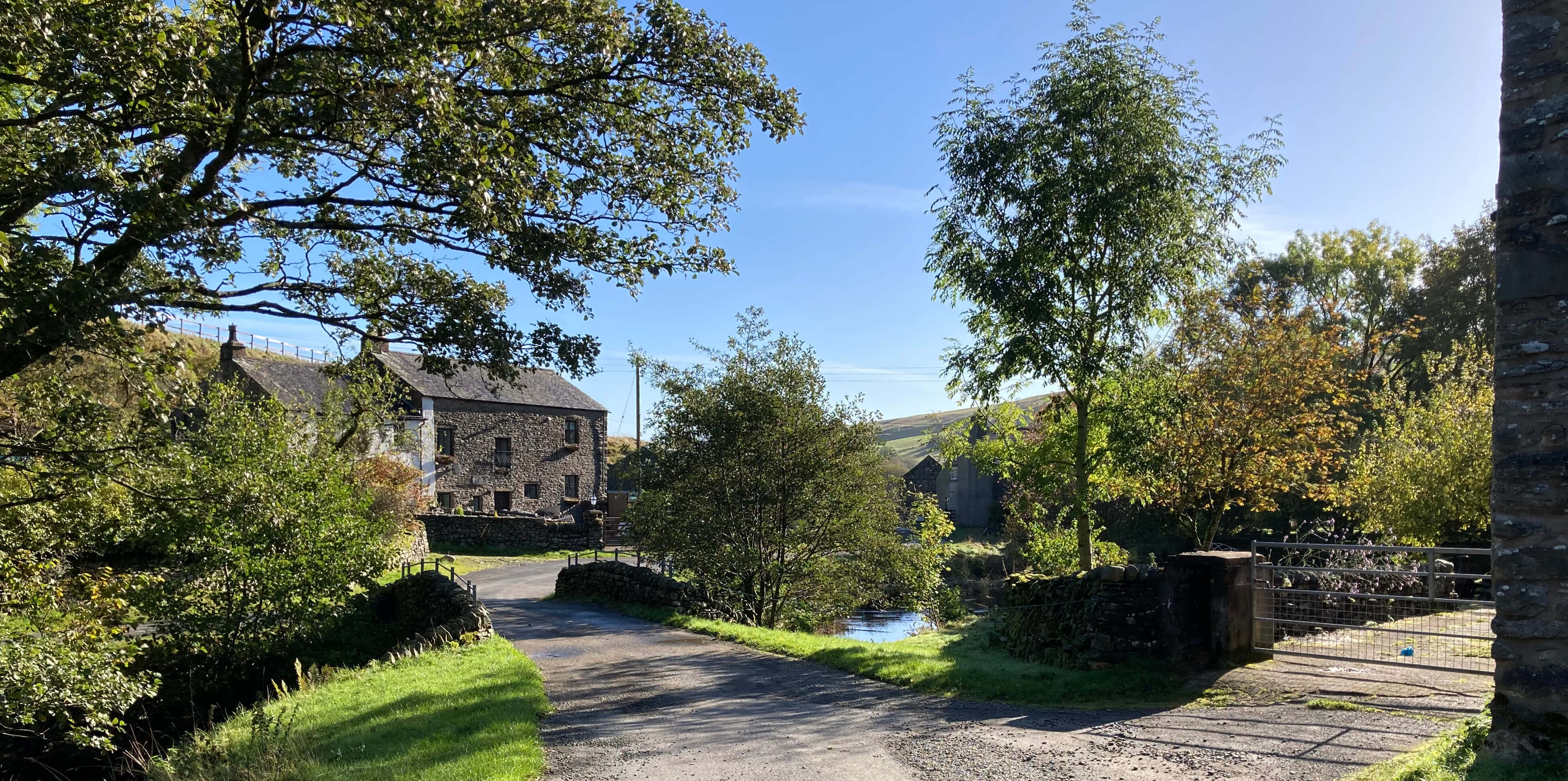
Left: Midwath Stead;
Right: The ruins of Greendale.
I walked on along the south bank of Bretherdale Beck, reaching the side-track to Breasthigh
Road, where there was a multitude of signs explaining that the track was closed for repairs.
Reading the small print, where it pointed out that there isn’t space for two vehicles to pass, I
deduced that vehicles are indeed expected to use this track, which, from what I remember of it, must
be quite a challenge. Why do we indulge recreational off-road drivers? This presumably ancient track
should be used only by feet.
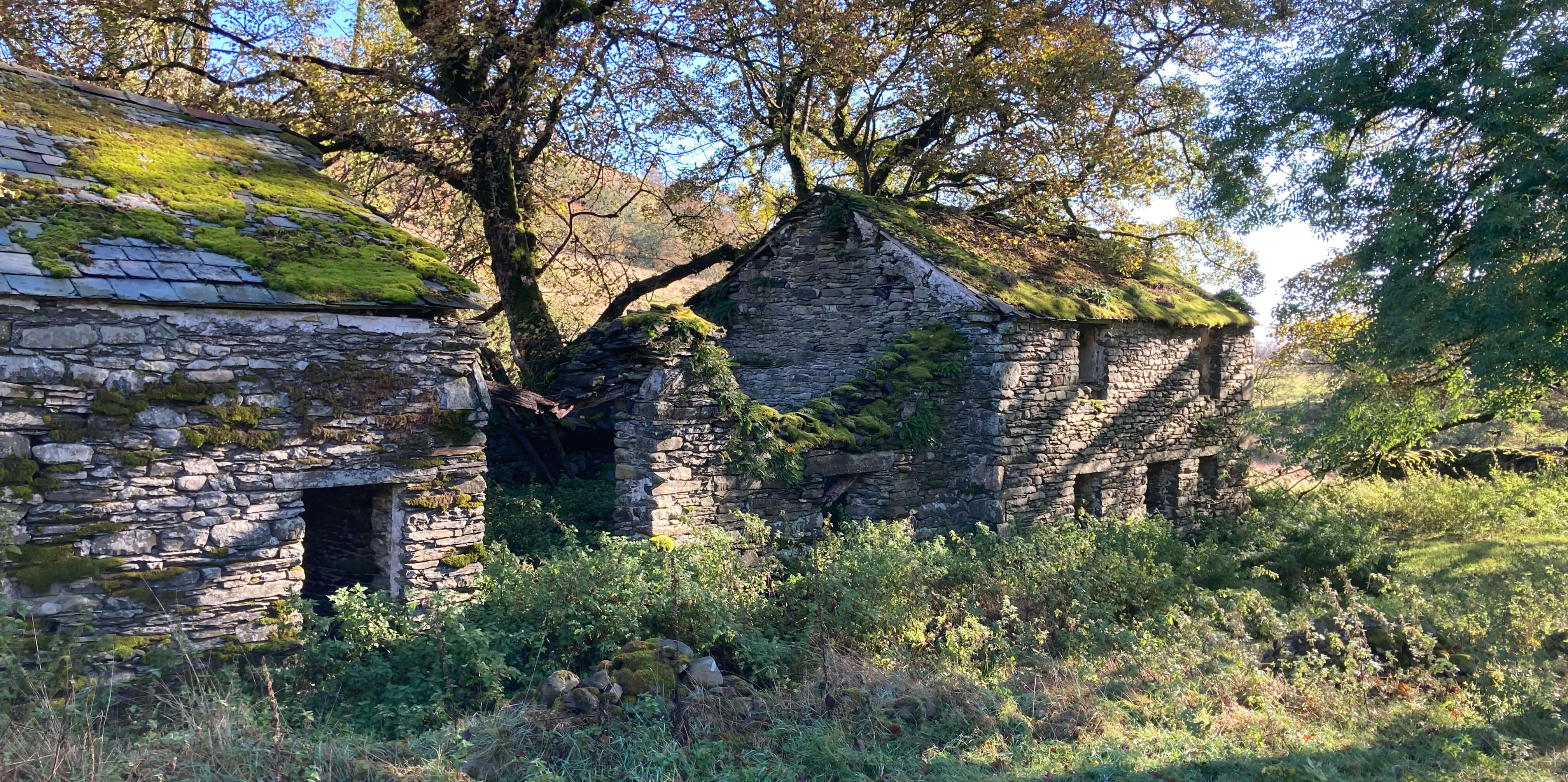
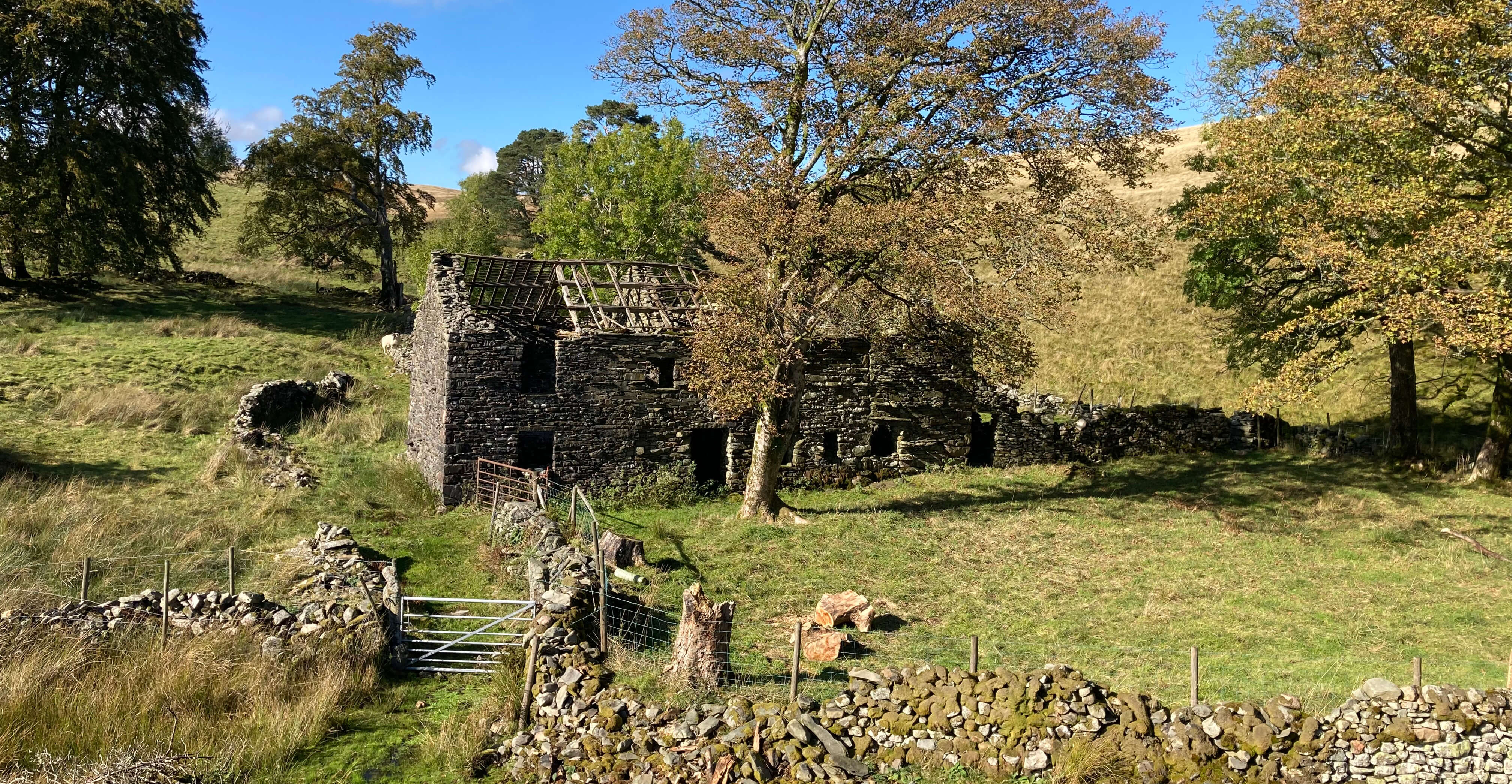
The farm of Bretherdale Head seemed to be still active but not the long-abandoned adjacent
Greendale. Beyond Greendale the path – marked as a bridleway although there is no sign that horses
use it – deteriorated. Another abandoned farm, Parrocks, on the opposite bank, was passed,
although it is more of a surprise that anyone ever attempted to farm in this isolated,
difficult-to-access location than that it was abandoned.
The ruins of Parrocks
The traverse around the head of Bretherdale to the Birkbeck Fells to the north was more
difficult than I remembered or hoped. Bretherdale Beck itself was too full, with slippery stones that
it was easy to fall off and in. Also, there were high fences to keep deer out from the newly-planted
saplings. The fences didn’t keep me out – or, once I was in, in. My recent outings seem,
unfortunately, to have generated a series of don’t-do-as-I-did narratives.
I was eventually able to clamber up to the top (at about 400 metres) of Birkbeck Fells,
which is also now part of the Lake District National Park, although I don’t know what merits it has to deserve
this. To me, it seems a featureless moor of little interest or character. A number of hill names are
given on the map but it is hard to relate them to particular humps on the ground. I followed
sheep tracks eastward, pausing at a sunny spot by one of the large pink granite erratics that are
scattered about the moor. Here I could try to dry out,
whilst having a snack and watching the two
lanes of M6 traffic gliding silently across the distant hills.
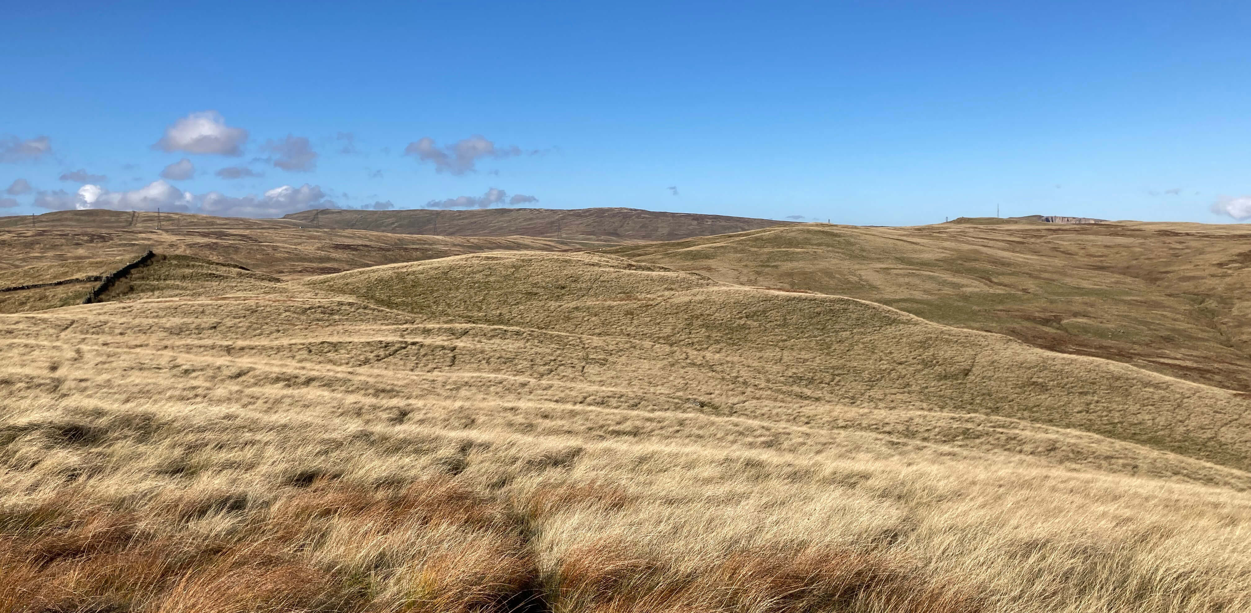
Left: Birkbeck Fells;
Right: The ruins of Eskew Head.
Walking on, I passed the ruins of Eskew Head which were particularly poignant, as although
the roof and much else had
collapsed, it was possible to see what was once the garden and imagine a family trying to make a living here.
But it must have been an impossible challenge in this isolated spot, delightful though it may appear.
Walking back through the hamlets of Greenholme and Roundthwaite it is easy to reflect upon
the timelessness of this region. Nothing much has changed since my previous visits. Bretherdale
is, more or less, as it was. And yet there is a perpetual flux, with sometimes major disruptions.
The lane that I was on was once the major north-south route in the region, long before the M6 and
railway appeared just to the east. It was a drove road for cattle from Galloway, and Greenholme
and Roundthwaite were important staging posts. Today, all is quiet – apart from the noise of the M6
and railway.
Date: October 13th 2022
Start: NY611029, layby on the road to Roundthwaite, overlooking the M6 (Maps: OL19, OL7)
Route: N – Roundthwaite – NW on Pikestone Lane – Low Greenholme – SW –
Bretherdale Hall – SW, NW – Midwath Stead – W – Bretherdale Head – NW for about a mile, N –
Round Hills – E – Eskew Head, Ewelock Bank – E, S – Greenholme – SW, S – layby
Distance: 9 miles; Ascent: 240 metres
Home
Preamble
Index
Areas
Dales
Hills
Lakes
Places
Reserves
Rivers
Structures
Villages
References
Me
© John Self, 2018-

Top photo: The western Howgills from Dillicar;
Bottom photo: Blencathra from Great Mell Fell