
Home Preamble Index Areas Dales Hills Lakes Places Reserves Rivers Structures Villages References Me
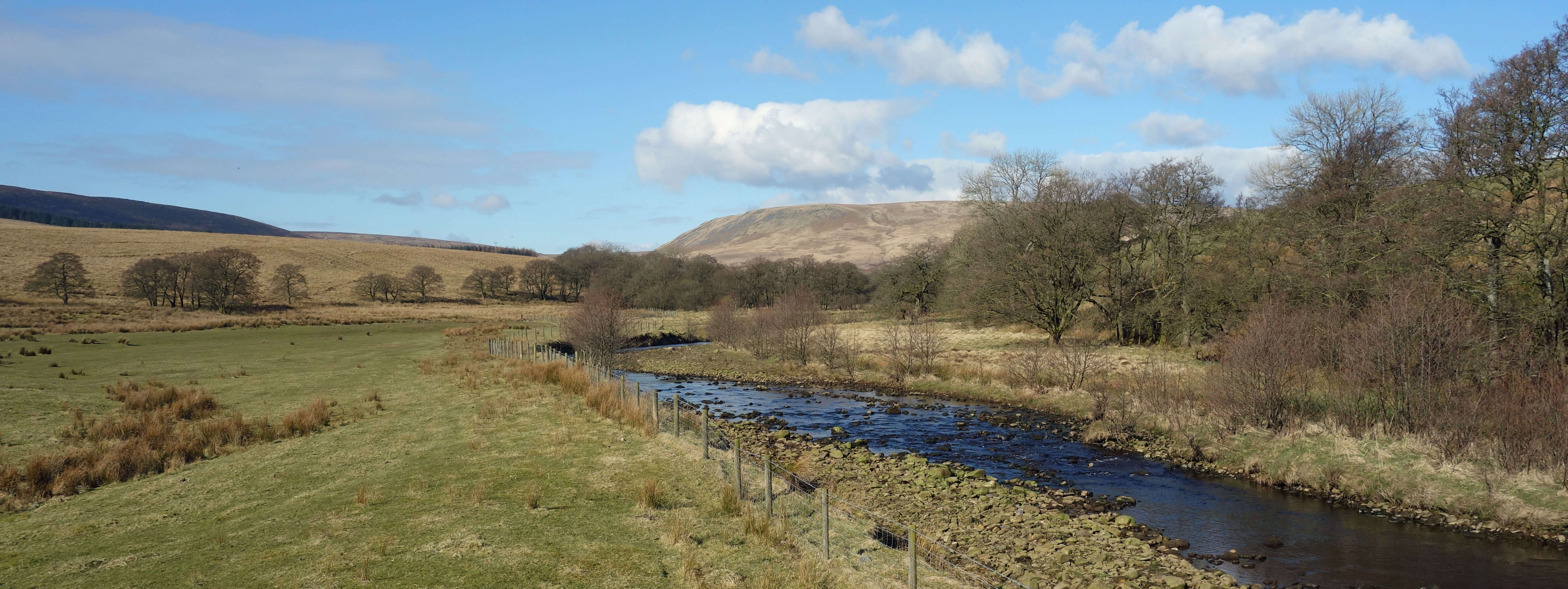
River Hodder (above the reservoir)
I proceeded north past the derelict farmhouse of New House, across the young River Hodder, and eventually back towards the reservoir. As I swung west, I came upon the third purpose of the reservoir, that is, to provide a fishery. Stocks Reservoir is said to be the largest fly-fishery in North-West England. It is, I read, well-stocked with brown, rainbow and blue trout. I never knew there were blue trout. The genetic diversity of trout is complex – too complex for me – but as I understand it only the first of these three is native to England, which seems a shame for Stocks Reservoir, although I am somewhat reassured to read that the Stocks fish are triploid, meaning that they are sterile. Anyway, the anglers are clearly content, not least because they are not restricted to fishing from the bank. There is a fleet of ‘Coulam boats’ specifically designed for fly-fishing. The boats must, of course, stay in their part of the reservoir, south of the island. I wonder how the anglers get on with those cormorants, when they are keen to cull them elsewhere.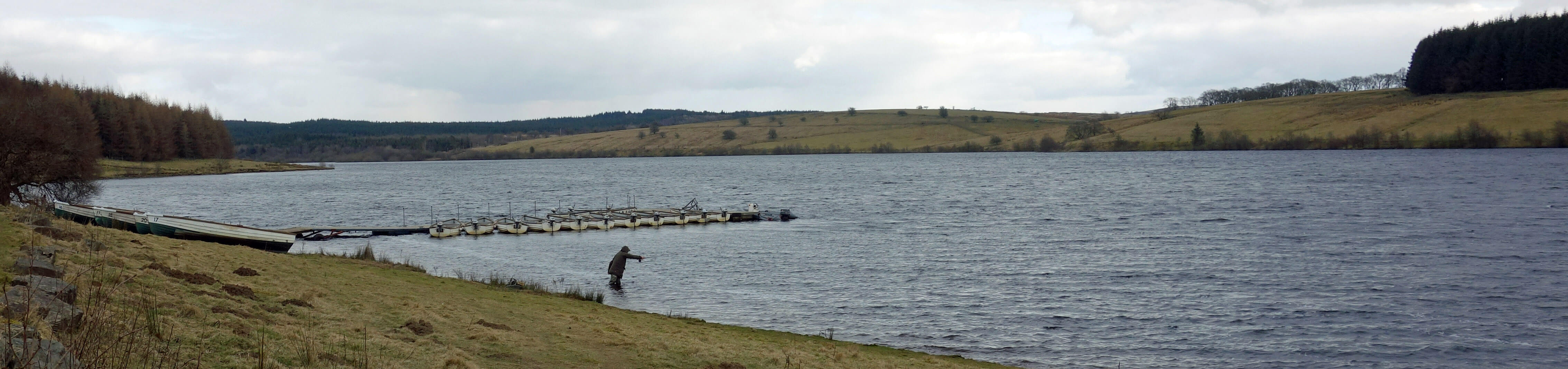
Fisherman and Coulam boats at Stocks Reservoir
I saw five fishermen, which was five more than I expected on such a cold day – two of them up to their thighs in the icy water. I walked on and came across several signs warning me of frogs. The frogs certainly looked ferocious on the signs, but I managed to evade them. I then reached the dam, which is the most obvious sign of the reservoir’s fourth purpose – its original one – to hold back water for the people of Fylde and Blackpool. The reservoir was created in the 1930s, and in the process drowned the village of Stocks-in-Bowland. Its chapel and the 165 bodies in its graveyard were moved to a new site on the eastern shore. I wonder if they were equally considerate in moving the living to a new site.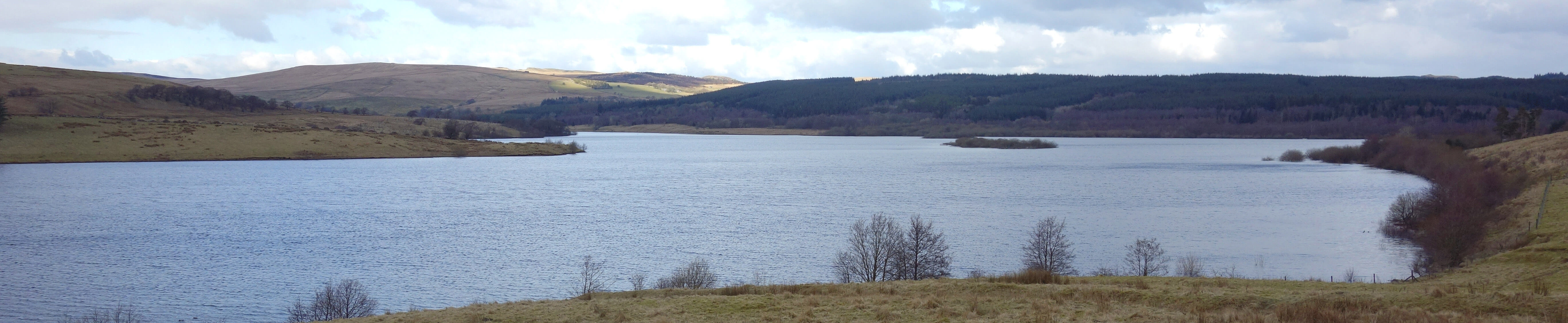
Stocks Reservoir and Gisburn Forest
Just ahead of me, over the dam, I could see a party of sixteen walkers, confirming the last purpose of the reservoir, the one that I was making use of, that is, to provide a pleasant outing for saunterers like myself. In fact, I was delighted to find that this is no ordinary walk – it was voted the 67th best walk in a recent ITV programme on Britain's Favourite Walks. Wow! Just for the record, North-West England (as defined by me in the Preamble) has 16 walks in the top 100, including 6 of the top 10:1. Helvellyn (via Glenridding Common) 3. Malham and Gordale Scar 4. Catbells 5. Scafell Pike (from Wasdale Head) 7. Buttermere (around the lake) 8. Coniston Old Man, including Dow Crag 25. Ingleborough (from Clapham) 27. Ambleside to Grasmere, via the Coffin Route 30. High Cup Nick 36. Ingleton Falls 54. Richmond to Reeth (part of the Coast-to-Coast) 61. Grassington to Kilnsey 67. Forest of Bowland (around Stocks Reservoir) 69. Brontë Waterfalls 81. Saltaire to Skipton (by the Leeds-Liverpool Canal) 86. The Witches Trail (below Pendle)I was delighted not so much because the Stocks Reservoir circuit is a fine walk but because it is, in fact, a rather unadventurous one by North-West England standards. We have many other walks that could have appeared on the list, but I won’t quibble, seeing as the vote proved that North-West England is the best region for walking in Britain.
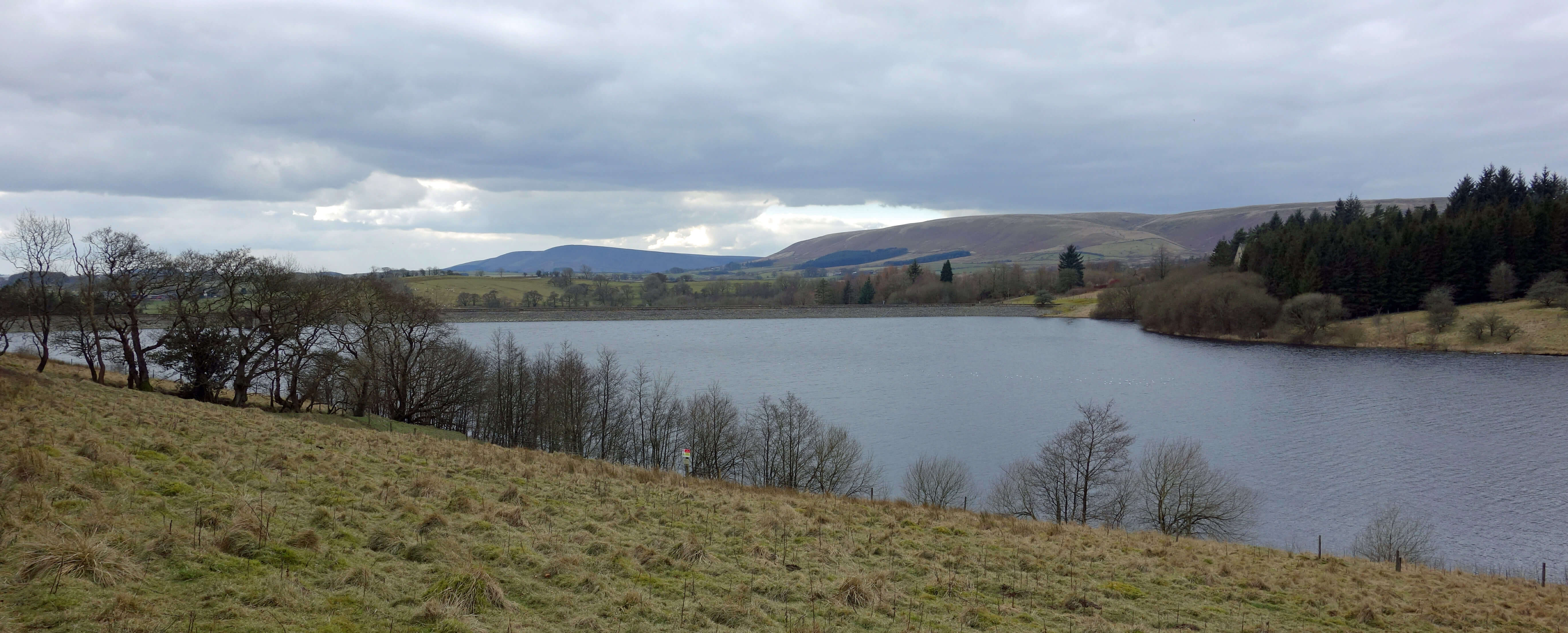
Stocks Reservoir
Home Preamble Index Areas Dales Hills Lakes Places Reserves Rivers Structures Villages References Me
© John Self, 2018-

Top photo: The western Howgills from Dillicar; Bottom photo: Blencathra from Great Mell Fell