
Home
Preamble
Index
Areas
References
Me
Saunterings: Walking in North-West England
Saunterings is a set of reflections based upon walks around the counties of Cumbria, Lancashire and
North Yorkshire in North-West England
(as defined in the Preamble).
Here is a list of all Saunterings so far.
If you'd like to give a comment, correction or update (all are very welcome) or to
be notified by email when a new item is posted - please send an email to johnselfdrakkar@gmail.com.
139. Ruskinĺs View and a View of Ruskinĺs View
Messages from deepest Cumbria continue to confuse me. Yes, visitors, lots of them, are welcome. Especially if they spend lots of money.
Which I donĺt. But every week thereĺs a news item regretting all these visitors. They are walking up the fells in flip-flops, over-stretching the
Mountain Rescue teams; they are causing the Lake District to be knee deep in
the rubbish that is usually distributed across the continent; they are walking socially distant on the fells, thereby
increasing erosion; they are infecting locals with
covid, giving Cumbria one of the highest infection rates in the country. Visitors are now asked to take a test before coming ľ but
since they are less likely to be infected than the locals perhaps itĺs the latter who should be doing the testing. I thought it best
to stay away and took a short bus-trip to Kirkby Lonsdale instead.
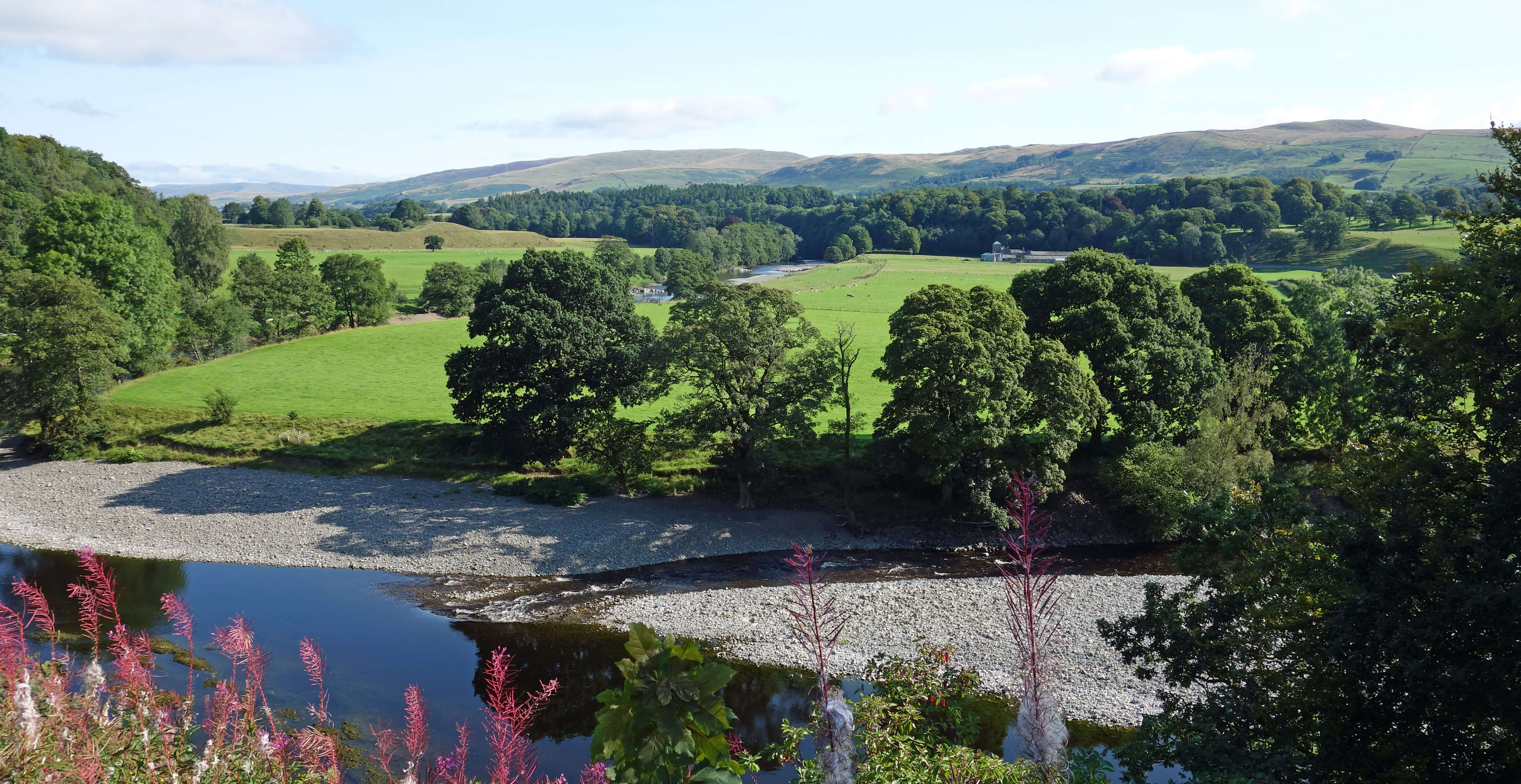 From the market square I walked through the churchyard to the view (now called Ruskinĺs View) that in 1875 caused John Ruskin
to write
From the market square I walked through the churchyard to the view (now called Ruskinĺs View) that in 1875 caused John Ruskin
to write
ôThe valley of the Lune at Kirby is one of the loveliest scenes in
England Ś therefore, in the world. Whatever moorland hill, and sweet river, and English
forest foliage can be at their best, is gathered there; and chiefly seen from the steep
bank which falls to the stream side from the upper part of the town itself ...
I do not know in all my own country, still less in France or Italy, a place more naturally
divine, or a more priceless possession of true 'Holy Land'.ö
At that time Ruskin was 56 and a man of the world sufficient to have seen many views with which to compare this one.
He saw the River Lune approaching and then swerving south by the bank below, with the hills of Barbon Low Fell in the distance.
Many visitors to Kirkby Lonsdale must wander to Ruskinĺs View and wonder what all the
fuss is about. It is pleasant enough
but not that special. The words of Ruskin quoted above are never put into context. He was not writing for the local tourist
industry. His words were within a diatribe criticising the inhabitants of Kirkby Lonsdale. He was saying, it seems to me, that this
location (the beauties of which he exaggerated for effect) should be valued and protected, not ruined. He was appalled that locals used the
bank as a rubbish tip: they
ôpitch their dust-heaps, and whatever of worse they have to get rid of, crockery and the rest ľ down
over the fence among the primroses and violets to the river ľ and the whole blessed shore underneath ů is one waste of filth, town
drainage, broken saucepans, tannin and mill-refuseö [1].
He didnĺt like the recently-erected iron rails, which he thought dangerous, nor
the seats, which he thought badly-designed. He didnĺt think much of their church renovation either:
ôthere is a fine old church, with
Norman door, and lancet east windows, and so on; and this, of course, has been duly patched, botched, plastered and primmed up; and
is kept as a tidy as a new pinö.
Today, the rest of Kirkby Lonsdale is as tidy as a new pin too.
I dropped down to the river, crossed the Devilĺs Bridge, walked along Chapelhouse Lane, and continued under the old railway
line, along a stretch of the Roman Road, and past Fell Yeat plant nursery. There are two tracks north from Fell Road. The lower
(Fellfoot Road) is the better known but the higher one is better ľ and it heads where I wanted to go. It is not only
higher but also more open, giving fine views across the serene, green Lune valley to the Lake District skyline. It also
affords a view of the
stone circle
which you would never notice without the map telling you it is there.
It is not worth trespassing for a closer view of the
dozen or so small stones.
From this track it was a short climb to the prominent cairn of Brownthwaite Pike (421 metres). The view from the cairn is extensive.
To the south, the Lune heads towards Morecambe Bay. Circling east, we then have the Bowland ridge of Wardĺs Stone and, closer by,
Gragareth, Crag Hill and the top of Calf Top. To the north is the upper Lune valley, from the Howgills. To the west is the
majestic skyline of the southern Lakeland hills. And there, nestled in the valley, lies Kirkby Lonsdale, including Ruskinĺs
View. I need hardly say which of the two views I prefer. (Brownthwaite Pike is the nobble on the right skyline of the Ruskinĺs
View photo above.)
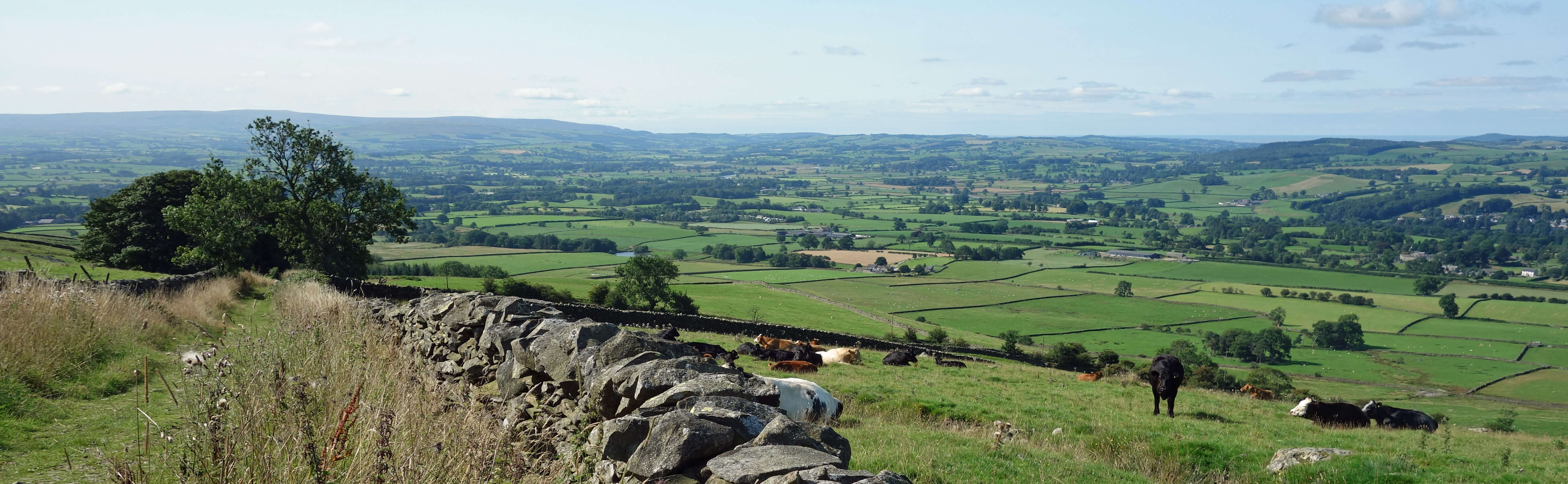
Looking south from the track approaching Brownthwaite Pike
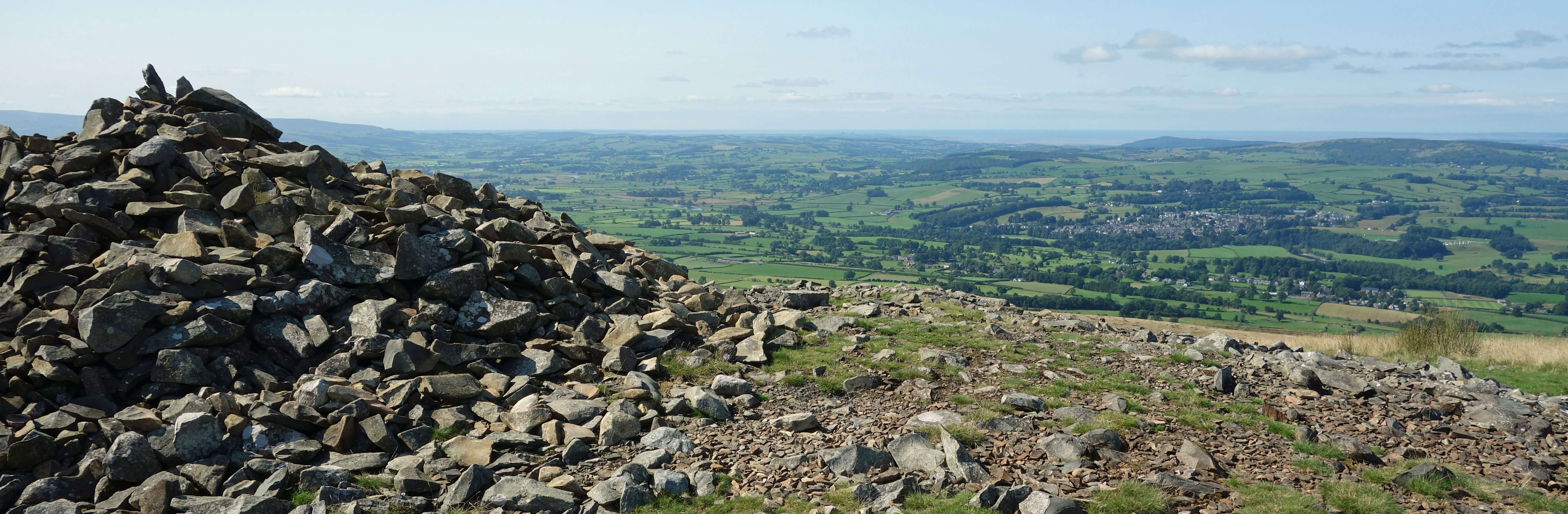
The view from Brownthwaite Pike, with Kirkby Lonsdale in the middle distance
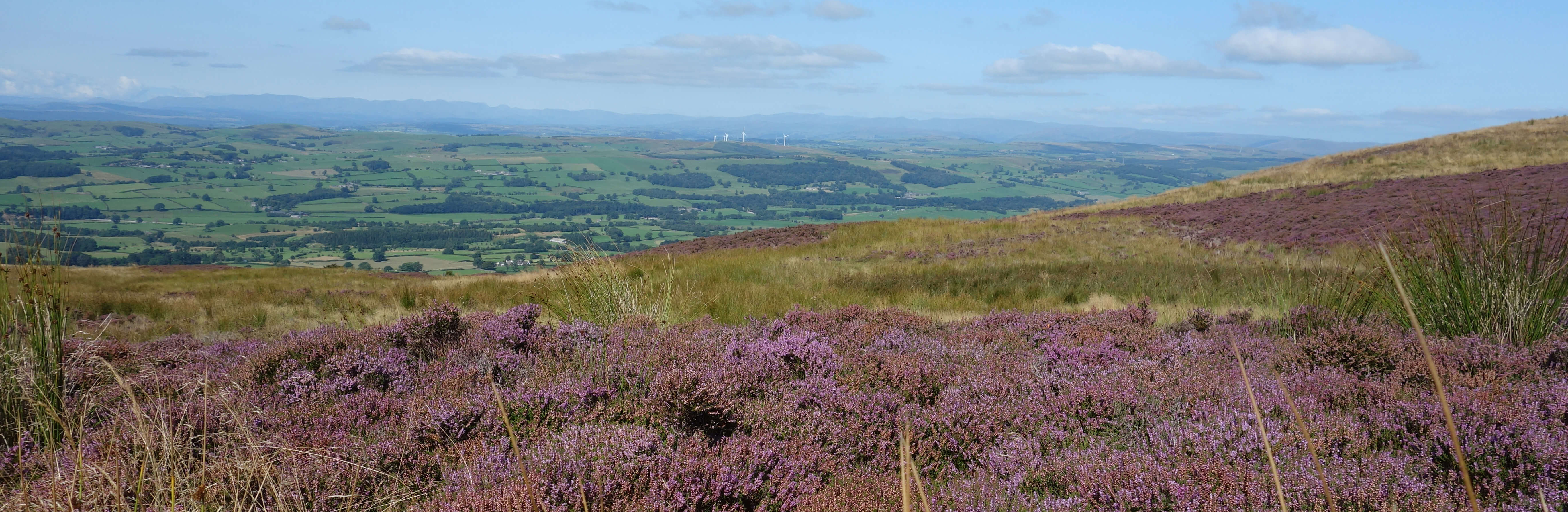
Looking north from the northern slopes of Brownthwaite
From Brownthwaite Pike I began a circuitous ľ rather too circuitous, it turned out ľ return to Kirkby Lonsdale. I dropped down to
Fellfoot Road, which would have been easier without the bracken, and walked past the mansion of Whelprigg, which I could hardly see through the
trees. After looking for some time for somewhere to pause for a lunch-break, I eventually walked onto the driving range of Kirkby
Lonsdale Golf Club (the golfers were all on the course proper, none of them needing to practise
their driving), where I found a comfortable bench. Afterwards I walked on and detoured north
to Beckfoot Farm to see the small old packhorse bridge, only a metre wide, now overgrown and unusable.
The rest of the walk passed in something of a daze, as, although it was pleasant enough with views across to the Barbon
hills, I saw little that was sufficiently different from what I had seen on previous walks in this region to distract me from my
increasing exhaustion. Eventually, I re-crossed the Devilĺs Bridge, which was now crowded, and saw that many people were
frolicking in and by the banks of the Lune. Perhaps I should have done likewise.
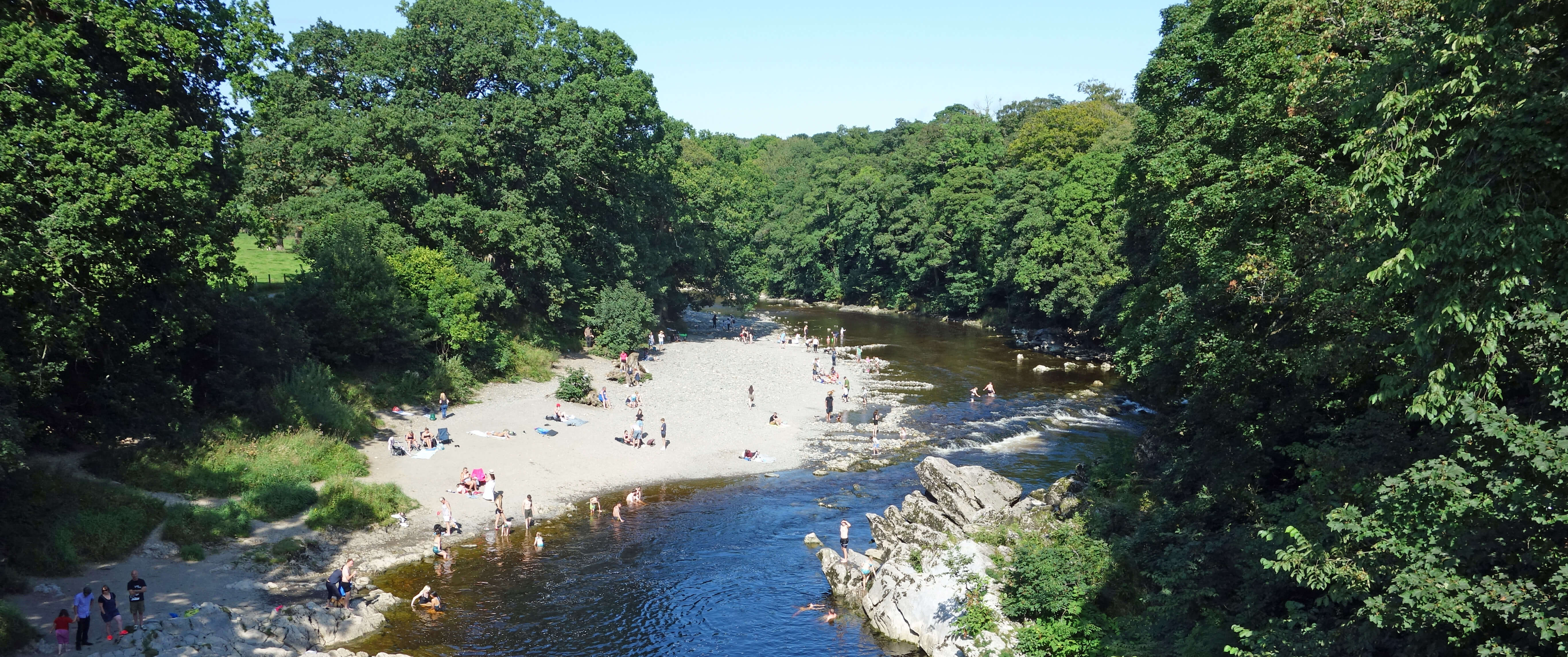
From the Devil's Bridge
[1]. In Ruskin's Fors Clavigera,
Letter LII (1875).
Date: August 26th 2021
Start: SD612786, Kirkby Lonsdale market square (Map: OL2)
Route: N ľ Ruskinĺs View ľ SE, S ľ Devilĺs Bridge ľ E, NE on Chapelhouse Lane, E under old
railway line, N on Wandales Lane, E past Fell Yeat, N, NE ľ Brownthwaite Pike ľ NW, W by Drygill Wood ľ Fellfoot Road ľ
N, W, SW, N past Whelprigg and Low Bank House ľ lane ľ SW, N, SW, W on Scaleber Lane ľ N ľ Beckfoot Farm ľ S, E on Lowfields
Lane ľ S, E ľ Casterton church ľ S past Old Manor, SW on Chapelhouse Lane, W ľ Devilĺs Bridge, Kirkby Lonsdale
Distance: 11 miles; Ascent: 410 metres
Home
Preamble
Index
Areas
References
Me
ę John Self, 2018-

Top photo: The western Howgills from Dillicar;
Bottom photo: Blencathra from Great Mell Fell