
Home Preamble Index Areas Dales Hills Lakes Places Reserves Rivers Structures Villages References Me
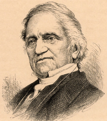 In 1831 Adam Sedgwick (1785-1873), Dent-born
Professor of Geology at Cambridge University, presented a paper
to the Geological Society of London in which he described, for the first time,
In 1831 Adam Sedgwick (1785-1873), Dent-born
Professor of Geology at Cambridge University, presented a paper
to the Geological Society of London in which he described, for the first time,
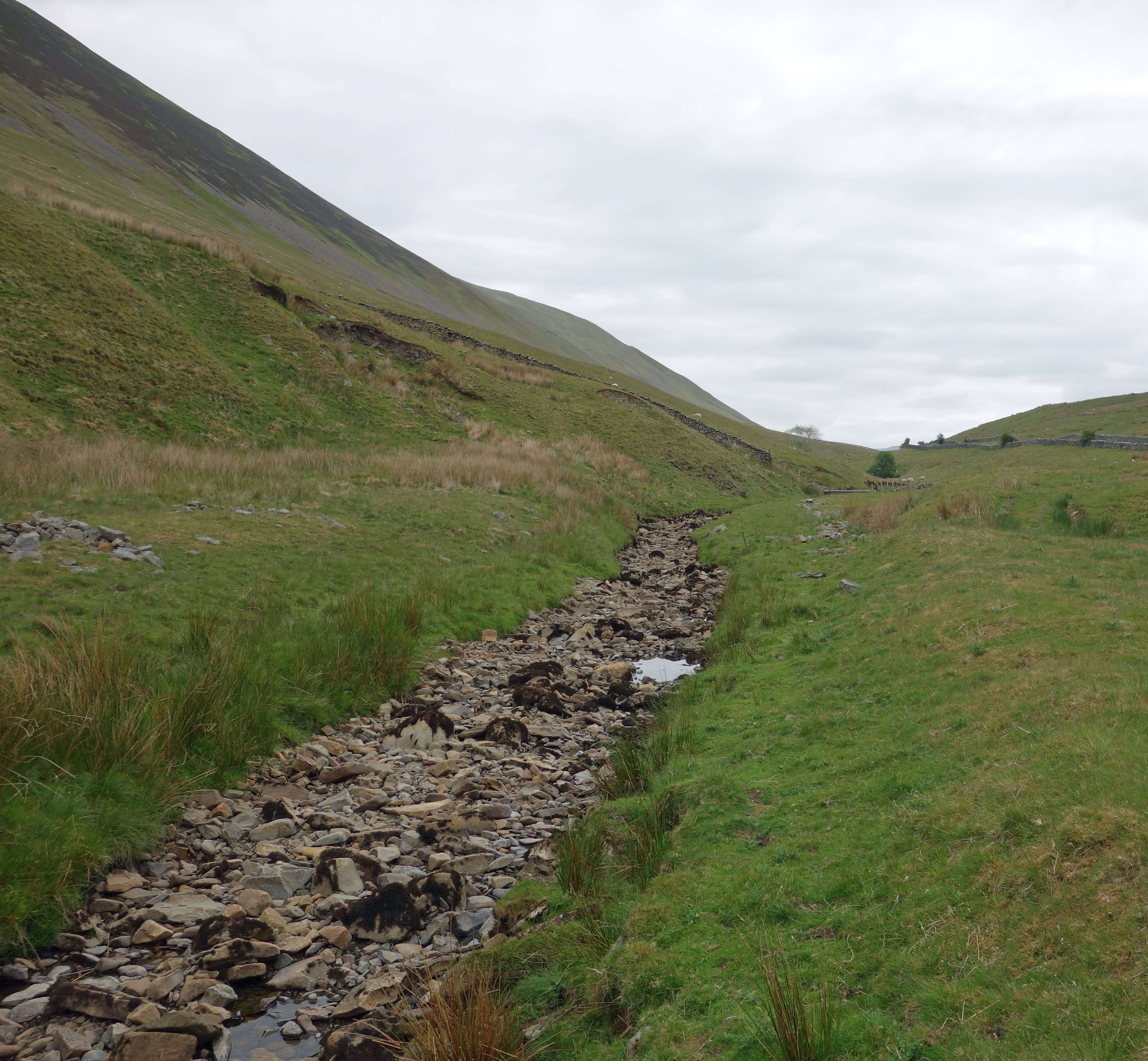
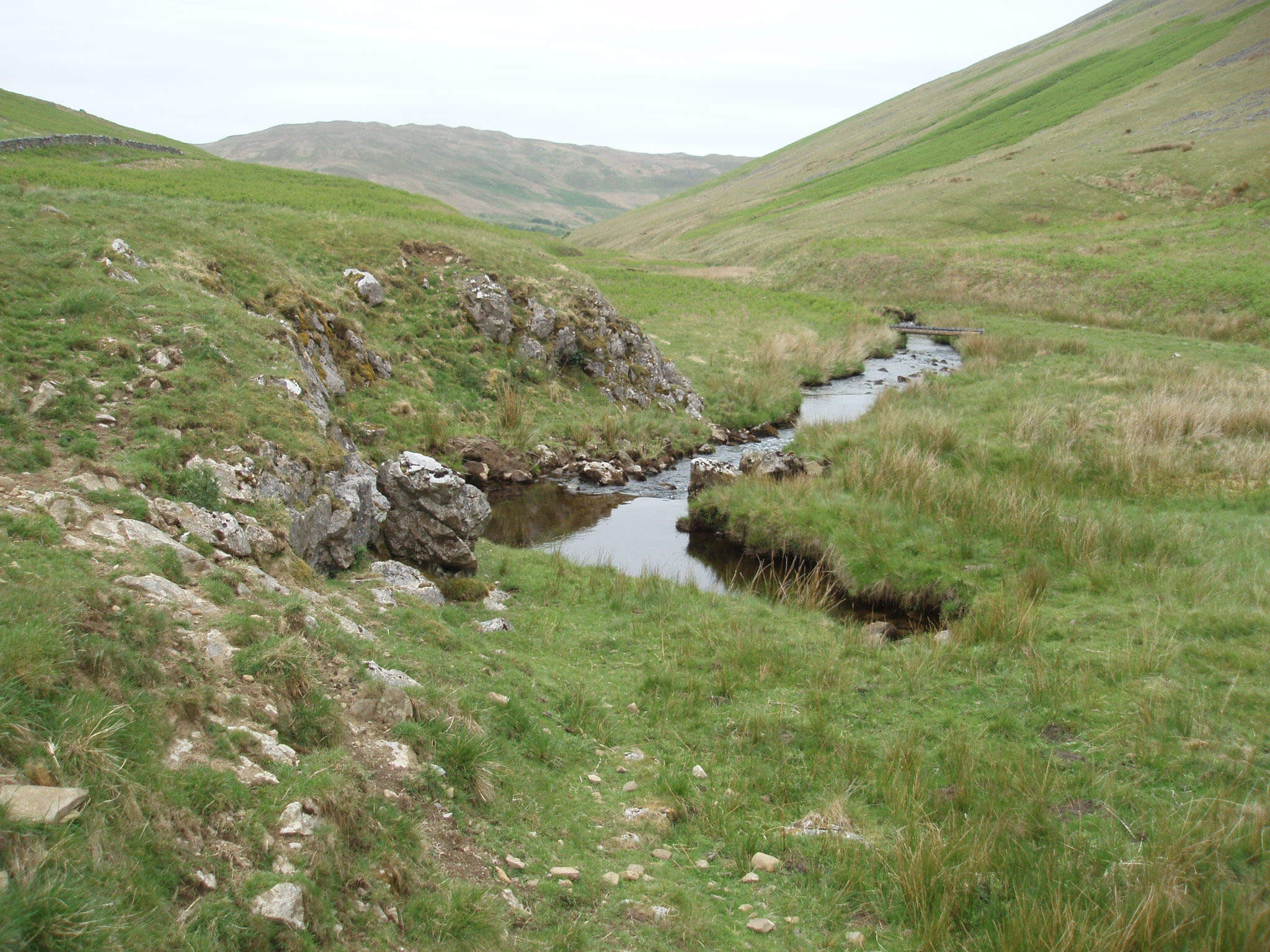
“[a fault] passing along the south flank of Casterton Low Fell, up Barbondale, thence across the valley of Dent, through the upper part of the valley of Sedbergh, and along the flanks of Bawfell [now spelled Baugh Fell] and Wildboar Fell [Wild Boar Fell], to the ridge between Mollerstang [Mallerstang] and Ravenstone dale [Ravenstonedale]; and that along the whole of this line there are enormous and most complex dislocations … The ruptures produced by it are fortunately on a scale too great to be overlooked or misunderstood.”I am capable of overlooking and misunderstanding anything but with Sedgwick’s strong hints about what to look out for we set off north from Blindbeck Bridge, walking on the west bank of Barkin Beck. We passed our inexpert eye over the rocks on the slopes up to Calf Top of Middleton Fell – a grey slate, it seemed. A dipper or two were happy to lead us upstream although the grey wagtails seemed more agitated. The beck was low but flowing contentedly enough until, after a mile or so, just before Short Gill Bridge, it split into two. The left branch (shown left below, looking upstream) was dry. The right branch (shown right below, looking downstream) flowed only a short distance and was issuing from under a large rock.
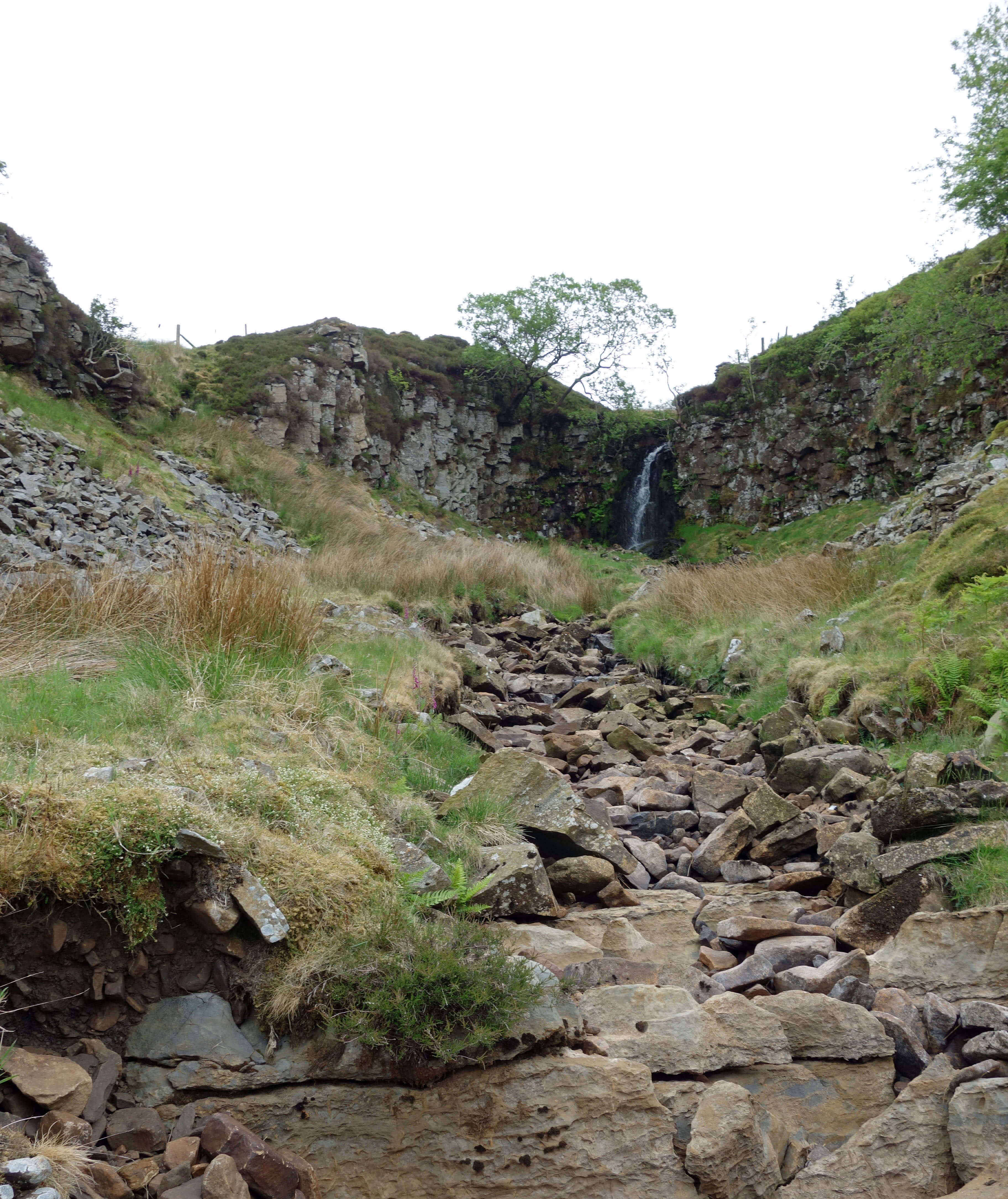 However, walking alongside Barkin Beck we had seen no sign of the promised ruptures. These only became apparent to
us as we walked up beside Short Gill. Here, a prominent ridge of limestone, unlike anything on the smooth slate
slopes opposite, had been distorted, with some strata appearing to be on end. The only
previous time that I have visited Short Gill I walked down beside a bubbling beck that suddenly disappeared at the
limestone ridge to leave a weird silence. Today, though, the bed of the beck continued to be dry for some distance as we
continued up, until we reached an upper waterfall (shown right), below which the water immediately disappeared through rocks.
However, walking alongside Barkin Beck we had seen no sign of the promised ruptures. These only became apparent to
us as we walked up beside Short Gill. Here, a prominent ridge of limestone, unlike anything on the smooth slate
slopes opposite, had been distorted, with some strata appearing to be on end. The only
previous time that I have visited Short Gill I walked down beside a bubbling beck that suddenly disappeared at the
limestone ridge to leave a weird silence. Today, though, the bed of the beck continued to be dry for some distance as we
continued up, until we reached an upper waterfall (shown right), below which the water immediately disappeared through rocks.
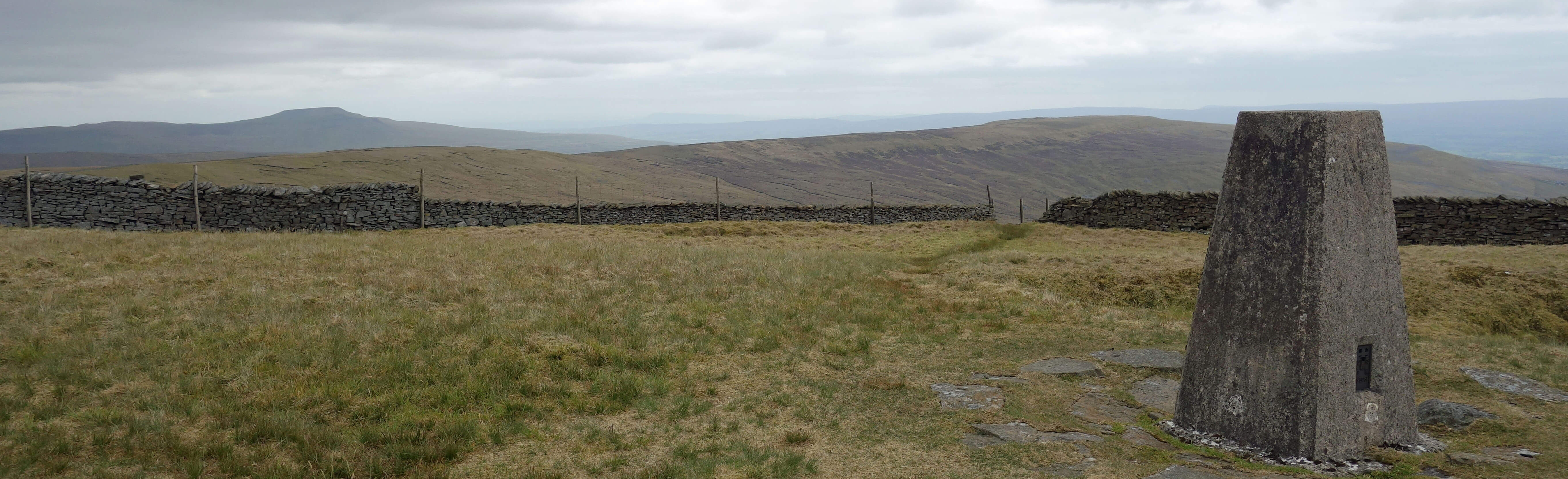 We emerged from the Short Gill ravine to tackle the long slog up to Crag Hill (682 metres). Rounding one bend we came
upon a buzzard perched on a post just ten metres ahead. It didn’t notice us for a while. It was probably focussed
on the voles. I have never seen so many voles on one walk – they were constantly catching our eye as they
scuttled into their little burrows ahead of us. From Crag Hill we could see as far as Pendle, Black Combe
and Wild Boar Fell but it had remained overcast so that everywhere was a rather dull grey.
We emerged from the Short Gill ravine to tackle the long slog up to Crag Hill (682 metres). Rounding one bend we came
upon a buzzard perched on a post just ten metres ahead. It didn’t notice us for a while. It was probably focussed
on the voles. I have never seen so many voles on one walk – they were constantly catching our eye as they
scuttled into their little burrows ahead of us. From Crag Hill we could see as far as Pendle, Black Combe
and Wild Boar Fell but it had remained overcast so that everywhere was a rather dull grey.
Home Preamble Index Areas Dales Hills Lakes Places Reserves Rivers Structures Villages References Me
© John Self, 2018-

Top photo: The western Howgills from Dillicar; Bottom photo: Blencathra from Great Mell Fell