
Home
Preamble
Index
Areas
Dales
Hills
Lakes
Places
Reserves
Rivers
Structures
Villages
References
Me
Saunterings: Walking in North-West England
Saunterings is a set of reflections based upon walks around the counties of Cumbria, Lancashire and
North Yorkshire in North-West England
(as defined in the Preamble).
Here is a list of all Saunterings so far.
Guaranteed ad-free, AI-free and free!
If you'd like to give a comment, correction or update (all are very welcome) or to
be notified by email when a new item is posted - please send an email to johnselfdrakkar@gmail.com.
245. To Beacon Tarn – One of the Best Short Walks in Lakeland
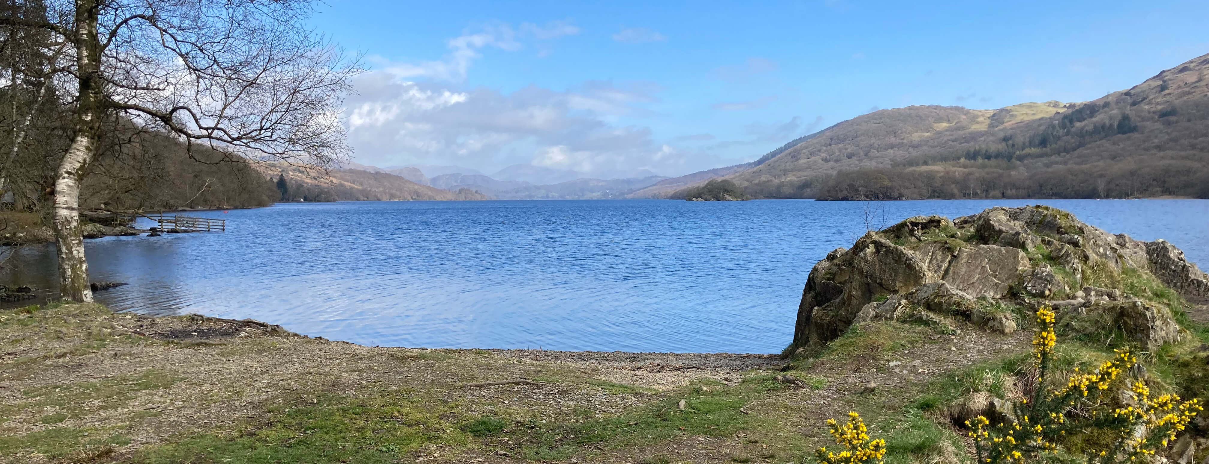
Coniston Water from Brown Howe
The triangle of land between the A593 and the A5084 south of Torver, to the west of
Coniston Water, is virtually empty. Behind the road-side houses and farmsteads
is a terrain of rough boggy heather and bracken, gently undulating to generate modest
heights some of which have generously been given names, such as Green How, Rattan
Haw, Wool Knott and Bleak Knott, but none of which are likely to attract anyone but the
most obsessive fell-walker determined to tick off all named tops. Except, that is,
for the highest of them, Beacon Fell. This provides the focus for a
charming, gentle walk, with the bonus (since it is the highest point) of fine
views in all directions.
We set off from the Brown Howe car park, where we were surprised to find
that the toilet block was closed as it deemed today (April 1st) to still be winter.
Coniston Water looked a splendid soft blue. We walked slowly up the road that is
only for traffic to Stable Harvey, which must be one of the most isolated farms in
the Lake District. We walked up through a woodland of scattered silver birches with
occasional juniper, which I did not expect. I suppose I had assumed that these
commons, as they are named on the map, would be open pastures – but, of course, in
the not-so-distant past all this land would have been tree covered. At ground level
there was little but dead, orange-brown bracken.
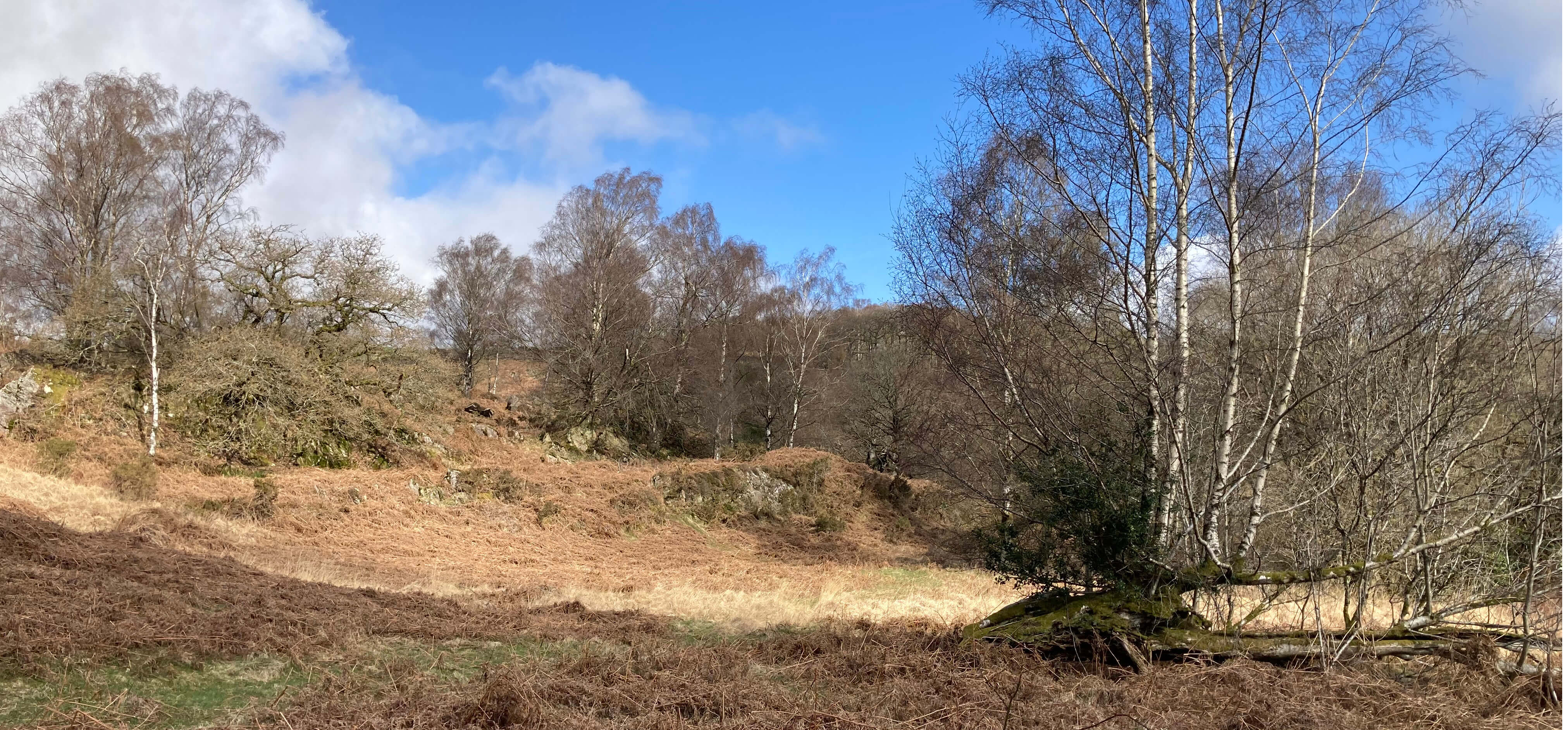
The terrain of Blawith Common
At a bend in the road, where it begins to level off, a clear grassy path led off south.
It took us through the bracken, around rocky outcrops, over a few little humps,
past heather and bilberry, rising up gradually to the top of Beacon Fell (or Beacon,
as it says on the map). Since this is the second Beacon Fell we have visited in
recent weeks I began to wonder about the nature of these beacons, and if they
really served such a function and for whom.
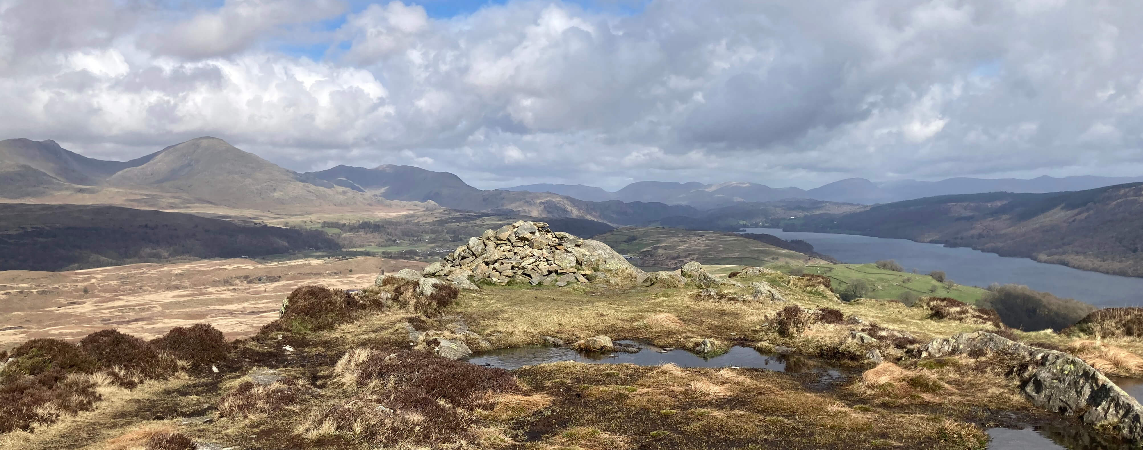
The cairn on Beacon Fell, looking north to the Old Man of Coniston
Did this beacon warn people inland of approaching armadas on Morecambe Bay? Is
there any record of such an armada ever entering Morecambe Bay? Or perhaps this
beacon relayed messages from beacons on, say, Black Combe, warning of invading forces in
the Irish Sea. I can think of a number of tops (in addition to these two Beacon Fells)
in North-West England that are named as beacons and, in most cases, I wouldn’t doubt
their previous roles as beacons:
• Beacon Brow (SD1769), on Walney Island.
• Beacon Hill (NY5231), north of Penrith.
• Beacon Hill (NY6309), north of Orton.
• Beacon Hill (SD2671), east of Barrow-in-Furness.
• Beacon Hill (SD7548), north-west of Sawley in the Ribble valley.
• High Haume Beacon (SD2276), near Askam-in-Furness.
• Lowick Beacon (SD2883), north of Ulverston.
• Pinhaw Beacon (SD9447), south-west of Skipton.
• Thornthwaite Beacon (NY4310), at the head of Troutbeck.
• Whinfell Beacon (NY5700), above the Westmorland Borrowdale.
There are also, of course, many hill-tops that served as beacons that are not
today named as Beacons. Anyway, this Beacon Fell, because of its prominence despite
its lowly height (255 metres), is well able to serve as a beacon, if necessary. In
view, first and foremost, is, to the north, the magnificent arc of Coniston Old Man
and Dow Crag. To the north-east, virtually the full length of Coniston Water can
be seen and beyond the lake are the tops of Helvellyn, Fairfield, Red Screes, High
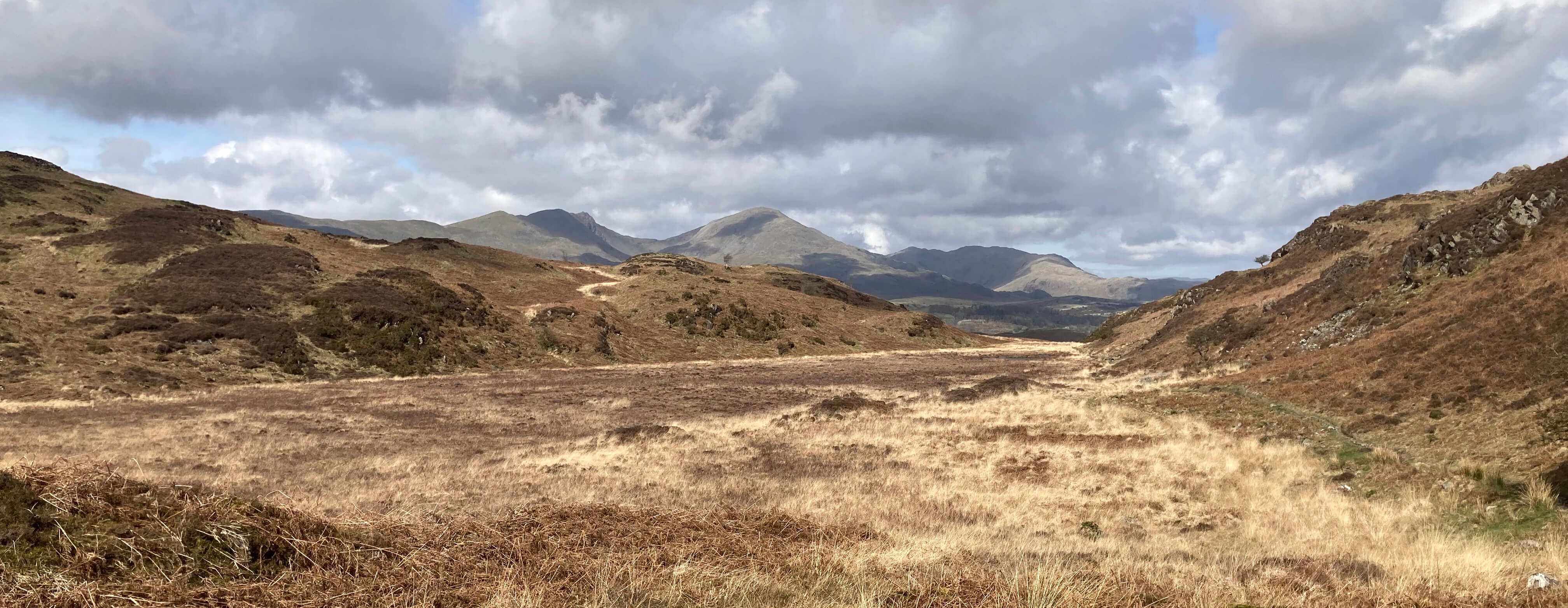
Street and Harter Fell. Further east Ingleborough can be identified. To the south
are the south Lakes estuaries and, at our feet, Beacon Tarn.

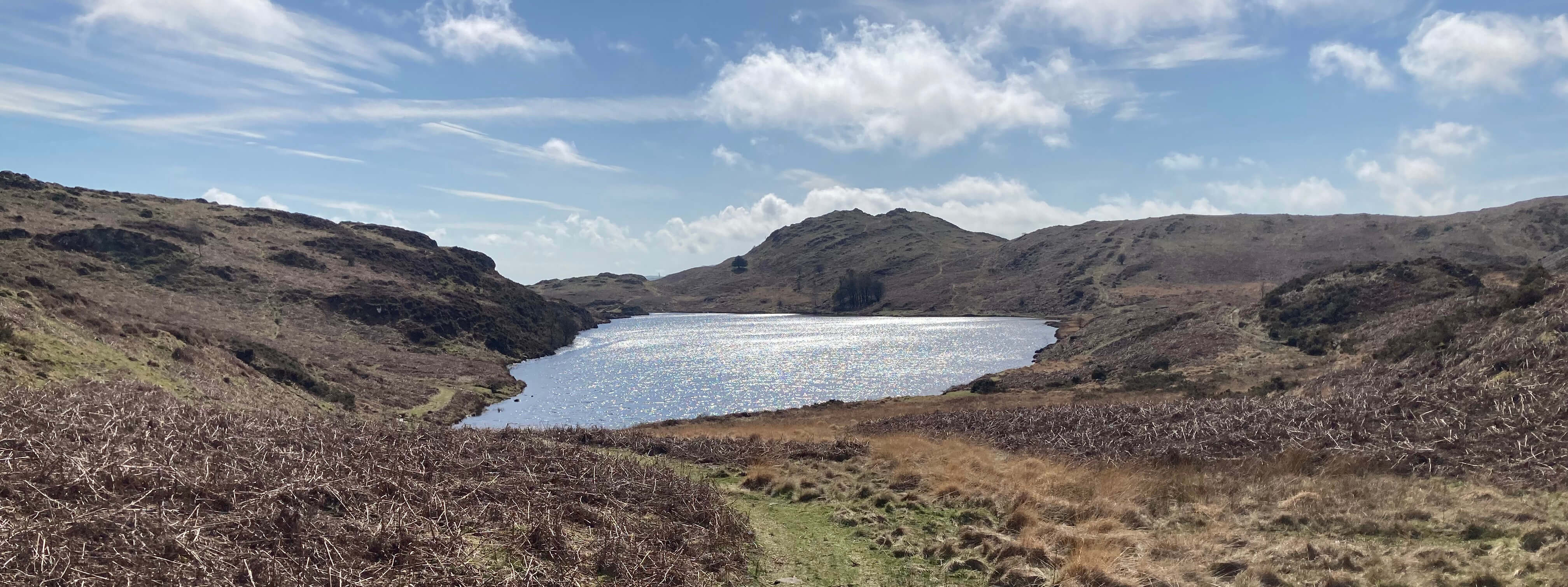
Beacon Tarn from Beacon Fell
We walked to it, to sit by the tarn for a snack. It is a somewhat surprising oasis
to find here, tucked among these hills, although the ground is certainly wet enough
to provide sufficient water. This attractive tarn is about half-a-mile long and quite shallow.
(I keep reading that Arthur Ransome's Swallows were taught to fish here, which means
nothing to me but is
surely fiction as swallows don't eat fish.)
The map marks the Cumbria Way along
the tarn's opposite shore and, although I had thought that this Way was little walked, we
did in fact see a few groups walk along it while we sat there.
Eventually, we joined the Way to walk north. The path passed to the east of a flat
area that looked like it was once a tarn itself, now overgrown with vegetation. We
continued to rejoin the farm road but first detoured north to the top of the ridge
of Coals Hill in order to have another look at the view ahead. Then we dropped down
to Brown Howe where we discovered that winter was over: the toilets were now open.
Looking back to Beacon Tarn
Looking forward to the flat area, with Coniston Old Man in the distance
Overall, a very pleasant walk to serve as hors d'oeuvre for a possibly more substantial main course
on the following day … [246]
Date: April 1st 2026
Start: SD290911, Brown Howe car park (Map: OL6)
Route: NW on private road – near Stable Harvey – SW – Beacon Fell – SW – Beacon
Tarn – N, NW on Cumbria Way, N – horizon near Coals Hill – S, SE – car park
Distance: 4 miles; Ascent: 250 metres
Home
Preamble
Index
Areas
Dales
Hills
Lakes
Places
Reserves
Rivers
Structures
Villages
References
Me
© John Self, 2018-

Top photo: Rainbow over Kisdon in Swaledale;
Bottom photo: Ullswater