
Home Preamble Index Areas Dales Hills Lakes Places Reserves Rivers Structures Villages References Me
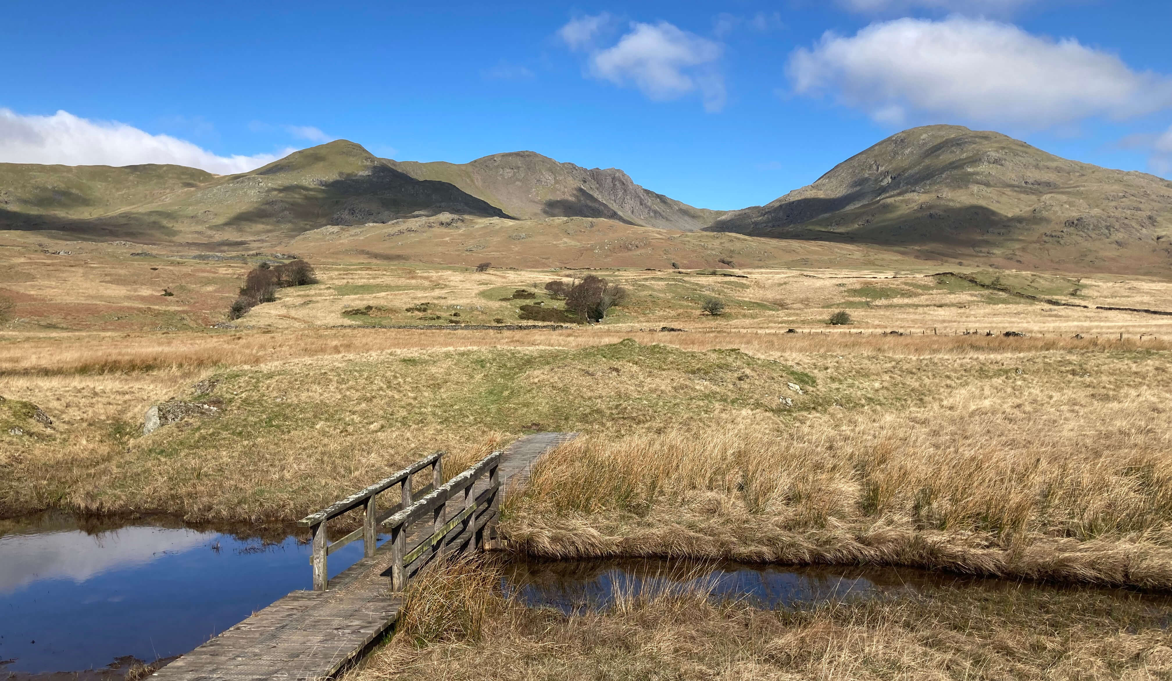
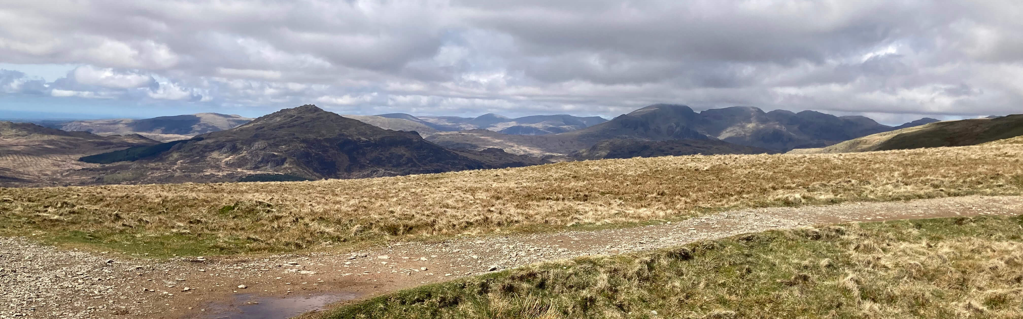
Brown Pike, Buck Pike, Dow Crag and The Old Man of Coniston from Torver High Common
We found a way around the bog and continued up to the disused Ash Gill quarry. There are a number of disused quarries in this region û and one, Broughton Moor Quarry, still active, to the south (visited in [28]). Active quarries are an eyesore but once abandoned they seem to meld eventually back into the landscape, partly because the remains are of slate, which belongs here, if not quite where it has been left. The Ash Gill quarry is a Site of Special Scientific Interest because of the exposed Ordovician rocks containing significant fossils.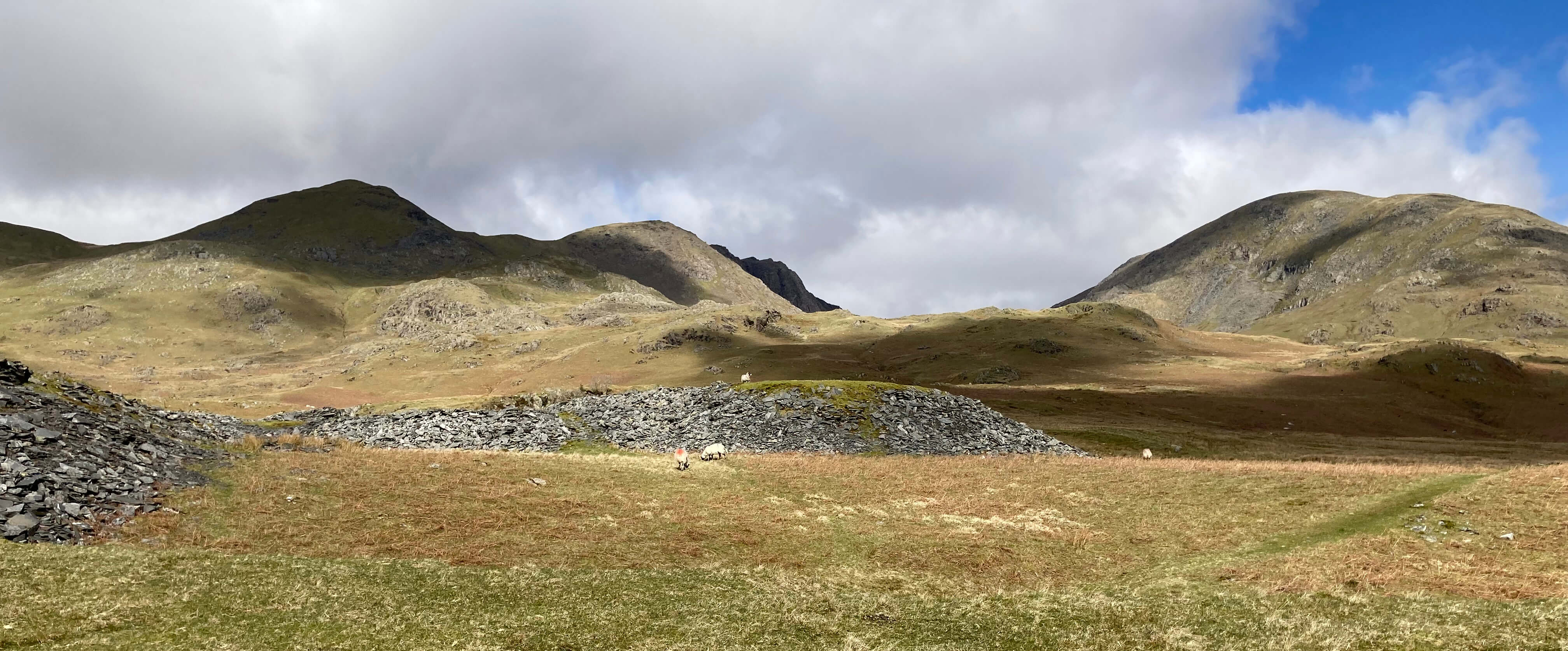
From the disused Ash Gill quarry
Here we turned north-east to take a clear path above a wall. Halfway along, near another disused quarry, the well-known Walna Scar Road (a track) came into view, with a few people (the first weÆd seen since leaving Torver) toiling along it. The Walna Scar Road is an ancient track that links Coniston and the Duddon valley, and was particularly in use when the quarries hereabouts were active. Here we had a decision to make û should we continue to the track, turn right and return to Torver? But having come so far à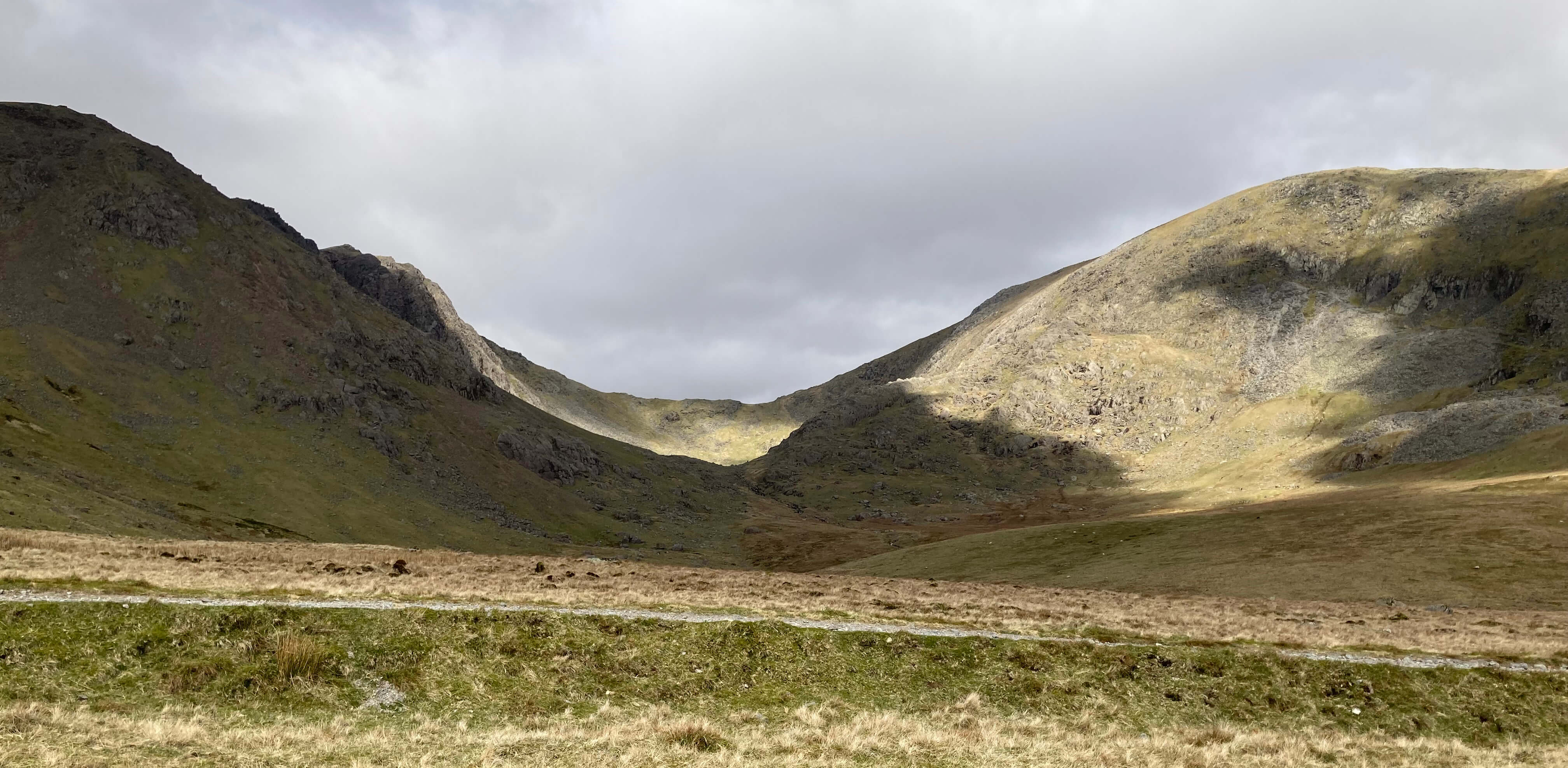
From near the Walna Scar Road (in the foregaround)
à We turned left to continue on the track, which is here substantial enough for vehicles but less so the higher that we walked. We thought it would be good to continue to the col (at a height of about 605 metres) in order to see the renowned view westward. Yes, it was well worth the effort. The green Duddon valley lay below, with Harter Fell (walked up in [230]) immediately ahead and Eskdale, explored last summer, beyond, and the Irish Sea further beyond, and to the north-west the majestic Scafell group. Now, we could turn back and follow the track down to Torver. But having come so far à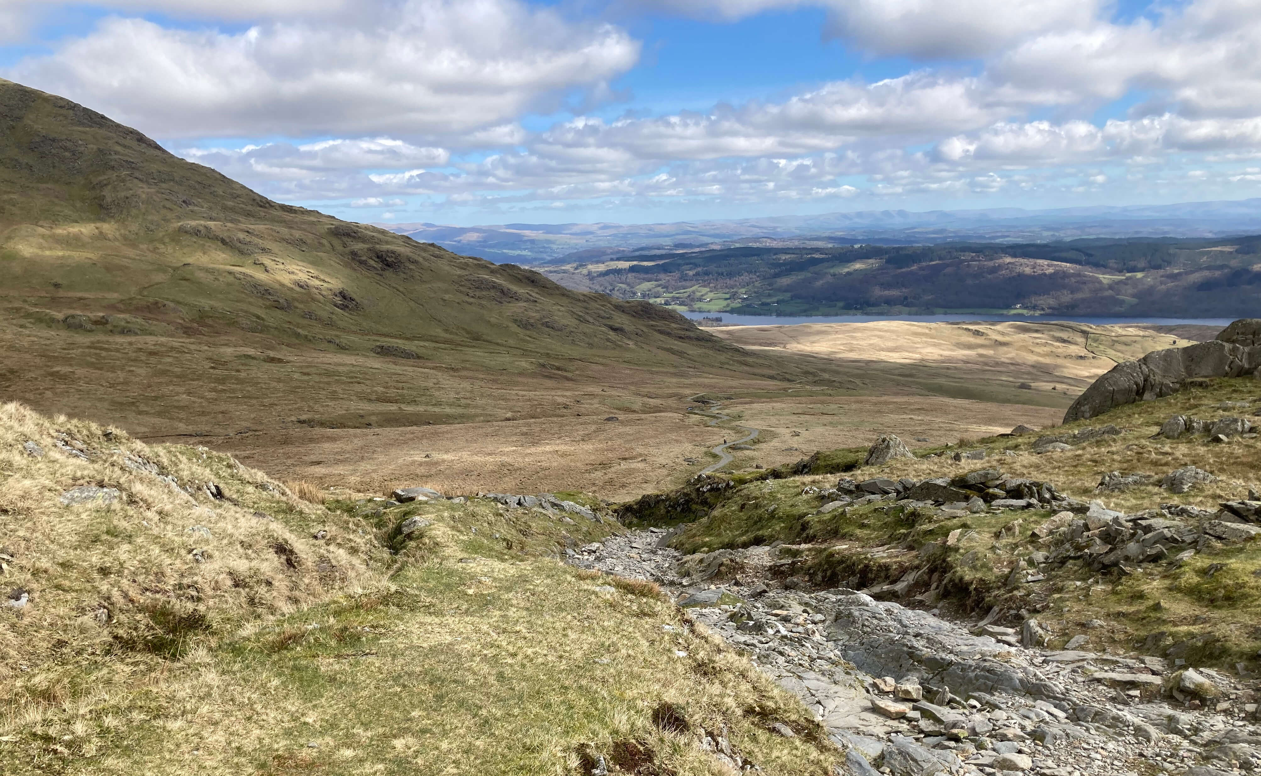
Looking back down the Walna Scar Road
At the top of the Walna Scar Road, Harter Fell ahead and the Scafell group to the right
à We noticed a group of about ten people gathered at the top of Brown Pike (682 metres) and it didnÆt look far away. So on and up we trekked. From the top we had views of the Old Man across the deep valley within which GoatÆs Water lies. Also on the steep eastern slopes of Brown Pike we could see the attractive Blind Tarn, so-called because it has no apparent outlet. At least, it looks attractive from Brown Pike but at the tarn-side it is rather desolate, being surrounded by the spoils of another old quarry. Having now ascended further than we have managed since we walked up Blencathra three years ago [178], it was surely time to turn, retrace our steps and take the path back to Torver. But having come so far à
Blind Tarn below Brown Pike, from Buck Pike
And then on to Dow Crag (778 metres). From the path to and from Dow Crag there are dramatic views down the gullies that separate the buttresses of Dow Crag, with the harsh calls of ravens adding to the ominous scene. We scrambled about the jumbled heap of huge rocks at the top of Dow Crag but didnÆt feel it necessary to touch the top of the topmost of them. The view from Dow Crag has it all: the highest mountains in England, many other heights, cliffs to peer down, valleys (especially of the Duddon), coves (in fact, The Cove just east), lakes (especially Coniston Water), the bay (Morecambe Bay), the sea, tiny fellow walkers (probably) on the Old Man, and not forgetting the sky and (probably) clouds.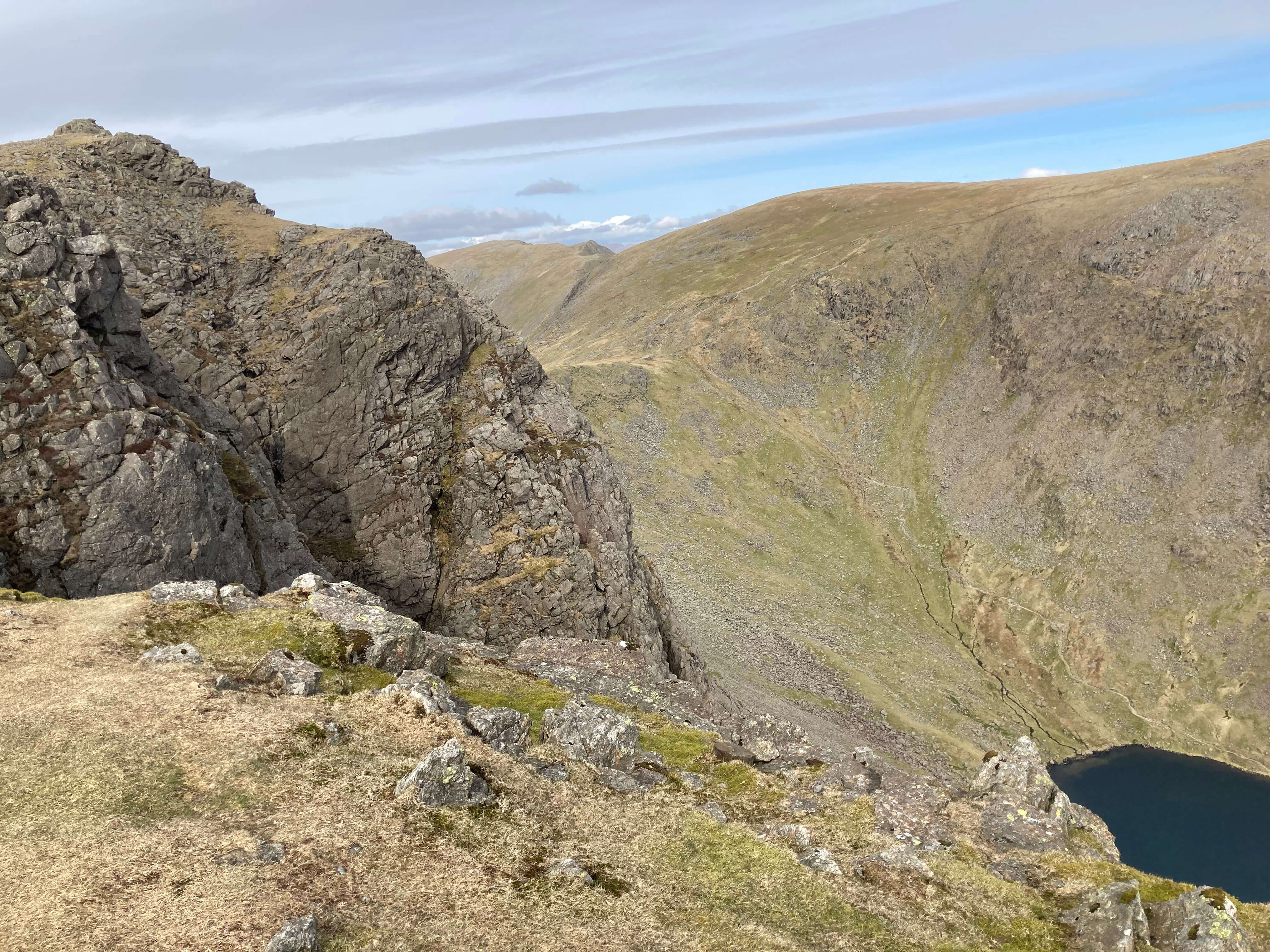

Left: Dow Crag and Goat's Water; Right: Easy Gully from Dow Crag (it is only easy for climbers).
Since I started Saunterings in 2018 I have walked higher than Dow Crag on only four occasions: up High Street [12], Cross Fell [56], Dove Crag [159] and Blencathra [178], two of those with Ruth, two alone. The fact that we had conquered Dow Crag encouraged me to think that more high tops are within range. However, from the top of Dow Crag we could walk no higher without dropping down a considerable distance first, so it was surely time to turn back to Torver. But having come so far à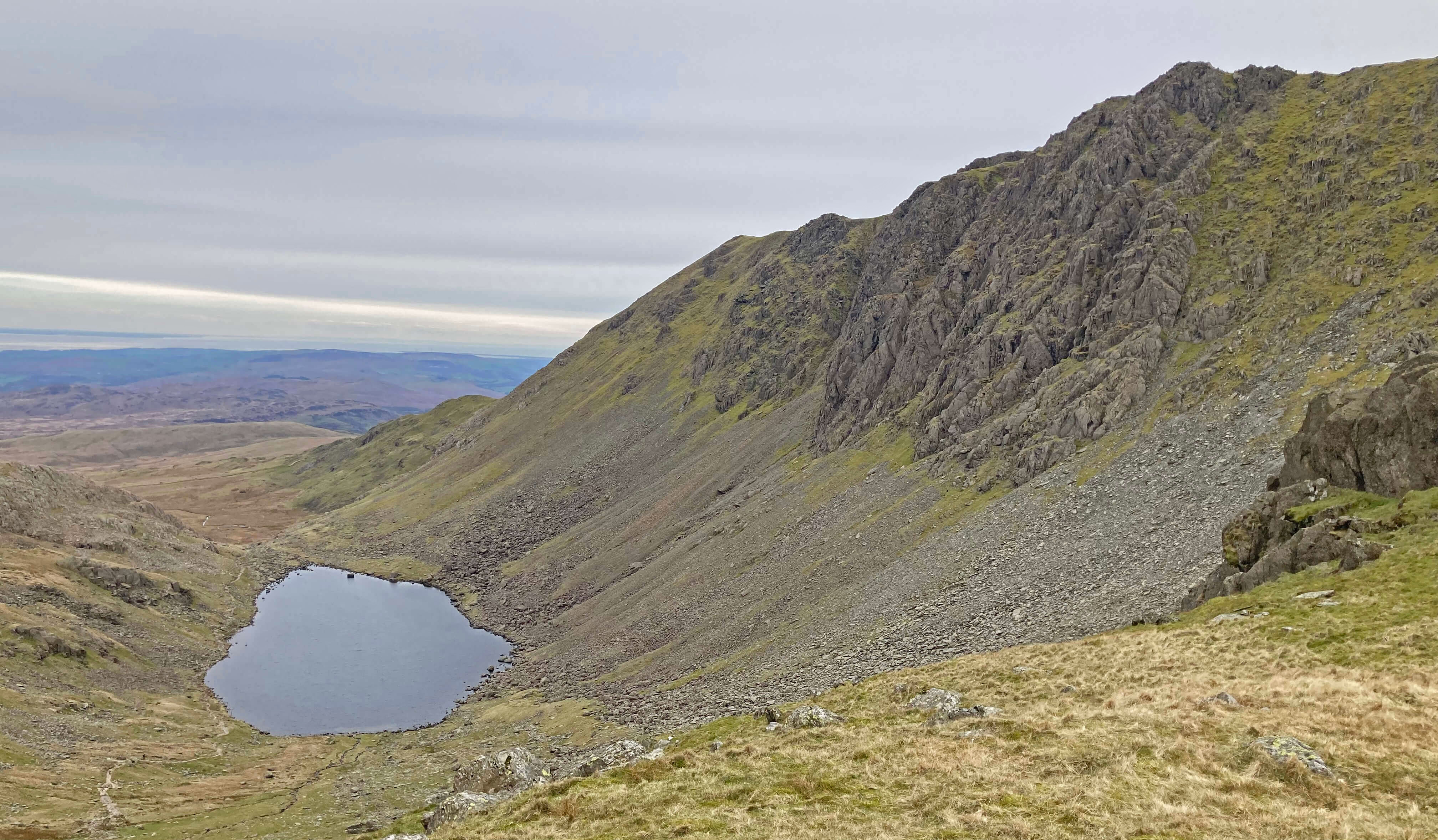
Goat's Water and Dow Crag from Goat's Hawse
Fit younger fell-walkers would take this walk in their stride but we felt a satisfying sense of achievement. The walk took us about eight hours, but we were not in a hurry and paused often, every minute being a pleasure and a privilege.
Home Preamble Index Areas Dales Hills Lakes Places Reserves Rivers Structures Villages References Me
® John Self, 2018-

Top photo: Rainbow over Kisdon in Swaledale; Bottom photo: Ullswater