Western Howgills

Home   Preamble   Index   Areas   Map   References   Me   Drakkar

Saunterings:  Walking in North-West England

Saunterings is a set of reflections based upon walks around the counties of Cumbria, Lancashire and North Yorkshire in North-West England (as defined in the Preamble). Here is a list of all Saunterings so far.
If you'd like to give a comment, correction or update (all are very welcome) or to be notified by email when a new item is posted - please send an email to johnselfdrakkar@gmail.com.

178.  Back in the Saddle of Blencathra

At the bottom of all these Saunterings I have included a photograph of Blencathra. To save you flipping to the bottom I include it here too:
blencathra

Blencathra from Great Mell Fell

I must have thought, when setting up these webpages, that this iconic image of Lakeland would be a pleasing way to wrap the page up. Unfortunately, I was mistaken. An eminent aesthetician singled out Blencathra from all the Lakeland hills as being displeasing, disagreeable and disgusting. I’m very sorry about that. I hope that the photograph hasn’t put you off your dinner.

Forget that for the moment: let’s get on with our walk. On another sunny day we set off from the small village of Mungrisdale, which kindly welcomes car-parkers, and headed west alongside the River Glenderamackin. A short detour was necessary on a new path replacing the one recently washed away and then we were on the long, gently rising path below The Tongue. To the left were the imposing Bannerdale Crags, above which, as we neared the ridge, we had our first sight of our target, Blencathra.
bannerdale crags

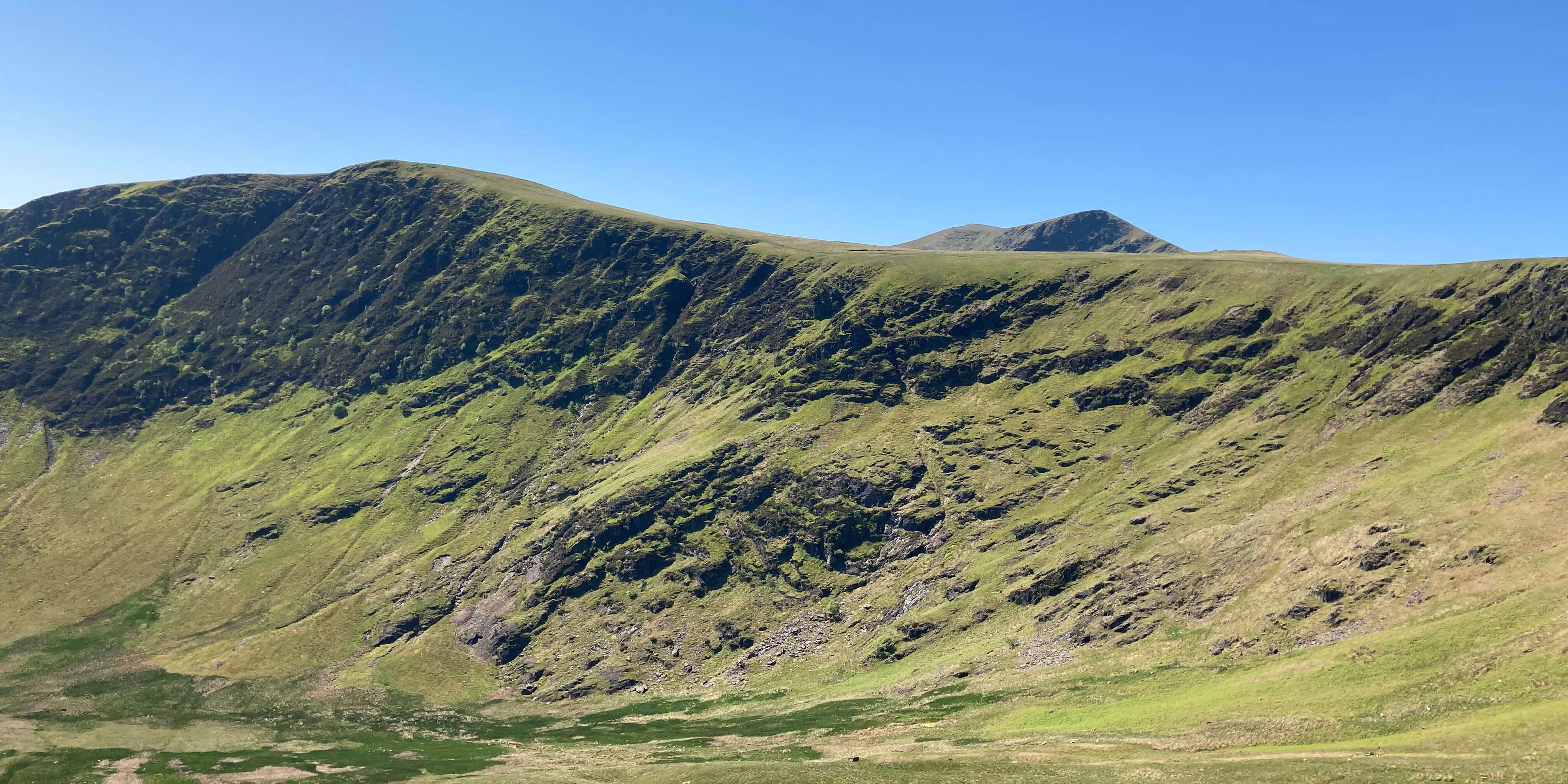
Bannerdale Crags with, peeping above, Atkinson Pike and, to its left, Blencathra

The path south, on the rim of Bannerdale Crags, is in fact just below the top and therefore provides no view of Skiddaw and the hinterland Back o’Skiddaw but we soon left it, heading for the prominent top of Atkinson Pike. To the left of the Pike we had a view of the profile of Sharp Edge, with a few tiny figures inching their way along it. Sharp Edge is the narrowest, and scariest, ridge in the Lake District although you cannot really appreciate this with a side view.
atkinson pike

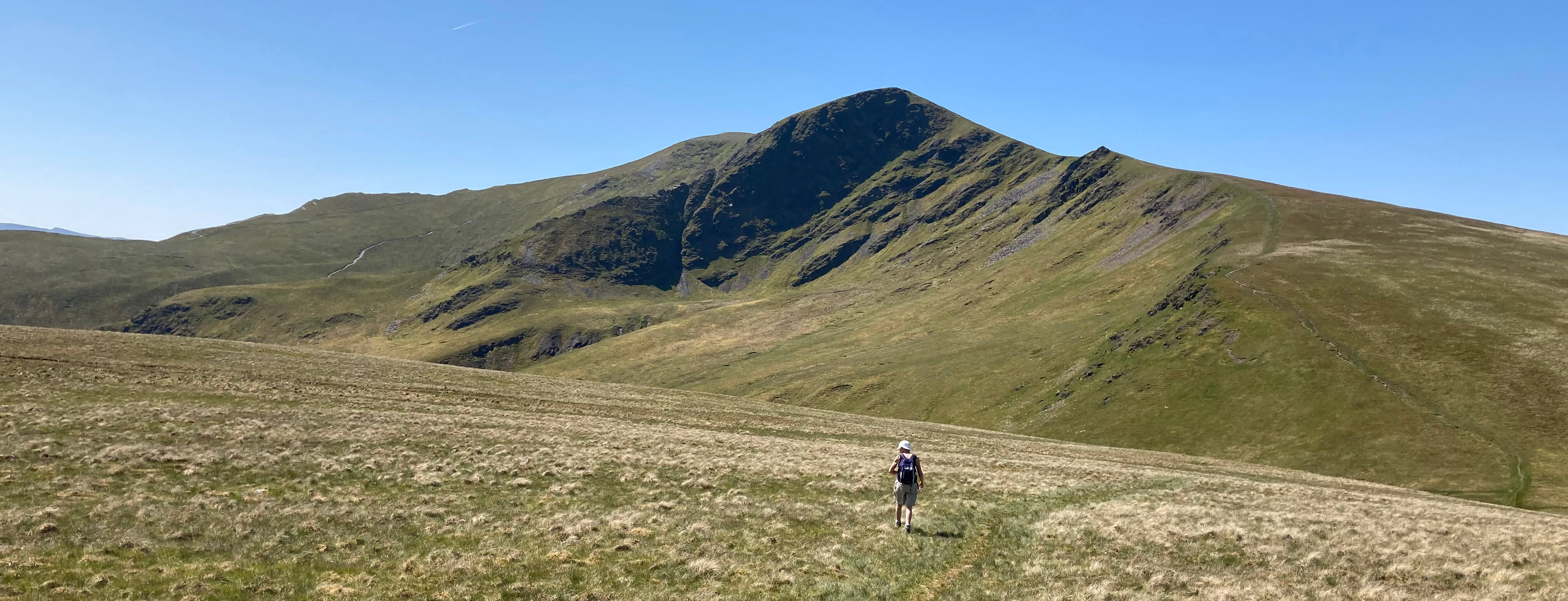
Approaching Atkinson Pike
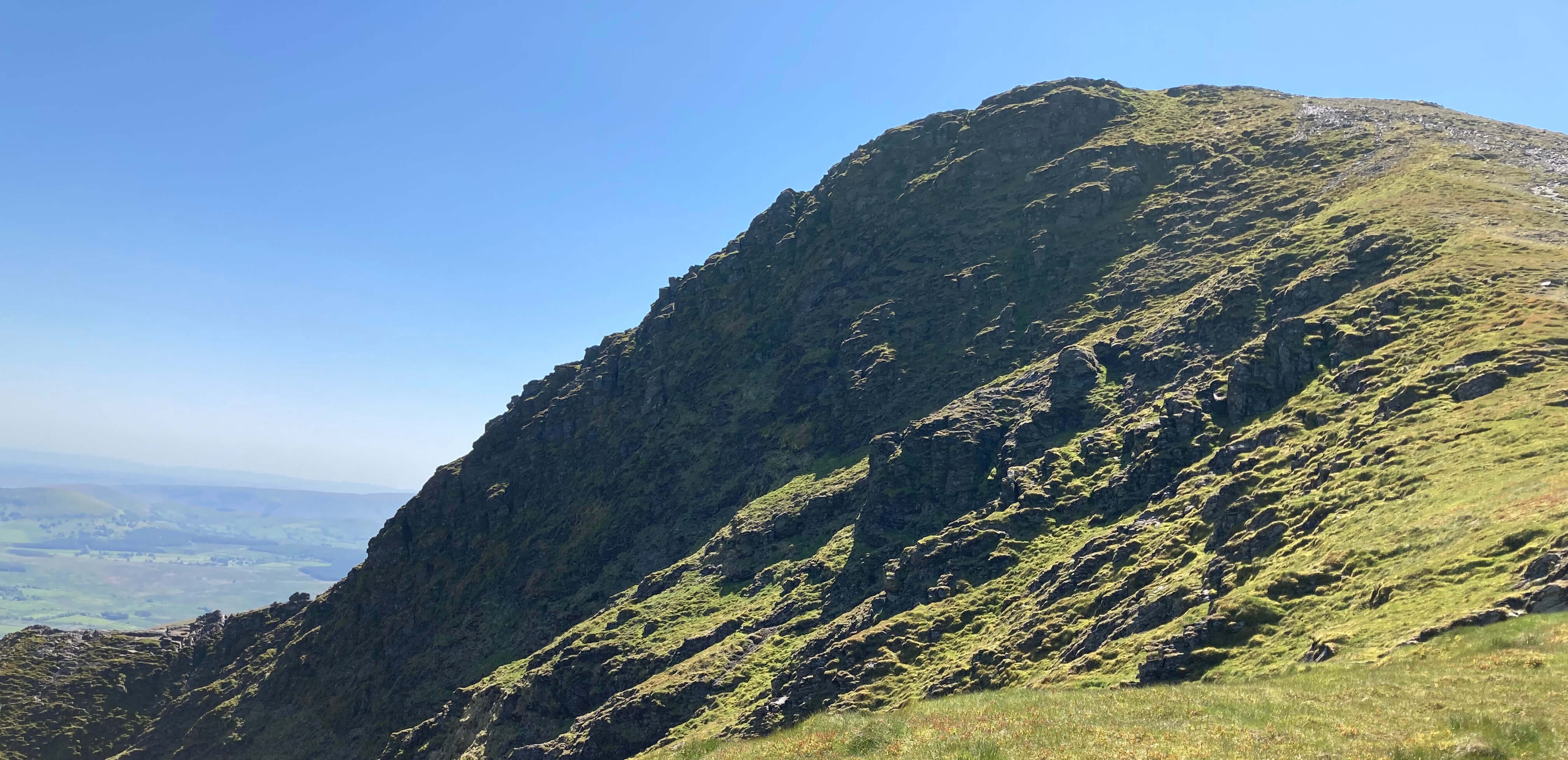
sharp edge

Sharp Edge

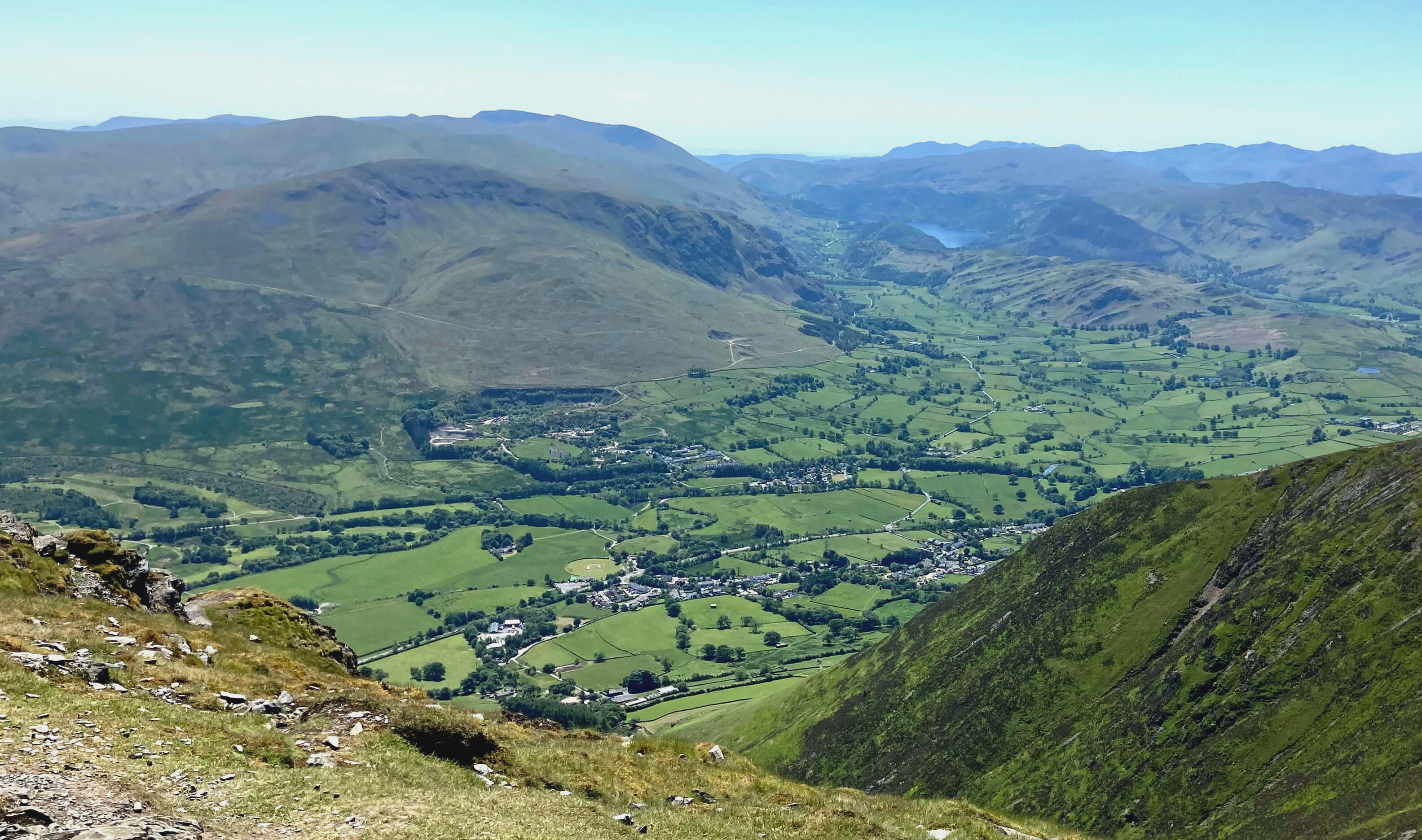
From Atkinson Pike (845 metres) it was but a stroll to the top of Blencathra (868 metres), where, as you’d expect on such a day, there were a fair number of people milling and lolling about, all lightly clothed in the June sunshine but with a fresh breeze. The views were, of course, good but not as clear as might be hoped, because of the haze accumulated from recent still, sunny days. For our lunch break we retreated from the breeze into the saddle that lies between Atkinson Pike and Blencathra, which used to be more often called Saddleback.

from blencathra 
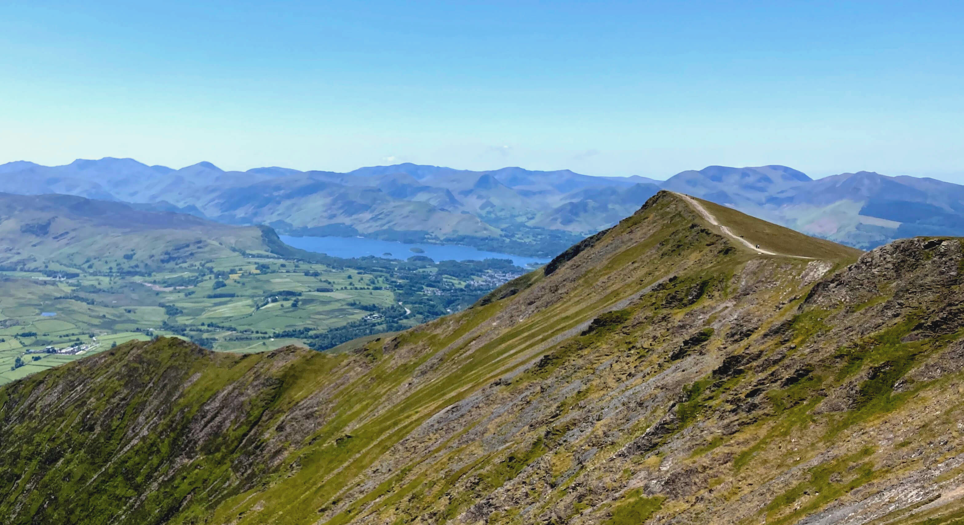
Right: From Blencathra towards Derwent Water, a little hazy today.

It was the shape of this saddle that so discombobulated our aesthetician. William Gilpin (1724-1804), born in Cumberland, was an artist, cleric and author, best known as one of the originators of the concept of ‘the picturesque’. In 1772 he elaborated his ideas in a document now available on-line (Gilpin, 1772). On page 82, he writes:
“The beauty of a distant mountain in a great measure, depends on the line it traces along the sky; which is generally of a lighter hue. The pyramidal shape, and easy flow of an irregular line, will be found in the mountain, as in other delineations, the truest source of beauty.
       Mountains therefore rising in regular, mathematical lines, or in whimsical, grotesque shapes, are displeasing. Thus Burnswark, a mountain on the southern border of Scotland; Thorp-Cloud, near Dovedale in Derbyshire, especially when seen from the garden at Ilam; and a mountain in Cumberland, which from its peculiar appearance in some situations, takes the name of Saddleback, all form disagreeable lines. And thus many of the pointed summits of the Alps are objects rather of singularity, than of beauty. Such forms also as suggest the idea of lumpish heaviness are disgusting – round, swelling forms, without any break to disincumber them of their weight.
       Indeed a continuity of line without a break, whether it be concave, straight, or convex, will always displease, because it wants variety; unless indeed it be well contrasted with other forms. The effect also of a broken line is bad, if the breaks are regular. The sources of deformity in the mountain-line will easily suggest those of beauty. If the line swell easily to an apex, and yet by irregular breaks, which may be varied in a thousand modes, it must be pleasing. And yet abruptness itself is sometimes a source of beauty, either when it is in contrast with other parts of the line; or when rocks, or other objects, account naturally for it.”
Gilpin is here asserting that our appreciation of the beauty of a mountain is a function only of its appearance and, in particular, of its skyline. Yes, I can accept that for a mountain like, say, Mount Fuji, which I have only ever seen photographs of, I can only judge its beauty by its appearance. If I followed Gilpin’s guidelines then I would not consider Mount Fuji beautiful – it is too symmetrical, without the irregular breaks that Gilpin requires.

from blencathra2 Right: From Blencathra, looking south, Thirlmere just visible.

Beauty, whether of a mountain or a person or a flower, is not as simple as that. I suspect that Gilpin, writing in 1772, was suffering from mathematics-envy. At that time, mathematics and science were having increasing explanatory and predictive success. There was (and still is) a subconscious desire to apply mathematical techniques to areas where they do not obviously apply. Hence, Gilpin’s pseudo-scientific language and the attempt to ‘formalise’ the nature of beauty.

We know that there is much more to Blencathra than its saddleback. The view of the saddleback is prominent as you approach Blencathra from the east, as most people do, but the best view of Blencathra is from the south. From here we see the series of ridges ascending the mountain side like cathedral buttresses, with the skyline less significant. In general, for any mountain we see more than just the skyline. And we see more than shapes – we have colours and textures to consider.

Also, I find it hard to separate my appreciation of the so-called beauty of a mountain from other factors. Blencathra is the first recognisable Lake District hill we see when we return home from Scotland. I am therefore fond of its distinctive shape. Whenever I see it, I am reminded of previous outings on Blencathra – the day we had a conversation with a glider suspended above us, the day I ran over both Skiddaw and Blencathra, the day we were led to tackle Sharp Edge without fore-warning, the day we walked up in snow from Askew Rigg Farm. My appreciation of Blencathra, beauty and all, derives not just from the mountain itself but also from personal experiences of it, as it does for everybody.

We eventually began to make our way down by taking the path to Scales Tarn, looking a deep blue nestled below the crags. We had a view of the other side of Sharp Edge and could see that although it is sharp it is not very long. It is long enough when on it though. The path dropped down by Scales Beck and then, more gently, by the River Glenderamackin. This was pleasant enough, strolling along accompanied by the clear, tumbling waters of the river, but I was becoming tired, perhaps from the sameness of the view for the two miles along by the Glenderamackin. The hills to the left were thoroughly covered with fresh bracken, which is always a depressing sight, although Souther Fell to the right seemed relatively free of it.
scales tarn

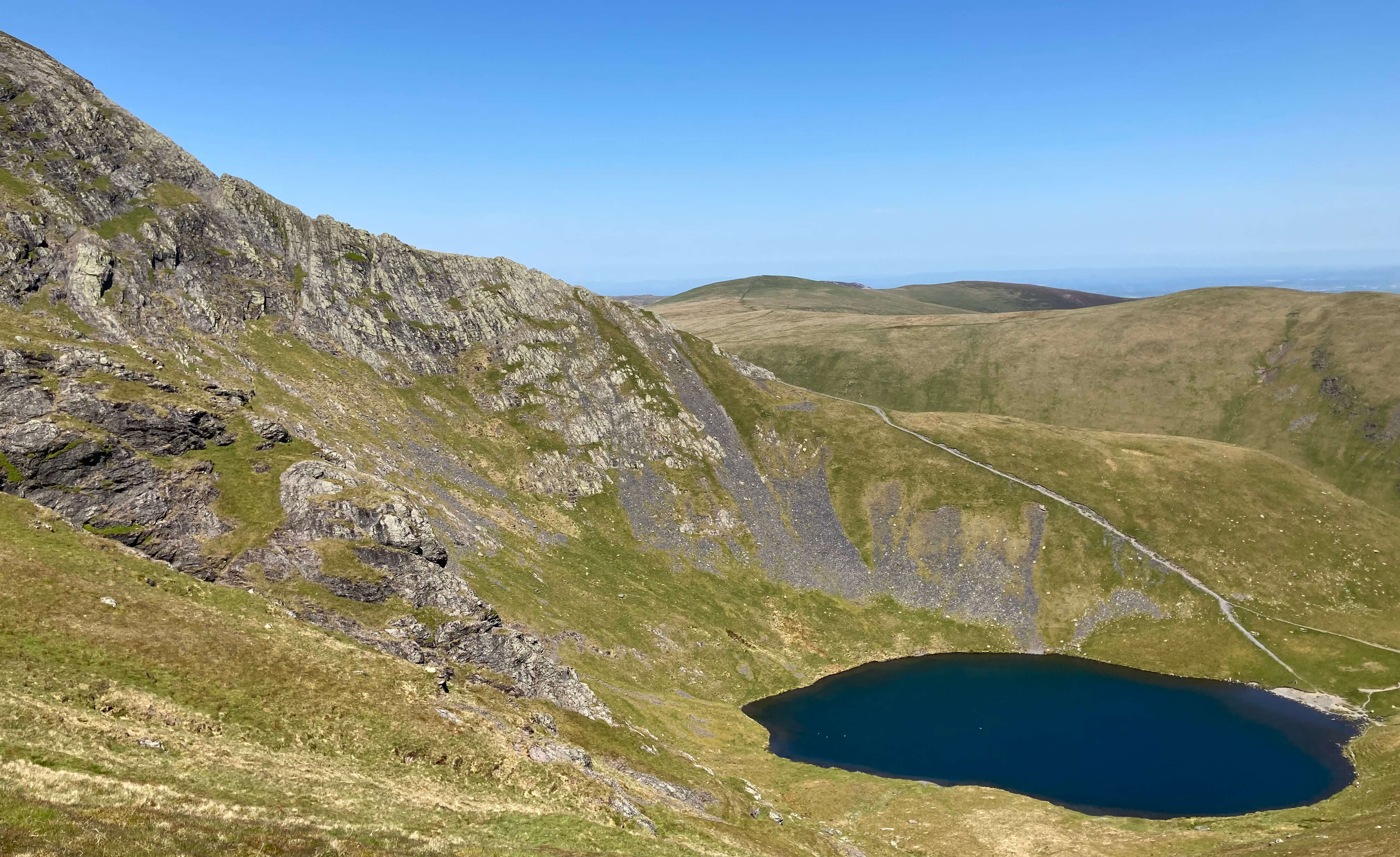
Scales Tarn, with Sharp Edge to the left

saddleback

Saddleback from Mousthwaite Comb

Enjoying an ice-cream at the Mill Inn, Mungrisdale, we reflected on our expedition. Since I started Saunterings in 2018 I have walked up only one mountain higher than Blencathra, and that was Cross Fell in July 2019 (Sauntering 56). This is the highest we (Ruth and I) have walked since 2009. Perhaps we can manage some other high mountains?

    Date: June 2nd 2023
    Start: NY364302, Mungrisdale  (Map: OL5)
    Route: N, W by Glenderamackin River, SW, NW below The Tongue – northern edge of Bannerdale Crags – S, SW – Atkinson Pike – S – Blencathra – E, NE – foot of Scales Tarn – E, SE, E, N, W – footbridge – NW, N, NW by river, E - Mungrisdale
    Distance: 9 miles;   Ascent: 620 metres

The two following items:
     180.   Bowland at Heart
     179.   A Kendalian Intermezzo
The two preceding items:
     177.   Two of the 'Dales 30': Fountains Fell and Darnbrook Fell
     176.   The Cragg – Clougha Cuckoo Circuit
Two nearby items:
       54.   Follies around Flusco
       61.   Knott Alone
A list of all items so far:
               Saunterings

Home   Preamble   Index   Areas   Map   References   Me   Drakkar

    © John Self, Drakkar Press, 2018-

Blencathra

Top photo: The western Howgills from Dillicar; Bottom photo: Blencathra from Great Mell Fell