
Home Preamble Index Areas References Me
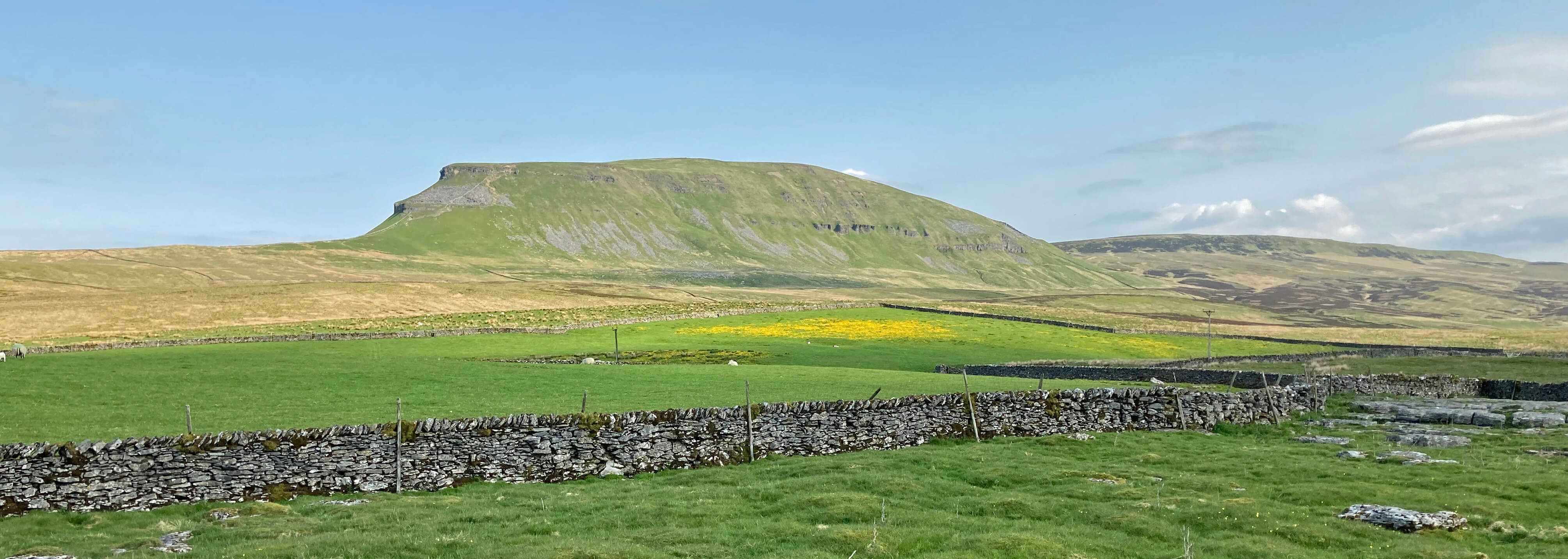
Pen-y-ghent from Dale Head
Fountains Fell is a couple of miles south-east of Pen-y-ghent and suffers by comparison with it. Fountains Fell, at 668 metres, is only 26 metres lower than Pen-y-ghent but it lacks the latter's grandeur, with its dramatic cliffs overlooking Ribblesdale. Pen-y-ghent, being one of the Yorkshire Three Peaks, has thousands of visitors a year and many more admirers travelling in Ribblesdale. Fountains Fell has relatively few visitors and admirers, since it cannot be well seen by travellers anywhere. It does, in any case, look a rather undistinguished top. The 431-kilometre Pennine Way does cross Fountains Fell but very few walkers will add an extra kilometre by detouring to the actual top of the fell.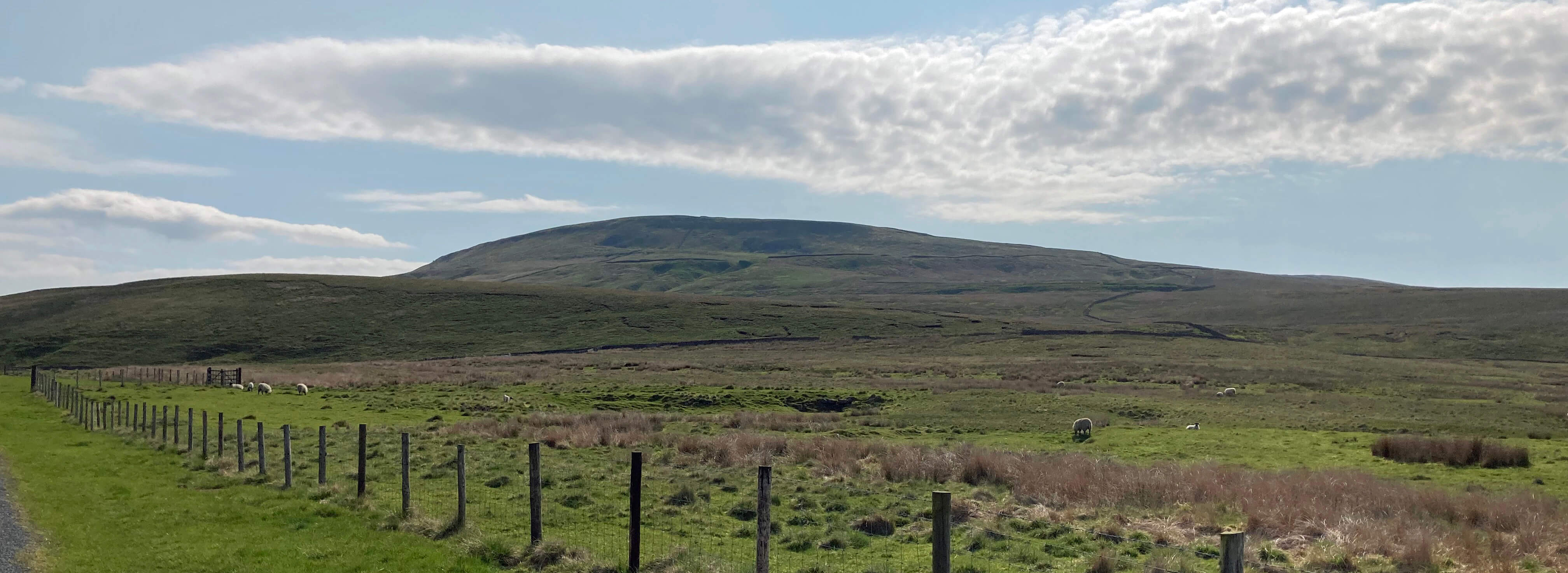
Fountains Fell from Dale Head
However, Fountains Fell does have one thing that Pen-y-ghent doesn’t, according to the OS map, and that is coal pits - so I set out to see them. From Dale Head I walked along the road, which is part of the Pennine Way, with what I think of as the back side of Pen-y-ghent impressive to the left and the slopes of Fountains Fell, less so, to the right. Leaving the road, I toiled up the path and near the top I met a walker heading down. He said that he was walking the Pennine Way and would today walk from Malham to Horton (17 miles) and that he would then turn and walk back, tomorrow, I assume. And then he would do similar from Horton and so on. In this way, he said, he would walk the Pennine Way from south-to-north and north-to-south at the same time. Don’t you find such people annoying? They take on a ridiculous challenge and then decide it is not ridiculous enough. I didn’t like to ask him if he detoured from the path to the top of Fountains Fell, as I planned to do.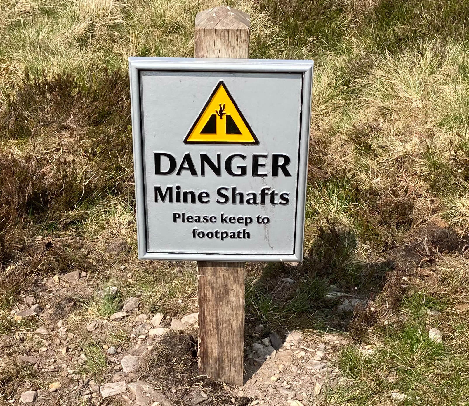 Unfortunately, when I reached the top of the path there was a sign saying
“Danger Mine Shafts Please keep to footpath”, with a daunting illustration. After
some deliberation, I set off to the highest point by walking alongside the wall -
I figured that they wouldn’t build a wall over a shaft and they wouldn’t dig a
shaft under a wall. I walked gingerly along with what
looked like the remains of a battlefield, complete with bomb craters, to my left.
Eventually, I reached the cairn at the highest point, for what it’s worth. The
disused coal pits are marked a little to the west but I was not enjoying walking
on this fell, fearing every step might be my last, although it seemed pretty obvious
where the shafts were. So I didn't investigate further as my imagination is quite capable of
picturing a disused coal pit.
Unfortunately, when I reached the top of the path there was a sign saying
“Danger Mine Shafts Please keep to footpath”, with a daunting illustration. After
some deliberation, I set off to the highest point by walking alongside the wall -
I figured that they wouldn’t build a wall over a shaft and they wouldn’t dig a
shaft under a wall. I walked gingerly along with what
looked like the remains of a battlefield, complete with bomb craters, to my left.
Eventually, I reached the cairn at the highest point, for what it’s worth. The
disused coal pits are marked a little to the west but I was not enjoying walking
on this fell, fearing every step might be my last, although it seemed pretty obvious
where the shafts were. So I didn't investigate further as my imagination is quite capable of
picturing a disused coal pit.
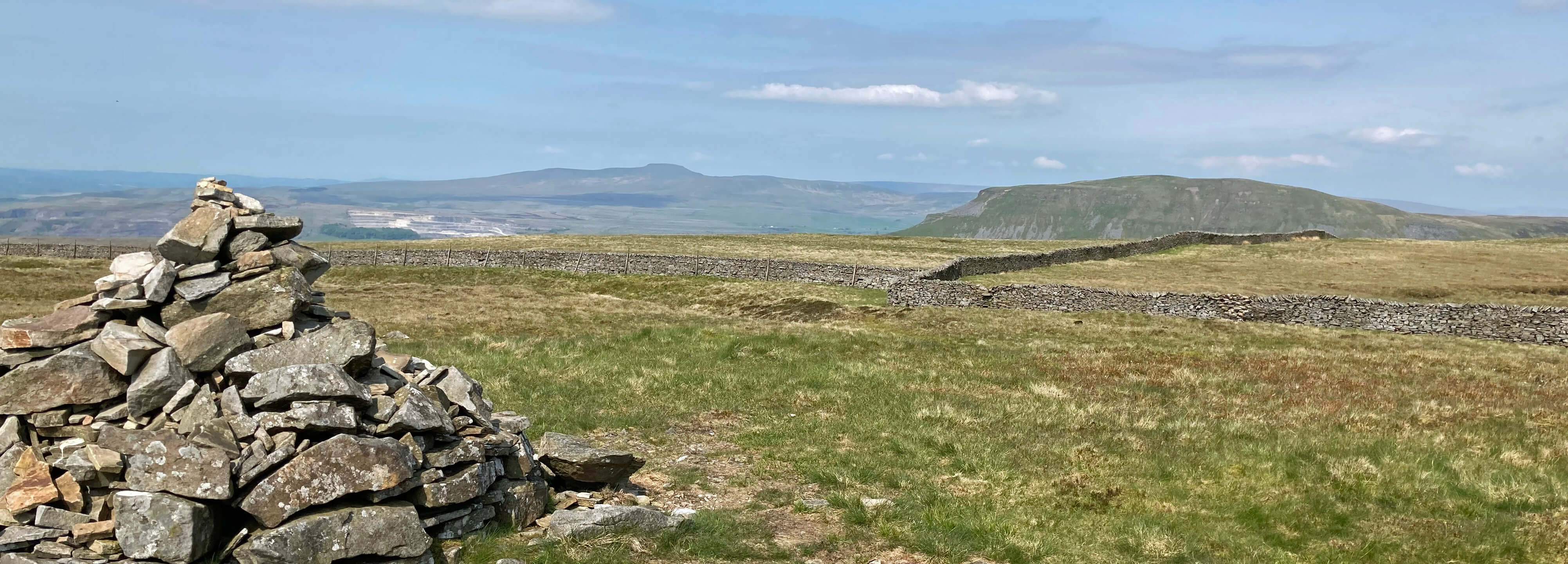
From the top of Fountains Fell towards Pen-y-ghent, with Ingleborough to the left
The OS map marks a tarn on Fountains Fell, reasonably named Fountains Fell Tarn, but I couldn’t see it from the cairn. I don’t take the OS’s word for everything so I set off to find it. But this meant walking away from the safety of the wall. Evidently, I didn’t fall down a shaft - but I was relieved to reach the haven of the Pennine Way path. The tarn lies in a shallow basin with no natural outlet and seems a pleasant oasis below this battered landscape.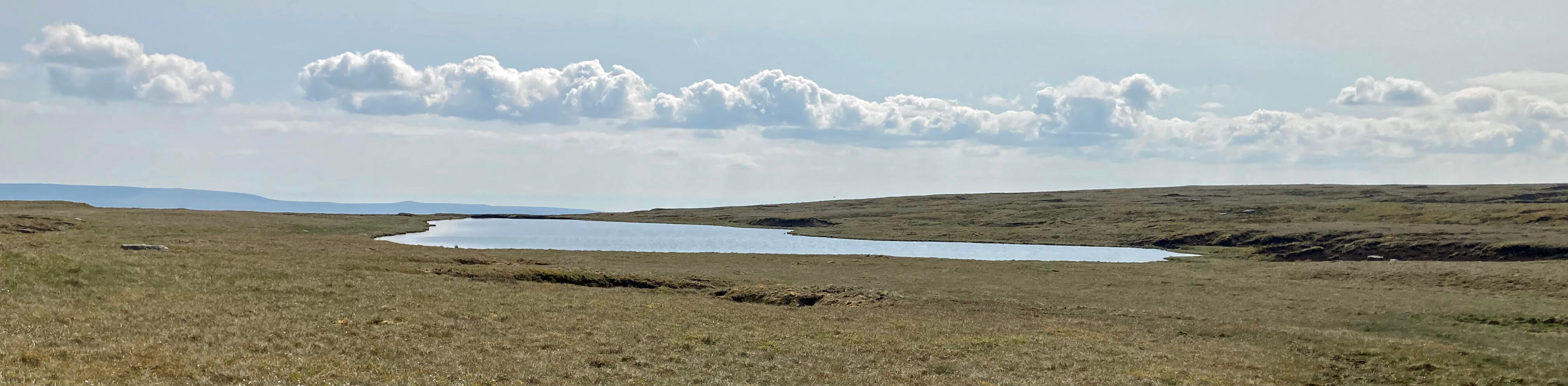
Fountains Fell Tarn
Having come this high I thought I might as well walk on to Darnbrook Fell (624 metres), a mile to the north-east. It is, after all, another of the ‘Dales 30’, that is, hills in the Yorkshire Dales National Park which are over 2,000 feet high and have a drop of over 30 feet. The map marks no paths and I could see none on the ground. The safest bet seemed to be to return on the Pennine Way to the wall and then follow that in the other direction, towards Darnbrook Fell. There is usually a sort-of-path by walls. And so there was, but not one I’d want to tackle after wet weather - and not again even after dry. What a dismal top Darnbrook Fell is! It doesn’t even have the excuse that Fountains Fell has, that miners have turned it inside out. Darnbrook Fell’s desolation is all its own work. Even the trig point is a sorry sight, being perched on its base with about a metre of peat having eroded away.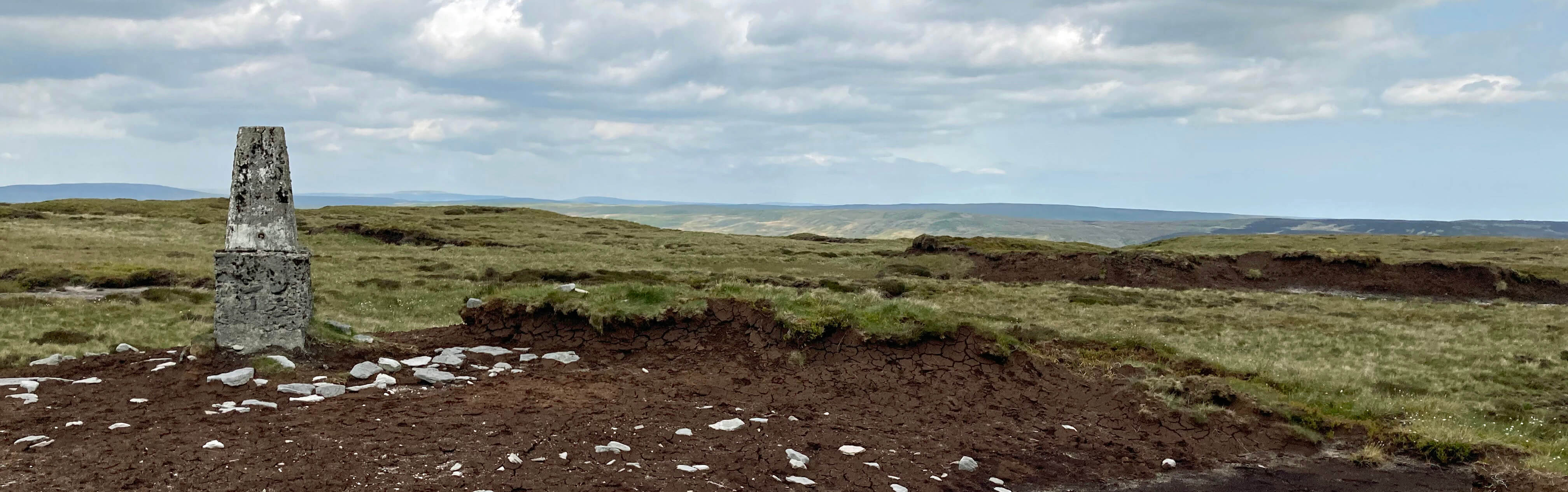
The top of Darnbrook Fell
I escaped north, where I was lucky to find a path made by the farmers’ quads. This provided views into Littondale, one of the prettiest of the Yorkshire Dales. However, it really needs sunshine to enliven its limestone to be seen at its best and by now cloud was greying everything. The track west through Dawson Close must be one of the best for walkers in the Dales although it doesn’t really go anywhere that walkers might want to go. So I had it to myself, apart from the sheep. The track is high above the valley of Hesleden Beck, a tributary of the River Skirfare that runs through Littondale. It was silent apart from the birds, and there were only a few of those but one of them was a cuckoo, who managed a few unenthusiastic calls.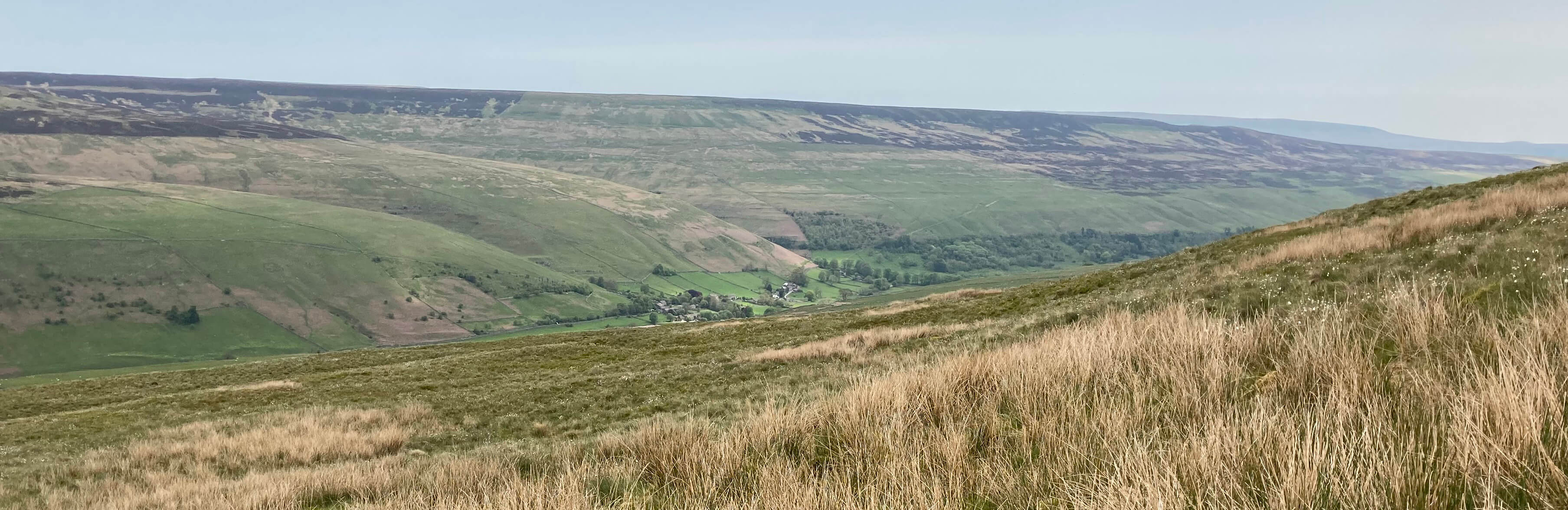
Littondale from the slopes of Darnbrook Fell
I followed this track and then the road for four miles back, with a now dark Pen-y-ghent ahead. I like a straightforward end to walks. Some challenging scrambling is fine earlier on but with increasing physical and mental tiredness I don’t want to be fiddling about with maps, compasses, theodolites, google maps, and what-not. I want to coast back to base, relaxed, reflecting on the day’s walk and wondering if I can scrape some words into a Sauntering.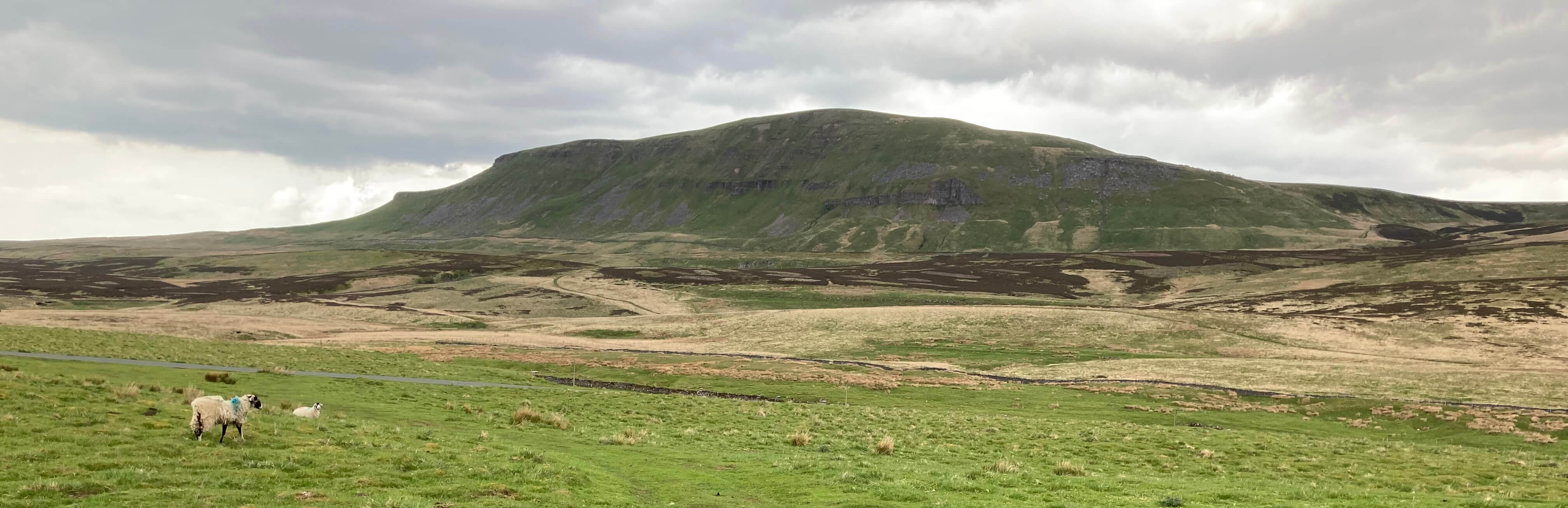
Pen-y-ghent again
By the way, I recently tried to sign up on Facebook but it rejected me, not believing that ‘John Self’ was a real name. I blame Martin Amis. He wrote Money: A Suicide Note, an unauthorised biography of myself which everyone assumed to be a novel featuring a deplorable reprobate for whom Amis invented the fitting name of John Self. Who does Facebook think it is? Denying me my birthright, a name passed down to me by generations of Norfolkfolk, a name from the Viking for 'seawolf', a name as common in Norfolk as Smith.
Home Preamble Index Areas References Me
© John Self, 2018-

Top photo: The western Howgills from Dillicar; Bottom photo: Blencathra from Great Mell Fell