
Home
Preamble
Index
Areas
Dales
Hills
Lakes
Places
Reserves
Rivers
Structures
Villages
References
Me
Saunterings: Walking in North-West England
Saunterings is a set of reflections based upon walks around the counties of Cumbria, Lancashire and
North Yorkshire in North-West England
(as defined in the Preamble).
Here is a list of all Saunterings so far.
If you'd like to give a comment, correction or update (all are very welcome) or to
be notified by email when a new item is posted - please send an email to johnselfdrakkar@gmail.com.
175. White Scar, Whitbarrow and Witherslack
Of all the sciences geology seems the least plausible to me. How can someone look at a rock
and tell me what it was doing 350,000,000 years ago? According to geologists, the rocks of
Whitbarrow were at that time just settling down on the bed of an ocean south of the equator.
Does that sound plausible?
Not only that but the rocks around Whitbarrow are not, as we might think, just
limestone but limestone of different kinds, or formations, as geologists would say. According to
this document,
the limestone is, from bottom to top (or older to younger), of the
Martin, Red Hill, Dalton, Park and Urswick Limestone Formations (unless they have changed their
names, as rock formations are distressingly liable to do).
I expect that geologists would tell
me that the different formations are from different sediments in different seas in different
places. How they know this I cannot say but I have to believe their every word
û even though less than a
hundred years ago nobody believed them. The theory of plate tectonics, explaining how land
masses and associated oceans moved about, had not yet been developed.
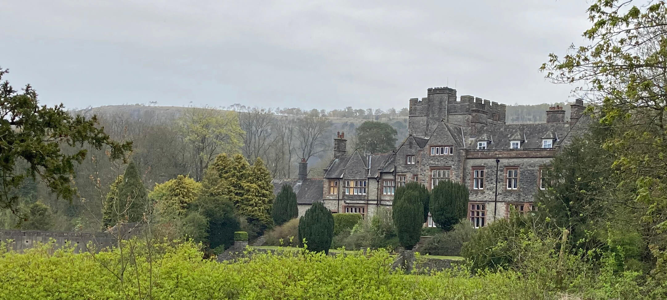 Right: Witherslack Hall, on an overcast day.
As Ruth was going to Witherslack Hall I took the opportunity to have a walk around the
region, looking at the limestone a little more closely, in particular, on White Scar, the dramatic
white cliff that confronts visitors as they head west along the southern coast of Cumbria. White
Scar is not what visitors expect to see in Cumbria. Cumbrian hills should be dark, knobbly
peaks, with grey, slatey slopes. But White Scar is not alone. There is a series of limestone
hills around the Kent estuary: Scout Scar, Hampsfell, Yewbarrow, Arnside Knott, Farleton Knott.
I walked south from Witherslack Hall, with the shaded cliffs of Whitbarrow looking
somewhat forbidding, passing fields of surprisingly young lambs,
to the hamlet of Beck Head. Here there was a puzzle. A barn said ôHikers Restö above the
door û but a notice on the door said ôHikerÆs Rest is closed to the publicö. I was not yet
in need of a rest so pressed on along a broad track that curved around the lower flanks of White
Scar. I passed a neat bench that offered a view of the trees that had grown immediately in front
of it, hiding the Kent estuary beyond. A deer, also looking surprisingly young, skipped into the undergrowth. To the left
towered the cliffs of White Scar but I couldnÆt really see them through the trees until I
neared RavenÆs Lodge.
I had intended to continue past RavenÆs Lodge and climb to the top of White Scar
through RawsonÆs Wood. However, it was a grey day with a forecast of heavy rain. I didnÆt
fancy being on Whitbarrow in a downpour so instead turned east on the side-road. This
provided a wide vista of the White Scar cliffs and, grey as the day was, I could agree that
the limestone did not look all the same. I could believe that White Scar displays the three
youngest formations (Dalton, Park and Urswick), as
this document
asserts. The other two (Martin and Red Hill) are seen elsewhere in the region, apparently.
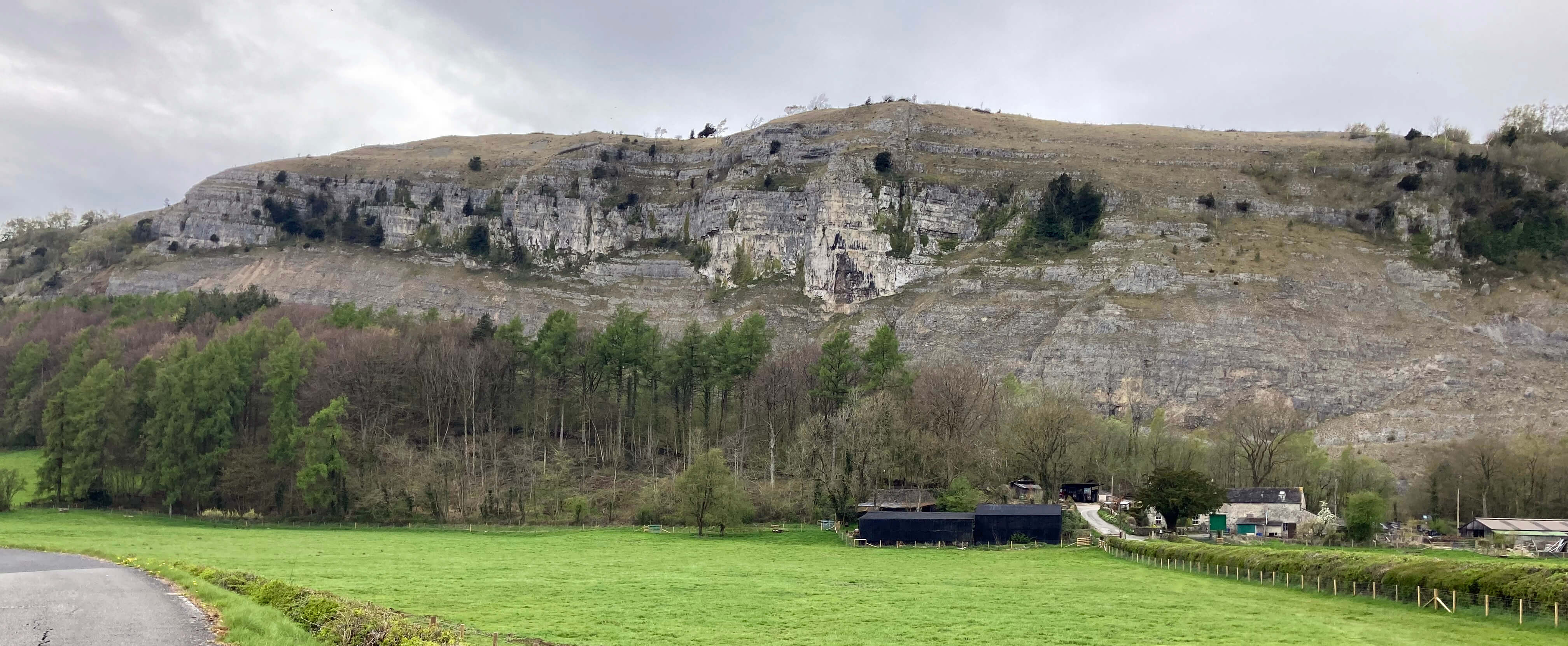
White Scar (western end) - less white than it usually is
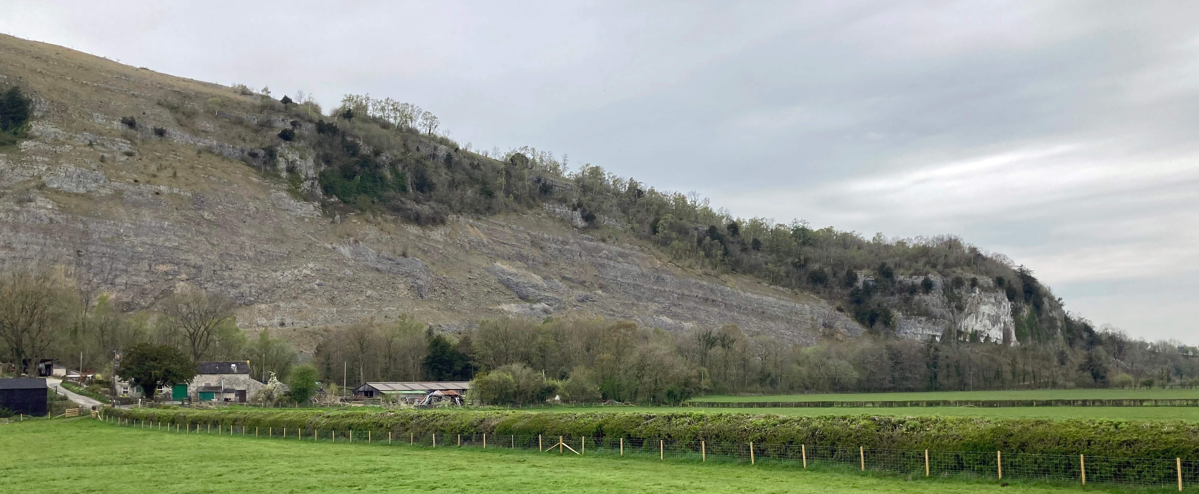
White Scar (eastern end)
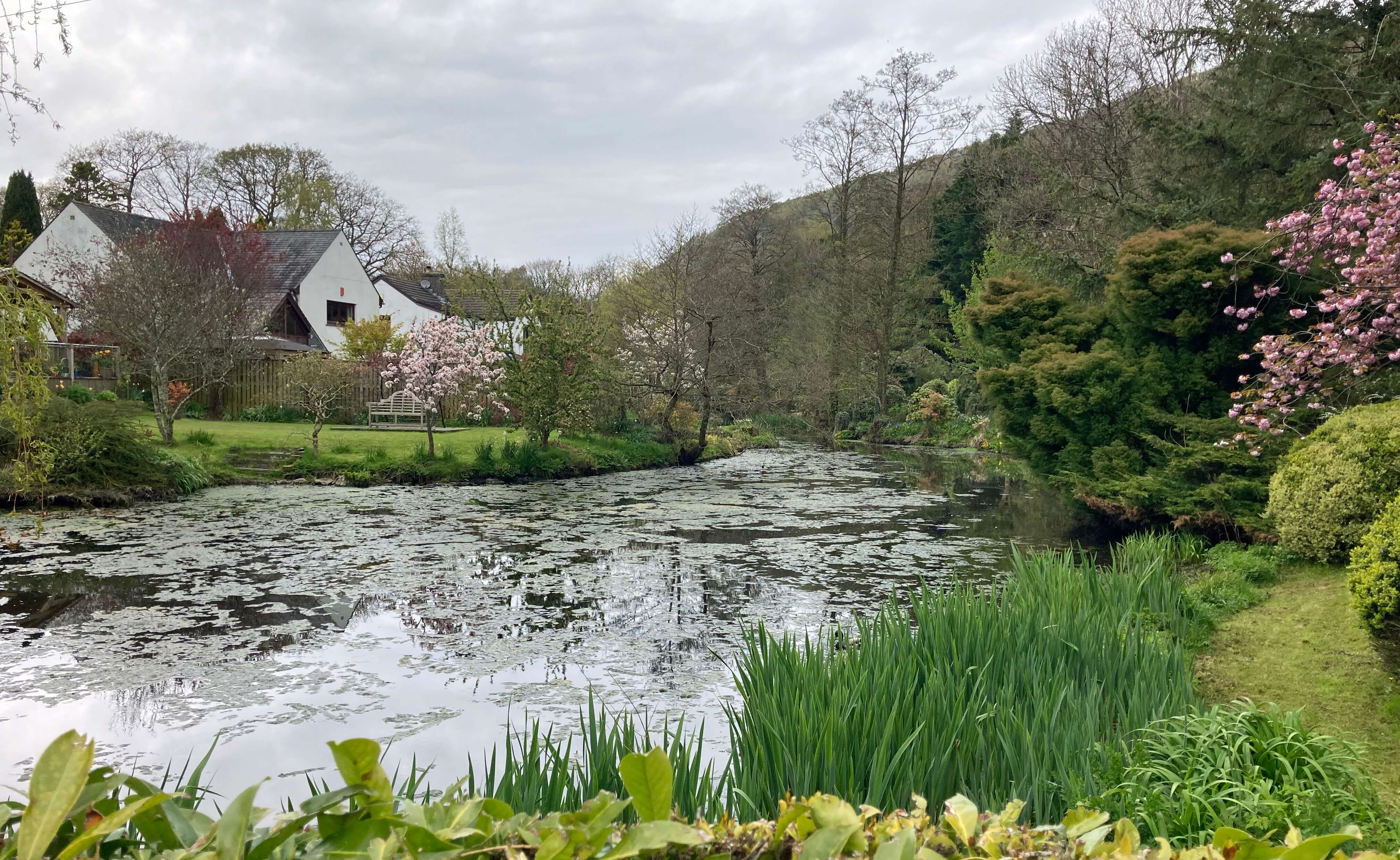 Right: The Mill Side mill pond, now a garden feature.
The side-road was perched a metre or so above the adjacent fields into which it was
collapsing, leaving cracks hazardous for walkers, cyclists and horses (and cars too, soon).
The fields themselves continue south virtually flat across Foulshaw Moss to the Morecambe
Bay coast some three miles distant. When the glaciers melted all this area was under water,
with Morecambe Bay inlets extending up the present Lyth and Winster valleys, to the east and
west of White Scar, which stood as a promontory with the sea lapping at its foot. As sea
levels dropped lakes were left in the valleys but they have since drained away, unless you
count the tiny Helton Tarn as a remnant. During periods of heavy rain the valleys begin to
return to their previous watery state.
I walked on to Mill Side, the second (after Beck Head and before Town End û three
traditional names) of the hamlets that comprise Witherslack. There is a charming lack of
uniformity in the region. Every house builder seems to have done their own thing. Houses
face every which way, no two alike. Most are a mixture of old and new û an old farm cottage, say,
embellished with a new verandah, say. The narrow lanes wander about, in no hurry
to get anywhere. It is, unfortunately, not quiet, with the A590 just south.
Passing through Nether Hall and walking up through weather-beaten yews,
I reached the ridge of Yewbarrow. It is always a pleasant
surprise to find within the Lake District a region that I havenÆt visited before that seems
unaffected by the tourist invasion. It seems a natural, open upland with scattered trees,
quiet and ignored (except in summer when people come looking for the butterflies for which
Yewbarrow is known). I passed a badgersÆ sett right by the path but I didnÆt explore further
from the path as the promised rain was beginning to fall.
Date: April 27th 2023
Start: SD435860, Witherslack Hall Farm (Map: OL7)
Route: S, SE û Beck Head û E, SE, NE û RavenÆs Lodge û SE, SW,
NW û Mill Side û W past Rocky Common û N, W through Nether Hall û Yewbarrow û N û Witherslack Hall Farm
Distance: 6 miles; Ascent: 50 metres
Home
Preamble
Index
Areas
Dales
Hills
Lakes
Places
Reserves
Rivers
Structures
Villages
References
Me
® John Self, 2018-

Top photo: The western Howgills from Dillicar;
Bottom photo: Blencathra from Great Mell Fell