
Home
Preamble
Index
Areas
Dales
Hills
Lakes
Places
Reserves
Rivers
Structures
Villages
References
Me
Saunterings: Walking in North-West England
Saunterings is a set of reflections based upon walks around the counties of Cumbria, Lancashire and
North Yorkshire in North-West England
(as defined in the Preamble).
Here is a list of all Saunterings so far.
If you'd like to give a comment, correction or update (all are very welcome) or to
be notified by email when a new item is posted - please send an email to johnselfdrakkar@gmail.com.
160. Levens Park and the River Kent
The river that runs through Levens Park is not the River Leven. The River Leven flows from the
foot of Windermere through Newby Bridge to its estuary on Morecambe Bay. The river at Levens Park
is the River Kent, which arises in Kentmere and flows past Staveley, Burneside and Kendal, entering
Morecambe Bay at Arnside. Having got that matter clear in my head, I felt free to amble on the eastern banks of
the River Kent.
I assume that Levens Park was once fully integrated within the Levens Hall estate, the
present Levens Hall having been built upon the site of a pele tower of about 1350. Today the Park
and the Hall are separated by the A6. With the A590 and A591 on other sides of Levens Park,
it forms an island of green peace – almost, because there is the sound of the surrounding traffic.
I headed east, with the river curving gracefully to my left, on a stately promenade between two
rows of oaks of some vintage apart from a few younger ones that are presumably replacing those
that have succumbed to old age or storms. The deer of the deer park were in hiding apart
from the one I saw, looking lost.
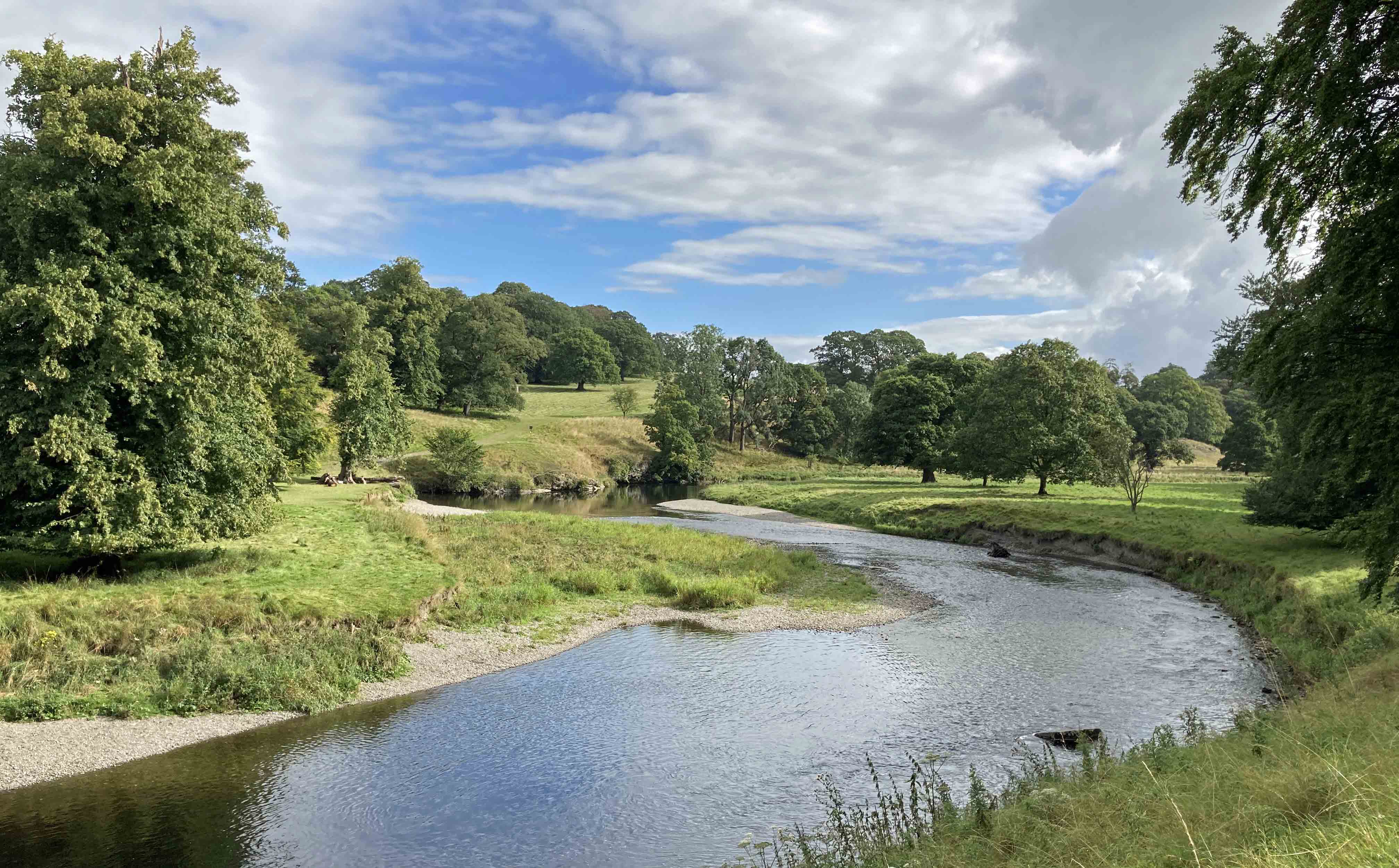
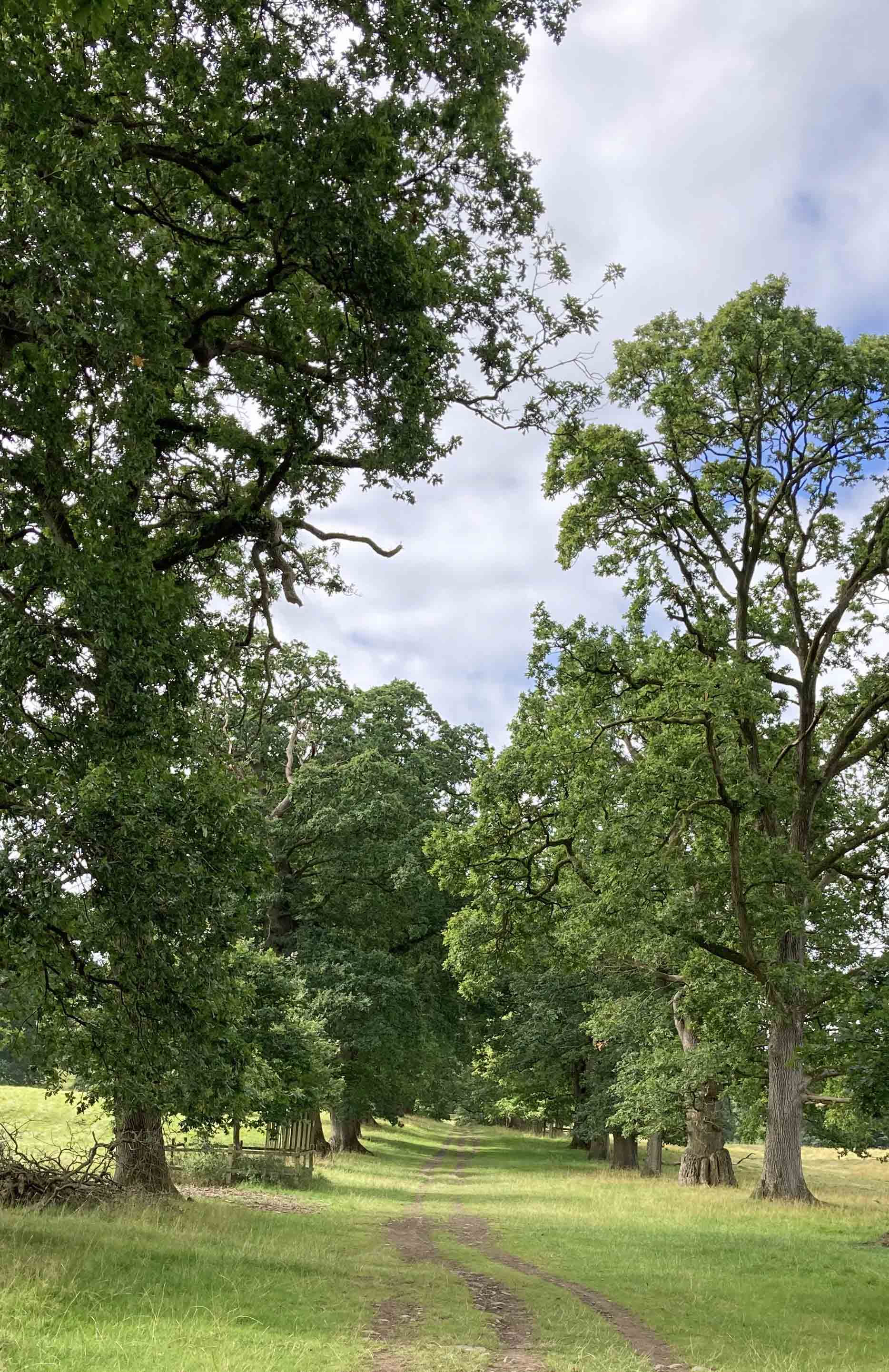
Left: The River Kent at Levens Park; Right:
The oak avenue at Levens Park.
At the northern end of the park, near Archer’s Hill, there is, according to Ibbotson (2021),
an ancient ring cairn that when excavated revealed artefacts including ceramic beakers almost
certainly associated with the Bell Beaker culture that journeyed to Britain at the beginning of
the Early Bronze Age (around 2500 BC). However, the signposts on the oak avenue were so adamant
about the direction of the path that I didn’t dare leave it to search for the ring cairn. In
any case, August, when the grass is high, is not the best time to look for ancient monuments.
Leaving the park, I crossed over the A591 and walked up a field to what is marked on the OS map
as “Lancaster Canal (Northern Reaches)”. There is no sign of a canal here. Further along,
however, there is an isolated bridge in the field that certainly looks like a canal bridge,
and beyond that a dry, now overgrown, ditch that could once have been a canal. Yes, this
is the line of the old Lancaster Canal, the Northern Reaches of which were completed in 1819.
Parts of this section of the canal began to be filled in from the 1940s, with the
whole six-mile stretch from Stainton to Kendal drained in 1953.
I left the ex-canal briefly at Sedgwick in order to have a look at Sedgwick House, the roof
of which I had glimpsed from the ex-canal path. However, it was hidden behind large trees. The house
was built in 1868 by the Lancaster firm of Paley and Austin for the Kendal banker
William Wakefield (1828-1889).
His company owned six of Westmorland’s seven gunpowder factories, three of which were near Sedgwick. The first factory, in Old Sedgwick, started in 1764 and the last, at nearby Gatebeck, closed in 1937.
It is well-known that for centuries before the tourist invasion Cumbria had been a hive of
mining and quarrying activity. Norman Nicholson’s classic book Portrait of the Lakes,
published in 1963, describes the history of mining in Cumbria, from the Celtic tribes digging for copper to the few mines still functioning at the time he was writing. He notes, in passing, that “before the invention of gunpowder, mining was a very difficult operation.” He does not go on to say that Cumbria developed its own gunpowder industry, which it was well able to do, with its woodlands for charcoal and abundance of water power.
But what else does gunpowder need? What actually is
gunpowder? It is a mixture of charcoal,
sulphur and potassium nitrate. According to Life and Traditions in the Lake District (Rollinson, 1974),
the last two were imported from India and Italy via the port of Milnthorpe, from which the
gunpowder not required for local quarrying was shipped to Liverpool – which surprises me, as
I had assumed that Milnthorpe had ceased to be a viable port long before. For obvious reasons,
gunpowder-making was fraught with danger and despite precautions to prevent accidental
sparks explosions were not uncommon. The Blackbeck factory in the Rusland valley had
eight accidents between 1867 and 1911, killing 27 people in all.
Overall, I have the impression that Cumbria does not want to dwell upon its gunpowder industry.
There are museums about many aspects of the Cumbrian heritage but I’m not aware that any say much
about gunpowder. The village of Sedgwick doesn’t either. I saw no sign that gunpowder works had
ever existed around here. However, gunpowder has not been entirely forgotten because I notice that
the Lake District National Park Authority referred to “the remains of early metal mines, charcoal
blast furnaces, gunpowder works and many other features relating to past industries” in its case
for becoming a World Heritage Site, which it duly became in 2017.
I returned to the ex-canal. Here it has disappeared into Sedgwick gardens. The
Northern Reaches Restoration Group campaigns to re-open the 14-mile stretch of ex-canal between Tewitfield and Kendal.
This group is a successor to the Association for the Restoration of the Lancaster Canal which was
formed in 1963. So that's almost 60 years that enthusiasts have been trying to revive this canal.
In 2003 a
report
said that re-opening the canal would "create more than 800 jobs [and] attract an extra million
visitors a year", with "hopefully, boats [being able] to sail all the way from Kendal to London."
It is good that this report is still on-line, so that we can see how fanciful such reports can be.
I haven't surveyed the whole ex-canal to see what progress has been made
but I didn't notice any on the stretch I walked along (although Larkrigg Hall Bridge may have had
a lick of paint).
But it's all in safe hands. The
Northern Reaches Restoration Group
looks a formidably formal organisation, replete with committees, constitutions, councillors, and so on,
ideal to stifle any actual activity. I find it hard to imagine that it will ever be considered
money well spent to buy people’s gardens
or farmer's fields to convert back to a canal.
Meanwhile it is interesting to see how we and nature have reclaimed the ex-canal. Beyond
Sedgwick another isolated bridge is passed and then the ex-canal runs through a wood, with
the dry ditch still obvious but now with mature trees growing in it. Larkrigg Hall Bridge is
another fine ex-canal bridge and beyond it, on the opposite ex-towpath, alone in a field, is a
stone with the number 3 on one side and 24 on the other (the miles to Kendal and Lancaster).
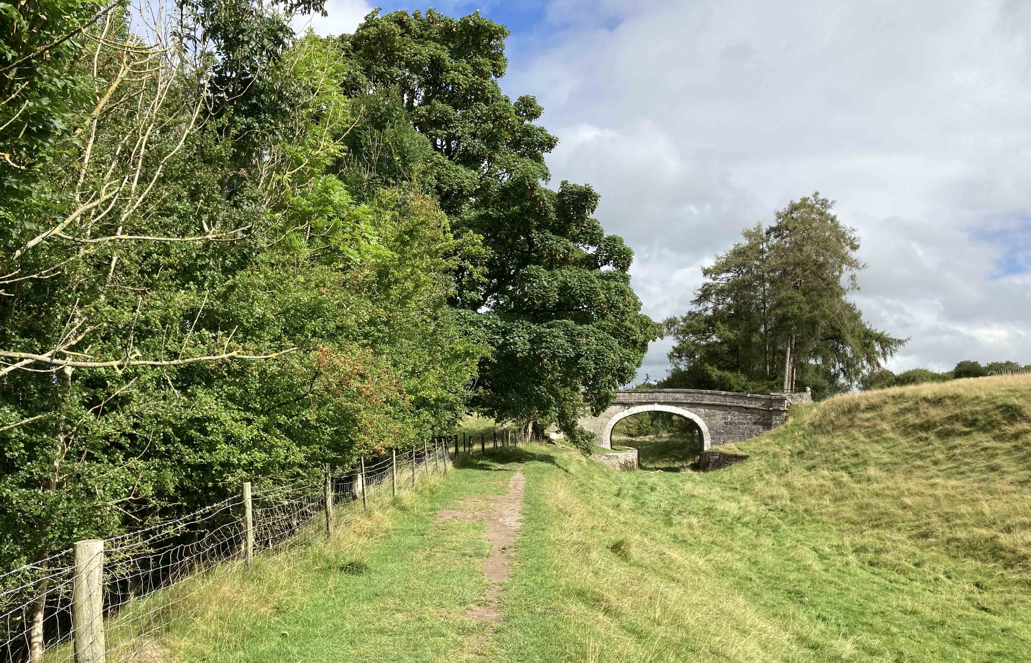
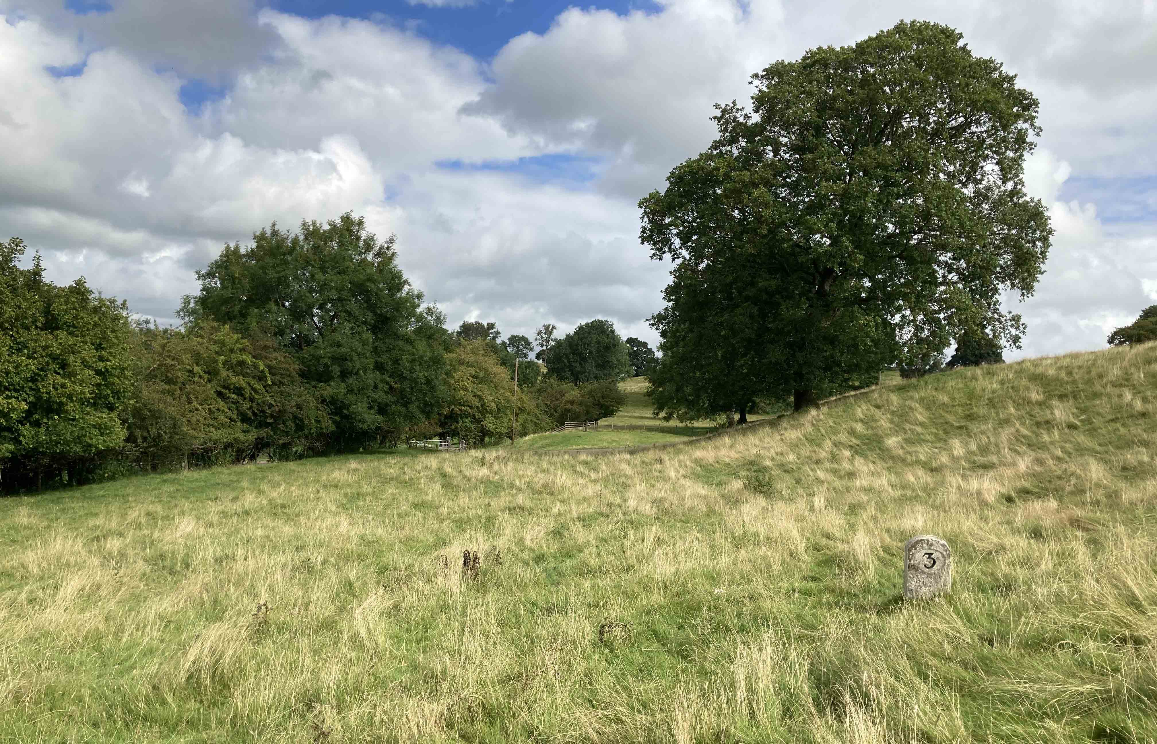
Left: Larkrigg Hall Bridge; Right:
A canal milestone with a 3 on it (the canal ran to the left of it).

 Furthest left: Hawes Bridge.
Nearest left: The River Kent south of Hawes Bridge.
Leaving the ex-canal at Crowpark, I turned west to the 18th century,
grade II listed Hawes Bridge, high
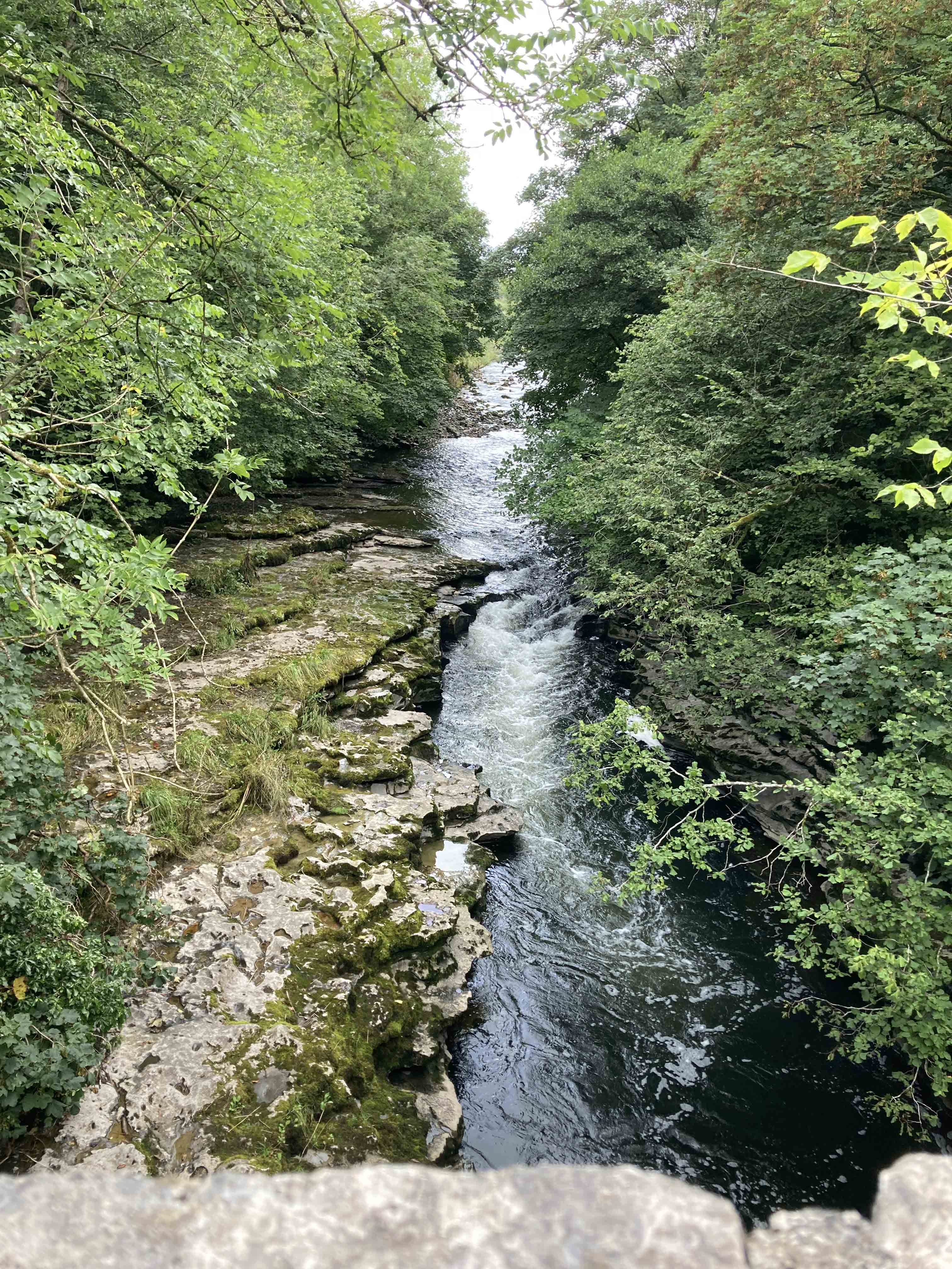
above the Kent. To the north the river was white and lively, forming mini-waterfalls; to the south,
it was silent and still, lying in dark pools. The Kent continued to have this dual personality all
the way back to Levens Park. In places it was so still that it could not be seen or heard through the
trees on the steep east bank. Elsewhere I was aware of the white rapids below.
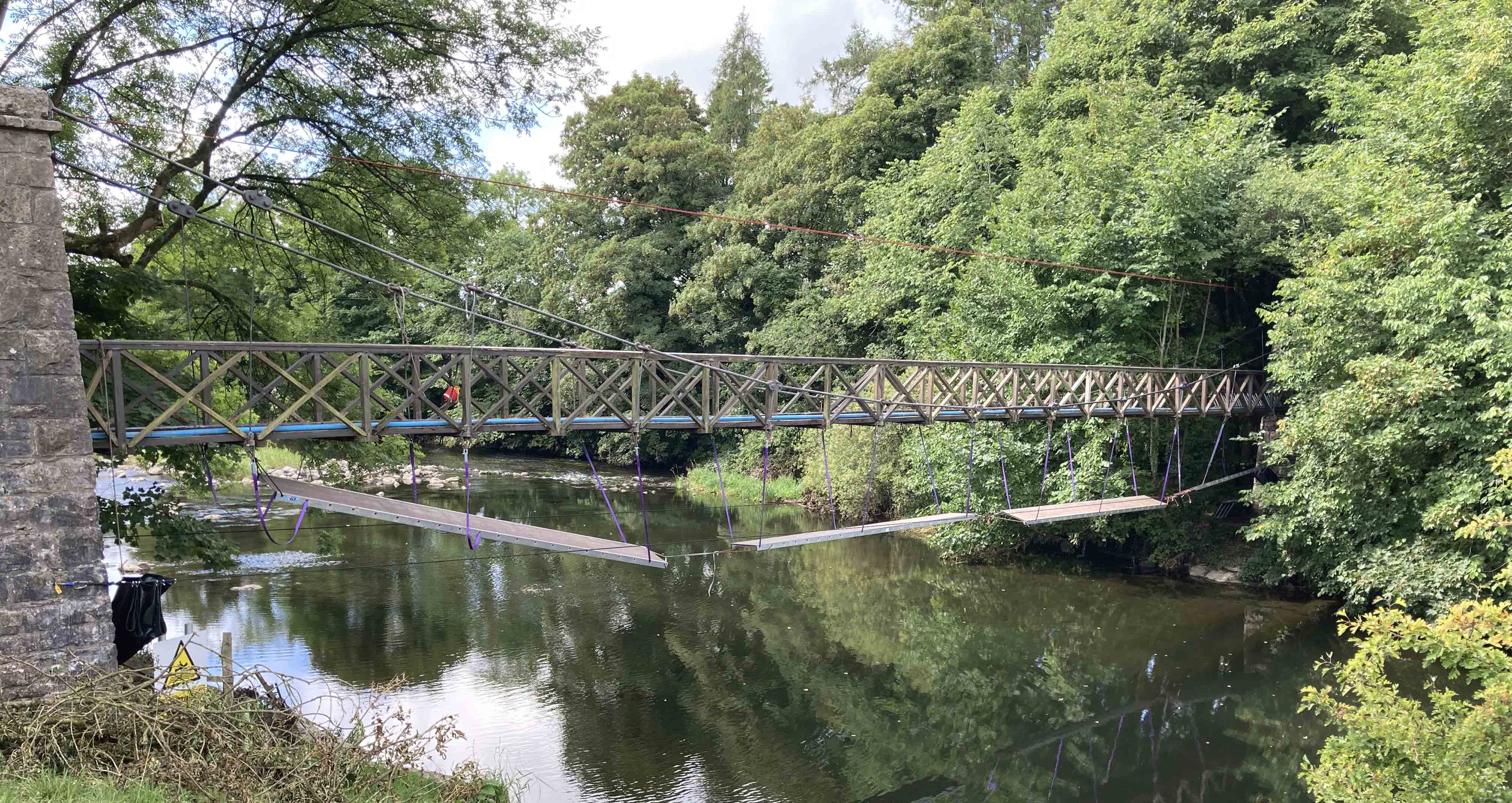 Right: The suspension bridge at Wilson Place.
Of course, in spate
it is all very different. The Kent has a large catchment area and although it is a wide river in Kendal it is
liable to cause flooding there. When all that water is squeezed into this deep gorge just a few metres
wide it must be quite a sight. Anglers, bathers and canoeists argue
about the best recreational use of this stretch of river. I’d prefer it left for the
dippers, the eels and other birds and fish.
I understand that there are remains of a gunpowder mill on the opposite bank in Low Park Wood
but my half-hearted thought of investigating them was thwarted by the fact that the suspension bridge
at Wilson Place was very much in need of repair. A notice said that work was due to start on August 1st
but there wasn’t any sign of it. So I continued along the lane, over the bridge,
along Force Lane, under the A590 and back, soothed by my gentle,
almost genteel, stroll.
Date: August 19th 2022
Start: SD498863, A6 lay-by (Map: OL7)
Route: S over Levens Bridge, E, NE through deer park, NE – Sedgwick – N – Crowpark
Bridge – W – Hawes Bridge – S on path by River Kent, W on lane over River Kent, S, E past Park Head – A6 lay-by
Distance: 6 miles; Ascent: 40 metres
Home
Preamble
Index
Areas
Dales
Hills
Lakes
Places
Reserves
Rivers
Structures
Villages
References
Me
© John Self, 2018-

Top photo: The western Howgills from Dillicar;
Bottom photo: Blencathra from Great Mell Fell