
Home
Preamble
Index
Areas
Dales
Hills
Lakes
Places
Reserves
Rivers
Structures
Villages
References
Me
Saunterings: Walking in North-West England
Saunterings is a set of reflections based upon walks around the counties of Cumbria, Lancashire and
North Yorkshire in North-West England
(as defined in the Preamble).
Here is a list of all Saunterings so far.
If you'd like to give a comment, correction or update (all are very welcome) or to
be notified by email when a new item is posted - please send an email to johnselfdrakkar@gmail.com.
174. Morecambe Away and Home
Spring has moved on since my last Sauntering, in late February. Now, in mid-April, the frogspawn is
tadpoling, the chiffchaffs are chiffchaffing, the orange tips are fluttering, and the willows are
greening. However, the spring in my step has lapsed. To regain it, gradually, I thought IÆd
begin with a local walk by taking the bus to Morecambe and then walking home.
I had hardly got underway when I saw a heavily-backpacked, brightly-dressed walker taking
selfies by the RNLI (Royal National Lifeboat Institution) station.
She turned out to be Tracey from Chippenham, near Bath, a woman who has embarked on
a 12,000 mile walk around the coast of the UK in aid of the RNLI. She had started in Cornwall
in 2020 and has only 9,000 miles to go. I see from an
article
in the Wiltshire Times that she began the challenge after ôfeeling like she had nothingö. Luckily,
I feel that I have everything that a man could reasonably want and may therefore be immune
from such a challenge. We didnÆt chat for long as she needed a coffee and to do ôsome adminö.
Even when walking as free as the wind you cannot escape admin.
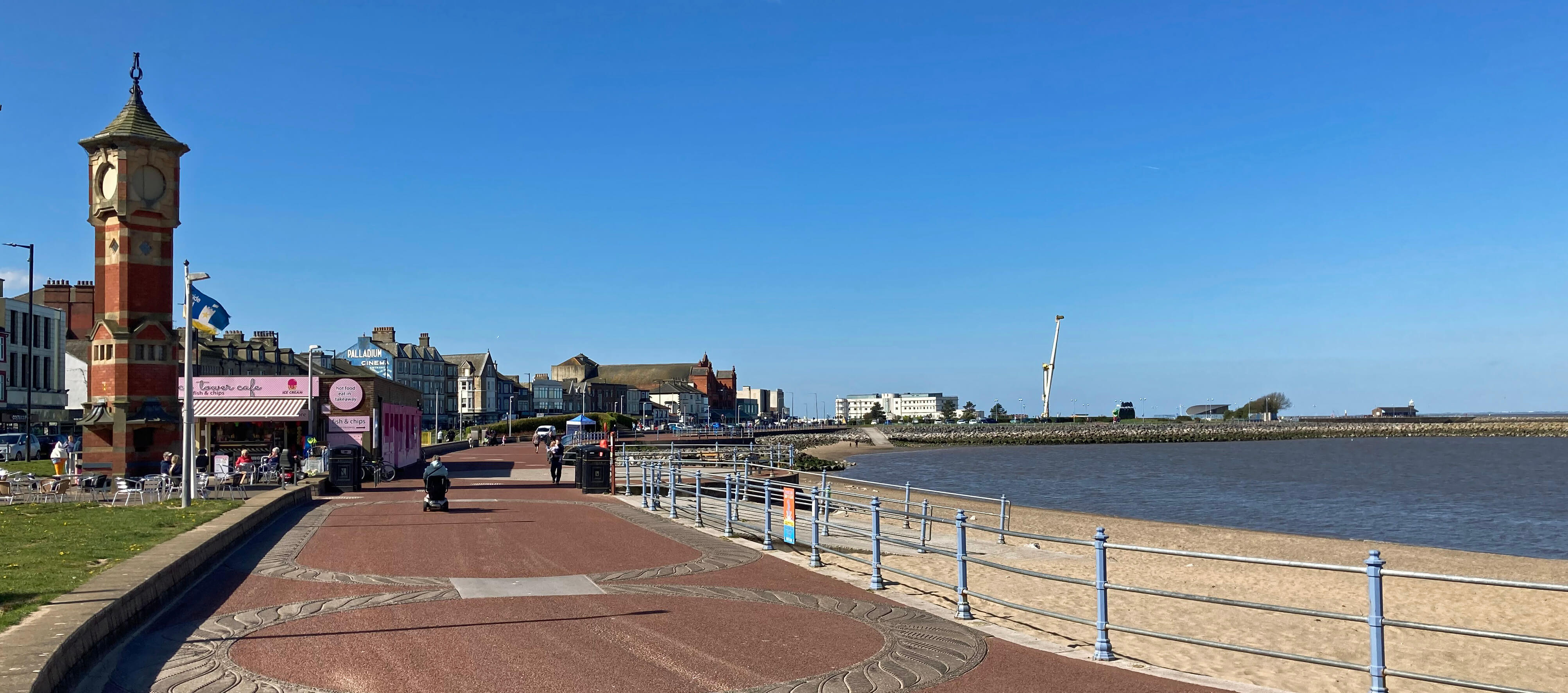
The view back along the Morecambe Promenade from near the
Clock Tower to the Midland Hotel and the site of Eden Project Morecambe
I walked past the site of the planned Eden Project Morecambe. The last time I walked here
[36] in 2018,
the plan had just been mooted. There was no sign, however, of work on the Eden Project, the site being
occupied by a kind of fun-fair. So I walked on along the promenade into a bracing breeze, with,
across the bay, a fine panorama from Black Combe to Ingleborough.
I was reluctant to leave the promenade but I had to walk inland if I wanted to get home.
Google Maps suggests a variety of routes but I suspect that it considers only the duration
of a walk, not whether a walk is interesting or enjoyable. I really didnÆt want to walk
along busy roads, through standard estates, around office blocks or along over-familiar
paths. So I headed south along Broadway (the A589), which is indeed a broad way, having
wide pavements to keep me from the traffic, to Torrisholme.
Torrisholme is an ancient village, mentioned in the Domesday Book, but it has
now been absorbed into Morecambe. To the east of Torrisholme is the Bay Gateway, a
new road that links the M6 to the port of Heysham and that serves as a de facto boundary
between Morecambe and Lancaster. There is otherwise no discernible separation between
the two.
The history of the conjoined conurbations is complicated. Lancaster is, of
course, an old city, the historic county town of Lancashire,
but it has not expanded like, say, Manchester by swelling from its
core to smother adjacent towns and villages.
Lancaster has absorbed a few villages (such as Skerton and Scotforth)
but it is now smaller than many other Lancastrian towns. Morecambe, on the
other hand, did not exist until 1889, when it was named to include the hamlets of
Poulton, Bare and Torrisholme, which were developing because of the tourist trade.
Morecambe Bay had been so named in the 18th century.
Morecambe has now spread to reach Heysham to the south and, arguably, Hest Bank and
so on to the north.
There is a not altogether helpful rivalry between Lancaster and Morecambe. Wikipedia
quotes the populations as 52,000 and 35,000, respectively, but the maps shown do not
entirely correspond to our informal idea of their scope.
The parliamentary constituencies further confuse matters.
For this purpose Lancaster is divided by the River Lune, the southern part joining with
Fleetwood, twenty miles away,
to form the Lancaster and Fleetwood constituency and the northern part (notably Skerton)
joining with Morecambe plus Carnforth and many other villages to form the
Morecambe and Lunesdale constituency.
ThereÆs also a æCity of
LancasterÆ local government district that includes all of Lancaster, Morecambe,
Carnforth and much else, with a population of 143,000 û a kind of æGreater LancasterÆ,
a name which would give the region more weight, but one which Morecambians would
not agree to. Morecambe, they would argue, is now the more vibrant of the two,
boosted by the Eden Project Morecambe, looking forward to alliances with friends around
the bay, rather than backward to Lancaster. And what surer guide can there be to
their relative merits than Morecambe being in the third
tier of English football, while Lancaster languishes in the seventh tier?
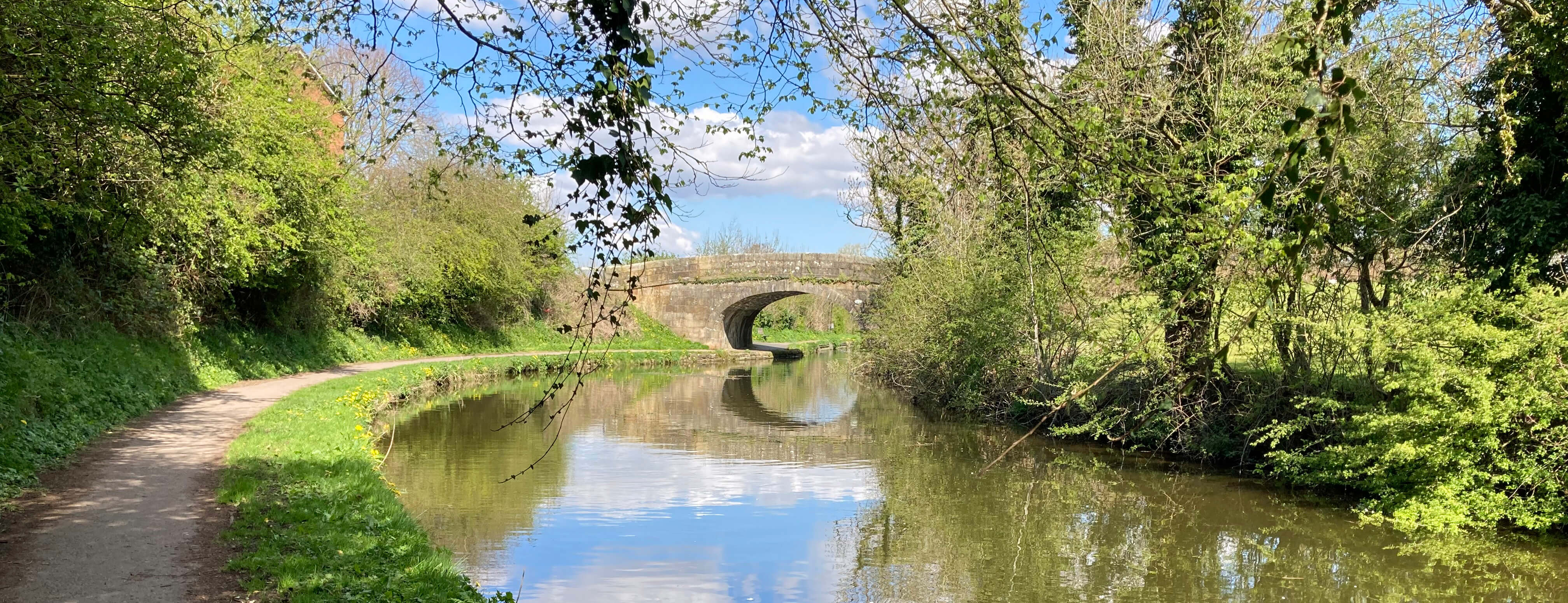
Lancaster Canal
Continuing under the Bay Gateway, I reached the relative tranquillity of the Lancaster
Canal, which I followed to the Lune Aqueduct. Here I managed to find the path on the
north bank of the Lune û a path that I had never walked before, although I had walked
or run on the south bank path scores of times. The path is reached by dropping down
from the aqueduct on the west side and curving under the arch on an unpromising narrow
platform. The path east is somewhat eerie, passing below and then through the Halton
Training Camp, which was acquired for military training in 1938 but seemed to be
deserted today. If the army no longer needs this camp then thereÆs some prime real
estate here that we could use to lessen the building on more green fields.
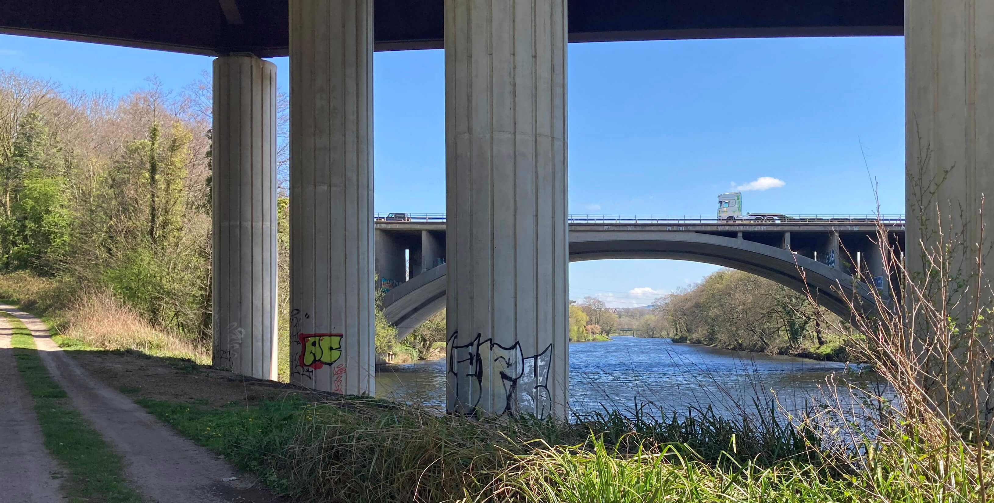
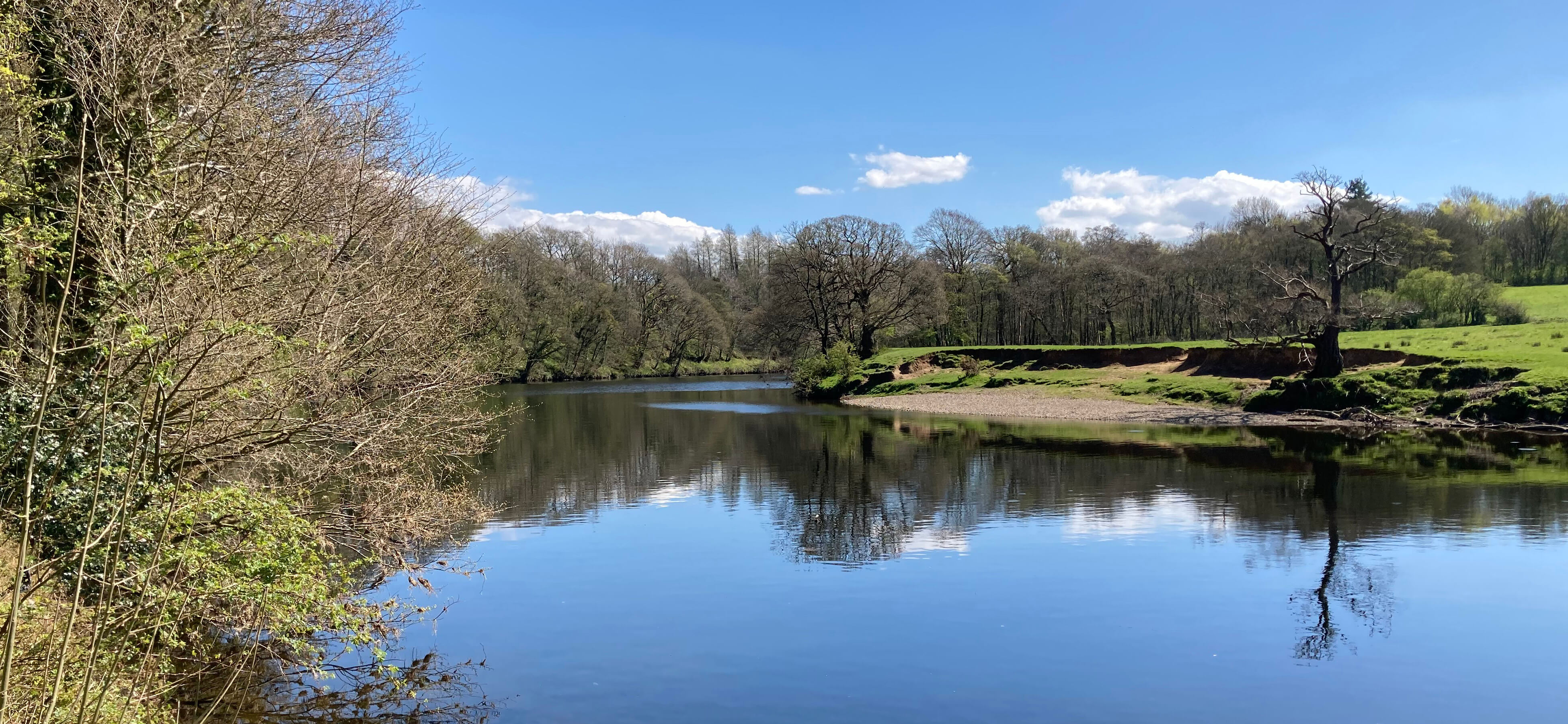
The M6 bridge from under the new bridge, showing an otherwise pleasant
stretch of the River Lune
Near the motorway bridges I came across a fulsome display of bluebells. Bluebells
already? Spring has really slipped by.
Beyond the M6 I walked through Halton, pausing at St Wilfrid's Church.
St Wilfrid was of the 7th century but the oldest part of the church is the 12th century
Norman stones built into the arch (although, of course, there may have been an
earlier church on the site). In the churchyard
stands a cross, 3.5 metres high, carved with Christian symbols and a version of the
Sigurd the Volsung legend by Norse settlers who came to the region in the 10th century.
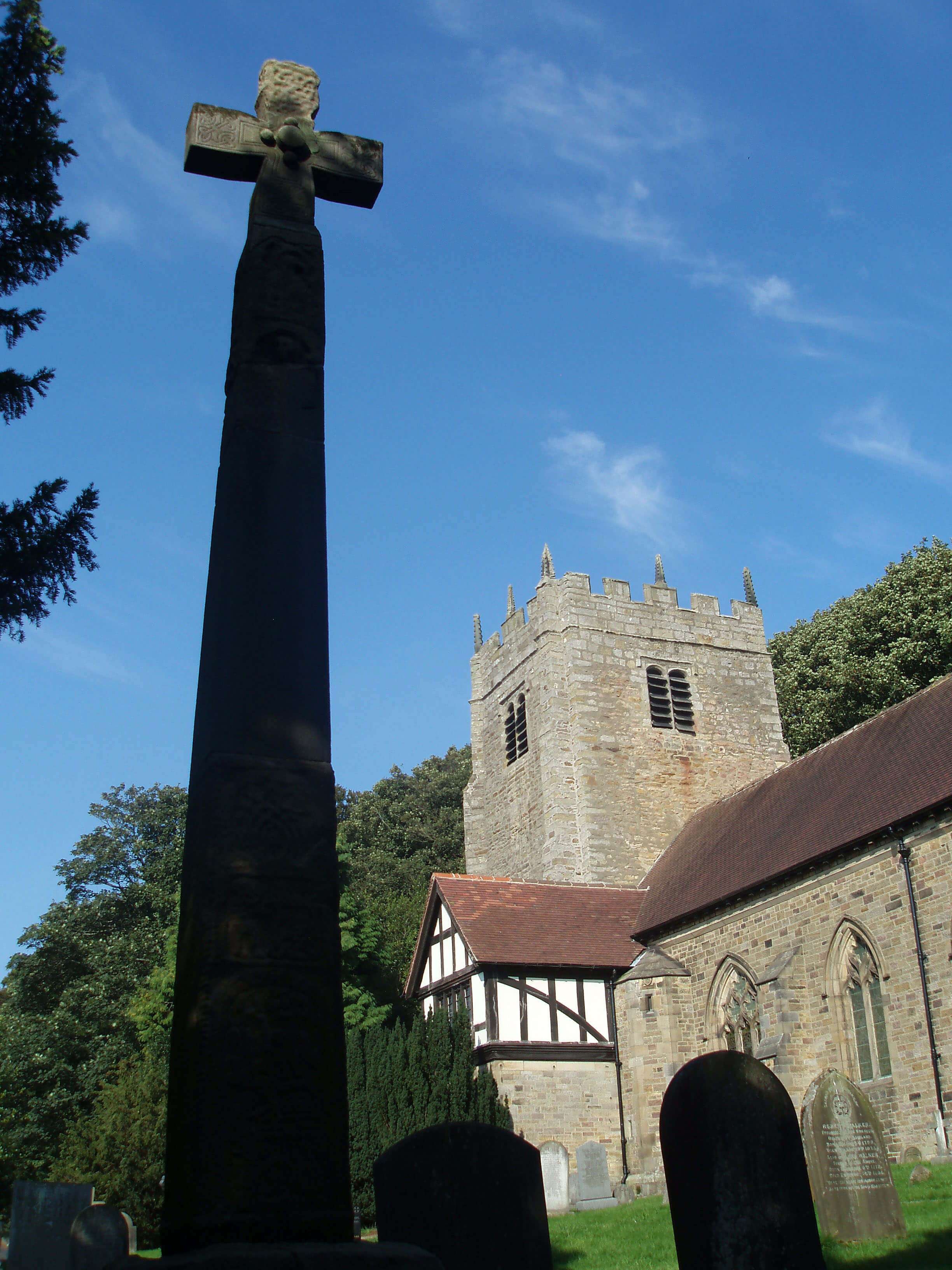
St Wilfrid's, Halton with Viking cross (this photo was
taken on an earlier occasion - today the cross is more shrouded by trees)
For the information about Sigurd above I am, as usual, reliant on experts, which is
an increasingly risky thing to be, now that computers can generate such plausible
nonsense that we must doubt anything we read. We recently asked ChatGPT to
generate a pleasant walk about our village. It duly obliged, with reassuringly precise
details. Unfortunately the walk bore no relation to the real world. When we queried
ChatGPT it blithely admitted that it didn't have access to maps, so had made the
walk up. Perhaps I should get ChatGPT to generate these Saunterings.
At the Crook oÆLune I continued by the Lune
to see if the sand martins had returned, another sign of spring. And of course they had,
in good numbers. But I saw no swallows. No swallows does not a summer make either.
Approaching the Crook o'Lune
Date: April 20th 2023
Start: SD427643, The Platform, Morecambe (Maps: 296, OL41)
Route: (linear) N around Midland Hotel, NE along prom û A589 û SE û
roundabout û E through Torrisholme, along Barley Cop Lane, along Hammerton Hall Lane û canal û
E along canal û Lune Aqueduct û NE on north bank of Lune û Halton û S, E on north bank, SE
û Crook oÆLune û NE on north bank û Waterworks Bridge û SE û Brookhouse
Distance: 9 miles; Ascent: 30 metres
Home
Preamble
Index
Areas
Dales
Hills
Lakes
Places
Reserves
Rivers
Structures
Villages
References
Me
® John Self, 2018-

Top photo: The western Howgills from Dillicar;
Bottom photo: Blencathra from Great Mell Fell