
Home
Preamble
Index
Areas
Hills
Lakes
Dales
References
Me
Saunterings: Walking in North-West England
Saunterings is a set of reflections based upon walks around the counties of Cumbria, Lancashire and
North Yorkshire in North-West England
(as defined in the Preamble).
Here is a list of all Saunterings so far.
If you'd like to give a comment, correction or update (all are very welcome) or to
be notified by email when a new item is posted - please send an email to johnselfdrakkar@gmail.com.
189. The Standard Pen-y-ghent Walk
 The walk from Horton-in-Ribblesdale up Pen-y-ghent is one of the most popular Yorkshire Dales
walks, and we saw no need to seek any variation. It is a walk that any reasonably fit person
can tackle for a satisfying day's outing.
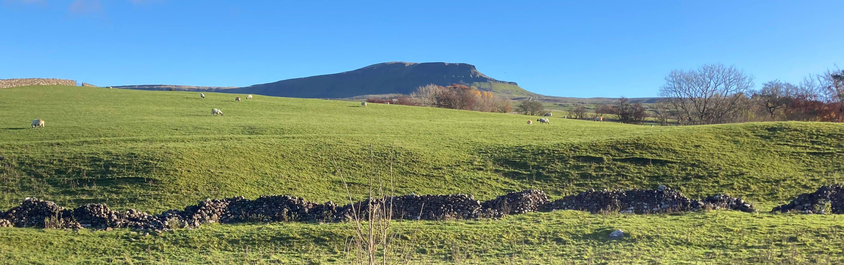
From Horton the objective soars high on
the eastern horizon (shown right). It is rare for a hill-walk to have the target so immediately visible.
The walk from Horton-in-Ribblesdale up Pen-y-ghent is one of the most popular Yorkshire Dales
walks, and we saw no need to seek any variation. It is a walk that any reasonably fit person
can tackle for a satisfying day's outing.
From Horton the objective soars high on
the eastern horizon (shown right). It is rare for a hill-walk to have the target so immediately visible.
We walked south through Horton, noticing that the Pen-y-ghent cafÈ was not yet open.
As we peered in the windows to see if it would be open for a cuppa on our return a man drove
from its car-park and told us that it has been closed for four years ñ from which we deduced
that it wouldnít be open for our cuppa. It was sad to see its demise. For years it had served
as a self-appointed base for Three Peaks walkers. If the four years is accurate then we canít
even blame covid for its closure. Iíd have thought a cafÈ here would thrive.
We walked past the church, along the lane to Brackenbottom, and on to the open fell.
Actually, it wasnít really the open fell: it was an artificial pathway of large flat slabs.
Prodigious efforts have been, and are being, made to protect (or replace) this path.
Clearly, the work is necessary because of the numbers of walkers, on the Pennine Way,
the Three Peaks walk, or just, like us, walking up Pen-y-ghent.
The new paths are obviously a help to walkers but I wondered what fell-runners
make of them. When I used to run on the fells I wore special shoes with hard-wearing,
studded soles to provide a grip. They were uselessly slippery on flat slabs. Now the
differently sized steps must make it difficult to get into a natural stride, especially
downhill. Still, I expect that fell-runners cause more wear-and-tear than walkers so itís
best we keep them away.
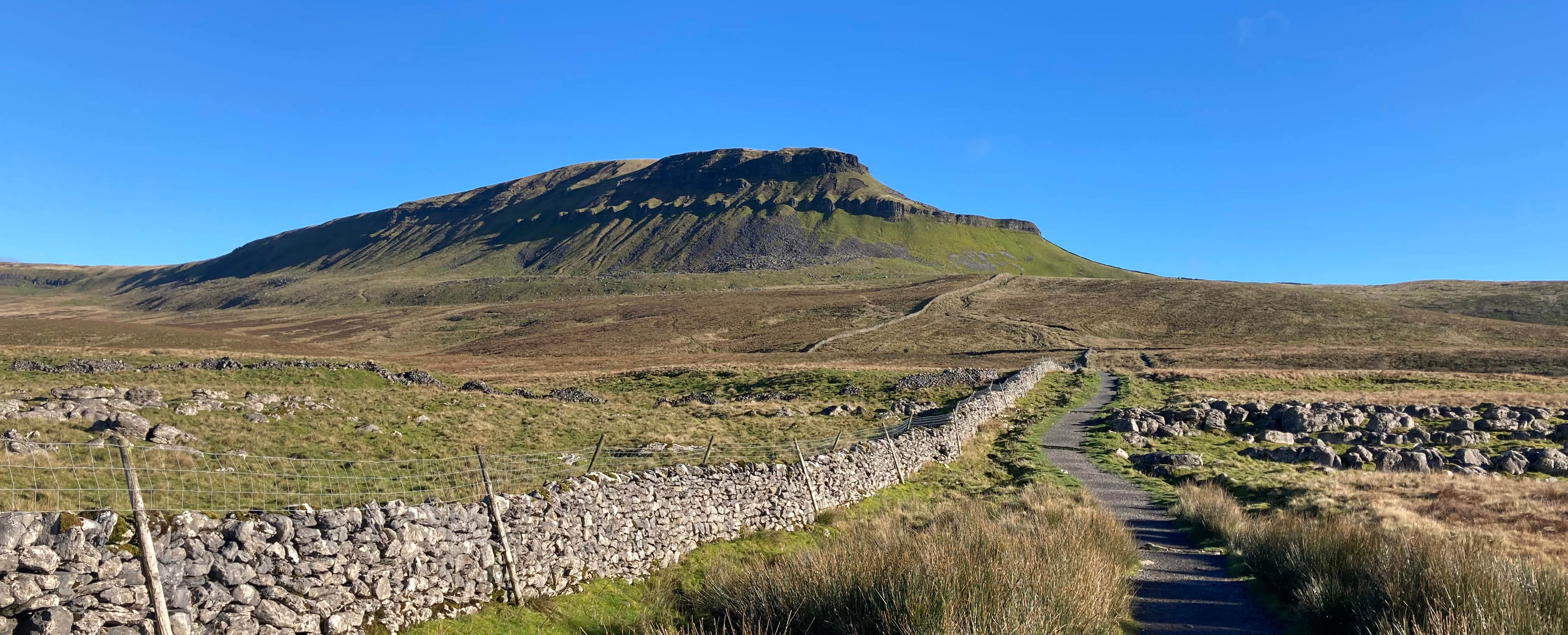
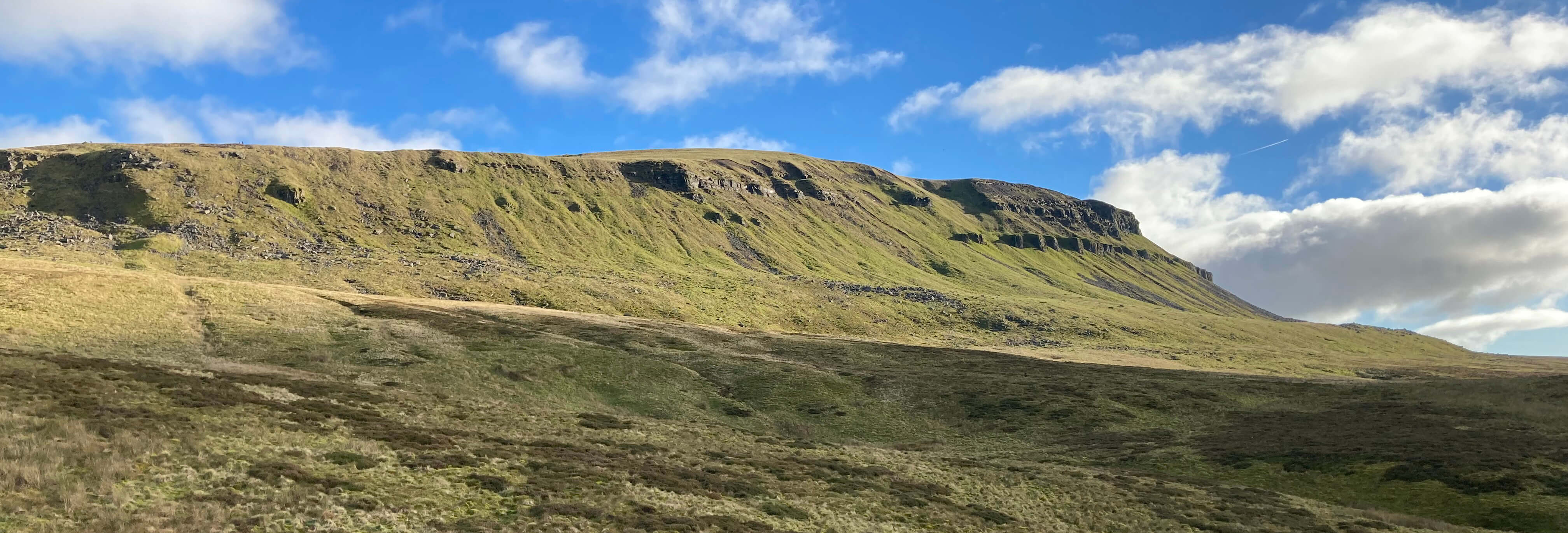
Pen-y-ghent from the path up from Brackenbottom
On the way up, the nose of Pen-y-ghent rears high to the left, with parts exhibiting an
alarming verticality. Of course, for walkers thereís a way around, scrambling up natural
steps in the limestone strata. This being a bright Saturday ñ perhaps the last for a
while, who knows? ñ there was quite a bottleneck of scramblers, but it was all quite
relaxed and sociable.
After the scramble itís a stroll of a few hundred yards to the top (694 metres). The view is, of course, extensive, with Ingleborough and Whernside to the west, Fountains Fell to the east, Pendle more distantly to the south, and also distantly some Lake District hills.
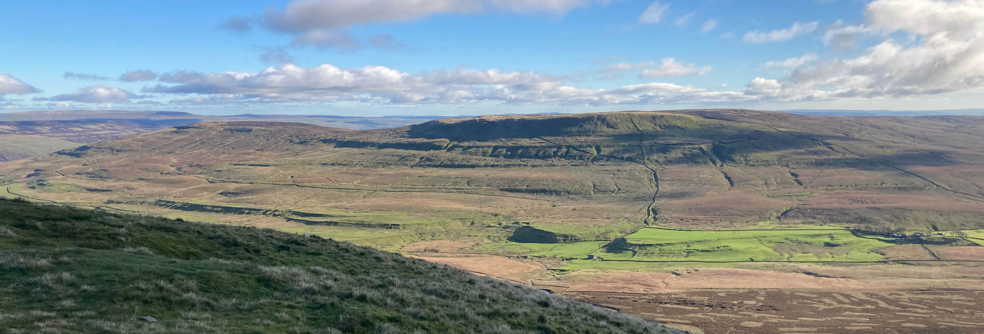
Fountains Fell from the top of Pen-y-ghent
This being such an obviously enjoyable walk, quite convenient from our home, I wondered why,
in six years of Sauntering, I hadnít already walked up Pen-y-ghent. Then I thought of
that walk up High Street [12]
in May 2018 when I commented on the great Lakeland peaks, listing nine of them, visible
from High Street, saying that ìI can hardly wait to visit them again during the course
of these Saunteringsî. As it happens, I have visited only one (Blencathra) of the nine peaks
I mentioned.
Perhaps I have lacked energy or enthusiasm. Perhaps the objective expressed
half-heartedly in the Preamble
to visit all 400 5km x 5km squares in North-West England, in order to give a balanced
impression of the region, has led me elsewhere. But I never really addressed that
objective and it necessarily faded away during the pandemic.
Iíll try to walk up more hills. Saunterings and I need fresh impetus. Walking
up a hill adds focus and provides a sense of achievement. But which hills
should I walk up? In [124] I listed the
most prominent hills
in North-West England, extracted from the
Database of British and Irish Hills.
The 'prominence' of a hill is equal to its 'drop', that is, the minimum vertical height
you have to lose when walking from its top to any higher hill. I think of the most
prominent hills as the 'top drops'. I remarked in
[124] that ìif you wanted a list of the best 100 hills
to walk up in North-West England then you could do worse than adopt the most prominent
100î. Whereas the highest hills are almost all in the Lake District, the top drops are
an interesting mix of generally isolated hills distributed around the region and some of them
are not particularly high.
So I will aim to walk up those of the 100 top drops that I havenít already
Sauntered up. In six years I have walked up only 26 of them (now including Pen-y-ghent).
Although, in general,
I will aim to walk up to the summit sometimes the slopes
of a hill are more interesting and enjoyable. I want to retain the spirit
of Saunterings as an eclectic mix of walks, high and low, with discussions of miscellaneous
associated issues. This can serve as a second half-hearted aim
to help me stride forward whole-heartedly.
Paragraph added later: I have listed the tops in the Hills website
and added a link to it in the banner at the top and bottom of these webpages (so
you can follow my progress, if any).
To avoid becoming obsessed with tops,
I have similarly added links to Lakes and
Dales (and, later, Places),
as they also provide
perfectly satisfactory objectives for a walk.
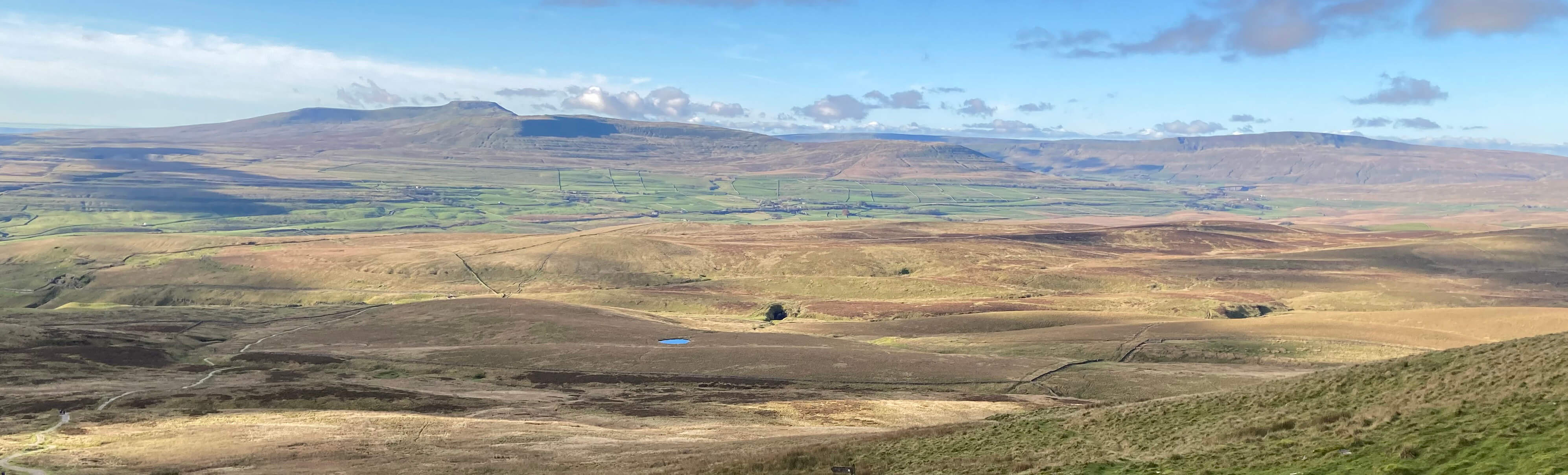
Ingleborough and Whernside from our lunch spot
From the trig point our path drops down diagonally across the flank of Pen-y-ghent.
We paused by the limestone pinnacles
for a lunch snack while walkers streamed up and down the path
(mainly down, as the anti-clockwise circuit is to be preferred). Continuing west,
the old wooden boards, always wet and slippery, have
long gone. We left the path briefly to look at the enormous chasms of Hunt Pot and Hull Pot,
the second of which is seen as the dark mark in the middle of the above photo.
Unlike many pot-holes, the 'charms' of Hunt Pot and Hull Pot are better appreciated by
walkers at the surface than by cavers underground (I understand that cavers cannot
get anywhere worth going underground). The evil-looking slit of Hunt Pot captures
becks flowing west from Pen-y-ghent. On our visit the water into Hull Pot was entering
from a waterfall at the base of the cliff ñ only after heavy rain does it enter at
the lip. The waters from both then flow underground to emerge near Horton.
We proceeded overground.
A look back at Pen-y-ghent
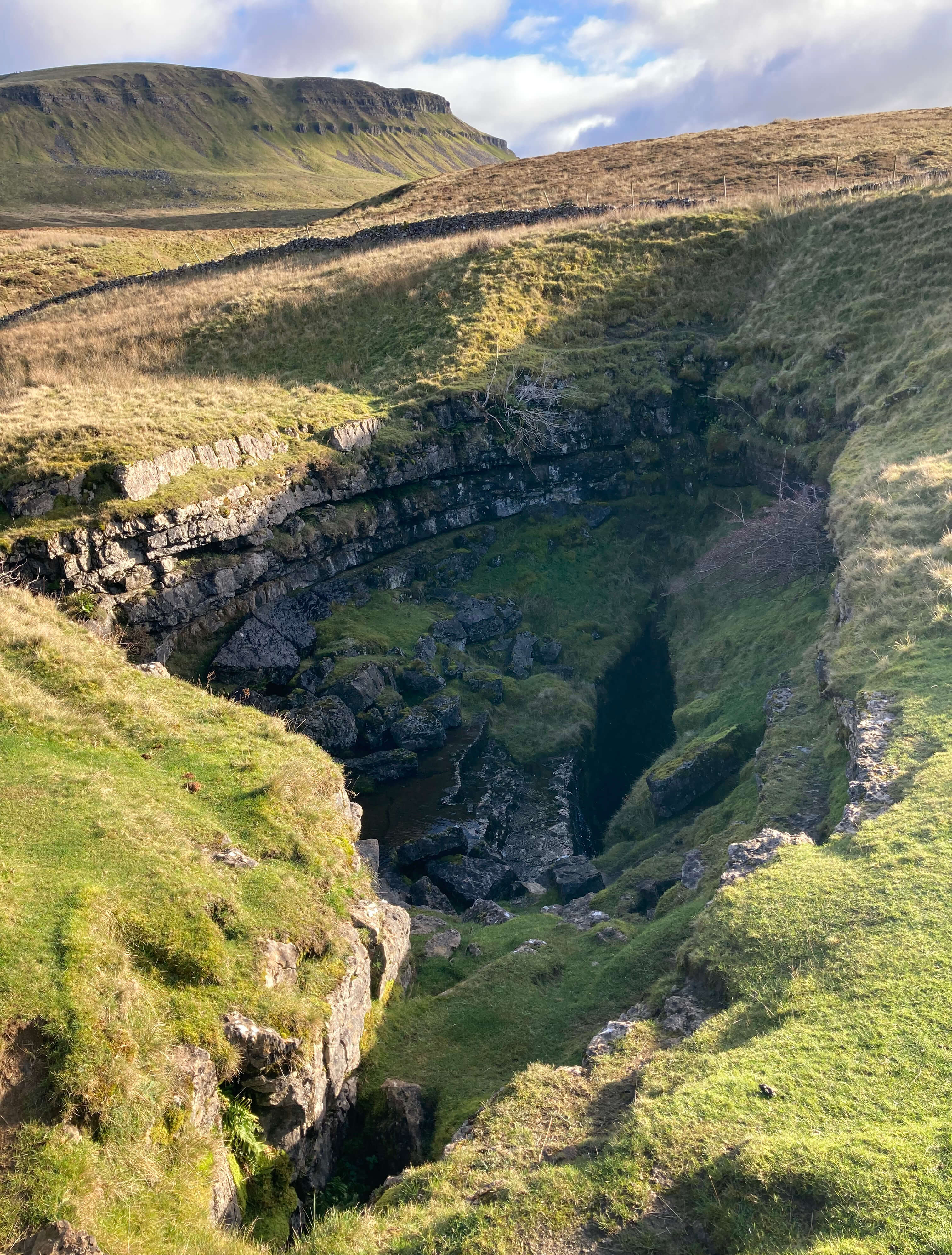
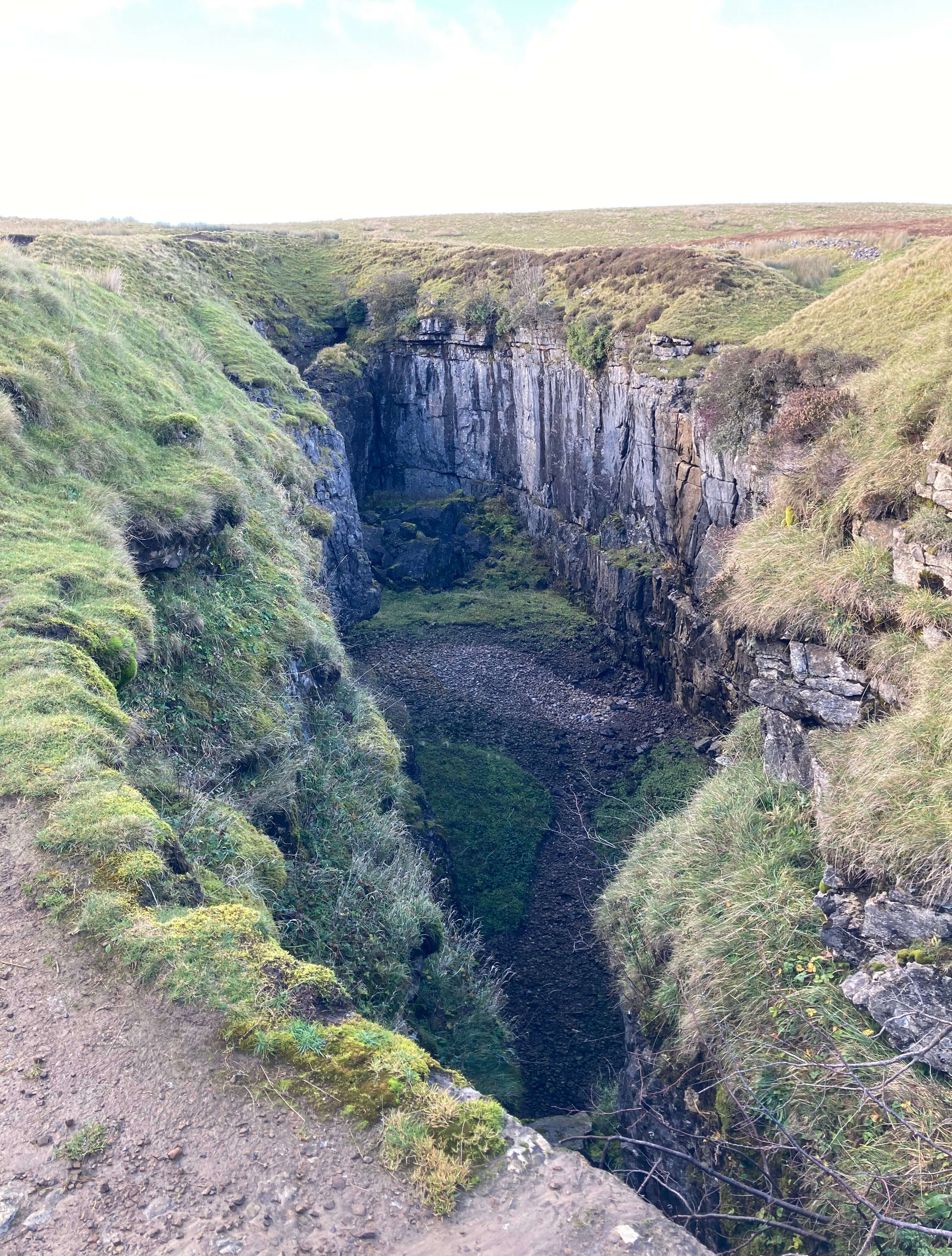
Left: Hunt Pot; Right:
Hull Pot.
Date: November 11th 2023
Start: SD807726, Horton-in-Ribblesdale car park (Map: OL2)
Route: S ñ Horton Bridge ñ E ñ Brackenbottom ñ NE, E, N ñ Pen-y-ghent
ñ N, W (detours to Hunt Pot and Hull Pot), SW ñ Horton
Distance: 6 miles; Ascent: 465 metres
Home
Preamble
Index
Areas
Hills
Lakes
Dales
References
Me
© John Self, 2018-

Top photo: The western Howgills from Dillicar;
Bottom photo: Blencathra from Great Mell Fell