
Home
Preamble
Index
Areas
Dales
Hills
Lakes
Places
Reserves
Rivers
Structures
Villages
References
Me
Saunterings: Walking in North-West England
Saunterings is a set of reflections based upon walks around the counties of Cumbria, Lancashire and
North Yorkshire in North-West England
(as defined in the Preamble).
Here is a list of all Saunterings so far.
If you'd like to give a comment, correction or update (all are very welcome) or to
be notified by email when a new item is posted - please send an email to johnselfdrakkar@gmail.com.
13. The Cairns of Grisedale Pike
From Garsdale Station I could see the cairns of Grisedale Pike. They stood like pimples on the horizon of east Baugh
Fell, some two miles away. Our northern hills have thousands of cairns but few of them are as finely located as those
of Grisedale Pike. Do we have too many cairns? What are they all for? Grisedale
Pike was my first objective, and as
I slogged up the long slope, accompanied by an insistent cuckoo (my first of the year) and admiring the emerging view
of Whernside and Ingleborough to the left and Mallerstang and Great Shunner Fell to the right, I contemplated the nature
of cairns.
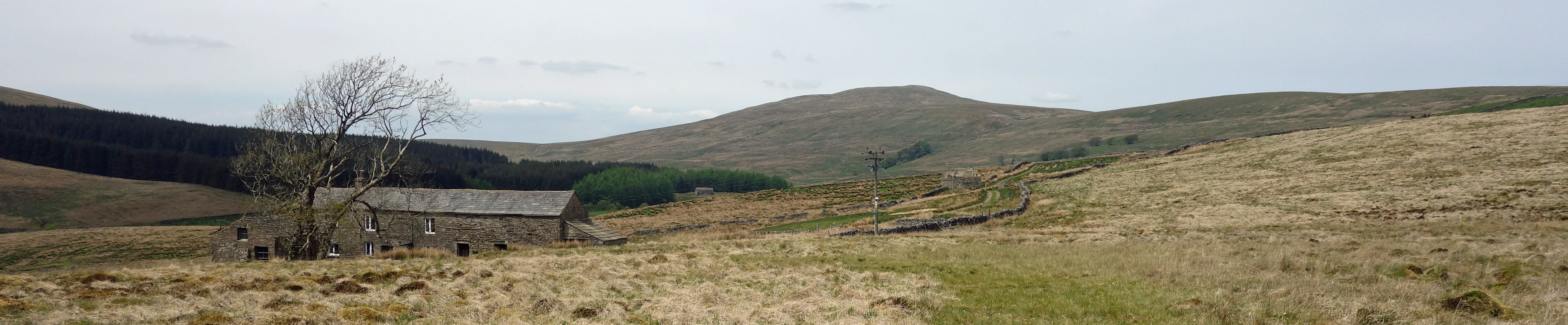
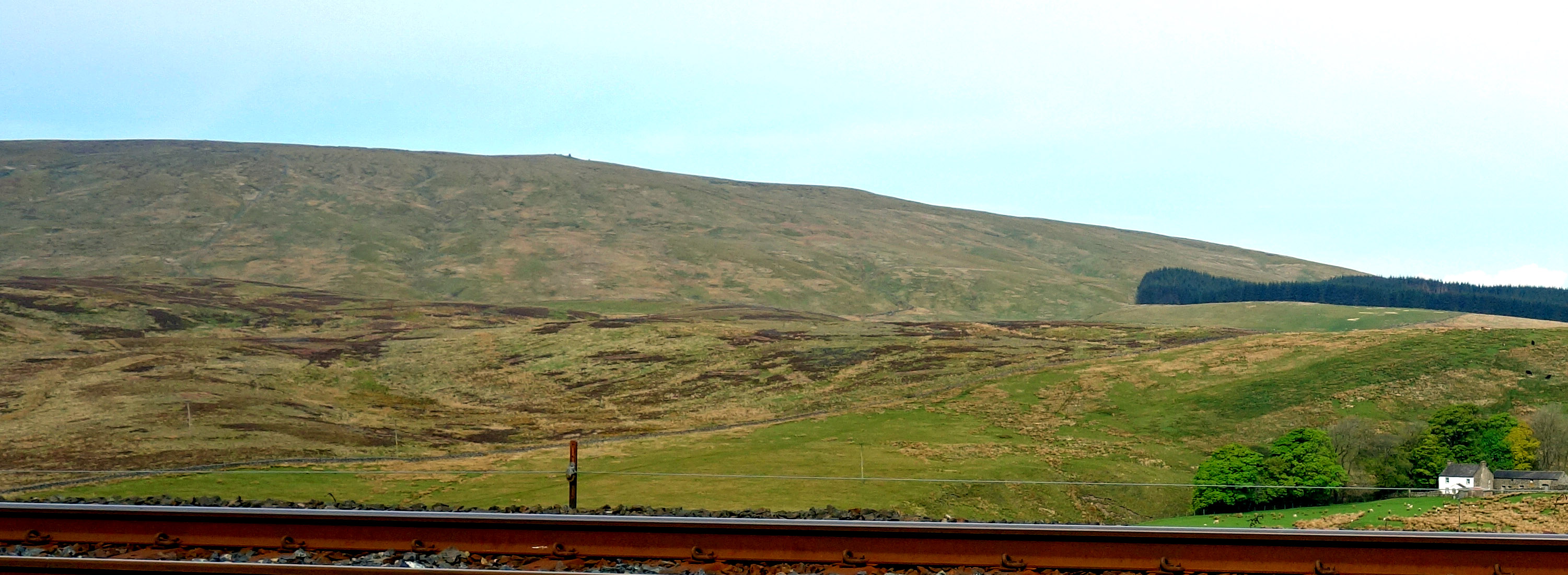 Right: Grisedale Pike (the cairns are directly above the post).
Sometimes the word ‘cairn’ is used for just a mound of stones but here I am meaning a cylindrical stack of
rocks, usually constructed by methods similar to dry-stone walling, a few inches to several feet high. Such a cairn
could fall down, whereas a mound looks like it has already fallen down. A cairn is often on a hill-top or skyline,
like those of Grisedale Pike, or, more typically, beside a trail. It is, of course, intended to be seen.
There seem to be three purposes for a cairn. One is to mark a significant site, for example, a memorial.
Some ancient cairns mark burial sites. A second purpose is to serve as some kind of personal or spiritual statement,
perhaps as a work of art. The sculptor
Andy Goldsworthy
has created a number of cairn-shaped artworks to adorn the
landscape. At this very moment, an
'Art of Balance Exhibition'
in Edinburgh is displaying the art of stone stacking.
Apparently, “an international community of land artists are finding mindfulness, meditation and patience in the art
of finding the balance”. I have not seen any examples of their work on the hills of North-West England but even so
many of our more down-to-earth cairns are more elaborate than seems necessary and may be thought to have some aesthetic
merit. For example, Thornthwaite Beacon, near High Street, is an impressive 14 feet tall.
Thirdly, a cairn may serve as a landmark or guide, to shepherds or walkers, for example. Sometimes a cairn
acts as a magnet, as Grisedale Pike was doing for me. In addition to landmark cairns, walkers are blessed with many
smaller cairns intended to indicate a route. Indeed, many walkers feel it their duty to add a rock to a cairn, or to
start a new one, as they walk by. The outcome is a profusion of cairns of doubtful utility. Harry Griffin counted 128
cairns on the Nan Bield pass, where it would be an achievement to lose the trail even in fog.
Apart from this unnecessary proliferation, there are other objections to cairns. First, of course, it involves
moving rocks from their natural position. While one person moving one rock is no big deal, if thousands of walkers do
so then obviously this will expose soil and increase erosion. Also, there is the simple fact that we do not have the
legal right to move rocks and build structures on land that is not ours. Perhaps the most serious complaint is that
cairns interfere with the natural wilderness that we sometimes seek away from humanity. They make it clear that
others have been this way before us, and that they are guiding us where to go. To some walkers, cairns are like other
detritus left by inconsiderate walkers or even a form of graffiti. At all events, it is clear that cairn-making does
not accord with the ‘leave-no-trace’ ethic advocated for walkers.
I noticed no cairns to guide me up to Grisedale Pike. The direction is obvious, although the pudding shape of
Baugh Fell ensures that, once you embark on the walk up, the Grisedale Pike cairns are never in view until you've
almost reached
them. As I reached Grisedale Pike, I saw that there were several cairns here, in various states of repair – fourteen,
counting generously. This raises the further question:
Why are there often several cairns and not just one? There
are other groups of cairns in our region, such as the Megger Stones in Dentdale and Nine Standards Rigg above Kirkby Stephen.
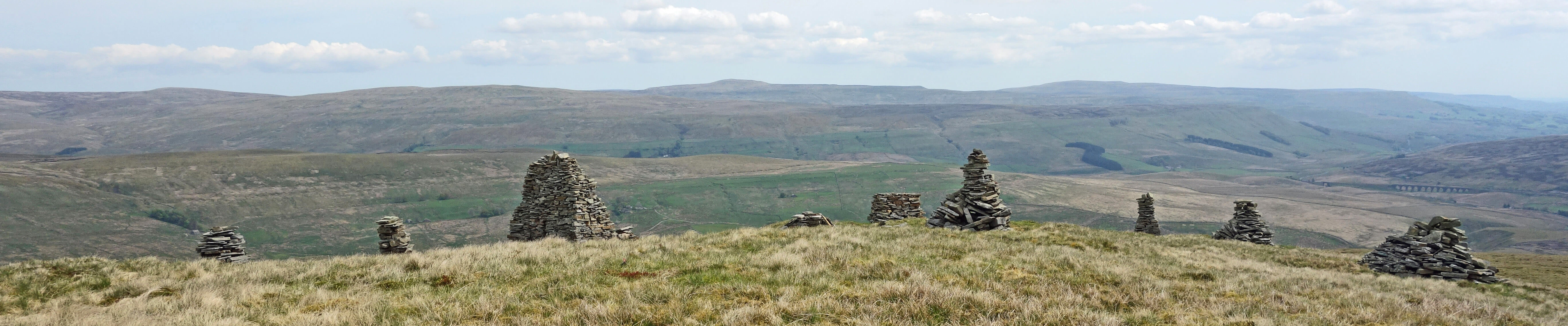
Grisedale Pike
Perhaps it is simply to underline the special nature of the spot, and Grisedale Pike is certainly an excellent viewpoint. Or it could be because there happens to be a plentiful supply of the right kind of rocks to hand. Cairns tend to be made of flat slates that can be fitted together. Here, after walking up a long, featureless, grassy slope, it makes an agreeable change to come upon a rocky outcrop with loose millstone grit slates lying about. There seems no harm in adding a few slates to the piles – and, of course, to admire the views of the surrounding hills and the valleys of Rawtheydale and Wensleydale.
Despite having come as far as Grisedale Pike (at 620 metres), I felt no obligation to continue up to Tarn Rigg Hill (678 metres),
the highest point of Baugh Fell. I have been there before, so I knew what I was prepared to miss. There is nothing at all
(certainly no cairn) to indicate the top, and the peat is tiring and uninspiring. Yes, a view from a mountain top is
always good but I decided to forego it this time and instead drop down by Shorter Gill, over some limestone scars,
into Grisedale.
I wanted to see how the dale was getting on, after its demise reported by ‘The Dale that Died’ book
(Cockcroft, 1975) and
TV programme.
The latter tells how the fourteen hardy hill-farming families had gradually moved out, unable to make a
living in this high, remote valley, to be replaced by a lone incoming ex-miner (and wife). We see him
tending sheep in the mud and snow, riding uphill to the accompaniment of Sibelius’s 5th, and spending
a lot of time with
the local chapel (I skipped this part).
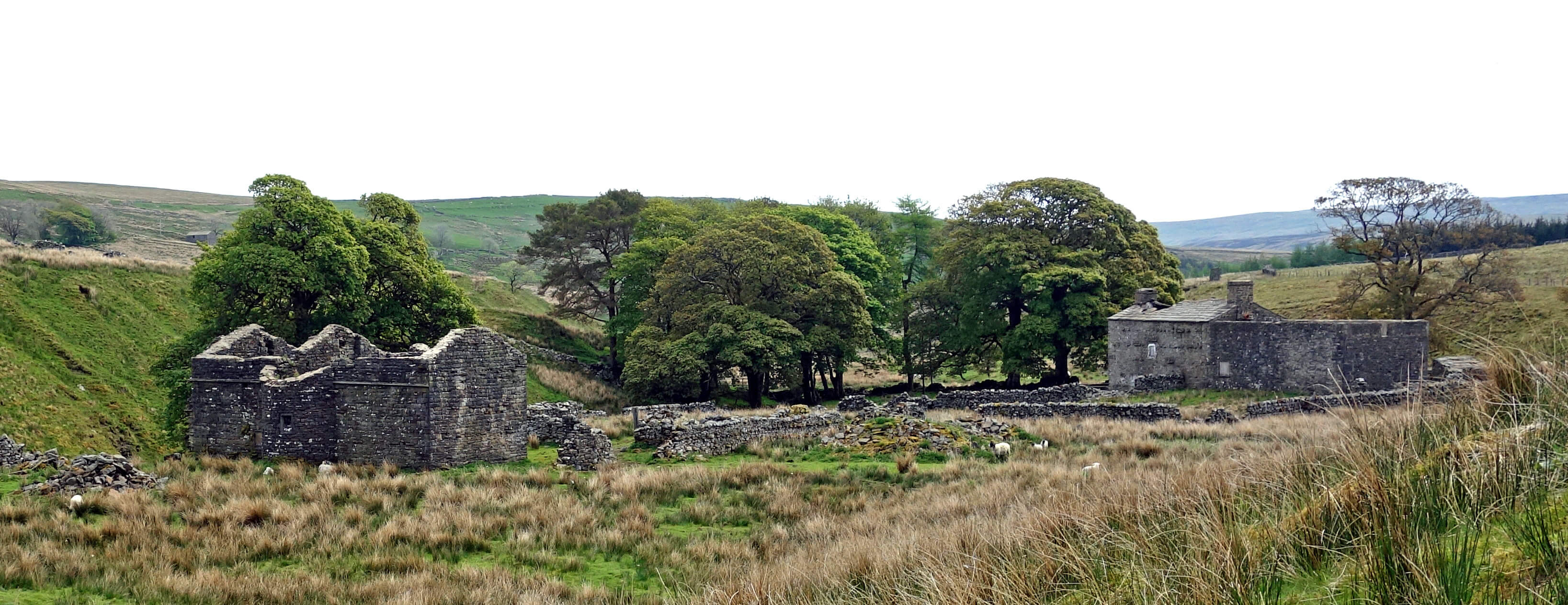
The abandoned farms of West Scale and East Scale
We humans think a lot of ourselves. A dale does not die just because people move out.
On the contrary, wildlife returns. It becomes more alive than it was with people there. Anyway, the dale is
not empty of people today. It is true that there is only one farm (Mouse Syke) left but most buildings have
been renovated, presumably as holiday homes. A few of the old farmsteads, however, are beyond repair. West
Scale and East Scale, for example, are impressive ruins, or rather are ruins of once impressive farm buildings.
Reachey was described as derelict by Wainwright (1972) but now it is receiving the final touches of
a renovation so thorough that I doubt that much of the original dereliction remained. The once-ruined Aldershaw is
now surrounded by mature trees that make it hard to appreciate the quality of its renovation.
Blake Mire, an exposed, desolate building, also seems in the process of resuscitation: it has a new roof and
windows. Despite this evident vitality I am afraid that Grisedale will be stuck with its epitaph for some time,
thanks to those who keep mentioning it.
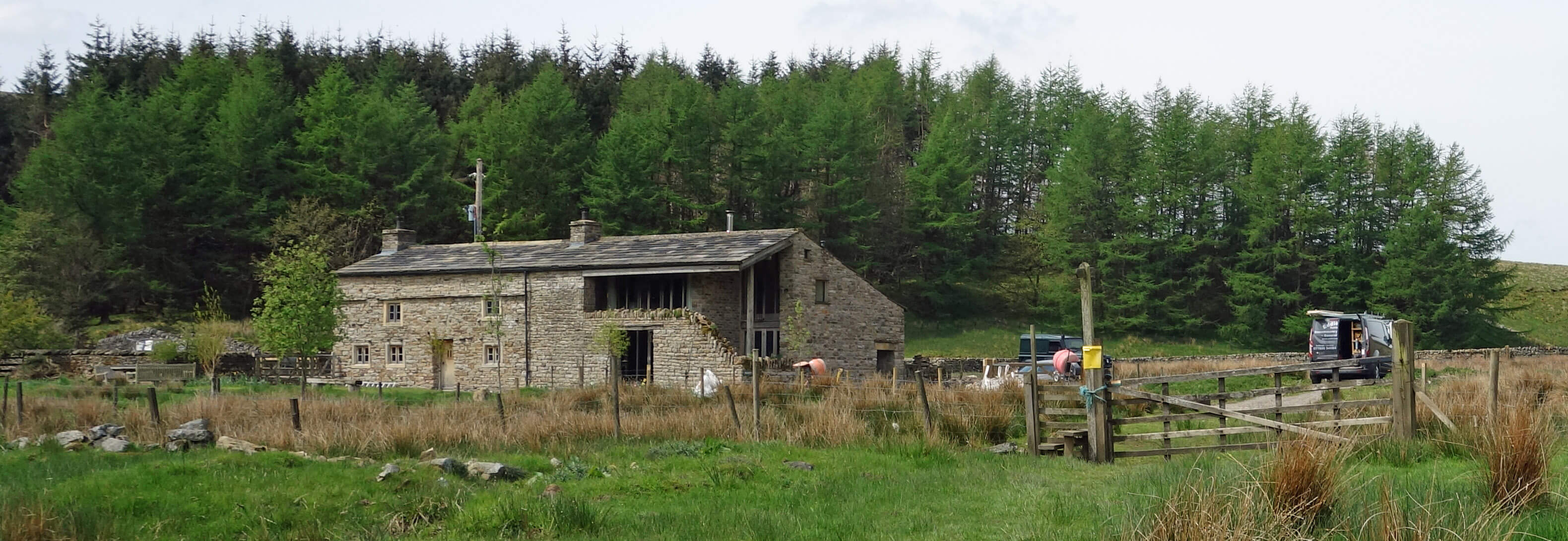
Reachey
Blake Mire
Date: May 18th 2018
Start: SD787917, near Garsdale Station (Map: OL19)
Route: N, SW on A684 and Old Road – N – Riggs – W – Grisedale Pike – NE – West Scale –
SE – Reachey, Blake Mire, Garsdale Station
Distance: 6 miles; Ascent: 350 metres
85(+962)/2250
Home
Preamble
Index
Areas
Dales
Hills
Lakes
Places
Reserves
Rivers
Structures
Villages
References
Me
© John Self, 2018-

Top photo: The western Howgills from Dillicar;
Bottom photo: Blencathra from Great Mell Fell