
Home
Preamble
Index
Areas
Dales
Hills
Lakes
Places
Reserves
Rivers
Structures
Villages
References
Me
Saunterings: Walking in North-West England
Saunterings is a set of reflections based upon walks around the counties of Cumbria, Lancashire and
North Yorkshire in North-West England
(as defined in the Preamble).
Here is a list of all Saunterings so far.
If you'd like to give a comment, correction or update (all are very welcome) or to
be notified by email when a new item is posted - please send an email to johnselfdrakkar@gmail.com.
14. Logging Along the Cam High Road
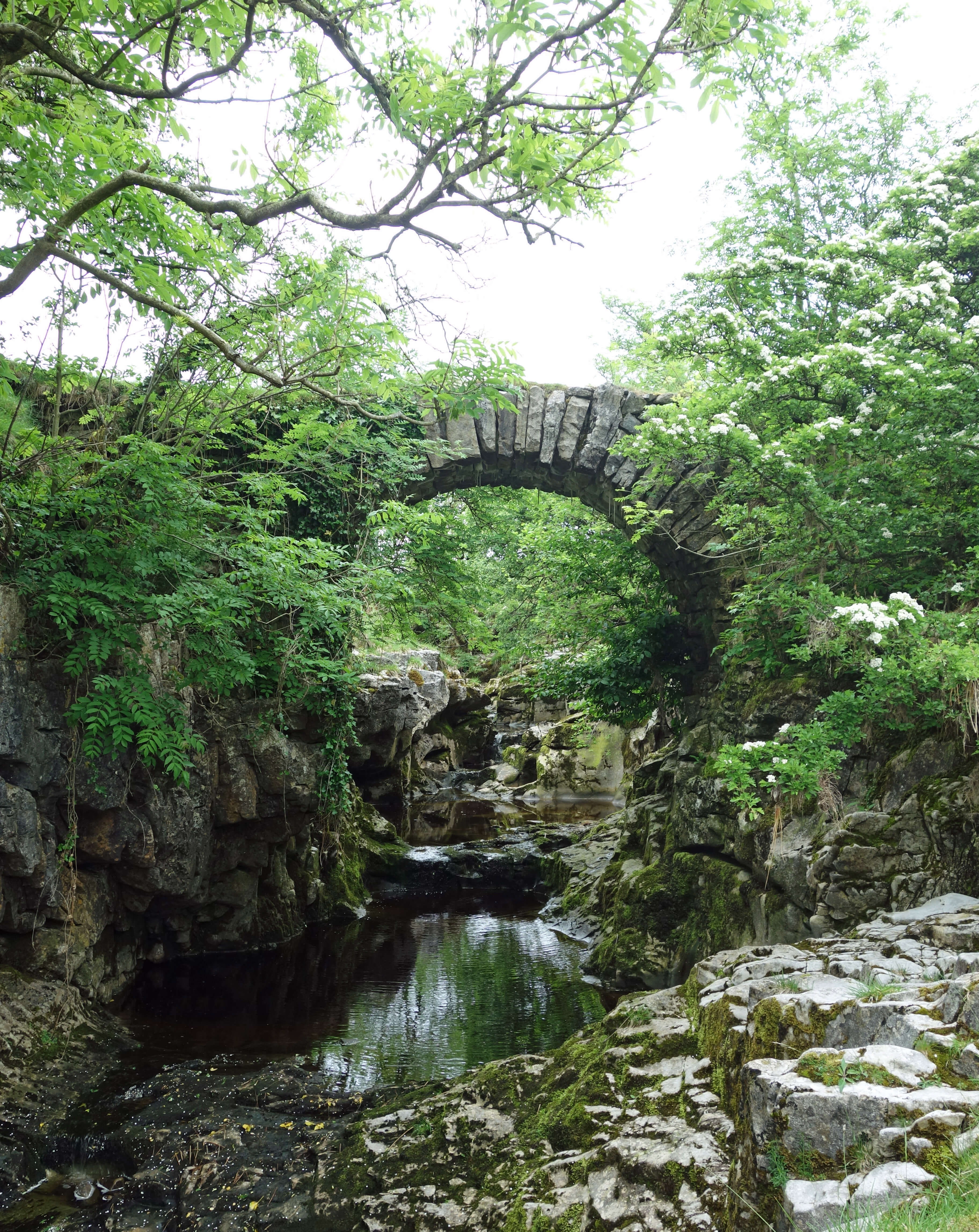 Right: Thorns Gill bridge.
Should the Cam High Road be made a proper road? Is it fit for purpose
in the 21st century? The answer depends, of course, on what its purpose is
deemed to be. However, before tackling
that question I treated myself to a detour. I walked to Thorns Gill, within which flows the
infant River Ribble, in order to see the splendid little bridge with a narrow arch perched
across a mini-gorge. If fairies lived then they would surely live here. I continued
alongside the beck past various small waterfalls, by many dark, deep pools, and by Katnot Cave,
where gushing water could be heard but not seen.
And then out on to the open moor to walk up the Cam High Road. It is a track that runs for about
ten miles, reaching a height of nearly 600 metres, between Bainbridge in Wensleydale and Gearstones at Ribblehead.
It is on the line of a Roman road between the camp at Bainbridge and camps to the south, such as Ribchester
in the Ribble valley. It is therefore a track of considerable vintage.
 In 1751 the Cam High Road became part of the Lancaster-Richmond turnpike. The first turnpike act in England had been passed in 1663, making travellers contribute to the maintenance of roads for the first time. Previously, it had been the responsibility of those living by the road to keep it in good repair, but they had little incentive to do so and nobody lived by the Cam High Road anyway. The first turnpikes in the north were created fairly late in the process but the Lancaster-Richmond turnpike was one of the first, and certainly one of the most important, in the region. All of the Lancaster-Richmond route was subsequently surfaced apart from the Cam High Road, which remained a track much like it was in 1751.
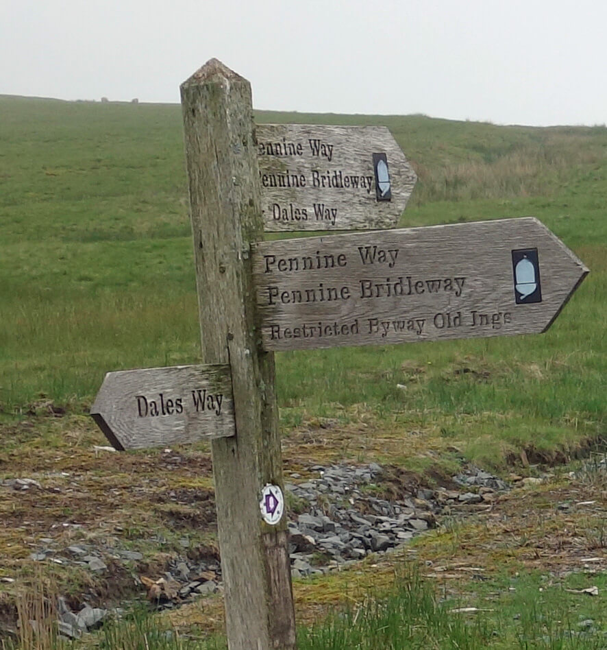
In 1965 the Cam High Road between Cam End and Kidhow Gate became part of the Pennine Way, England’s first Long-Distance Path. Later it also became part of the Dales Way and the Pennine Bridleway. In the early 21st century, the walkers and horse-riders on these paths began to be accompanied by ‘green-laning’ motor-cyclists and drivers of 4x4s. A ‘green lane’ is not a legal term but is generally understood to mean an unsurfaced, public byway used for recreational purposes. After some controversy, a Traffic Regulation Order deemed that the Cam High Road is not a green lane and hence this absurd activity – flaunting off-road vehicles, damaging the track, and annoying track users on legs – is no longer allowed there.
The Cam High Road faced a new challenge in 2011. Forty years before, thanks to generous tax concessions,
land owners had planted coniferous forests at Cam Woodlands and Greenfield Forest, to the east of the Cam High Road.
Now the time had come to harvest this crop of timber. It seems that, in the hurry to profit from those tax concessions,
not much thought had been given to how this harvesting might be done. There is a narrow, winding road from Cam Houses
north to Gayle but instead
permission was sought
to use the more direct Cam High Road south to enable huge timber trucks
to get to and from the forests. Extraction work began in 2011 but was immediately halted when the historic track was
seen to be damaged. I understand that some agreement was reached to allow the felling to continue but whether this
involved work on the Cam High Road or the road to Gayle I am not sure.
I thought I’d walk up to see how the Cam High Road and the trees of Cam Woodlands and
Greenfield Forest were getting on. On the way up I was passed by a van with ‘Komatsu Forest
Quality’ on its side. So forestry work was on-going and vans did use the track. I could not,
however, believe that timber trucks could use it, as the track was much as I remembered it,
being somewhat eroded in places, although it is perhaps wider and more stone-surfaced than it
was, creating a more visible scar on the hillside. I walked on up but sadly, at about 500 metres, I met the cloud coming down. I reached West Gate where a sign warned of operations being carried out by K.R. Dodd Forestry – but I could see nothing of them. I could not see the trees for the cloud and therefore, sorry, I cannot report on how the timber extraction is progressing.
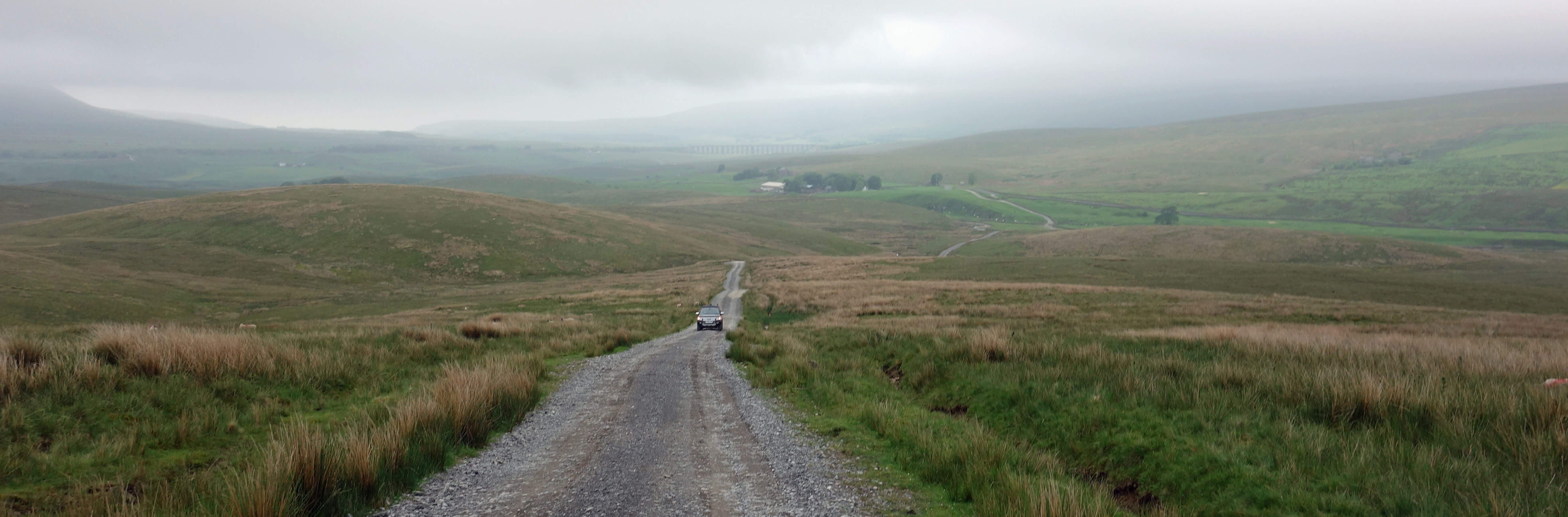
Cam High Road
I strained my ears to hear any sound of work but all was silent. Actually, I became more
aware of the sounds, now that I could see so little. The clouds hissed over the grass.
I heard the occasional morose sheep somewhere out there. I heard curlews but now with
only snatches of their early spring burble, or just a staccato beep-beep-beep, or sometimes
an even more staccato five-beep version. I heard lapwings, also less flamboyant than
earlier in the year. I disturbed two golden plover before they could treat me to the
plaintive whistle that would so suit the conditions. I did not hear any grouse, even
though I passed several grouse butts. They were all dilapidated apart from one line of
butts that had recently, if optimistically, been re-furbished. This line ran across
the Dales Way. Are walkers and shooters compatible?
The dominant sound, however, was that of the skylark. Its song was like a continuo throughout the ten-mile walk, as I could hear one or more skylarks for almost every step of the way, even in the cloud. A recent radio item reported that half the people surveyed had never heard a skylark. This was presented as evidence that skylarks aren’t about as much as they used to be. It might also be evidence that people don’t get about as much as they used to.
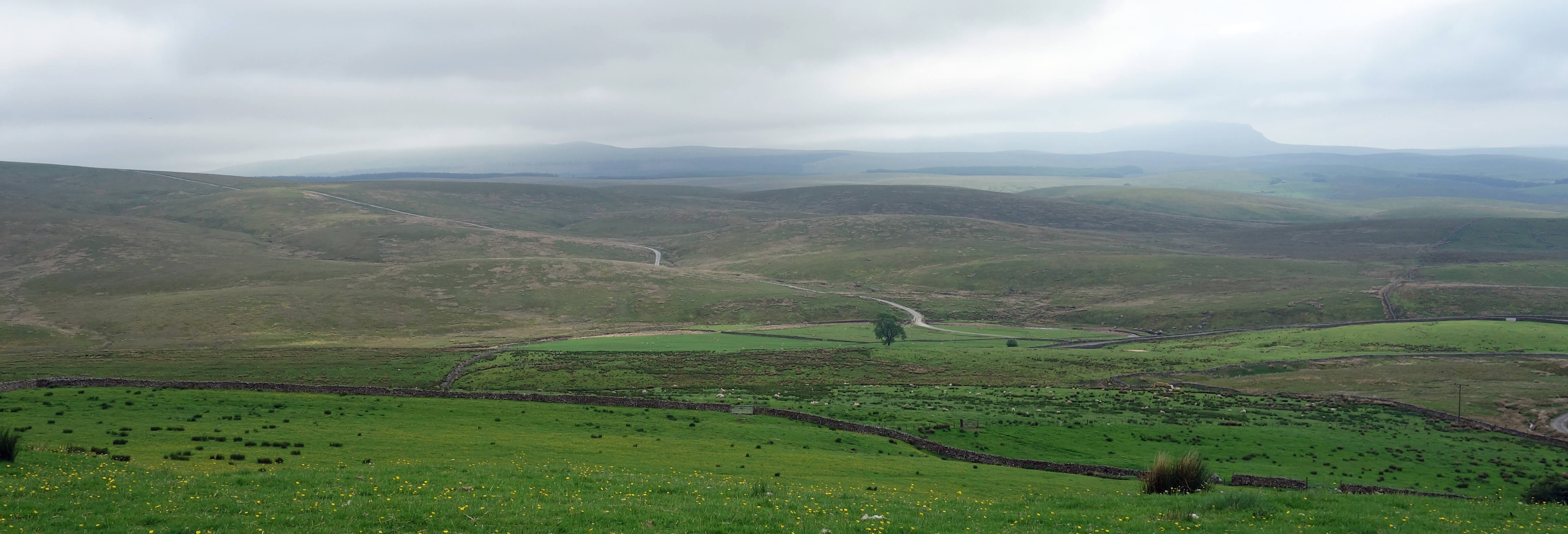
Cam High Road from the Dales Way (Pen-y-ghent beyond)
Date: June 4th 2018
Start: SD771796, on Blea Moor Road at Ribblehead (Map: OL2)
Route: NE – Ribble Head House – S – Thorns Gill – NE, by Katnot Cave – Cam High Road –
E, NE – gate beyond West Gate – NW, N – Gavel Gap – W on Ribble Way, W on road – Stoops Moss – S on Dales Way –
Gearstones – SW – Blea Moor Road
Distance: 10 miles; Ascent: 260 metres
Home
Preamble
Index
Areas
Dales
Hills
Lakes
Places
Reserves
Rivers
Structures
Villages
References
Me
© John Self, 2018-

Top photo: The western Howgills from Dillicar;
Bottom photo: Blencathra from Great Mell Fell