
Home Preamble Index Areas Hills Lakes Dales References Me
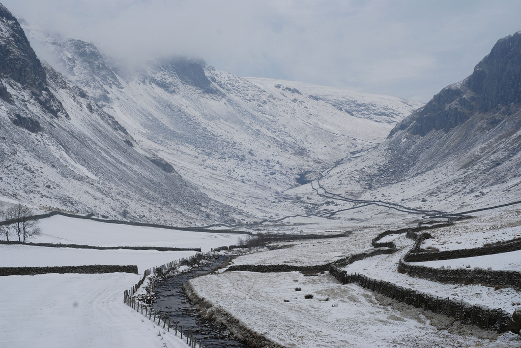
Longsleddale and Gatescarth Pass, Boxing Day, 2010 (Photo: Pamela Self)
This being the time of year for reflections on the past and plans for the future – and when the cold, the rain and the wind confines softies like me to the armchair by the fireside – I thought I'd escape by amusing myself with memories of an epic 60-in-60-by-60 challenge – namely, to reach the top of the 60 highest mountains in Wainwright's list of 214 within the 60 days before my 60th birthday. Perhaps you'll be interested in the words written at the time, so I've included them below.
 2. High Stile
This was a walk on a fine sunny day with Ruth and daughter Pamela, up from London.
Buttermere does, of course, make an excellent outing for a day in the Lake District, for those here only
briefly. Buttermere is surrounded by a number of lofty tops but only one of them, High Stile, makes
the highest 60. Therefore it made sense to bag the lonely High Stile
– and include the non-counting Red Pike and High Crag – on one of the classic lakeland walks.
We walked south from the village of Buttermere to Burtness Wood and up through the wood to Bleaberry Tarn,
where lunch was taken.
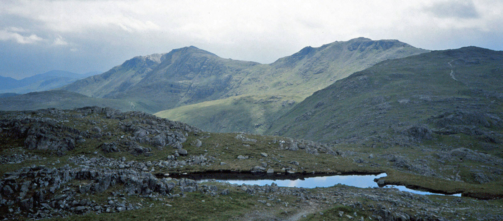
Then we walked west to The Saddle and up the red slopes to the top of Red Pike (755m).
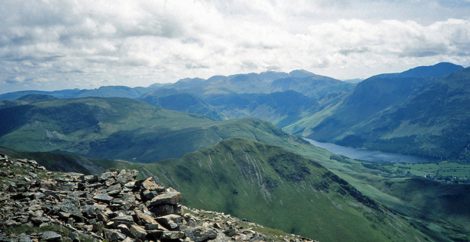
From here we bowled along (photo left) the ridge south-east to HIGH STILE (807m),
with views of Skiddaw, Helvellyn, Great Gable, Scafell,
Pillar, and so on, and of five lakes, Bleaberry Tarn, Buttermere, Crummock Water, Ennerdale Water and Loweswater.
We continued above the precipitous Grey Crag and Eagle Crag to High Crag (744m).
The photo right is the view across to Fleetwith Pike. It was then a scramble down the scree of Gamlin End and then by a wall (followed by two garrulous Americans) to
Scarth Gap. We dropped down to the
south-west corner of Buttermere, and walked by the lake and through
Burtness Wood back to the village, and a drink at the Bridge, followed by supper in the van on Honister Pass.
3. Dow Crag, Brim Fell, The Old Man of Coniston
After squeezing the van in the space at the end of the lane
to Scarr Head,
I ran up the lane and along the track and past the disused quarry with its waterfall.
Continuing to Torver Bridge, I reached the track of Walna Scar Road and ran up to the col.
It was then along the fine ridge south, passing a few walkers who looked at me as if questioning
the wisdom of running on these crags in cold and cloudy weather, and over Brown Pike (682m), Buck Pike (744m) and DOW CRAG (778m).
After dropping down to Goat's Hawse and up to BRIM FELL (796m),
it was south to The OLD MAN OF CONISTON (803m).
Here a fair number
of walkers had congregated, admiring the views of Coniston Water, many Lakes peaks, Sellafield, and the
top half of the Isle of Man, although the views were, in fact, not so clear.
I cut north-west back to Goat's Hawse and then tried to run south by Goat’s Water,
but the accumulated boulders made this difficult. From there, it was over The Cove and on to the
old quarry and back.
4. Haycock, Scoat Fell, Steeple, Pillar, Red Pike
On a cloudy, rain-threatening day I was tipped out at Netherbeck Bridge
to run on the fells while Ruth proceeded to the Wasdale camp site.
I ran north by Nether Beck, leaving it after a couple of miles in order to continue by Ladcrag Beck
to reach the ridge past High Pikehow and Gowder Crag, which I scrambled up to reach
HAYCOCK (797m). Following the wall east, I reached SCOAT FELL (841m) and made the short detour to STEEPLE (819m).
It was cold and rough going, but I didn't shorten the run and continued to make the there-and-back run
across Wind Gap to the outlier PILLAR (892m). There were grand views of High
Stile, and so on (visited on walk 2) and down to Wasdale Head.
Back, skirting Scoat Fell, I turned south to RED PIKE (821m) and
on to Dore Head and then began to drop
down by Over Beck. It now began raining. I had seen nobody on the fells all day
(well, it was rather bleak), until near
Dropping Crag I saw a woman walking up. It was Ruth coming to meet me, which was good of her, of course,
but it did mean that out of politeness I had to walk with her back to the Wasdale camp site,
getting increasingly wet and cold.
On reflection, it was a rather foolhardy run. It was long, lonely and over difficult terrain, in far from ideal
weather.
 5. Kirk Fell
It rained all morning and low cloud sat on the hills.
It is, of course, possible to walk on the hills in cloud and rain (and some people – not me – profess
to enjoy it) but it was early days in the '60 in 60' challenge and we could hope for better days later.
We hung around all morning and had lunch in the Wasdale Head inn, after which the cloud lifted a little.
We thought that we might at least be able to get up KIRK FELL (802m).
So, from the Wasdale Head car park we walked straight up the southern slope to find its top, in cloud (the photo
left of Wasdale was taken before we reached the cloud).
There were occasional views of Great Gable and Pillar as the cloud swirled about.
We walked by
Kirkfell Tarn and down Rib End to Beckhead Tarn, and then turned south to walk above Gable Beck,
with fleeting views of Lingmell, back to Wasdale Head, where Great Gable could be seen to be still in cloud (photo right).
We lingered for tea and supper
before returning home.
6. Caudale Moor, Red Screes
This outing was in two parts, a short run and a short walk,
the aim being to tick off two peaks that cannot easily be combined with others.
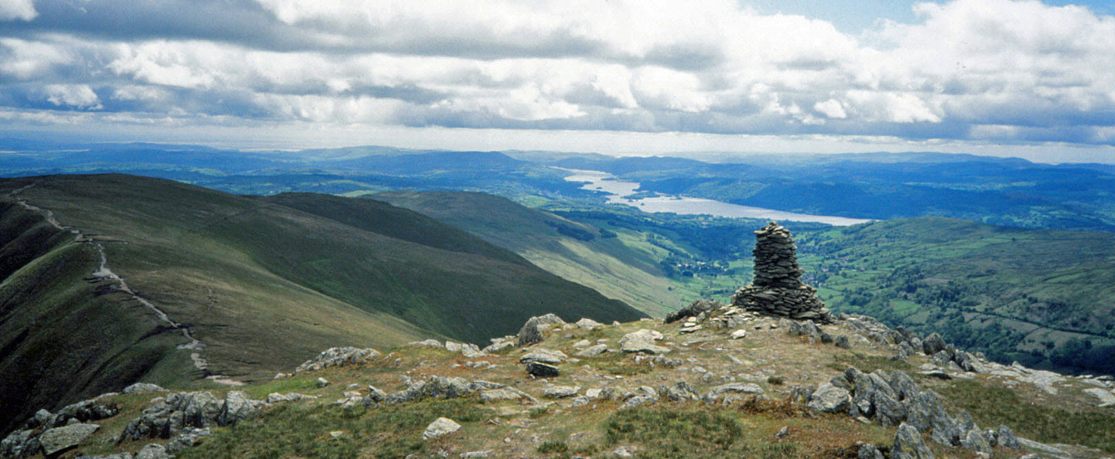
First, I ran east from the Kirkstone Pass up to St Raven's Edge and then ran north past
Pike How and John Bell’s Banner to CAUDALE MOOR (763m), or
Stony Cove Pike. From here there were views of High Street, the Kentmere Horseshoe (with Pendle beyond),
and Helvellyn, but there were clouds over Scafell. I returned, locating the Monument on the way.
A secondary aim was to try out a new bum bag (I didn’t like it: it seems surprisingly hard to find
one suitable for running).
Next, I walked west straight up RED SCREES (776m),
passing many bags of stones dropped here to repair the path.
Somewhere near the top I must have strayed from the path because I found myself on a
scary bit – but no harm done.
From the top there were good views of High Street,
Helvellyn, and Fairfield. Instead of returning the same way, I continued north on the Smallthwaite Band
to Middle Dodd (654m), with views of Brotherswater, and then dropped down by a wall to the road, which I walked up back
to the Kirkstone Pass car park.
 7. Harter Fell, Mardale Ill Bell, Thornthwaite Beacon, Ill Bell
This walk was the classic
Kentmere Horseshoe, walked anti-clockwise, with Ruth.
We walked north to Rook Howe and crossed the beck to reach High Lane and then took
the path east. At the wall we turned north past Wray Crag to Shipman Knotts (587m) and then
Goat Scar (626m) for the view of Longsleddale, with Ingleborough and Pendle in the distance.
We continued on the ridge past Kentmere Pike (730m), which wasn't in the highest 60, on to
HARTER FELL (778m), which was. It was breezy on top, with broken cloud, but not cold.
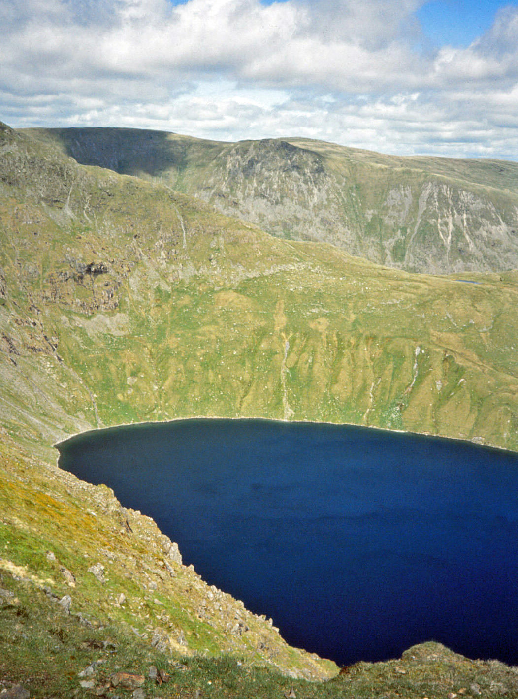
Crossing the Nan Bield Pass took us to MARDALE ILL BELL (761m).
Here we paused for lunch, perched over Blea Water (photo left), with a view of
Haweswater and the Mardale Head car park, where there were many cars for some reason.
At THORNTHWAITE BEACON (784m), we walked a few yards north for the view of Ullswater.
There was also a panorama of many western fells, although Scafell was again in cloud.
The long ridge walk took us past Froswick (720m), ILL BELL (757m) and
Yoke (706m) to the Garburn Pass, where we turned east to return to the Kentmere church.
The photo right shows Ill Bell and Windermere.
8. High Raise
This was supposed to be a run but the terrain was
mainly scrubby underfoot, with rocky outcrops, and no paths, so there was little real running to be
had. From the car park I headed north a little way to get on the open access land and
then struggled, on a warm and mainly overcast day, broadly west over the Wythburn Fells, long and difficult going, with nothing
distinctive to help me know where I was, until eventually I
emerged on the ridge south of Ullscarf (726m).
I didn't need to get to the top of Ullscarf but I trotted up anyway to find, to my surprise,
a walker sat at the cairn, contemplating the evolving views of Red Pike (looking strikingly red when
it caught the sun),
Pillar, and so on. I joined him for a short while, at a discreet distance, and then left him to his thoughts.
I turned back south and ran along the long ridge over Greenup Edge
and Low White Stones to reach my only real objective of the day, HIGH RAISE (762m).
High Raise hasn't much to commend it but there is a close-up view of the Langdale Pikes.
Mission accomplished, I turned east to Codale Head. From here, there was a view of the route ahead,
roughly north-east, but it was slow going again as there was no path until beyond the tarn above Greenburn.
Then it was east to Steel Fell (553m) and north down the ridge to Steel End and the Wythburn car park.
9. Skiddaw, Little Man, Blencathra
I was tipped out on the A591 by Ruth and a friend
(who had come to see the ospreys) and left to run east for some time to meet up again later (much later).
I took the steep path up to The Edge and followed it south to Ullock Pike, without much running so far.
Then it was along Longside Edge, passing Long Side (734m) and Carlside Tarn, to reach the
steep climb to the Skiddaw ridge. I ran north to SKIDDAW (931m) and then back south
to LITTLE MAN (865m).
I then began a long run across the vast emptiness east of
Skiddaw. I first sailed down a good track to Sale How and Skiddaw House.
I continued south-east to The Stake and then tackled the interminably boring Mungrisdale Common.
At least it was a gloriously sunny day.
Eventually, I reached the Blue Screes of Atkinson’s Pike, which I scrambled up and
then continued south up BLENCATHRA (868m). Now it was a relatively gentle (although I was very tired)
run down south-west over Knowe Crag to our agreed meeting place of Blencathra
Centre car park. It took 2 hours 45 minutes.
10. Crinkle Crags, Bowfell, Esk Pike, Great End
On another cloudless day I walked up by
Gaitscale Gill and emerged on the ridge left of Great Knott.
I turned north to take the classic path over CRINKLE CRAGS (859m), which unfortunately
only counts as one peak despite the many tops. There were, of course, views into Langdale to the east
and to the Scafells to the west. After crossing Three Tarns, I clambered up BOWFELL (902m),
where I paused, along with a quite a few others, for my sandwiches.
Immediately after standing up to resume the walk, I somehow tripped
over a boulder and tumbled downhill. I just couldn't get my legs ahead of me to stop myself as I fell over
the rocks until I completed a somersault which an onlooker described as "very graceful". The impact was also
somewhat painful. My hip hit a rock so hard that my belt was split in two – and the hip itself had quite
a gash. I was sore and shaken elsewhere too. What to do now? Well, it was a long way back to the car
whichever way I went, so I thought I might as well carry on as planned (hitching my trousers up from time to time
and ignoring the ooziness on my hip).
I crossed the Ore Gap to ESK PIKE (885m) and then Esk
Hause to GREAT END (910m). This was a fine perch for views with Scafell Pike close ahead.
Now I had to get back. I returned to Esk
Hause and scrambled down by the headwaters of the Esk, with the Scafell hills towering very high to the right.
I crossed Great Moss ahead, skirting below Low Gait
Crags. I was quite exhausted now and having difficulty map reading, but I found the waterfalls of Lingcove Beck
and walked up and over into Moasdale. This was very boggy where the footpath was marked so I kept
higher, below Little Stand. Crossing Gaitscale Close brought me back to the car after 6 1/2 hours,
tired and bruised. (Ruth patched me up when I got home.)
 11. Glaramara, Allen Crags
My tumble on Bowfell made me resolve to not run on the
fells anymore. I had been walking, not running,
on Bowfell but I was made well aware that accidents can happen at any time, and probably more
likely while running and
at my age. If I had a similar accident while running then I would be in trouble, with few clothes,
no food or water, and alone (possibly for some time). And it could easily have been worse.
I had no control as I was tumbling. I could have hit my head as easily as my hip and I could have tumbled
down a more precipitate slope without a convenient somersault pad.
So we had a relatively gentle walk from Seathwaite.
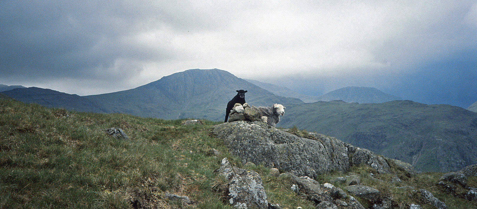
We climbed up by Hind Gill to GLARAMARA (783m), where there was a noisy group of people (and a few sheep,
photo left).
Dark clouds hovered over Wasdale but otherwise we had good views of
Bowfell, Great Gable, and Great End.
We walked south (photo right) past various tarns, including Lincomb Tarn and
High House Tarn, pausing by one of them for lunch, and then on to ALLEN CRAGS (785m).
We dropped down to the well-trodden footpath between Langdale and Wasdale, and continued by Ruddy Gill and Grains
Gill back to Seathwaite.
It may have been 'relatively gentle' but it was not gentle
enough. I was still sore after the Bowfell tumble and thought it best to have a week's rest from fell-walking to recover.
 12. Great Dodd, Watson's Dodd, Stybarrow Dodd, Raise, Whiteside
I was now behind schedule,
with 30 peaks left but only 20 days. However, I was not too concerned. Some of the isolated peaks
had been ticked off and in some of the up-coming outings I hoped to bag a few peaks at a time.
We booked a night at the Stybeck Farm campsite near Thirlmere
in order to have two profitable days walking, we hoped. However, the forecast of thunderstorms was discouraging.
We could well believe it, as the atmosphere was close and oppressive clouds sat on the hills.
Nevertheless, we set off.
We walked up from Legburthwaite, behind
Castle Rock (photo left), across Mill Gill, up St John’s Common to Little Dodd.
Now in the cloud, we carried on, prepared to abandon the hills at the first rumble.
Continuing in the same line brought us safely to GREAT DODD (857m).
On these rolling hills without distinguishing features
we had to rely on the compass to take us south on the ridge over
WATSON’S DODD (789m) and STYBARROW DODD (843m) – and down to Sticks Pass, with occasional glimpses of
Ullswater and Thirlmere – and then up to RAISE (883m) and WHITESIDE (863m).
Here the cloud lifted and as we began the walk down by
White Side and Brown Crag we could see aggressive clouds over the Dodds where we had just
walked (photo right). We pressed on over Fisher Place Gill to Stybeck Farm, without a drop or a rumble
(although we later heard that there'd been heavy rain elsewhere in the Lake District).
 13. Grisedale Pike, Hopegill Head, Grasmoor, Wandope, Crag Hill, Sail
The storm-clouds of yesterday had cleared, so on a bright day
we drove north from Stybeck Farm to
tackle one of the standard Lake District horseshoe walks, plus an extension.
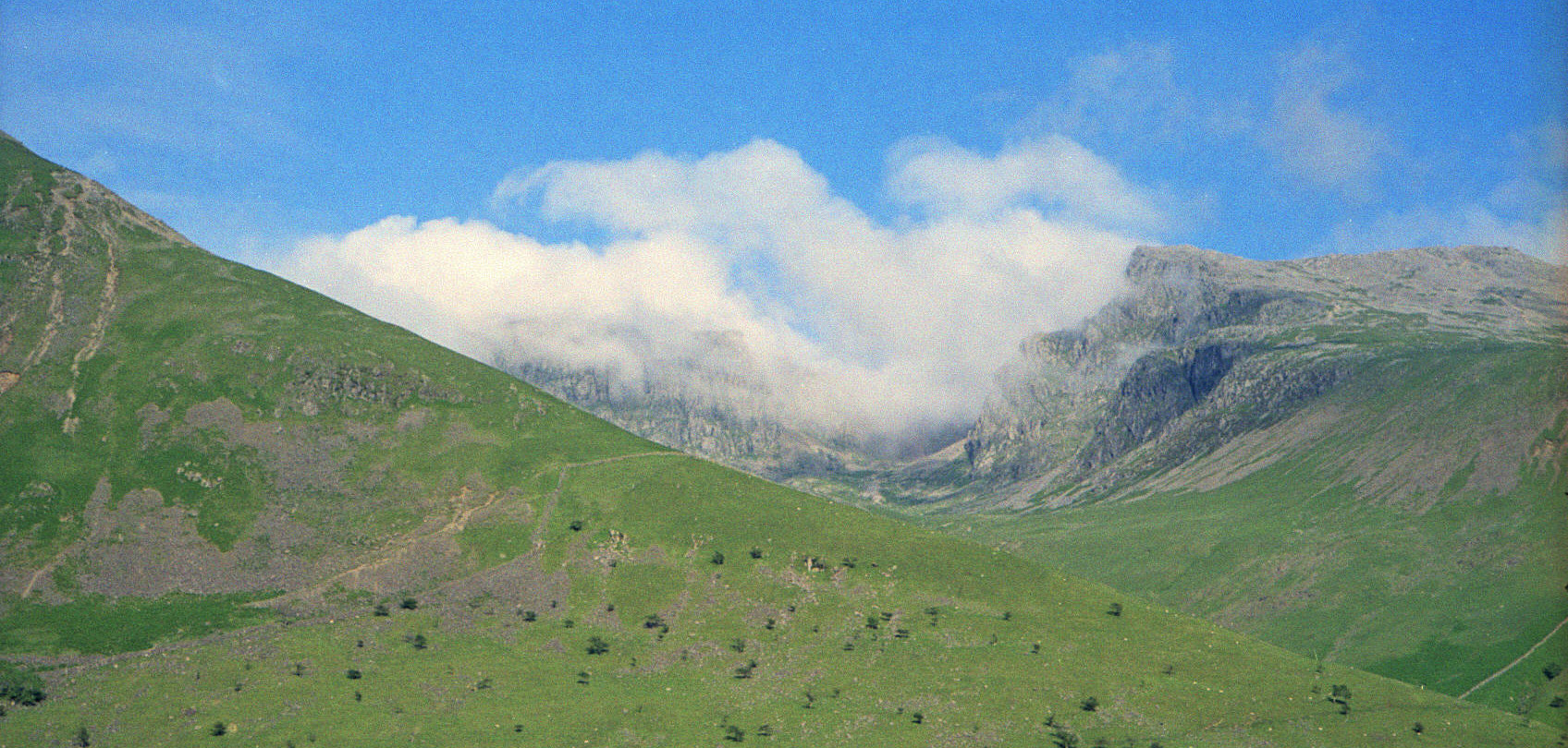
We parked at Braithwaite and walked west over Sleet How to GRISEDALE PIKE (791m) and then above (photo left)
Hobcarton Crag to HOPEGILL HEAD (770m). Here we had good views of Skiddaw and to the north
of the Scottish hills. We turned south over Sand Hill to Coledale Hause, where we paused for lunch.
The standard horseshoe would now return on the southern
ridge of Coledale but we went on up to GRASMOOR (852m), where we had views of Crummock Water (photo right), Red Pike,
the Scafells, Great Gable and the Helvellyn ridge (we were getting to be dab hands at recognising the
peaks from different directions). We then cut across to WANDOPE (772m) and skirted around crags to
reach CRAG HILL (839m). We were now back on the normal horseshoe route and continued to SAIL (773m) and
after Sail Hause and Outerside turned north-east by Stile End to Braithwaite.
 14. Lingmell, Scafell Pike, Scafell, Slight Side
We returned to the Wasdale camp-site hoping for better
luck with the weather than on the previous occasion, but as we drove up Wasdale it didn't look promising,
with the tops in cloud. For what it was worth, the forecast had said the clouds would lift, so we
set off, without much optimism, aiming to tick off one peak at least.
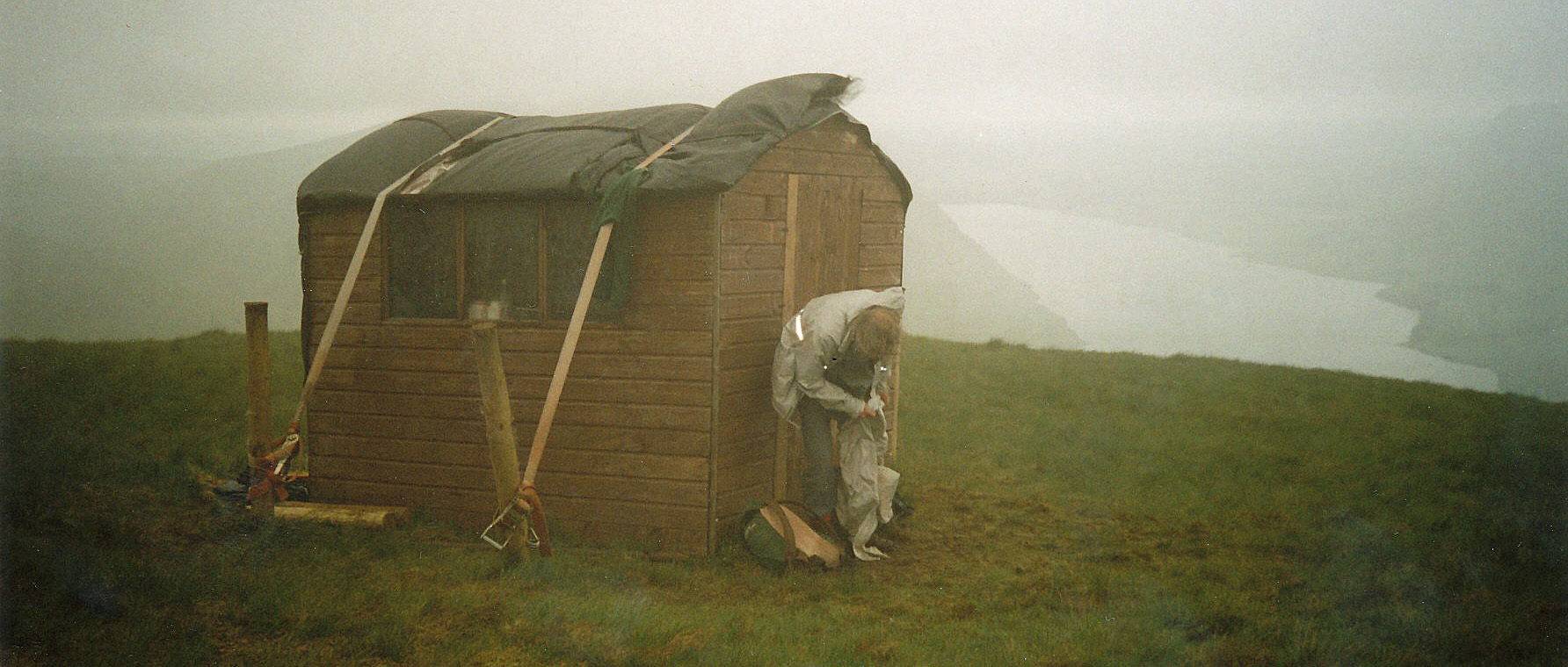
We walked by Lingmell Gill and then followed the long ridge up the slope.
Before reaching the cloud we paused for lunch. We then entered the cloud and set about finding the top.
The photo left shows me changing into wet gear, sheltering behind what looked like a garden shed that, for some reason,
was tethered to the mountain.
We floundered a bit, went too far north, but eventually found what we believed to be the top of
LINGMELL (807m).
As we dropped down to Lingmell Col, the cloud seemed to be beginning to
lift, with tantalising glimpses of the crags of SCAFELL PIKE (978m).
Should we go for it? Well, we did, and for once there were few people about at the highest point
of England. With cloud swirling not far above us, we crossed Mickledore and walked down to
clamber up the gully to Foxes Tarn. The path above was badly eroded
but we soon gained the top of SCAFELL (964m). There were now definitely some gaps in the cloud, even sunshine,
as we walked south (photo right) over Long Green, with views of Eskdale, to SLIGHT SIDE (762m).
From there we traversed back below Scafell to Green How, and turned west to join the
footpath north to the camp site. So luck was on our side after all, enabling us to get to the two
highest peaks of all.
 15. Great Gable, Green Gable
The following day the cloud was forecast to
stay all day but even so we thought we could achieve our objective.
We decamped and drove to Wasdale Head car park and headed north-east past
Row Head and Burnthwaite to take the ridge path by Gable Beck.
We were soon in cloud and paused near Beck Head for a snack before scrambling up
the rough west ridge of GREAT GABLE (899m). We were working by compass now
but on the slopes down from Great Gable we met a young couple, lost, with no compass, no map except a
one-page sketch with no contours shown, and not many clothes. We gathered that they had walked
here from the Honister Pass,
some three miles to the north, and were hoping to walk down the craggy slope we had just
struggled up and return on the path known as Moses Trod. We tried to discourage them but
they seemed oblivious to the situation they were in or any problems they might have.
We crossed Windy Gap and climbed GREEN GABLE (801m)
where we met a group of walkers that didn't know which Gable they were on.
We returned to Windy Gap and dropped down Aaron Slack, from where we saw the
couple being escorted off the mountains, which was a relief.
At Styhead Tarn the cloud was beginning to lift.
From the path above Spouthead Gill we now had views of the Great
Gable rocks, Lingmell and (occasionally) Scafell Pike.
By the time we were back in the valley it was almost a clear blue sky (the photo left shows Scafell across Lingmell).
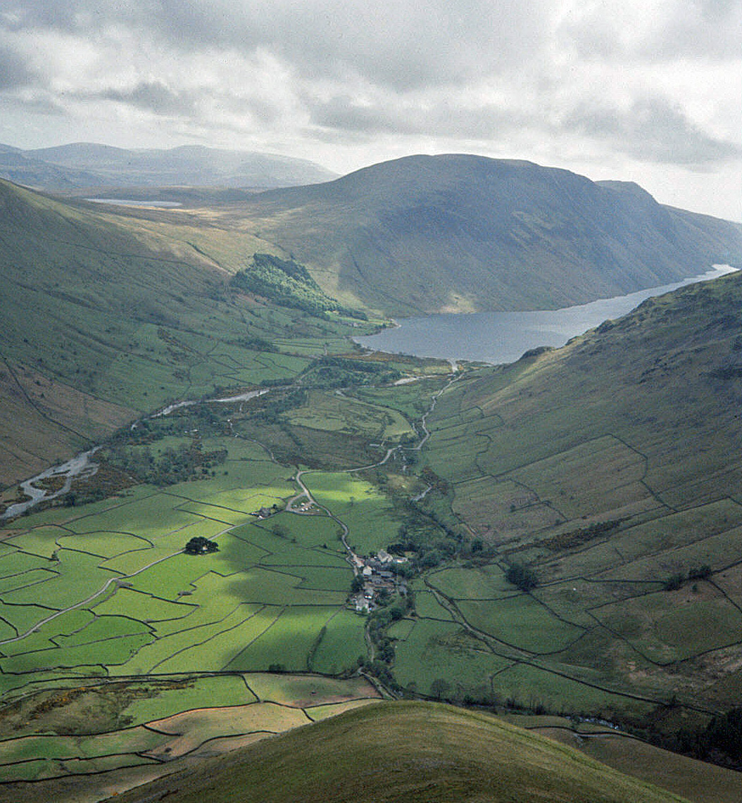
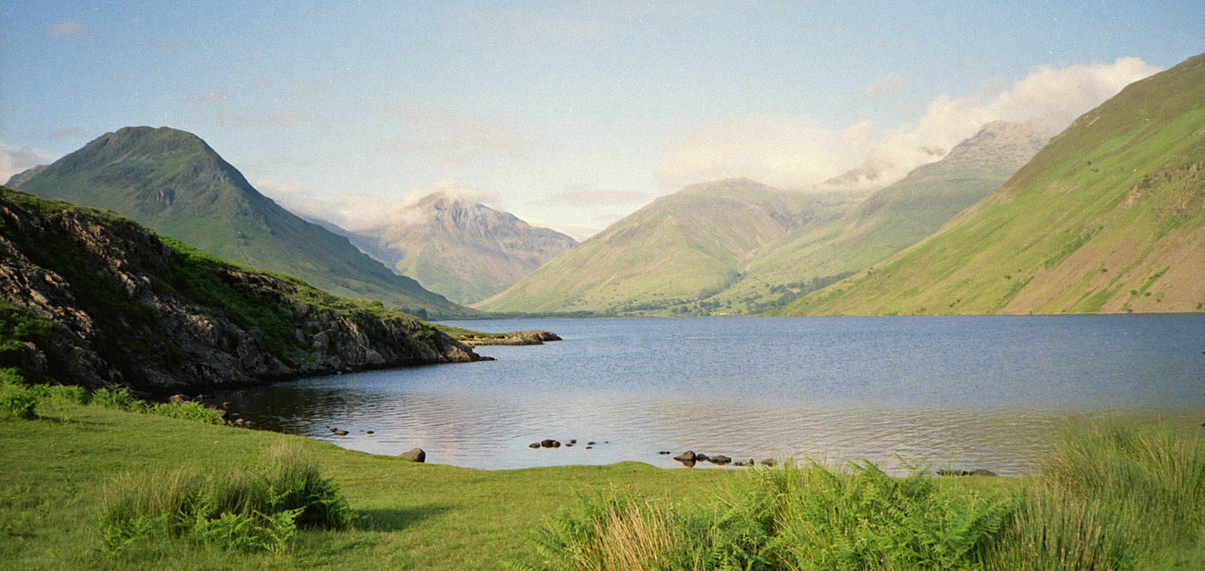
Afterwards, on our way home, we stopped by Wast Water, with the classic view back up the lake (photo right),
and made ourselves supper, and later on, on Birker Fell,
paused for coffee with a view back to the Scafell hills.
It is amazing how Lake District weather can change so quickly and unexpectedly!
We could easily have abandoned this day as not worth bothering with.
16. St Sunday Crag, Fairfield, Great Rigg, Hart Crag and Dove Crag
Two days later I was back in the Lake District again, this time with son Martin,
hoping to tick off a few more peaks to get ahead of schedule, just in case we should have days of terrible weather.
We could see that the tops were in cloud but set off optimistically from the car-park, heading north to
Deepdale Bridge, from where we walked up Deepdale to Wall End.
We climbed up, over pathless ground, by Coldcove Gill to Lord’s Seat and Gavel Pike (784m) and then ST SUNDAY CRAG (841m),
which was still in cloud. Along the ridge, Deepdale Hause wasn't, so we paused there for lunch.
Continuing over Cofa Pike (823m) we could hear the voices of climbers but not see them.
By the time we reached FAIRFIELD (873m) the cloud had lifted but it was still swirling about on
Helvellyn.
From Fairfield we walked south to GREAT RIGG (766m) and back,
an extra two miles that makes no sense except that Great Rigg was on my 'highest 60' list.
Leaving Fairfield a second time we followed a more rational route east where there were many
walkers on the Fairfield Horseshoe.
We passed HART CRAG (822m) and DOVE CRAG (792m) but there we left the standard path and
traversed back below Hart Crag to reach the Hartsop above How ridge.
Now it was straight down, past Gale Crag and Bleaberry Knott and through Low Wood, to Cow Bridge.
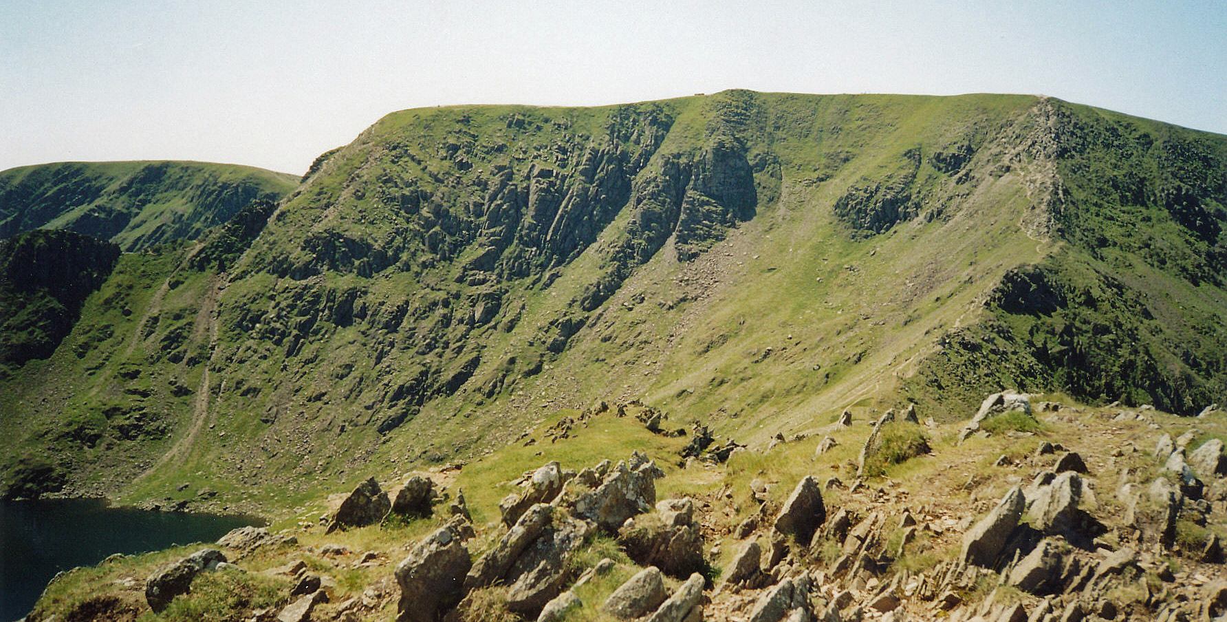
 17. Catstye Cam, Helvellyn, Nethermost Pike and Dollywaggon Pike
On a roll now, we (Ruth and I) returned for another classic
Lakeland walk, on a clear-skied day. From a busy Glenridding car-park, we walked west to Rattlebeck Bridge
and above Glenridding Beck and
then followed Red Tarn Beck all the way up to near
Red Tarn itself. We clambered up the pointy peak of CATSTYE CAM (890m), with views across
to the south of Striding Edge, Red Tarn and Helvellyn
(the photo left shows Helvellyn from the path from Catstye Cam), and
then walked a little north, off the walkers' path, to have lunch overlooking Keppel Cove.
Then it was up the narrow ridge of Swirral Edge to HELVELLYN (950m), where there were great views to the west
and many people admiring them.
We did not on this occasion return via Striding Edge as we
had two further peaks in sight. We walked south to NETHERMOST PIKE (891m), which is a nondescript top,
and to High Crag (884m, only 7m lower), which is more exciting.
Then it was DOLLYWAGGON PIKE (858m) and down its eroded slope to Grisedale Tarn.
We then had a long but pleasant walk back down Grisedale, past Ruthwaite Lodge, with the crags high above,
over by Lanty’s Tarn and back to Glenridding.
18. Wetherlam
With only a cluster of four peaks south of Wrynose, at the head of Little
Langdale, remaining we set off optimistically. It was, however, ominously cloudy
when we parked at Fell Foot. We walked up the road a short way and then crossed the River Brathay
to reach the ridge of Rough Crags, with occasional glimpses through the cloud.
However, as we reached Wet Side Edge it became cloudier and then wetter.
We met a group of four men who were entranced with their newly-invented GPS equipment, which they
were planning to use to find the remains of an aircraft that had long ago crashed on these slopes.
We, however, had no such equipment and as it became wetter, windier and colder we abandoned
our walk near Little Carrs and retreated, disappointed, to the van where we had some soup as the rain fell.
Eventually the clouds lifted a little and we thought that we had time
left to bag one peak so we set out again. This time we walked south to Bridge End to reach
the path south of Greenburn Beck, which we followed over Birk Fell Hawse to the top of WETHERLAM (762m).
Here we were rewarded with a fleeting gap in the clouds but we weren't tempted to walk further or indeed
to linger on Wetherlam. We returned over Birk Fell Hawse. On the way we saw an ambulance wailing over
the Wrynose Pass and we thought of the four men and their technology but, no doubt, it wasn't for them.
We crossed Greenburn Beck to return to Fell Foot over Hollin Crag, and returned home somewhat chastened.
 19. Great Carrs, Swirl How and Grey Friar
We returned the next day, which although cloudy
was forecast to remain dry.
Now we could polish off the final three, and having ticked off Wetherlam yesterday our task was easier,
as we could park at Wrynose Pass and have less height to gain. There was only a relatively short
distance to walk so this was a leisurely celebratory stroll. We returned to Wet Side Edge and Little Carrs
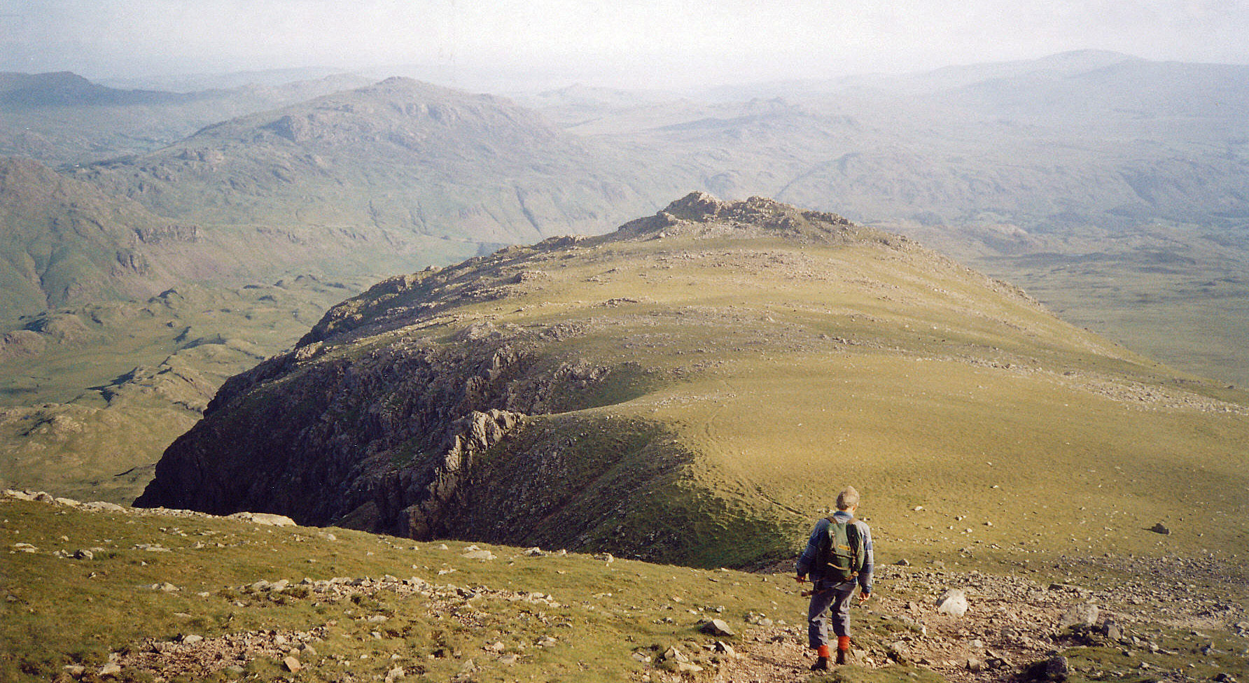
and continued to GREAT CARRS (785m) and, only a little beyond, to SWIRL HOW (802m).
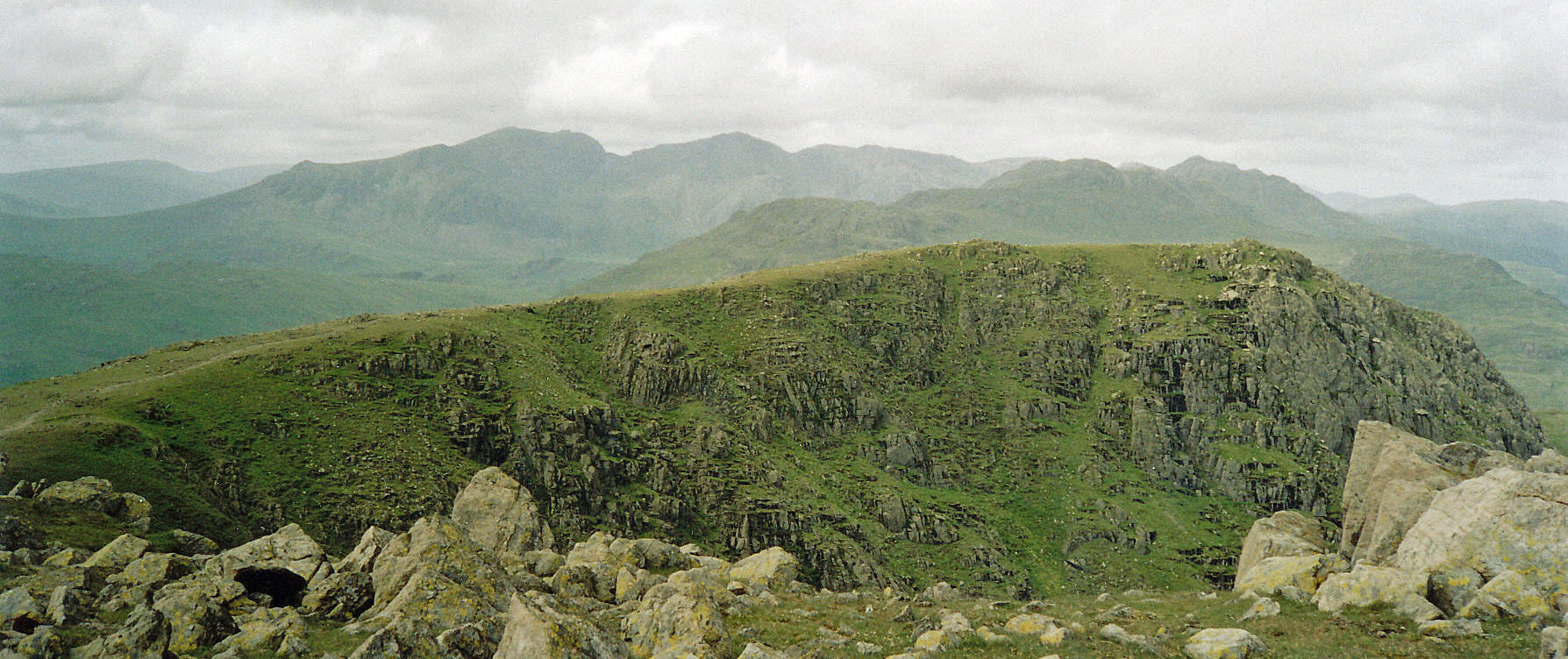
The photo left shows the Swirl How top and the one right shows the view of the Scafells and Bowfell from it.
Now, at last, it was on triumphantly
to the final top, the otherwise undistinguished, GREY FRIAR (773m), with good views
of the Scafells ahead.
And so the 60 peaks were visited within the 60 days.
It is not a difficult challenge, physically – assuming, of course, that there are no accidents.
The Bowfell tumble did put me out of action for a few days but, reflecting now, I think it affected me
mentally too, in that I lost my nerve for a while, knowing that, however careful you are,
accidents can happen at any time. I think it is no coincidence – although I wasn't
conscious of this at the time – that of the ten outings up to that point I had been alone on seven
of them and of the nine outings after I was alone on none of them. Maybe I felt safer in company –
or maybe others thought I was not safe alone. Anyway, I made it, with help. So, thanks for looking
after me – and thanks Ruth for all the photos (at that time I wasn't using a camera).
The main potential
problems to be overcome are that of finding enough days to travel to the Lake District (which is, of
course, easier if you already live there) and that of the Lake District weather (which we have to
accept that we can do nothing about).
A concentrated period focussed on the Lake District means that you become much
more familiar with the peaks, not just the ones climbed, and how they all fit together, as you see them
repeatedly from different angles. The 'highest 60' forms a perfectly adequate subset of the Wainwrights.
Personally, I've never felt any urge to walk up some of the lesser hills of his 214.
I have walked up the best and I'd rather walk up them again.
Home Preamble Index Areas Hills Lakes Dales References Me
© John Self, 2018-

Top photo: The western Howgills from Dillicar; Bottom photo: Blencathra from Great Mell Fell