
Home
Preamble
Index
Areas
References
Me
Saunterings: Walking in North-West England
Saunterings is a set of reflections based upon walks around the counties of Cumbria, Lancashire and
North Yorkshire in North-West England
(as defined in the Preamble).
Here is a list of all Saunterings so far.
If you'd like to give a comment, correction or update (all are very welcome) or to
be notified by email when a new item is posted - please send an email to johnselfdrakkar@gmail.com.
188. From Pooley Bridge to Glenridding on the Ullswater Way (Eastern Half)
After our heroic efforts yesterday [187] on the western half, the plan was tackle the eastern
half – actually, rather more than half – of the Ullswater Way. Unfortunately, after the
exertions of yesterday and then too much food and too little sleep, I didn’t feel up to it.
Our room was much too hot. I had to open the windows wide and lay on, rather than under,
the quilt to cool down to a reasonable temperature. We have been used to sleeping relatively al
fresco in the camper van on our Lake District visits until it recently reached the end of
the road. We’ll have to work at softening ourselves up so that we can wallow in the luxury
that the typical Lake District visitor apparently expects.
Not for the first time, Ruth got us up and moving. At least I knew that there’d
be a ferry back from Howtown, five miles away, if required. It was a brighter morning
than expected and the mist further up the lake was lifting, as were my spirits. We passed
through a number of lakeside camp-sites, which, for some reason, we had never thought of
using when we had the camper van. It certainly seems an idyllic spot. There are open
views across the lake, beyond those pootling about in their yachts, to Little Mell Fell and
Gowbarrow Fell, where we trekked yesterday.
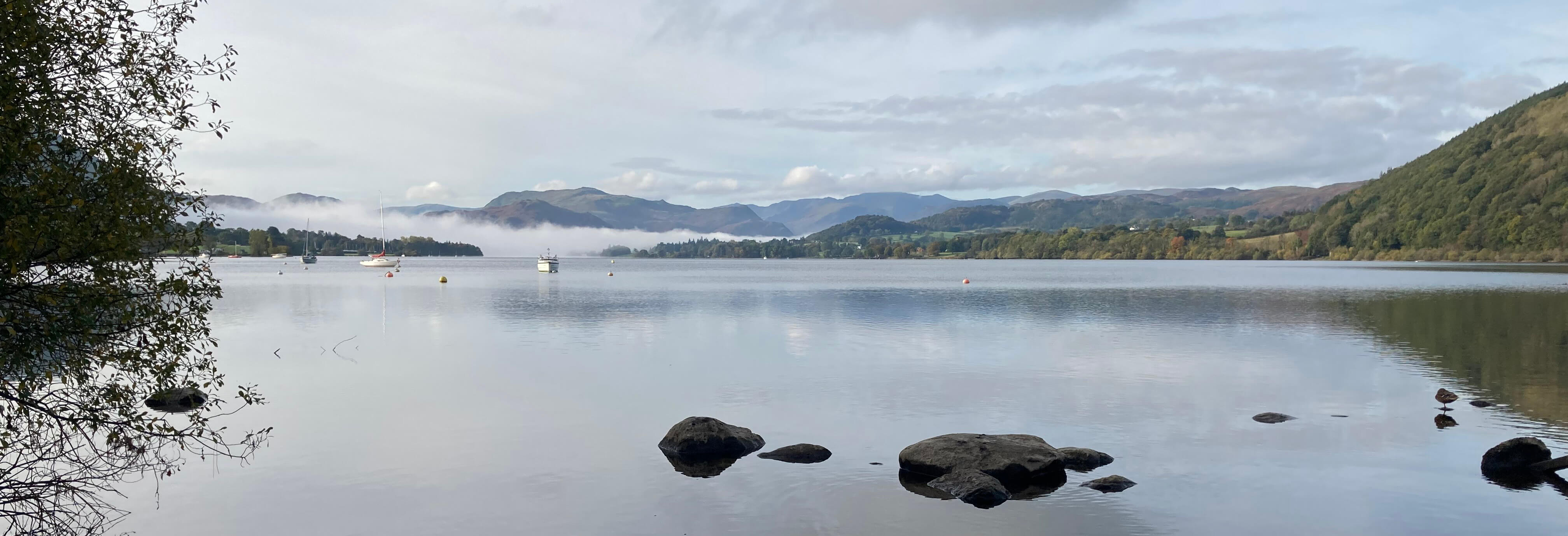
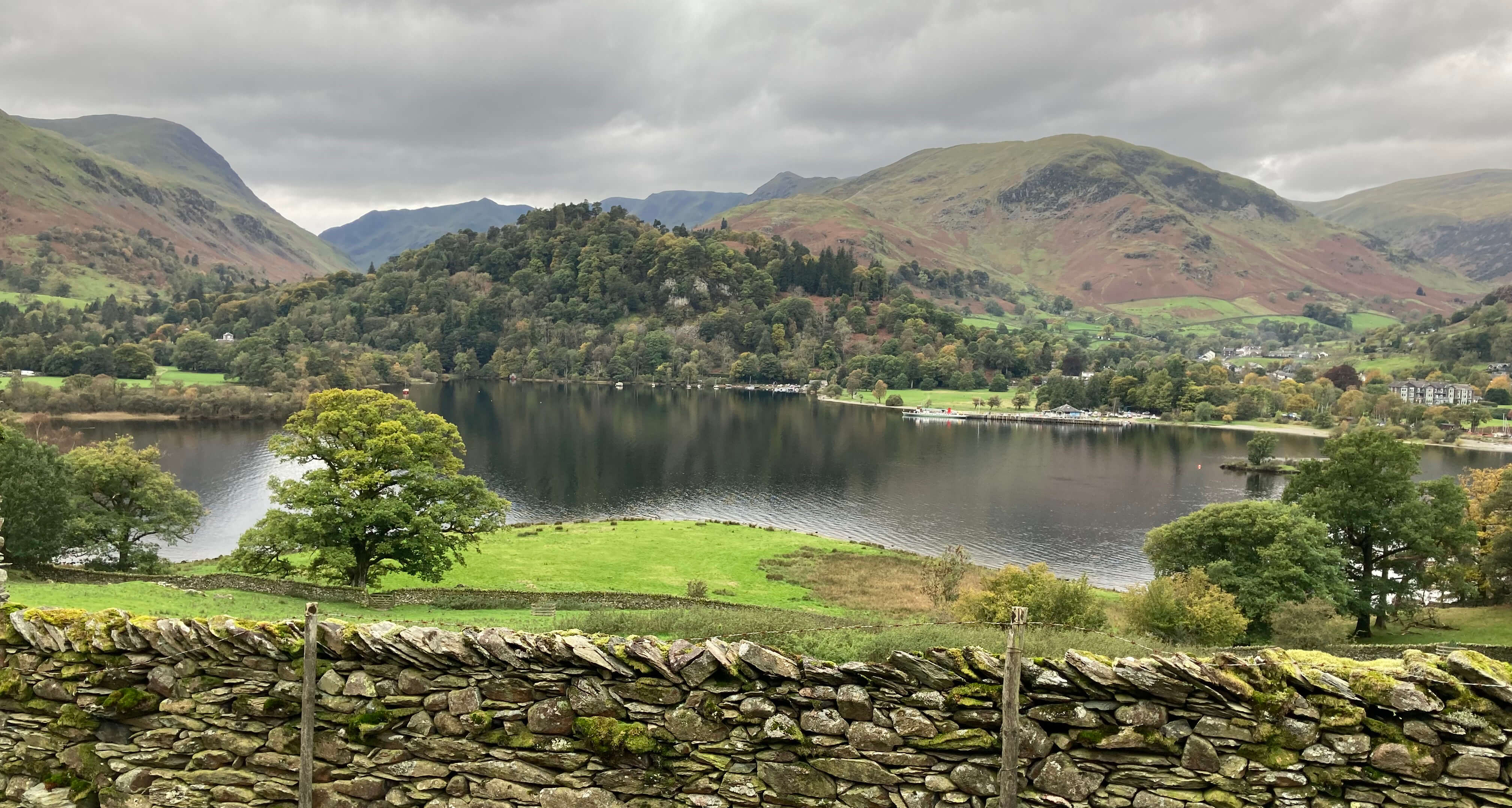
Ullswater from Pooley Bridge
After a couple of miles, the Ullswater Way leaves the lake’s edge and takes us through
several fields which provide an even better view over the lake. Somewhere along the way
we missed an Ullswater Way signpost and found ourselves on the quiet, dead-end road into
Howtown. We paused in Howtown for a coffee and scone, where our host disconcerted me by
saying that it’s another four hours walk to Glenridding, with lots of ups and downs. My
emergency ferry was due in – but we ignored it.
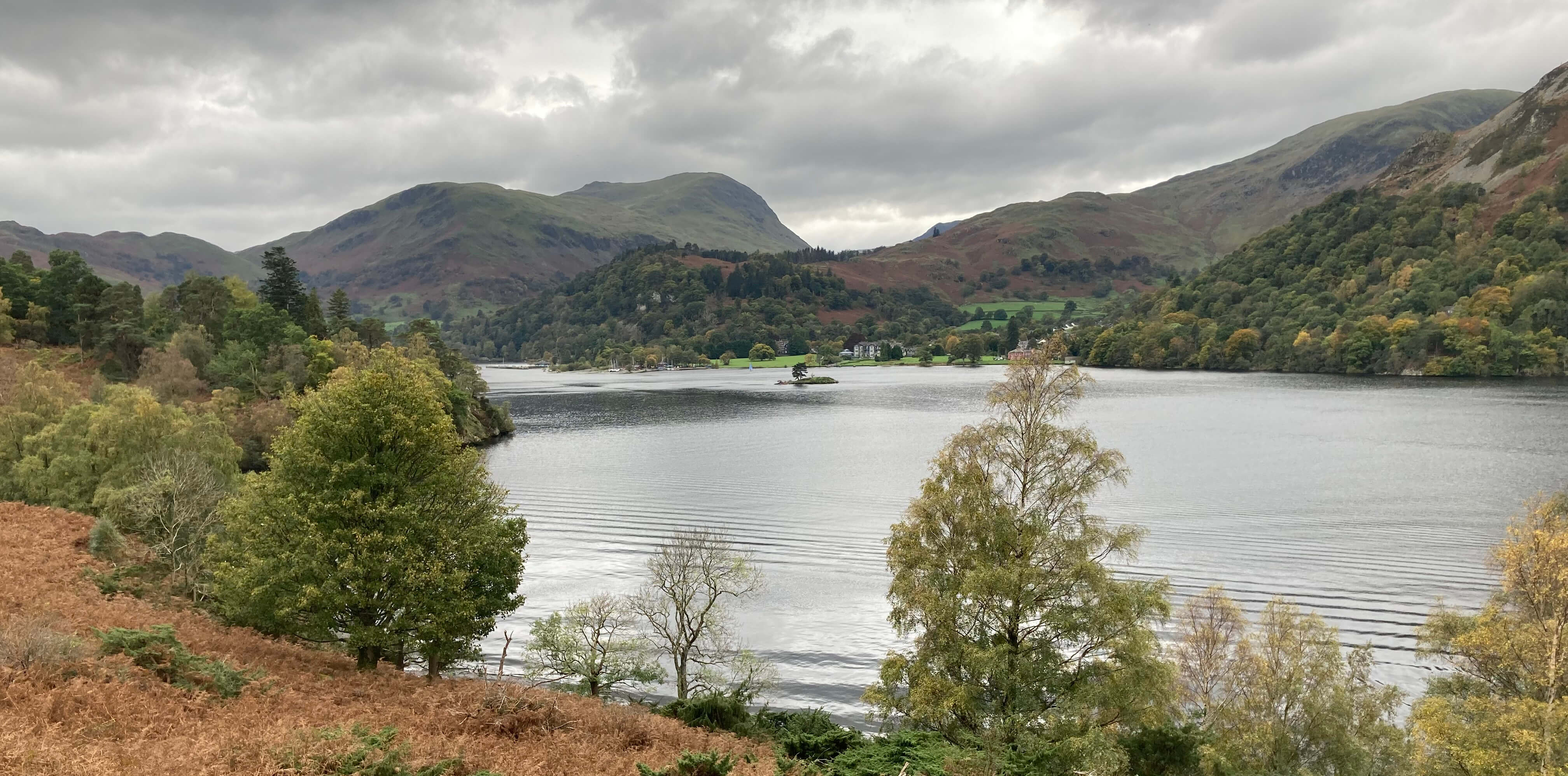
Ullswater from the Ullswater Way approaching Howtown
Yes, there were lots of ups and downs (but never to any great height) to get us around
the wooded headlands below Hallin Fell, Birk Fell and Place Fell, avoiding rocks and roots.
Between the first two headlands there’s a more gentle section through fields around Sandwick.
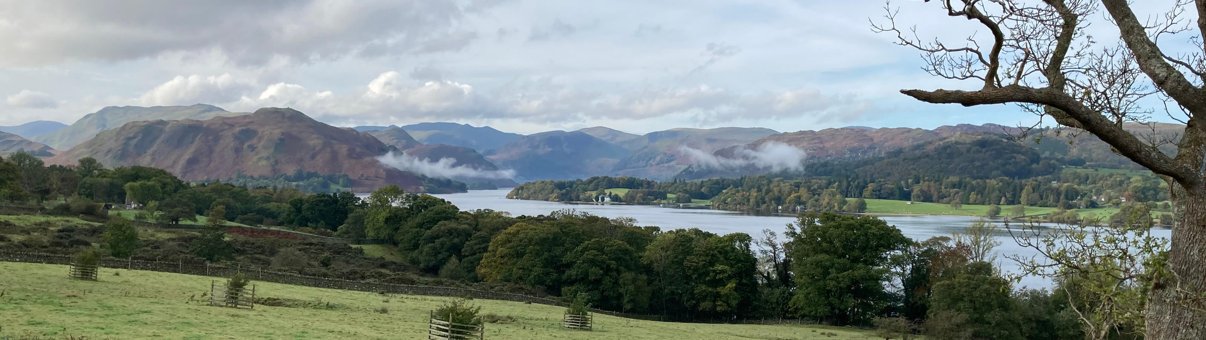
And then, past Silver Point, we had our first view of our destination, Glenridding, not
far away – but with a lake between here and there.
The walk between Patterdale and Howtown is one of
the Lake District’s classics – and deservedly so, with its many and varied views of and
across the lake, with the mountains of Red Screes, Fairfield, St Sunday Crag, Helvellyn and
so on forming the backdrop. We could also see across to the lower slopes with the
green glades of Glencoyne Park and Gowbarrow Park, within which lies Aira Force – where we
had walked yesterday.
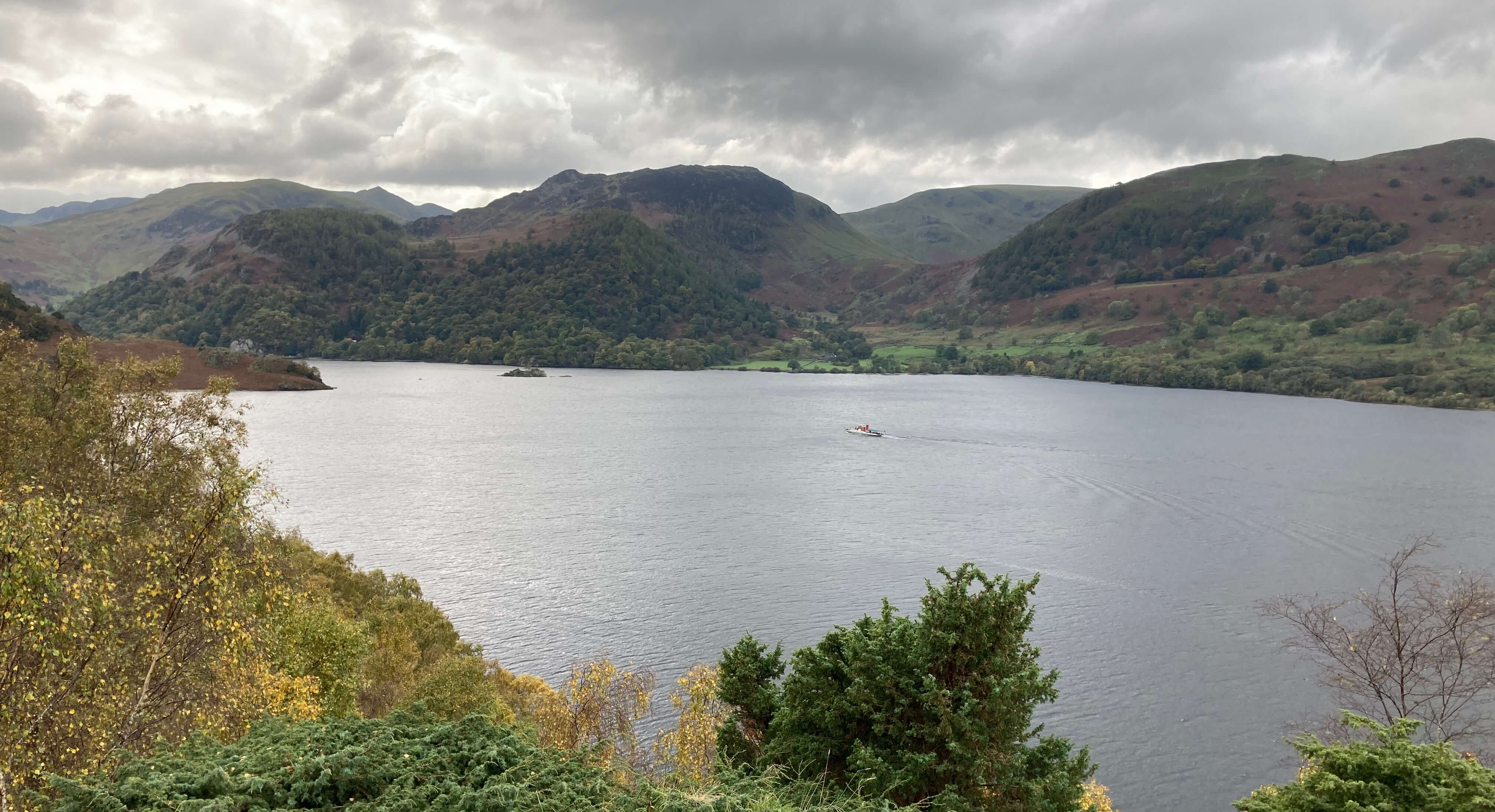
Looking across Ullswater to Glencoyne Park, with a steamer mid-lake
Ullswater and Glenridding
Looking across to the Glenridding pier
Further on we passed another of the art installations of the Heritage Trail that accompanies
parts of the Ullswater Way. I wasn’t much interested in them, as the Ullswater Way provided
enough for me to think about. The Ullswater Way does not need art installations. No art
installation can improve upon the landscape already here. I’d rather look at the view ahead
up to the Kirkstone Pass and along Deepdale towards Fairfield.
On the stretch towards Side Farm we were greeted with a fly-past of four jets, twice.
This was a kind, if noisy, gesture to mark our achievement, but it wasn’t really necessary.
Anyway, we still had a mile to go, through Side Farm and alongside the road from Patterdale
to Glenridding, to await our bus back to Pooley Bridge.
So, we completed our circuit of Ullswater.
In [187] I mentioned
that I had walked or run around ten of the lakes. But they were all single-day circuits. The Ullswater
circuit was a two-day effort. May I consider it ticked off too? Please.
In case you're interested in my previous lake circuits, they were:
• Buttermere (there’s a standard walk around this lake).
• Coniston Water (in the Coniston 14 road race - three of my
circuits were in road races, which I am surprised to see still take place, despite
the increased traffic).
• Derwent Water (in the Derwentwater 10 road race).
• Elter Water (within a run through Great and Little Langdale,
not close to the lake itself).
• Esthwaite Water (within a run through the forests to the
east and west – the lake itself has little access and a closer circuit would involve the use of
roads on both sides).
• Grasmere and Rydal Water (were both enclosed within
[146] – a closer circuit for both is hampered by the road).
• Haweswater (by a run around it – not to be recommended because
of the fast traffic on the road along the east).
• Thirlmere (walked around in [3]).
• Windermere (in the Windermere marathon).
That leaves Bassenthwaite Lake,
Crummock Water,
Ennerdale Water,
Loweswater and
Wastwater.
Date: October 23rd 2023
Start: NY470273, Pooley Bridge (Map: OL5)
Route: (linear, almost all on the Ullswater Way) SW, SE – Cross Dormont – SW –
Sharrow Cottages – W – road – SW – Howtown – NW, SW – Sandwick – W, SW – Silver Bay – S – Side Farm – W, NW – Glenridding
Distance: 11 miles; Ascent: 120 metres
Home
Preamble
Index
Areas
References
Me
© John Self, 2018-

Top photo: The western Howgills from Dillicar;
Bottom photo: Blencathra from Great Mell Fell