
Home
Preamble
Index
Areas
Dales
Hills
Lakes
Places
Reserves
Rivers
Structures
Villages
References
Me
Saunterings: Walking in North-West England
Saunterings is a set of reflections based upon walks around the counties of Cumbria, Lancashire and
North Yorkshire in North-West England
(as defined in the Preamble).
Here is a list of all Saunterings so far.
If you'd like to give a comment, correction or update (all are very welcome) or to
be notified by email when a new item is posted - please send an email to johnselfdrakkar@gmail.com.
33. Is Nappa Hall Napping - or Dying?
I have it on good authority (in fact that of Historic England) that
Nappa Hall,
which is near Askrigg in Wensleydale, is “probably the finest and least-spoilt fortified manor house in the north of England.” In that case, it deserved to be the focus for a saunter around the middle of Wensleydale.
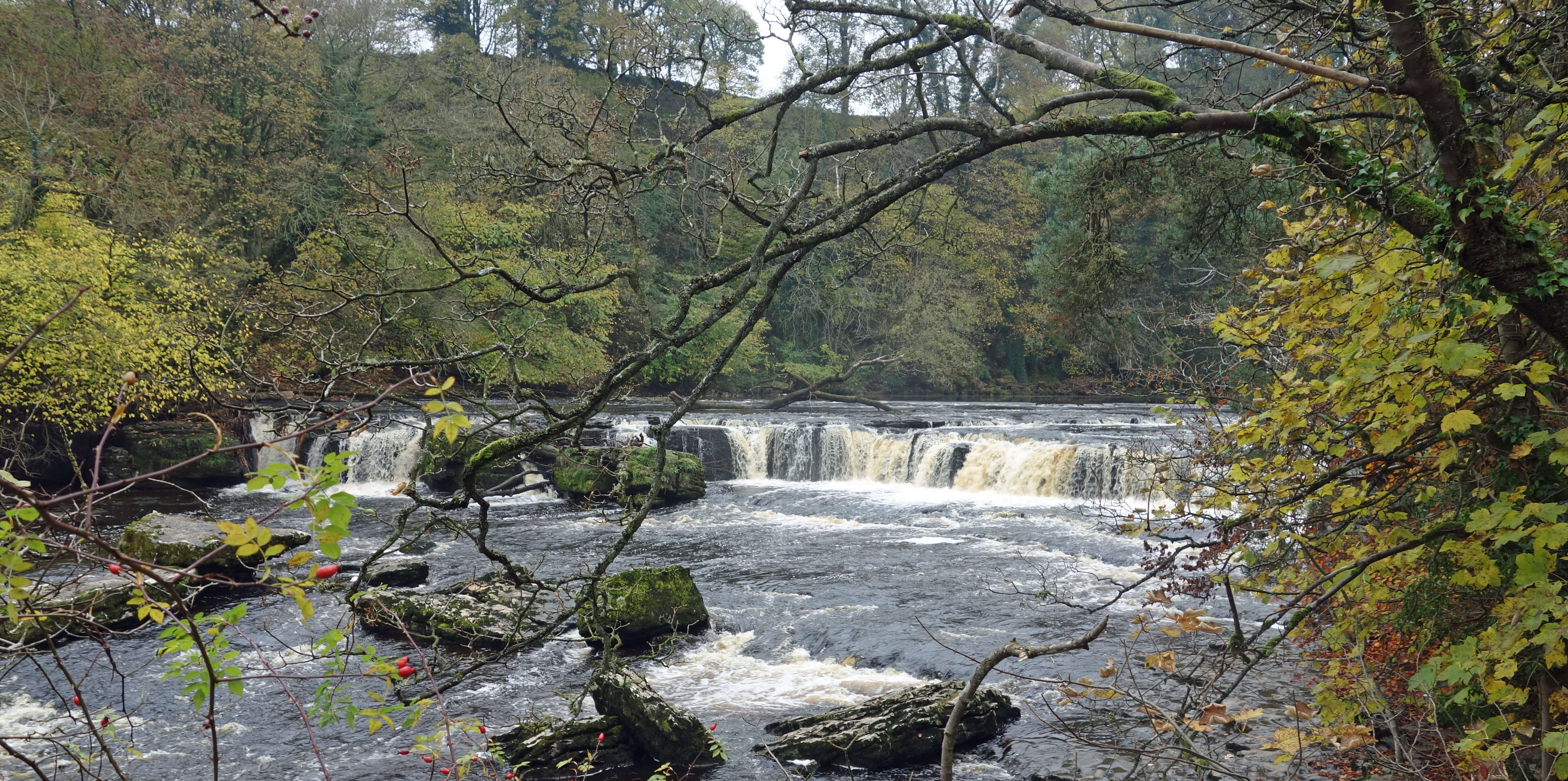
The sun that brightened my drive to Wensleydale had disappeared by the time I reached it. Low cloud smothered the hills. All was grey, silent and still. If there were any remnants of autumn colour then they were thoroughly dampened, apart from a few larch which somehow kept their glow. Nothing moved (except a little traffic): it was as if life was preparing for a winter hibernation. I walked over the River Ure, past Bear Park (no, I didn’t see any) and on towards the famous Aysgarth Falls. It wasn’t on my itinerary to visit the falls but I had a quick look at High Force anyway.
 I continued north to the village of Carperby, where every building that I saw was a fitting
stone-grey. The village seemed to disappear into the hillside. There were no white-washed walls
although one or two doors had been bravely coloured. Carperby is said to be a village of two
centres, a West End and an East End. I only saw the former – perhaps the latter is gayer, but I
doubt it.
I continued north to the village of Carperby, where every building that I saw was a fitting
stone-grey. The village seemed to disappear into the hillside. There were no white-washed walls
although one or two doors had been bravely coloured. Carperby is said to be a village of two
centres, a West End and an East End. I only saw the former – perhaps the latter is gayer, but I
doubt it.
The gloom was getting to me – no doubt Carperby sparkles in the summer sun. I passed
only a few buildings but one of them was a Quaker Meeting House (1864) and two were Wesleyan
Chapels (1826, 1890). According to its
Conservation Area Character Appraisal
there are “dramatic views outwards from the village … towards Penhill, Bishopdale and Addlebrough”. I could see absolutely nothing across the valley and not much more of the nearby hills of Carperby Moor.
 I followed the Oxclose Road (which is not a road but a bridleway path) west for three miles.
It is a good path for striding out, which is the best thing to do when the only scars to be seen are
not the limestone scars to the north but the scars of old lead mines near the track. The murk was
harder to accept knowing that it had been sunny just five miles south. The only cheery sight was of two
hares lively enough to indicate that they do not have the myxomatosis that is said to be spreading
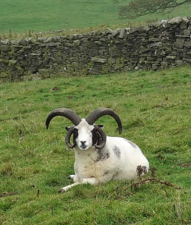
from rabbits to hares. I was momentarily excited by a sheep with impressive horns, which shows how dull
this walk had been.
I followed the Oxclose Road (which is not a road but a bridleway path) west for three miles.
It is a good path for striding out, which is the best thing to do when the only scars to be seen are
not the limestone scars to the north but the scars of old lead mines near the track. The murk was
harder to accept knowing that it had been sunny just five miles south. The only cheery sight was of two
hares lively enough to indicate that they do not have the myxomatosis that is said to be spreading
from rabbits to hares. I was momentarily excited by a sheep with impressive horns, which shows how dull
this walk had been.
Eventually I dropped down to Nappa Hall. The first impression is of a large, solid grey
edifice in need of repair – understandably so, since it is mainly of the 15th century. It was
built by the Metcalfe family after land was given to James Metcalfe of Worton by Sir Richard
Scrope of nearby Bolton Castle following service at Agincourt in 1415. The hall is probably more
due to James’s son, Thomas, since James would have been getting on a bit by the time of most of
the building, in the 1470s.
Thereafter, for three centuries, the Metcalfes set about consolidating
and enhancing their status in the region. They played a leading part in thwarting Scottish invasions
of northern England and took on various administrative roles. For example, Christopher Metcalfe
became High Sheriff of Yorkshire, a position of power he emphasised by having a retinue of 300
Metcalfes on white horses accompanying him to the York assizes in 1556. The Metcalfes energetically
propagated their name, so much so that by the end of the Middle Ages the Metcalfe family was
thought to be the largest in England (Muir, 1991). They seem to have had something of the
nature of a Scottish clan – indeed, the
Metcalfe Society today refers to the ‘Metcalfe clan’.
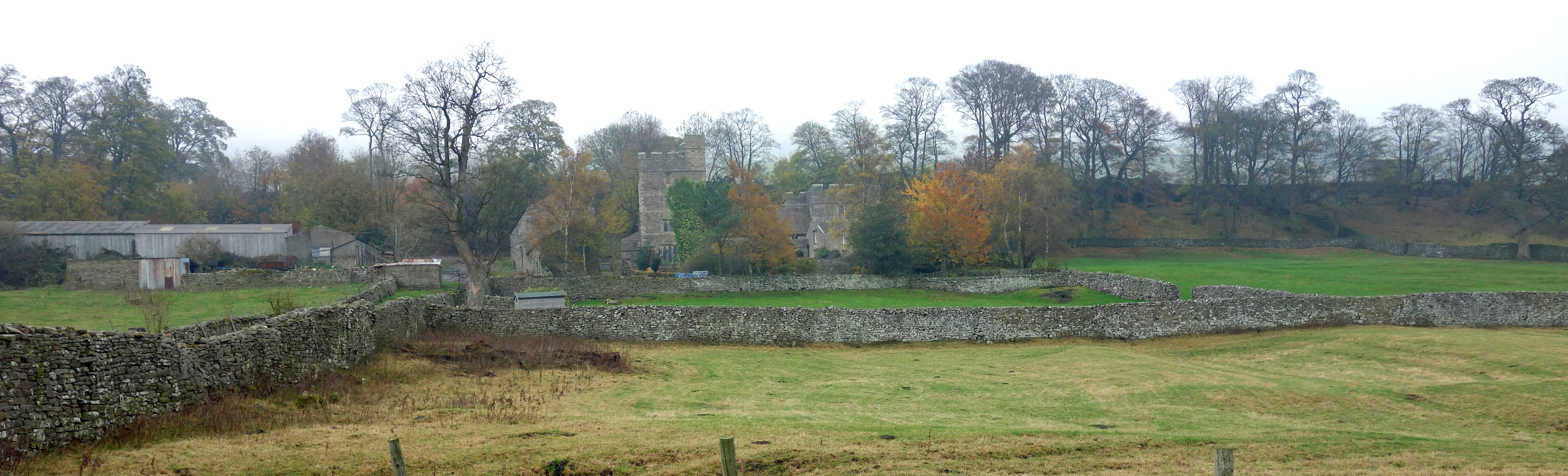
Nappa Hall - sorry, the cloud droplets have fuzzied this photo.
(There's a better photo of Nappa Hall on Wikipedia.)
Nappa Hall reflected the growing wealth and status of medieval rural gentry. It has a
long hall and two towers, of four and two storeys, with crenellated parapets that give
an impression of defensibility. Subsequent alterations by the Metcalfe family are,
according to a Historic England report, “not indicative of great wealth or having
distinguished craftsmen at command”.
After the Metcalfes left Nappa Hall in the 1750s it was occupied by tenant farmers. They had little incentive to maintain the whole building, and parts of it, such as the high tower, suffered from neglect. The wealthy owners did have schemes for the Hall, such as converting it into a shooting lodge, and it seems that a stable and coach house were added but the original Hall remains substantially intact.
Members of the Metcalfe family moved back into Nappa Hall in 1889 but sold it in 2008 to the
publican and artist, Mark Thompson. He put forward plans to renovate the Hall, including converting
some of the Hall and outbuildings for holiday lets. However in 2014 it was reported in the
Yorkshire Post
that Thompson, although “in the middle of restoring Nappa Hall”, was moving to Greece. I don’t know what the situation is today.
To me, it seemed that Nappa Hall was grey, silent and still, like almost everything
else I’d seen. A close inspection is not possible but I could see no sign of habitation or on-going work.
There was nobody about and no cars parked. From the road there was nothing to even indicate that
Nappa Hall was there – and I saw no indication that the building is of any significance. If Nappa
Hall is as moribund as it seems to be and if it’s as important as Historic England says it is
then it’s rather sad. But if all those Metcalfes don’t care about it, why should I?
I cheered myself up on the walk back, along the old railway line and by the River Ure, by admiring the many fine barns, which are, in general, much more substantial structures than the acclaimed field barns of Swaledale to the north. The sun never made it to Wensleydale.
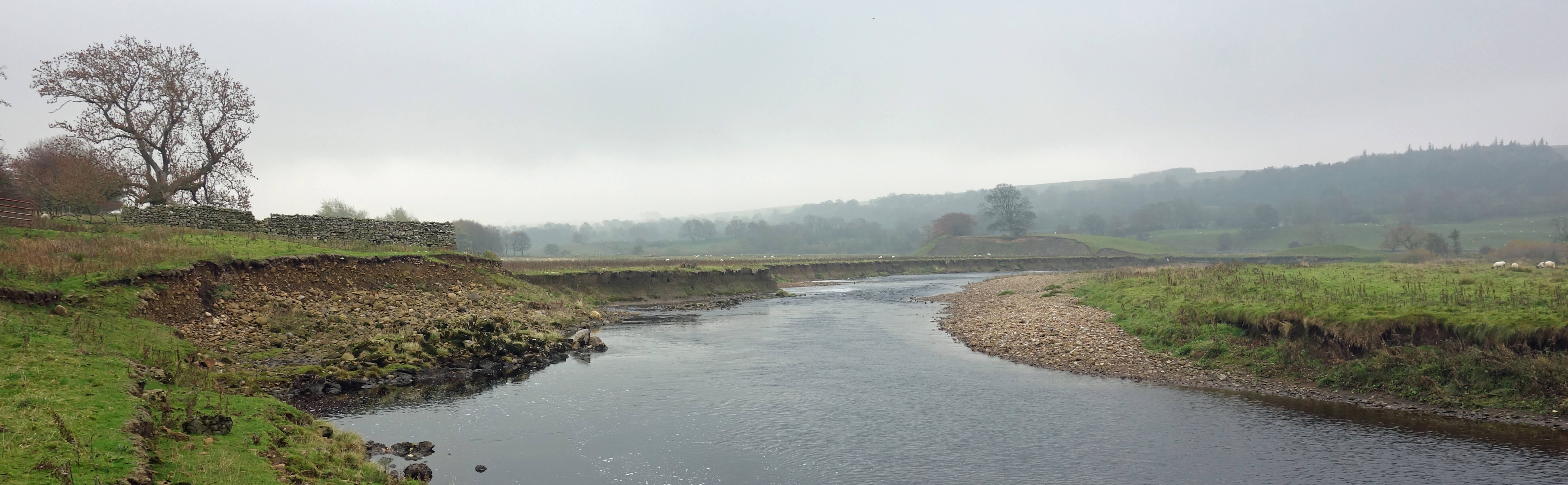
The River Ure, still under cloud
Date: November 5th 2018
Start: SD995889, P on A684 just west of Aysgarth (Map: OL30)
Route: N across River Ure, E – Bear Park – SE – High Force – N – Carperby – NW –
Oxclose Gate – W, NW on
bridleway – Heugh – SE, S – Nappa Scar Farm, Nappa Hall – W – old railway line – SE along railway line and by river – P on A684
Distance: 9 miles; Ascent: 160 metres
Home
Preamble
Index
Areas
Dales
Hills
Lakes
Places
Reserves
Rivers
Structures
Villages
References
Me
© John Self, 2018-

Top photo: The western Howgills from Dillicar;
Bottom photo: Blencathra from Great Mell Fell