
Home
Preamble
Index
Areas
Dales
Hills
Lakes
Places
Reserves
Rivers
Structures
Villages
References
Me
Saunterings: Walking in North-West England
Saunterings is a set of reflections based upon walks around the counties of Cumbria, Lancashire and
North Yorkshire in North-West England
(as defined in the Preamble).
Here is a list of all Saunterings so far.
If you'd like to give a comment, correction or update (all are very welcome) or to
be notified by email when a new item is posted - please send an email to johnselfdrakkar@gmail.com.
31. Pink Stones on the Orton Fells
The stone circle one mile east of Orton is magical but not because of its location or its structure.
Compared to the Castlerigg stone circle near Keswick, with its large monoliths in a dramatic setting
with a panoramic view, the
Orton circle (usually called Gamelands)
is uninspiring, being set in the corner of an ordinary field, with little view, and being composed of relatively small, prone stones. Not prune stones, prone stones. These stones have obviously fallen from the white limestone cliffs of the Orton Fells to the north and in the process of rolling down to form this circle have been metamorphosed into pink granite. That sounds magical to me.
Geologists have another theory. They say that a different trick has been played upon
us. When we weren’t looking, during the last Ice Age, the pink stones were slipped here by
glaciers from where the Shap Pink Quarry now is, five miles to the west. They call the stones
‘erratics’. Neolithic men and women must have gathered up 32 of them, plus one limestone
boulder by mistake, to make this circle.
Now, if the geologists’ theory were correct then the erratics wouldn’t just be in this one field – they would be scattered all around the region. So I would look out for them on this walk around the Orton Fells. I wouldn’t pause or divert from my route but I’d just see how many pink granite boulders I’d come across along the way.
I headed east on what is part of the Coast-to-Coast walk and by the time I
reached the road at Acres I’d already spotted eleven ‘pinks’, including two in the
wall of a barn (so, 43 in total). I saw another seven (50) around the hamlet of
Sunbiggin, where I noticed that they have recently set up a Coast-2-Coast Café.
I wonder how well it does, in this spot out-of-the-way except for those walkers.
I pressed on to Sunbiggin Moor, where although this heathery land has
probably never been cultivated I didn’t see any pinks. Perhaps I was distracted
by the views of autumn mist lifting from the Howgill valleys and from Wild Boar Fell.
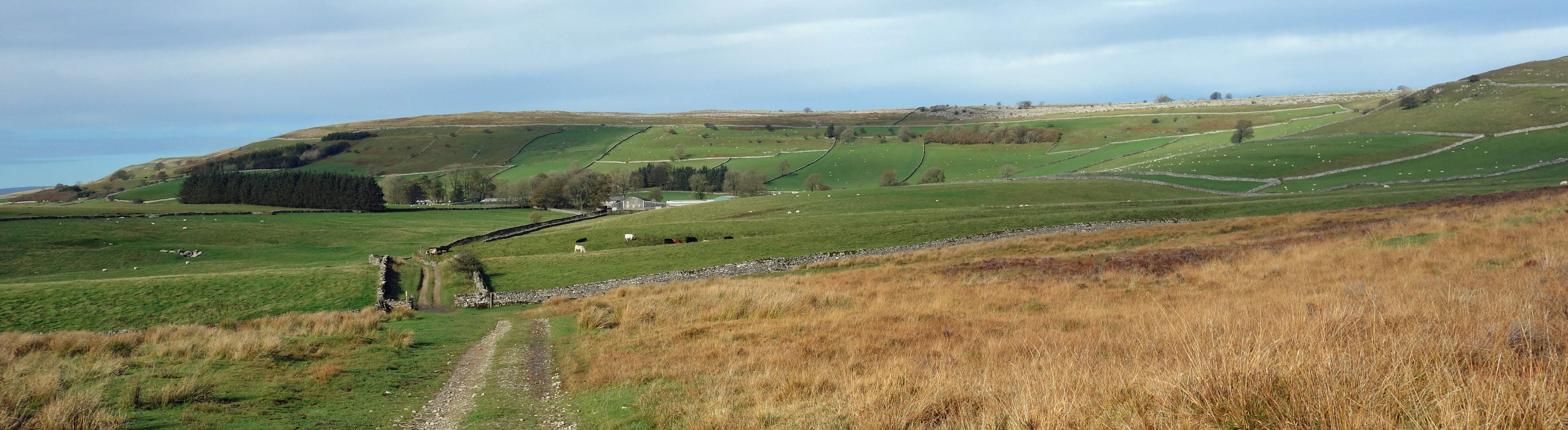
Sunbiggin and the Orton Fells from Sunbiggin Moor
Turning north, I came upon a pink so big that it has a name, Mitchell’s Stone (51). It is embedded in the wall that forms the parish boundary. Next I walked up and over the limestone terraces of Great Kinmond, with fine views opening out of the North Pennines ahead and of the Lake District hills to the west, with the distinctive profile of Blencathra prominent. I saw another pink when I reached the bridleway and a further seven close by the path further north (59). Here the soil had turned a dark red, which I assume is the influence of Penrith Red Sandstone.
I continued to the ancient settlement near Maisongill which the
Historic England website
considers to be “a good example of a Romano-British enclosed hut circle settlement”. To me,
it seemed to be a set of strange humps in a field, with a few stones sort-of-aligned. There
were two pinks (61) among the stones. This region appeared to be prime farming land, with
lush green fields well stocked with contented cattle and sheep. I passed six more pinks (67) in
the fields and by the fine track over Asby Winderwath Common up to the Great Asby Scar gate.
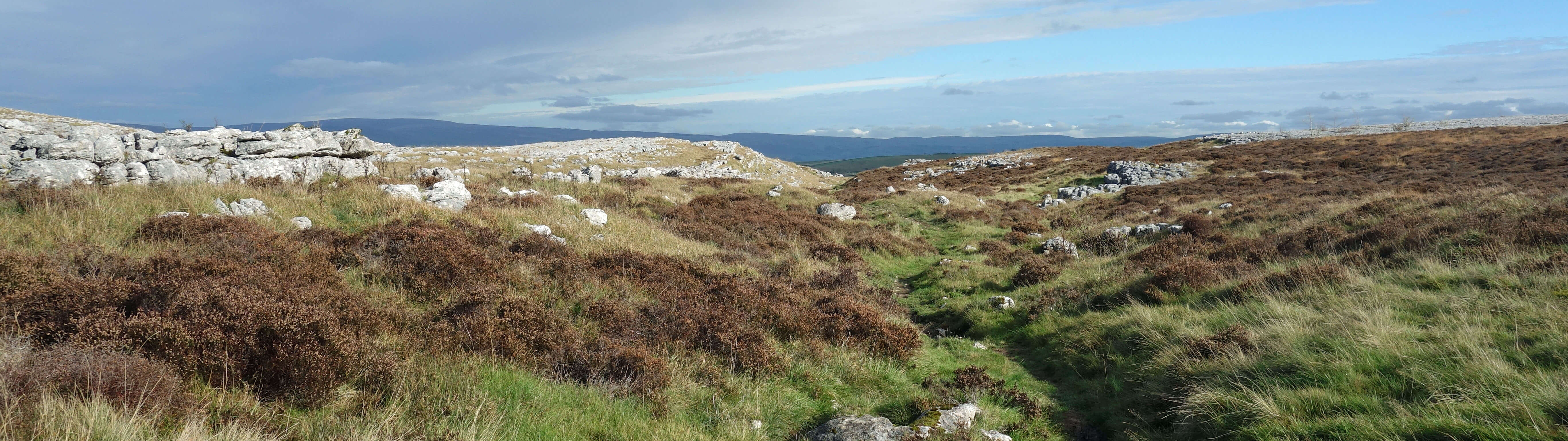
Great Asby Scar
Here Natural England has fenced off an area as part of a
Great Asby Scar National Nature Reserve.
The absence of grazers naturally leads to a change in the vegetation. The limestone terraces heretofore had been rather bare, with just the occasional shrub surviving the attentions of the sheep. Here, heather and small shrubs-cum-trees are recolonising. It is a rather captivating, secluded area among limestone outcrops that I imagine at other times of the year has a more impressive display of flowers. I had forgotten about the pinks until I stepped on one embedded in the path (68).
I cut across to see the Thunder Stone, another large pink embedded in a wall, spotting another pink on the way there, and on over Beacon Hill to the road, seeing three more pinks on the way (73). The path down to Broadfell passes fields that have a number of large stones within. With my new expertise at identifying pinks, I’d confidently say, from a distance, that these are also pinks. I counted twelve (85), and, since I’d otherwise have to trespass with a tape measure, I declare two of them joint winners of the largest pink prize. They looked about two metres round. The glaciers did well to shift those.
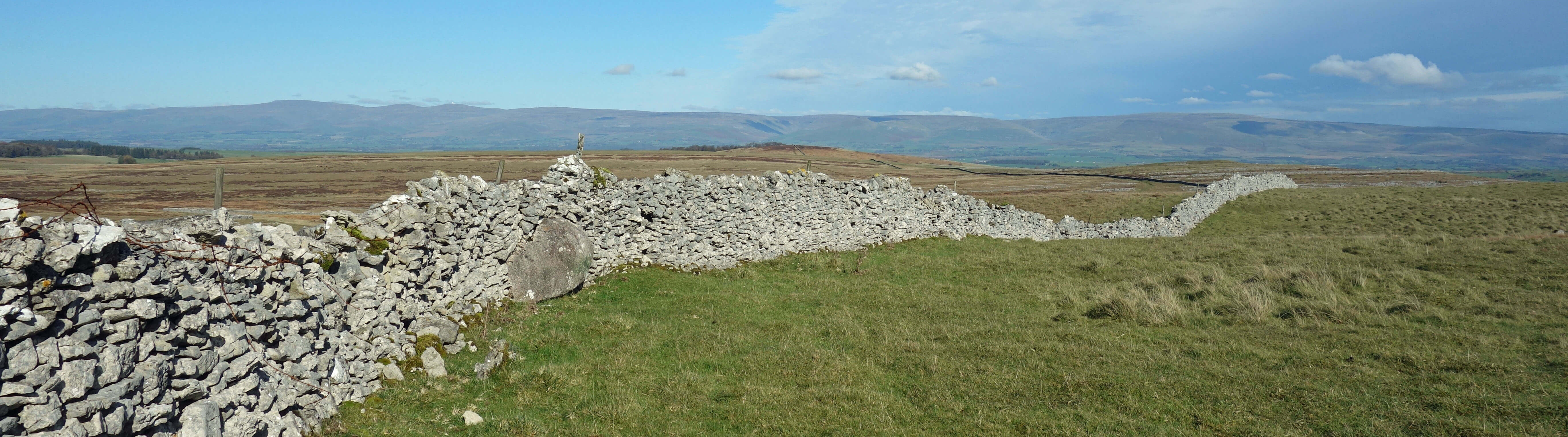
The Thunder Stone with North Pennines beyond
The beck flowing past Broadfell seemed somewhat jaunty and not fully settled into its bed. At a wee bridge at least eight pinks (93) had been used to protect the bank. I saw three pinks in the beck, two beside it (98) and I suspect many protecting it, overgrown with moss. At this point, two buzzards circled noisily above – which made me realise that the Orton Fells had been devoid of bird sound, unless you count a helicopter.
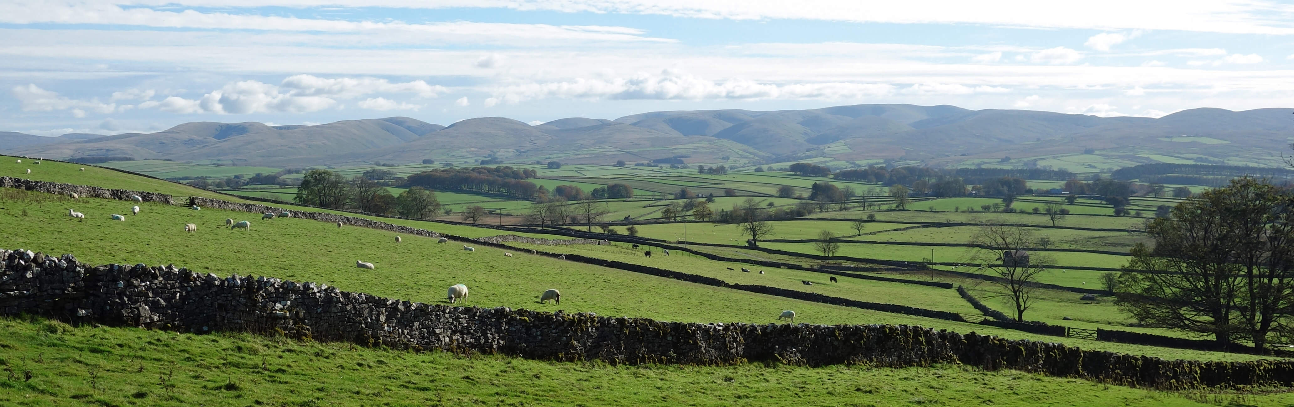
The northern Howgills from the path down to Orton
Entering the village of Orton, I noticed three large pinks embedded in garden walls, two
used as garden ornaments, and about twenty positioned along grass verges – all before I’d reached the ice-cream shop. I stopped counting. Clearly, the residents of Orton are fond of their pinks. Yes, the pink granite boulders are well scattered around the Orton Fells. The geologists might be on to something.
Date: October 15th 2018
Start: NY622082, Orton (Map: OL19)
Route: E, N on Knott Lane – stone circle – E – Acres – NE – Sunbiggin – E, N – Mitchell’s
Stone – N, NW, N on Dales High Way – settlement – NW, SW on Sayle Lane, SW – Great Asby Scar – W – Thunder Stone –
SW, W – Beacon Hill, quarry – S – Broadfell, Orton
Distance: 11 miles; Ascent: 275 metres
Home
Preamble
Index
Areas
Dales
Hills
Lakes
Places
Reserves
Rivers
Structures
Villages
References
Me
© John Self, 2018-

Top photo: The western Howgills from Dillicar;
Bottom photo: Blencathra from Great Mell Fell