
Home
Preamble
Index
Areas
Dales
Hills
Lakes
Places
Reserves
Rivers
Structures
Villages
References
Me
Saunterings: Walking in North-West England
Saunterings is a set of reflections based upon walks around the counties of Cumbria, Lancashire and
North Yorkshire in North-West England
(as defined in the Preamble).
Here is a list of all Saunterings so far.
If you'd like to give a comment, correction or update (all are very welcome) or to
be notified by email when a new item is posted - please send an email to johnselfdrakkar@gmail.com.
29. The Quiet End of the Ribble Way
Some walkers advocate urban walking. This is not just because they don’t have fields, hills and
valleys nearby. They have convinced themselves that urban walking has its own benefits. The
90% of us who live in urban regions have a duty, they say, to investigate whatever is within our walking range. Shops, churches, streets, slums, palaces … all can be visited without the danger of becoming stuck in a bog or falling off a cliff. Urban walkers may indulge a fascination with local history and architecture, with areas of dereliction seemingly of particular appeal. Although many cities have developed without the notion that people might choose to walk about them, recent renovations of canals, old railway lines and riversides have provided avenues of relative peace for walkers. They have also provided havens for wildlife and indeed the concentration of it within urban patches of greenery may surpass that now remaining in the uniform, sterilised fields of our countryside.
I began this saunter with some urban walking of my own. From Preston bus station, an iconic building in its own right,
I headed through the traffic and Saturday shoppers, past some fine municipal buildings and down Fishergate.
Beyond the railway station stood the sturdy, red County Hall. Housing the Lancashire County Council offices, it confirms that Preston is the administrative centre of Lancashire, with Lancaster retaining the honorific title of ‘county town’.
At the end of Fishergate a melange of roundabouts, bridges and flyovers ensured a cacophony from
which I expected to escape by joining the
Ribble Way and following it towards the estuary. The Ribble Way
is a 70-mile path between the source of the River Ribble above Ribblehead and not quite the estuary but Longton, where the Ribble meets the River Douglas. Although it seems more natural to me to walk down with a river, the Ribble Way is usually described as starting at Longton. I suspect that this is so that walkers don’t skip the Preston-Longton section, thereby depriving Longton of the walkers’ custom.
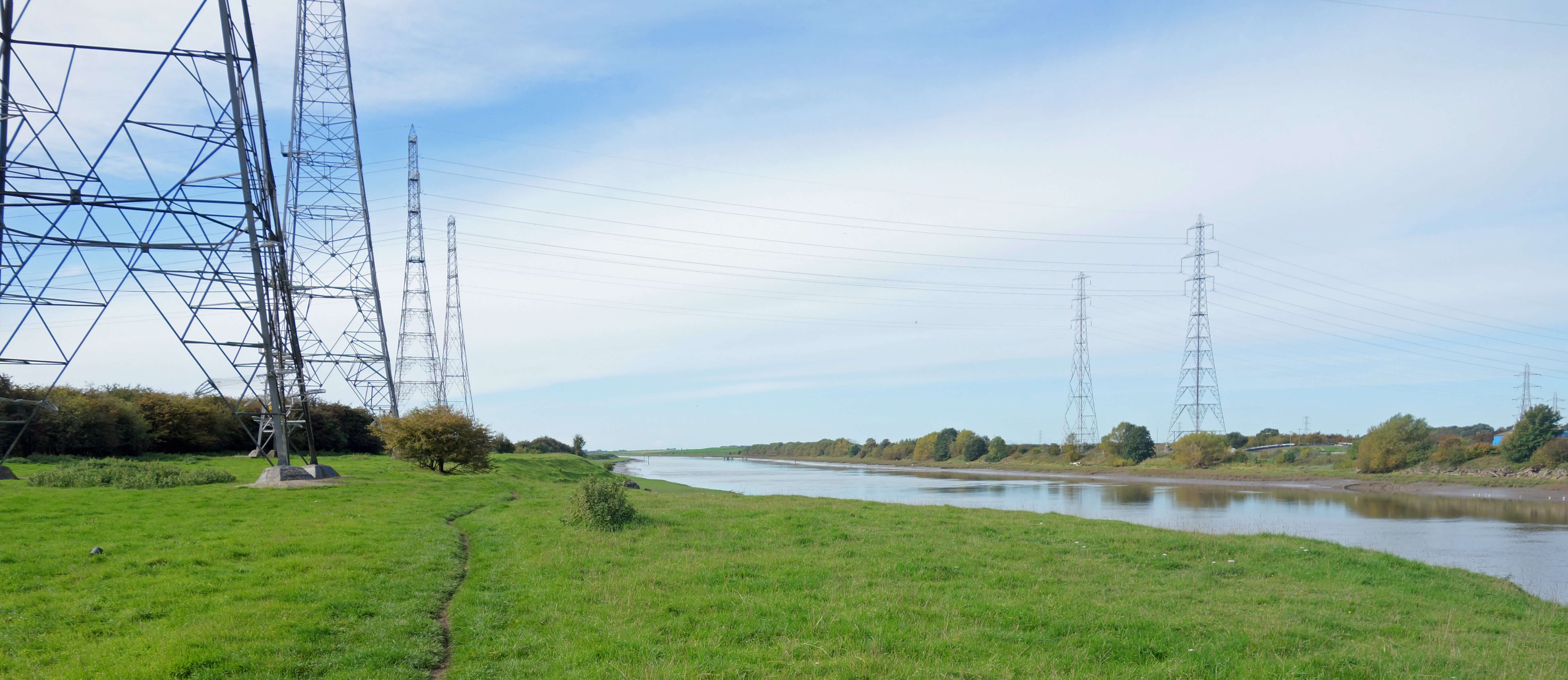 As I walked west the roar of traffic gradually subsided to a hum. I anticipated rural tranquillity thereafter but I was disabused in two ways. First the horizon became infested with pylons – I counted about fifty of them. When pylons first appeared in the countryside about a hundred years ago there were, of course, objections. However, some people professed to like them. In fact, there was a group of ‘pylon poets’ who expressed admiration for pylons and other technological innovations. Today we see protests only when pylons are proposed within revered landscapes, such as the Lake District. On the whole, we see pylons but no longer notice them. We cannot help but notice them on this section of the Ribble Way: we walk right by them.
The second intrusion came from the north bank of the Ribble. The air gradually became filled with the
noise of scores of motorbikes on the
Preston Docks Motocross
track. It is not a karting track, as marked on the OS map, and it is longer than indicated there, extending for a mile or so to Savick Brook. I have tried to think of a simile (angry wasps, farting tubas) to convey the impression of this noise but none do it justice. You’ll just have to imagine the continuous, intermingled vrooms of many bikes as they raced round bends and over humps, a noise that accompanied me unabated for an hour or more. The noise is particularly annoying because you can’t really see what is causing it. There is an occasional glimpse of a bike flying over a hump but you can’t see enough to engage with the activity or to appreciate whatever skill is necessary. As far as I could tell, the bikers were not organised at all, as they would be for races, say. They just seemed to be speeding about at random.
I am not implying that this activity should not be allowed. Clearly, hundreds of people were enjoying themselves
on the north bank, whereas on the south bank there was only me and two women with a dog. Even in silence I don’t
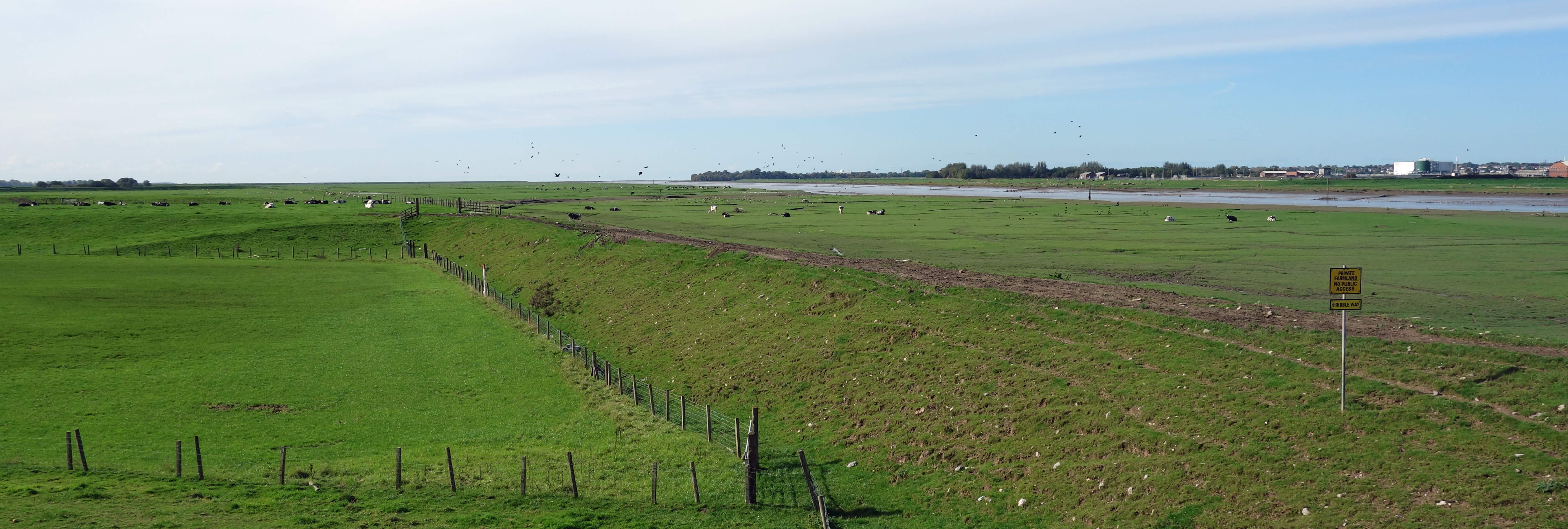
think we’d be having much fun. There was little to see. Ahead the horizons were flat, with only a distant
indication of Warton and Lytham and no real view of the sea. To the left were ordinary farming fields,
none rising to more than five metres or so. To the right, the Ribble flowed slowly seawards within its banks of the usual flood detritus. It was only the levee that I was walking on that provoked any thought. It is surely not natural and yet it seems far wider than it needs to be. It must have been a prodigious effort to build it.
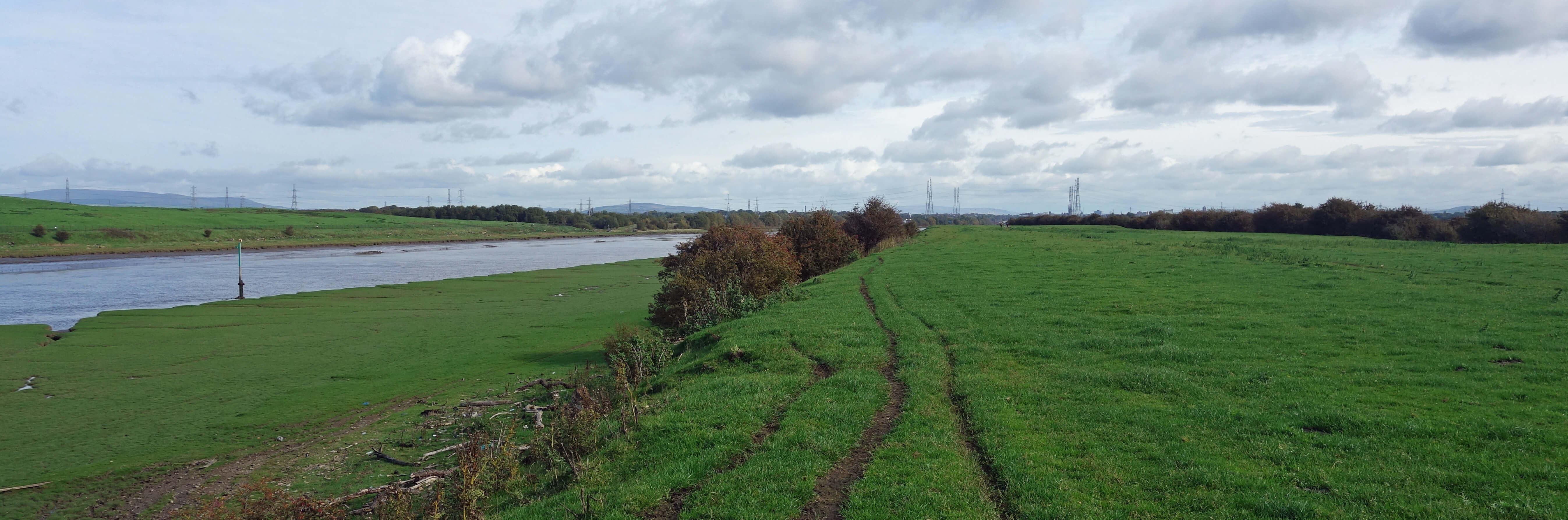
From the Ribble Way, near the River Douglas, looking east
From the Ribble Way, near the River Douglas, looking west
The motorbike noise did not begin to fade away until the path turned south as it reached the River
Douglas. Looking back through the pylons and beyond Preston I could see the Pennine hills and envy the walkers thereon. Longton Marsh is marked as open access land but it lacked allure so I ignored it and pressed on to the end of the Ribble Way. From here I tackled more urban (or suburban) walking to get back to Preston. The roads became progressively noisier but I am not complaining. It’s what you expect of roads heading towards a city. The few lulls in the traffic noise were filled by the distant vrooming.
I passed through Longton and Hutton both, I’m sure, fine places to live, if you need to commute to Preston.
Shops, pubs, garages, and so on – but I saw nothing of distinctive interest that would cause me to encourage anyone
to visit. I entered Penwortham, separated from Preston only by the Ribble. I noticed a line of shops that all
seemed to offer cosmetic services. Is it possible
nowadays to make a living by treating lashes and brows? What’s wrong with
our natural lashes and brows? Can men have their lashes and brows treated? I would
hope so in this
day and age. Yes, this urban walking certainly stimulates thoughts that do not occur on a mountain top.
Date: October 6th 2018
Start: SD542297, Preston bus station (Map: 286)
Route: SW – Penwortham New Bridge – N, W, S along Ribble Way –
Dolphin Inn, Longton – NE, E – Longton – NE – Hutton, Penwortham, Preston bus station
Distance: 13 miles; Ascent: 20 metres
Home
Preamble
Index
Areas
Dales
Hills
Lakes
Places
Reserves
Rivers
Structures
Villages
References
Me
© John Self, 2018-

Top photo: The western Howgills from Dillicar;
Bottom photo: Blencathra from Great Mell Fell