
Home
Preamble
Index
Areas
Map
References
Me
Drakkar
Saunterings: Walking in North-West England
Saunterings is a set of reflections based upon walks around the counties of Cumbria, Lancashire and
North Yorkshire in North-West England
(as defined in the Preamble).
Here is a list of all Saunterings so far.
If you'd like to give a comment, correction or update (all are very welcome) or to
be notified by email when a new item is posted - please send an email to johnselfdrakkar@gmail.com.
10. The 'Hillfort' of Addlebrough
Mike Harding – singer, songwriter, comedian, author, poet, broadcaster and multi-instrumentalist,
according to
his website, and also a Lancastrian enamoured of
the Yorkshire Dales and a former president
of the Ramblers’ Association – wrote in his 1986 best-seller Walking the Dales that the first century
Brigante chief Venutius “hoped to contain the power of the Romans … [and] as well as the massive fort at
Stanwick [near Brough], he built forts on Ingleborough, Gregory Scar (north of Grassington) and on
Addlebrough in Wensleydale”. It is a romantic thought that the brave British Brigantes built a
fort on the prominent flat-topped hill of Addlebrough in order to face off the Romans based down in
the valley at
Virosidum, their fort at
Bainbridge, but is it likely?
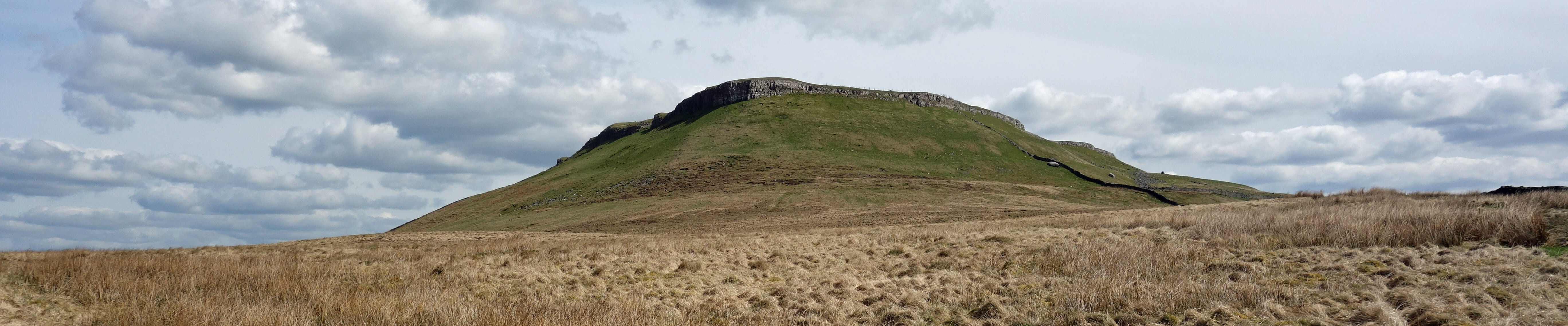
Addlebrough, from the north-west
The second part of the name Addlebrough is presumably derived from the Old English word burh, meaning "a fortified place”.
However, the Ordnance Survey does not use its special font to mark an ancient hillfort on Addlebrough although it
does indicate ancient settlements and cairns on and around it. Perhaps Harding assumed an analogy with Ingleborough,
where a hillfort is marked by the Ordnance Survey. However, Johnson (2008) doubts that the evidence of ancient
constructions on Ingleborough signifies a hillfort, despite what the Ordnance Survey has marked.
Perhaps it depends what exactly we mean by a ‘fort’. If we adopt the standard dictionary definition of a
“military building designed to be defended from attack” then, yes, a hill-top barracks, surrounded by a wall, is
rather difficult to attack. However, there is little need to attack because the garrison therein is no threat and
does not have the means (water and food) to survive there for long. Although the Brigantes were hardy people,
it seems somewhat perverse for them to expose themselves to the worst of the elements on Ingleborough and
Addlebrough (perhaps less so on Addlebrough, as it is only 480 metres high), although the climate was rather warmer
and less windy at that time.
However, if we doubt the existence of a hillfort on Ingleborough and especially on Addlebrough then we
need to explain what the ancient constructions were. As far as Ingleborough is concerned, Johnson suggests that
the ancient hut circles are from structures that may have served more of a ceremonial function. In Addlebrough’s
case, we seem to have settlements marked not on the plateau top but to the west and south of it. I went to try
to absorb the atmosphere of these ancient settlements, without, of course, expecting to find any answers.
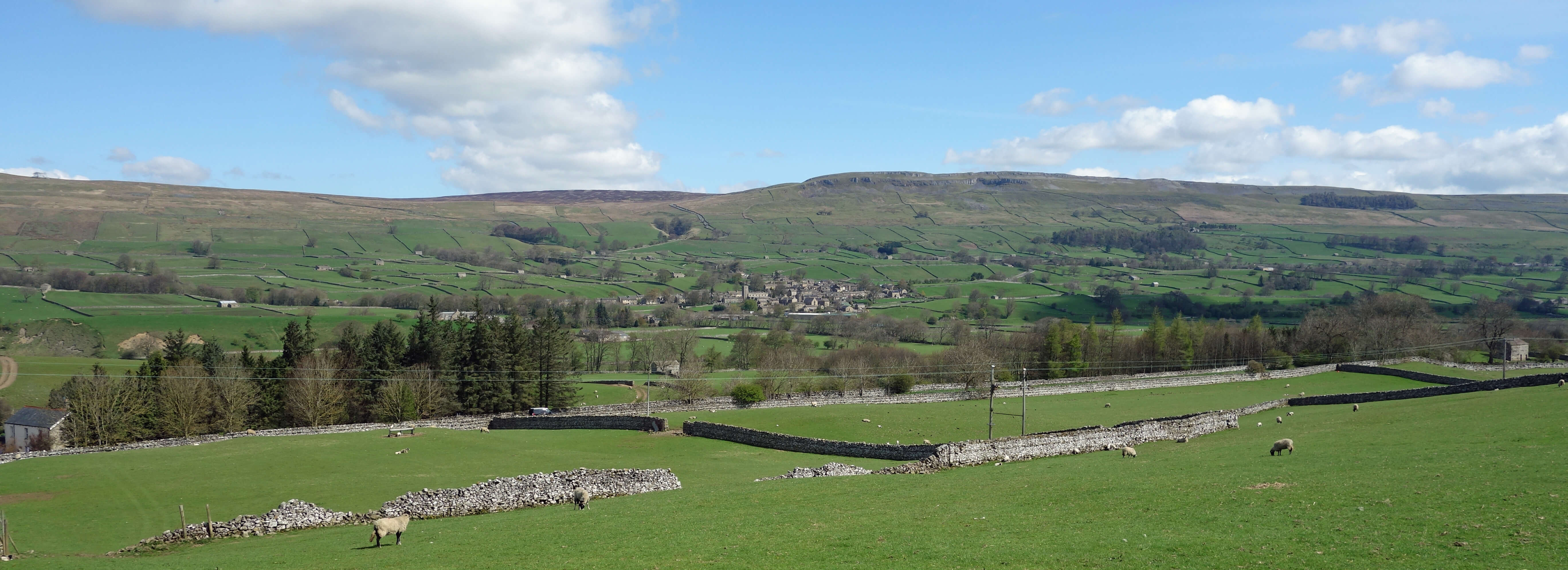
Wensleydale, from near Bainbridge
I walked from the triangular green of Bainbridge to Thornton Rust, a quiet village of fine houses
and a tucked-away car park, from which a bridleway heads up to Addlebrough. I detoured south to Greenber Edge
to have a look at the remains of old settlements, that is, the lines of old walls and a large pile of stones
forming the cairn of Stony Raise. Of course, not all ancient people settled in the higher regions. That is
just where there are still remains. The remains of those who lived in the valley of Wensleydale no longer
remain, because the farming since has obliterated them. Anyway, clearly some people had long ago settled
themselves upon this high ridge, with a view of Addlebrough across Thornton Mire.
I settled myself there to
have a snack and to imagine their life. Radiocarbon dating studies of the mire have shown that 8,500 years ago
it was a pine forest, that by 4,500 years ago birch, alder and hazel predominated, and that by 2,500 years ago
the woodland had been cleared. I don’t know how they survived then but if they had lived here now they could
have had a rabbit-rich diet, as the hill was full of them.
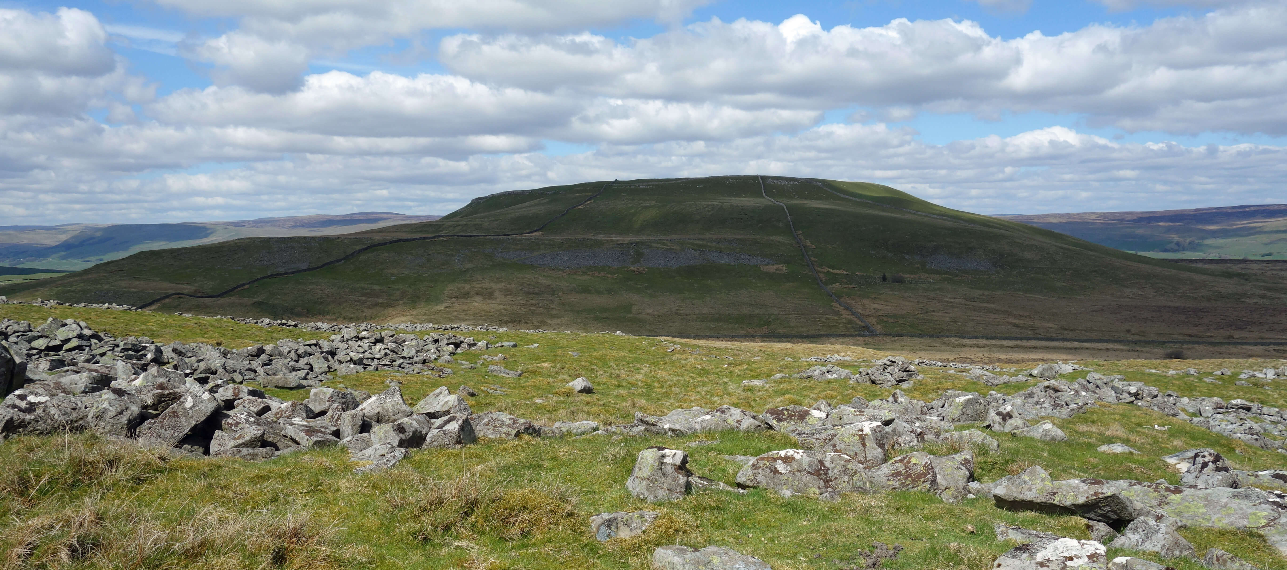
Addlebrough from the ruins of the ancient settlements
I reflected also upon the geology. The scars below Addlebrough, and of Addlebrough itself, are
obviously of limestone but the walk up the bridleway headed towards the darker hills of Black Pasture and
Stake Fell. One or two grouse flew past, and a shooting hut and butts could be seen. This hill becomes
heather moorland, with the heather growing upon millstone grit, not limestone. The Greenber Edge settlers
seemed to use slate, not limestone, for their walls and cairns.
The view from Addlebrough was splendid. The spring green valley of Wensleydale was stretched out
below, with the River Ure meandering therein and with Abbotside Common and Askrigg Common rising above.
The only discordant note lie on the horizon, which was disfigured by patches of rare, medium and thoroughly
burnt heather. How did we come to accept this as natural? And how did the Commons come to be uncommon,
reserved for a few to kill birds? I turned away, west, where a fine view opened out of Semer Water, the second
largest natural lake in North Yorkshire, Malham Tarn being the largest.
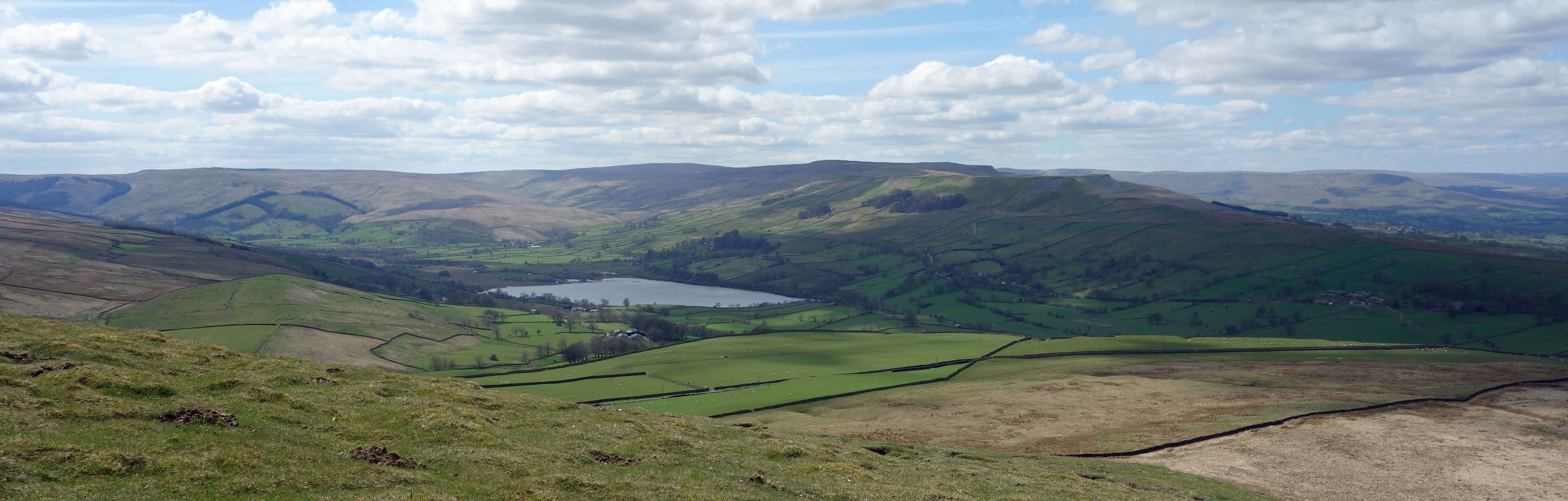
Semer Water, from Addlebrough
I wandered about the top of Addlebrough. I could see nothing that, to my inexpert eyes, seemed similar to the remains of
ramparts and hut circles that even I can make out on Ingleborough. Addlebrough has a natural defence to the
north, in its limestone cliffs, but that seems all that might support a hillfort theory. My doubts are
reinforced by a
2014 report
by the Swaledale and Arkengarthdale Archaeology Group that says categorically
that “there are no defended settlements, or hillforts, in Wensleydale.” I conclude that Mike Harding was
carried away in his enthusiasm.
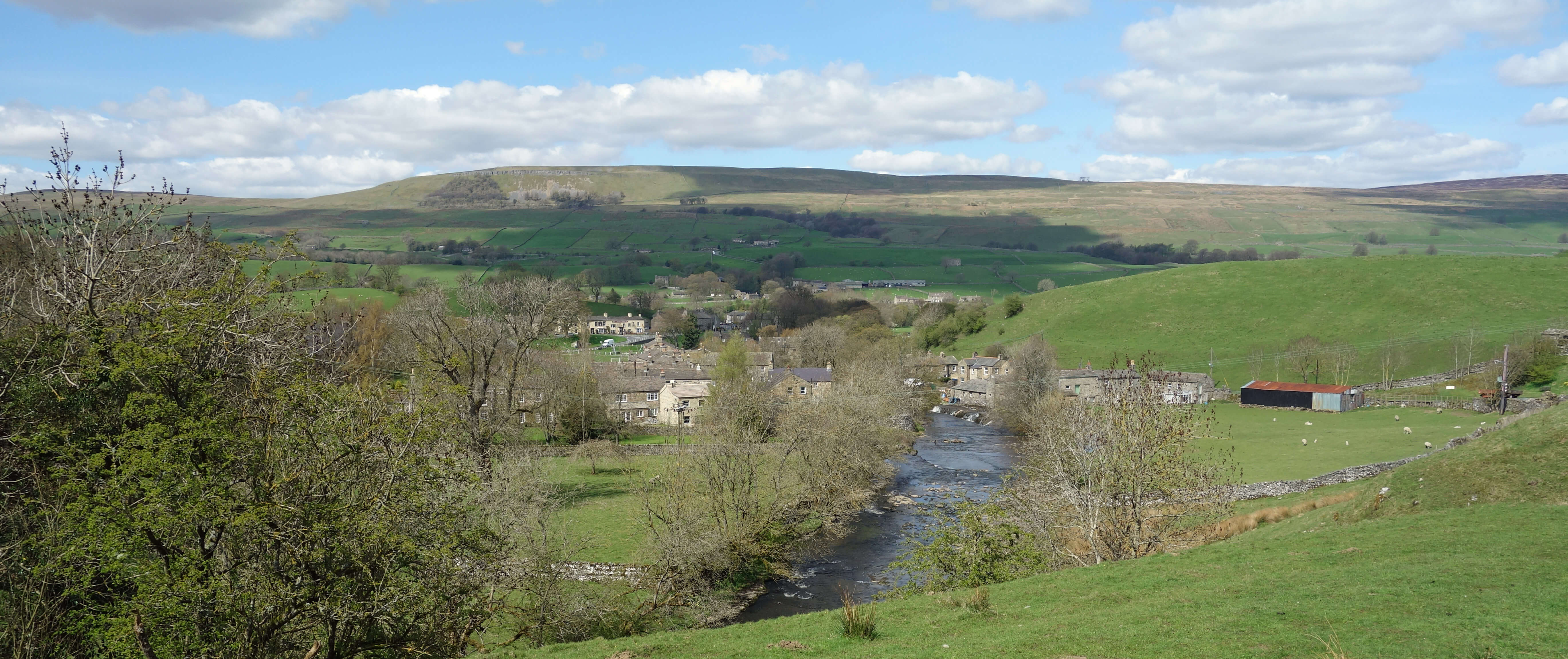
Bainbridge
Date: April 30th 2018
Start: SD934903, Bainbridge green (Map: OL30)
Route: SE over bridge – Brough Scar – E – Cubeck, Thornton Rust – SW, SW on bridleway, S –
Greenber Edge – W – Stony Raise – N – Addlebrough – W – Devil’s Stone – NW, N – Bainbridge
Distance: 8 miles; Ascent: 260 metres
Home
Preamble
Index
Areas
Map
References
Me
Drakkar
© John Self, Drakkar Press, 2018-

Top photo: The western Howgills from Dillicar;
Bottom photo: Blencathra from Great Mell Fell