
Home
Preamble
Index
Areas
References
Me
Saunterings: Walking in North-West England
Saunterings is a set of reflections based upon walks around the counties of Cumbria, Lancashire and
North Yorkshire in North-West England
(as defined in the Preamble).
Here is a list of all Saunterings so far.
If you'd like to give a comment, correction or update (all are very welcome) or to
be notified by email when a new item is posted - please send an email to johnselfdrakkar@gmail.com.
180. At the Heart of Bowland: Langdendale, Bleadale and Haredendale
One of the problems with gallivanting to all corners of North-West England is that
it may lead to the neglect of favourite localities nearby.
It must be a decade or more since I have walked from the picnic spot
at the heart of Bowland, by Langden Brook. So we set out to remedy this on
a sunny afternoon walk.
I always try to make the journey to and from a walk part of the day's entertainment,
rather than just a means to an end, but I don't usually write about it here.
I make an exception today because this drive is, for me, the best in the district.
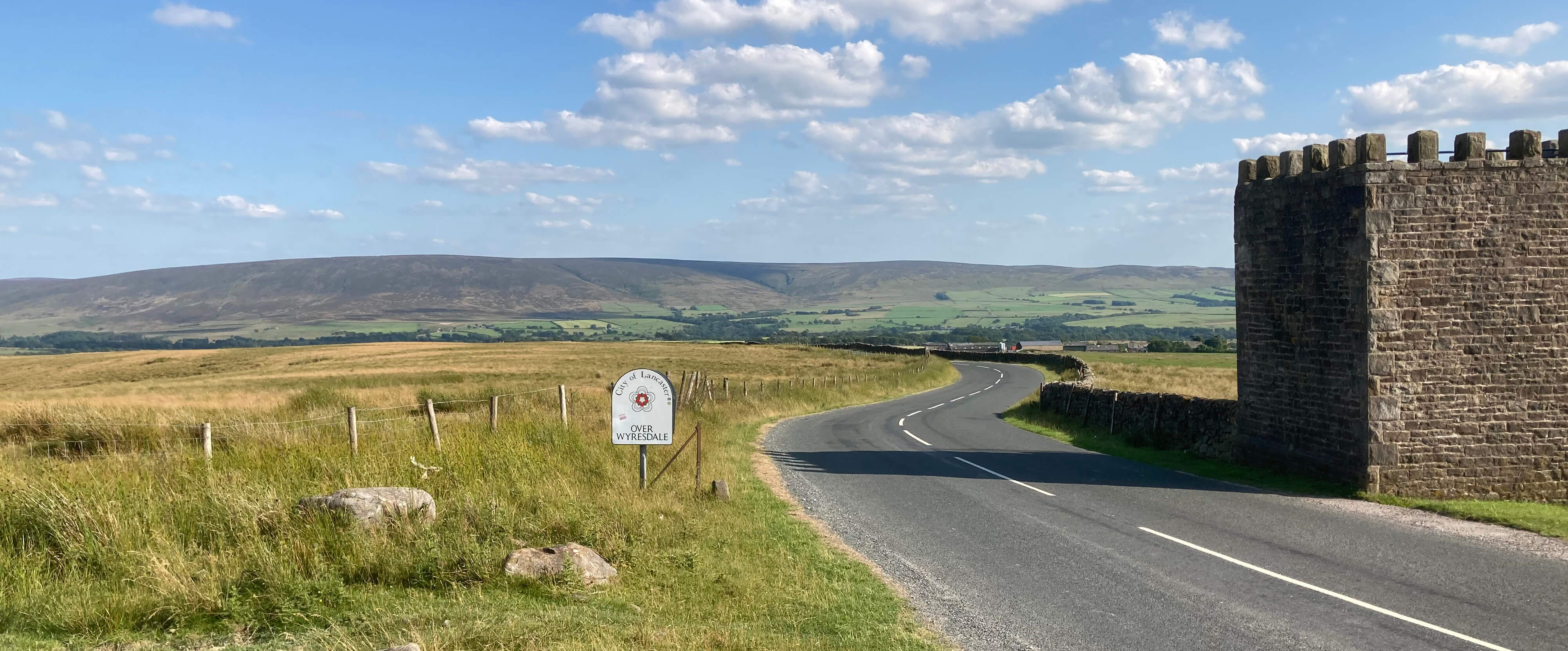
Passing through the green Quernmore valley, we drove up past Clougha Pike to Jubilee Tower,
with its excellent views across Morecambe Bay. On this occasion, however, the Lake District hills
were just grey outlines.
The road drops down to cross the Tarnbrook Wyre and then rises east alongside
the Marshaw Wyre to reach the watershed at the Grey Stone of Trough.
It then drops down through the Trough of Bowland, with waterways now flowing
eastward to join the River Ribble, eventually.
Beyond the never-changing Sykes Farm, we parked in the trees by Langden Brook.
Jubilee Tower, looking towards Hawthornthwaite Fell
We walked past the water intakes into the open countryside of
the Langden Brook valley, which I will call Langdendale.
There are usually one or two strollers on the stony track west
û while we were having a snack under a shady tree we chatted to a man
who seemed annoyed to have to leave the hills for a barbecue û but
beyond the so-called Langden Castle (just a barn) I've never seen anybody.
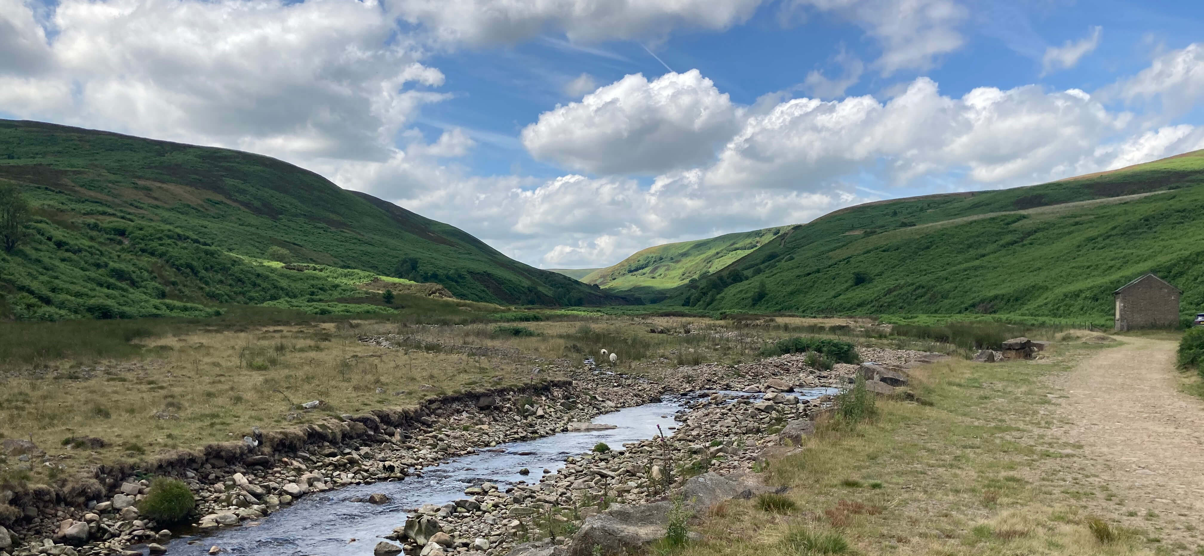
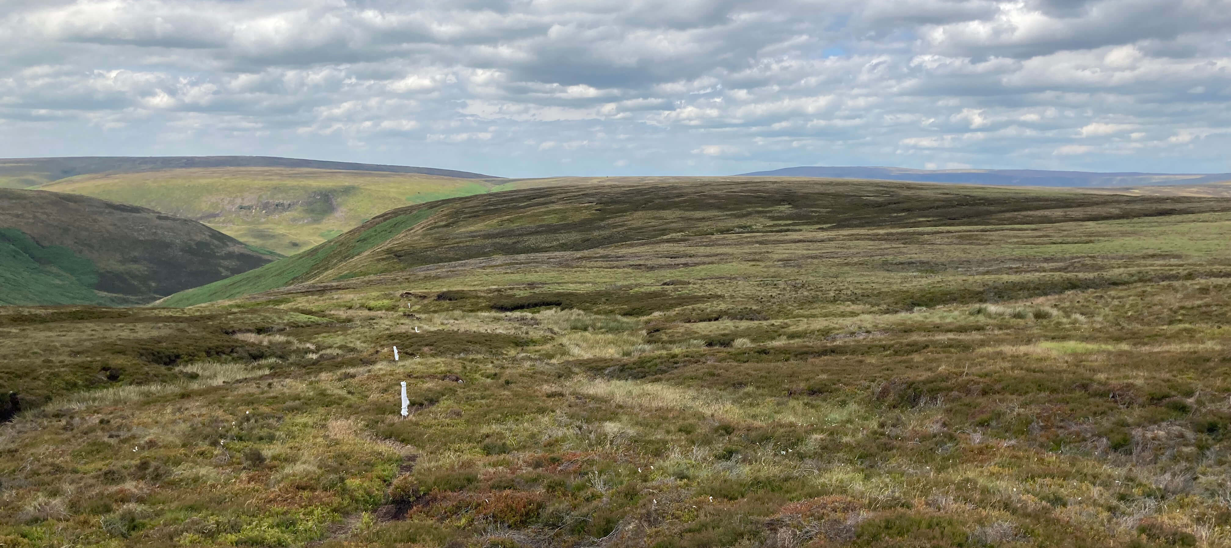
Entering Langdendale
The indistinct path south by Bleadale Water is better tackled when the bracken is not high.
I think we crossed the water-courses more times than was necessary.
However, the overall direction is clear enough and once the east bank of
Bleadale Water is gained it is straightforward into a remote wilderness,
which I will call Bleadale.
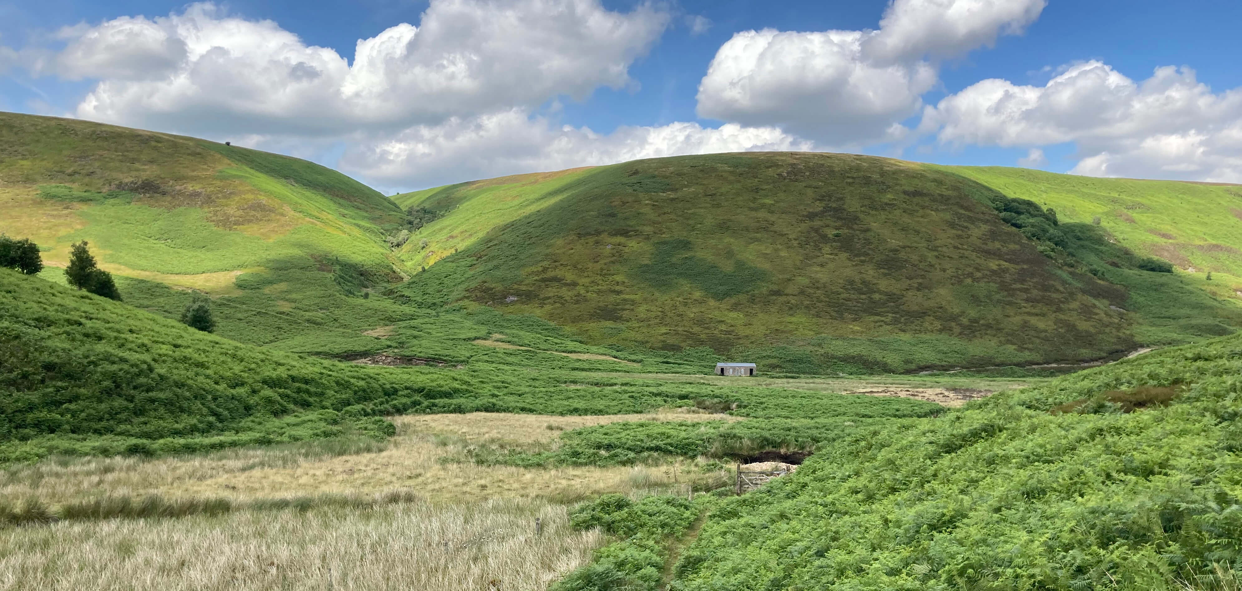
Looking back to Langden Castle from Bleadale
After about a kilometre a gill, unnamed on the map, opens out just before which a path
branches off left up the hillside. There seems to be nothing to mark the beginning of this path
but the path itself can be seen higher up cutting a swathe through the bracken.
Once the path is located it leads unerringly up to a line of grouse butts on
the top of Hareden Fell (at about 400 metres).
In fact, I'd guess that this path was created by grouse-shooters trekking up here
from Langden Castle when it was used as a shooting cabin.
Modern grouse-shooters are lazier: they expect to be driven up to cabins nearer the butts.
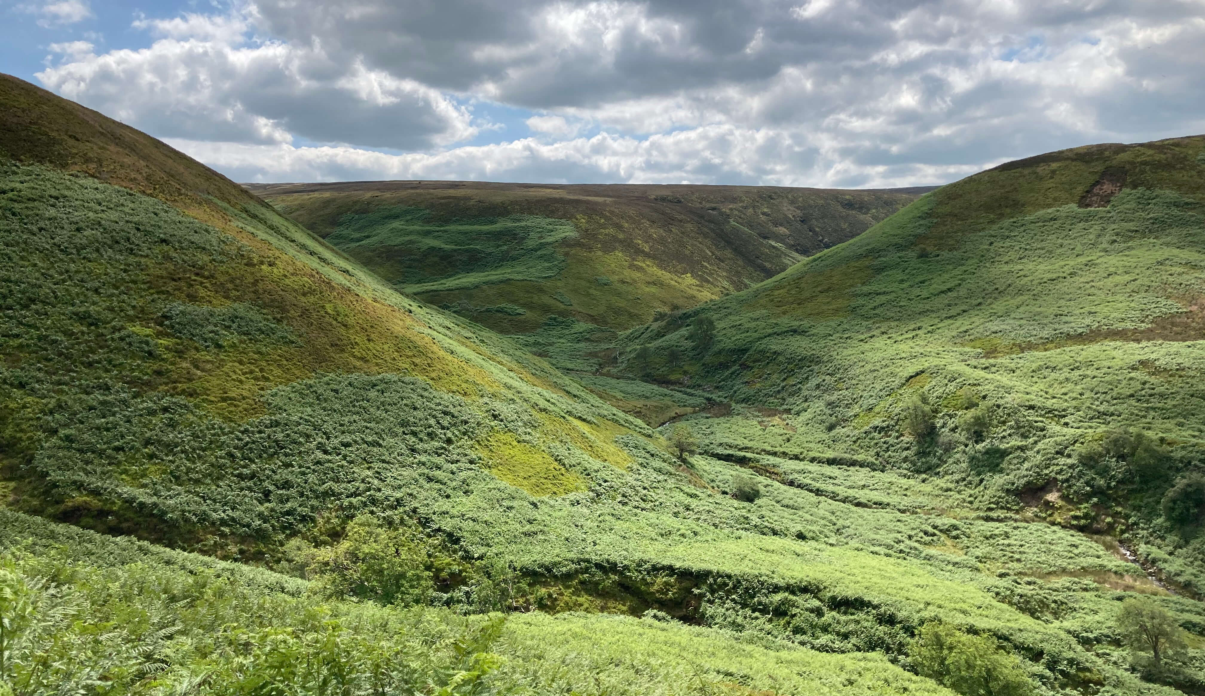
Looking up Bleadale, from the path climbing Hareden Fell
The grouse butts were a motley set of constructions that I doubt are still in use.
Except by us. We used them as directional aids.
There is always a path between grouse butts so we followed it
up to meet another line of grouse butts at 45 degrees.
We followed this second line north before cutting across moorland
to reach the track that leads up to the butts.
Hareden Fell is a rather unremarkable hump. There are no features of
interest on its broad expanse and it doesn't really have a top, since it continues
to rise slightly to the south.
And yet it's quintessentially Bowland up here.
As all the Bowland hills are
about 400 or 500 metres high one feels at the centre of a sea of hills
with the dark swells of Totridge to the east, Fair Snape to the south,
Hawthornthwaite Fell to the west, and many more.
It is not possible to see anything beyond the Bowland hills,
except to the east where there's a glimpse of the Yorkshire Dales tops.
As there's no sight of roads or houses, it really is a world apart up here.
Hareden Fell
However, not all seems well with the Bowland fells. You'd think
that in this neglected wilderness nature would flourish.
Well, the bracken is but we didn't see much flora or fauna to get excited about.
Birdlife was thin in the air.
We didn't see or hear a single grouse. I'd like the grouse to be here
because they are native moorland birds that belong here (and not so that
they may be shot).
My impression is that grouse-shooting on Hareden Fell has been abandoned.
I have expected grouse-shooting to die out fairly soon
not because there will be legislation to ban it and
not because grouse-shooters will repent the iniquity of their ways.
My anticipation was that individual grouse-shooters would come to realise that
they have become subjects of ridicule (do you remember when they sought exemption
from the covid restrictions?) and would give it up,
rendering the activity unprofitable.
Nobody likes to be the subject of ridicule.
But the absence of grouse would certainly end grouse-shooting!
In case the disappearance of grouse from Bowland should seem unlikely it is perhaps
worth mentioning that this is referring to red grouse. Fifty years ago
black grouse were also abundant in Bowland. There are none today.
There is a programme, or at least a hope, to restore black grouse to Bowland,
by transfer (natural or otherwise)
from populations of black grouse in the north Pennines that have stabilised and even increased
in recent years.
Following the track down into the valley of Hareden Brook, which I will call Haredendale,
we passed two shooting lodges,
the first definitely no longer in use and the second apparently so, as
there is no longer an access track to it.
Again, the valley was quiet and empty û and again it was overrun with bracken.
We noticed that a few trees had been planted, which may be the first steps
towards returning the valley to a more natural state.
The path eventually runs by Hareden Farm, and then a permissive path
allows a return alongside Langden Brook to the picnic spot.
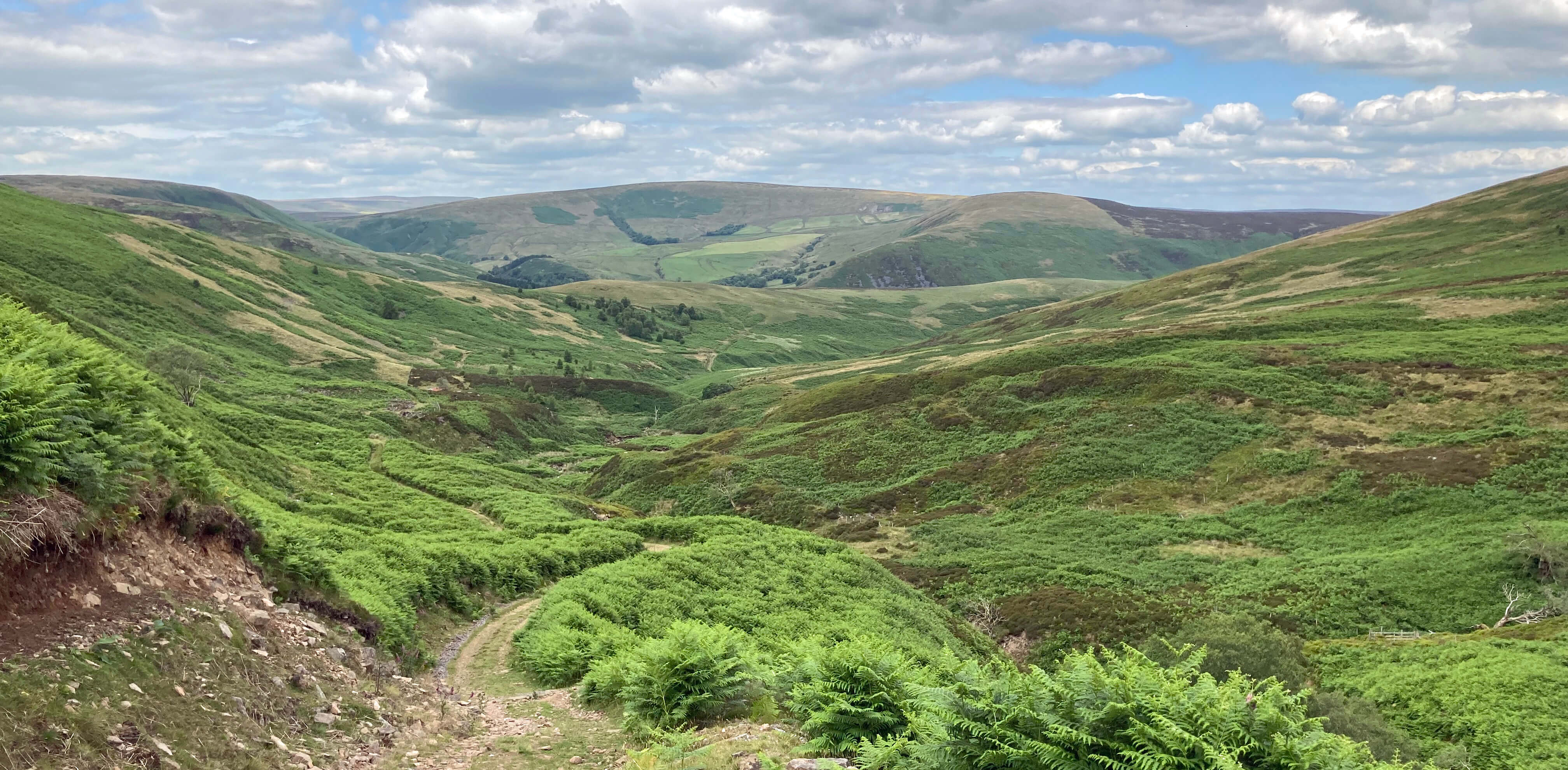
The track into Haredendale
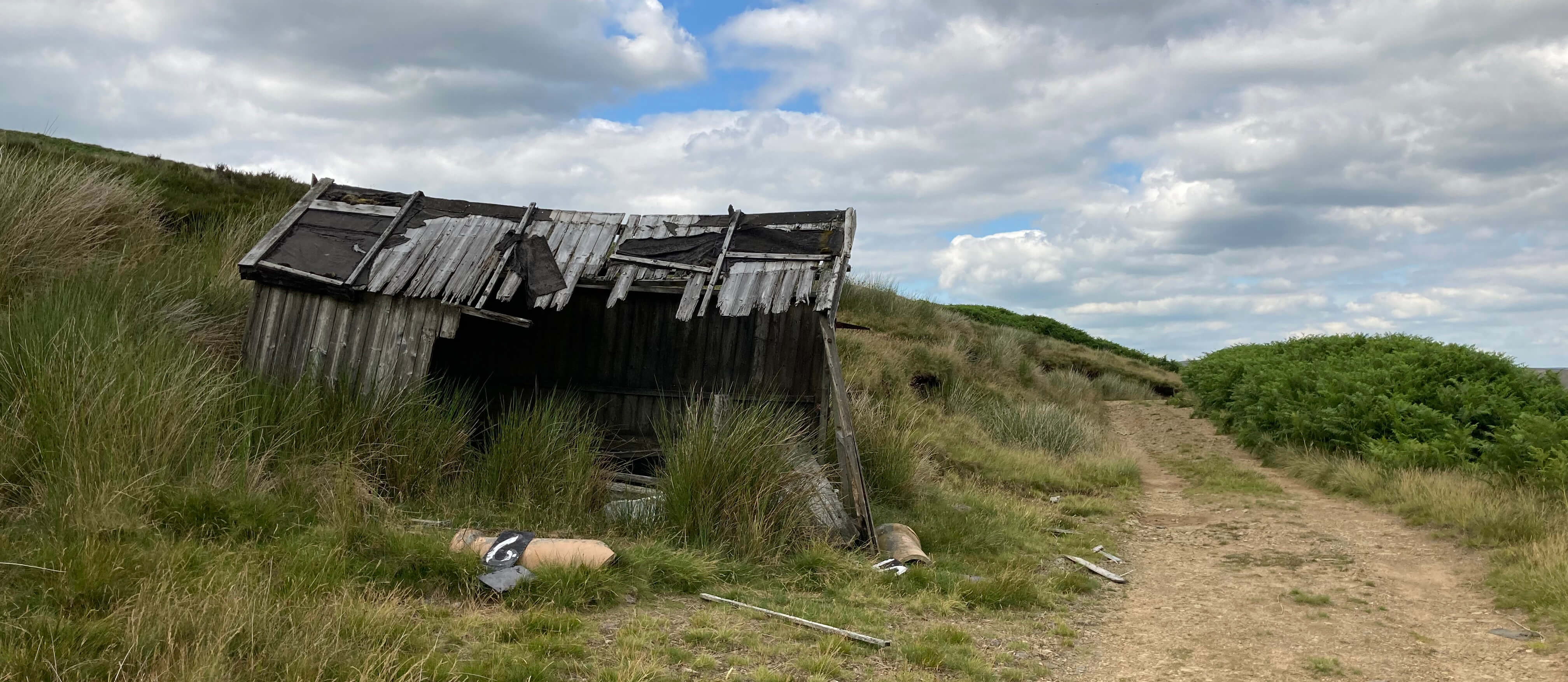
Haredendale ex-shooting cabin
As you may have noticed, the two streams emerging from the mountains are
Brooks, not Becks, as they would be in Cumbria. 'Beck' is derived from
the old Norse and its absence from central Bowland is an indication
of the limits of the Viking intrusion.
(On the other hand, we do have Fells, also from the old Norse, in Bowland.) Most
streams within Bowland are
called Brooks, although there are a few Becks to the south of Bowland.
My own village, to the north of Bowland, is in two minds about this.
The streams running through it are called Kirk Beck and Bull Beck
(and the latter is called Tarn Brook higher up the hill) and
the village itself is Brookhouse.
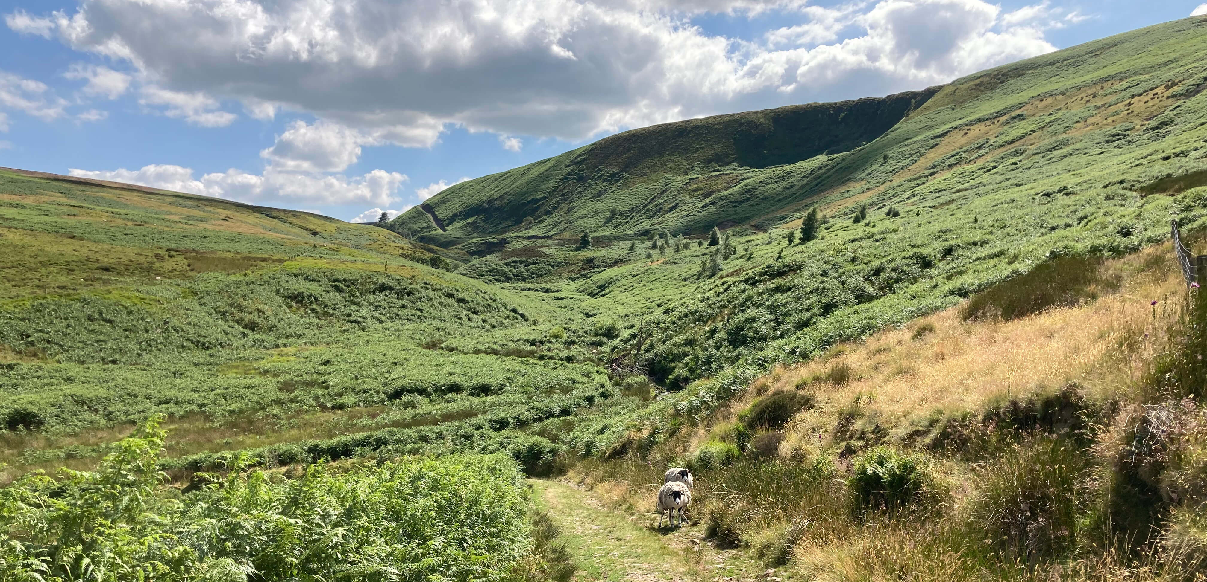
Looking back up Haredendale (our track down cuts the
horizon one-third in from the left)
Date: July 7th 2023
Start: SD632512, Parking spot by Langden Brook (Map: OL41)
Route: E û Langden Castle û S, SE by Bleadale Water, SE
on track û grouse butts û N, NE on track, N, E, NE û Hareden Farm û NW by
Langden Brook û parking spot
Distance: 7 miles; Ascent: 240 metres
Home
Preamble
Index
Areas
References
Me
® John Self, 2018-

Top photo: The western Howgills from Dillicar;
Bottom photo: Blencathra from Great Mell Fell