
Home
Preamble
Index
Areas
References
Me
Saunterings: Walking in North-West England
Saunterings is a set of reflections based upon walks around the counties of Cumbria, Lancashire and
North Yorkshire in North-West England
(as defined in the Preamble).
Here is a list of all Saunterings so far.
If you'd like to give a comment, correction or update (all are very welcome) or to
be notified by email when a new item is posted - please send an email to johnselfdrakkar@gmail.com.
181. Trail-Blazing on Farleton Knott
I set off west from Kirkby Lonsdale under grey skies. The clouds were flirting with
the hill-tops, making me glad that I had not been so bold as to head there. Instead,
I arrived first at the hamlet of Biggins, in two parts, Low and High. Biggins seems
somewhat aloof from Kirkby Lonsdale, a gathering of grand houses, most of grey stone,
including Biggins Hall, looking no grander than the rest. These houses are, however,
outshone by the bright white
Lonsdale Hall,
recently built on the outskirts of High
Biggins. It is, I believe, for sale for about ú2.5m. Perhaps if I had enough money
I could force myself to live in such a mansion so unsuited to its surroundings.
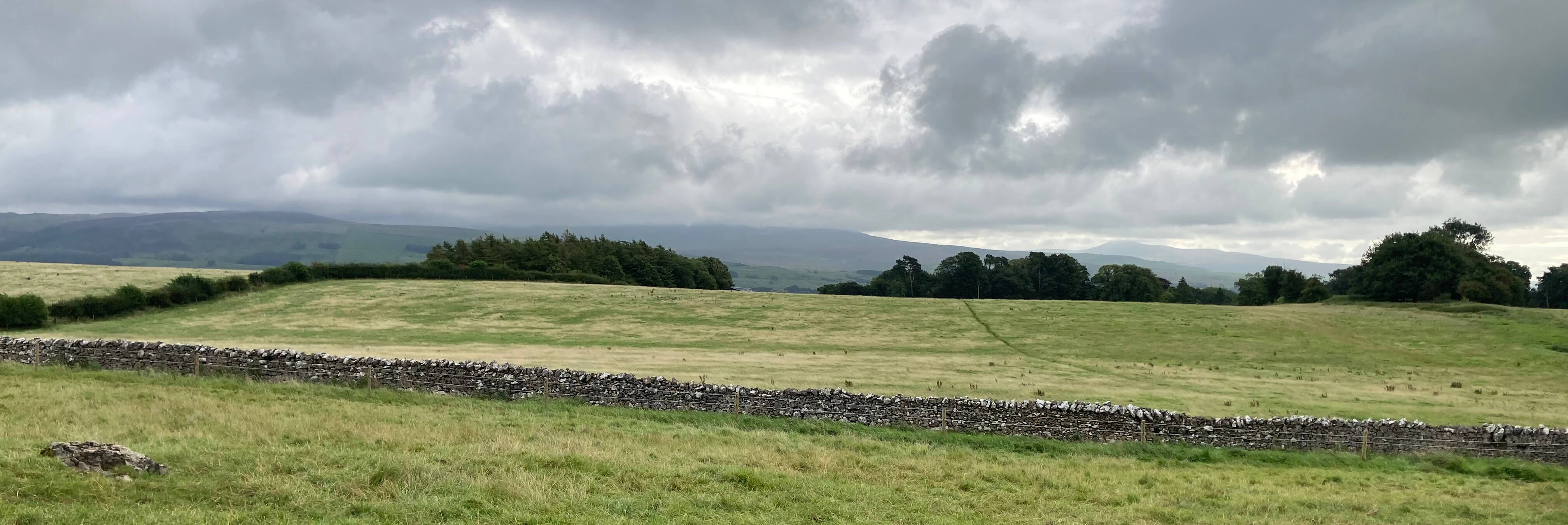
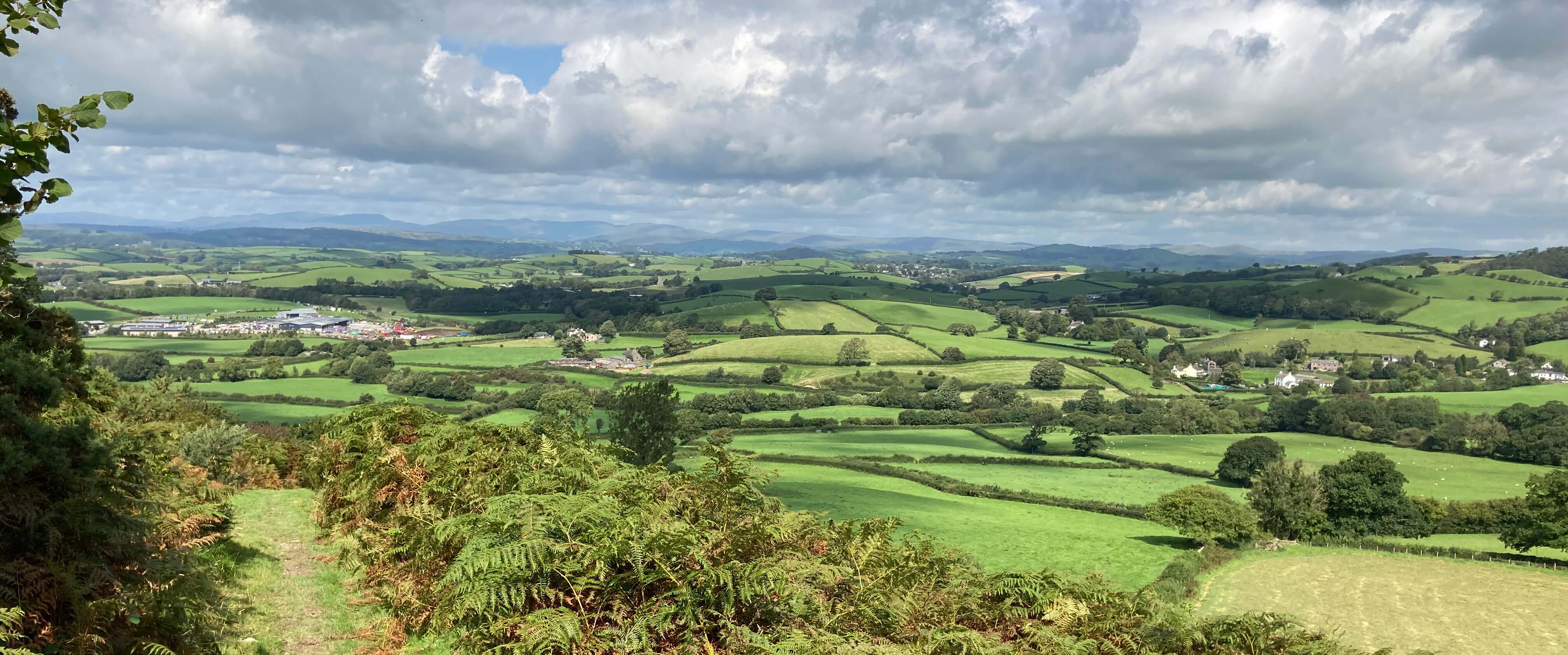
The view east from near Biggins, Ingleborough just visible, Whernside in cloud
Beyond High Biggins I walked across a series of fields. One was adorned with the
spindliest buttercups I have seen. Another had equally tall grass, too wet for me,
although it seemed to suit the many swallows swooping over it. Then I walked along
a limestone ridge, past a few horses, safely corralled, with views of a rather
sombre Hutton Roof Crags (walked on in [98])
and Farleton Knott to my left. Ahead, there was a distant view of some Lake District
hills that had managed to be under but not in cloud, as most of the hills to my right
(the Howgills and Yorkshire Dales hills) remained. But, if I looked carefully enough,
I could see one or two tinges of blue in the sky,
sufficient to add one or two dashes of colour to the gloomy fields.
Somewhere along the ridge I crossed the watershed, leaving Lunesdale behind me,
with the waters of Lupton Beck to my right eventually joining
the Kent estuary near Milnthorpe. I settled in for some walking along quiet
country lanes. At Kilnerfoot a roof displayed BINGO in large letters. This presumably
advertised Bingo Fest 2023 but the nature of that fest eludes me. I skirted the
village of Hutton Roof to pause for sustenance at its church, accompanied by numerous
swallows and martins.
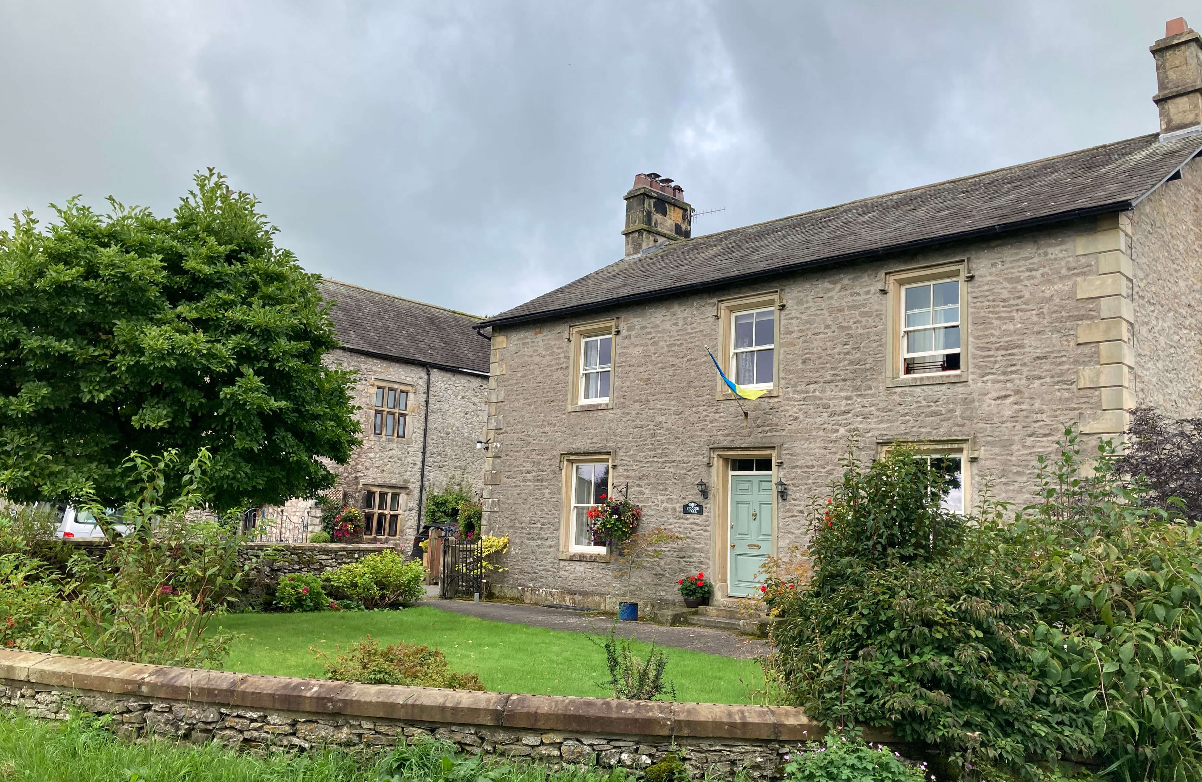
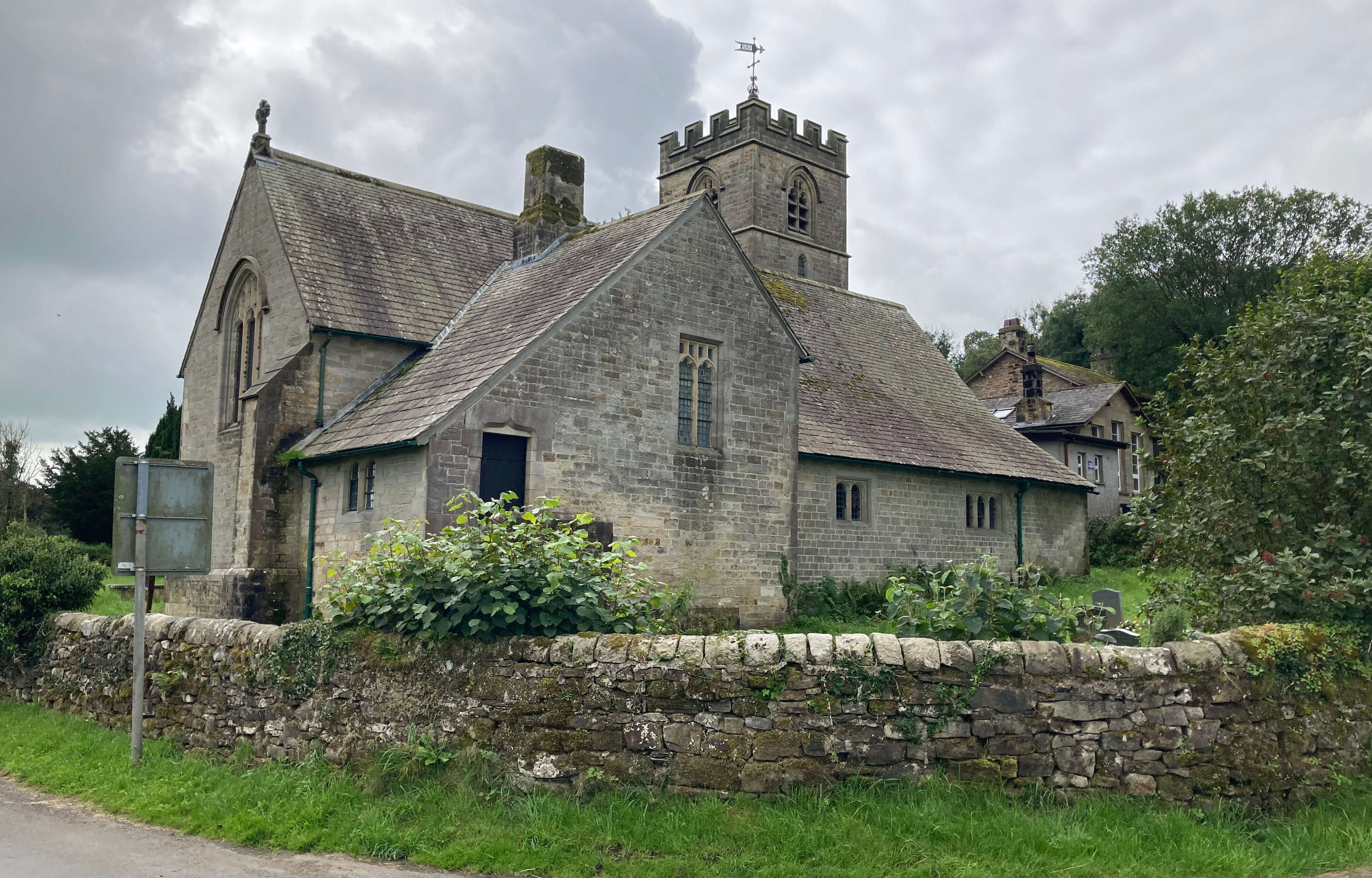
Left: Biggins Hall; Right: St John's Church, Hutton Roof
Continuing towards another of the many Newbiggins in the region, I found that I had,
at last, acquired a shadow. The lanes immediately perked up. The honeysuckle,
hardly noticeable before, now shone bright white, yellow and purple.
Rosehips sparkled bright red. Some butterflies
appeared. I sampled a few blackberries. This was more like it.
At the end of Puddlemire Lane I came to a gate with the notice shown. Does
it seem odd to you in any way?
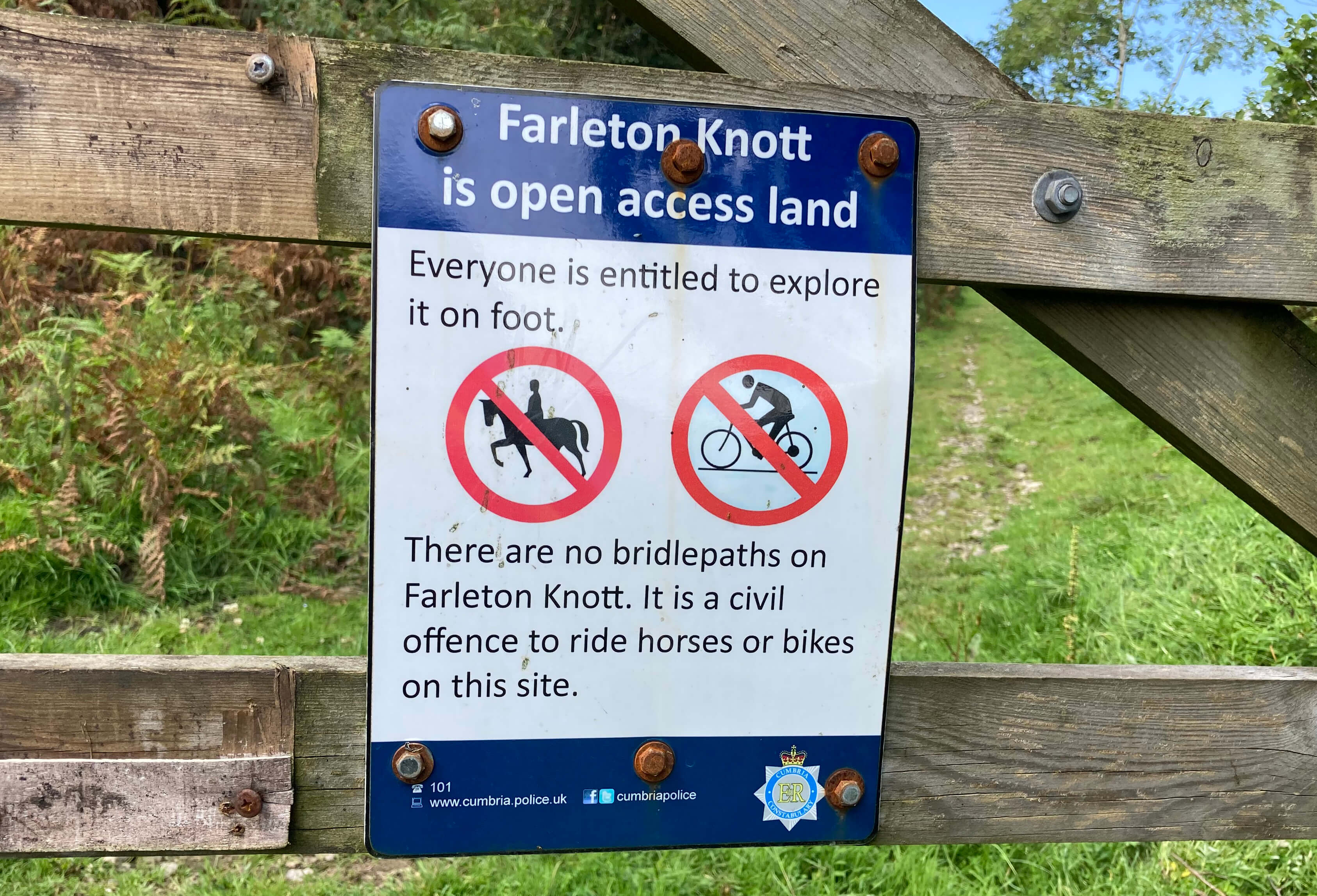
During my wanderings I must have come across thousands of notices. Many of them are from
land-owners advising me how not to misbehave on their land. Others are from some
authority, such as Natural England or the local council, telling me of various conditions
that restrict my walking on the land. This notice, however, is from Cumbria Police.
IÆm not sure that IÆve seen a sign from the police on our hills before. They donÆt
usually bother themselves with civil, as opposed to criminal, offences.
So, what terrible turpitude has occurred on Farleton Knott to cause the police
to become involved? The landowners here are the Dallam Tower Estate (the northern
part of the fell) and the National Trust (the southern part) û the scope of the notice
is not clear from the sign. Their opinions, if any, on Farleton Knott are limited by
the fact that it is all open access. However, as the notice makes clear, the open
access legislation does not provide access to all. Horse-riders and bikers are only
allowed on bridleways and there never were any on Farleton Knott. Is that enough
for the heavy hand of the police?
I expect that horse-riding has occurred on Farleton Knott for decades and I doubt
that anyone has objected. The problem would therefore seem to lie with the bikers, although the two
cannot be separated by law. I can certainly see (literally, since there are Youtube
videos of bikers in action on Farleton Knott) that bikers careering over these limestone
crags and down the narrow paths between gorse and bracken would be a hazard for walkers
(and if bikers were allowed here they would no doubt say that walkers are a hazard for them).
But is a dispute between walkers and bikers a police matter?
An additional factor is that Farleton Knott is a Site of Special Scientific
Interest because of its limestone pavements and flora thereon. Bikers would not,
however, bike over the clints and grikes of the pavements. They would follow the same
paths as walkers. The straw that broke
the policeÆs back was that some bikers found Farleton Knott not challenging enough and
set about it with their spades to create new trails with various humps to soar over.
I used ætrail-blazingÆ in the title but now I am unsure what æblazingÆ means. Can
you blaze anything other than trails? So, after many years during which tolerance
gradually turned to anger, the police finally decided that digging up other peopleÆs legally
protected land and potentially harming its special flora was going too far.
I zigzagged up on a path through the high bracken to emerge on the open limestone crags.
The view west to the Lake District from the path up
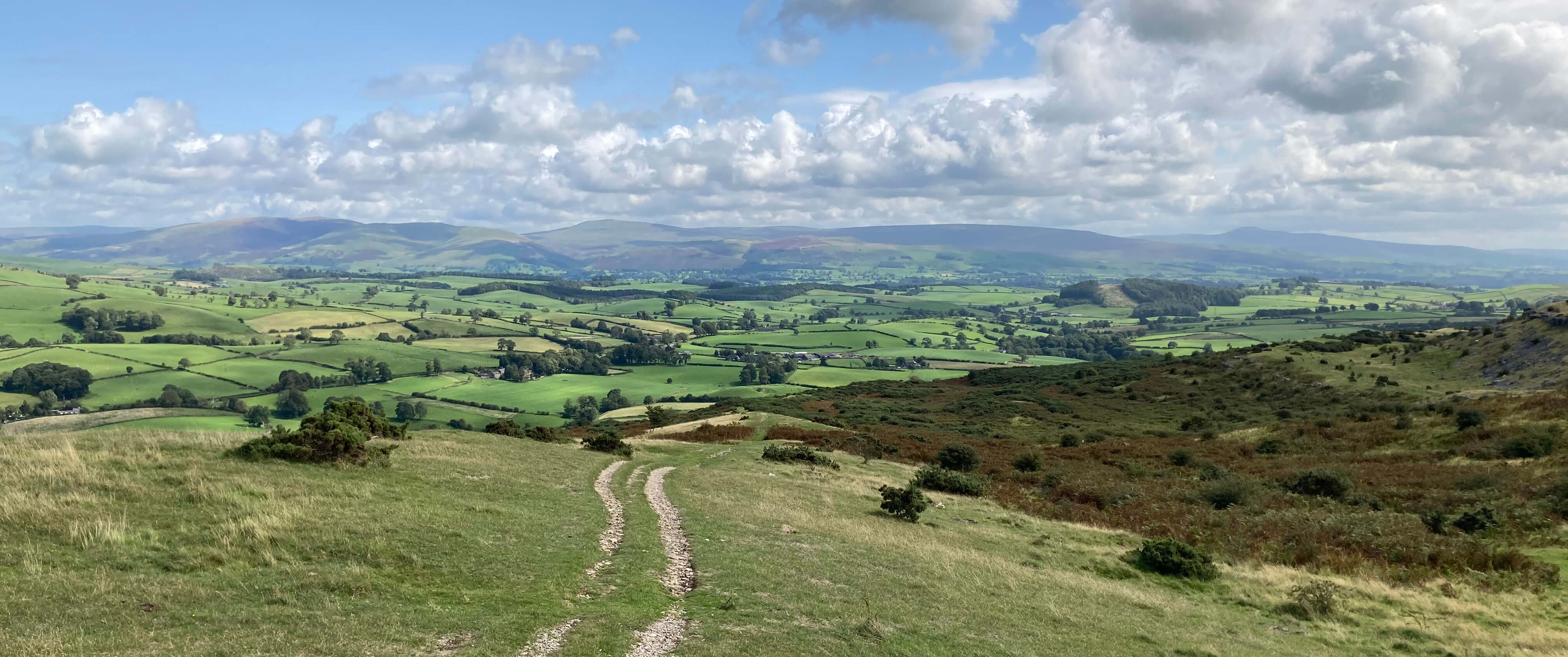
The view east towards Ingleborough and Whernside from near the top
The clouds that still hung over the bay and the Lake District hills dulled the view westward
from the Farleton Knott cairn that overlooks the M6.
I walked down past the cliffs of Holmepark Fell, and took the bridleway east. This skirts
Holme Park Quarry, providing no view of it. The quarry was silent on this occasion but is,
I think, still active. Even if it isnÆt, it is too late for the vast quantities of
limestone that have been removed, as shown by this
aerial video.
I picked up the old track of Slape Lane that heads direct to Burton-in-Kendal.
My impression of this track deteriorated as I went along. At first, it was a pleasant walk
through woodland. It then became a narrow path between high beech hedges, so I could see
nothing at all. It was just a matter of plodding on and on û and then on
and on some more. At the end there was a toposcope telling me the names of the Lake District
hills that I couldn't see from the path.
Date: August 23rd 2023
Start: SD609785, Kirkby Lonsdale bus stop (Maps: OL2, OL7)
Route: (linear) W by A65, S through Low Biggins, W through High Biggins
and fields û Gallowber Lane û W, SW û Hutton Roof û N û Holly Grove û W û Newbiggin û NW
on Puddlemire Lane, zigzag up û Farleton Knott û S below Holmepark Fell û bridleway û SE û Rawley
Copse û SW, S, SW on Slape Lane û Burton-in-Kendal
Distance: 9 miles; Ascent: 235 metres
Home
Preamble
Index
Areas
References
Me
® John Self, 2018-

Top photo: The western Howgills from Dillicar;
Bottom photo: Blencathra from Great Mell Fell