
Home
Preamble
Index
Areas
References
Me
Saunterings: Walking in North-West England
Saunterings is a set of reflections based upon walks around the counties of Cumbria, Lancashire and
North Yorkshire in North-West England
(as defined in the Preamble).
Here is a list of all Saunterings so far.
If you'd like to give a comment, correction or update (all are very welcome) or to
be notified by email when a new item is posted - please send an email to johnselfdrakkar@gmail.com.
182. Along the North Fylde Esplanade
It being unreasonably unseasonably hot, I headed to Knott End-on-Sea to walk along the
North Fylde Esplanade, hoping to be cooled by sea breezes. Unfortunately, the Knott
End Esplanade ends after about 300 metres, as the road turns inland, leaving the walker
to continue along the embankment, as far as that is possible.
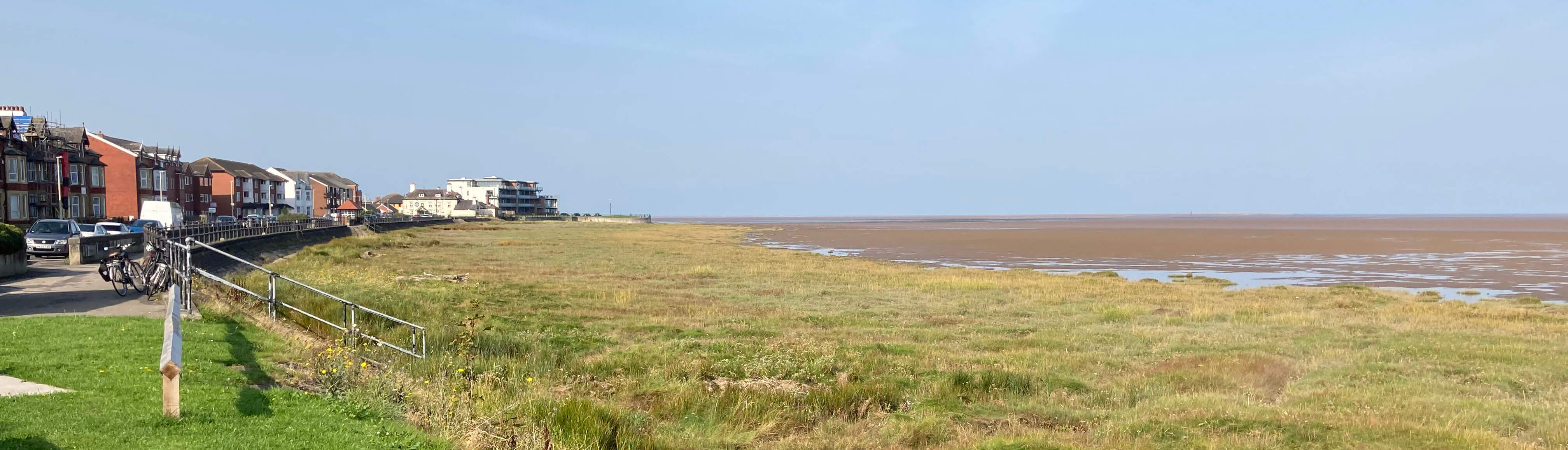
Looking back towards the Knott End ferry from the end of the Esplanade
I said ægood morningÆ to all the dog-walkers of Knott End but eventually I had the path more
or less to myself. The tide was out û far out. I could not see the waters of Morecambe Bay
at all, except for the puddles left in the mud. I could not see the Lake District hills
either, not even a faint grey outline, which I could at least make out in the direction of
the Bowland hills. All I could identify on the seaward side was a few little egrets (other
birds being more camouflaged) and Heysham Power Station.
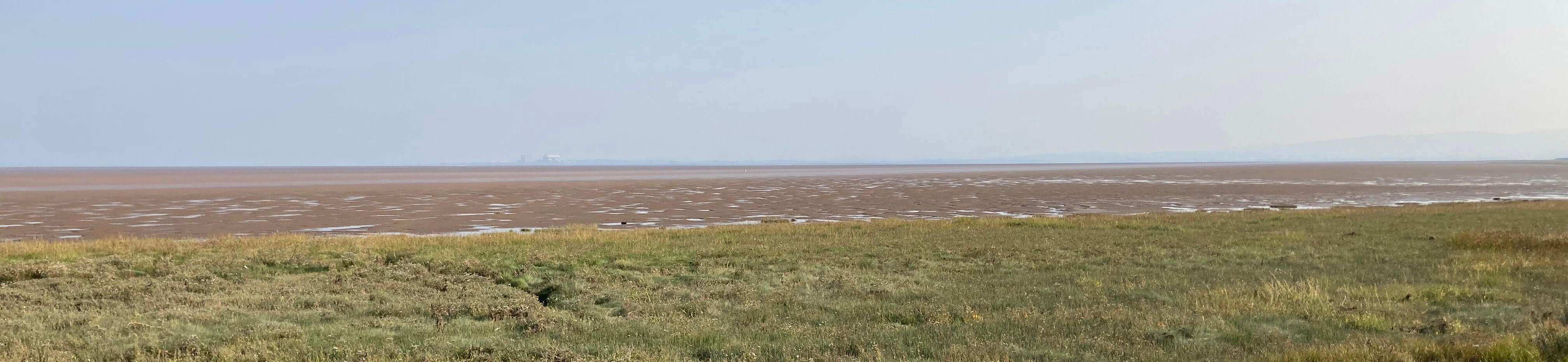
The view of Morecambe Bay from the embankment (the Power Station
is one third in from the left)
Inland the view is of back gardens, holiday parks, and fields of horses or cows. One
nondescript field had a sign saying ôPrivate land. Please do not point your binoculars
into the fieldsö û surely, an encouragement to do so. Overall, though, the impression
is that the land inland is no higher than the marshes on the seaward side of the
embankment and is therefore completely dependent on that embankment to prevent flooding.
The marshes seaward are all part of the Wyre and Lune Sanctuary Nature Reserve.
IÆm not sure of the legal status of such a sanctuary but I assumed it to be a place
where wildlife is safe from interference and hunting. However, it did not stop a
dog-walker and a horse-rider venturing further onto the marshes and mud than I would dare to go.
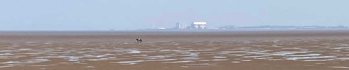
A zoomed-in picture of the horse-rider within the sanctuary
After three miles thereÆs a barrier across the embankment at the car-park near Fluke Hall.
This seems a matter of concern to the several bloggers describing their walks around the
coasts of Britain. I suppose that they have committed to walking as near to the sea as possible.
Here, they cannot get near, or should not. The Pilling Embankment, built in 1981 to run
five miles or so
from this car-park to the River Cocker near Cockerham, is out of bounds for walkers,
except for a middle section which is walkable outside the period of December 26 to Good Friday.
This restriction is for the benefit of the thousands of over-wintering birds, although
I doubt that their end of winter is determined by the Christian calendar.
So I walked inland and then followed the permissive path back to the embankment.
I was alone for the mile or so to the end of the permitted section at Lane Ends.
There were a few cars parked here but nobody about. Perhaps people rendezvous here for discussions in
their cars. Those coastal bloggers are frustrated to see the enticing out-of-bounds
embankment ahead and to find that they are forced to walk inland, either on the A588 (a
suicidal endeavour) or even further inland on the so-called Lancashire Coastal Way, where
the farms at the beginning of this stretch are apparently not welcoming to walkers.
This region is proving difficult for the England Coast Path
(recently ridiculously renamed the King Charles III England Coast Path).
This 2,700 mile path was proposed in 2014 and is always due for completion in a year or two's time.
Here, the plan is, I think, to provide a new path tucked on the landward side
of the embankment between Lane Ends and Cocker Bridge.
This will please neither the walkers, who still won't be able to see the sea, nor
the birds.
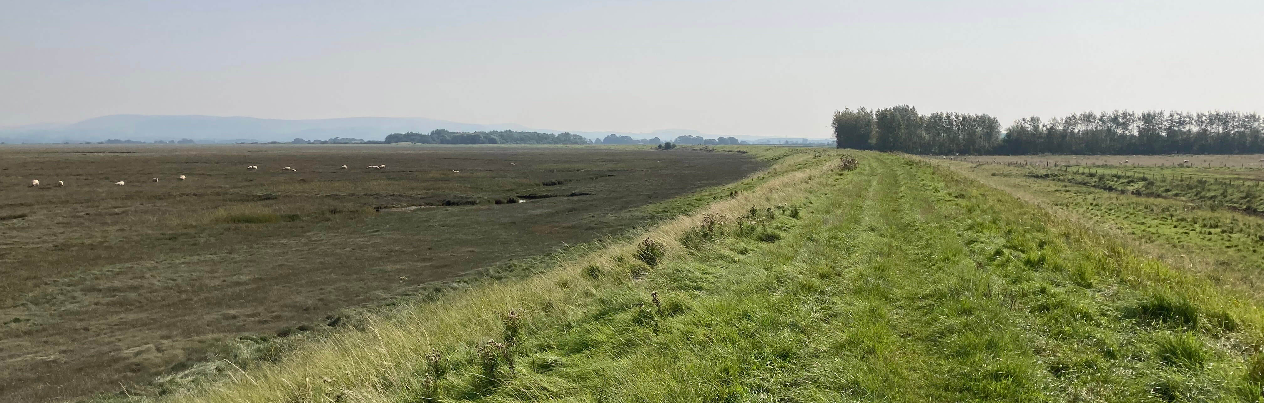
The Pilling Embankment (Lane Ends is at the second group of trees)
I compromised by walking one kilometre along the A588 and then taking Gulf Lane to join the
Lancashire Coastal Way. I passed a Moss Edge, one of several Moss Edges or Moss Sides that encircle
an area about three miles across. Within the circle was the notorious Pilling Moss or bog,
about which it was said that æPilling Moss, like GodÆs grace, is boundlessÆ. Today, it is
all flat fields for pasture or crops, about five metres above sea level, but that, obviously, wasnÆt
always the case.
At the end of the Ice Age glacial deposits were distributed over the region, to no
great height. Trees colonised the area but were chopped down by about 4000 BC, which,
together with the many artefacts found here, shows that a sizable community lived here at
that time.
(It is known that the trees were chopped down, and didn't just fall down,
because their stumps, still upright, and their trunks, horizontal, are sometimes found
preserved in the ground.) The region then became wetter and by
about 1000 BC had become a bog, with peat
then forming to a depth of four metres or more. In recent centuries the bog was drained,
and the peat dried out. It was then either dug out for fuel (up to the 1950s) or left to
shrink where it was. Either way, the land level was lowered.
It now depends upon the protection of the Pilling Embankment. All in all, itÆs a case study
in how we carry out short-term changes for our benefit without regard to long-term problems.
The sea breezes that had freshened me on the long embankment walk did not reach this
far inland. It became stiflingly hot. I passed normal farming activities plus a strange
set of concerns û Farm Yard Brew Company, Attitude Airsports Ltd, Cockerham Goat Meat Farm û but
I realised that I was too exhausted to take much notice of them. I focussed on making
slow progress, trying not to pass out into a roadside ditch. At long last, I staggered
into the village of Cockerham, hoping to find something to revitalise me. But Cockerham
seems to have only a pub (which was closed) and a funeral directors, and I was determined
not to provide the latter with any custom.
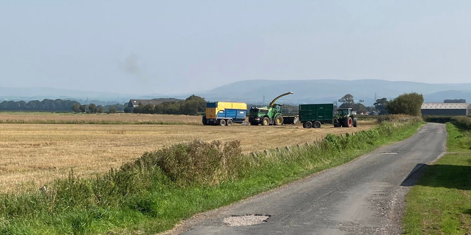
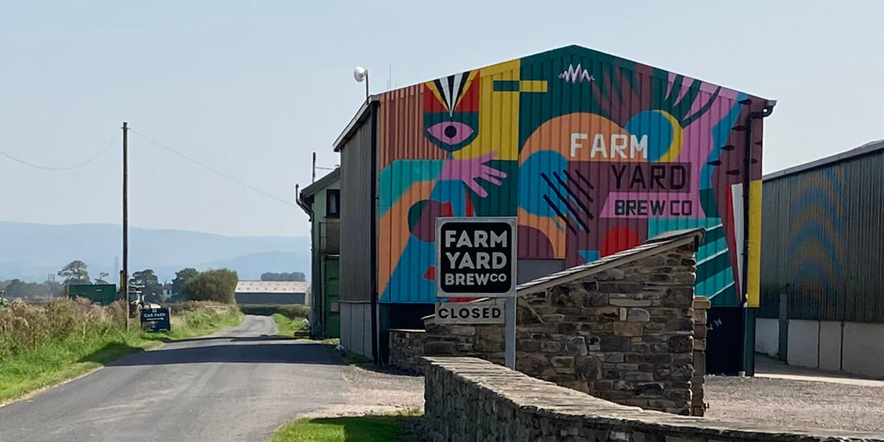
Some activities along the Lancashire Coastal Way, traditional and less so
Date: September 6th 2023
Start: SD346485, Knott End (Map: 296)
Route: (linear) NE along embankment û car park near Fluke Hall û SE û just
before Breck Bridge û N û embankment û E û Lane Ends amenity area û SE, NE on A588, S û Gulf
Farm û SE, E, NE û Great Crimbles û N û Cocker Bridge û NE û Cockerham
Distance: 9 miles; Ascent: 10 metres
Home
Preamble
Index
Areas
References
Me
® John Self, 2018-

Top photo: The western Howgills from Dillicar;
Bottom photo: Blencathra from Great Mell Fell