
Home
Preamble
Index
Areas
References
Me
Saunterings: Walking in North-West England
Saunterings is a set of reflections based upon walks around the counties of Cumbria, Lancashire and
North Yorkshire in North-West England
(as defined in the Preamble).
Here is a list of all Saunterings so far.
If you'd like to give a comment, correction or update (all are very welcome) or to
be notified by email when a new item is posted - please send an email to johnselfdrakkar@gmail.com.
184. Three Ways to Gawthorpe Hall
For the first time in my life I stopped a train.
Burnley Barracks is a 'request stop' on the train that trundles between Preston and
Burnley, so I asked the ticket-woman for it to stop there and she didn't forget to tell the driver.
As I was the only person to get off and nobody got on, I claim full responsibility for
stopping the train.
My plan was to walk on the Burnley Way and the Brontë Way, passing Gawthorpe Hall
near Padiham,
and continue to either Hapton, Huncoat or Accrington station, depending on my energy
and enthusiasm at the time.
From the station I located the Burnley Way (although I saw no sign of it) and it
took me under the railway line, alongside a bright green canal,
over the M65 and into the suburbs of Whittlefield.
I found myself on Pendle Way, which is not to be confused with the Pendle Way.
The former is the name of the road that I was walking along, the latter is a 45-mile trail
that wanders around the hill of Pendle but not here.
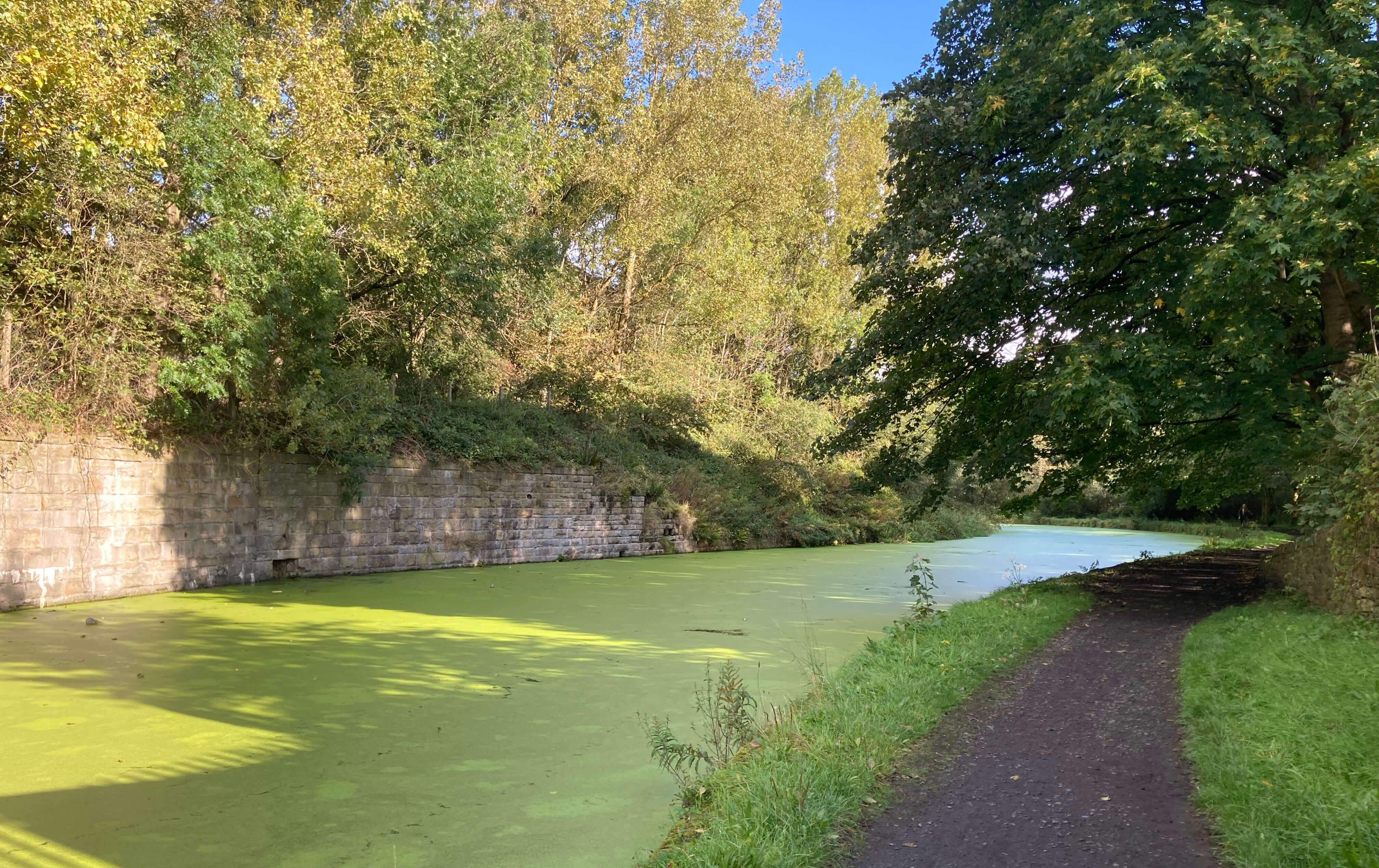
The Leeds-Liverpool Canal at Whittlefield
The Burnley Way led me away from the houses to a short stretch of the
River Calder, as if to reaffirm that the Way is indeed a Recreational Route. The Burnley
Way is a 40-mile circular path that passes through Burnley and Pendle Witch country. It is
not, I think, a trail that walkers set out to walk from end to end (being circular, it doesnít
have ends). It is more one that walkers may walk bits of, sometimes by chance, like me.
The path curved around to the north of the houses, separated from them by a high fence to preserve
my privacy. Along the way, the Burnley Way turns north (although I saw no sign of it).
So I was back among the houses.
I found a path through them and arrived at what I assumed to be the Brontë Way
(although I saw no sign of it). The Brontë Way is an end-to-end path but
I doubt that many people walk it end-to-end. The 44-mile path starts at Oakwell Hall
(probably the Fieldhead of Charlotte Brontëís novel Shirley) near Birstall and ends at
Gawthorpe Hall, perhaps appropriately since Charlotte Brontë also ended here, according
to the narrative that has her catching a chill on a visit to Gawthorpe Hall in January
1855, after which her health deteriorated, leading to her death two months later.
In other accounts, she was very poorly anyway from a troublesome pregnancy.
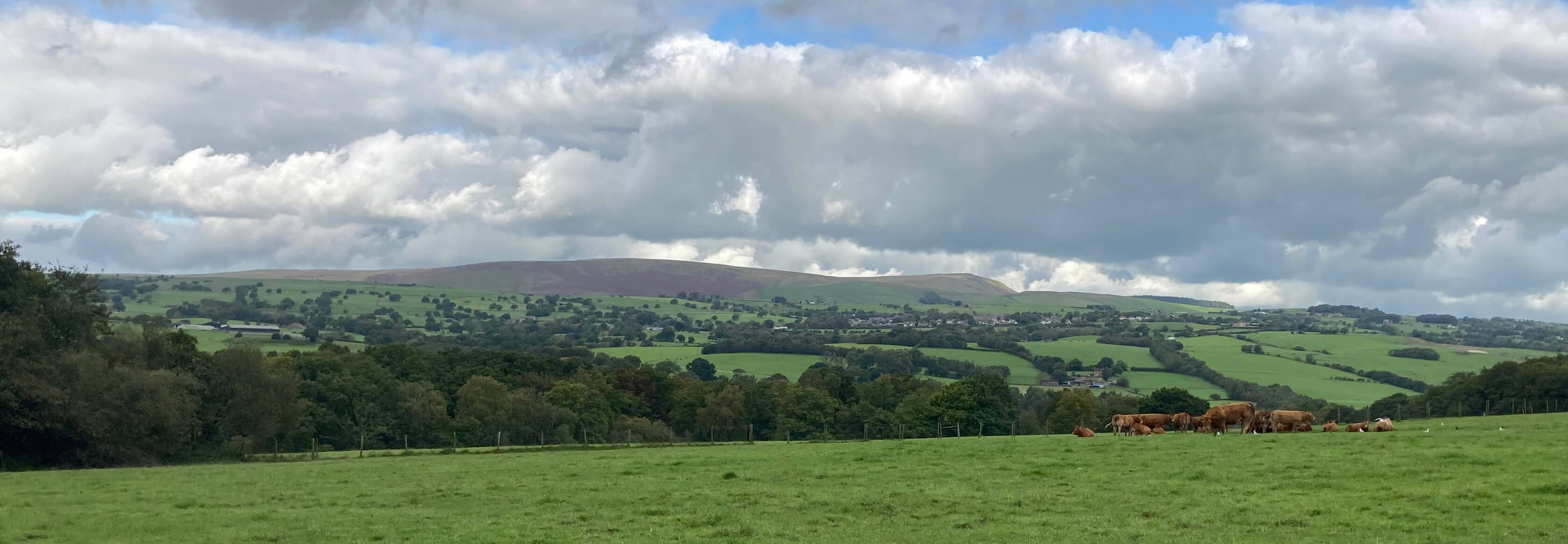
A view of Pendle
From the A671 I walked on along Habergham Drive, which is no longer a drive but is part of the Brontë Way
(although I saw no sign of it). I arrived at Gawthorpe Hall.
It looked a sombre building to me: four-square, dark sandstone coloured, mottled black.
The present hall is a 19th
century renovation of a 17th century hall built around a 13th century pele tower.
The central turret that rises above the roof level is, I think, pretending to be the pele tower.
The hall is variously described as
Elizabethan (of the era of Elizabeth I (1558-1603)) and Jacobean (of the era of James I
(1603-1625)). I rather doubt that the externals of the hall are quite
that old. Inside, there are, I expect, grand rooms and furniture of that vintage.
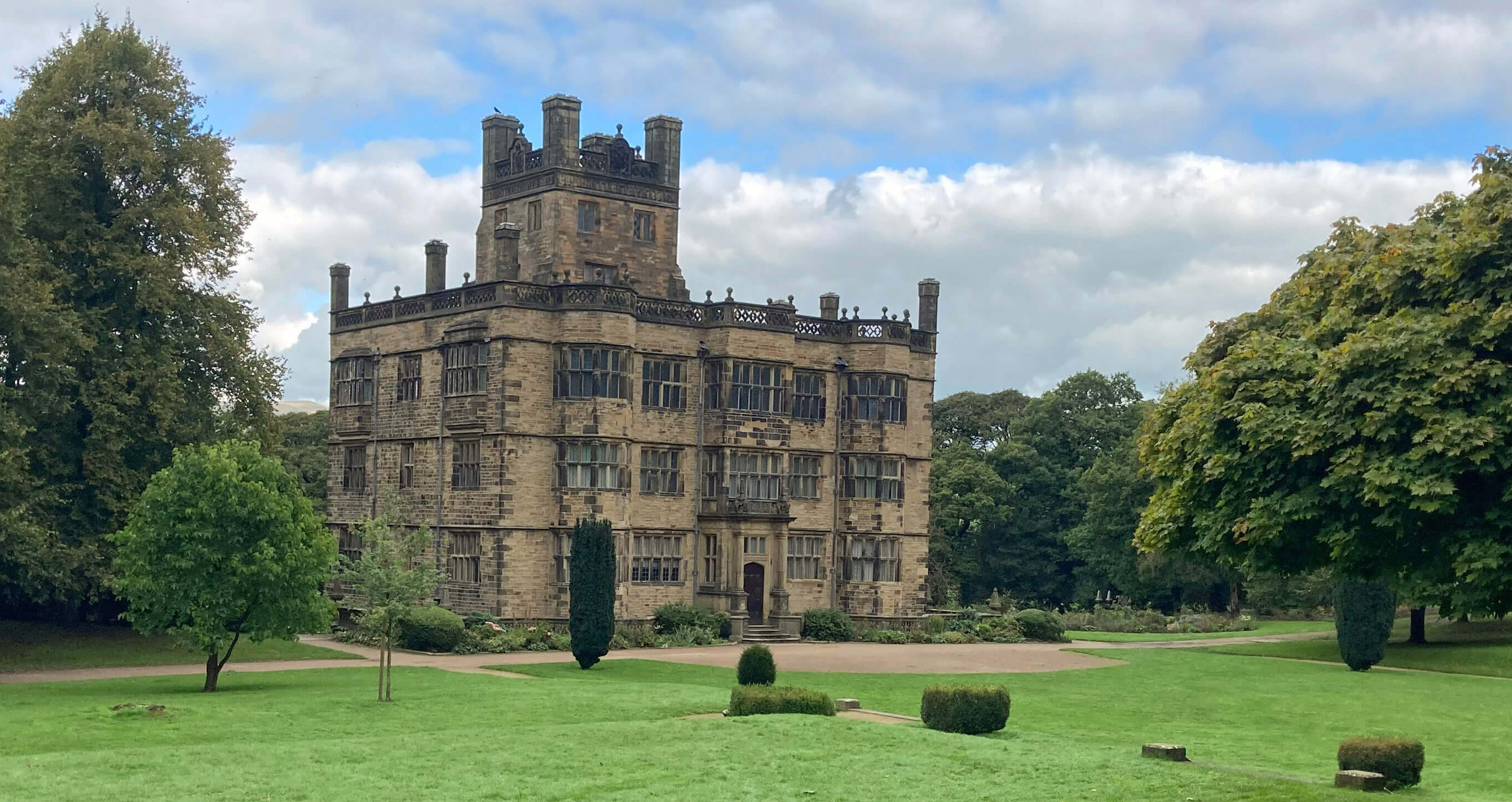
Gawthorpe Hall
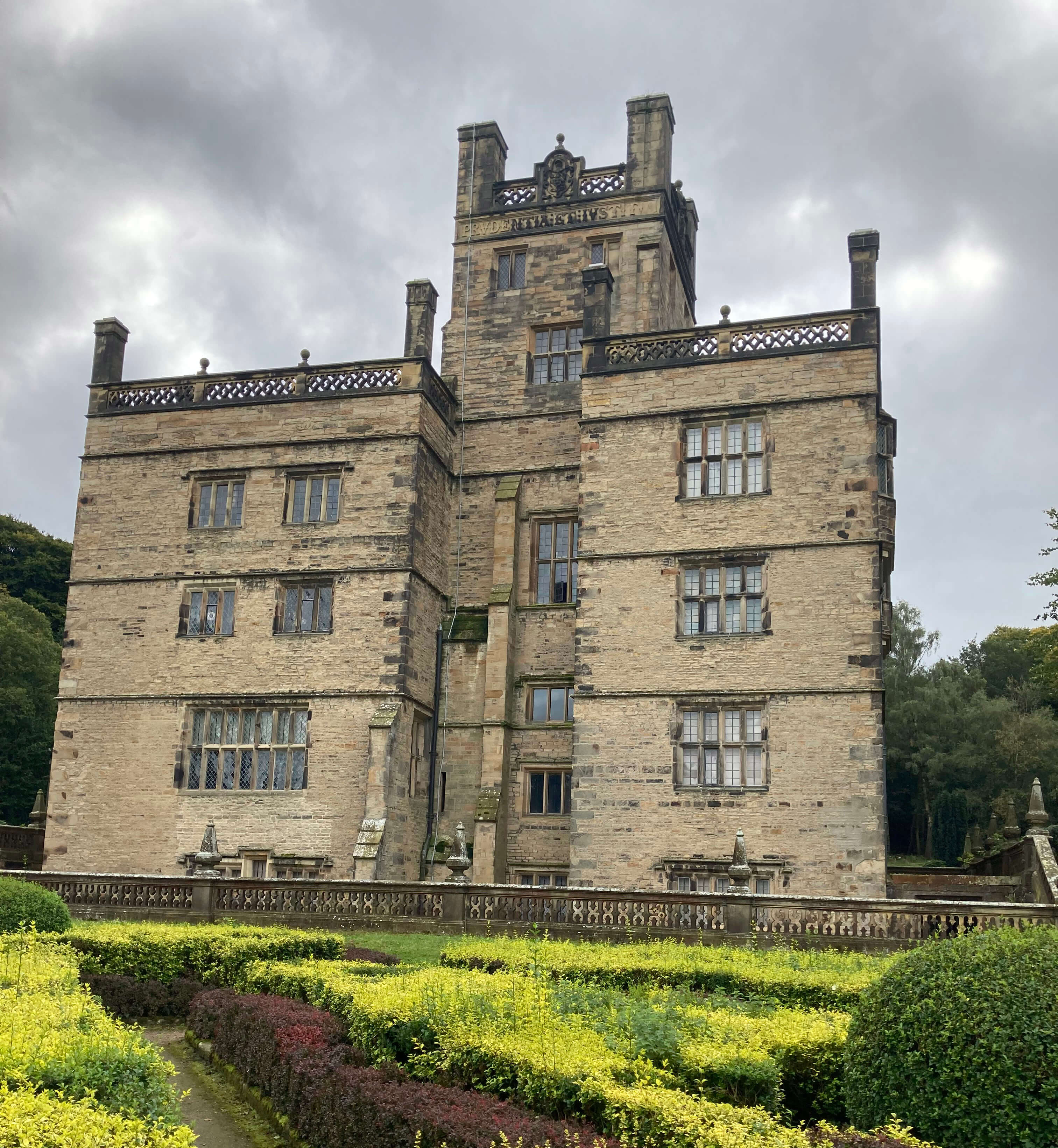 Right: Gawthorpe Hall from the other side.
Gawthorpe Hall was given to the National Trust in 1970 by the 4th Lord Shuttleworth.
The National Trust began in 1894 as something of a
campaigning organisation, seeking to protect open, green spaces for the public, but after
it became possible in 1934 to avoid death duties by leaving land assets to the National Trust,
it perforce focussed upon the country houses of landed gentry. The Trust owns great swathes of land
in the Lake District and lesser but still substantial swathes in the Yorkshire Dales.
However, in the northern part of Lancashire (the part within the scope of these Saunterings)
the National Trust logo can be seen in only three places: Silverdale (visited
in [134]),
Heysham [101] and Gawthorpe Hall. This hall, then, is this
regionís only representative of the stately mansions within the National
Trust portfolio.
I wandered up to the main door, where a woman of the hall was in dispute with a
bridal party that had arrived for photographs without permission or payment of the usual fee.
I was relieved to find that the hall was not yet
open for visitors, so I could not be tempted to pay the £6 (for non-members of the National Trust) to enter.
When I cancelled our National Trust membership in 2017 I received a letter asking me why ñ so
I told them, and Iíll tell you too but if youíd prefer not to read a word against a beloved
national institution you may skip this list:
(1) The Trust had (I will use the past tense because
some of these comments may no longer apply) over one billion pounds in reserve funds or
long-term investments and it received over £250 million a year in member subscriptions.
It therefore didnít need our money, at least, not as much as other charities.
(2) The Trust had an army of nearly 50,000 volunteers, which
helped the management to pay themselves an adequate salary, for a charity. How many National Trust employees
do you think receive over £60,000 a year? Have a guess ...
(3) The Trust seemed to help itself to more of
our money by increasing our direct debit every
year by more than inflation, without mentioning, let alone justifying, this. Even our utility
suppliers feel an obligation to justify price increases.
(4) The Trust seemed to focus on its stately mansions
rather than, as I would prefer, on the nature preservation that its founders emphasised. The latter would be
less expensive. Nature does a pretty good job of preserving itself.
(5) (This one was more a source of amusement.) The Trust
always addressed its letters to us to ìMrî although Ruth and I were joint members. I asked them
to change this to ìMr and Mrsî or ìMrs and Mrî but was told that it was beyond the computerís
capabilities. I am not sure that the Trust saw the point of my request.
To answer the question in (2) above, in 2020/21 there were 269 employees who
received more than £60,000.
I see that the National Trust is in a spot of bother.
And not before time.
It is good that we and the National Trust reflect upon its aims. For too long the Trust
has blithely assumed that the general public will continue to feel it almost a patriotic
duty to support its worthy objectives.
The Trust has always been a conservative (small c) organisation, concerned
to protect what it considers to be the best of our national heritage. Now it has become
embroiled in the Conservative (large c) Partyís wrangles, with a group of right-wingers
called Restore Trust
seeking membership of the National Trustís council in order to
influence policies and urging people to
ìrejoin the National Trust to save it from wokeryî.
If I knew what wokery is then I might rejoin to ask for more of it.
I walked west along Stockbridge Drive, which is a drive, into Padiham.
Padiham is a more substantial place than I had envisaged but I hadn't come
to savour its attractions. I aimed to be re-united with the Burnley Way, which
according to the map winds through Padiham more or less beside the River Calder.
Yes, you've guessed it ñ I saw no sign of it, the Way that is, not the river.
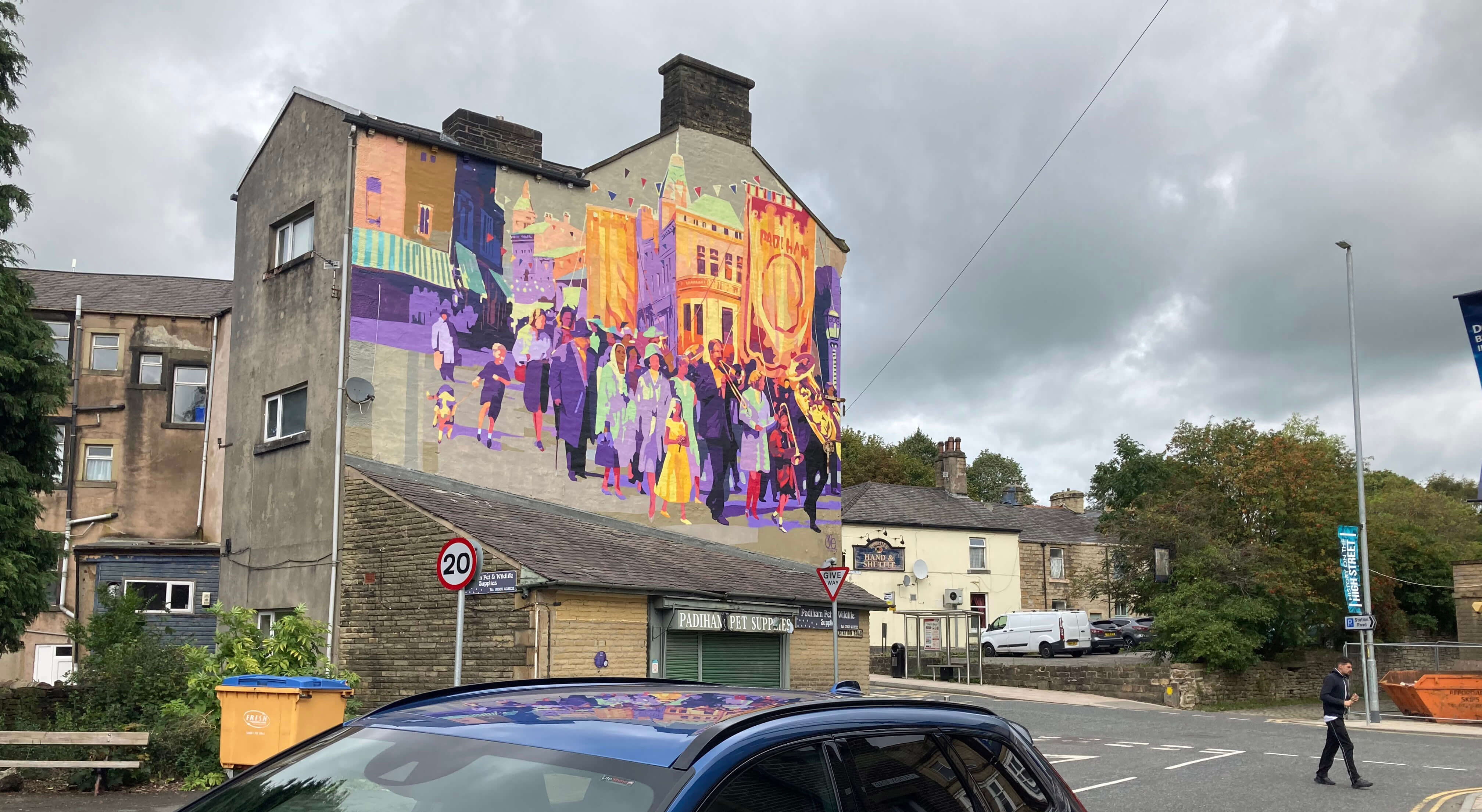
A sign of gaiety in Padiham
I somehow found myself in the backside of Padiham, walking past
scrap metal merchants and the like, feeling increasingly that this was
unlikely to be where anyone would be encouraged to walk.
After studying the map later I think that I was indeed on the Burnley Way
(and I have a photo to prove it ñ yes, I saw a sign of it, see below)
but at the time I lost my nerve and my patience. I recalled having seen
in the middle of Padiham a sign to Hapton railway station, so I retraced
my steps to follow it. I had had enough of plodding through built-up regions, some of scruffiness, in
search of Ways that seem largely a figment of the map-maker's imagination.
Back in the centre of Padiham I couldn't at first re-find the sign to Hapton
railway station.
I walked up and down the main street (the A671) wondering why the two
pubs are called the Flying Dutchman and the Hand and Shuttle.
The Art Deco Town Hall, built in 1938, has been renovated as contemporary office space
after being damaged in the Boxing Day 2015 floods but it looked rather
inactive to me.
Padiham once had twenty cotton mills and two large collieries.
I don't know what it has today, despite my more-extensive-than-planned exploration.
Eventually I found the sign to Hapton station and
walked, with no detours, along the road to it. The station was another
request stop and I looked forward to re-using my new powers of train-stopping.
But I didn't have to ñ there were ten other people waiting to do the job.
Three signs more representative of this walk:
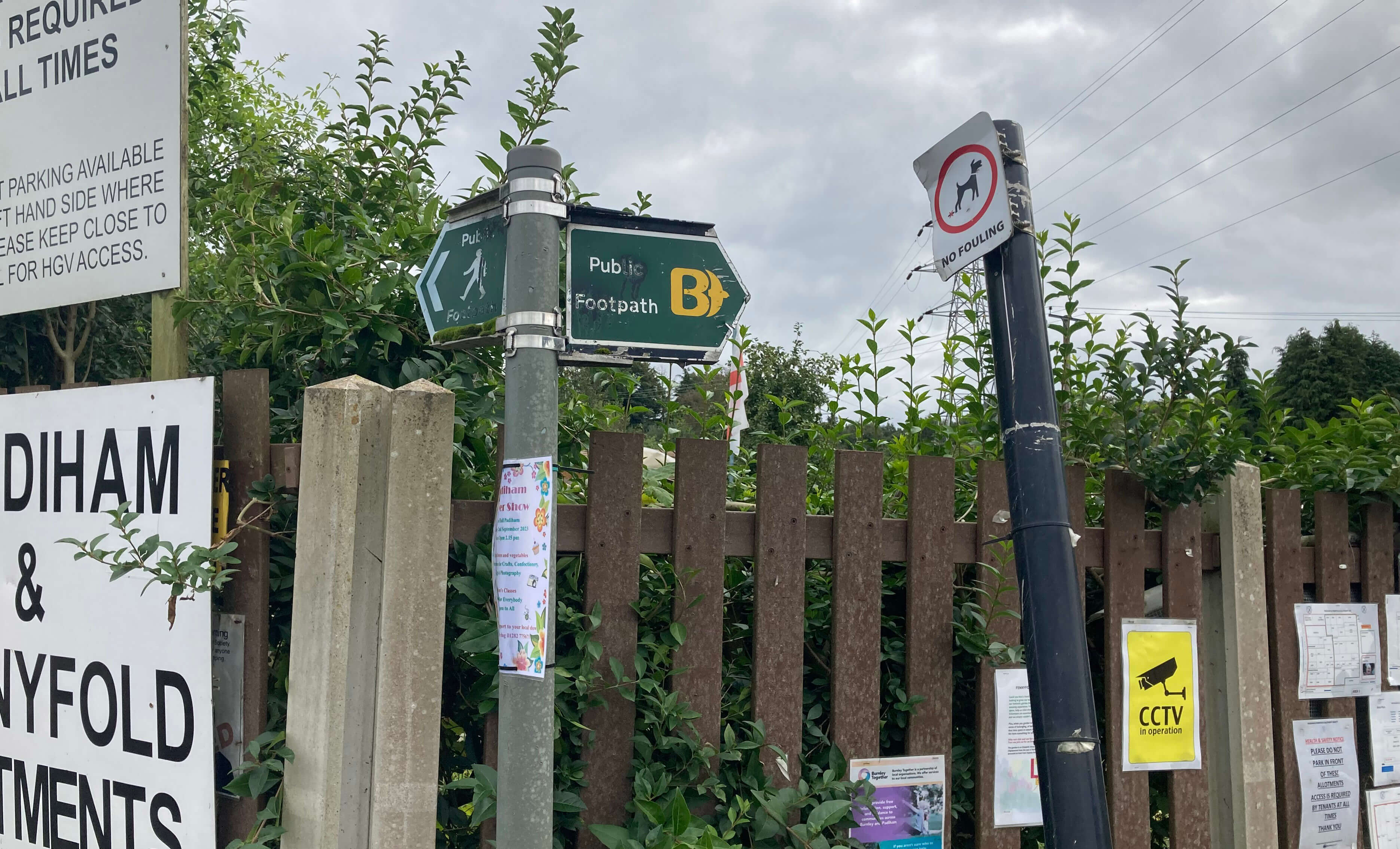
In the Padiham scrapyards, the only Burnley Way sign I noticed
(without knowing it was a Burnley Way sign at the time)
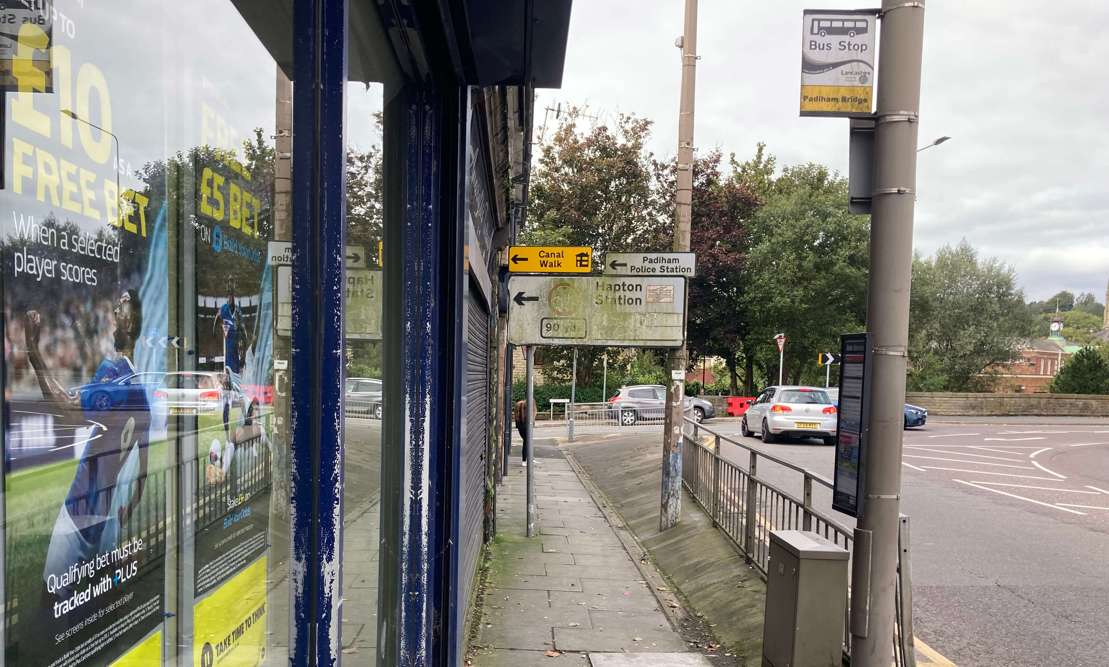
The sign to Hapton railway station (no wonder I had trouble re-finding it)
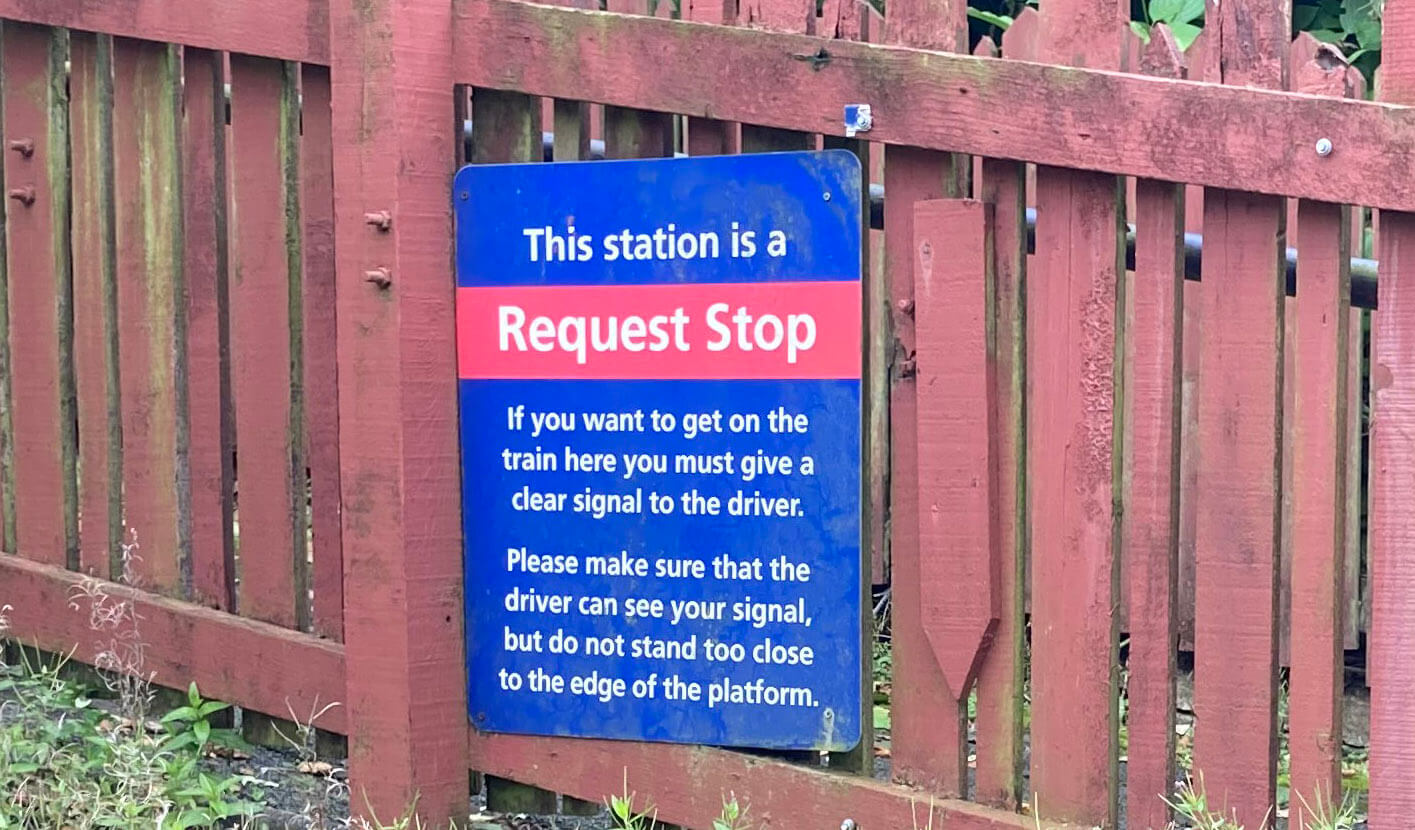
The sign informing us how to behave at a request stop
Date: September 23rd 2023
Start: SD832328, Burnley Barracks station (Map: OL21)
Route: (linear) S, E, N on Burnley Way, NE ñ River Calder ñ N, E ñ
road ñ N, NW ñ Bronte Way ñ SW ñ A671 ñ W, NW on Habergham Drive, N ñ Gawthorpe Hall ñ
SW on Stockbridge Drive ñ A671 ñ NW ñ in and around Padiham ñ S on road ñ Hapton railway station
Distance: 7 miles; Ascent: 50 metres
Home
Preamble
Index
Areas
References
Me
© John Self, 2018-

Top photo: The western Howgills from Dillicar;
Bottom photo: Blencathra from Great Mell Fell