
Home
Preamble
Index
Areas
Dales
Hills
Lakes
Places
Reserves
Rivers
Structures
Villages
References
Me
Saunterings: Walking in North-West England
Saunterings is a set of reflections based upon walks around the counties of Cumbria, Lancashire and
North Yorkshire in North-West England
(as defined in the Preamble).
Here is a list of all Saunterings so far.
If you'd like to give a comment, correction or update (all are very welcome) or to
be notified by email when a new item is posted - please send an email to johnselfdrakkar@gmail.com.
185. The Peace of Shap
The village of Shap is long and thin. This is a legacy of its days as a major staging post
on the main western north-south road, the A6. It was a regular feature of winter news
bulletins to hear of vehicles stuck in snow and ice on the Shap road, with travellers
seeking refuge in the village. There are still three pubs along the main road but I don’t
know how busy they are now that the M6 has stolen all their passing traffic.
I set off for a circuit to the west and east of Shap in order to gain some
appreciation of the long history of the region. From the main road I headed west to
the Goggleby Stone. This large stone is now cemented into place to stop it wandering off
or falling over. It is said to be one of the few remnants of the Shap Avenue.
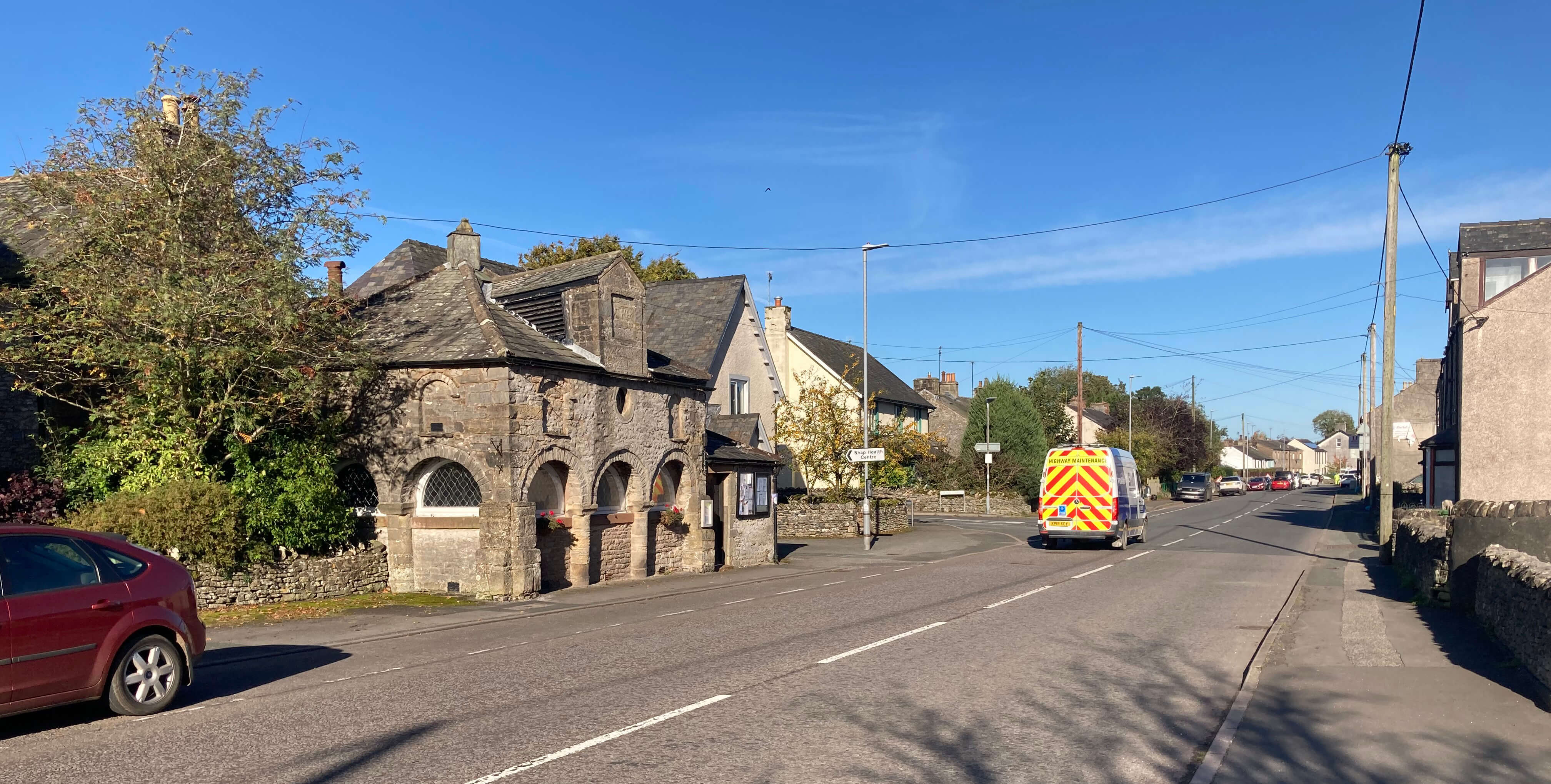
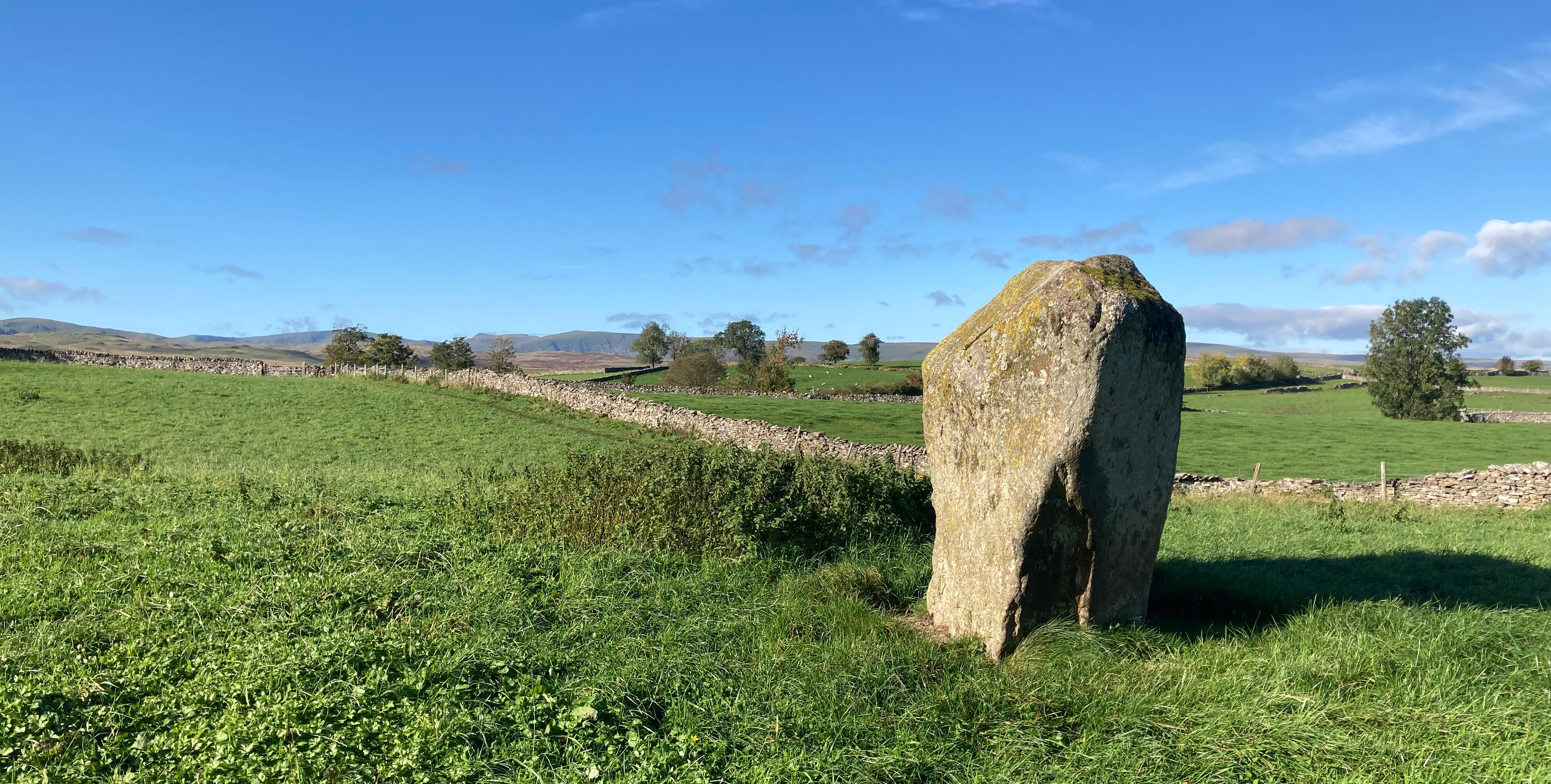
Left: The A6 in Shap; Right:
The Goggleby Stone.
The Shap Avenue seems to be a rather mythical creation, as there is little evidence of it to see
on the ground. Some experts claim to have identified about thirty large stones that
mark the line of the avenue. However, the presence of large stones in these fields is no great surprise.
On the drive from Tebay to Shap many such stones (pink granite erratics) can be seen
in the fields either side of the motorway. I suspect that the locals, in an
attempt to lure back their lost visitors, may be avenue on.
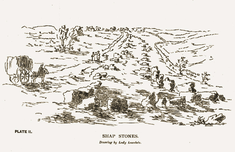
Actually, the evidence for the avenue lies in
documents of the 17th and 18th century. These describe an avenue, about twenty metres
wide, of very large stones that ran for over a mile south from a large burial mound at
Skellaw Hill (north of the Goggleby Stone) to a stone circle at Kemp Howe (now just
east of the A6 but largely demolished by the railway).
There's also a drawing of the avenue, by Lady Lonsdale in 1775 (shown below).
This avenue is thought to
be of the early Bronze Age, about 2000 BC.
It is described in William Camden's Britannia (1610) as:
... huge stones in forme of Pyramides, some 9 foote high and foureteene
foot thicke, ranged directly as it were in a rowe for a mile in length, with
equall distance almost betweene, which may seeme to have bin pitched and
erected for to continue the memoriall of some act there atchieved, but what
the same was, by injurie of time it is quite forgotten.
It is, of course, a great shame that the
largest known prehistoric monument in Cumbria was destroyed in relatively recent times,
presumably to provide building material for the houses of Shap.
I walked on. It was all remarkably quiet, even in the hamlet of Keld.
I walked past the houses and the tiny Keld Chapel to the River Lowther and back, and it
looked a pleasant place but I saw nobody at all. So I walked across fields to
Shap Abbey, the remains of which stand tucked in a dell by the river.
Shap Abbey flourished from the 12th to 16th century but today only the tower
still stands, although not quite to its original height. Its isolated location
would seem ideal for solemn contemplation.
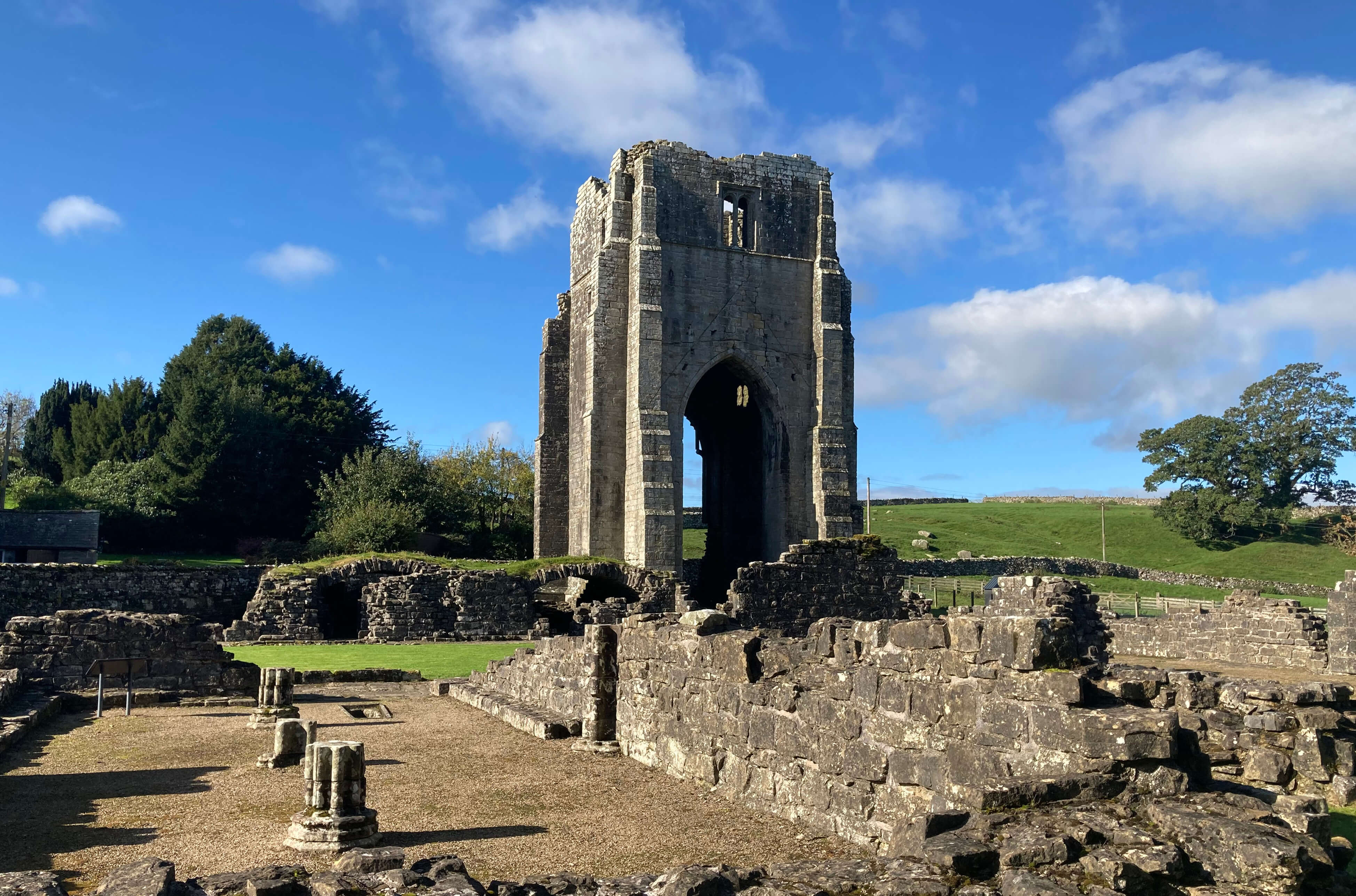
Shap Abbey
I was quite enjoying some solemn contemplation myself. It was tranquil and serene.
I heard a buzzard and one or two crows and at one point a skein of geese flew
over but otherwise it was silent. I decided to forego the eastern half of the
planned walk, with all the noise of quarries, works, railway and motorway, and
instead extend my walk westward to make the most of the peace.
I walked up from the river, across fields, to see what is marked on the
map as an ancient earthwork. If it weren’t so marked on the map nobody would
notice it. Well, I wouldn’t but presumably antiquarians can tell that this long
mound of earth, hardly a metre high, wasn’t just dug out, say, fifty years ago.
I haven’t been able to find out anything about when and why this earthwork was created.
A view westward to the Lake District hills
The track and then road (but one not intended for public traffic: I assume it was laid
down when the nearby reservoirs were constructed) were quiet and airy, with long
views west to the High Street ridge and east over Shap to the northern Pennine hills.
At a road junction I decided to walk further west to the ancient cairn marked on
the map at White Raise.
However, the route from the road across the moor looked a boggy challenge, so I settled for a
fine view west over the extensive farm of Tailbert to the Lake District hills.
I usually find
antiquities marked on the map disappointing, as I don’t have the expertise to appreciate their
significance, but, as I read later, this cairn does at least have plenty to show
for itself. It is, I read, a large round Bronze Age cairn, some twenty metres in diameter,
built by stones and cobbles to a height of nearly two metres, with an open cist within.
A workman at Tailbert looked at me, questioningly, commenting that "we don't see
walkers about here", so I walked back, eastwards.
Left: The hamlet of Keld; Right:
The River Lowther at Keld.
I arrived back at Keld, which was now buzzing with the activity of one man walking
his dog. This time I turned south to Thornship and then across fields to Brackenber
Lodge, which is not what I think of as a lodge but a group of mainly terraced houses.
It is on the line of the Shap Avenue, although there’s nothing to see to show it.
And so, with the increasing sound of the quarries, works, railway and motorway, back
to Shap.
Returning to Shap
Date: October 12th 2023
Start: SD567139, lay-by on A6 at south end of Shap (Map: OL5)
Route: N on A6, W on Bampton road, SW, S, E – Goggleby stone – W, SW –
Keld – SW, NE through Keld and back – NW – Shap Abbey – NW, W – track east of Rayside –
S, SE – road junction – W – track to White Raise – E, SE, NE – Keld – SE – Thornship –
NW, S, NE past Brackenber Lodge – A6 – S – lay-by
Distance: 7 miles; Ascent: 105 metres
Home
Preamble
Index
Areas
Dales
Hills
Lakes
Places
Reserves
Rivers
Structures
Villages
References
Me
© John Self, 2018-

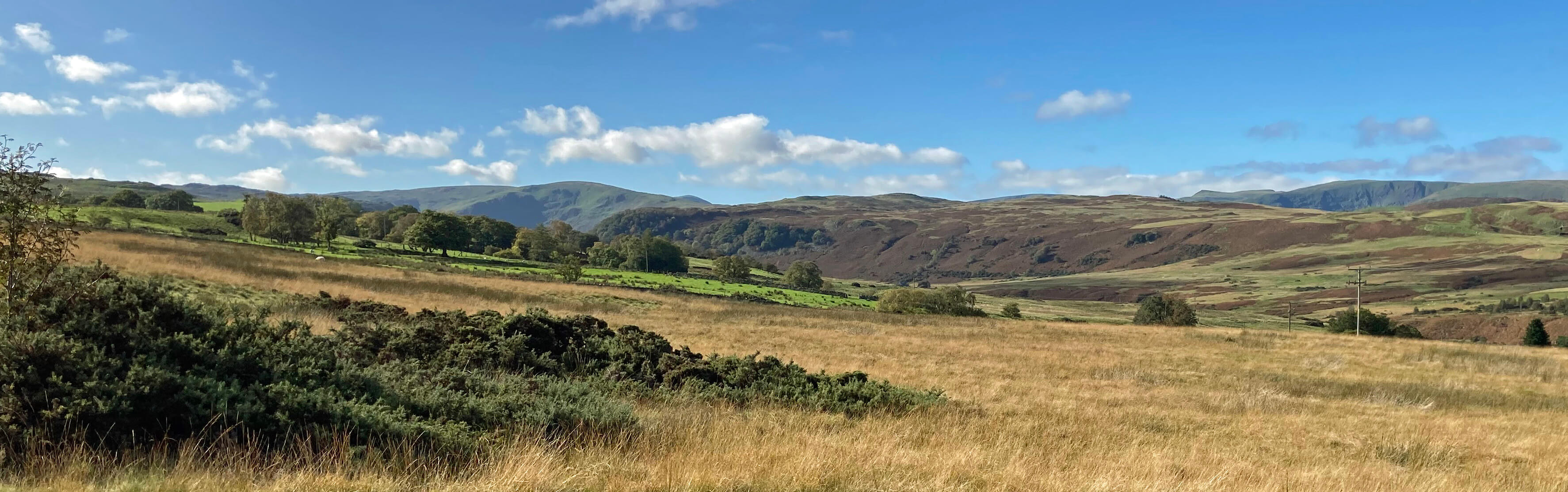
Top photo: The western Howgills from Dillicar;
Bottom photo: Blencathra from Great Mell Fell