
Home
Preamble
Index
Areas
Dales
Hills
Lakes
Places
Reserves
Rivers
Structures
Villages
References
Me
Saunterings: Walking in North-West England
Saunterings is a set of reflections based upon walks around the counties of Cumbria, Lancashire and
North Yorkshire in North-West England
(as defined in the Preamble).
Here is a list of all Saunterings so far.
If you'd like to give a comment, correction or update (all are very welcome) or to
be notified by email when a new item is posted - please send an email to johnselfdrakkar@gmail.com.
67. The Consolation of Arant Haw
I always assume that an enforced change to a plan works out for the best. We intended to walk in Dentdale. Having decided to avoid the narrow, steep, and possibly icy roads through Barbondale, Kingsdale and upper Dentdale, we set off towards Kirkby Lonsdale and Sedbergh only to be stopped by a barrier across the road at Tunstall. After a detour through Burton-in-Lonsdale, we eventually reached Sedbergh only to be stopped by another barrier across the road to Dent. Apparently a lorry had damaged a bridge over the Rawthey. No sensible detours were possible this time, so we stopped and wandered, rather aimlessly, into Sedbergh.
After a stroll along the main street of Sedbergh, browsing the bookshops and enjoying a
leisurely cappuccino, we reviewed our options. Having come this far, we thought we might as well
walk up Winder (473 metres), since every visitor to Sedbergh is expected to do so. It was a
bright, still frosty, day but the puffs of hill cloud were lifting, promising good views from
the top of Winder.
On the way up, we chatted with locals lucky to have this for a regular walk. They assured us that we were better off on Winder than we would have been in Dentdale, which, they said (exaggerating a little), would all be in shade this time of the year. Winder was certainly in the sun and with no breeze it began to feel quite balmy.
We walked up by Settlebeck Gill and, with more enthusiasm now, instead of cutting
across directly to Winder, we thought we’d continue to Arant Haw (605 metres), which promised
even better views. As we reached the ridge, the Lake District profile appeared ahead of us,
with the first snows of winter (the first snows seen by us, anyway) visible on the Scafells,
Bowfell and Helvellyn.
At Arant Haw we sat basking in the sun, although there was still ice
on the puddles. It was quite soothing, having, for once, no objective and no plan. We didn’t even have a map to make a plan with (well, we did have a map but not of where we were) but, with the cloud having dissipated, we could hardly lose our bearings.
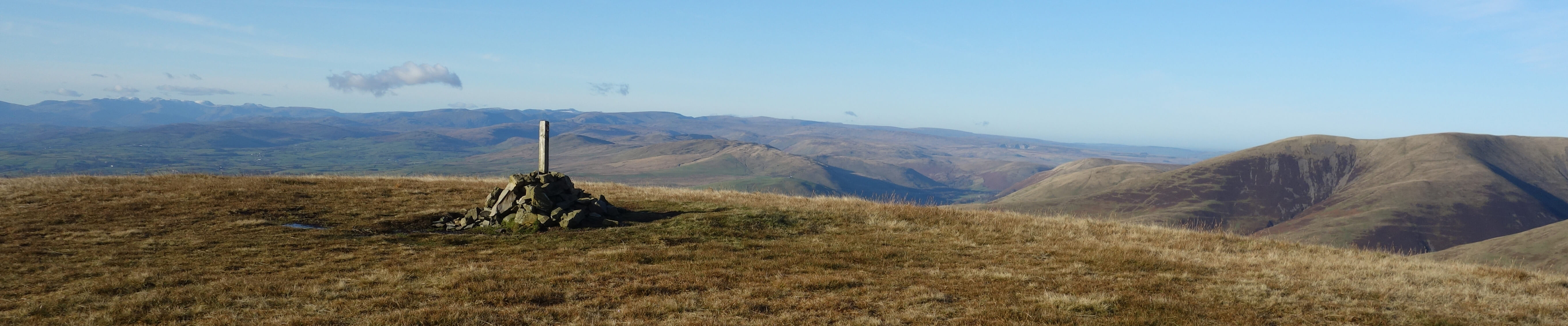
North from Arant Haw, towards Calders and The Calf, with Wild Boar Fell to the right
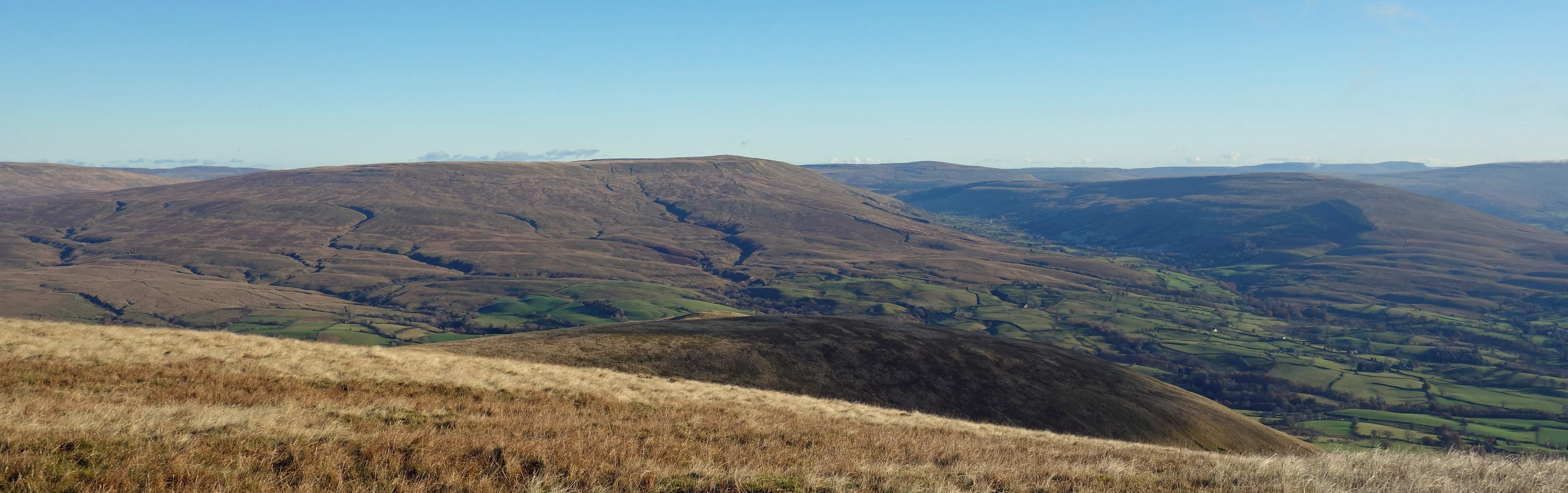
West from Arant Haw, towards the Lake District hills
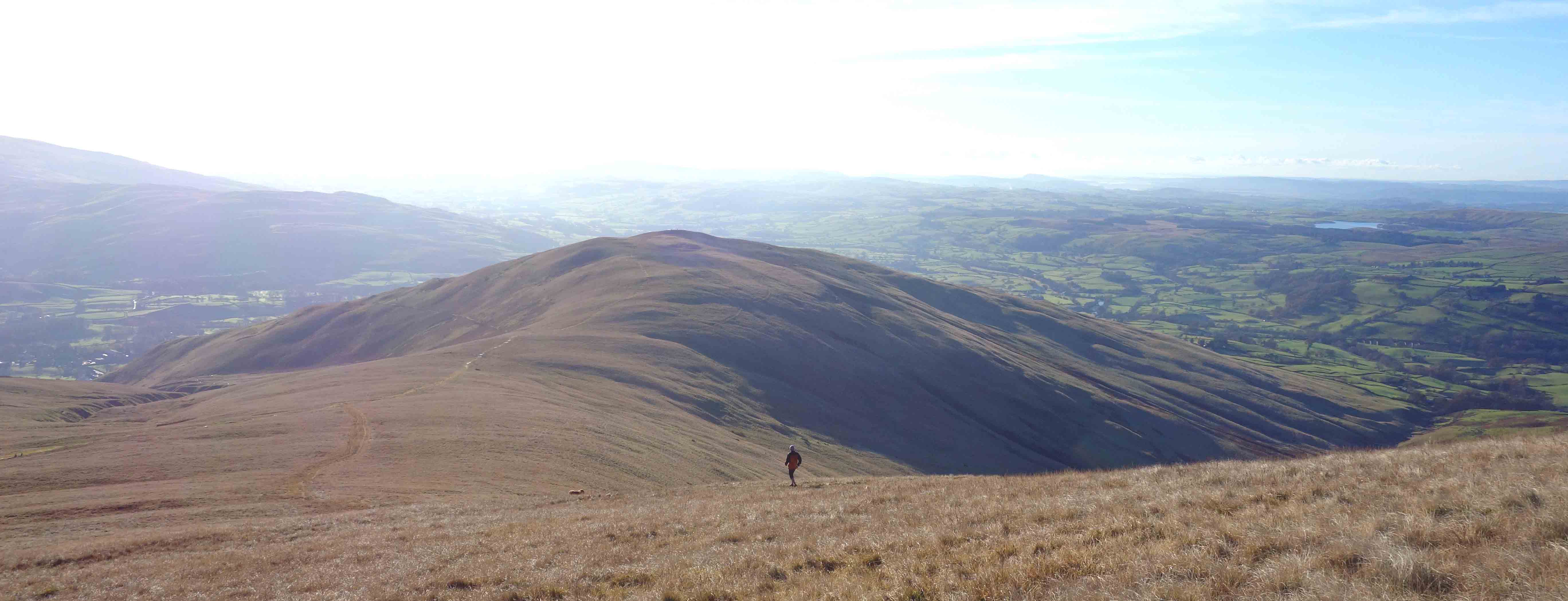
South from Arant Haw, towards Winder
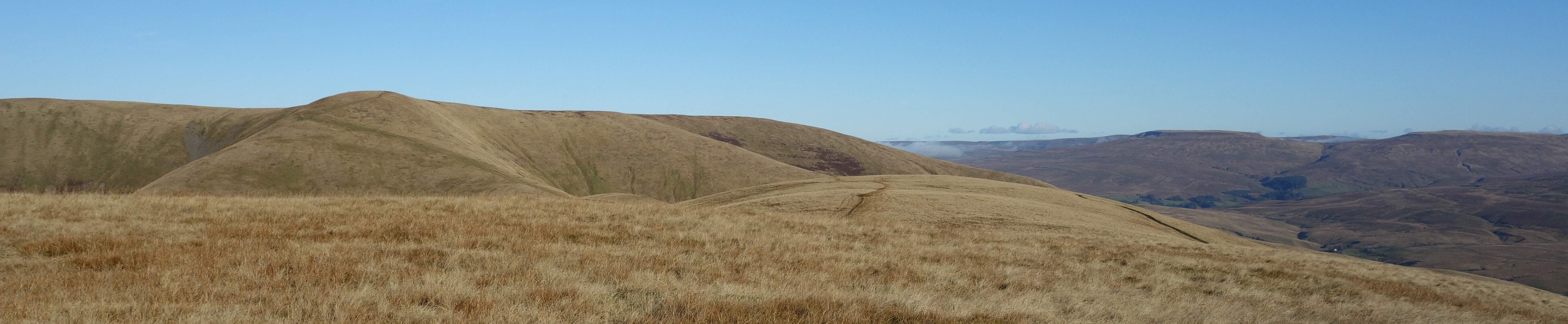
East from Arant Haw, towards Baugh Fell, Great Knoutberry Hill, Aye Gill Pike and Pen-y-ghent
So we sat admiring the view eastwards. It was not what we had set out to see but the view could hardly be
bettered. To the north were Wild Boar Fell and Swarth Fell, with the tops of the Mallerstang hills visible
through the col between them. Then the broad expanse of Baugh Fell was spread out, looking quite appealing
from this distance although it is a muddy morass on closer acquaintance, with its gullies etched out by the
low sun and with the dark valley of Garsdale below. Great Knoutberry Hill stood in the distance, at the
head of Garsdale and Dentdale, with our original objective of Aye Gill Pike to its right. The distinctive
tops of Pen-y-ghent and Ingleborough could be seen, with the less distinctive top of Whernside between.
Below all this lay the green fields of Rawtheydale, its drumlins half in sun and half in shade.
Morecambe Bay and our home valley of Lunesdale glittered to the south.
Because of our late start and our relaxed frame of mind, we did not think about walking further
north, as walkers on the standard walk to The Calf, the highest point of the Howgills, would do. Instead
we retraced our steps and then wandered over to Winder, with its trig point and toposcope added in 2000.
We again took our time to appreciate the views over a distant M6 to the Lakeland hills, our sense of peace
and stillness enhanced by the implicit comparison with the noise and haste of the motorway.
We then ambled down to Sedbergh.
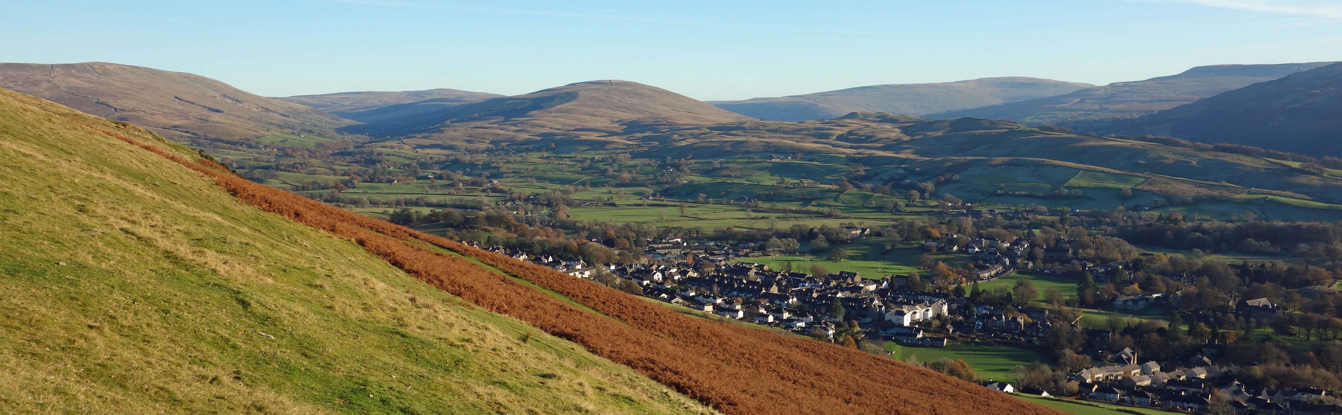
Sedbergh from the slopes of Winder
On the way home we paused at the picnic spot by Killington service station to watch as the sunset transformed the Howgills from red-orange to grey, while the reservoir was perfectly still to reflect the hills and trees. So a not particularly energetic, purposeful or informative Sauntering this one but perhaps one more in the spirit that I originally envisaged when I started this blog.
Date: November 18th 2019
Start: SD658917, Sedbergh, by the school (Map: OL19)
Route: N by Settlebeck Gill – Arant Haw – S, SW – Winder,
Lockbank Farm – E, S – Sedbergh school
Distance: 4 miles; Ascent: 505 metres
Home
Preamble
Index
Areas
Dales
Hills
Lakes
Places
Reserves
Rivers
Structures
Villages
References
Me
© John Self, 2018-

Top photo: The western Howgills from Dillicar;
Bottom photo: Blencathra from Great Mell Fell