
Home
Preamble
Index
Areas
References
Me
Saunterings: Walking in North-West England
Saunterings is a set of reflections based upon walks around the counties of Cumbria, Lancashire and
North Yorkshire in North-West England
(as defined in the Preamble).
Here is a list of all Saunterings so far.
If you'd like to give a comment, correction or update (all are very welcome) or to
be notified by email when a new item is posted - please send an email to johnselfdrakkar@gmail.com.
171. Along the Ribble Way to Brockholes
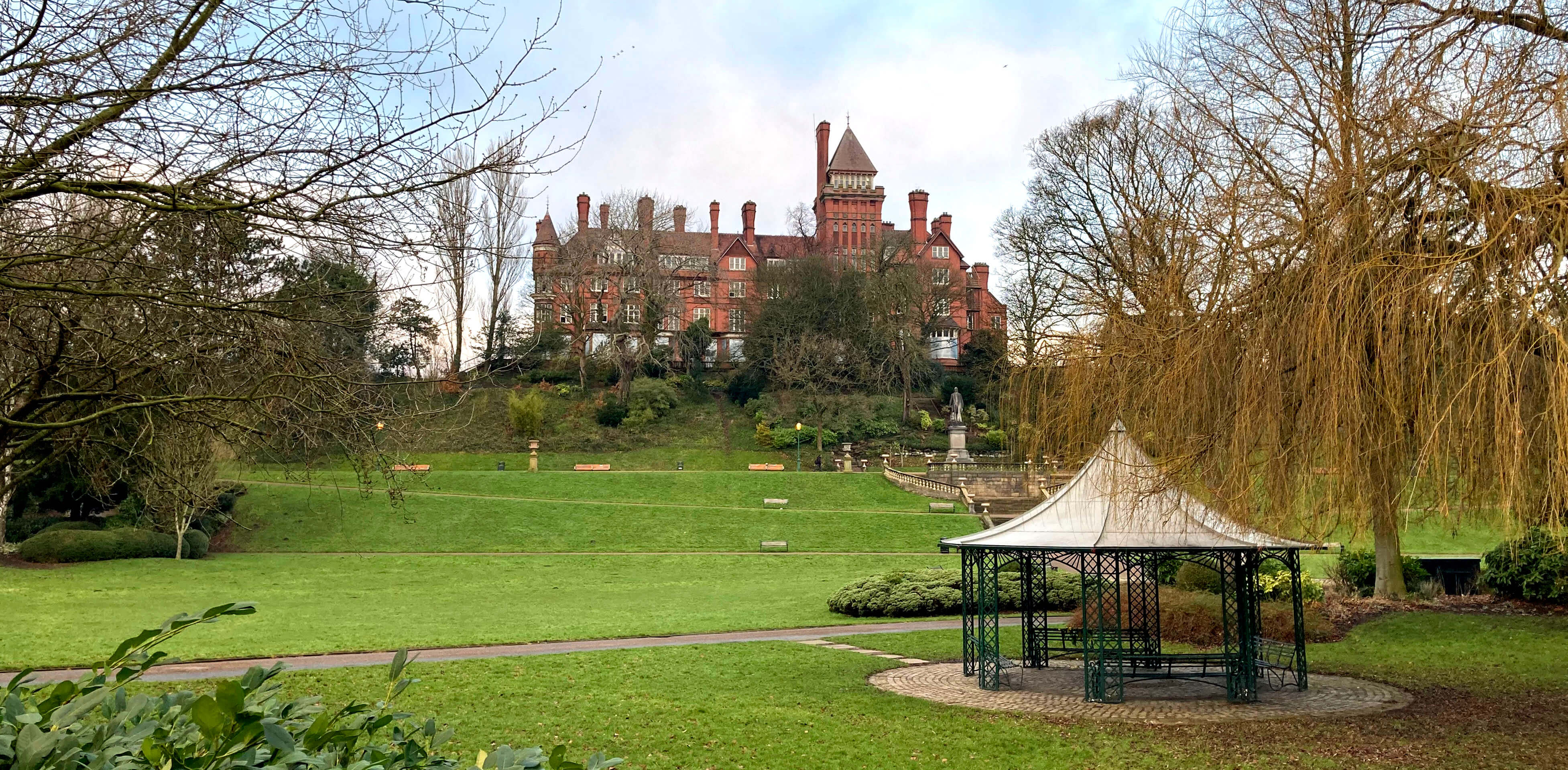
Right: Avenham Park.
Who could resist the offer of a lift to Preston? After a fretful night at the prospect of
tramping around Preston, it was touch and go whether I would get up and go. I did, and we
arrived at County Hall, Preston at 8 oÆclock, before the sun had risen.
I aimed to walk east on the Ribble Way, continuing from the Broadgate interchange where I had
joined the Ribble Way to walk west in [29]. The interchange was in turmoil,
with most of it being
repaired, and I saw no signs for the Ribble Way. Perhaps they were behind some of the many barriers. Anyway,
I walked east along Broadgate, past the listed Penwortham Old Bridge, built in 1759 and now used
only by cyclists and walkers. But not by me, as I continued along the north bank on the road,
now imaginatively called Riverside.
The Ribble here is a wide river, just within its normal tidal limit, running to its estuary
at a healthy speed. To the north was Avenham Park which the Visit Lancashire
website
considers to rank ôamongst the finest examples of traditional Victorian parkland in the North West". It
looked fine to me but I didnÆt stray far from the Ribble Way.
I passed a post with the number 0 on one side and the number 21 on the other. This marks the
beginning and end of the
Guild Wheel,
although as it is circular it has no beginning or end.
It is a 21-mile route that encircles Preston created in 2012 for cyclists and walkers. Much
of my walk along the Ribble Way was shared with the Guild Wheel, which meant that the path was surfaced
for the cyclists.
Next I passed the old Tram Bridge. This bridge was constructed in 1802 in order to
link the Lancaster Canal with the rest of the canal system when there was insufficient money
to build the planned aqueduct across the Ribble. The Tram Bridge was closed in 2019 (and it
did look in a rather rickety state) but it is clear that locals retain a fondness
for it. The so-called ælevelling upÆ programme has allocated ú6 million for the bridge
to be replaced, although many would prefer it to be repaired.
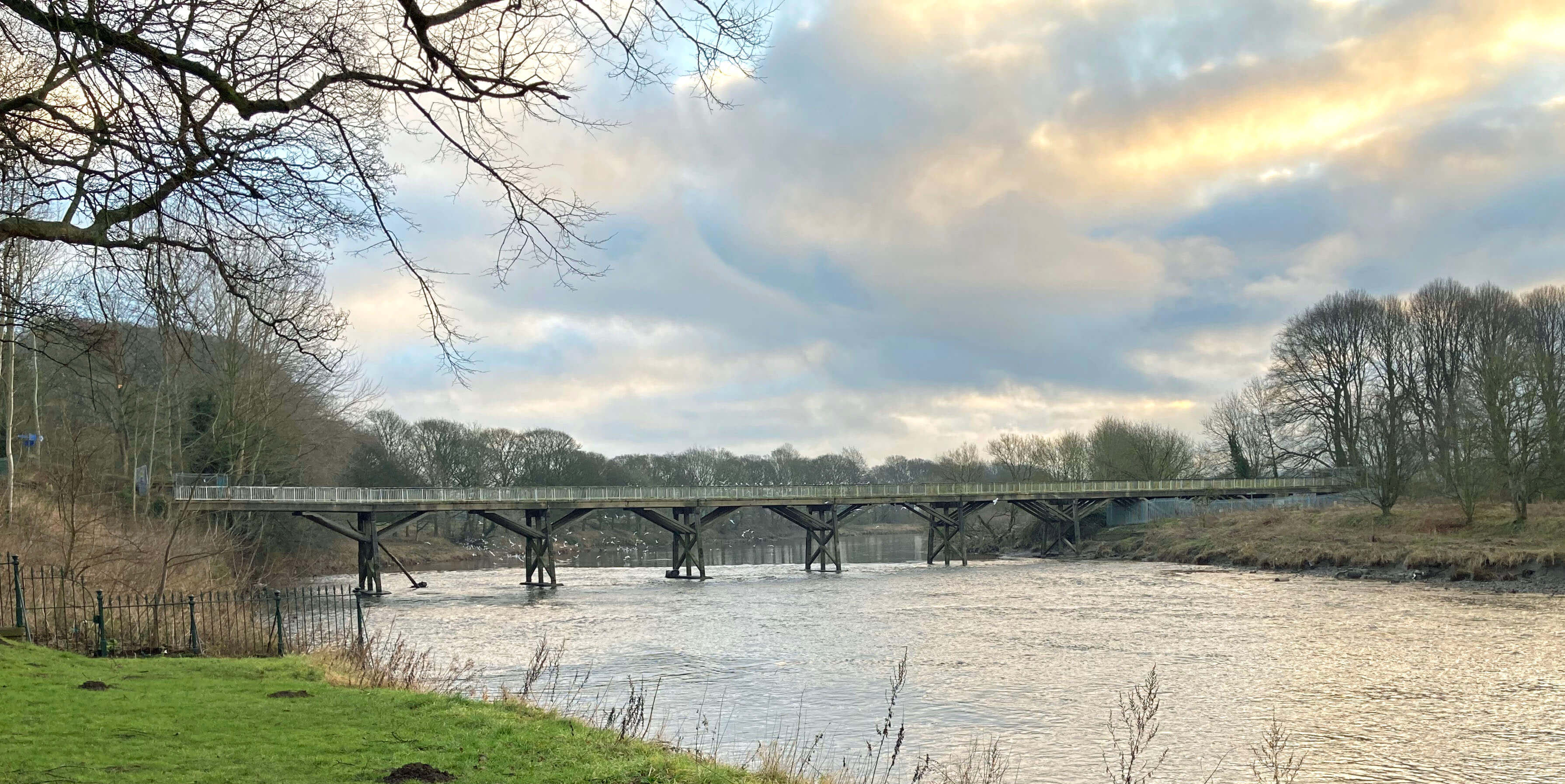
Tram Bridge
I left the Guild Wheel at Fishwick Bottoms to continue on the Ribble Way for three miles or so along the curving
banks of the Ribble. Here there are no houses or roads, because it is so
low-lying and flat that it must be liable to flooding,
but it isnÆt quiet as the M6 is not far ahead.
Although this was the best walking stretch I saw no walkers here. Instead, I saw a number of
fishermen, regularly spaced out along both banks, still, silent and in camouflage dull green.
They may have been statues but I am confident that they were not women, which is why I used æfishermenÆ.
Why are there so few fisherwomen? Women have understandably sought equality in
business, the media, sport, and so on. There are over a million fishermen in England,
spending many quiet hours by the riverside, if Fishwick Bottoms is any guide. If women
refuse to fish in similar numbers then, with all those hours saved, women will come to outnumber men in business,
the media, sport, and so on. That's not equality.
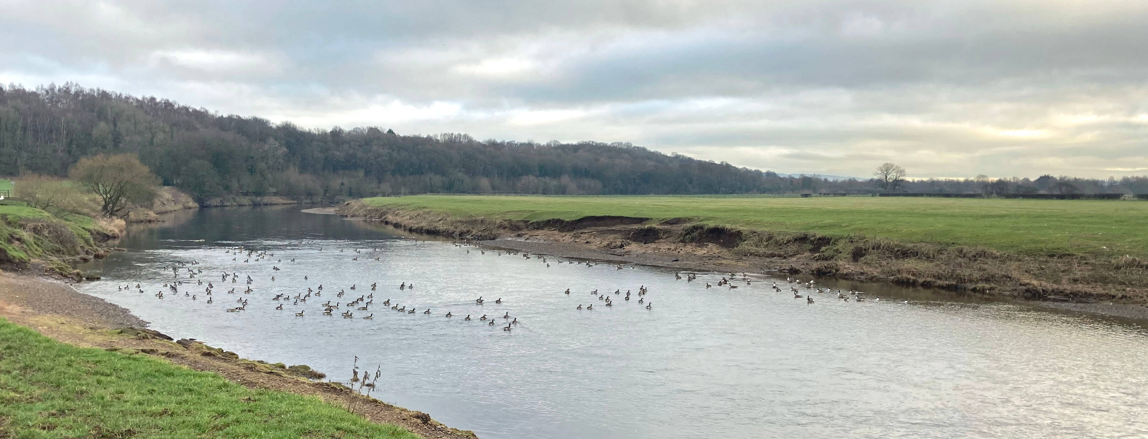
Canada geese on the Ribble at Fishwick Bottoms
The Ribble Way passed under the A59 and then the three bridges of the M6 junction to emerge
at the Brockholes Nature Reserve, which opened in 2011. This has been created within an old
sand and gravel quarry and includes a number of lakes and a floating ævisitor villageÆ. I wandered
about for quite a while but I must admit that it seemed rather dull. There were only a few
people mooching about and the miscellaneous ducks on the lakes weren't full of joie de vivre either.
I'm not a dabchick at identifying ducks.
I remember visiting
shortly after the reserve opened and then it seemed a-buzz, partly because of the novelty of the floating
structures. Admittedly it was summer then, not a cloudy, cold January day. Today, the ævillageÆ
looked closed or, if open, inactive. Perhaps I was too early for it to be open? There were many trails,
most adorned with little red, blue and yellow arrows but if you donÆt know what the colours
denote then they are annoying rather than helpful.
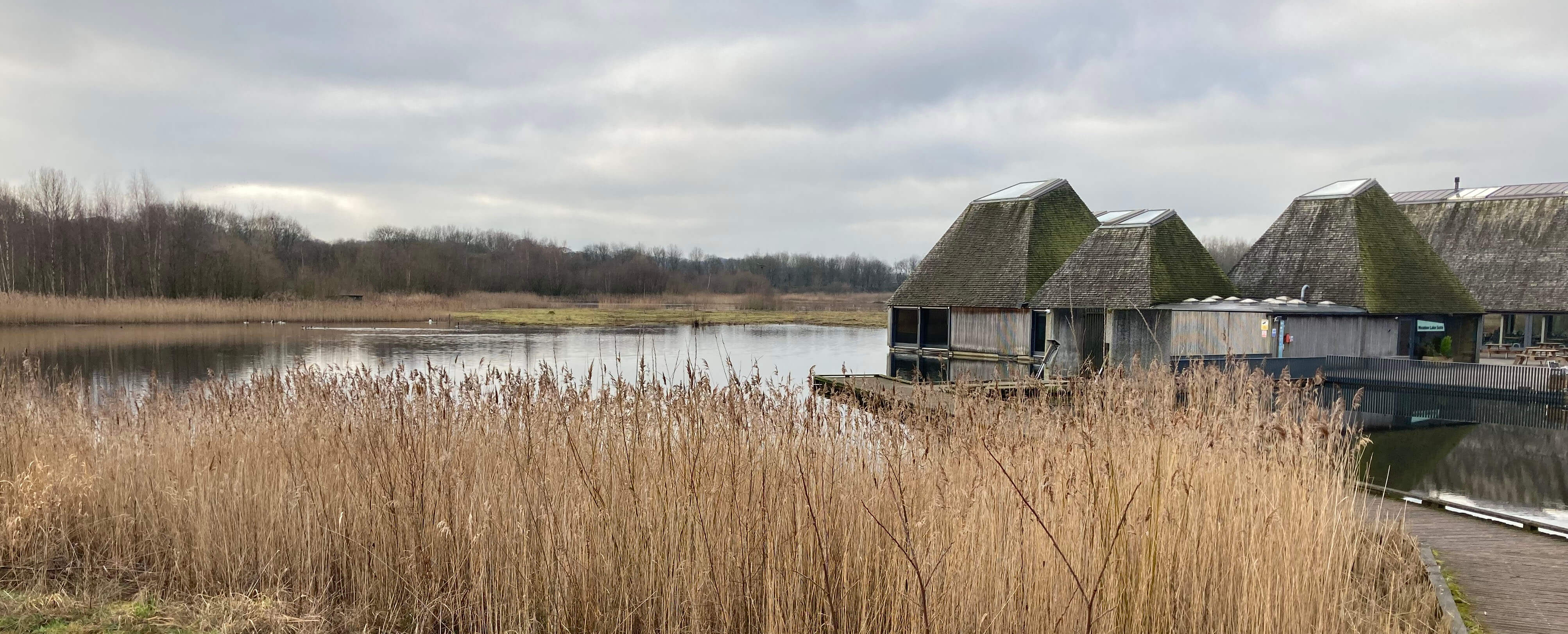
Brockholes Nature Reserve
I had intended to seek out the footpath shown above Boilton Wood to the north crossing the M6 but
I couldnÆt be bothered to try to find it amongst all these trails. Instead, I retreated under
the M6 back to the A59 which I then followed all the way to the Preston bus station. The A59 is a
perfectly adequate road for one of the main arteries into the heart of the city but I saw nothing
of particular interest amongst the garages, the cemetery, Ribbleton Park, pubs, food shops,
churches, mosques, hotels, and so on. (Hands up if you thought of telling me that arteries
carry blood away from the heart.)
Mingling among the residents going about their everyday business
I couldnÆt help wondering whether that ú6m for the Tram Bridge û and indeed
the whole
ú20m awarded
to ôdeliver a range of improvements to four major City parks, deliver safer
and healthier streets and more walking and cycling routes, including a Mobility Hub at Preston Bus
Station and new River Ribble bridge as a replacement of the Old Tram Bridgeö û could be better
used to improve their lives. Of course, the award corresponds to what
the Preston Council asked for but the council knows that the government wants the public to appreciate
its apparent largesse with relatively high-profile prestige projects rather than to be made aware that the
council can no longer provide essential public services because of cuts to its funding over many years.
Overall, I didnÆt have much get-up-and-go today. Perhaps I shouldnÆt have got up and gone.
Date: January 27th 2023
Start: SD533292, County Hall, Preston (Map: 286)
Route: (linear) SW on Fishergate û Broadgate û E (more or less) on
Ribble Way û Brockholes Nature Reserve û back on Ribble Way û A59 û W on A59 û Preston bus station
Distance: 9 miles; Ascent: 50 metres
Home
Preamble
Index
Areas
References
Me
® John Self, 2018-

Top photo: The western Howgills from Dillicar;
Bottom photo: Blencathra from Great Mell Fell