
Home
Preamble
Index
Areas
Dales
Hills
Lakes
Places
Reserves
Rivers
Structures
Villages
References
Me
Saunterings: Walking in North-West England
Saunterings is a set of reflections based upon walks around the counties of Cumbria, Lancashire and
North Yorkshire in North-West England
(as defined in the Preamble).
Here is a list of all Saunterings so far.
If you'd like to give a comment, correction or update (all are very welcome) or to
be notified by email when a new item is posted - please send an email to johnselfdrakkar@gmail.com.
This is one of several items about walking and walks from home during the
coronavirus lockdown of January - March 2021.
120. A Walk in Littledale in 1847
We left the house early-ish on Monday morning and decided to walk in 1847. We walked up the narrow, stony
track, past empty fields, to Moorside House.
[I will butt in, in italics, from time to time to relate this
fantasy to the scene today. They specified 1847 because that is the date of the first OS map available
on-line. It was a good job that they didn’t decide it was 1847 before leaving the house because their
house didn’t exist in 1847. Neither did almost all the other houses in the village. In 1847 there were
only about a dozen houses clustered around the church and pub. However, the layout of the village
tracks (now roads) was much as it is now. Moorside House is now called Moorside Farm.]
Turning right, past the Quarry Road track, we passed the Caton Workhouse, a building of some grandeur,
which may be some compensation for the poor souls compelled to live there and trek across to work in the Caton
mills. At least the women and boys only have to work for ten hours a day now, thanks to the new Factory Act.
Passing Tenters Farm and crossing Tarn Brook, views opened out over fields to the east.
[Quarry Road ran up to the quarries near the top of the moor. It still does although the quarries have been
disused for over a century. Caton Workhouse closed as a workhouse in 1866 and was converted to a residence,
Moorgarth. Tenters Farm is still there but views no longer open out here because Tarn Brook Plantation was planted
some time between 1847 and 1891 (the date of the next OS map on-line). It looks a natural woodland now.]
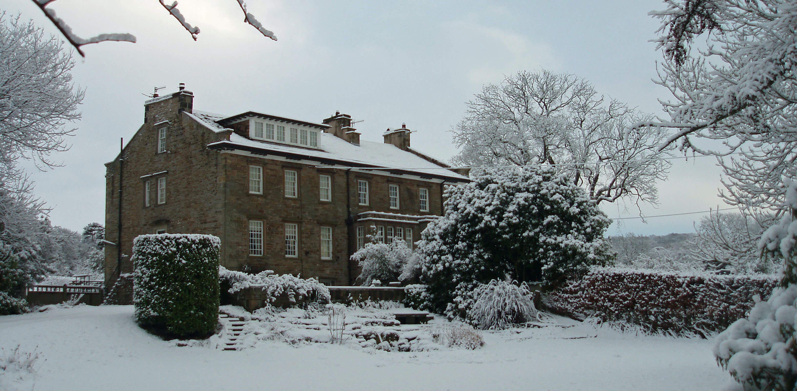
Left: Moorgarth (our walkers had no camera in 1847, so I’m re-using some old photos).
We turned left onto Littledale Road, ignoring the track straight ahead to an unnamed house,
and passed two farms to the right, Stoven House and Hodgson’s. After a while, Roeburndale Road branched off to the left but we continued straight ahead over the rise of
Littledale Road, pausing at the ancient Cross Stone at the highest point.
[Littledale Road and Roeburndale Road were called roads on the 1847 map but were just
rough tracks, no doubt. The unnamed house is Cransfield House on today's map and the two farms are now
Stauvins Farm and Ravenscar Farm.
The main road now turns to
the right. It was built between 1847 and 1891. The present track of the old Littledale Road (shown right) perhaps
indicates the state of these ‘roads’ in 1847. I doubt that the cross was still there in 1847 but its
stone base was. It’s there now.]
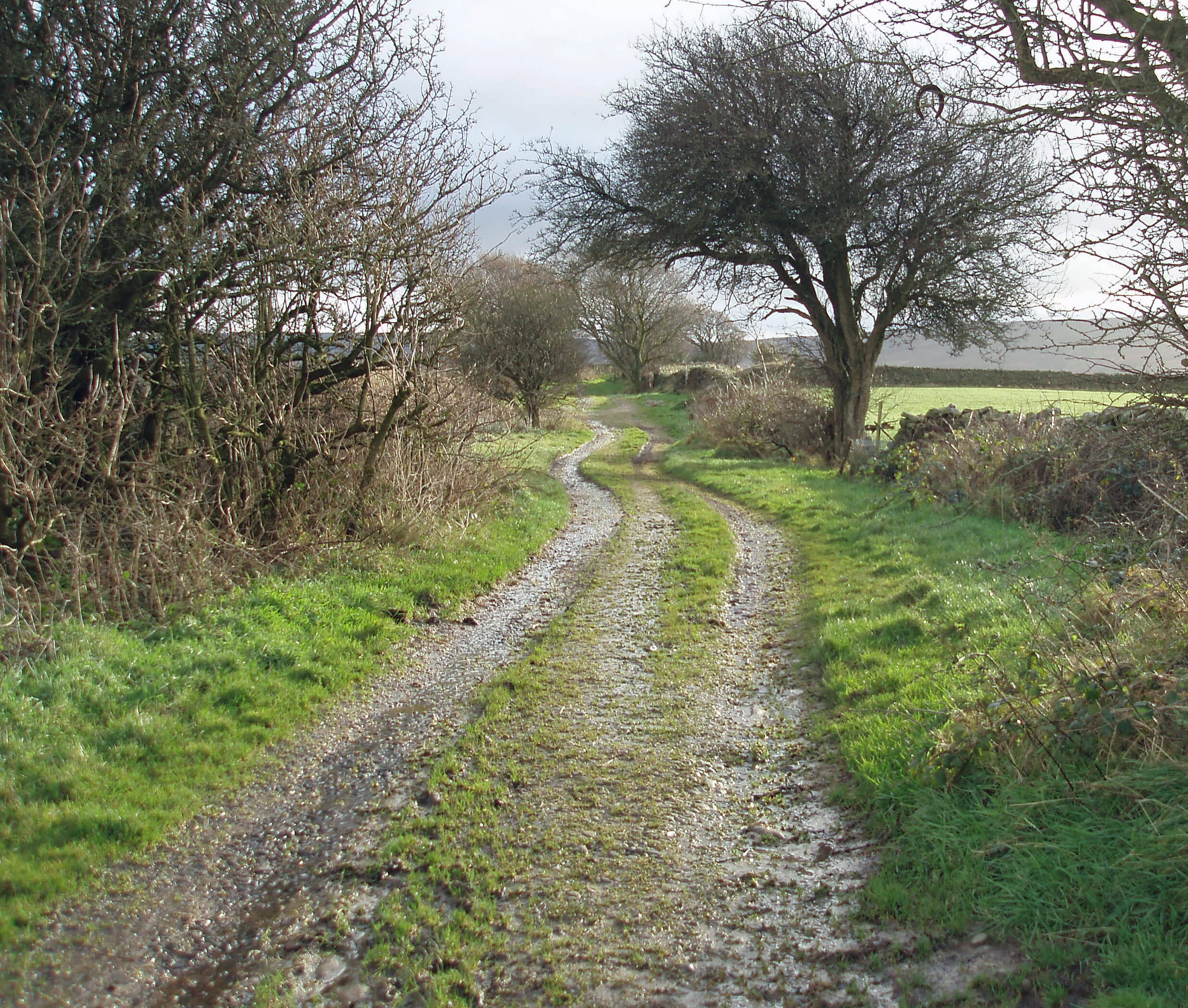
Right: The Littledale Road track.
We then dropped down to pass the Crossgill Bobbin Mill and
took the side track to Fostal Bridge over Foxdale Beck – Fostal presumably being a map-maker's
mishearing of the local pronunciation of Foxdale.
[There's a scout camp now where the mill was. New House Farm, on today's map, wasn’t there in 1847 but it was built before 1891 and so is new with respect to the other
farms in the region. In 1847 the main track continued to the hamlet of Crossgill along what is now an
overgrown avenue between trees. The continuation of the road to Crossgill wasn’t completed until some time
between 1895 and 1913.]
We then walked through a pleasant dell by Nicka Wood and Udale Beck rising to Bell Hill House, with
views to the moor below Ward’s Stone. We didn't continue as far as Dale Side but took
the airy track east to the farm of Field Head
which provided views over to Caton Moor and Morecambe Bay.
[Bellhill Farm now has a few new residences adjoining.
Caton Moor was empty then. Now we have windmills.
Field Head is still a farm. Dale Side, built 1685, is marked on today's map,
but is derelict, although maybe the barn is
still in use. It is a listed building, as are many of the other buildings passed on this
walk. The path to Field Head is a
little less airy now as a number of plantations were added to the map between 1847 and 1891. Again,
some of them look natural woodlands now although others have dense conifers. I don’t know if they
would have been planted with conifers in the 19th century – or indeed why there was a spate of tree-planting
at this time.]
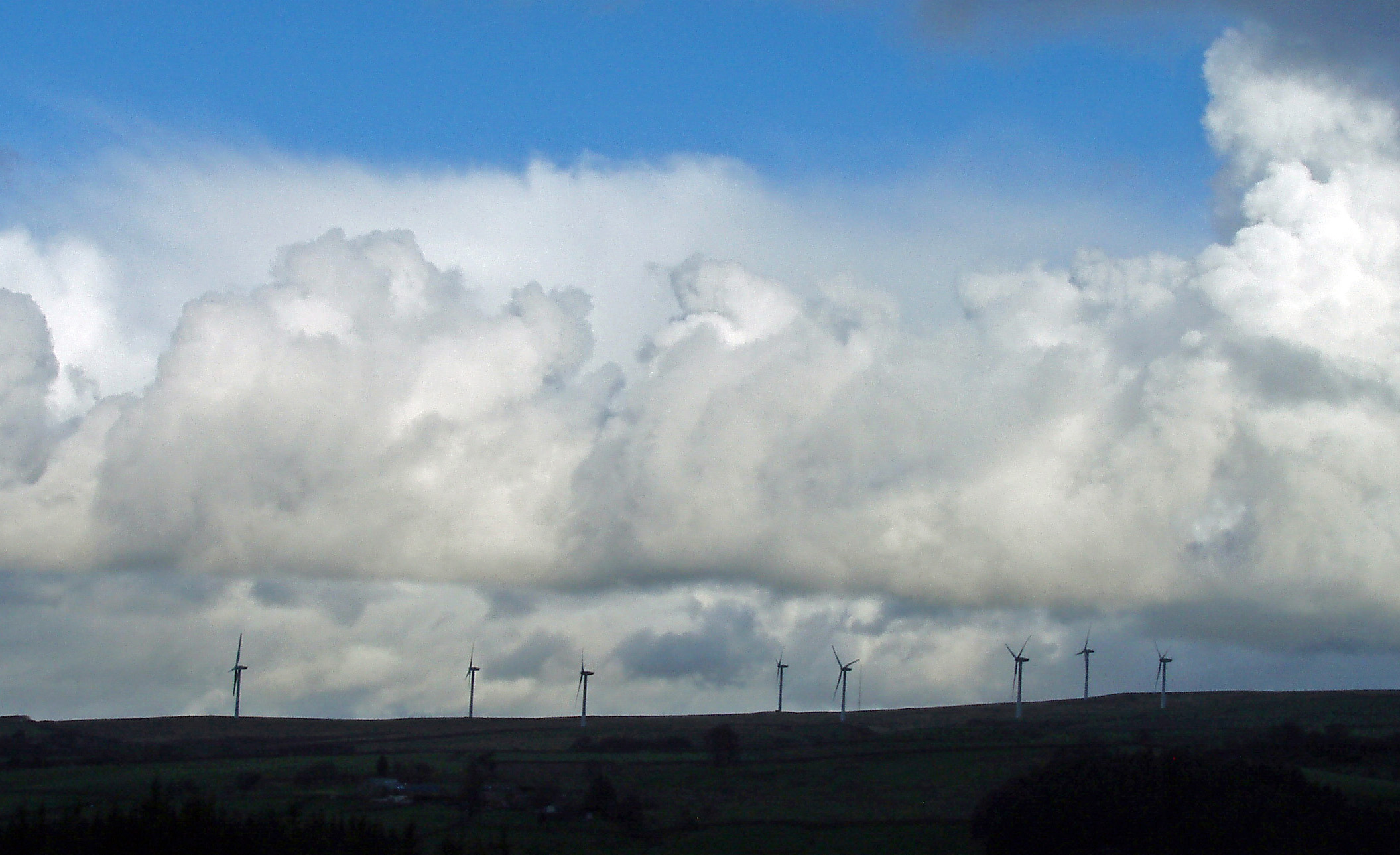
Left: The Caton Moor windmills, plus impressive clouds.
From Field Head we walked across boggy fields, down through a wood, to cross Foxdale Beck and
emerge at Tongue Moor. Ruth saw a white stoat
[113]
near here: I missed it.
[The name Tongue Moor referred to a farm or house, not to the moor itself.
It dated back to at least the 15th century but was demolished in the 1970s. The Littledale Hall that is
now here is not on the 1847 map because it was built for the Rev. John Dodson who retired as Vicar of
Cockerham in 1849. His isolated ‘free church’ a little further on bears a date of 1849. Littledale Hall
is now a residential addiction treatment centre.]
Turning west, we walked past the
quarry and coal pits and took a little detour to the hamlet of Crossgill, which is not much more than a
farm, with a date of 1681, and the Crossgill Chapel, built in 1755.
[The quarry and coal pits
are now within a small plantation. The site of the old quarry is clear but not that of any coal pits.
Crossgill is little bigger today than it was in 1847. The chapel was renamed as St Anne’s Church by
1891 before being converted to a residence in the 1990s.]
We then struggled up the steep track passing Haws House, turned west on the
Roeburndale Road, crossing Crossgill Beck and walked on, with wide views over Morecambe Bay and to
the Lake District hills.
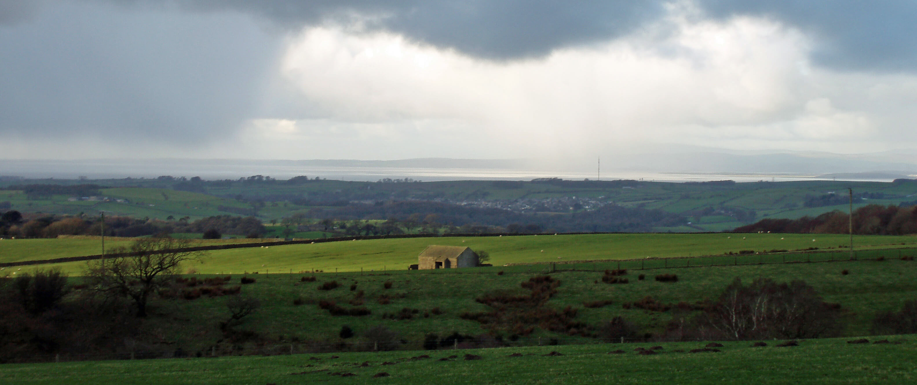
Right: The view over Morecambe Bay from the road to Haws House.
[Haws House is still there.
The Brookhouse Brickworks near Crossgill Beck came and went between
1847 and now. The residence of Roeburn Glade now occupies the site.]
After passing Berry’s Plantation, we re-joined the Littledale Road
and walked home, our feet beginning to feel a little sore. It’s time someone made some stout walking shoes.
How old Wordsworth manages to wander about his hills I don’t know.
[Berry’s Plantation (called
the Roeburndale Road Plantation today) looks a natural woodland to me. Nearly all the woodlands
on the 1847 map are called ‘Wood’s – and I assume these are more natural than the Plantations.
Why would anyone plant such a Plantation before 1847? Perhaps ‘Plantation’ doesn’t necessarily
mean that trees were planted?]
[The overall conclusion from this walk is that anyone who lived in this region in 1847 would
have little difficulty in finding their way around today. Most of the tracks (called roads then) have
become tarmacked roads. The only new (between 1847 and 1891) road is the one avoiding the steep rise
over the Cross Stone hill. The fields, fences and walls are all pretty much in the same place. All the
farm buildings (except the derelict Dale Side and demolished Tongue Moor) are still there (modernised, of course)
and most are still farms. It’s likely that some
have the same families within them. Only one farm (New House) has been added to the set since 1847.
It’s rather reassuring that in this rapidly changing world some
things change hardly at all.]
Date: February 15th 2021
Start: SD543644, Brookhouse (Map: OL41)
Route: S, SW on Littledale Road and past Cross Stone – New House Farm – S over
Fostal Bridge – Bellhill Farm – E – Field Head – NE – Littledale Hall – W – Crossgill – E, NE –
Roeburndale Road – W, NW – Brookhouse
Distance: 7 miles; Ascent: 160 metres
Home
Preamble
Index
Areas
Dales
Hills
Lakes
Places
Reserves
Rivers
Structures
Villages
References
Me
© John Self, 2018-

Top photo: The western Howgills from Dillicar;
Bottom photo: Blencathra from Great Mell Fell