
Home
Preamble
Index
Areas
References
Me
Saunterings: Walking in North-West England
Saunterings is a set of reflections based upon walks around the counties of Cumbria, Lancashire and
North Yorkshire in North-West England
(as defined in the Preamble).
Here is a list of all Saunterings so far.
If you'd like to give a comment, correction or update (all are very welcome) or to
be notified by email when a new item is posted - please send an email to johnselfdrakkar@gmail.com.
This is one of several items about walking and walks from home during the
coronavirus lockdown of January - March 2021.
118. Coast-to-Coast in Six Days
Understandably, the BBC has difficulty providing fresh travel programmes at the moment (February 2021) and is therefore
repeating old ones, such as those of Michael Palin. If it’s good enough for the BBC then I can do similar,
or better because the text below has never seen the light of day before. Just as the BBC shows the films
unedited to provide a window onto the past, so these unedited (apart from a few cosmetic changes) words of 1993 reflect an age that I have certainly passed.
This coast-to-coast route was not THE Coast-to-Coast route devised by Wainwright. His route takes walkers
across the hills, dales and moors of three National Parks. I wanted to run, not walk, and although I was
happy to run on craggy hills and boggy moors (up to a point) I preferred steadier running along country
lanes and tracks. Wainwright's route is usually walked west-to-east, is 190 miles or so, and links St Bees Head and
Robin Hood's Bay. Our coast-to-coast route was east-to-west (because I wanted to get into
a rhythm first before tackling the hilly parts), was a more satisfying 200 miles or so, and began at
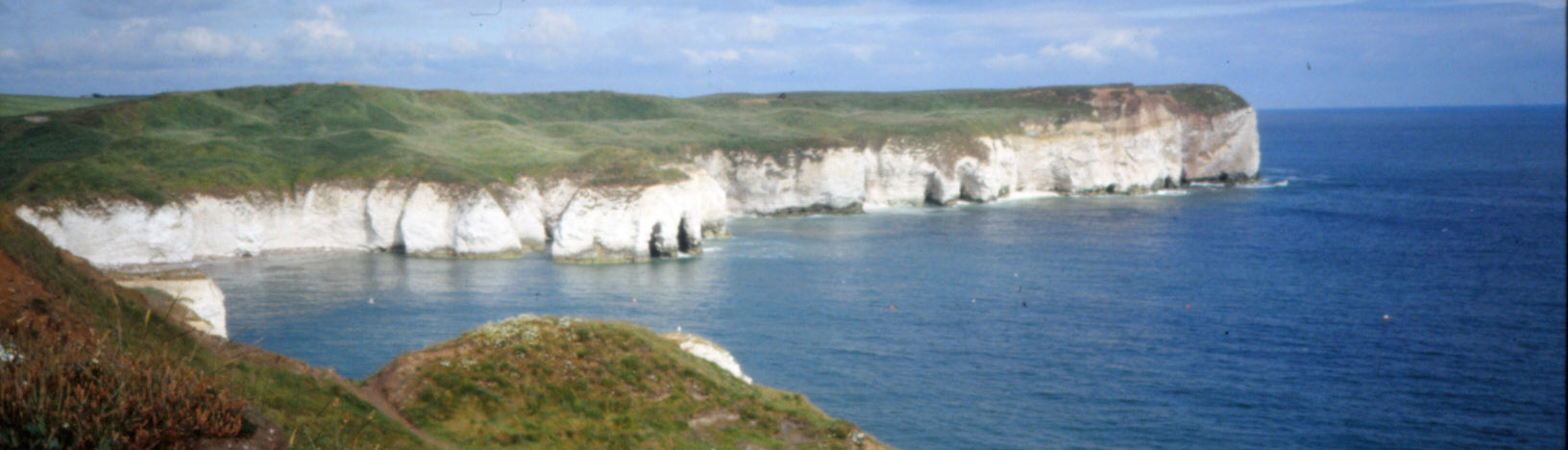
Flamborough Head (which, rather than Robin's Hood Bay, is the jutting out bit on the east coast
that better compares to St Bees Head on the west coast).
Now to the 1993 words:
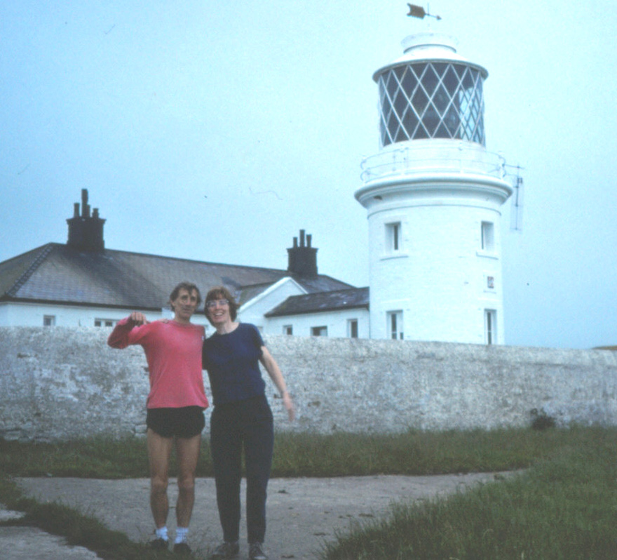
 The aim was to run from Flamborough Head lighthouse to St. Bees Head lighthouse, an estimated 200 miles, in six days.
Each day, at least for the first four days until we reached Tebay, was to involve four runs of nine miles each,
two in the morning with a half-hour break, two in the afternoon with a half-hour break, with a long break in the
middle of day for Ruth to go riding. After Tebay, because the run was more cross-country and it would be
harder to meet up, breaks would be arranged as appropriate.
The aim was to run from Flamborough Head lighthouse to St. Bees Head lighthouse, an estimated 200 miles, in six days.
Each day, at least for the first four days until we reached Tebay, was to involve four runs of nine miles each,
two in the morning with a half-hour break, two in the afternoon with a half-hour break, with a long break in the
middle of day for Ruth to go riding. After Tebay, because the run was more cross-country and it would be
harder to meet up, breaks would be arranged as appropriate.
(Comment added today: This paragraph about the logistics will probably be of little interest, unless
you are planning something similar. Of course, it would be
different today, with mobile phones and other technology.)
We allowed for ten-minute miles, so ninety minutes for each nine miles. Since it was not possible to predict
exactly where would be a good place for Ruth to park the camper-van, we agreed a ‘lower’ and ‘upper’ bound for
meeting up. The lower bound, at near the nine-mile mark, was the point which I would not pass before an agreed
time, which for nine miles was eighty minutes after I set off (since on our trial run I’d found it hard to run
as slow as ten-minute miles). The upper bound, at some distinctive point about a mile further on, was the point
beyond which I would not pass and would expect Ruth to arrive at no later than the agreed time, twenty minutes
after the lower bound time. So if Ruth reached the lower bound before the agreed time she would know that I was
not ahead of her and could continue to find a convenient meeting place, stopping at the upper bound if she couldn’t
find one; if she was after the lower bound time she would carry on until passing me (if I were ahead) up to the upper
bound.
Day 1: Flamborough Head – Low Marishes
 1st Leg: Flamborough Head – Grindale
Having picked up a hired camper-van in Darlington, we stayed in the Thornwick camp north of Flamborough and had a good sunset walk along the cliff tops and down to the cove to see the caves.
Ruth got up early to return to the cove with the camera (I saved my energy).
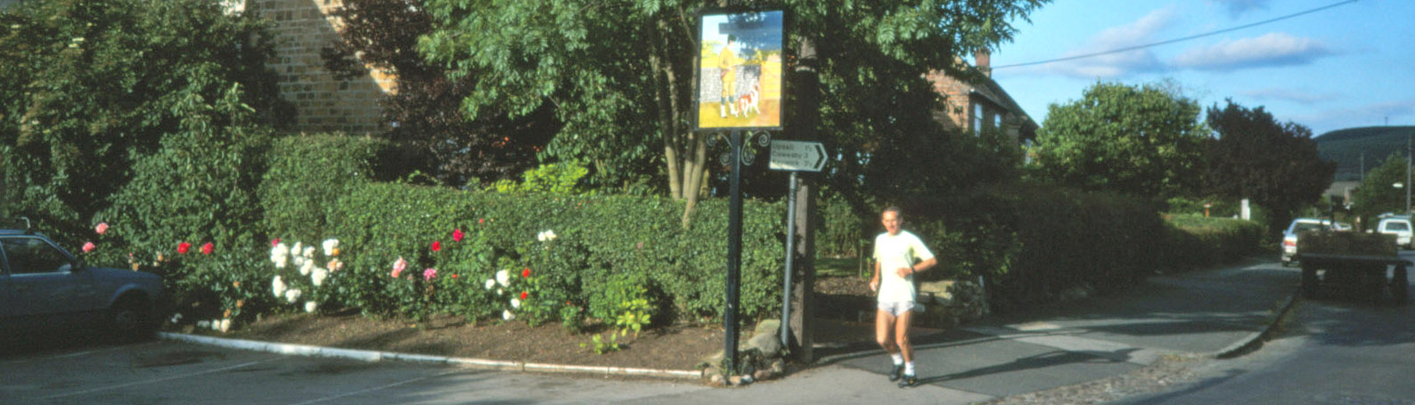
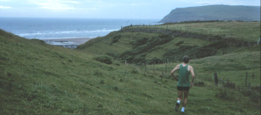
The day started bright and breezy, with the wind against, and a threat of showers. There were few people at
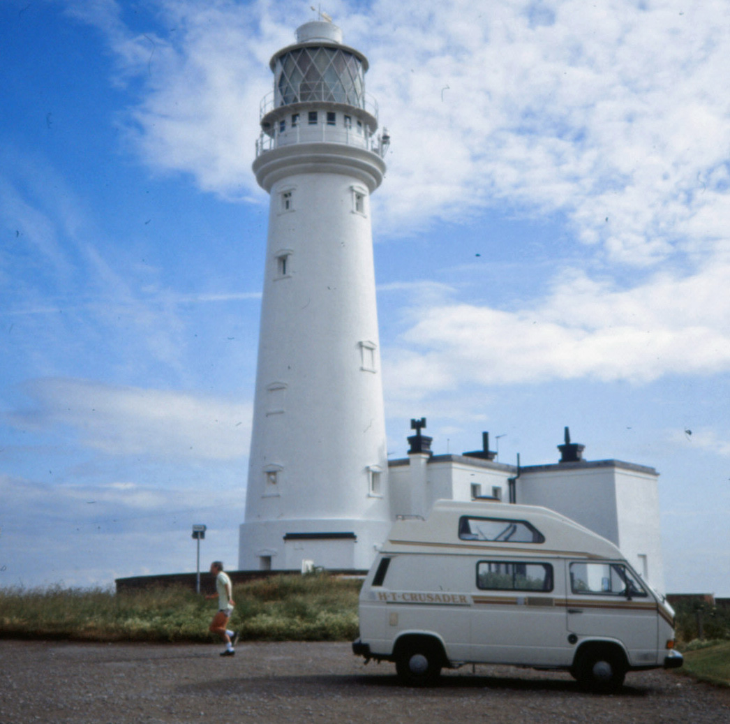
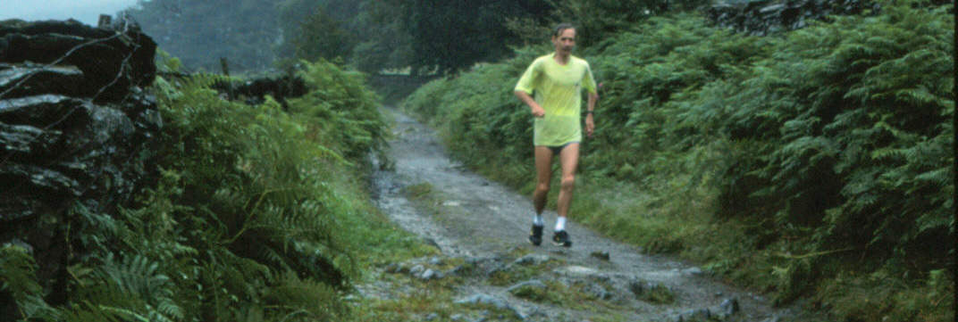
Flamborough Head lighthouse as I set off (photo left) at 9.00 a.m. on a Sunday morning. Ruth stayed to walk down to paddle in the sea and look at the old tower. I plodded on through Flamborough and towards Bempton.
From Bempton it was onto quiet (apart from skylarks) country lanes to Grindale. The sea was hardly seen at all, it being down below the cliffs. I saw no sign of the aerodrome marked near Grindale. I arrived early at the lower bound and in fact had to wait at the upper bound for a couple of minutes, just beginning to wonder if our plans had failed at the first test. Ruth had had a little look at Bridlington.
2nd Leg: Grindale – Foxholes
There was a shower just as I set off but I soon dried out. This was a straightforward run through quiet villages
such as Burton Fleming. Ruth had a look at Willy Howe, a prehistoric mound.
We also passed our first blue field, which Ruth identified as flax. Towards Foxholes, the number of motor-bikers, on their Sunday outings, increased. Wold Newton had the traditional green and pond but Foxholes only the green, where Ruth parked for the lunch break.
Riding: Snainton Riding Centre, about four miles north of West Heslerton.
3rd Leg: Foxholes – West Heslerton
Again there was a shower just as I set off, harder than last time. It seemed quite a long grind up to Sherburn
Brow (166m) but there were good views. I’d decided to avoid the A64 (which did look busy) and to run along East
Heslerton Brow along the Wolds Way. This involved more of a drop down and a climb up than I’d imagined, and then
much more scrambling. The path was very overgrown in places (and the grass now very wet) but at least it was
well marked. At the point of turning off the road I had apparently just missed Ruth who had driven up here and
had a problem with starting the camper-van. She was picturing having to call the AA and concerned that the
whole expedition was in jeopardy. It seemed that the starter motor had jammed but it started after a
little rest (just like me).
While Ruth was struggling with the van, I ran down across the fields to West Heslerton and then across the A64 to find Ruth, as hoped, just a bit further on, round a bend, but still worried about the van.
 4th Leg: West Heslerton – Low Marishes
This was a rather nondescript run along a lane north of the Derwent.
There were farms off the road every few hundred yards but not much to see. One farm seemed to be having a little
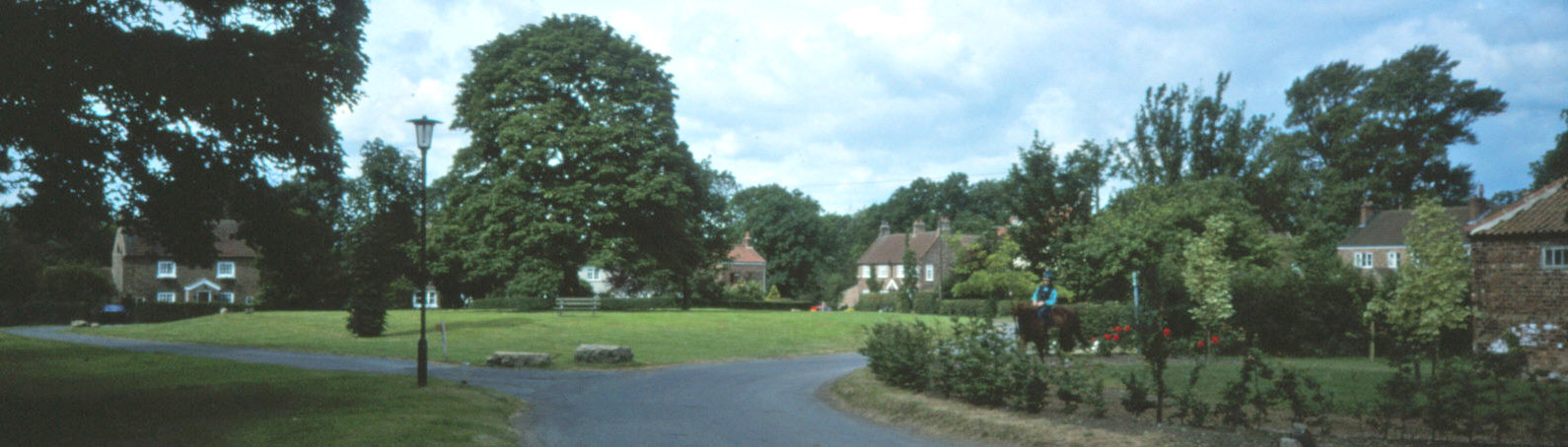
party in the garden, otherwise it all had a very quiet Sunday evening feel. Ruth was waiting beyond Low Marishes,
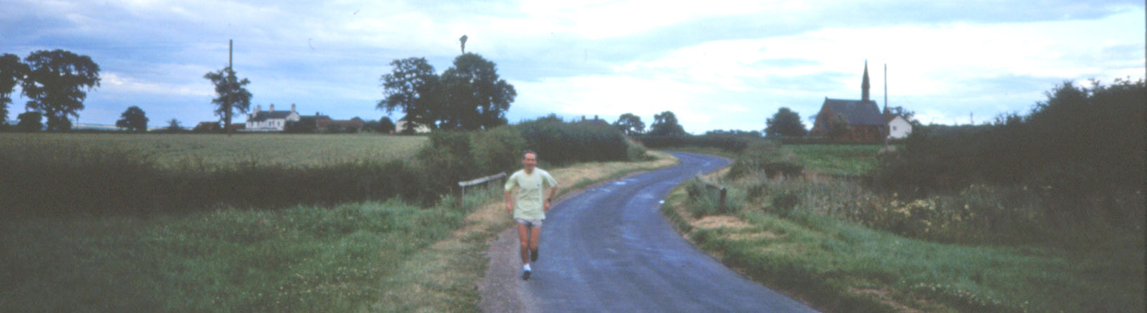
sketching its distinctive church. At the end of the first day (right) my right knee was a bit sore and I was naturally tired but otherwise ok.
We stayed in the Ashfield Caravan Park, Kirby Misperton – next to Flamingo Land – and had our evening meal in the associated pub.
Date: July 11th 1993 (posted here on February 12th 2021)
Route: Flamborough Head – W – Flamborough – NW – Bempton – W (past North Dale) –
Grindale, Burton Fleming, Wold Newton, Foxholes – NW – near Sherburn – jink W, S, W – West Heslerton Brow –
NW – West Heslerton – N – Yedingham – W past Marishes Lodge Farm, etc., SW – Low Marishes (36 miles)
Day 2: Low Marishes – Knayton
1st Leg: Low Marishes – near Sparrow Hall
The day began with a cloudless sky, with good views of the North Yorkshire Moors, but it had clouded over a bit by nine o’clock.
I thought that the second day would be the hardest – the day I would see if I could keep going (hardly running)
with all the aches and pains. Once I had managed to get started, it was not too bad.
The footpath through Costa Farm was not marked but no-one objected. It was still windy and becoming quite warm as I ran through Great Barugh and Brawby. I seemed to be well ahead of schedule and so walked for a bit.
I reached the upper bound near Sparrow Hall at the same time as Ruth, arriving from the opposite direction, having
stocked up and gained some reassurance about the camper-van.
 2nd Leg: Sparrow Hall – Helmsley
This was along quiet country lanes through Harome (a nice-looking village) until we joined the main road into Helmsley. A man near Summerfield commented that it was a nice day for a run (I didn’t tell him where I was running).
It became rather warm as I got towards Helmsley and for the first time I began to feel exhausted and realised that my legs were not going quite where I wanted them to. I was nursing my knee and generally moving uncomfortably. Ruth had set us up for a picnic in Helmsley car-park but it clouded over and the breeze was still cool, so we retreated into the van.
Riding: Bilsdale Riding Centre, Hawnby, a few miles north-west of Helmsley.
3rd Leg: Helmsley – Hesketh Grange
This began with a long run up the B1257 out of Helmsley. Turning left gave good views of Duncombe Park and the rolling hills and woods around Rievaulx Abbey, the abbey itself being briefly visible before the bridge and a very fine cottage. After running up through the wood, I emerged on a ridge beyond Old Byland with good views all around.
It was a gentle jog (I was early again) along a straight, wide, open road towards Hesketh Grange. I was walking between the bounds as Ruth came up behind. We had now reached a height of 303m, the highest point so far, on the ridge of Hambleton Hills.
 4th Leg: Hesketh Grange – Knayton
This leg began with a steep run down Sneck Yate Bank, so steep in fact that I could not run it comfortably at all.
I’m sure this section led to the eventual loss of a toe-nail. Ruth had a look at the Hesketh Dike. Once down in Boltby (another picturesque village), running was ok. There were good views of the scars behind in the sunset.
As I rounded a hump there was our first view of the Dales way ahead across the plain – it surprised me to realise that tomorrow we should be over there. Upsall had an interesting horseshoe barn. This was a short leg, as we had done extra on the earlier ones, and I reached Knayton with little trouble and so the second day was completed.
Ruth had parked near a pub, so we nipped in there for a meal before re-tracing our steps to High Paradise, where we
stayed in comparative luxury. The hosts were used to exhausted walkers staying there, since they were on the
Cleveland Way, but not coast-to-coast runners.
Date: July 12th 1993
Route: Low Marishes – W – Costa Farm, Shortten Hall – W, N – Great Barugh
- W, S – Brawby – NW, N – Sparrow Hall – W, NW – Southfield – S, W – Harome, Helmsley – W past
Rievaulx Abbey – N, W – Old Byland – W, N, SW down Speck Yate Bank – Boltby – W, N, W, NW – Knayton (36 miles)
Day 3: Knayton – Low Whita
1st Leg: Knayton – Theakston Grange
 The day began bright and breezy again, not warm – just right for running, if the wind were not in the wrong direction.
Although it was a struggle to start, I no longer doubted that (barring accidents) if I could start I would be able to keep going reasonably comfortably. I avoided the planned footpath behind Brawith Hall as I had learned not to trust them (Ruth later confirmed that it ended in brambles).
After a short stretch on the A168, I ran through the nice villages of Thornton-le-Moor and South Otterington to
meet Ruth in Maunby. She had reconnoitred the path which was unclearly marked across the Swale – if this path
were non-existent then it would necessitate a long detour to the next crossing on the A684. She showed me how
to get across the old railway bridge. I took the footpath (again unmarked) near Swainby Abbey, which I saw no signs of, and came to a barrier – a wheat field with no way across. But then I saw that a gap of a few inches had been left, which I assumed to be the path. So I ran along this in the middle of the field, with wheat up to my ears, and eventually reached Allerthorpe Hall, though I couldn’t see it as I had to run through smoke from a farmer’s burning off.
I reached the A1 junction before Ruth who had had a long detour from Maunby.
The day began bright and breezy again, not warm – just right for running, if the wind were not in the wrong direction.
Although it was a struggle to start, I no longer doubted that (barring accidents) if I could start I would be able to keep going reasonably comfortably. I avoided the planned footpath behind Brawith Hall as I had learned not to trust them (Ruth later confirmed that it ended in brambles).
After a short stretch on the A168, I ran through the nice villages of Thornton-le-Moor and South Otterington to
meet Ruth in Maunby. She had reconnoitred the path which was unclearly marked across the Swale – if this path
were non-existent then it would necessitate a long detour to the next crossing on the A684. She showed me how
to get across the old railway bridge. I took the footpath (again unmarked) near Swainby Abbey, which I saw no signs of, and came to a barrier – a wheat field with no way across. But then I saw that a gap of a few inches had been left, which I assumed to be the path. So I ran along this in the middle of the field, with wheat up to my ears, and eventually reached Allerthorpe Hall, though I couldn’t see it as I had to run through smoke from a farmer’s burning off.
I reached the A1 junction before Ruth who had had a long detour from Maunby.
2nd Leg: Theakston Grange – Diamond Hill farm
There was a new A1 junction to give access to Leeming airfield, which solved the anticipated problem of how to cross the A1. The B6285 was quite busy and it was becoming warm.
Through Bedale I joined the A684 and then escaped along the side road to Newton-le-Willows. It was now so warm that I took my top off. Again I was in danger of being early, so I put the top back on and walked through Newton-le-Willows. As I was approaching the A684 I saw the familiar white snail turn off towards our agreed meeting place. So I broke into a jog and eventually found Ruth parked at the upper bound near Diamond Hill farm, which was a nice spot for a lunch break.
Riding: Yafforth Equestrian Centre, near Northallerton, five miles north of South Otterington.
3rd Leg: Diamond Hill farm – Stainton
During the lunch break I had read in the paper that rain was forecast, which seemed unlikely, but sure enough as I was running up the hill through East Hauxwell the first drops fell. The road east was much wider than indicated on the map. The first curlews were heard which confirmed that we were nearing the Dales, as was obvious from the views.
The road dropped down past Halfpenny House and then past Wathgill Camp, where I received my first ‘get those knees up’, from an army sergeant naturally. Ruth passed me here and parked just ahead near two goats at the entrance to Stainton. We celebrated the fact that this was exactly half way.
4th Leg: Stainton – Low Whita
I made the mistake of thinking that this was only a short run of seven miles for by the end I was feeling more tired than at any time previously. It may have been because it became darker as the cloud came down and the drizzle began to settle in (I’ve noticed before that these conditions induce tiredness).
The run along the B6270 to Grinton gave good views of the various priories in the dale. Past Grinton I ran up past
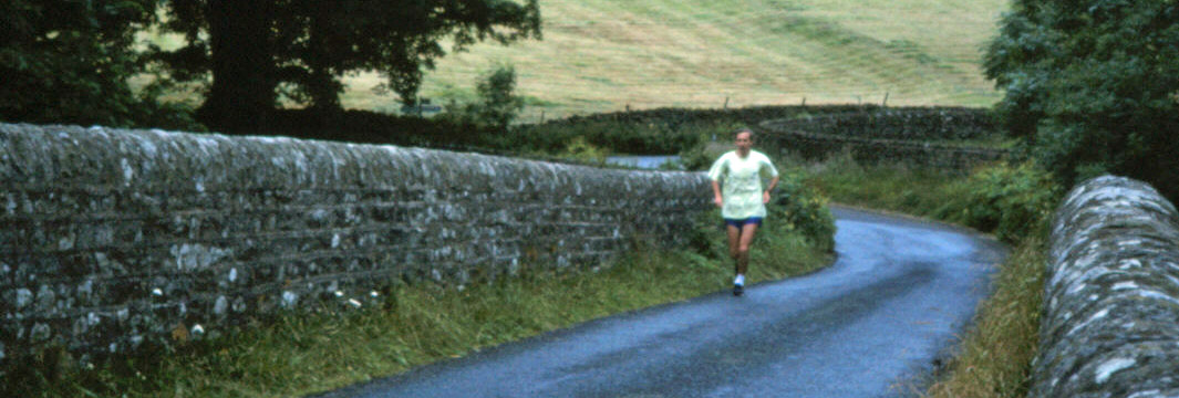
Swale Hall and along the track opposite Reeth – it was along here that tiredness really set in. Ruth was parked near
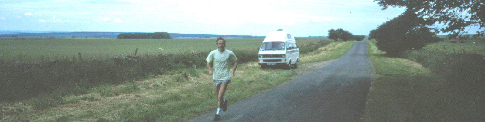
the bridge near Low Whita (shown right).
We stayed in the Orchard caravan park in Reeth. I had a shower which revived me a little. We walked up to
the centre of Reeth, in heavier rain now, to phone home.
Date: July 13th 1993
Route: Knayton – W, S, W – A168 – W – South Otterington – SW – Maunby, Swainby Abbey
- N – Allerthorpe Hall, Gatenby – SW – Theakston – NW – Exelby, Bedale – NW, W – Newton-le-Willows – N –
Diamond Hill Farm – W – Hunton – W, N – East Hauxwell – N, W – Halfpenny House – NW – Stainton – NW, W –
Grinton, Low Whita (36 miles)
Day 4: Low Whita – Low Borrowbridge
1st Leg: Low Whita – Hoggarths
We had arranged a lunch with friends near Kirkby Stephen and so, to avoid too much
backtracking, I decided to run a 11 or 12-mile first leg, with a short pause after 7 miles in Muker. The road
through Gunnerside to Muker was quite quiet and easy-going, although the views were a bit restricted by the low
cloud. In Muker I saw the van parked and nipped in for a drink, assuming Ruth was having a look round
Muker. The road continued through Thwaite and Keld, classic Swaledale villages. There were a few walkers about,
this being Pennine Way country. There were reasonable views of the scenery although we were now (at 340m or so)
almost in the cloud-cum-drizzle.
Ruth had still not passed me by the lower bound, the Stonesdale turn-off, so I walked/jogged to the upper bound
at the bridge near the caravan site near Hoggarths at Whitsun Dale. Still no sign of Ruth. It was now raining.
I was beginning to feel that some problem had occurred when, ten minutes late, the van came into view.
Ruth had thought I meant 10.00 in Muker, not here.
2nd Leg: Hoggarths – Easegill Head
The road (and me) climbed up Birkdale, becoming increasingly in the cloud. The views were rather grey,
which was a pity.
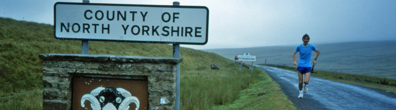
The highest point of the whole run (518m) was passed at the county border, which stimulated another
mini-celebration, with Ruth taking snaps galore.
The run down to Nateby was not as easy as it should have been since any running downhill was painful for
the legs. The original plan was to run across country to avoid the terrible A685 but we changed this in
order to finish up nearer our hosts for lunch. So I ran towards Kirkby Stephen and then through to the
A685, up the steep hill to the junction with the A683, where Ruth was parked.
Riding: at our friends near Kirkby Stephen
3rd Leg: Easegill Head – Gaisgill
This began in pouring rain along the A685. With the traffic shooshing past in clouds of spray it was not much
fun – in fact, it was rather ridiculous. Although it had eased off by the time I’d reached the side road
through Ravenstonedale I was soaked through. The photos show that I was thinking the whole exercise rather silly.
The map in my hand was reduced to a soggy mess (but I didn't really need one).
Through Newbiggin-on-Lune (near the source of the Lune, so perhaps I could just swim home) and along the long side-road through Kelleth it was easy-going, splashing through the puddles. Ruth chaperoned me carefully along this leg (to make sure the rain hadn’t made me give up) and we had a shorter-than-normal break (since it was hardly worth trying to get dry) near Gaisgill bridge.
4th Leg: Gaisgill – Low Borrowbridge
This really was a short run (only five miles or so) because of the long runs in the morning. I had run these roads before so it was very straightforward, taking the back road through Cocklake to Tebay and then across the M6 to the familiar parking place at the end of Borrowdale.
I freshened up and we had supper in the van. While we were there a serious-looking cyclist returned to the other car parked there and I wondered if he had the better idea (and where he’d managed to get to on his bike).
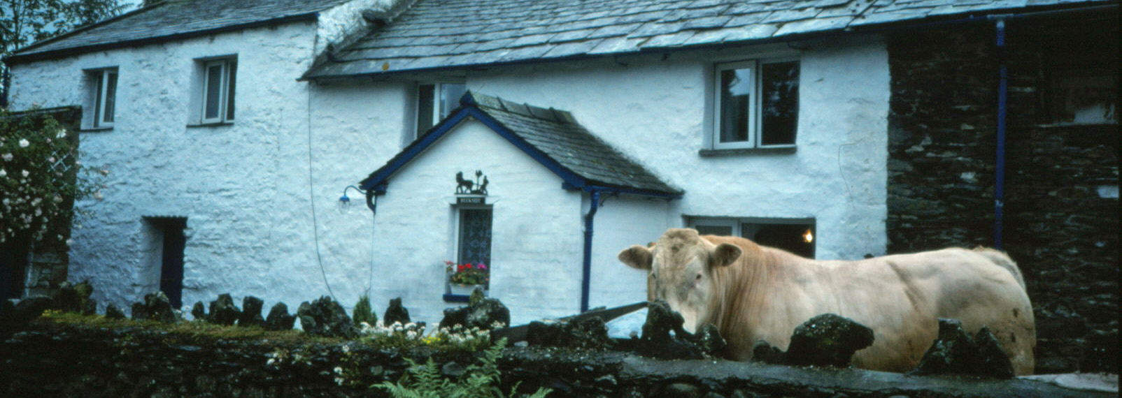
We then retired to Beckside farm, which was very comfortable and quiet, the only disturbance being from
Charlie, the bull. A Dutch couple were also staying there. We no longer hesitated in saying what we
were doing, as we were confident now of making it. ‘Only’ 56 miles to do in two days. A postcard home
commented that "a little thing like agony isn't going to stop us now".
Date: July 14th 1993
Route: Low Whita – W – Feetham, Gunnerside, Muker, Thwaite – N – Keld
- W – Hoggarths – W, NW – Nateby – N, W, SW on A685 – Ravenstonedale – NW – Newbiggin-on-Lune –
W – Kelleth, Gaisgill – SW – Tebay – S – Low Borrowbridge (36 miles)
Day 5: Low Borrowbridge – Cockley Beck
1st Leg: Low Borrowbridge – Watchgate
It was raining again. This leg began with a familiar run through Borrowdale, although I had not run it in this
direction before. A new gate replacing the old one with its plea to ‘save water; save Borrowdale’ (a
reference to an old plan to build a dam here) was the only change I noticed. Again, the tops of the
hills were in clouds. I ran down the A6 rather than try to find the footpaths as originally planned
as it was easier to get in a rhythm on the road. I met Ruth travelling in the opposite direction – she had
missed the agreed meeting point at the head of Longsleddale. This was a short leg as there seemed
little point taking the camper-van up Longsleddale.
 2nd Leg: Watchgate – Troutbeck
This was an 11 or more mile run over roughish ground because of the difficulty of meeting up at an
intermediate point. It first involved a run up Longsleddale to Till’s Hole. This is a nice valley
with lots of farms, unlike Borrowdale which has only one. Then across country to Stile End in heavy
rain. There were no walkers but a group were repairing the footpath above Till’s Hole.
Then through Kentmere, where there were one or two people mooching about in their rain-gear. And
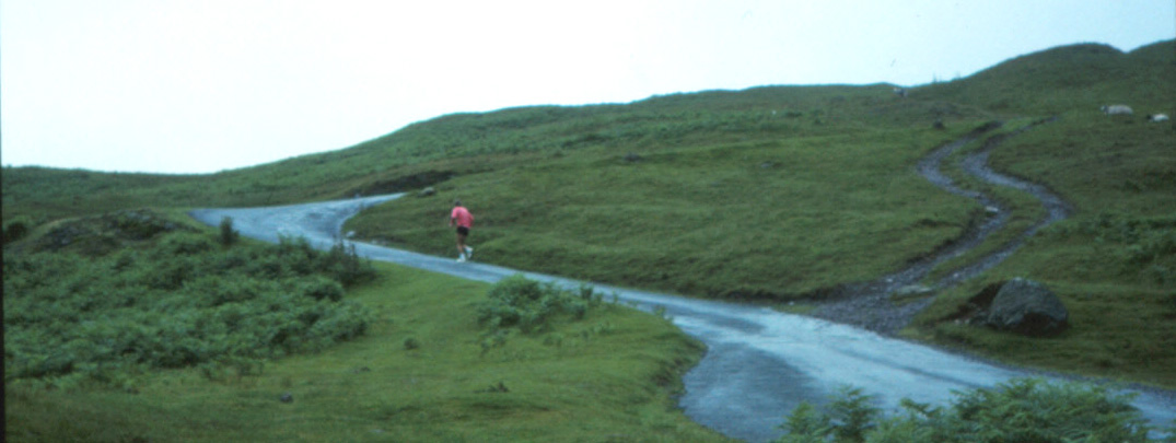
then across the Garburn pass, which was in the cloud most of the way. The path was rocky, wet and
slippery and I took it very gingerly (shown right). I passed only one serious walker on the way. Emerging from
the cloud, I saw Limefitt park below, which was a relief, and then Ruth, who had walked a little
way up the path from the van parked where the path met the main road. Again I was soaked through.
Riding: Ruth had forgotten that the Lakeland Equestrian Centre is near Troutbeck so hadn't
booked a ride. This realisation, following a drive that bordered home ground, resulted in
a temporary loss of holiday feeling and she felt at a loose end although I didn’t really notice as I
was in a daze by this time.
3rd Leg: Troutbeck – Cockley Beck
It was still raining and there seemed little point mucking about with complicated plans: we thought we
might as well just get the rest of the day’s running over in one go and not worry about finding somewhere
to park on the way. We’d try to get over Wrynose (making 31 miles today), leaving Hardknott for tomorrow.
So I ran up through Troutbeck, skirting round to the Ambleside road (again, not bothering with the
planned footpaths). It was now raining very hard. All the traffic must have wondered what on earth
I was doing. At Clappersgate I took the back road to join the A593 (passing a runner, only the second
seen so far). I was by now thoroughly drenched. The rain eased off as I ran through Little Langdale.
 Before Fell Foot I began to feel exhausted – this would have been the nine-mile mark, where I would
normally have a break, so I decided to have a ten-minute walk and look at the scenery. Just then the
sun came out, but only very briefly. I then embarked on Wrynose. As a little challenge, I thought
I’d try to run, very slowly of course, all the way up – and I managed to do that. By this time, I was
wondering where Ruth was: I expected, or perhaps hoped, to see her somewhere en route or at the top of
Wrynose, but she had not passed me yet, and I was beginning to run over-time. Over Wrynose, the cloud
re-appeared. Running downhill was much harder – the knees were not used to this. Halfway down I was
relieved to see Ruth appear behind me over Wrynose (just delayed by the difficulty of getting the
camper-van along narrow lanes and through the water running across them). We met as planned at Cockley Beck bridge, very relieved to have
got the toughest day’s running, and much worse conditions than I’d ever pictured, behind us.
We drove the van down Dunnerdale and spent the night in an idyllic spot near the river.
Before Fell Foot I began to feel exhausted – this would have been the nine-mile mark, where I would
normally have a break, so I decided to have a ten-minute walk and look at the scenery. Just then the
sun came out, but only very briefly. I then embarked on Wrynose. As a little challenge, I thought
I’d try to run, very slowly of course, all the way up – and I managed to do that. By this time, I was
wondering where Ruth was: I expected, or perhaps hoped, to see her somewhere en route or at the top of
Wrynose, but she had not passed me yet, and I was beginning to run over-time. Over Wrynose, the cloud
re-appeared. Running downhill was much harder – the knees were not used to this. Halfway down I was
relieved to see Ruth appear behind me over Wrynose (just delayed by the difficulty of getting the
camper-van along narrow lanes and through the water running across them). We met as planned at Cockley Beck bridge, very relieved to have
got the toughest day’s running, and much worse conditions than I’d ever pictured, behind us.
We drove the van down Dunnerdale and spent the night in an idyllic spot near the river.
Date: July 15th 1993
Route: Low Borrowbridge – W through Borrowdale – A6 – SW – side-road to
Longsleddale – NW – Till's Hole – W over Stile End – Kentmere – W, SW over Garburn Pass – road
near The Howe – W past Town End, Jenkin Crag – Waterhead – W – Clappersgate – W along Little
Langdale – Fell Foot – W over Wrynose Pass – Cockley Beck bridge (31 miles)
Day 6: Cockley Beck – St. Bees Head
 1st Leg: Cockley Beck – Dalegarth Station
The cloud was still low, with a light drizzle from time to time. This last day had not been planned, so we improvised.
This was a short leg to enable us to use the toilets at Dalegarth station and to plan the rest of the day.
Ruth would meanwhile ring riding stables from the public phone beyond Hardknott. My knees were very stiff
and while getting up Hardknott (shown right) was a struggle, getting down was again much worse. It was really quite
painful and a great relief to get to the level of Eskdale. The cloud was now beginning to lift a little.
At Dalegarth, after making ourselves comfortable, we had a coffee at the station while we worked out the next stage.
2nd Leg: Dalegarth Station – Santon Bridge
Ruth had arranged to ride near Egremont at 12.00 so there was only time for another short leg of 5 or 6 miles.
The run through Eskdale Green and Santon Bridge was, I’m sure, very pleasant (apart from the legs) but I can’t
say that I remember much of it (although I remember us parking outside houses with curious residents, who probably
thought we were even curiouser).
Riding: High House, near Egremont
3rd Leg: Santon Bridge – Beckermet
We still had 17 miles to do, but it was downhill (not
necessarily a good thing) all the way now. The weather had brightened considerably, although I’m not sure
that on the run from Santon Bridge to Gosforth I really could see the sea. On the drive to the riding stables, we
had seen that the A595 was no fun to run along, so I changed the plan in order to get off it at Calder Bridge –
though I could not avoid the road works at Sally Hill, where I bashed my shoulder on a waiting lorry. At
Calder Bridge I turned left towards Sellafield, which turned out to be a mistake as new roads meant a long
detour to Beckermet. Somehow I was ahead of schedule and so I walked the extra bit. Ruth also had problems
finding Beckermet. Eventually we had a break at the tower, not far from the sea.
4th Leg: Beckermet – St. Bees
Now it was so warm I put on the green top for the first time. This was a short run along the coastal road to St. Bees, where we had decided to meet up for old times’ sake, before the final stretch. I could hear the sea but not see it until I crossed the railway line and ran along the golf course at St. Bees.
It had now turned cold but we had an ice-cream and Ruth paddled in the sea.
5th Leg: St. Bees – St. Bees lighthouse
My knees were really sore and for the first time I felt I was hobbling not running. So this was a very slow
jog for two miles or so along the cliff top. A group of runners – some not so serious-looking – passed me,
sounding as though they were starting some ridiculous long run. Despite moving so slowly, I reached the
lighthouse before Ruth, unfortunately, as she could not drive the van near and so had to run almost
as far as me. We relaxed by completing a lap of honour walking along the official coast-to-coast route to Sandwith,
where our old friend, the camper-van, was waiting.
Date: July 16th 1993
Route: Cockley Beck bridge – W over Hardknott Pass – Dalegarth Station, Eskdale
Green, Santon Bridge – NW – Gosforth, Calder Bridge – SW, NW – Beckermet – NW – St Bees, St Bees Head
lighthouse (25 miles)
 Reflecting now in 2021, yes, we had an enjoyable week that we remember fondly and were, of course,
pleased to complete the challenge and that the planning all worked out relatively smoothly.
The week was not all about running, although I've focussed on that here. After all, I only ran for
six hours a day. We had the many breaks (including the midday riding) and long evenings, and Ruth managed
to see a few things along the way. We separated and reunited twenty-four times and it was always a
relief and a little celebration that another stage had been completed. I began to really look forward to
seeing the van towards the end of a run (oh, and Ruth too). And Ruth enjoyed the camper-van and being the
'support team' (obviously, it is not possible to do a run like this without support) - and being
tour photographer too - thanks!.
Reflecting now in 2021, yes, we had an enjoyable week that we remember fondly and were, of course,
pleased to complete the challenge and that the planning all worked out relatively smoothly.
The week was not all about running, although I've focussed on that here. After all, I only ran for
six hours a day. We had the many breaks (including the midday riding) and long evenings, and Ruth managed
to see a few things along the way. We separated and reunited twenty-four times and it was always a
relief and a little celebration that another stage had been completed. I began to really look forward to
seeing the van towards the end of a run (oh, and Ruth too). And Ruth enjoyed the camper-van and being the
'support team' (obviously, it is not possible to do a run like this without support) - and being
tour photographer too - thanks!.
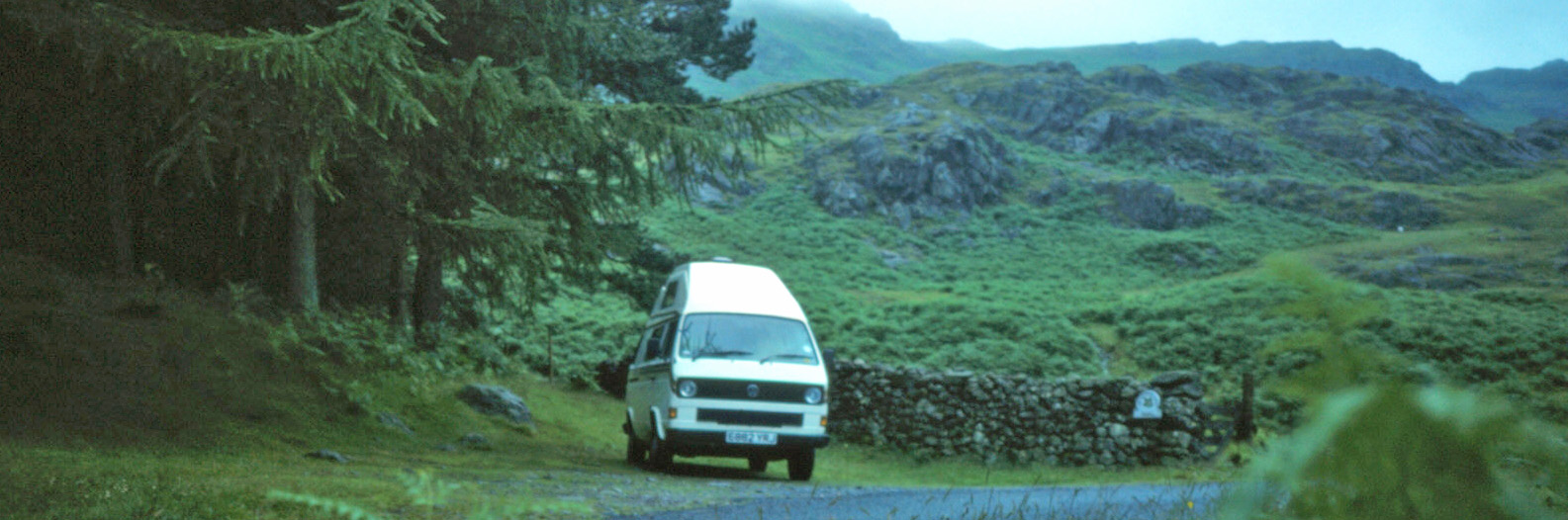
(This awakened enthusiasm for camper-vanning has had a lasting effect. Our only car for the last twenty years
has been a small camper-van. It's great for the one-day or two-day trips to the hills and dales, when we
can eat and drink, change clothes, rest, and sleep in comfort. All our holidays have been with the camper-van:
we haven't been near an airport for twenty years. We have taken the van overseas four times – to Ireland (twice),
to the Isle of Man and to France/Switzerland/Germany. Otherwise, we are content to explore the varied
British regions.)
However, a week was enough and once was enough. I doubt that my knees would have managed a seventh day.
I did feel, though, that the first four days of relatively
flat running had been easy enough and that I could have carried on in that way 'indefinitely'.
But the novelty of the routine palls. There is always the concern that any problem will ruin the rest
of the planned schedule. (And wet, smelly running gear is not the best companion in a camper-van.)
Also, this kind of running was not for me – running as slow as possible in order to keep moving as
long as possible. I preferred to get a move on if I was supposed to be running.
As regards
lasting general impressions, I'd say that we gained a different appreciation of the nature of England. We
avoided busy roads, of course, and also the desolate high hills. We mainly used quiet lanes and tracks,
passing through innumerable villages and hamlets, most of them off the tourist routes. There was a timeless
charm with a peaceful air of activity. We saw nothing of the ‘industrial north’. It was an England that
is normally unseen and yet one that perhaps captures its character best. There is, of course, a sense of
satisfaction in running across one’s own country but it is more than that. It provides an intangible
feeling of ‘ownership’. My country, I feel, is (or was) within my physical and mental compass.
Home
Preamble
Index
Areas
References
Me
© John Self, 2018-

Top photo: The western Howgills from Dillicar;
Bottom photo: Blencathra from Great Mell Fell