
Home
Preamble
Index
Areas
Dales
Hills
Lakes
Places
Reserves
Rivers
Structures
Villages
References
Me
Saunterings: Walking in North-West England
Saunterings is a set of reflections based upon walks around the counties of Cumbria, Lancashire and
North Yorkshire in North-West England
(as defined in the Preamble).
Here is a list of all Saunterings so far.
If you'd like to give a comment, correction or update (all are very welcome) or to
be notified by email when a new item is posted - please send an email to johnselfdrakkar@gmail.com.
This is one of several items about walking and walks from home during the
coronavirus lockdown of January - March 2021.
121. The Phantom Hills of Mallowdale Pike, High Stephen’s Head and Gallows Hill
In
[109]
I mentioned that Wikipedia’s
map of Bowland
shows twelve hills. In the course of these Saunterings I have walked up eight of them but the other four are
outside my walking-from-home range. However, the OS map shows to the north of Ward’s Stone three attractive
names that are within my reach: Mallowdale Pike, High Stephen’s Head and Gallows Hill.
They attracted me, anyway. I walked up the Littledale Road again, with the low sun, directly ahead,
having already removed all signs of the morning frost. I hoped that it would soon remove the clouds that sat
upon the Bowland hills to yield the forecast blue skies. Following the permissive path to Haylot Fell, I soon
lost the path – and then my bearings, as the cloud swirled about obscuring any features there might be on this
featureless moor. Looking back, I could see that Caton Moor (361m) was well in the cloud. I occasionally
glimpsed what I hoped was Gallows Hill (about 460m) ahead and tried to follow a bee-line towards it. The going
was slow because, although there weren’t the boulders and heather as elsewhere on these slopes, it was mainly
clumpy grass, with bogs between the clumps. At least, a skylark, my first of the year, was happy in the cloud.
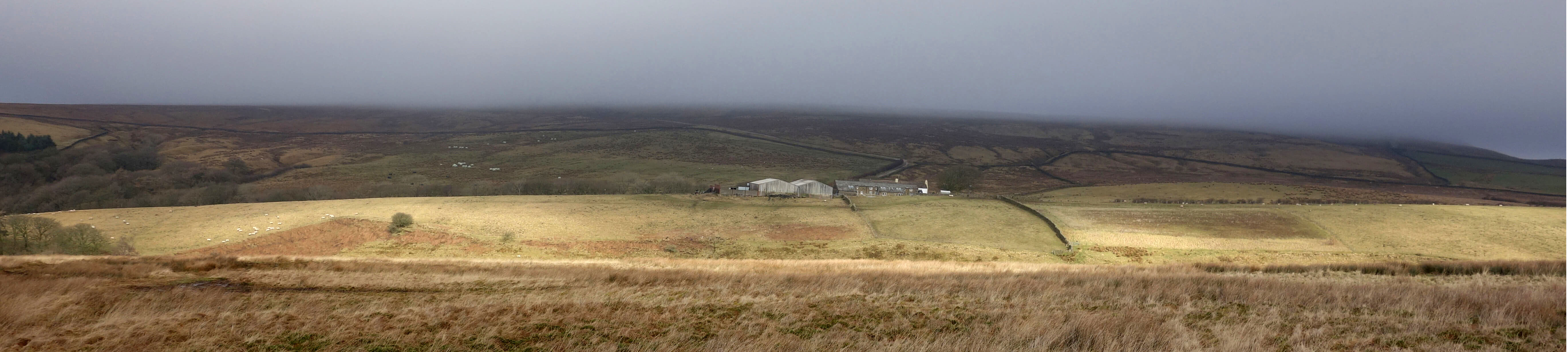
Looking back across Littledale to the farm of Deep Clough and Caton
Moor, in cloud. (Looking ahead there was similar cloud.)
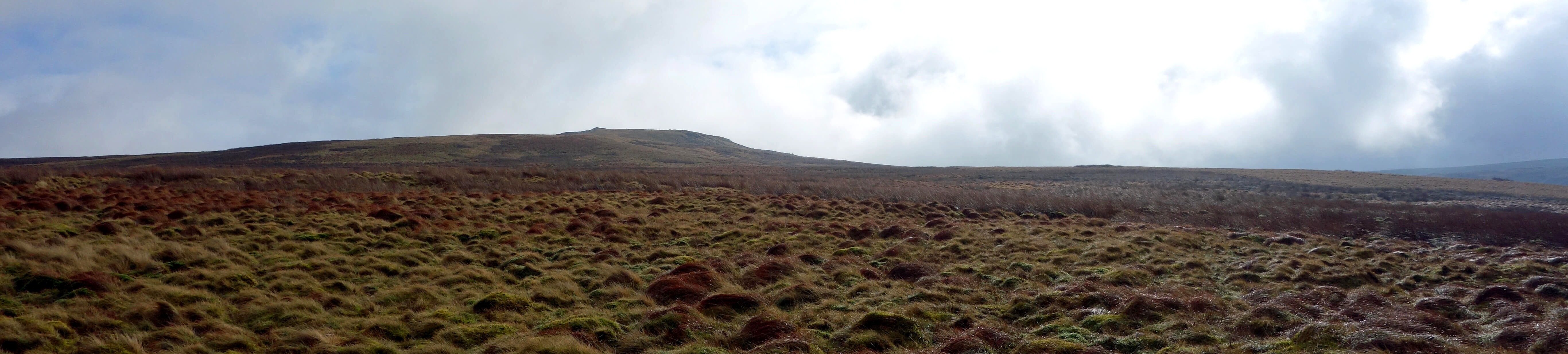
A glimpse of Gallows Hill and of the energy-sapping, clumpy, boggy
land to cross to reach it
Eventually, I reached Gallows Hill, where only the configuration of walls and fences confirmed that it was
indeed Gallows Hill. With fleeting sights to the east of Mallowdale Pike, looking quite diminutive, I followed
the fence on to High Stephen’s Head (about 490m), which again I could only tell that I had reached by the
complex of walls there. Dropping down out of the cloud, I contoured round to the top of Mallowdale Pike
(about 430m), with good views into upper Roeburndale but with the Dales hills beyond still in cloud.
From the top I headed north to Mallowdale Bridge, crossing a field where I disturbed several snipe,
which tells you that it was a boggy field, and heard my first curlews on the moors, which, since it
was only late February, may mean that we may hope that spring will be early this year.
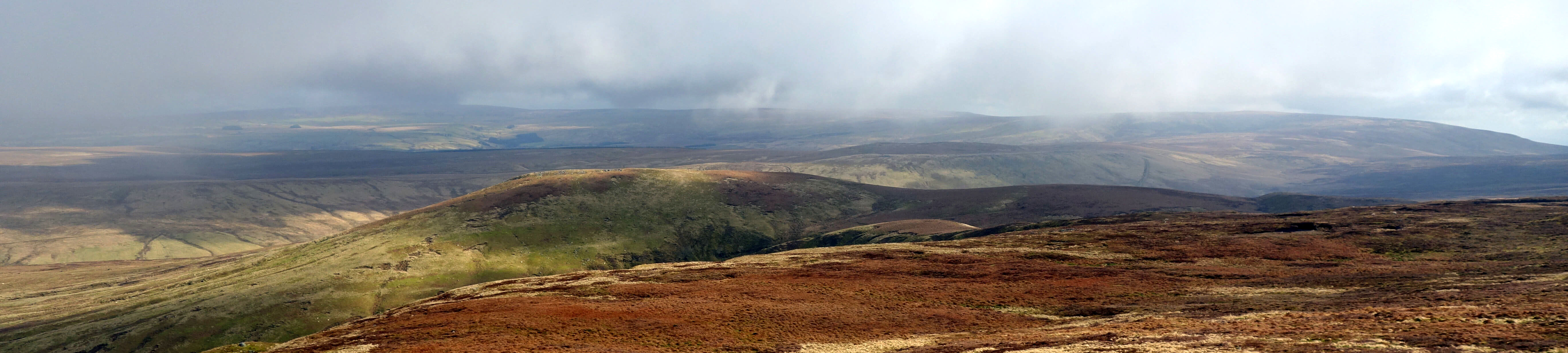
Towards Mallowdale Pike and Roeburndale from between Gallows
Hill and High Stephen’s Head. There’s a dab of sunlight on Mallowdale Pike, the col of which can
be discerned to its right.
At the bottom corner of the field I had a decision to make: should I trespass a short distance on the
west bank of the River Roeburn to reach the bridge or cross the river (quite a challenge) to continue
on access land on the east bank? I don’t need to say what my decision might have been because at that
point a farmer drew up on his quad. He said at first that he was checking that I had my dog under control,
as a walker’s dog had recently killed two lambs. I easily reassured him on that point, having no dog. He
then said that I shouldn’t be here as the access area ended at the wall above. So I produced the map
from my pocket, to show him that I knew exactly where we were and where the access area was
(unless my map was out-of-date). He didn’t exactly
concede but after we’d chatted about where I’d been walking he knew that I was no mischief-maker. I then
implied that since the OS map's orange border for the access area is on the west bank I thought I'd have access
to the bridge there but it seems that I was supposed to cross the river. As I hoped, he took pity and suggested that I hop over his fence.
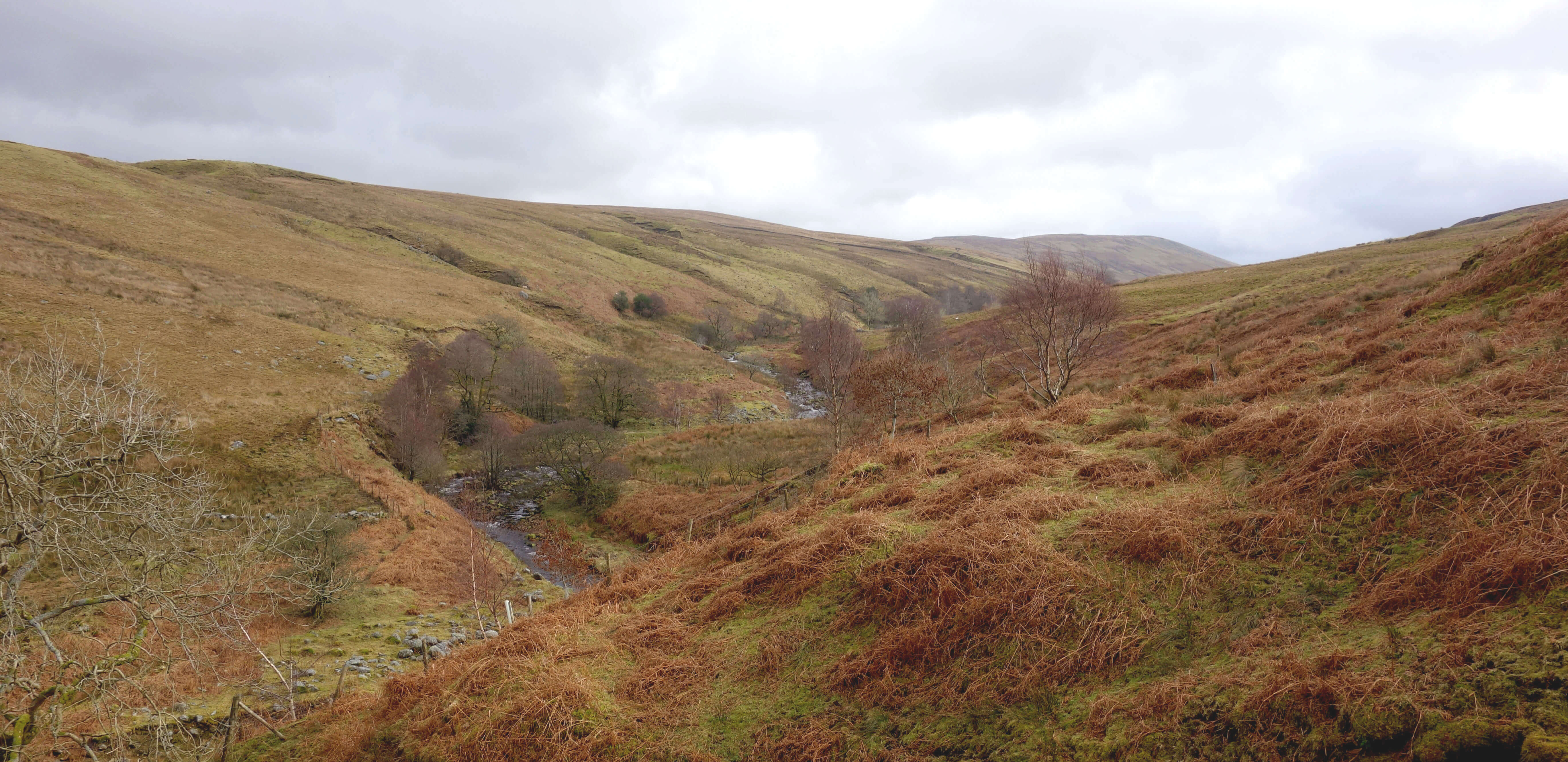
Looking up Roeburndale after hopping over the fence
I had my sandwiches by the bridge, where a dipper peeped past. The walk back, with a delightful
climb through Melling Wood, and then passing Haylot Farm and over Caton Moor (hearing more skylarks and
curlews – but not yet any lapwings) was uneventful but longer than my walking fitness was ready for.
For much of it, Mallowdale Pike, High Stephen’s Head and Gallows Hill were on the skyline opposite, but there
was still cloud beyond.
Why weren’t one or more of these names on Wikipedia’s map? Are they
not significant hills? Indeed, what exactly is a hill? There are many
everyday words to describe our landscape: beach, bog, moor, stream, village, wood, and so on. We don’t insist on a precise definition of them. Unless we’re a scientist, in which case we need to define, for example, ‘bog’, ‘fen’, ‘mire’, ‘marsh’ and different varieties of them in order to ensure that our words are not misunderstood. And unless we’re a ‘bagger’, that is, someone who aims to visit instances of a class to tick them off on a list.
A hill-bagger needs a definition of a hill. This is usually in terms of two factors: the height
and the drop. The height is, of course, the height above sea-level, although the height above the starting
point for a walk up is more relevant to a walker! The drop of a hill is the minimum vertical height
you have to lose when walking from its top to any higher hill. For example, the drop of Scafell (height 964m)
is 132m because that is the minimum height you have to walk down before you can walk up Scafell Pike (978m). The drop of Scafell Pike is 912m. You’d have to walk down at least that much before walking up, say, Ben Nevis.
Quite small hills can have significant drops. For example, Arnside Knott (159m) has a drop of 151m. The drop is the usual measure for deciding whether a rise is an independent hill or merely a pimple on the slope of a higher hill. For example, walking down the southern ridge from Helvellyn we pass Nethermost Pike (891m, drop 29m), High Crag (884m, drop 9m) and Dollywaggon Pike (859m, drop 50m). If we require a drop of 30m (the usual criterion) for an independent hill then of the three only Dollywaggon Pike qualifies. A hill (of any height) with a drop of at least 30m is called a ‘tump’ (thirty and upwards metres prominence). Other species of hill may be generated by varying the height and drop requirements.
Does a tump correspond with our everyday subjective sense of a hill? I’m sure
everyone would agree that Arnside Knott is a hill even though it is not very high. And not
many would insist that Nethermost Pike is an independent hill, despite its height. However, in
[103]
I walked to (I’d hardly say up) Trashy Hill (about 10m, drop about 4m) in the Fylde. Despite its name, it’s not a tump or a hill by any reasonable objective definition. For its residents its ‘hilliness’ was crucial. That drop of 4m meant that they had relatively solid ground to walk upon, not the flat bog that surrounded them. This suggests that what is considered a hill depends upon the context.
The focus upon the height and the drop ignores any aesthetic factors. Some hills have an appealing
conical shape (from some viewpoints). Some hills are more enjoyable to walk up than others – although we won’t agree on which ones. Some hills enable better views. Which of Skiddaw (931m, drop 709m), Skiddaw South Top (925m, drop 4m) and
Latrigg (368m, drop 73m) provides the best view?
What about Clougha Pike, walked up in
[110]? It’s in the Wikipedia 12. And it
certainly looks like a hill as you walk up it, with its peak and trig point
on the sky-line. However, when you reach the top you find that you don’t need to lose much height to walk on
up to Grit Fell. The trudge to Grit Fell adds little to the enjoyment of climbing Clougha Pike and the view
from there is worse. Grit Fell (468m, drop 31m) is a tump; Clougha Pike (416m, drop 5m) isn’t. Similarly,
consider Winder (473m), near Sedbergh. It looks like a hill from Sedbergh. What happens on the other side of Winder – whether it drops down or continues up – is irrelevant to the perception of hilliness. In fact, it drops 32m.
Would it be less of a hill if its drop were 29m?
So there are non-tumps that I would consider hills.
Are there tumps that I would consider non-hills? The B6254 (the Kirkby
Lonsdale Road) runs through undulating terrain for about ten miles between Halton
and Kirkby Lonsdale. The OS map gives spot heights for about fifty rises. Nobody
could name the highest of them, for the simple reason that it has no name. The
highest point (163m) of the region is in fact in a field east of Oaken Head. Nearby
there are high-points of 159m, 153m, 153m, 150m, 149m, and so on. The Oaken Head
top is not a hill, to my eyes, but its drop is 115m! Maybe
I should think of the whole ten-mile ridge as a hill?
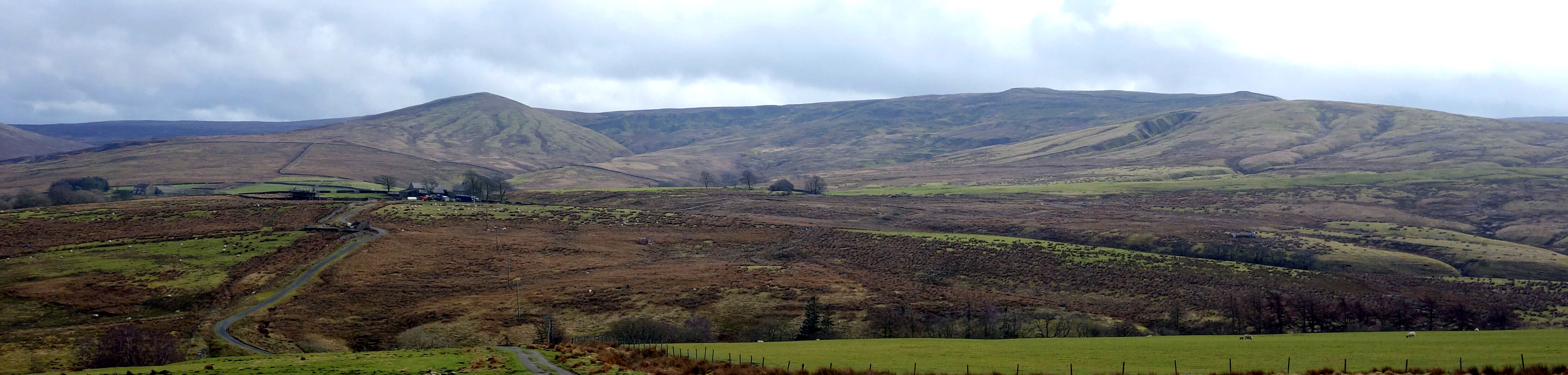
Mallowdale Pike to the left, with the nobbles of High Stephen's Head
and Gallows Hill on the sky-line (or cloud-line, as I'm not sure they'd be on the sky-line if there
weren't cloud behind)
What of Gallows Hill, High Stephen’s Head and Mallowdale Pike? From below, Gallows Hill
looks like a hill but from it there is a drop of no more than 2m, I’d say, to reach High
Stephen’s Head although it’s hard to tell what’s horizontal by eye, especially in cloud.
High Stephen’s Head was in cloud but seemed to drop 5m or more before rising to
Ward’s Stone. I approached Mallowdale Pike from the south over its highest col
and it is surely a good 10m rise to the top. Seen from the north, its striking conical shape makes it look every inch a hill.
Fortunately, there is a
Database of British and Irish Hills.
It’s a monumental piece of work, diligently created over decades to provide definitive data about all
our hills, all 21,192 of them. Clougha Pike is in the database (but is not a tump, as said above) but I can find no mention of Mallowdale Pike, High Stephen’s Head or Gallows Hill. They are not hills, according to this database. Well, I don’t care what the database, the number-crunchers, the technology, the surveyors and the hill-baggers say – they are all hills for me. In fact, I’d say that Clougha Pike and Mallowdale Pike are among the best hills of Bowland.
P.S. Just for the record, among the 21,192 hills of the database there are (I make it) 35 hills with a height
over 200m and a drop over 30m within the boundaries of Bowland.
This then is a list of the hills of Bowland:
                                   ht gridref drop
  Ward's Stone                    563  591587  395   75
  Pendle Hill                     557  804414  395   20
  Longridge Fell - Spire Hill     350  657410  242
  Fair Snape Fell                 521  597472  226  109
  Easington Fell                  396  730486  194
  White Hill                      544  673587  159   96
  Whins Brow                      476  636532  134   59
  Caton Moor                      361  583639  128   94
  Middle Knoll                    395  654543   99
  Beacon Fell                     267  570427   94
  Nicky Nook                      215  519485   90
  Bowland Knotts                  430  722603   87
  Wheathead Height                389  839427   75
  Hawthornthwaite Fell Top        479  580515   66   99
  Holden Moor [Whelp Stone Crag]  371  759591   66
  Hailshowers Fell/Ravens Castle  486  697608   65   96
  Mellor Knoll                    344  647495   61
  Baxton Fell                     469  671560   56
  Ling Hill                       290  758534   53
  Totridge                        496  634487   52
  Waddington Fell                 395  714475   51
  Mossthwaite Fell                244  669494   48
  Kitcham Hill                    283  669480   44   30
  Beacon Hill                     305  753480   42
  Wolfhole Crag                   527  633578   39
  Parlick                         432  595450   39  109
  Boarsden Moor [Hund Hill]       245  677509   38
  Burn Moor                       402  694645   36
  Top of Blaze Moss               424  619524   35
  Marl Hill Moor                  311  695466   35
  The Cragg                       214  547617   35   91
  Stang Top Moor                  327  831412   34
  Long Knots                      256  643472   34
  Barnacre Moor                   219  533476   33
  Grit Fell                       468  557587   31  110
Date: February 26th 2021
Start: SD543644, Brookhouse (Map: OL41)
Route: S, SW on Littledale Road – New House Farm – E past Littledale Hall –
Ragill Beck – SE on permissive path – Haylot Fell – SE – Gallows Hill, High Stephen’s Head – E, N –
Mallowdale Pike – N – (note the comments above) Mallowdale Bridge – W, N, W –
Haylot Farm – NW, W – cattle grid – N, NW on bridleway, W on Quarry Road – Brookhouse
Distance: 12 miles; Ascent: 520 metres
Home
Preamble
Index
Areas
Dales
Hills
Lakes
Places
Reserves
Rivers
Structures
Villages
References
Me
© John Self, 2018-

Top photo: The western Howgills from Dillicar;
Bottom photo: Blencathra from Great Mell Fell