
Home
Preamble
Index
Areas
Dales
Hills
Lakes
Places
Reserves
Rivers
Structures
Villages
References
Me
Saunterings: Walking in North-West England
Saunterings is a set of reflections based upon walks around the counties of Cumbria, Lancashire and
North Yorkshire in North-West England
(as defined in the Preamble).
Here is a list of all Saunterings so far.
If you'd like to give a comment, correction or update (all are very welcome) or to
be notified by email when a new item is posted - please send an email to johnselfdrakkar@gmail.com.
This is one of several items about walking and walks from home during the
coronavirus lockdown of January - March 2021.
123. Over to Overton and Around Little Fylde
(I promised in [122]
to answer here the question posed there but a rare opportunity for a non-local walk has intervened.)
The governmentÆs February 23rd æroadmapÆ out of lockdown has not
so far led to any change in the advice on the
Ramblers web-page
that ōyou must continue to stay local and avoid non-essential travelö.
So I have. However, it became essential for me to travel to have the car serviced, even though it
hardly ever moves. While it was in the garage I took the opportunity to have my first walk this year
not from home.
Nobody would choose to walk on a cold, drizzly March morning along the A589 (Heysham Road) but
I was determined to relish the change of scenery, such as it was. I walked briskly for three miles
or more to Overton because I knew that there was little of interest on the way. Overton is a small
village at the northern end of the road that runs across the tidal marshes of the Lune estuary to
Sunderland.
On previous visits, I have found Overton to be a lively, sunny place with two pubs, a
garden centre, and a school. I anticipated that it would be different on a grey day during a
pandemic. I could hear children, recently returned to school, and there were a couple of people
in the garden centre, but the two pubs were, like all pubs, closed. They looked like they have been
closed for some time and are unlikely to re-open any time soon. The two houses
(Overton Hall and the Manor House) that were once the grandest of the village both looked
neglected and forlorn. On the other hand, there were a number of roofers, carpenters, and so on
working on various properties.
According to
Visit Lancashire,
Overton ōoccupies the site of a Roman settlementö. [1] Visit Lancashire is ōthe tourist board for the
county and a division of Marketing Lancashireö, which is ōthe agency charged with promoting the
county on a national and international stageö ¢ charged by the County Council, I assume.
None of these bodies would wish to mislead about Lancashire but what is the evidence for this
Roman settlement? A number of other websites make the same assertion, in the same words. They
have probably copied from one another. The book The Romans in Lunesdale (Shotter and White, 1995)
makes no mention of Overton. As far as I know, no Roman artefacts or
remains of Roman roads or buildings have been found in the
region. I wonder if somebody
once confused Overton with Over Burrow (where there was a Roman fort) or Overtown (which is on
the line of a Roman road), midway up the Lune valley.
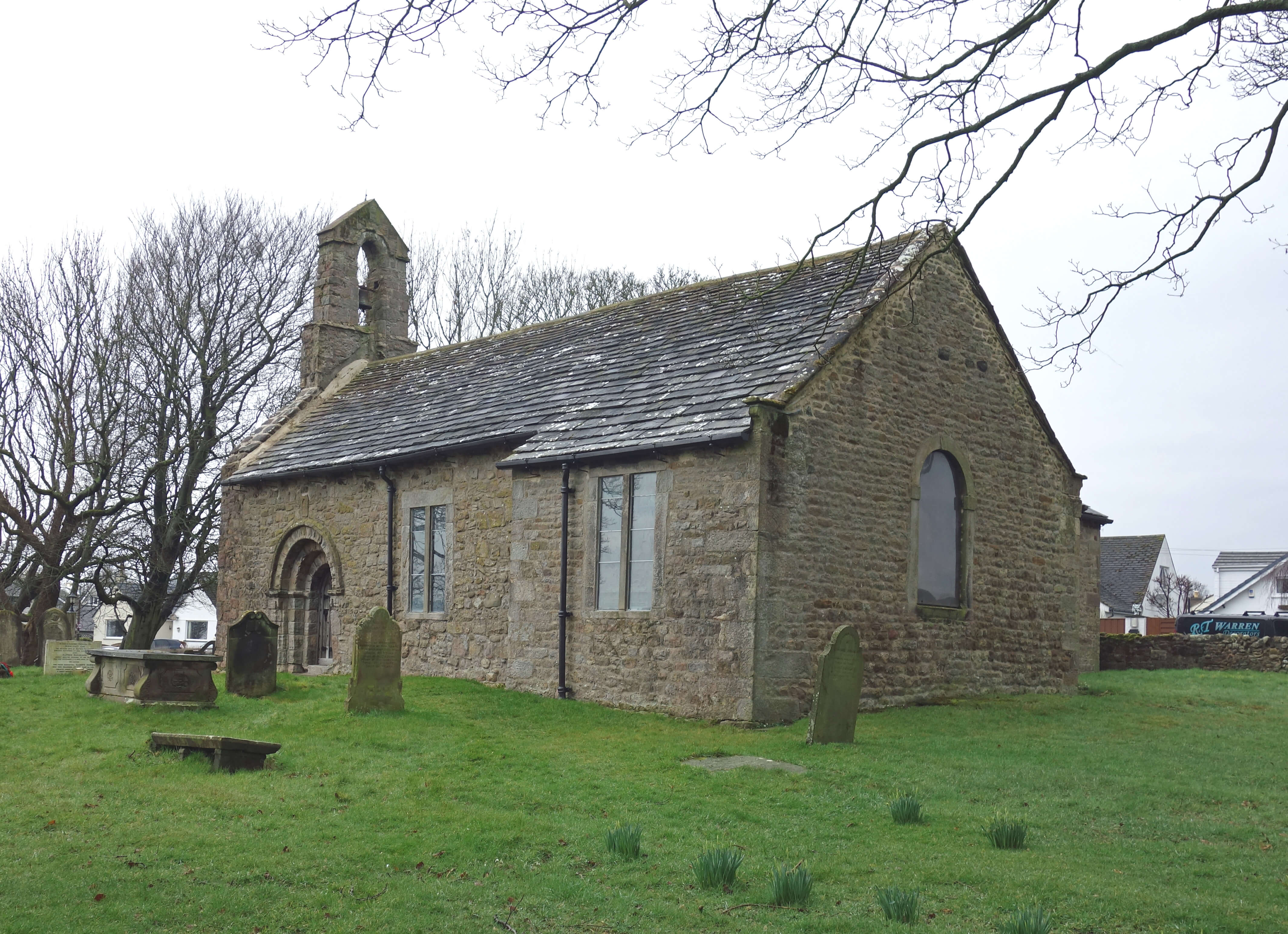
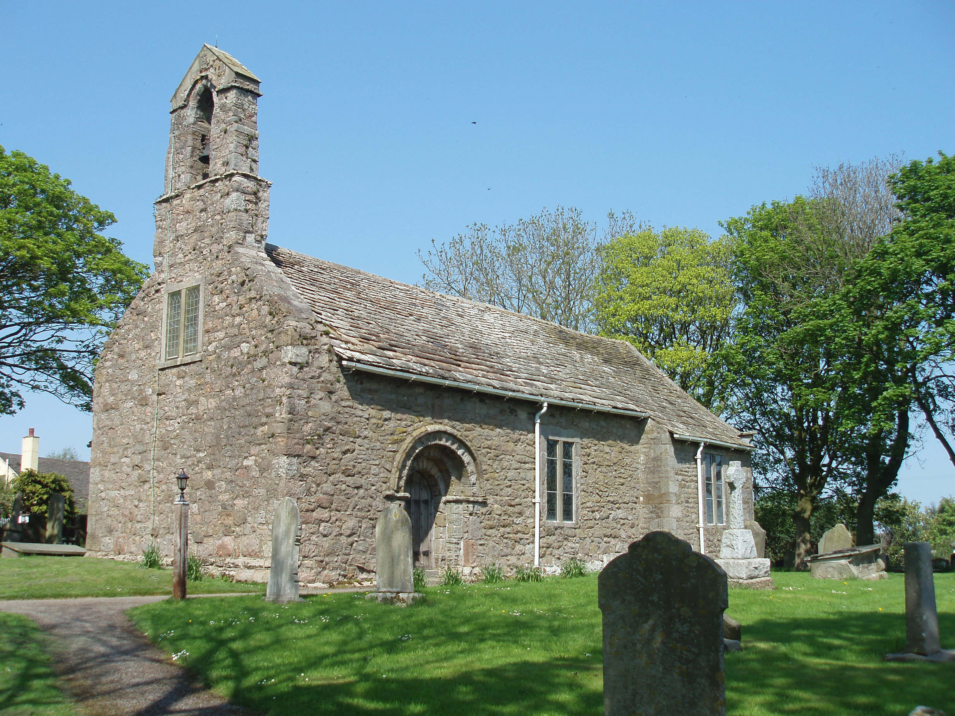
Left: St Helen's Church, Overton, today; Right:
St Helen's Church, on a sunnier occasion, in 2006.
At least we know that Overton is old since it is mentioned in the Domesday Book. Today,
the main reminder of this antiquity is the church of St HelenÆs.
Being of the 12th century, it is one of the oldest churches in Lancashire. It must have been
one of the most isolated too. I walked to it next. It was locked, as all churches are nowadays,
but I remember on a previous visit being intrigued by the novel (to me) arrangement inside, where
an extension to the side has no view of the altar. The church building is small and plain,
although the south doorway has a weathered Norman arch.
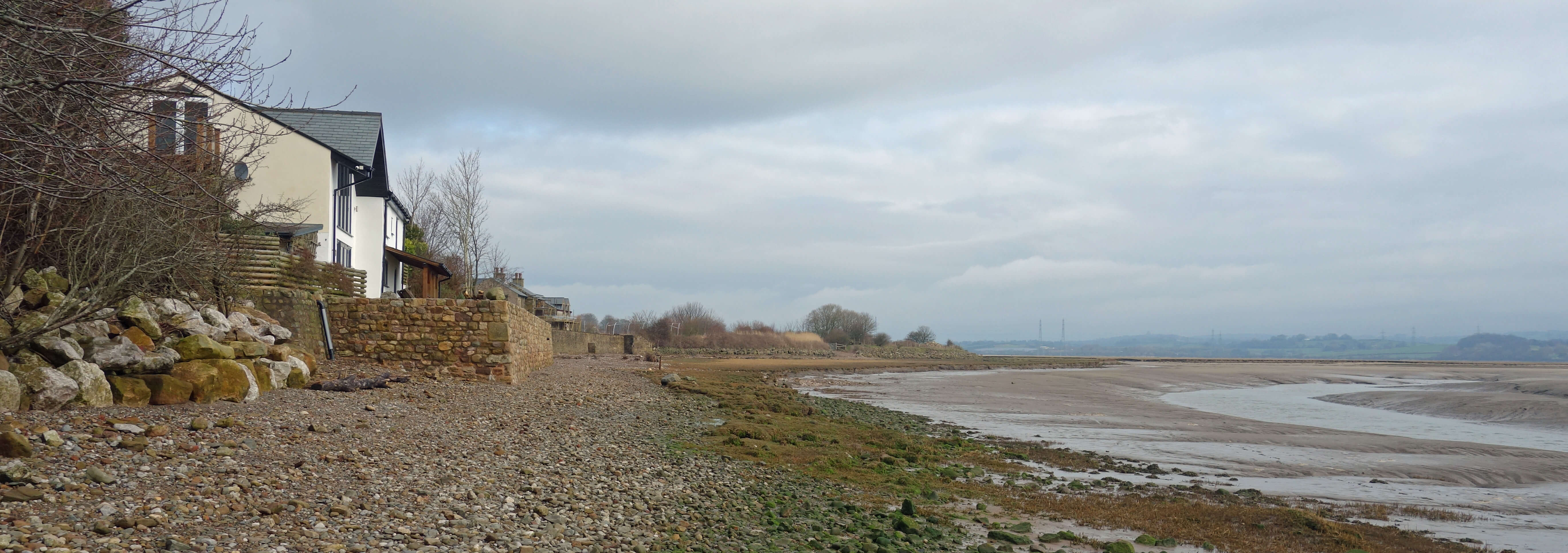
Walking on to Bazil Point, I came to
a peaceful but gloomy view across the mud of the Lune estuary to Glasson Dock and the
Bowland hills, in cloud. I treaded carefully through the tidal debris and walked up to the
trig point (31 metres) for its view over to Sunderland.
Bazil Point, Overton
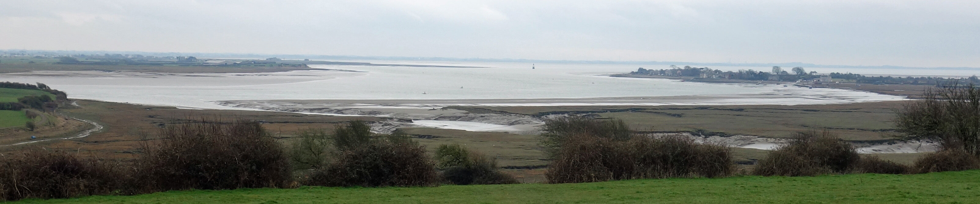
Looking along the Lune estuary towards Sunderland from near the
trig point
I had intended to return by walking across the flat area known as Little Fylde when it was
an undrained bog, or moss as they are called hereabouts. However, I thought that there was a
good chance that the paths were under water so I stayed on the roads.
The Lancaster Road from Overton is not a road that people are expected to
walk on, certainly not by the surprisingly large number of drivers on their æessential travelÆ.
The only light relief from the constant hopping into the hedge was the sight of two horses pulling
one cart with five people in luminous yellow (drivers wouldn't be expecting to bump into them either).
After my recent discussion of hills, I should admit that, after walking up to the Bazil Point
trig point, I didnÆt tackle any of the other formidable hills of Little Fylde (theyÆre all on private
land, anyway). Their names (Byroe Hill, Colloway Hill, Great Swart Hill, Oxcliffe Hill,
Windmill Hill) are impressive; their heights (28m, 36m, 23m, 15m, 25m, respectively) less so.
As in the (big) Fylde, any rise from low-lying land is deemed worthy of being called a Hill.
Continuing on the road over the marsh to the legendary Golden Ball pub (Snatchems), I was
not surprised to find it closed but was sad to see it up for sale. I wonder how many of our
closed pubs are closed for good.
Will we ever again see Snatchems as it was?
Snatchems as it was (from
the Snatchems web-site)
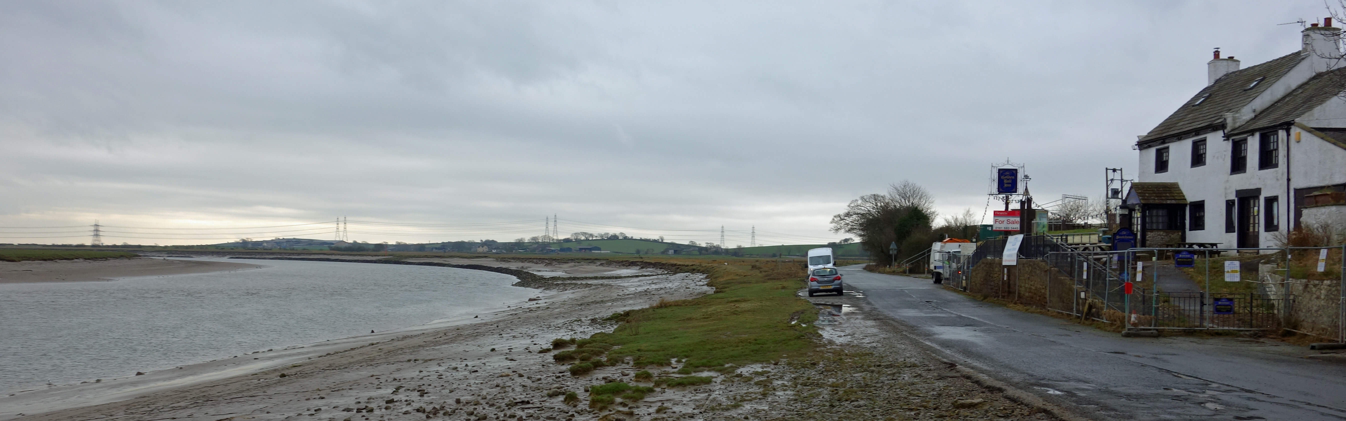
Snatchems as it is today
The surroundings did not lift me from the thought that we will have lost more important
things than pubs.
The air of dereliction was emphasised by all the rubbish
washed ashore by tides. Old baths, sofas, trampolines, cupboards, you name it, I walked past it.
ItÆs not all tidal debris: people know that thereÆs rubbish here so feel free to add
to it. IÆm sorry to say that on this walk I passed a record amount of rubbish, not just from the
tides but beside all the roads ¢ and all of this walk apart from around Bazil Point was on roads.
When I provide details of a route (as below) it should never
be taken to imply that I recommend it. With all the squalor and danger, I certainly donÆt in this
case. But it was my first non-local walk of 2021. Yippee.
Date: March 9th 2021
Start: SD422626, Woodlands Drive, Heysham (Map: 296)
Route: S, W ¢ A589 ¢ S ¢ A683 roundabout ¢ S, SE ¢ Middleton ¢ E, SE ¢
Overton ¢ S past church ¢ Ferry Cottage ¢ W around Bazil Point, N ¢ Overton ¢ W ¢ Globe ¢ E, N
on Lancaster Road, E ¢ Woodhouse Farm ¢ N, NE past Snatchems ¢ B5273 roundabout ¢ W on
Mellishaw Lane, on Oxcliffe Road, S, W, N ¢ Woodlands Drive, Heysham
Distance: 10 miles; Ascent: 30 metres
[1]. Note added in June 2026: The Visit Lancashire website appears to no longer exist.
However, other websites (e.g. this one
and this one)
still assert that Overton is on the site of a Roman settlement.
Home
Preamble
Index
Areas
Dales
Hills
Lakes
Places
Reserves
Rivers
Structures
Villages
References
Me
® John Self, 2018-

Top photo: The western Howgills from Dillicar;
Bottom photo: Blencathra from Great Mell Fell