
Home
Preamble
Index
Areas
Dales
Hills
Lakes
Places
Reserves
Rivers
Structures
Villages
References
Me
Saunterings: Walking in North-West England
Saunterings is a set of reflections based upon walks around the counties of Cumbria, Lancashire and
North Yorkshire in North-West England
(as defined in the Preamble).
Here is a list of all Saunterings so far.
If you'd like to give a comment, correction or update (all are very welcome) or to
be notified by email when a new item is posted - please send an email to johnselfdrakkar@gmail.com.
76. The Belted Beauties of Sunderland
As I needed to be in Heysham, I took the opportunity to walk along the coast to Sunderland Point, which is the southern tip of the peninsula that lies between the Irish Sea and the River Lune. Two hundred years ago these five miles of coast were ignored by mankind. There were no buildings at all overlooking the sea – not surprisingly perhaps since it was a bleak prospect of mud stretching far into the bay. The coast was lashed by westerly storms, which eroded the small cliffs and occasionally inundated the low-lying fields inland. It was a dismal, primeval landscape of little appeal, use or interest. Since then we have spoiled it.
Right: Ocean Edge Holiday Park.
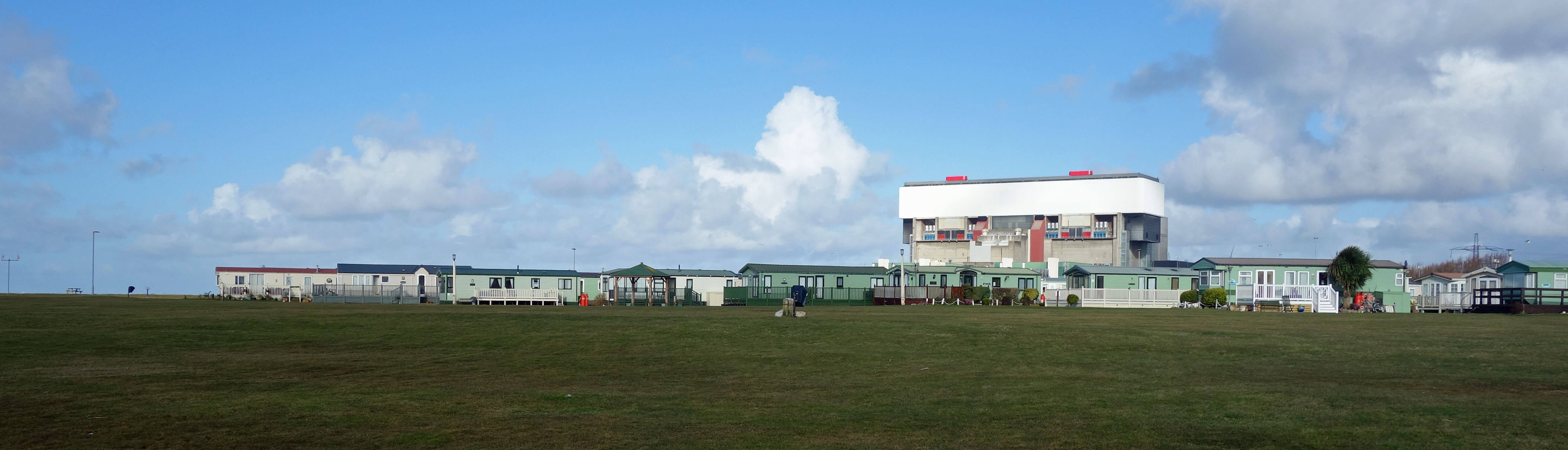
Most prominently, we have built Heysham Port and Power Station on an artificial promontory from the
rocky coast that used to run directly south from Near Maze on Half Moon Bay to Red Nab. Economically and
visually the Power Station dominates the region. We are accustomed to it now but what a structure it is to find on
Morecambe Bay! I headed towards it and then turned south to Ocean Edge Holiday Park along a long lane with no footpath. Holidaymakers at the Park are not expected to walk, as there is nothing to walk to. Instead, the lane is used to practise throwing rubbish out of car windows.
I can’t imagine what Ocean Edge puts in its brochure. It is tucked right by the Power Station. I suppose it is at the edge of an ocean but it seems that holidaymakers are not expected to clamber down to the beach.
Why would they want to? My use of the word ‘beach’ may have provoked images of golden sands, deckchairs, ice-creams, and sparkling waves. There is none of that here.
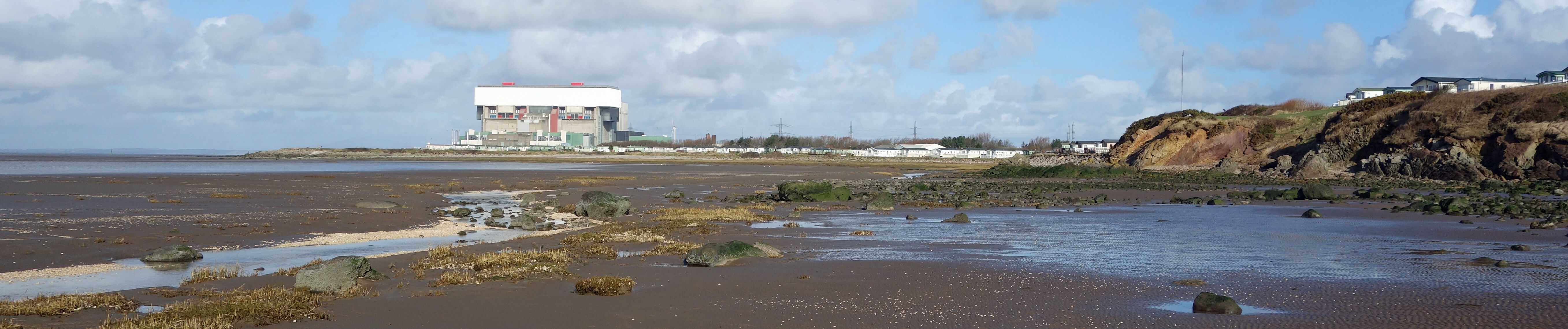
Heysham Power Station, holiday camps and Red Nab
I did clamber down and made my way (alone, of course) across tide-rippled mud, over slippery stones, and around shell-lined pools. Between the pebbles on the seaward side and the rocks on the landward side there’s a small strip of sand (being generous) but nobody could make a sandcastle with it. My ‘pebbles’ and ‘rocks’ are misleading too. They are mainly detritus (plastic, bottles, wood, netting, and so on) washed up in high tides or old concrete and brickwork that has fallen from the eroded cliffs. All along there are signs of manmade constructions collapsing – a half-gone old building, steps down the cliff with the bottom half missing, a concrete weir that has long since collapsed.
On most of the old bricks I could read the remains of “Claughton Manor Brick Co Caton”. So, these bricks came from my local moor, Caton Moor. We have gouged a large quarry into the moor, made bricks with the slate, transported them to here, built something-or-other with them, and then seen the buildings fall into the bay. An exercise in futility.
To avert my eyes from the dereliction, I gazed out over the unchanging, natural mudflats to see a panorama
from Blackpool Tower to the nuclear submarine shipyards of Barrow, with about 200 wind turbines on the horizon
between. Inland, a climb up the grassy slope is rewarded with a sight of a high security fence and
warnings of CCTV surveillance. This is protecting the Middleton Sands retirement village, which has been built on the site of the
Middleton Tower Holiday Camp
that from 1939 to 1994 housed up to 3,000 holidaymakers at a time. All they required for a fun-filled holiday was provided within the camp, for obvious reasons.
Vegetation on the windswept shore is scanty – sea holly, sea sandwort, lyme grass and a few scraggly yellow
horned poppies (that’s their name – they aren’t yellow in March). Beyond Potts Corner more grass and saltmarsh rush has
grown on the salt-marshes and it is here that the
belted beauty moth
is to be found. Yes, I did find it (two, to be precise) when, a few years ago, I infiltrated a group of lepidopterists who were visiting for their annual census. Normally, they find 200 - 1,500 of the moths.
It is believed that the Potts Corner colony is now the only one in England and, unlike colonies elsewhere that prefer sandy grassland, it is on salt-marshes that are under water several times a year. The female moth doesn’t fly at all and the male moth doesn’t fly far if it has any sense. Therefore the moths are found by wandering about the marsh, peering intensely into the grass hoping to spot a small greyish object.
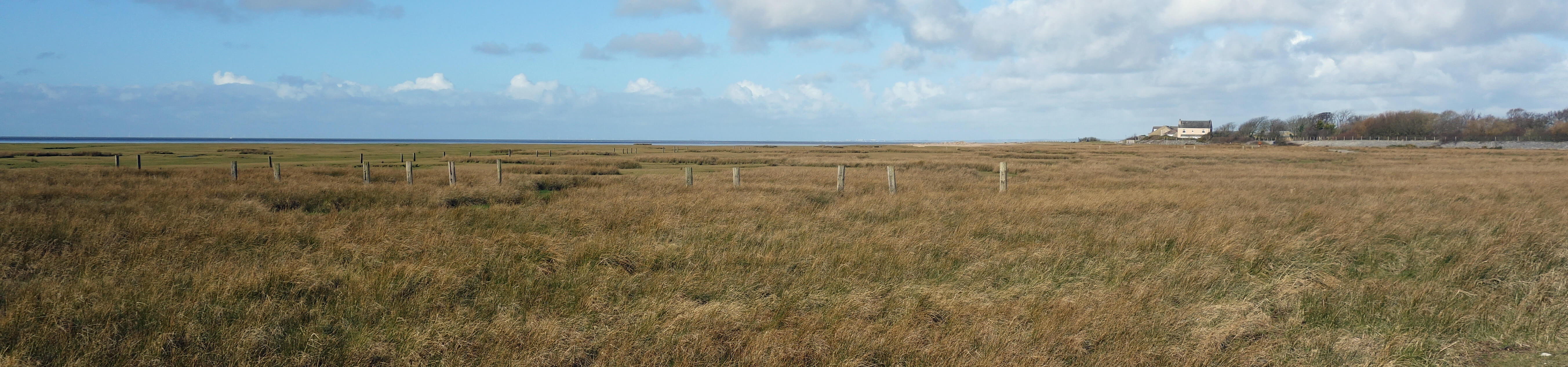
Where belted beauties are to be found, at Potts Corner. (Good luck! - but
perhaps they are best left to experts)
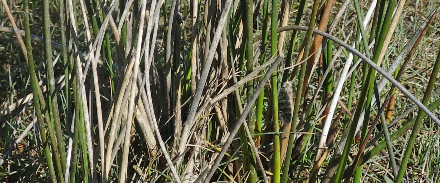 Right: My first belted beauty moth
(included only to show how hard
they are to find - it’s about halfway up, one-third in from the right).
Right: My first belted beauty moth
(included only to show how hard
they are to find - it’s about halfway up, one-third in from the right).
The belted beauty moth is clearly only just hanging on here. Would it matter if it died out? It is virtuous to think that all species matter equally and that they all deserve to survive, that every species is an integral part of the natural world and the loss of any one of them may have unforeseen ramifications for the others, that the extinction of any species makes our lives all the poorer, and that we have a duty to protect all species for future generations.
Is it really so? Who would miss these belted beauties? Hardly anybody knows that they are here and even fewer
have seen one. I doubt that any other species depends upon the belted beauty moths. Birds eat them but none depend upon
them. There are 160,000 species of moth – would it really matter if there were only 159,999? We might regret
the loss of, say, the black rhino but hardly the belted beauty – or am I guilty of speciesism? We only have
limited resources to save threatened species – how do we decide on priorities? Who are
we to decide anyway? Do we know how to save the belted beauty? It is part of evolution for species to die out, and many did before we could be held responsible. But we are not talking about the total extinction of the species – there are plenty of belted beauty moths elsewhere.
I made only a cursory search for belted beauties on this occasion as, although the moths must be here all year (as moth
or larva), it was a bit early for the census, which is usually at the end of April. I had to get round Sunderland Point, a mile south. I pressed on, alone again once past a couple of dog-walkers at Potts Corner. In the silence,
I enjoyed the shrill peeps of oystercatchers and the warbles of curlews as they prepared for their migration to their nesting grounds inland – and the sight of two whooper swans flying over, heading in the wrong direction if their aim was to get back to Iceland.
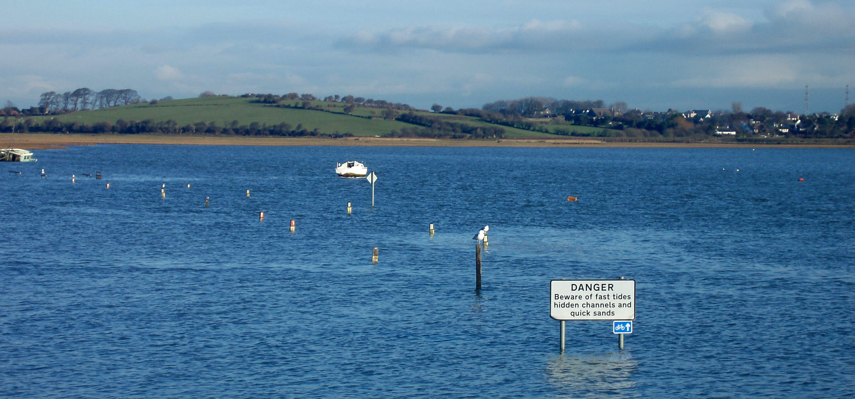
I reached Sunderland Point to walk past the huge boulders placed here to protect the bank. The last time I came here the bank, a two-metre high soil cliff, was exposed to the elements, which was just asking for erosion. The boulders are not elegant but may do the job, for a while. I am a little surprised that the money was found for this work as the government had intimated that it was impossible, with rising sea levels and stormier storms, to protect everywhere and that Sunderland Point was a low priority – which is understandable if economic payoff is the main factor. The small village of Sunderland, tucked on the leeward side of the Point, is vulnerable, both to government policy and to flooding. I noticed that a number of the cottages now have flood barriers over their doors and windows.
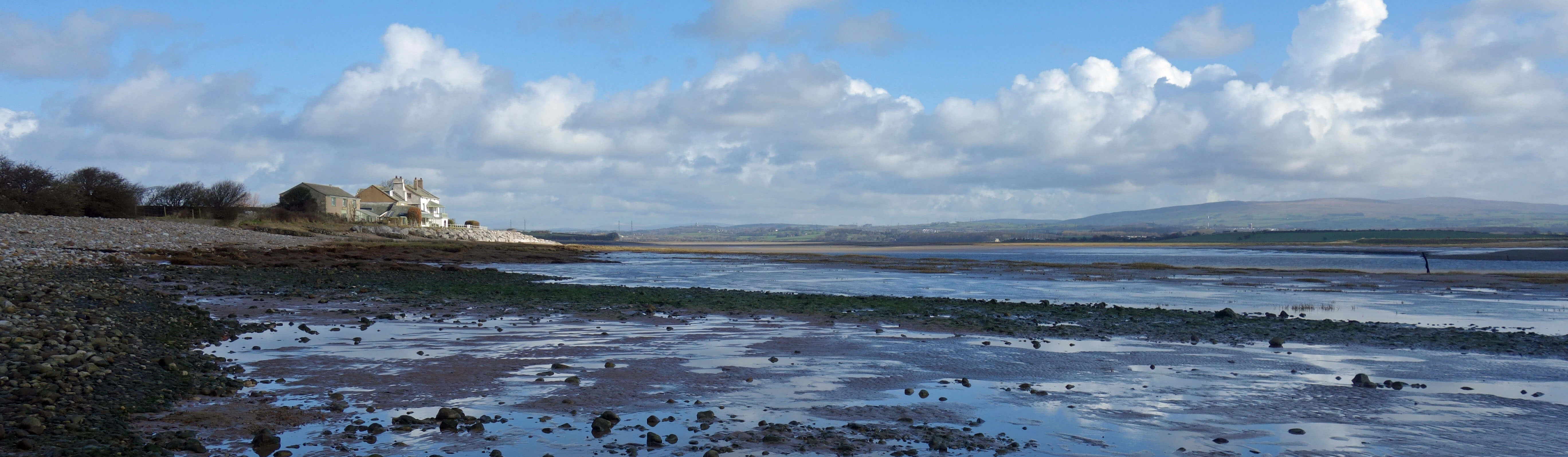
Around Sunderland Point
Somehow, perhaps because of the desolation that I had passed, Sunderland did not have the romantic appeal that I have
felt on previous visits. It is a charming, old-world spot, with its view inland over the Lune estuary to the Bowland
hills, but it is understandably weather-beaten and somewhat forlorn out of the summer season. It is said that
Sunderland is the only village in England that is cut off by the tides but that is said by those who rely on vehicles.
It is always possible to walk north from Sunderland.
The road back from Sunderland (photo taken in 2006)
However, of my return walk – across flat, wet fields, along rubbish-strewn lanes, under pylons, by industrial estates, and along the busy A589 – the less said, the better. So please forget that sentence.
Date: March 2nd 2020
Start: SD422626, Woodlands Drive, Heysham (Map: 296)
Route: S, W, S by A589 – roundabout – W, S – coast – S, SE –
Potts Corner, Sunderland Point – N – Sunderland, Trumley Farm, Middleton – NW on Middleton Road –
roundabout – N, E, N – Woodlands Drive, Heysham
Distance: 11 miles; Ascent: 30 metres
Home
Preamble
Index
Areas
Dales
Hills
Lakes
Places
Reserves
Rivers
Structures
Villages
References
Me
© John Self, 2018-

Top photo: The western Howgills from Dillicar;
Bottom photo: Blencathra from Great Mell Fell