
Home
Preamble
Index
Areas
Dales
Hills
Lakes
Places
Reserves
Rivers
Structures
Villages
References
Me
Saunterings: Walking in North-West England
Saunterings is a set of reflections based upon walks around the counties of Cumbria, Lancashire and
North Yorkshire in North-West England
(as defined in the Preamble).
Here is a list of all Saunterings so far.
If you'd like to give a comment, correction or update (all are very welcome) or to
be notified by email when a new item is posted - please send an email to johnselfdrakkar@gmail.com.
78. Around Roeburndale
To walk or not to walk? That is a difficult question in these worrying times. When we were
advised (March 15, 2020) to avoid all unnecessary travel an expert on a BBC question-and-answer session on coronavirus interpreted this to mean that we should not go for walks because we would be bound to come close to other people. Perhaps she was thinking of the streets of London. It is not difficult to stay clear of other people on the hills and moors of North-West England.
The following morning (March 16) a government minister said on the Radio 4 Today
programme that “those who will soon be asked to stay at home for an extended period would
still be able to go for a walk outside – it’s about being sensible but not mixing in crowds”.
However, it’s hard to know what’s ‘sensible’ in these unprecedented circumstances.
This morning (March 20) the Ramblers (née the Ramblers Association) website says that
“Official Government advice states that, apart from people who are in
households with symptoms or who have pre-existing health conditions that put them at
increased risk of contracting COVID-19, going for a walk independently can continue and is
an excellent way to maintain health and wellbeing – provided independent walkers stay more
than two metres from others”.
So, with some misgivings, we (the two of us) headed for the neighbouring valley of Roeburndale. We cocooned ourselves in the car, parked alone, and set off, although I admit that it didn’t seem ‘sensible’ to walk two metres apart in the open countryside when we haven’t been advised to keep two metres apart in the house.
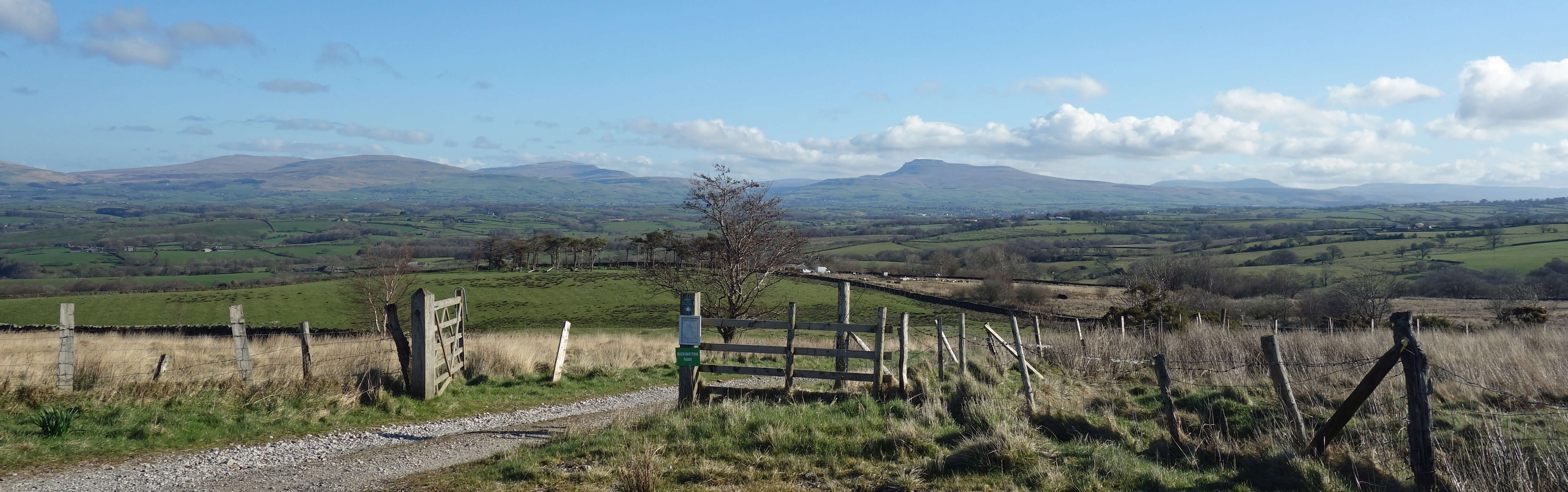
Setting off, in Roeburndale with Whernside, Ingleborough and Pen-y-ghent ahead
From the cattle-grid on the road on the western slopes of Roeburndale, we dropped down past Backsbottom Farm, crossed the River Roeburn and walked up through the wood to reach the path that runs south for a couple of miles, across pastures and moorland, to Harterbeck. It was a bit late in the year to notice my first skylarks but all the more welcome they were. Nobody can fail to be uplifted by the song of the skylark. Lapwing were gaily whirling about, with their characteristic calls, and curlew, too, were making their bubbling sounds, cherished by all moor-walkers. Curlews have become a red-listed bird recently but they seem to be flourishing on these quiet, small moors.
High Salter
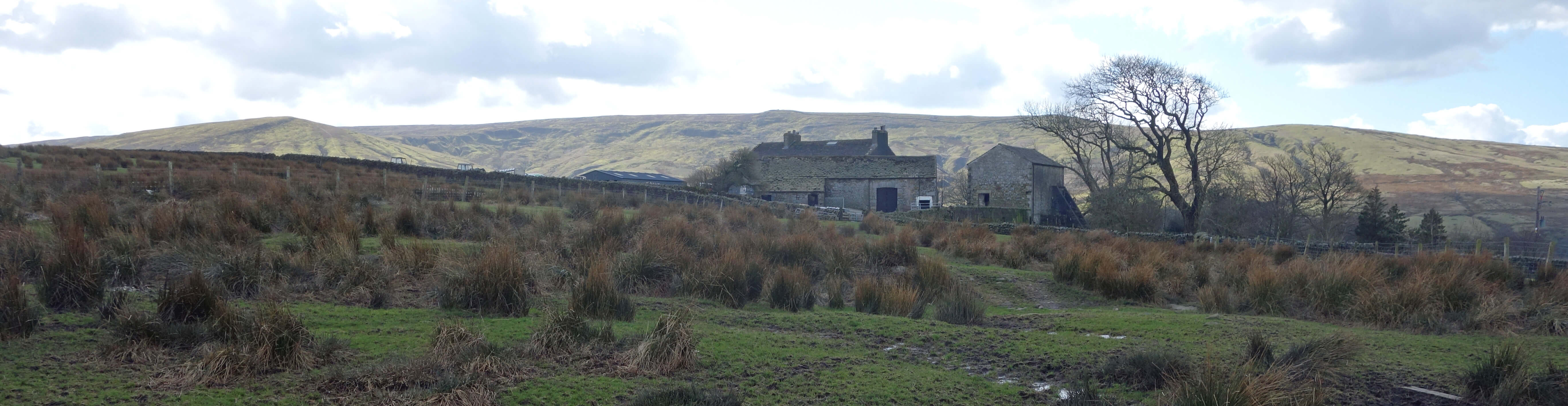
From Harterbeck we cut across to High Salter, where it must be a harsh life farming at 260 metres
on the fringes of Bowland
moors. Here, the so-called Hornby Road stops being a road and becomes a track that continues over to Slaidburn.
The Hornby Road is also known as the Old Salt Road. It is assumed that the farm was called High Salter because
people used to transport salt and other commodities over this track – or it is assumed that salt was transported
over this track because the farm was called High Salter. Perhaps it was neither. A ‘salter’ is a deer leap.
Plenty of names hereabouts could relate to deer-hunting: Roeburn, Hindburn, Harterbeck, Park House, Cold Park Wood,
Bowskill Wood, Hunt’s Gill, Buckbank Wood. Perhaps High Salter does.
 We dropped down past Middle Salter and Lower Salter, past the tiny Methodist chapel, across Barkin Bridge and followed
the permissive path into
Roeburndale Woods.
These woods are one of only nine nationally recognised woods in
Lancashire (one Special Area of Conservation and eight Sites of Special Scientific Interest): Artle Dale; Burton Wood;
Calf Hill and Cragg Woods; Cringlebarrow and Deepdale; Eaves Wood; Gale Clough and Shooterslee Wood; Red Scar and
Tun Brook Woods; Roeburndale Woods; and Thrang Wood (Lamb, 2018). If we include adjacent woodland, Roeburndale Woods is
the largest of these, at 92 hectares.
We dropped down past Middle Salter and Lower Salter, past the tiny Methodist chapel, across Barkin Bridge and followed
the permissive path into
Roeburndale Woods.
These woods are one of only nine nationally recognised woods in
Lancashire (one Special Area of Conservation and eight Sites of Special Scientific Interest): Artle Dale; Burton Wood;
Calf Hill and Cragg Woods; Cringlebarrow and Deepdale; Eaves Wood; Gale Clough and Shooterslee Wood; Red Scar and
Tun Brook Woods; Roeburndale Woods; and Thrang Wood (Lamb, 2018). If we include adjacent woodland, Roeburndale Woods is
the largest of these, at 92 hectares.
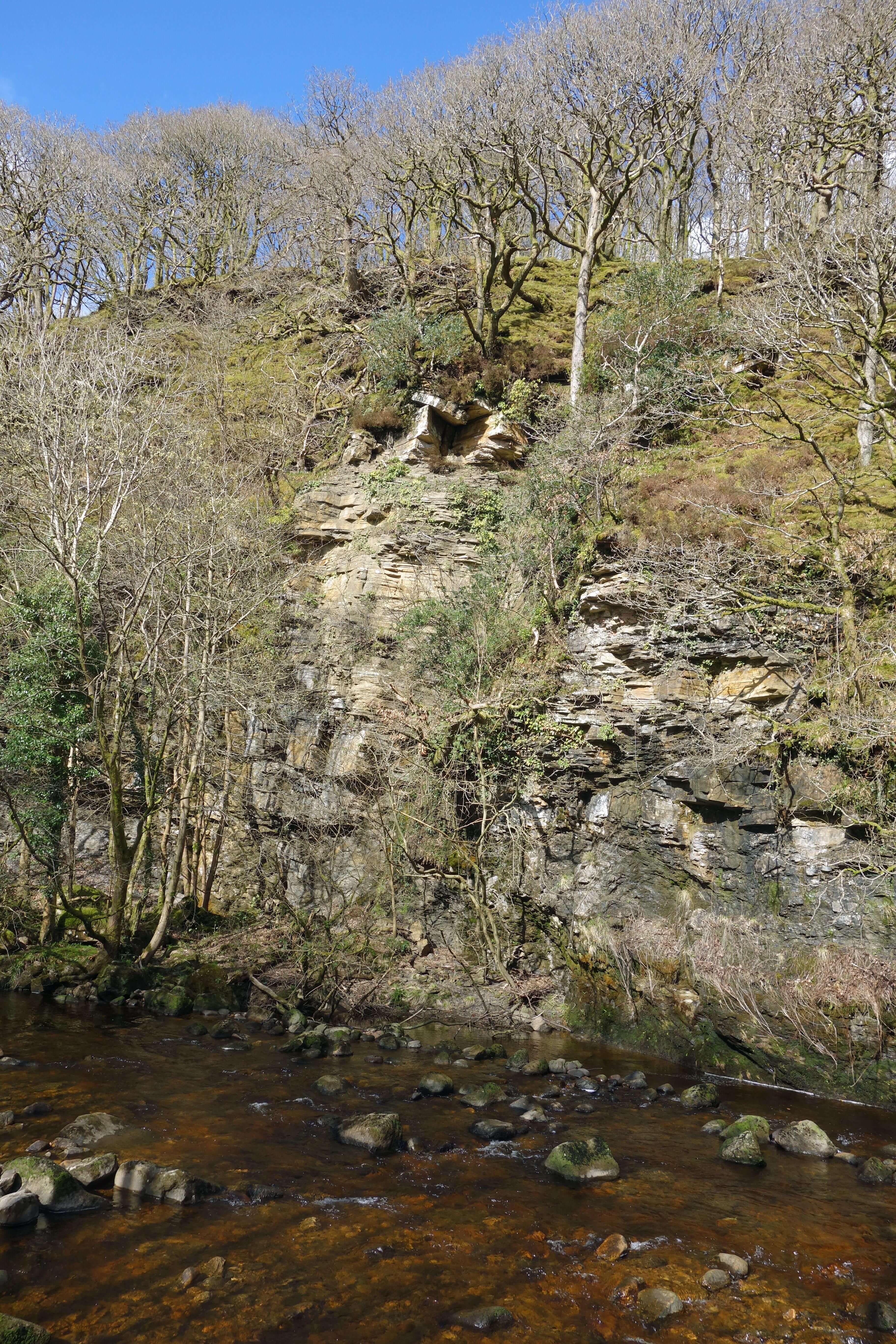
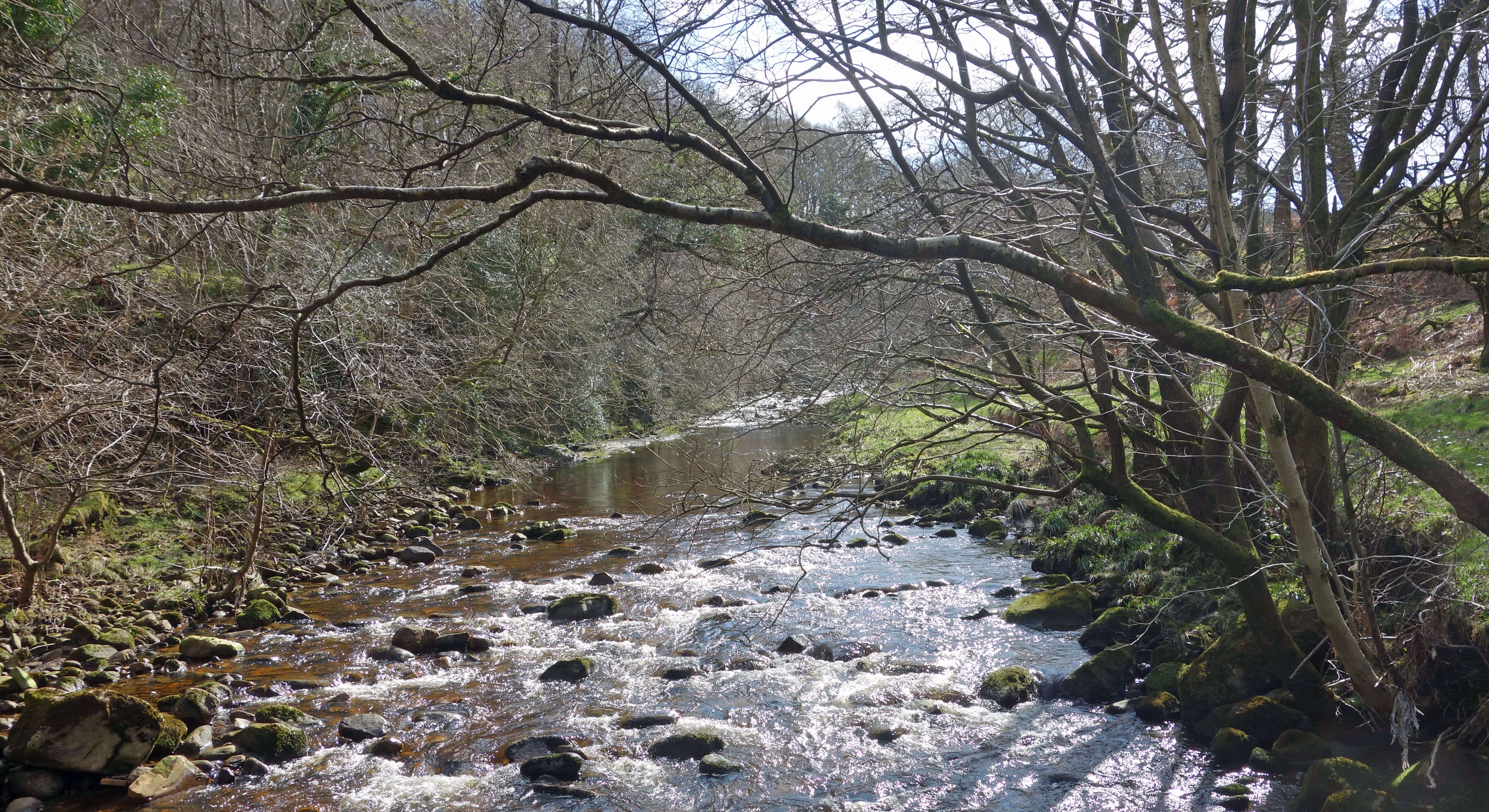
I expect that it is also the most dramatic (I’m only familiar with five of these woodlands). The woods clothe the
steep and sinuous slopes of Roeburndale, within which the River Roeburn flows with, on occasion, a ferocious temper,
causing much erosion and damage, such as in the
Wray Flood
of 1967. Along the length of the woods the underlying rocks give rise to a range of soils that support a variety of tree species, including oak, birch, ash, wych elm, hazel, small-leaved lime and alder. It is pleasant indeed to wind one’s way
along the permissive path, in silence apart from the Roeburn below and the birds above.
In the middle of the wood we noticed that a high wire fence was being installed. Its purpose was a
puzzle. The bottom few inches of the fence were curled up, presumably to allow small animals to get in and
out. Within the fence were some red water dispensers, presumably for whatever large animal is to be fenced
within. Surely they are not intending to fence deer in? Or deer out and
something else in? Whatever it’s for, I assume that it’s for a good
reason, as such a structure must need approval within a SSSI. Nevertheless, it was sad to see an interference with the apparent naturalness of the wood.
Shortly after, we spotted a roe deer before it sensed us. We watched it for a while, wondering if the freedom
that deer have had to roam these woods in the centuries since we stopped hunting them is about to be limited. Of course,
the fact that people like ourselves are encouraged to walk in these woods limits their freedom too. It is hard for us to get the balance between support and interference right. I hope that the deer can continue here, which would be more than the red squirrels mentioned in the SSSI citation have managed. I don’t think anyone has seen a red squirrel here for many years.
So, overall, it was a soothing walk, on which we could enjoy the exercise, the fresh spring air, and the
extensive views, although the thought of coronavirus was never far away. Whatever happens in the coming months, it
is to be hoped that such walks remain possible.[*] However, I am not sure that it will be possible or appropriate to
sustain the light-hearted tone of these missives. We’ll see how it goes. And of course I wish any readers the
best of health.
Date: March 20th 2020
Start: SD600657, by start of track to Backsbottom Farm (Map: OL41)
Route: E past Backsbottom Farm, over the river, through wood – near the road – S past
Outhwaite – Harterbeck – S, SW – High Salter – NW – Barkin Bridge – NE, N on permissive path
through Roeburndale Woods – bridge over Roeburn – W – start of track
Distance: 8 miles; Ascent: 170 metres
[*] On March 23 the Government said that we should only leave home for specified limited purposes, one of which
was "to take one form of exercise a day".
Therefore, for the time being, any walking must be from home.
Home
Preamble
Index
Areas
Dales
Hills
Lakes
Places
Reserves
Rivers
Structures
Villages
References
Me
© John Self, 2018-

Top photo: The western Howgills from Dillicar;
Bottom photo: Blencathra from Great Mell Fell