
Home
Preamble
Index
Areas
Dales
Hills
Lakes
Places
Reserves
Rivers
Structures
Villages
References
Me
Saunterings: Walking in North-West England
Saunterings is a set of reflections based upon walks around the counties of Cumbria, Lancashire and
North Yorkshire in North-West England
(as defined in the Preamble).
Here is a list of all Saunterings so far.
If you'd like to give a comment, correction or update (all are very welcome) or to
be notified by email when a new item is posted - please send an email to johnselfdrakkar@gmail.com.
This is one of several items about walking and walks from home during the
coronavirus lockdown of January - March 2021.
122. Walking Uphill and Walking Up a Hill
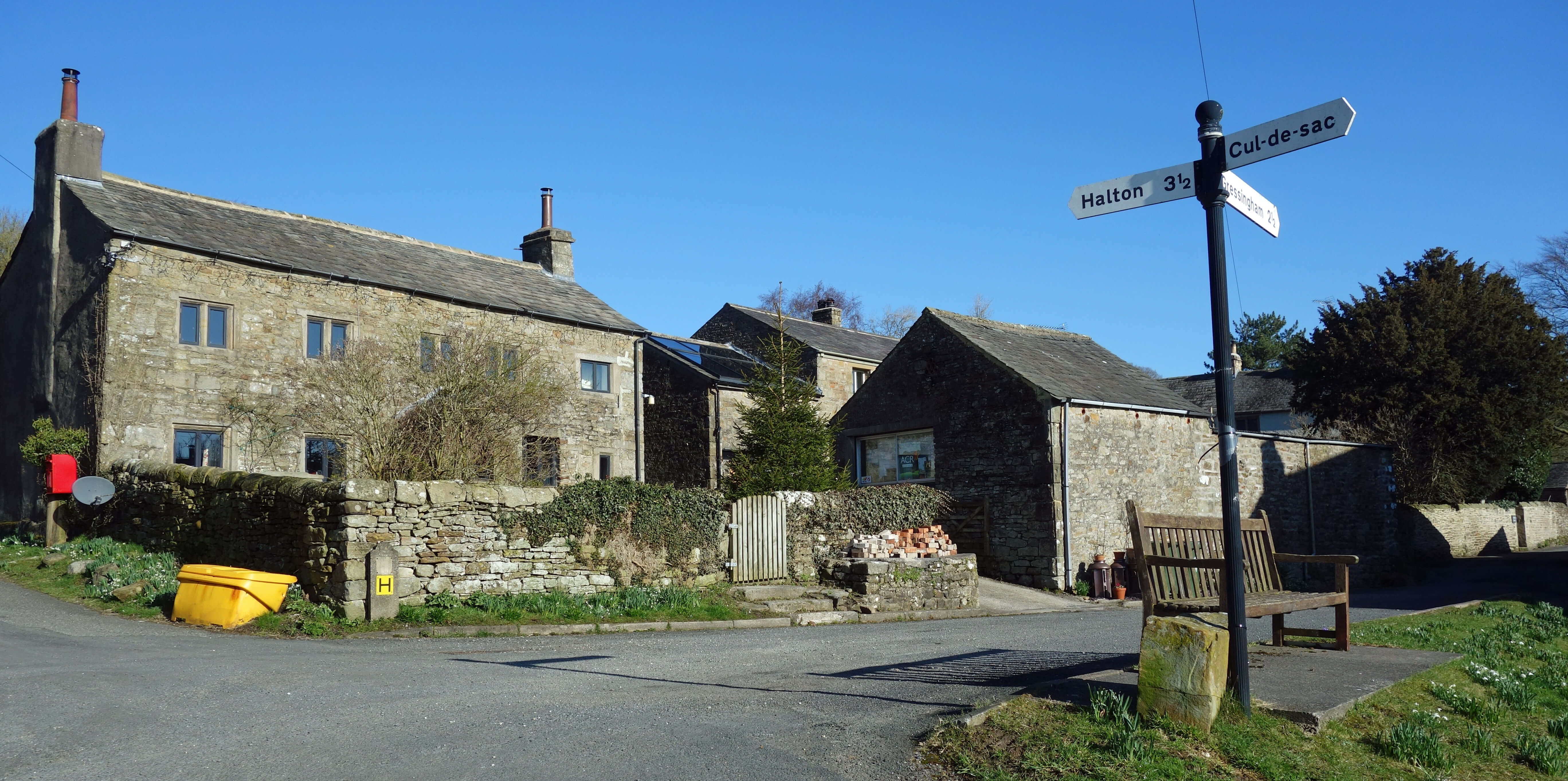 Right: Aughton.
In
[121]
I said bluntly that the Oaken Head top (height 163 metres, drop 113 metres) “is not a hill, to my eyes”. At the
time, the Oaken Head top was not visible to my eyes: I was relying on my memory. I now felt an
obligation to walk to this top to see if I had treated it unfairly.
So we set off for the top, which lies on the opposite side of the Lune valley from us, on a day that was
cloudless but with a low-lying mist-cum-murk that meant that of Ingleborough only the grey outline of its
top could be seen. We crossed Waterworks Bridge, walked through Lawson’s Wood, and took a short-cut across
the Lune meander to reach Aughton Barns. And from there we began a walk from a height of about 15 metres
through the village of Aughton to a height of about 150 metres near the Kirkby Lonsdale Road.
It is undeniably a walk uphill. Is it a walk up a hill? If I wrote that we walked up a hill
then you would reasonably expect me to say which one and where it is.
The OS map doesn't attach a name to any of the rises in the region, including the
highest one, which is a gentle, grassy mound north of the road, a
mile north-west of Aughton, near the farm of Oaken Head.
Nobody would notice it – except us, who were specifically looking for it.
To the eye, it is not obviously higher than other rises nearby. It is on private land but if we were able
to walk to the top then I doubt that we would find anything there to mark its eminence. Even the
phantom hills of Mallowdale Pike, High Stephen’s Head and Gallows Hill
[121]
had their piles of stones and cairns to show that somebody thought them points of interest, even if the
Database of British and Irish Hills
doesn’t. No, I don’t think I treated the Oaken Head top unfairly. As a hill, if it is a hill, it is far inferior to Mallowdale Pike.
It may seem that all this pseudo-philosophising about something as nebulous as the concept of a hill is
pointless. Unfortunately, it is a characteristic of our age, now that we have technology to yield numbers (in this
case, GPSs to measure height to millimetres) and
computers to mangle those numbers,
to try to quantify the unquantifiable and to regard the outcome as necessarily important and meaningful. Who can fail
to be impressed that the Oaken Head ‘hill’ has the 148th biggest drop in North-West England? It has a
bigger drop than most of Wainwright’s 214 hills!
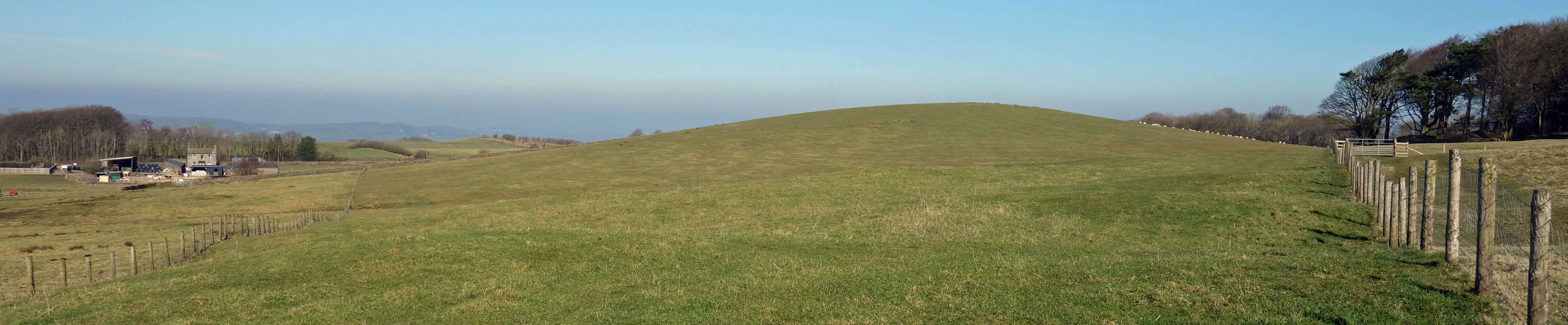
The Oaken Head top (with the farm of Oaken Head to the left)
The Database of British and Irish Hills is not responsible for people (like me) imbuing its data with significance. The database is neutral, except in two respects. First, the fact that it exists at all implies that this mass of data warrants all this effort, and secondly the decisions that have been made about what to include influence what we think are important attributes of a hill. Once the database exists, what use we make of it thereafter is up to us. We, not the database, decide what the significance of the ‘drop’ is, for example.
We must not mistake this vast accumulation of numbers for science. As with train-spotting, we have
many numbers but they cannot lead to any theories about the nature of the world. We must not
agonise over decisions the database-compilers have made, wondering how, for example, a hill can possibly
have a drop of 0 metres. There are 68 of them in the database. We must not worry our heads about
Corbetts, Deweys, Dodds, Donalds, Grahams, Hewitts, Humps, Marilyns, Munros, Murdos, Nuttalls, Simms,
Tumps, Yeamans, Clems, Pughs, McGrews, Cuthberts, Dibbles and Grubbs. We must not feel annoyed to find,
after slogging 400 metres up three hills,
that the database considers them to be of no account and yet manages to find 22 hills in my
home county, the famously flat Norfolk, including, for example, Ramsey Salt Marsh with a height of
3 metres and a drop of 3 metres (it’s an island). Of course, once it’s in the database it just has to be bagged
(you'll need a kayak) – see
hill-bagging.co.uk.
It’s laughable really – that anyone sets out to climb a 3 metre high hill, just because it is
mentioned in a database, and then thinks the achievement deserves to be recorded on-line. So let us too
use the database for amusement, now that we cannot get out and about on real hills.
Here, then, is a puzzle for you:
Which twenty hills in North-West England
have the biggest drops, according to the
Database of British and Irish Hills?
By North-West England I mean the region defined in the
Preamble,
that is, as far as hills are concerned, the Lake District, the Yorkshire Dales and the Pennines between
Bolton and Cross Fell. There are no prizes, so there’s no need to go googling – just think of the hills
and consider which have the biggest drop. I’ll give you a little help – of the twenty highest hills (nineteen
of which are in the Lake District) only seven are among the twenty hills with biggest drops. I’ll give
the answer in the next Sauntering.
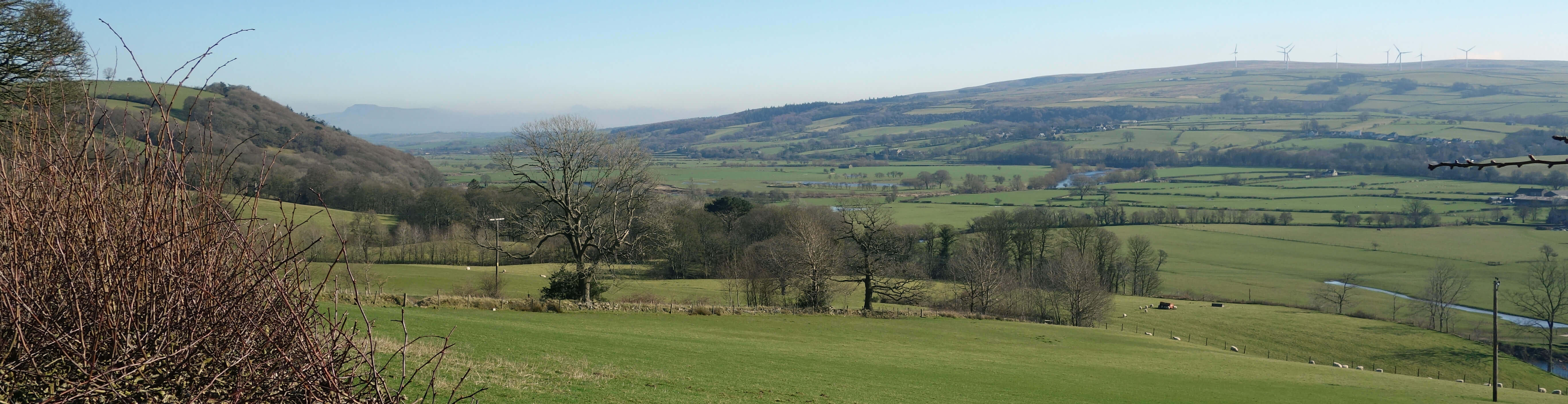
The Lune valley from near Halton Green
Date: March 1st 2021
Start: SD543644, Brookhouse (Map: OL41)
Route: N – Waterworks Bridge – NE – Aughton Barns – N, NW, W – Kirkby Lonsdale Road – SW,
S, W, S – Crook o’Lune – E on the old railway line, S – Brookhouse
Distance: 8 miles; Ascent: 175 metres
Home
Preamble
Index
Areas
Dales
Hills
Lakes
Places
Reserves
Rivers
Structures
Villages
References
Me
© John Self, 2018-

Top photo: The western Howgills from Dillicar;
Bottom photo: Blencathra from Great Mell Fell