
Home
Preamble
Index
Areas
Dales
Hills
Lakes
Places
Reserves
Rivers
Structures
Villages
References
Me
Saunterings: Walking in North-West England
Saunterings is a set of reflections based upon walks around the counties of Cumbria, Lancashire and
North Yorkshire in North-West England
(as defined in the Preamble).
Here is a list of all Saunterings so far.
If you'd like to give a comment, correction or update (all are very welcome) or to
be notified by email when a new item is posted - please send an email to johnselfdrakkar@gmail.com.
110. Cloughs and Grit: Clougha Pike and Grit Fell
We have been released from ‘lockdown 2’ (when I gave Saunterings a break) into the Lancashire Tier 3. This means
that I can travel from Lancaster (79 cases per 100,000 people) 33 miles south to Blackburn (295 cases per 100,000
people) but not 25 miles north to Tier 2 Kendal (130 cases per 100,000 people). It makes more sense to travel fewer
miles to the Bowland hills (0 cases per 100,000 grouse). As I live just within the Bowland AONB’s northern border
and have no wish to travel far, I suspect that I may be relying upon the Bowland hills in the coming weeks. I hope
that they will forgive me for questioning their ‘natural beauty’ recently
[99],
[109]. Now I have a prior question:
Why bother to become an AONB anyway – what benefits does it bring?
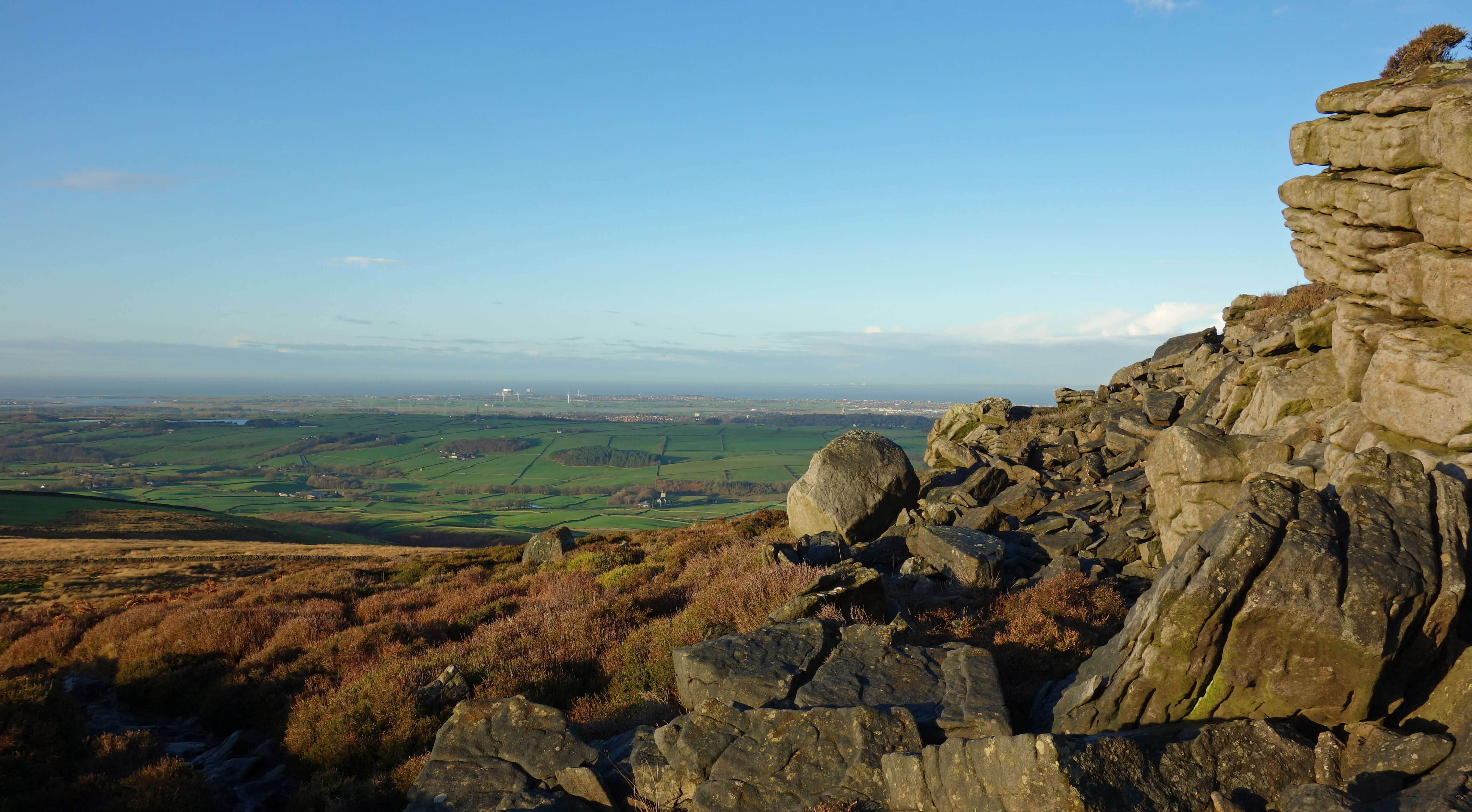 Right: Millstone grit halfway up Clougha Pike, looking towards Heysham.
Of the twelve hills listed in
[109] only three – Ward’s Stone, Grit Fell and Clougha Pike – are within my
walking-from-home range (just). The first I tackled in
[75], so I set out for the other two. However, I didn’t set out from home since Ruth was able to tip me out at the end of Rigg Lane, so saving me four miles of familiar road-walking. I walked to the car park, from where I headed east up the track to Clougha Pike, after pausing at the information board. Even the most mundane object prompts more questions than are good for me. In this case: Who was involved in the installation of
this information board? Was it:
1. DEFRA (the Department for Environment, Food and Rural Affairs), since Natural England (see 2) is “sponsored” by it,
whatever sponsored means?
2. Natural England, the non-departmental public body responsible for AONBs and Sites of Special Scientific Interest (part of Bowland is a SSSI)?
3. The EU, the body responsible for Special Areas of Conservation and Special Protection Areas (parts of Bowland are (or were) a SAC or SPA)?
4. The Forest of Bowland AONB Joint Advisory Committee?
5. The Forest of Bowland AONB ‘Unit Office’ (the group responsible, I think, for
the ‘management plan’ mentioned in [109], the latest version of which is
here)?
6. The landowner (the Abbeystead Estate)?
7. The local city council (Lancaster City Council)?
8. The local county council (Lancashire County Council)?
9. The local parish council (Caton Parish Council)?
10. Or somebody else?
You may regard it as a multiple-choice question and tick all those who you think were involved.
Halfway up Clougha Pike I passed Windy Clough to the north. This is a narrow gully through which, I suppose, the wind funnels on occasion. My dictionary defines the dialect word ‘clough’ simply as a ravine. My image of a ravine is rather more dramatic and on a larger scale than Bowland’s cloughs. The dictionary also says that clough may be pronounced to rhyme with bluff or plough. I have never heard anything other than Cluffa Pike. Whether anyone in north-west England pronounces clough like plough I haven’t a clue, which is perhaps another possible pronunciation.
As I crossed the stile onto the open fell, the sun at last arose over the Clougha Pike horizon, which was a mixed blessing. It dazzled my eyes, making it very difficult to look ahead to locate the muddy path as it weaved through the grit boulders. The Bowland hills are entirely of millstone grit, which lends a uniform drabness to the surroundings. And yet, if you pause to look at the boulders in sunshine then they can be seen to sparkle in a rather delightful way.
The view from Clougha Pike (413 metres) was not the best. The tops of the hills of the Lake District and the Dales were in cloud and the air was somewhat watery. After complaining about the December sun, I mustn’t appear too curmudgeonly – so I stress that Clougha Pike is one of the best viewpoints in North-West England. Even on a day without clear long-distance views, one can enjoy the view over the green Lune valley to Lancaster and Morecambe Bay, which was full, the tide being in.
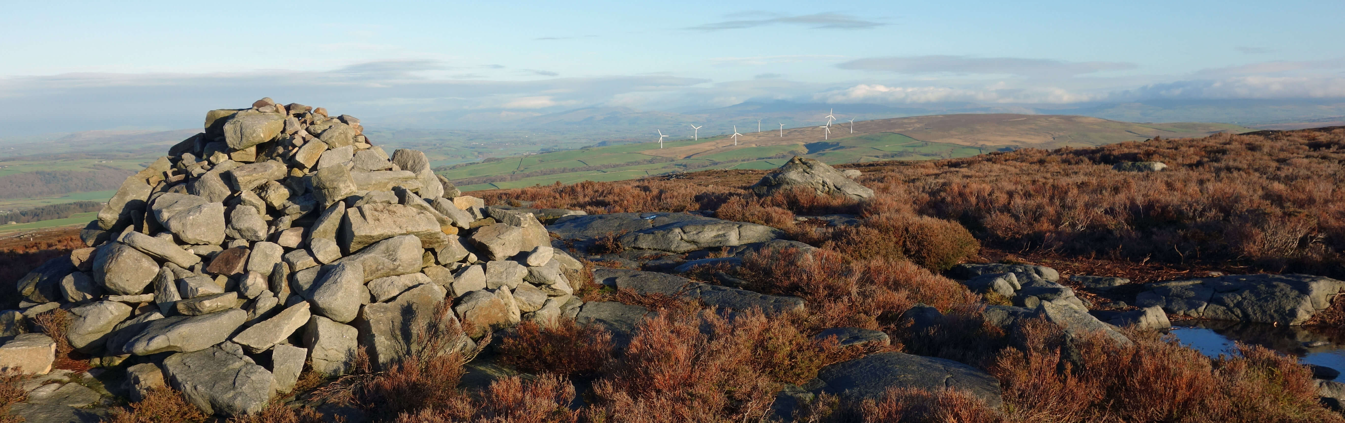
From Clougha Pike towards the Caton windmills (Ingleborough in cloud directly behind)
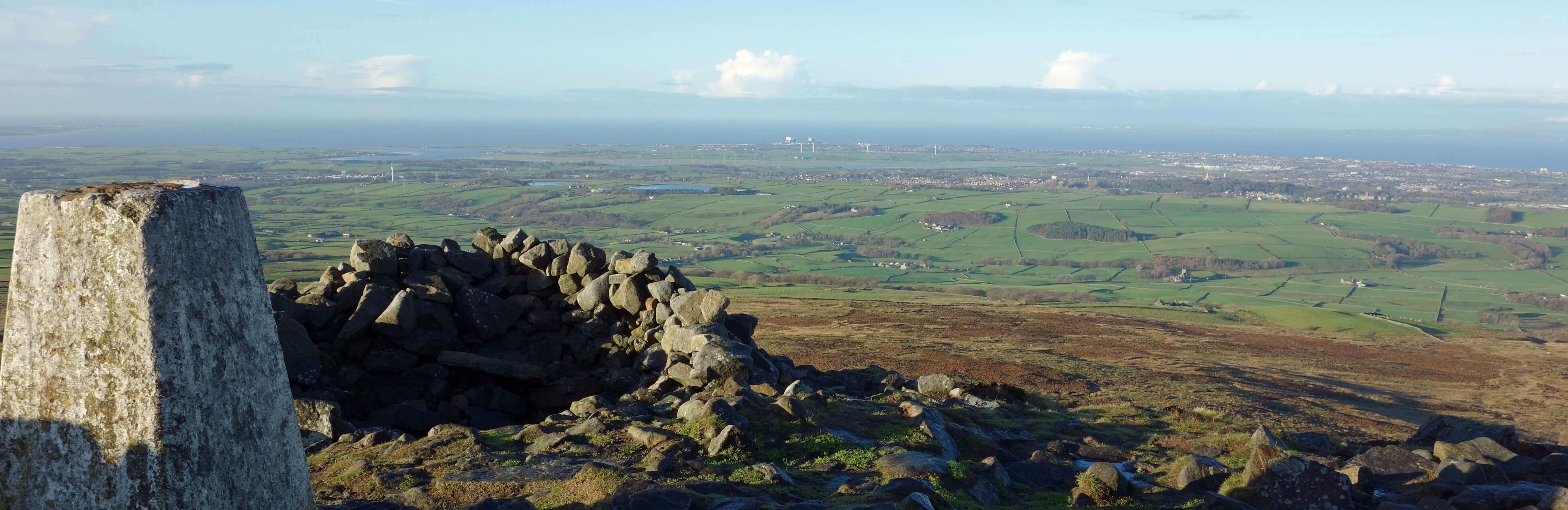
From Clougha Pike towards Morecambe Bay
Clougha Pike is not really a top. It is the nose of the ridge from Ward’s Stone over Grit Fell (468 metres), to which
I walked next. From Grit Fell I left the ridge path to walk north across the rough heather and boulders to reach
the shooters’ track. There was no path but it was actually easier walking there than on the ridge path, which
had been beaten into muddy, boggy submission, necessitating much careful detouring. I followed the shooters’ track
all the way down to The Cragg, where in May, so long ago and since when time has stood still, we had listened for
the cuckoos [91].
We had paused then to admire the long-distance view from Baines Cragg towards the Isle of Man and Skiddaw but I knew that it wouldn’t be so good today. I did, however, pause at another information board.
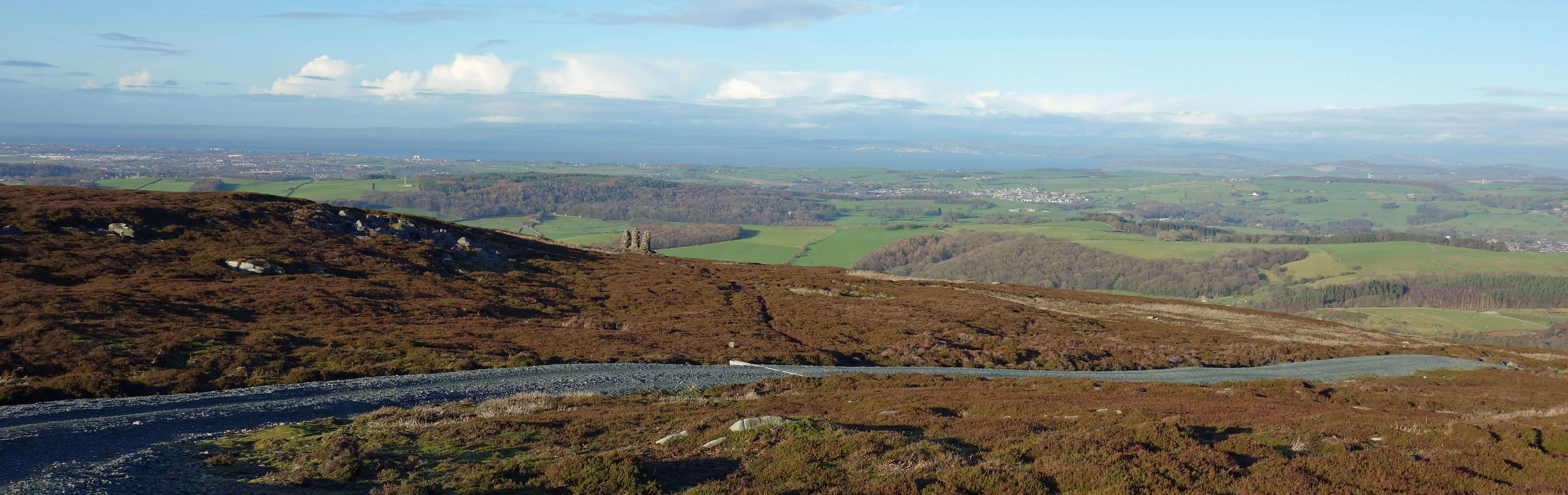
Down the shooters' track from Grit Fell (Lancaster, Morecambe Bay and Halton ahead)
The boards mention the Abbeystead Estate and the AONB but I don’t know if that constitutes an answer to my multiple-choice question. And that is the point. It is hard to know who is responsible for anything among the mish-mash of organisations that could be looking after Bowland. If you noticed something untoward in the Forest of Bowland to whom
could or would you report it? Who would have the authority to address whatever the matter is?
As long as the AONB designation achieves its purpose then perhaps it doesn’t matter. What is its
purpose? The AONB management plan says that it lies in “encouraging activities that conserve
and enhance the special qualities of the area and minimising activities that present a threat to the
unique character of the landscape.” I live in the Forest of Bowland but that fact has not
directly impacted upon me in any way. The AONB managers have never encouraged or discouraged any
activities of mine. I am not sure that I would need to take any notice of them if they did.
Of course, they are not bothered about people like me: it’s the major landowners that they have to deal with. I suspect that those landowners need take less notice of the AONB’s encouragements than I would. There may be agreement over information boards but what about if the AONB managers consider that excessive numbers of shooters’ tracks are being
built on the Bowland moors?
The AONB has a
Joint Advisory Committee
which “comprises the following organisations” and goes on to list twenty of them. No individuals
are named. How can a committee be comprised of organisations,
some of them rather large? As the name says, the FOBAONBJAC is only advisory and, as
its plan says, its delivery “is encouraged through effective partnership working, rather
than through enforcement”. Which, I suspect, is not a choice. Does the FOBAONBJAC have
powers to enforce anything? How does it deal with ineffective partnerships?
Many years ago I went to a talk by an AONB employee who spoke enthusiastically and knowledgeably about
the Bowland hen harriers. Since then, despite a high profile
Skydancer Project
that won a National Lottery award,
the Bowland hen harriers decreased, year by year, to none in 2017. The recent small increase in hen harrier numbers owes more to the efforts of United Utilities and the RSPB than to the AONB Committee, I think. Never mind, the Forest of Bowland AONB was the first protected area in England to be awarded the European Charter for Sustainable Tourism.
What is Bowland for? Us (as tourists or grouse-shooters) or hen harriers?
Date: December 15th 2020
Start: SD522596, end of Rigg Lane (Map: OL41)
Route: (linear) NE – Rigg Lane car park – SE – Clougha Pike, Grit Fell – N across moor –
shooters’ track – NW on track – Bark Barn – E – The Cragg – NE – New House Farm – NW – Brookhouse
Distance: 8 miles; Ascent: 360 metres
Home
Preamble
Index
Areas
Dales
Hills
Lakes
Places
Reserves
Rivers
Structures
Villages
References
Me
© John Self, 2018-

Top photo: The western Howgills from Dillicar;
Bottom photo: Blencathra from Great Mell Fell