
Home
Preamble
Index
Areas
References
Me
Saunterings: Walking in North-West England
Saunterings is a set of reflections based upon walks around the counties of Cumbria, Lancashire and
North Yorkshire in North-West England
(as defined in the Preamble).
Here is a list of all Saunterings so far.
If you'd like to give a comment, correction or update (all are very welcome) or to
be notified by email when a new item is posted - please send an email to johnselfdrakkar@gmail.com.
53. Why? On the Wyre Way
The Forest of Bowland Area of Outstanding Natural Beauty is known for its windswept heather moorlands
and blanket bogs but below the moors there is the timeless serenity of undulating lush green pastures
with hawthorn hedgerows, grey walls and scattered stone farmsteads, with farmers going about their
work as they have done for centuries. The upper part of the Wyre Way passes through some of these pastures.
The Wyre Way runs between the Wyre estuary at Fleetwood and not quite its source(s). At Abbeystead the
Way cannot decide which of the two branches is the major one and therefore splits in two, the southern
path following the Marshaw Wyre and the northern one the Tarnbrook Wyre. Then, halfway along, both paths
abandon the attempt to reach their sources (on Threaphaw Fell and Tarnbrook Fell respectively) and instead proceed across country to join up, thus creating a triangular loop at the top end of the Wyre Way.
I began at Tower Lodge, at the end of the Marshaw Wyre path, and headed for Tarnbrook. I was accompanied by a distant cuckoo and several too-close-for-comfort lapwings, no doubt annoyed that I was disturbing their nesting. Many fields had been freshly manured to ensure that I knew I was on farmland. Views of Ward’s Stone and Hawthornthwaite Fell opened out. I noticed that a new building was taking shape at the foot of the track up Tarnbrook Fell, which makes a change from seeing abandoned rural houses. The quiet stone cottages at Tarnbrook were much as I remembered them and the more refined village of Abbeystead also seemed unchanged. Children still played in the grounds of the small Abbeystead school, founded in 1664.
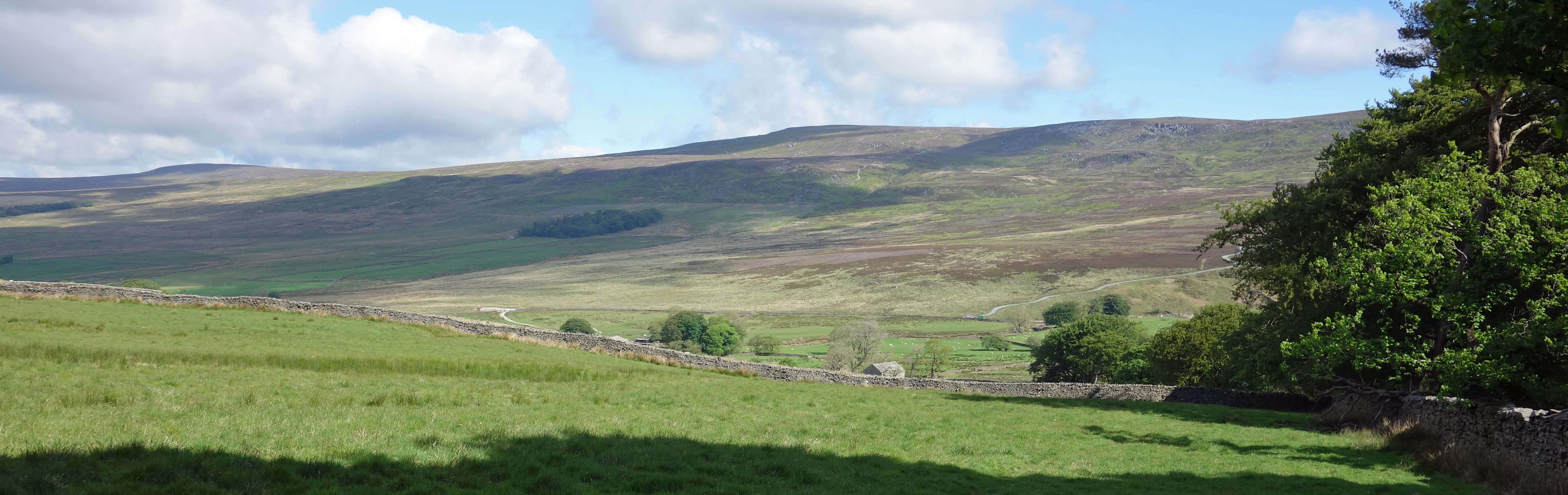
Ward's Stone from Hind Hill
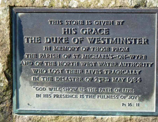
Sixteen people died. Eight died instantly and another eight died later from their injuries. The other
twenty-eight people present were seriously injured. You will not learn these raw facts from the discreet
plaque
commemorating the Abbeystead disaster that is placed by a building just past the reservoir. Needless to
say, the explosion on May 23rd 1984 – thirty-five years ago almost to the day – shattered the serenity of the region and the lives of many.
The most straightforward summary of the Abbeystead disaster that I have come across is that by
Kletz (2000):
“In 1984, at Abbeystead, Lancashire, water was pumped from one river [the River Lune at
Caton] to another [the River Wyre at Abbeystead] through a tunnel. When pumping was stopped some water
was allowed to drain out of the tunnel and leave a void. Methane seeping from the rocks below accumulated
in the void. When pumping was restarted the methane was pushed through vent valves into an underground
valve-house where it exploded, killing 16 people. If the operating staff had known that methane might be
present, they could have prevented the explosion by keeping the tunnel full of water or by discharging
the gas from the vent valves into the open air … The official report said that while references to the
presence of dissolved methane in water supply systems had been traced in published literature they were
not generally known to engineers concerned with water supply schemes. Nevertheless it is surprising
that a vent was routed into a pump-house. It seems that this was done because the local authority
objected in principle to any equipment that might spoil the view.”
That last sentence comes as a shock. It suggests that the disaster was our fault – that by insisting, through our councillors, that the environment should not be spoiled we risked the safety of the installation. Can we not insist on both, the safety and the environment, especially within an
Area of Outstanding Natural Beauty? If the designers cannot protect the public and the environment then the work should not proceed.
Sheep, hawthorn, Grit Fell and Ward's Stone from near Top of Emmetts
In the parliamentary debate the day after the explosion, a local MP expressed the commonly held “incredulity
that such an incident could have happened at a plant which posed no danger”. The subsequent
Health and Safety Executive report
of 1985 described the Lune-Wyre Transfer Scheme, the explosion and its causes but it was not explicit about any blame. It said, for example, that “smoking in the valve-house was not prohibited because the likelihood of a flammable atmosphere arising there had not been envisaged” but it didn’t say whether it should or could reasonably have been envisaged. The HSE was hardly in a position to do so because it had itself rated the installation as ‘low risk’ when it was commissioned in 1980. The inquest, accepting the implication that what happened could not have been anticipated, duly returned verdicts of accidental death.
But was the presence of methane such a surprise? I am no geologist or engineer but even I knew that
there had been small-scale coal mining here in past centuries and that methane results from coal extraction.
Hudson (2000) gives details of the ‘Caton collieries’ that mined a coal seam along the
Caton-Quernmore-Littledale boundary. He writes that “the Minute Books of Lancaster Corporation show
income from the town’s drift mine on the moor and coal mines in Quernmore from before 1680” and that
the Gresgarth estate was put up for sale in 1801 with the advert “For sale Grassyard Park, Hall, land
and collieries included.” This coal-mining history was not mentioned at all in the HSE report, presumably
because geologists concluded that the methane did not come from near-surface coal but from deeper
mudstones – but surely the possibility of methane should have been in the designers’ minds. A subsequent court case found the designers “liable in negligence for failing to exercise ‘reasonable care’ in assessing the risk of methane”. However, nobody was prosecuted. It may be relevant that ultimately this disaster was the responsibility of government, since the body in charge, North-West Water Authority, was at that time a regional authority, not a private company.
 The disaster happened in an out-of-the-way location and may be put out-of-mind by those not directly affected.
But two final thoughts: What if the explosion had happened, as it equally could have, at the opening ceremony in 1980,
when the Queen was present? And are we absolutely sure that those now carrying
out engineering work, such as fracking, in our region are not also incompetent and cavalier with our safety?
The disaster happened in an out-of-the-way location and may be put out-of-mind by those not directly affected.
But two final thoughts: What if the explosion had happened, as it equally could have, at the opening ceremony in 1980,
when the Queen was present? And are we absolutely sure that those now carrying
out engineering work, such as fracking, in our region are not also incompetent and cavalier with our safety?
I looked at the
plaque
again. If those affected by this disaster were content with this plaque then I should not comment, but
I can’t help asking questions. Why is the Duke of Westminster’s name there (in large font)? Why are
those who died not named? It’s not as though their names are unknown. Do they not deserve more respect
than a bland “those … who lost their lives”? Isn’t the biblical quotation singularly inappropriate? Or
are religious people able to reflect upon such an event in terms of the ‘path of life’ and ‘joy’? Since
the Duke wanted his name prominently on the plaque then he must expect questions (and we have a right
to ask them since we paid for this project). Was (some of) the work carried out on his land? If so,
did he receive payment for it and, if so, how much? Did the explosion happen on his land? Did he
contribute from his Ł9 billion to the fund for the families of the victims? Most of the 44 people present at the
explosion were from the village of St Michael’s-on-Wyre, here to be reassured about the pump’s operation,
and there is a more fitting memorial in the St Michael’s church.
So: a misguided project, negligently designed, carelessly managed, inadequately reviewed, shamefully
handled by the authorities – and then this pathetic plaque. I needed to move on. I continued on
the Wyre Way to Long Bridge, passing an array of thirty-two dead moles in varying states of decay
pinned to a wire. I realise that it is the local custom for mole-catchers to display their success but I am at a loss to understand what harm moles do in these pastures.
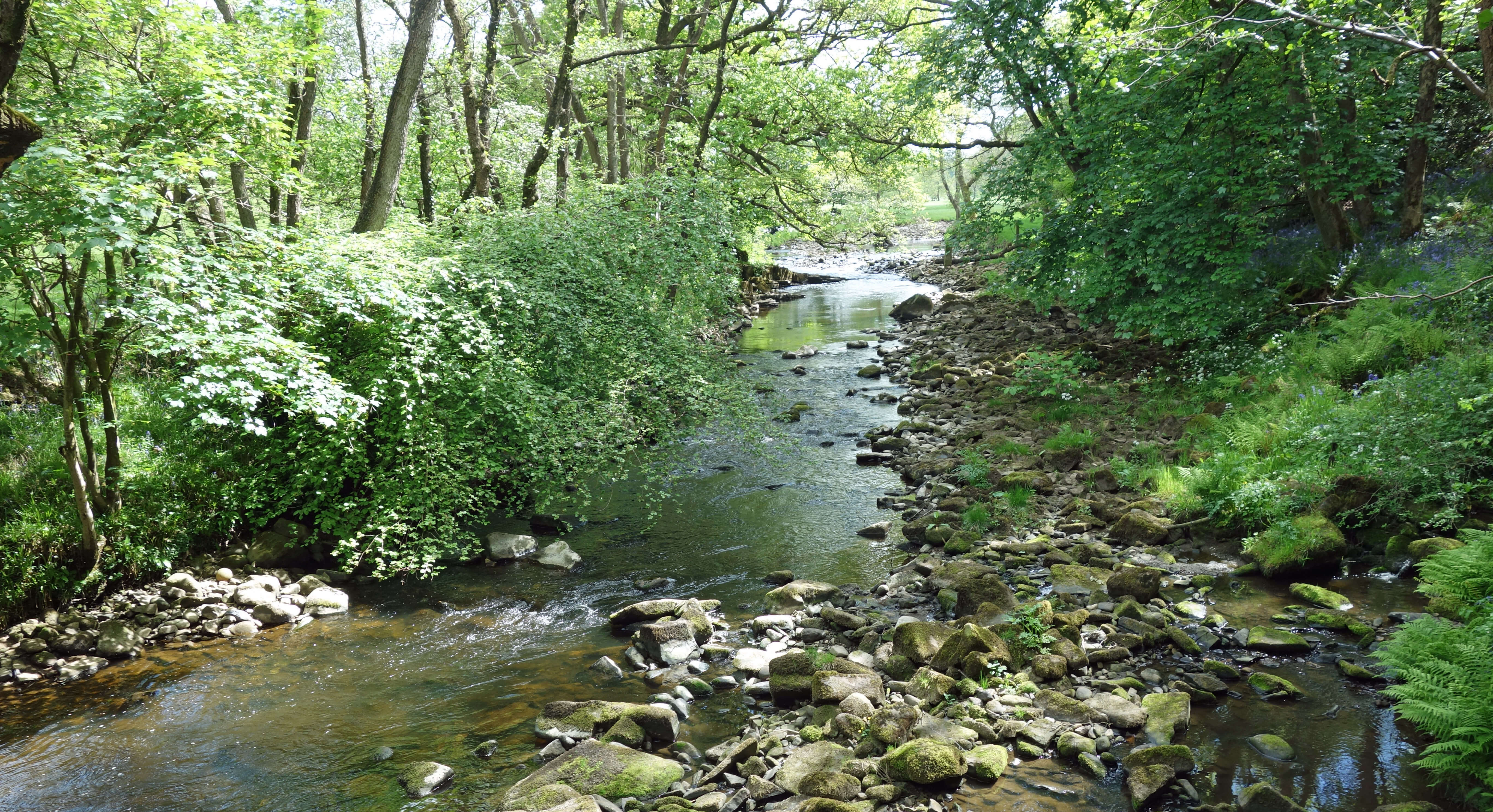
The Wyre from Long Bridge
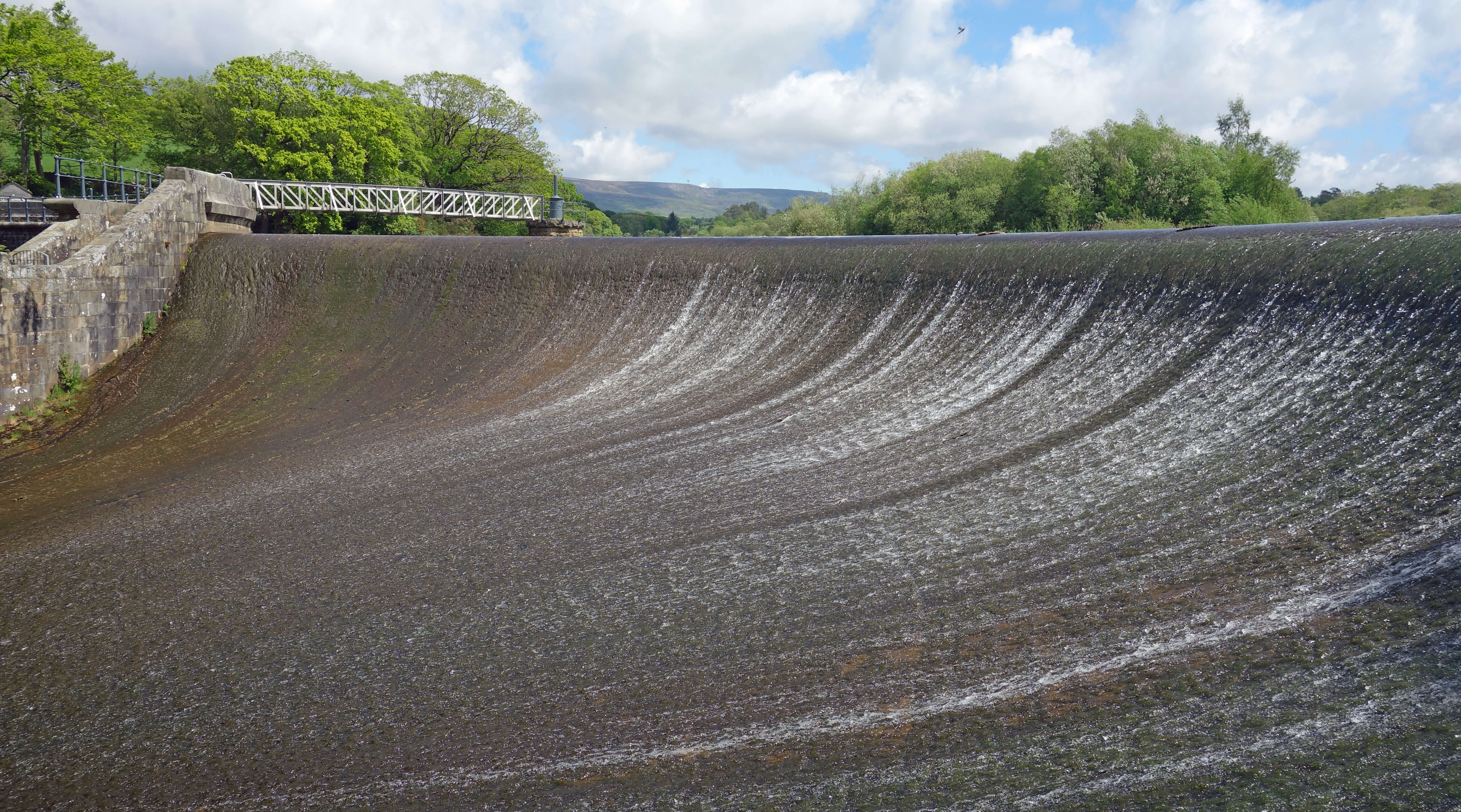
Across the bridge I passed through a cluster of farm buildings at Catshaw, with the Hall bearing a date of 1678, and then dropped down to the weir. Sadly, I had another view of the pump-house across the Wyre. I continued to be amazed that such an explosion occurred at such a location, so peaceful on every other day. If you asked the devil to devise a way to kill sixteen people here then I doubt that even he could have come up with such a scheme.
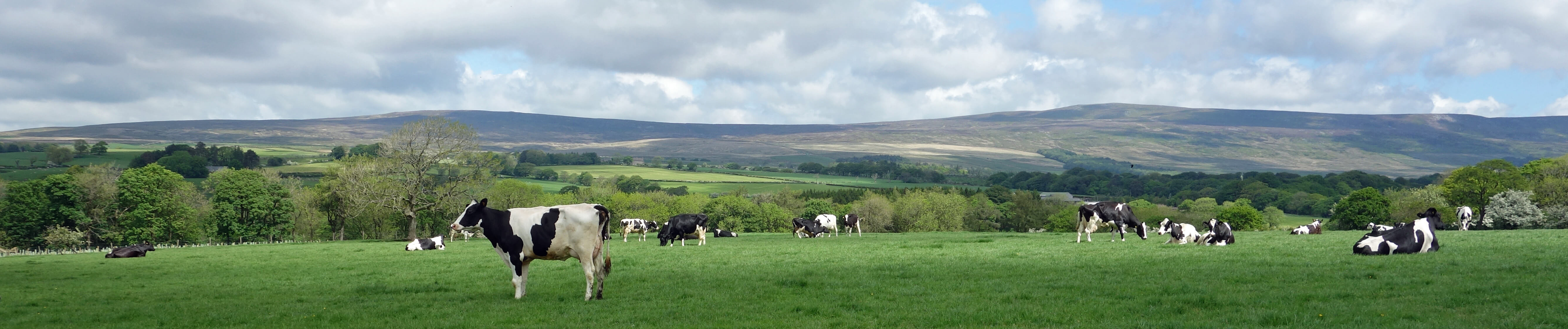
Cows, Grit Fell and Ward's Stone from near Catshaw Hall
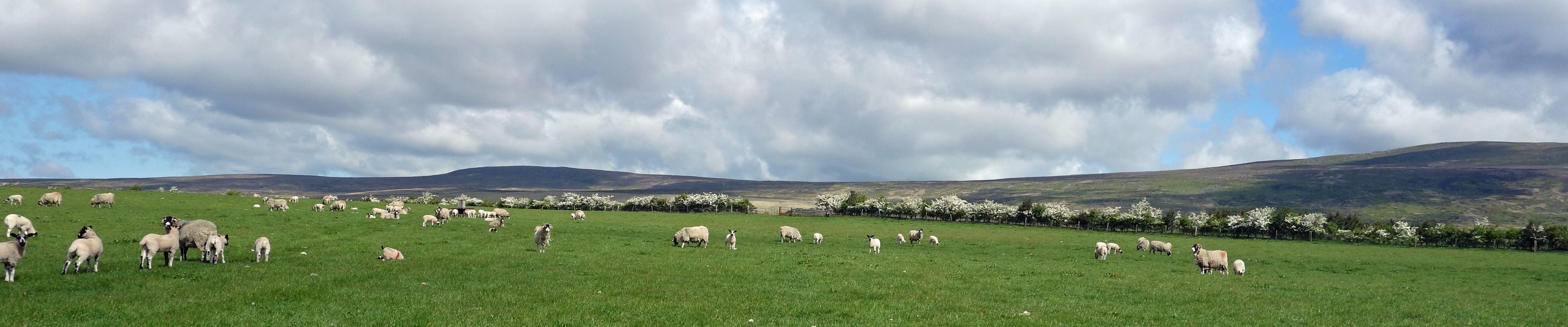
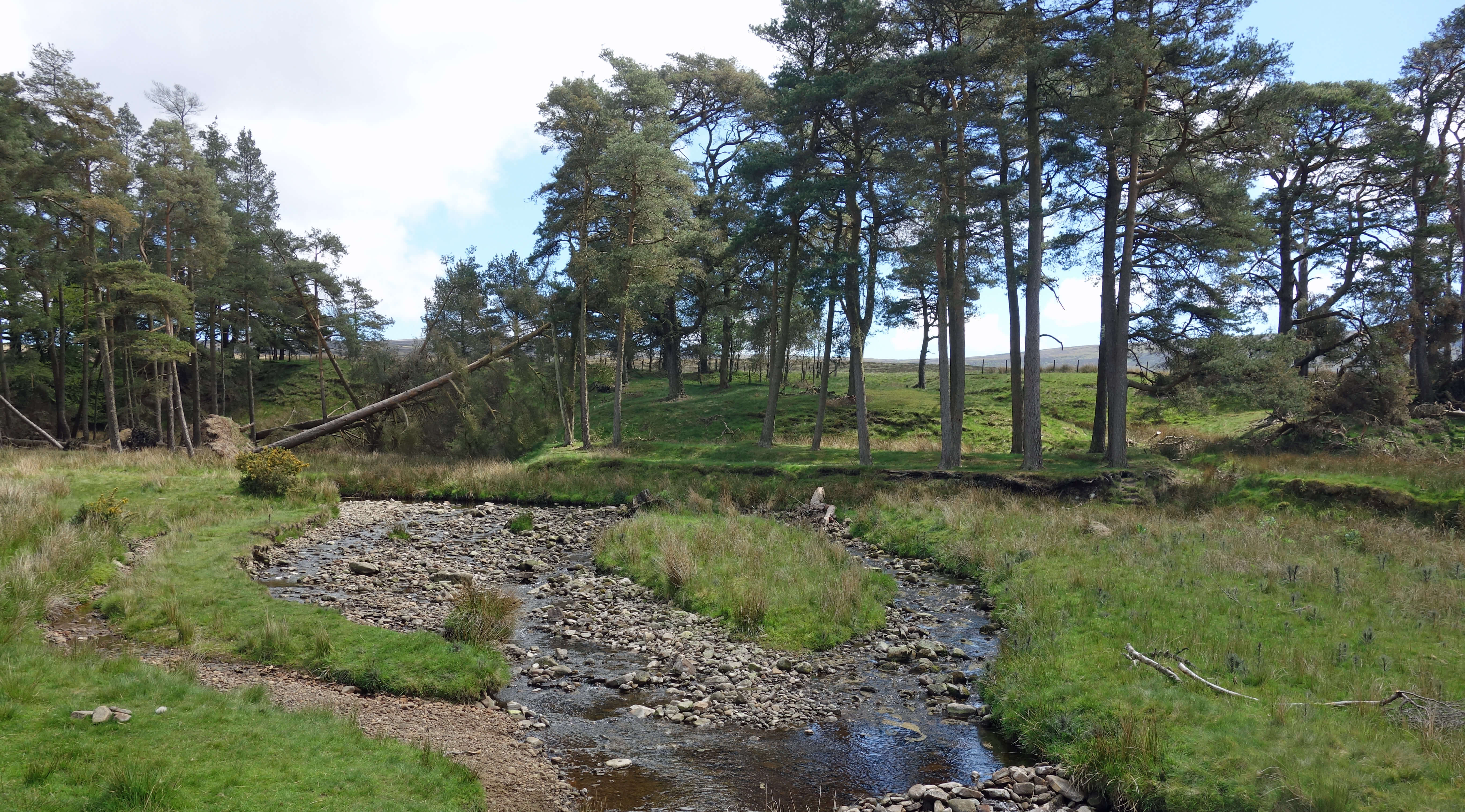
I walked back along the Wyre Way, across many fields and by the beck running prettily past pine and oak trees. In all, on this walk I saw 312 cows and 2,892 sheep. No, I must not risk losing the hard-earned trust that you have in the accuracy of these missives: let’s just say that I saw a lot of cows and even more sheep.
Left: The outflow from the Abbeystead Reservoir; Right:
The Marshaw Wyre.
Date: May 21st 2019
Start: SD603548, Tower Lodge (Map: OL41)
Route: N, NW, N, NW – Tarnbrook – SW – Top of Emmetts – W – Abbeystead,
Long Bridge – S, SE – Catshaw Hall – E, NE – weir – E, N – Stoops Bridge – E – Marshaw, Tower
Lodge
Distance: 9 miles; Ascent: 170 metres
Home
Preamble
Index
Areas
References
Me
© John Self, 2018-

Top photo: The western Howgills from Dillicar;
Bottom photo: Blencathra from Great Mell Fell